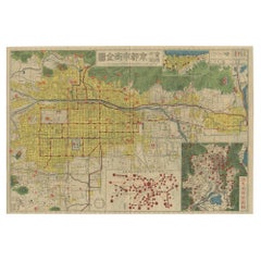
Items Similar to Historical Large Map of Kyoto, Japan (1905) - Published by Kobayashi
Want more images or videos?
Request additional images or videos from the seller
1 of 6
Historical Large Map of Kyoto, Japan (1905) - Published by Kobayashi
$1,676.84
$2,096.0420% Off
£1,242.63
£1,553.2820% Off
€1,400
€1,75020% Off
CA$2,289.20
CA$2,861.5020% Off
A$2,546.64
A$3,183.3020% Off
CHF 1,334.98
CHF 1,668.7320% Off
MX$31,119.33
MX$38,899.1620% Off
NOK 16,999.32
NOK 21,249.1520% Off
SEK 16,002.50
SEK 20,003.1320% Off
DKK 10,659.48
DKK 13,324.3520% Off
Shipping
Retrieving quote...The 1stDibs Promise:
Authenticity Guarantee,
Money-Back Guarantee,
24-Hour Cancellation
About the Item
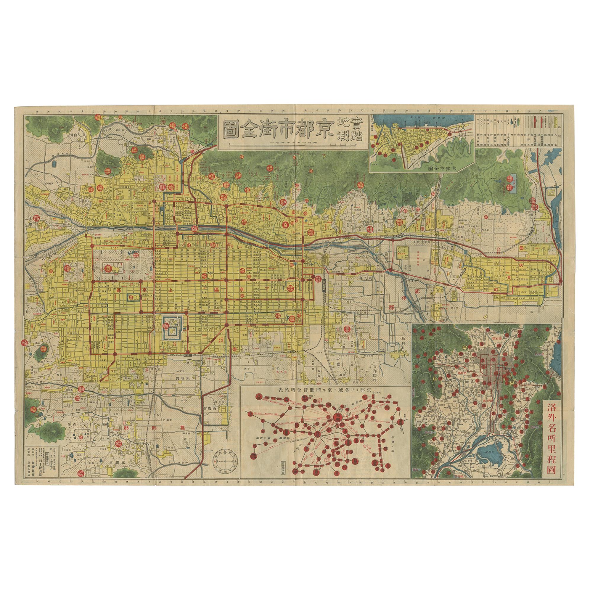
Old map of Kyoto, Japan. Published by Kobayashi, 1905.
This is an old map of Kyoto, Japan, published by Kobayashi in 1905. The map showcases a detailed layout of Kyoto during the early 20th century. Here is a description and some interesting aspects of the map:
1. Layout and Design:
- The map is highly detailed, with a grid-like layout that represents the city’s streets, buildings, and key landmarks.
- It includes color-coding to distinguish different areas or types of buildings, with shades of pink, yellow, and orange prominent.
2. **Geographical Features**:
- The map is bordered by mountainous regions, emphasizing Kyoto's location in a valley.
- Several rivers and waterways are depicted, including the Kamo River running through the city.
3. **Landmarks and Structures**:
- Major temples, shrines, and significant cultural landmarks are marked and often highlighted with specific illustrations or symbols.
- The Imperial Palace (Kyoto Gosho) is centrally located, indicating its importance.
4. Surrounding Areas:
- The outskirts of the map depict rural and forested areas, contrasting with the densely built-up city center.
5. Text and Labels:
- Japanese characters are used throughout the map to label districts, streets, and landmarks.
- The title of the map, which appears at the top, translates to "Map of Kyoto City".
### Interesting Aspects
1. Historical Context:
- This map provides a snapshot of Kyoto as it was in 1905, a period when Japan was modernizing rapidly after the Meiji Restoration.
- It reflects the blend of traditional and modern influences in the city at that time.
2. Cartographic Style:
- The map is hand-drawn with meticulous detail, characteristic of early 20th-century Japanese cartography.
- The artistic elements, such as the depiction of mountains and temples, highlight the aesthetic values of the period.
3. Cultural Significance:
- Kyoto is known for its historical and cultural heritage, and this map emphasizes many of the traditional sites that are still significant today.
- It serves as a historical document, showing the urban layout before modern developments altered the cityscape.
### About the Maker - Kobayashi
- Kobayashi was a common name in Japan, and without additional information, it is challenging to pinpoint the exact individual or publisher.
- The Kobayashi who created this map was likely a skilled cartographer or part of a publishing house specializing in maps and guides.
- During the early 20th century, many Japanese publishers produced maps for both local use and as guides for increasing numbers of travelers and scholars visiting historical cities like Kyoto.
This map is a valuable artifact for historians, geographers, and anyone interested in the evolution of Kyoto’s urban landscape and cultural heritage.
- Dimensions:Height: 21.26 in (54 cm)Width: 30.91 in (78.5 cm)Depth: 0.02 in (0.5 mm)
- Materials and Techniques:
- Period:
- Date of Manufacture:1905
- Condition:Wear consistent with age and use. Minor losses. Minor structural damages. Some minor defects on the folding lines, please study images carefully.
- Seller Location:Langweer, NL
- Reference Number:Seller: BG-117711stDibs: LU3054315760732
About the Seller
5.0
Recognized Seller
These prestigious sellers are industry leaders and represent the highest echelon for item quality and design.
Platinum Seller
Premium sellers with a 4.7+ rating and 24-hour response times
Established in 2009
1stDibs seller since 2017
2,502 sales on 1stDibs
Typical response time: <1 hour
- ShippingRetrieving quote...Shipping from: Langweer, Netherlands
- Return Policy
Authenticity Guarantee
In the unlikely event there’s an issue with an item’s authenticity, contact us within 1 year for a full refund. DetailsMoney-Back Guarantee
If your item is not as described, is damaged in transit, or does not arrive, contact us within 7 days for a full refund. Details24-Hour Cancellation
You have a 24-hour grace period in which to reconsider your purchase, with no questions asked.Vetted Professional Sellers
Our world-class sellers must adhere to strict standards for service and quality, maintaining the integrity of our listings.Price-Match Guarantee
If you find that a seller listed the same item for a lower price elsewhere, we’ll match it.Trusted Global Delivery
Our best-in-class carrier network provides specialized shipping options worldwide, including custom delivery.More From This Seller
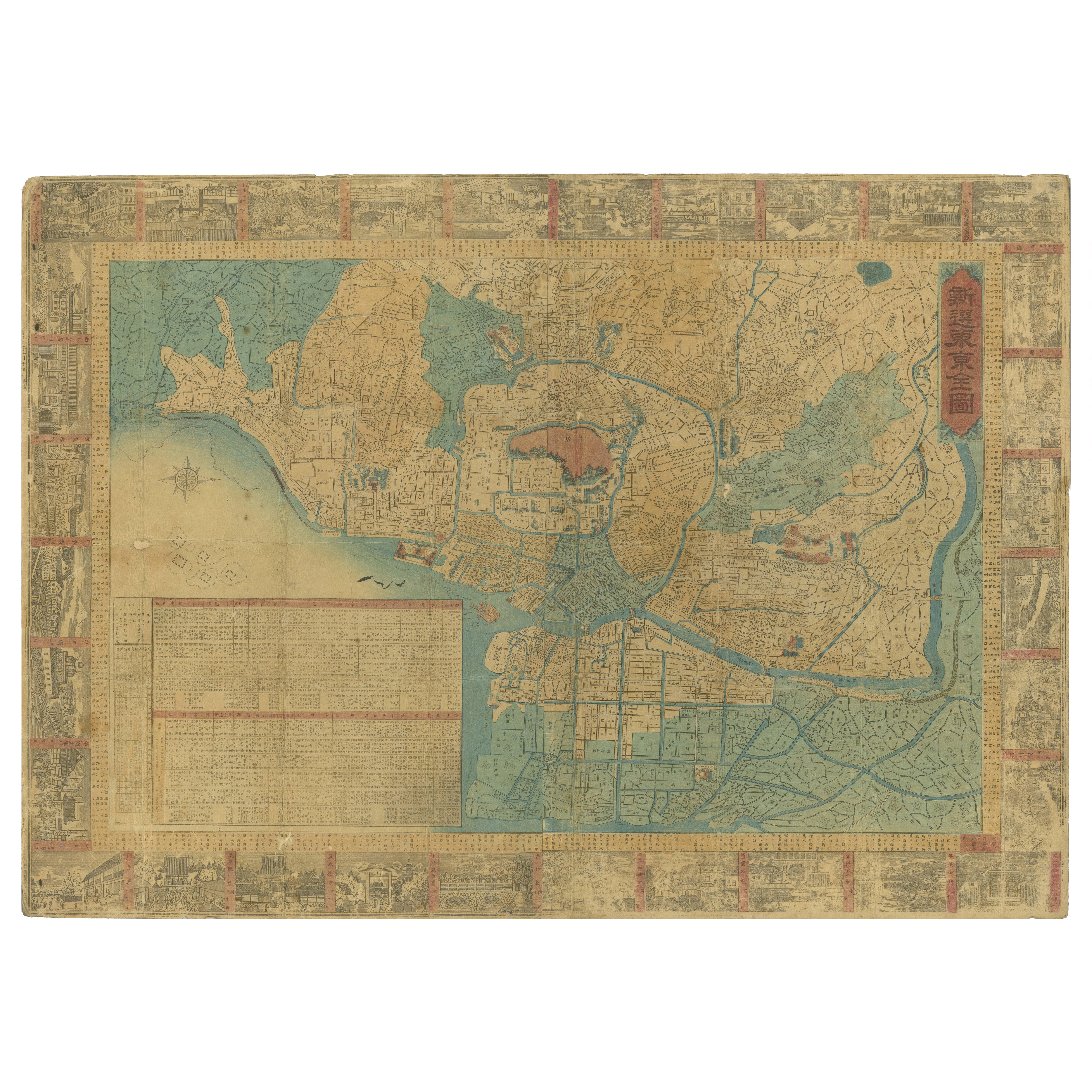
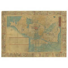
View AllAntique Folding Map of Kyoto, Japan, 1920
Located in Langweer, NL
Antique folding map of Kyoto, Japan. On the verso of this map photos of buildings, other structures and informative text can be found.
Category
20th Century Maps
Materials
Paper
1885 Shinsen Tokyo Zenzu: Rare Meiji-Era Map of Tokyo by Sakai Kinzaburo
Located in Langweer, NL
Title: Detailed Edo Period Map of Tokyo (Edo), Featuring Neighborhoods and Landmarks
This beautifully detailed patina rich map, titled "Shinsen Tokyo Zenzu" (Newly Selected Complete...
Category
Antique 1880s Maps
Materials
Paper
Antique Map of the Region of Tokyo and Nagasaki in Japan, 1922
Located in Langweer, NL
Antique map of Japan titled 'Japan - Environs of Tokio & Nagasaki'. Old map of Japan, includes inset maps of Tokyo, Nagasaki and surroundings. This map or...
Category
20th Century Maps
Materials
Paper

$172 Sale Price
20% Off
Antique Map of the Region of Wakayama, Nara and Osaka 'Japan'
Located in Langweer, NL
Geological folding map of the area with Wakayama, Nara, Osaka, Mie, and Shiga in Japan, circa 1880:
This map is a geological folding map, which means it was designed to be portable ...
Category
Antique Late 19th Century Maps
Materials
Linen, Paper
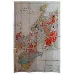
$910 Sale Price
20% Off
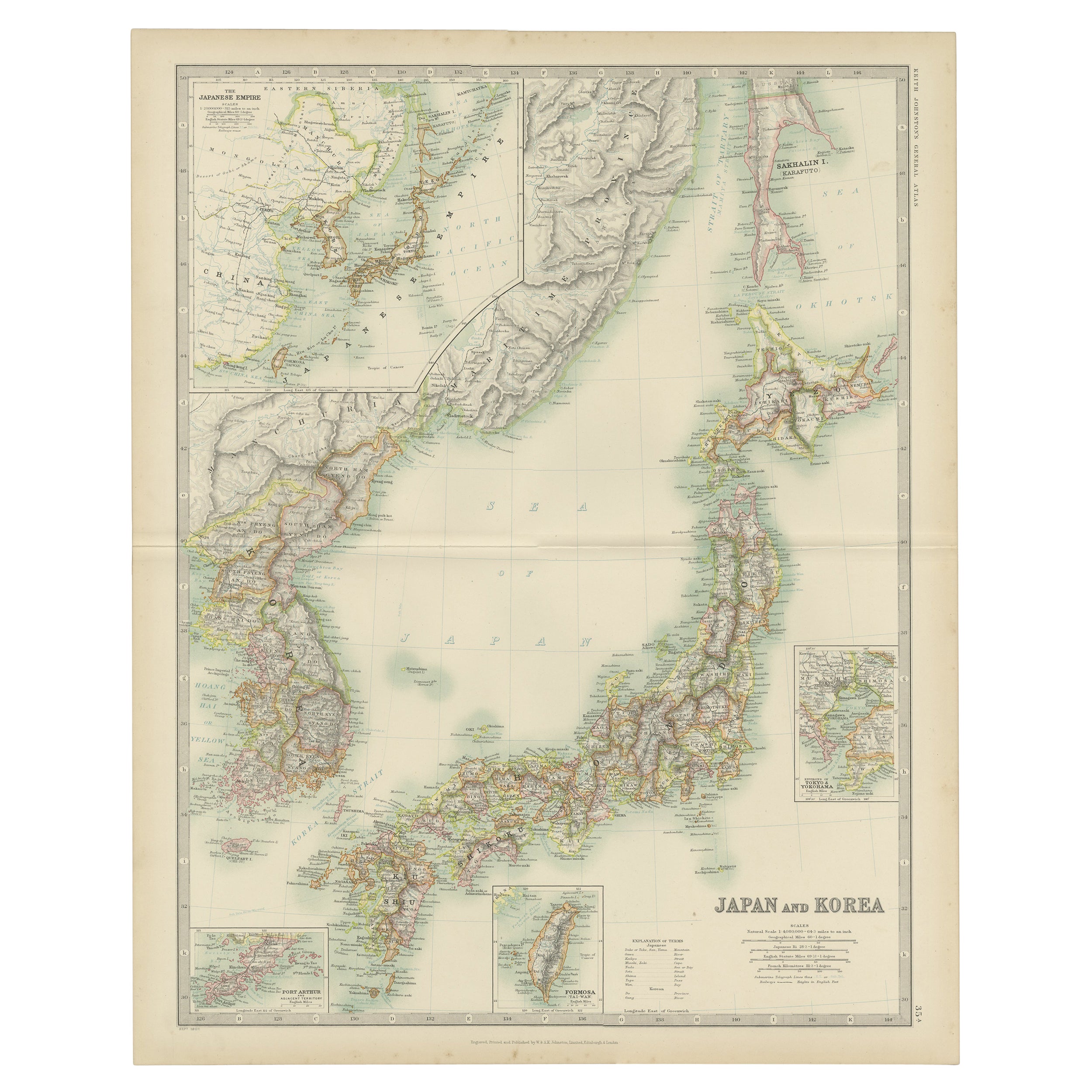
Antique Map of Japan and Korea by Johnston '1909'
Located in Langweer, NL
Antique map titled 'Japan and Korea'. Original antique map of Japan and Korea. With inset maps of the Japanese Empire, Port Arthur, Formosa ,Tokyo and Yoko...
Category
Early 20th Century Maps
Materials
Paper
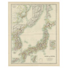
$335 Sale Price
20% Off
Antique Map of China and Japan by Meyer, 1895
Located in Langweer, NL
Antique map titled 'China und Japan'. Map of China, Mongolia, Taiwan and Japan. With an inset map of Jiaozhou Wan near Qingdao, and another of the region around Hongkong, including Kanton and Macau, with small plans of Hong Kong and Kanton. This map originates from a 1885-1907 edition of a famous German encyclopedia titled 'Meyers grosses Konversations-Lexikon', published in Leipzig and Vienna. Meyers Konversations-Lexikon was a major German encyclopedia that existed in various editions from 1839 until 1984, when it merged with the Brockhaus encyclopedia. Several of the plates were also used in Dutch Encyclopedia's like Winkler Prins...
Category
Antique 19th Century Maps
Materials
Paper
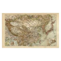
$81 Sale Price
20% Off
You May Also Like
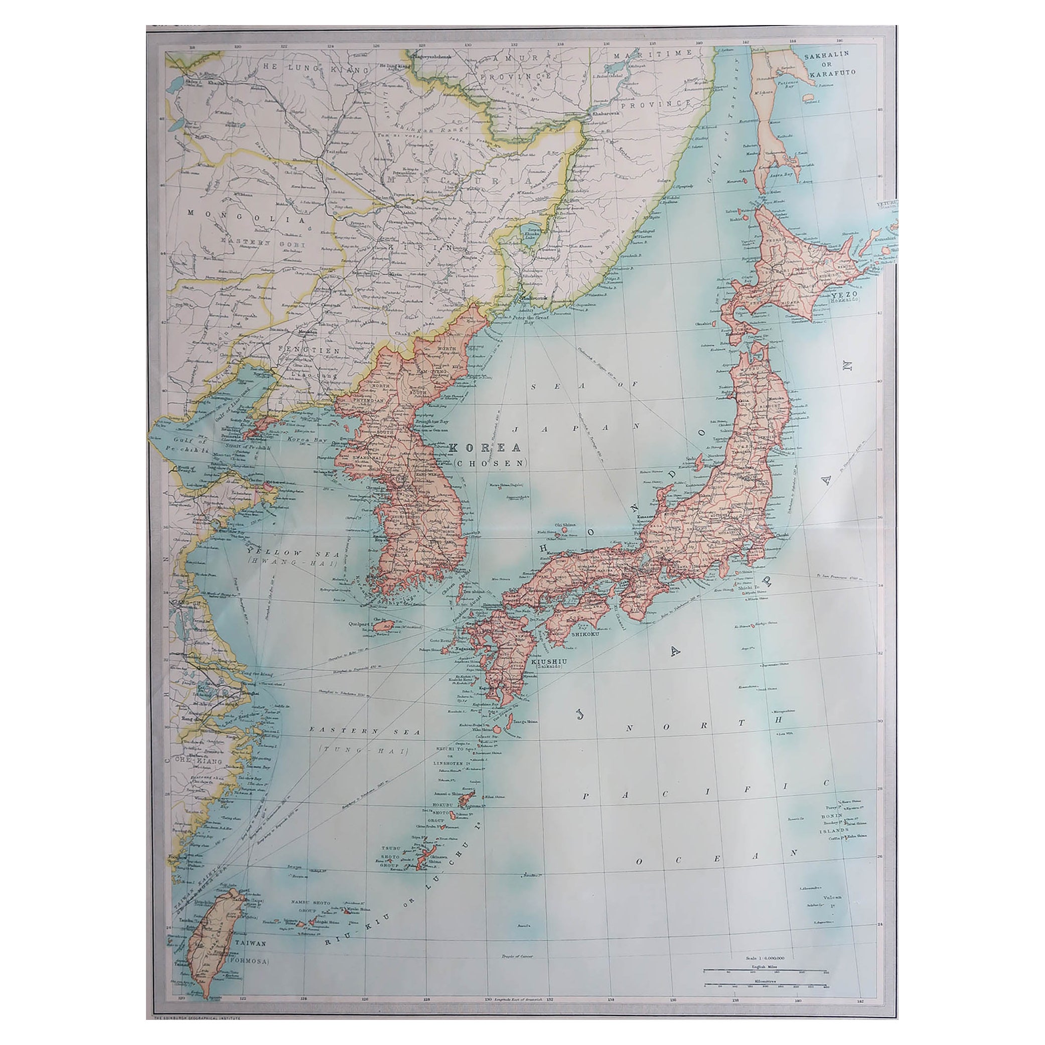
Large Original Vintage Map of Japan, circa 1920
Located in St Annes, Lancashire
Great map of Japan
Unframed
Original color
By John Bartholomew and Co. Edinburgh Geographical Institute
Published, circa 1920
Free shipping.
Category
Vintage 1920s British Maps
Materials
Paper

Large Original Vintage Map of Japan, circa 1920
Located in St Annes, Lancashire
Great map of Japan
Original color. Good condition
Published by Alexander Gross
Unframed.
Category
Vintage 1920s English Maps
Materials
Paper

China and Japan, English antique map by Alexander Keith Johnston, 1901
Located in Melbourne, Victoria
'China and Japan', antique lithographic map by Keith Johnston.
Central vertical fold as issued.
495mm by 625mm (sheet)
Alexander Keith Johnston FRS...
Category
Early 20th Century Victorian More Prints
Materials
Lithograph

Original Woodblock print Japan (1925), by Tsukioka Kogyo
Located in Oostende, BE
Original Woodblock print Japan (1925), by Tsukioka Kogyo. From the series ‘Noga Taikan’.
Based on characters of Noh Plays
Category
Vintage 1920s Japanese Prints
Materials
Paper
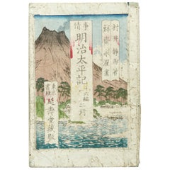
Antique Japanese History Book Meiji Era, circa 1878
Located in Barcelona, ES
Antique Japanese History book Meiji era, circa 1878 Woodblock print book Book dimensions: 182 mm x 121 mm There are damages because it is antique item as we show on the photos.
Category
Antique 1870s Japanese Meiji Books
Materials
Paper
Large Original Vintage Map of China, circa 1920
Located in St Annes, Lancashire
Great map of China.
Original color. Good condition.
Published by Alexander Gross
Unframed.
Category
Vintage 1920s English Edwardian Maps
Materials
Paper

More Ways To Browse
Historical Documents
Map Of Japan
Hand Drawn Map
Antique English Maps
Map Of India
British Empire Furniture
American West Antiques
Furniture Russian 18th Century
Antique Law Office Furniture
Map Stand
Antique Maps Of Italy
Antique Doctors
Antique Map India
Antique Topographic Maps
Antique Railroad
Antique Maps Of Africa
Railroad Furniture
Antiques Compasses