Items Similar to Jerusalem and Temple Imaginary Map by Blome, Published London 1689

Want more images or videos?
Request additional images or videos from the seller
1 of 11
Jerusalem and Temple Imaginary Map by Blome, Published London 1689
$644.70
£475.46
€540
CA$891.08
A$990.93
CHF 520.01
MX$12,083.97
NOK 6,573.14
SEK 6,162.58
DKK 4,111.10
About the Item
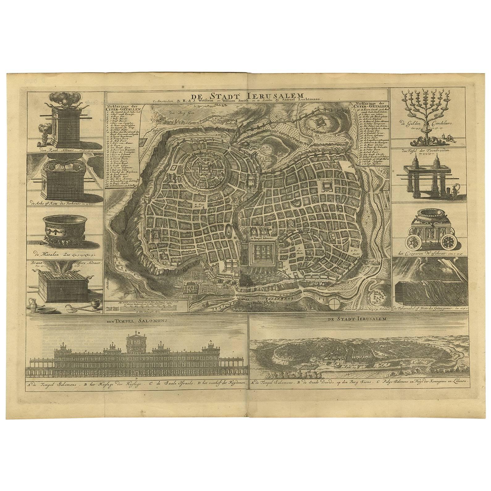
Imaginary Plan of Jerusalem by Blome after Villalpando, 1689
This impressive antique engraving presents an imaginary plan of Jerusalem by Richard Blome, published in 1689. The engraving is drawn after the influential work of Spanish Jesuit scholar Juan Bautista Villalpando, who in the late 16th century reconstructed the city and Solomon’s Temple based on biblical descriptions and his own interpretations. Blome adapted these designs for an English audience, combining theological scholarship with decorative cartography.
At the centre of the sheet is a highly detailed bird’s-eye view of Jerusalem, showcasing an idealised layout of the city’s streets, walls, and gates, with the Temple Mount as the prominent focal point. The plan is arranged with careful geometric divisions, reflecting Villalpando’s vision of a perfectly ordered sacred city rather than an accurate contemporary map.
Surrounding the plan are elaborate illustrations enhancing its religious significance. The upper part shows a grand elevation of the Temple of Jerusalem, designed with Renaissance-inspired architectural features. To the left are vignettes of King Solomon and ritual items such as the Altar of Incense and the Ark of the Covenant. On the right, the High Priest is depicted in full ceremonial garments, alongside the Menorah and temple furniture. Along the bottom are further illustrations including the Molten Sea basin and additional temple implements.
This engraving was published in London in 1689, a time when there was great interest in biblical scholarship, particularly in visualising sacred sites for educational and devotional purposes. Richard Blome (circa 1635–1705) was a prolific English cartographer and publisher known for his decorative maps and for making European cartographic works accessible in England.
Condition:
Fair. Overall age toning, minor foxing, a few short tears at the outer edges, a few affecting the engraved area. Creasing and some faint handling marks, typical for 17th-century prints. The impression remains strong. A few repairs with tape on the reverse. Folding line as issued.
Framing tips:
For an elegant presentation, frame this engraving in a dark walnut or antique gold frame to enhance its historic character. Use a neutral archival mat in off-white or cream to accentuate the intricate linework.
- Dimensions:Height: 16.74 in (42.5 cm)Width: 23.23 in (59 cm)Depth: 0.01 in (0.2 mm)
- Materials and Techniques:Paper,Engraved
- Place of Origin:
- Period:Late 17th Century
- Date of Manufacture:1689
- Condition:Fair. Overall age toning, minor foxing, a few short tears at the outer edges, a few affecting the engraved area. Creasing and some faint handling marks, typical for 17th-century prints. The impression remains strong. A few tape repairs on reverse.
- Seller Location:Langweer, NL
- Reference Number:Seller: BG-13757-111stDibs: LU3054345659692
About the Seller
5.0
Recognized Seller
These prestigious sellers are industry leaders and represent the highest echelon for item quality and design.
Platinum Seller
Premium sellers with a 4.7+ rating and 24-hour response times
Established in 2009
1stDibs seller since 2017
2,577 sales on 1stDibs
Typical response time: <1 hour
- ShippingRetrieving quote...Shipping from: Langweer, Netherlands
- Return Policy
Authenticity Guarantee
In the unlikely event there’s an issue with an item’s authenticity, contact us within 1 year for a full refund. DetailsMoney-Back Guarantee
If your item is not as described, is damaged in transit, or does not arrive, contact us within 7 days for a full refund. Details24-Hour Cancellation
You have a 24-hour grace period in which to reconsider your purchase, with no questions asked.Vetted Professional Sellers
Our world-class sellers must adhere to strict standards for service and quality, maintaining the integrity of our listings.Price-Match Guarantee
If you find that a seller listed the same item for a lower price elsewhere, we’ll match it.Trusted Global Delivery
Our best-in-class carrier network provides specialized shipping options worldwide, including custom delivery.More From This Seller
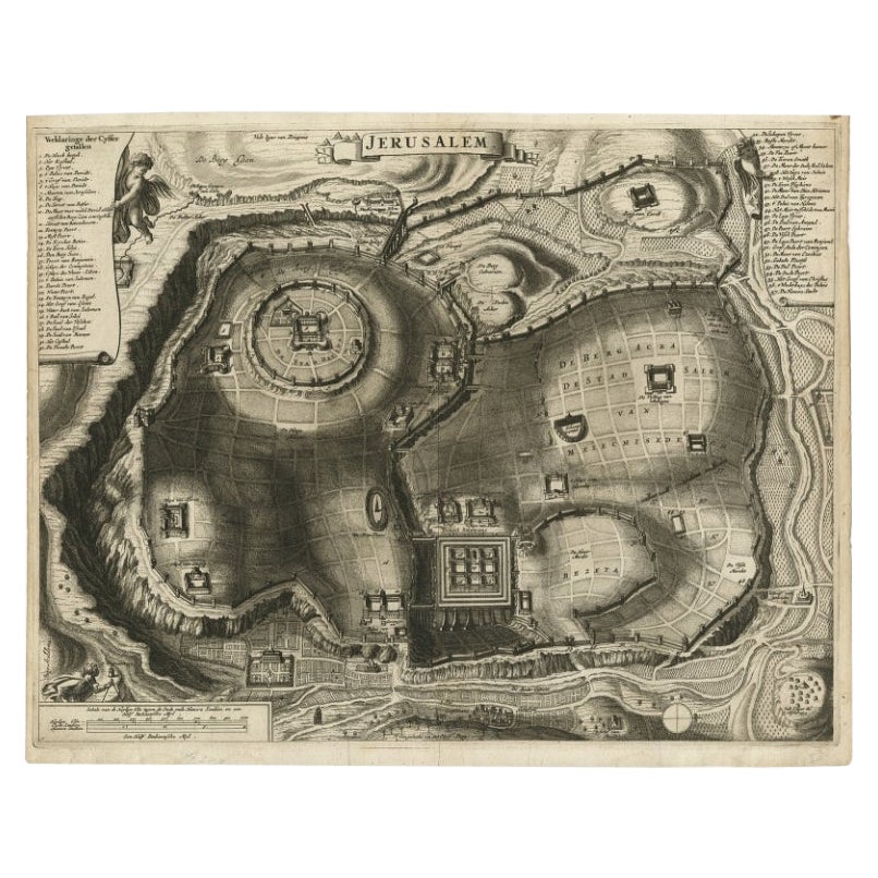
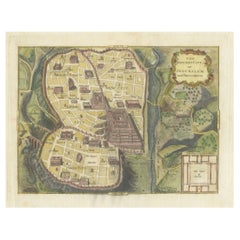
View AllAntique Detailed Map of Jerusalem in Israël with Extensive Key and Scale, 1698
Located in Langweer, NL
Antique map titled 'Jerusalem.'
Plan of the ancient city of Jerusalem. With extensive key and scale. Source unknown, to be determined.
Artists and Engravers: Made by 'Cornelis de...
Category
Antique 17th Century Maps
Materials
Paper

$620 Sale Price
20% Off
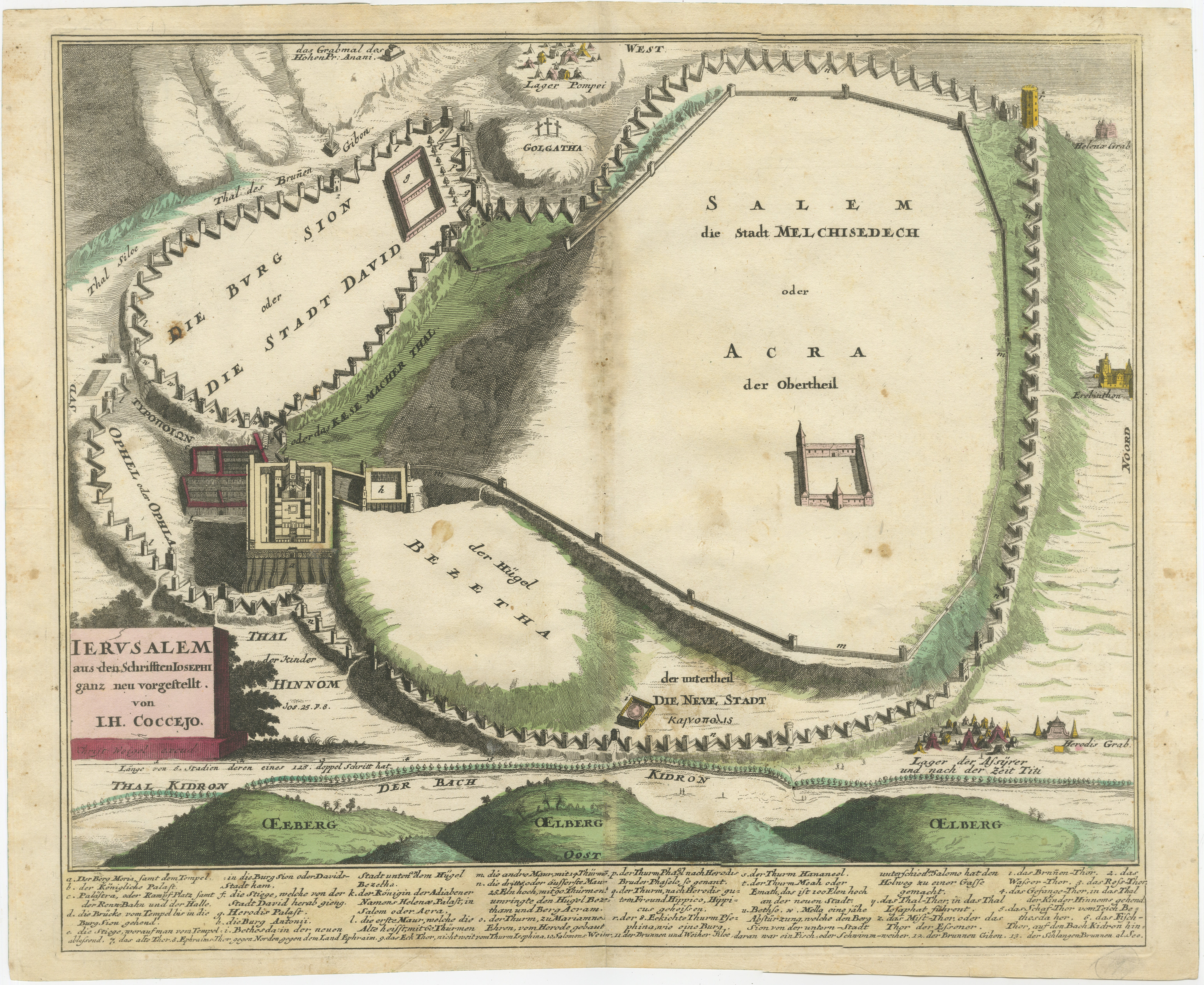
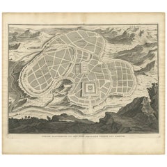
Original Antique Map of Jerusalem Based on Josephus' Writings by Weigel, ca.1720
Located in Langweer, NL
1720 Weigel Map of Jerusalem Based on Josephus' Writings
This intricate 1720 bird's-eye view map of ancient Jerusalem by I.H. Coccejo, engraved by Christoph Weigel, offers a fasc...
Category
Antique 1720s Maps
Materials
Paper

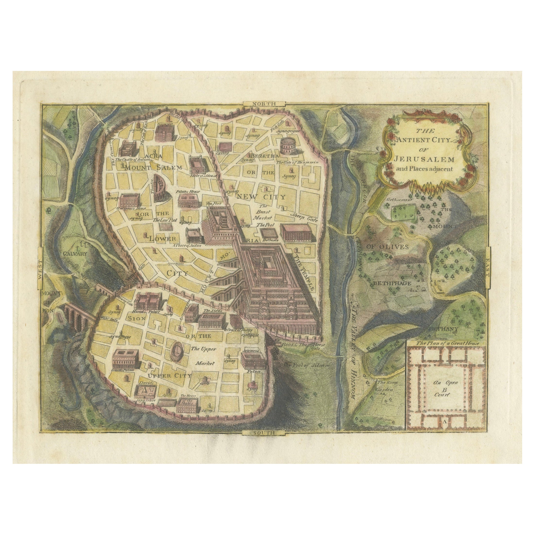
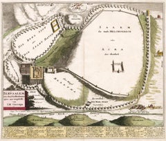
The Antient City of Jerusalem and Places Adjacent, Hand-Colored Map, 1699
Located in Langweer, NL
Title: "1699 Hand-Colored Bird's-Eye Plan of Jerusalem with Ancient and Biblical Landmarks"
This beautifully hand-colored, imaginary bird's-eye plan of Jerusalem, published in 1699,...
Category
Antique 1690s Maps
Materials
Paper
$248 Sale Price
20% Off
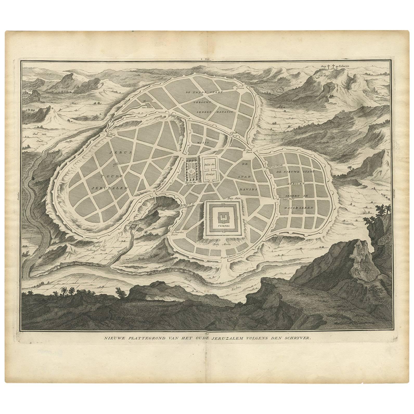
Antique Map of the Ancient City of Jerusalem by A. Calmet, 1725
Located in Langweer, NL
Antique map, titled: 'Nieuwe Plattegrond van het Oude Jeruzalem Volgens den Schryver.' - Bird's-eye view of the ancient city of Jerusalem shows its divisions with prominent depiction...
Category
Antique Early 18th Century Prints
Materials
Paper
$248 Sale Price
20% Off
Antique Bible Plan of Ancient Jerusalem, 1743
Located in Langweer, NL
This plan originates from ‘Biblia Sacra, dat is, de H. Schriftuer van het Oude, en het Nieuwe Testament, naer de laetste Roomsche keure der gemeine Latijnsche overzettinge, in nederd...
Category
Antique Mid-18th Century Maps
Materials
Paper

$819 Sale Price
37% Off
Antique Bible Plan of Jerusalem by Covens & Mortier, 1743
Located in Langweer, NL
This plan originates from ‘Biblia Sacra, dat is, de H. Schriftuer van het Oude, en het Nieuwe Testament, naer de laetste Roomsche keure der gemeine Latijnsche overzettinge, in nederd...
Category
Antique Mid-18th Century Maps
Materials
Paper

$525 Sale Price
20% Off
You May Also Like
Ancient Map - Zeilan - Etching by Johannes Janssonius - 1650s
By Johannes Janssonius
Located in Roma, IT
Ancient Map - Zeilan is an ancient map realized in 1650 by Johannes Janssonius (1588-1664).
The Map is Hand-colored etching, with coeval watercoloring.
...
Category
1650s Modern Figurative Prints
Materials
Etching

17th Century Topographical Map of Cote D'azur, Avignon, Frejus by Iohan Peeters
Located in New York, NY
Fine topographical 17th century map by Iohan Peeters of the towns of Avignon and Frejus in the Cote d'Azur-Provence-Alpes Region of Southeastern France.
Beautifully suited decorativ...
Category
Antique 17th Century Dutch Maps
Materials
Paper

17th Century Toulouse, Savve, Sommieres Topographical Map by Iohan Peeters
Located in New York, NY
Fine topographical 17th century map of Toulouse, Savve and Sommieres by Iohan Peeters
Beautiful engraving of the capital of France's Occitanie Region, Toulouse, called La Ville Rose- the Pink City, for the terracotta bricks used in its many buildings, giving the city a distinct apricot-rose hue. An important cultural and educational center, the city's residents included Nobel Prize winners and world renown artists- Henri de Toulouse-Lautrec, Henri Martin, Jean-Auguste-Dominique Ingres, Antonin Mercie, Alexandre Falguiere and more recently Cyril Kongo...
Category
Antique 17th Century Dutch Maps
Materials
Paper

1597 German Map of Alexandria by Georg Braun and Frans Hogenberg
By Georg Braun and Frans Hogenberg
Located in Chapel Hill, NC
1597 Map of Alexandria by Georg Braun and Frans Hogenberg, Germany. From "Civitas Orbis Terrarum", part 2, published in Cologne by Bertram Buchholz. Printed in 2 parts. Title: "Alexa...
Category
Antique 16th Century German Renaissance Maps
Materials
Paper

17th Century Dutch Map of the Holy Land at the Time of Jesus by Visscher
By Nicolaus Visscher
Located in Alamo, CA
This detailed Dutch map entitled "Het Beloofe de Landt Canaan door wandelt van onsen Salichmaecker Iesu Christo, nessens syne Apostelen" by Nicolaes Visscher (1610-1679), published i...
Category
1660s Prints and Multiples
Materials
Engraving

Map of Biblical Jerusalem
Located in New York, NY
Original copper engraving hand-colored at the time of publication. Nuremberg, 1720.
Category
1720s Prints and Multiples
Materials
Paper
More Ways To Browse
Jerusalem Furniture
Antique Architectural Plans
Altar Frame
Antique Ark
Folding Gate
Gold Menorah
Ceremonial Vignette
Altar Gates
Curved Velvet Couch
Velvet Curved Sofa
Wood Round Coffee Tables
Oak Brutalist
Used College Furniture
Wood Minimalist Chair
Antique Imperial Furniture
Gold Modern Coffee Table
Large Side Tables
18th Century Gilded Furniture