Items Similar to Large Antique Map of the west coast of Celebes, Sulawesi, Indonesia

Want more images or videos?
Request additional images or videos from the seller
1 of 6
Large Antique Map of the west coast of Celebes, Sulawesi, Indonesia
$405.68
$872.6953% Off
£303.66
£653.2353% Off
€344
€74053% Off
CA$558.33
CA$1,201.0753% Off
A$622.32
A$1,338.7153% Off
CHF 326.51
CHF 702.3853% Off
MX$7,599.56
MX$16,347.8953% Off
NOK 4,134.34
NOK 8,893.6353% Off
SEK 3,907.58
SEK 8,405.8353% Off
DKK 2,618.77
DKK 5,633.4053% Off
About the Item
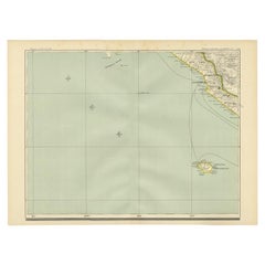
Original antique map titled 'Kaart der Westkust van Celebes van Makasser tot Laijkan'. This large map shows the west coast of Celebes, Sulawesi, Indonesia. It covers the region of Makassar to Cikoang. Inset map of the coast of Selat (Strait) Makassar, also showing the Dutch Fort Rotterdam, to day Fort Ujung Pandang. With historical traces dating back to the Kingdom of Gowa from the 16th century to colonization by the Dutch, this Fort has silently witnessed many episodes in Makassar’s history, playing a most essential role in its development. Originally called Benteng or Fort Jumpandang or Ujung Pandang, the huge complex was first built in 1545 in the era of Imanrigau Daeng Bonto Karaeng Lakiung or Karaeng Tunipalangga Ulaweng, the tenth King of Gowa. Initially, the fort was made from a mixture of Stone and burnt clay, and took the shape of a typical square Portuguese architectural style.
Published 1848.
- Dimensions:Height: 30.48 in (77.4 cm)Width: 21.38 in (54.3 cm)Depth: 0.02 in (0.5 mm)
- Materials and Techniques:
- Period:
- Date of Manufacture:1848
- Condition:Repaired. Wear consistent with age and use. General age-related toning. The map has been professionally restored along almost every margin and a horizontal restoration in the center of the map. Shows a few small splits and stains. Blank verso. Later hand coloring. Please study image carefully.
- Seller Location:Langweer, NL
- Reference Number:Seller: BG-13274-71stDibs: LU3054331099002
About the Seller
5.0
Recognized Seller
These prestigious sellers are industry leaders and represent the highest echelon for item quality and design.
Platinum Seller
Premium sellers with a 4.7+ rating and 24-hour response times
Established in 2009
1stDibs seller since 2017
2,517 sales on 1stDibs
Typical response time: <1 hour
- ShippingRetrieving quote...Shipping from: Langweer, Netherlands
- Return Policy
Authenticity Guarantee
In the unlikely event there’s an issue with an item’s authenticity, contact us within 1 year for a full refund. DetailsMoney-Back Guarantee
If your item is not as described, is damaged in transit, or does not arrive, contact us within 7 days for a full refund. Details24-Hour Cancellation
You have a 24-hour grace period in which to reconsider your purchase, with no questions asked.Vetted Professional Sellers
Our world-class sellers must adhere to strict standards for service and quality, maintaining the integrity of our listings.Price-Match Guarantee
If you find that a seller listed the same item for a lower price elsewhere, we’ll match it.Trusted Global Delivery
Our best-in-class carrier network provides specialized shipping options worldwide, including custom delivery.More From This Seller
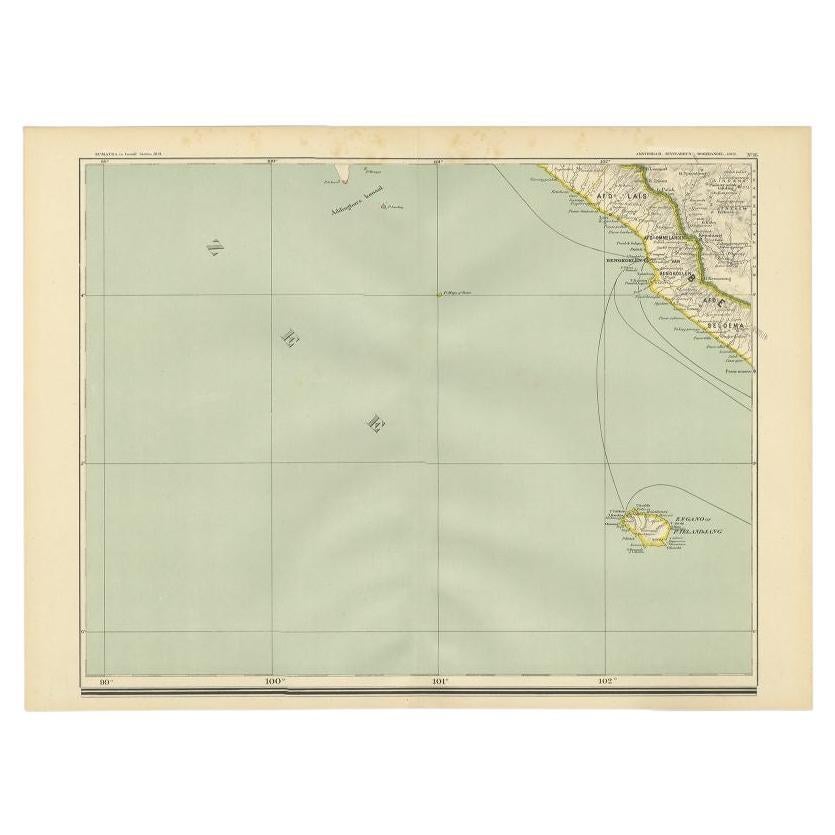
View AllAntique Map of the East Coast of Sumatra , Indonesia, 1900
Located in Langweer, NL
Antique map of the East Coast of Sumatra. Also depicting the Strait of Malacca. This map originates from 'Atlas van Nederlandsch Oost- en West-Indië' by I. Dornseiffen.
Artists and...
Category
20th Century Maps
Materials
Paper

Antique Map of the Region of Bengkulu in Indonesia, 1900
Located in Langweer, NL
Antique map of the region of Benkulu, Sumatra. Also depicting Enggano Island. This map originates from 'Atlas van Nederlandsch Oost- en West-Indië' by I. Dornseiffen.
Artists and E...
Category
20th Century Maps
Materials
Paper
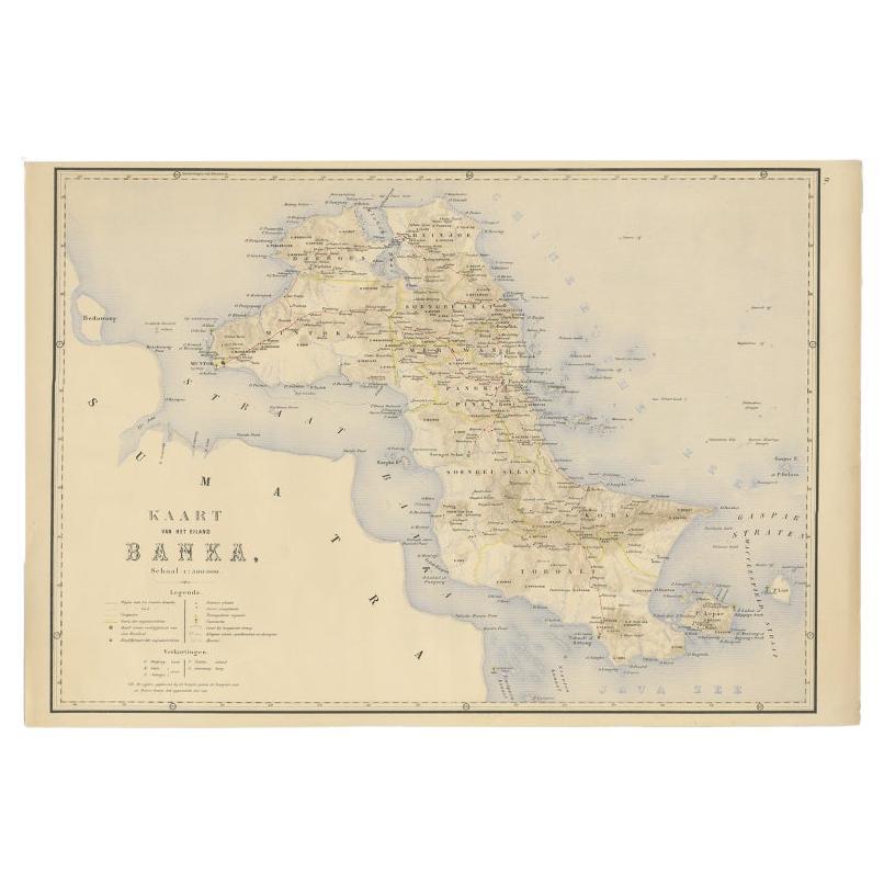
Antique Map of Bangka Island, Indonesia, 1885
Located in Langweer, NL
Antique map titled 'Kaart van het Eiland Banka. Old map of Bangka Island, or Banka. This map originates from 'Atlas der Nederlandsche bezittingen in Oost-Indië naar de nieuwste bronn...
Category
Antique 19th Century Maps
Materials
Paper
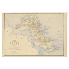
$330 Sale Price
20% Off
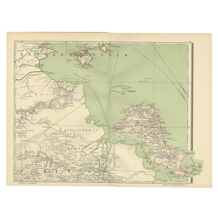
Antique Map of the Region of Banjarmasin, Indonesia 1900
Located in Langweer, NL
Antique Map of the Region of Banyuasin, Sumatra. Also depicting Bangka/Banka island. This map originates from 'Atlas van Nederlandsch Oost- en West-Indië' by I. Dornseiffen.
Artist...
Category
20th Century Maps
Materials
Paper

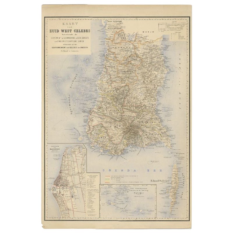
Antique Map of Southern Sulawesi by Stemfoort, 1885
Located in Langweer, NL
"Antique map titled 'Kaart van Zuid West Celebes'. Old map of the southern tip of the southwestern part of Sulawesi. Includes a large inset map of the Makassar area, centered on Fort...
Category
Antique 19th Century Maps
Materials
Paper
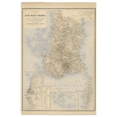
$258 Sale Price
20% Off
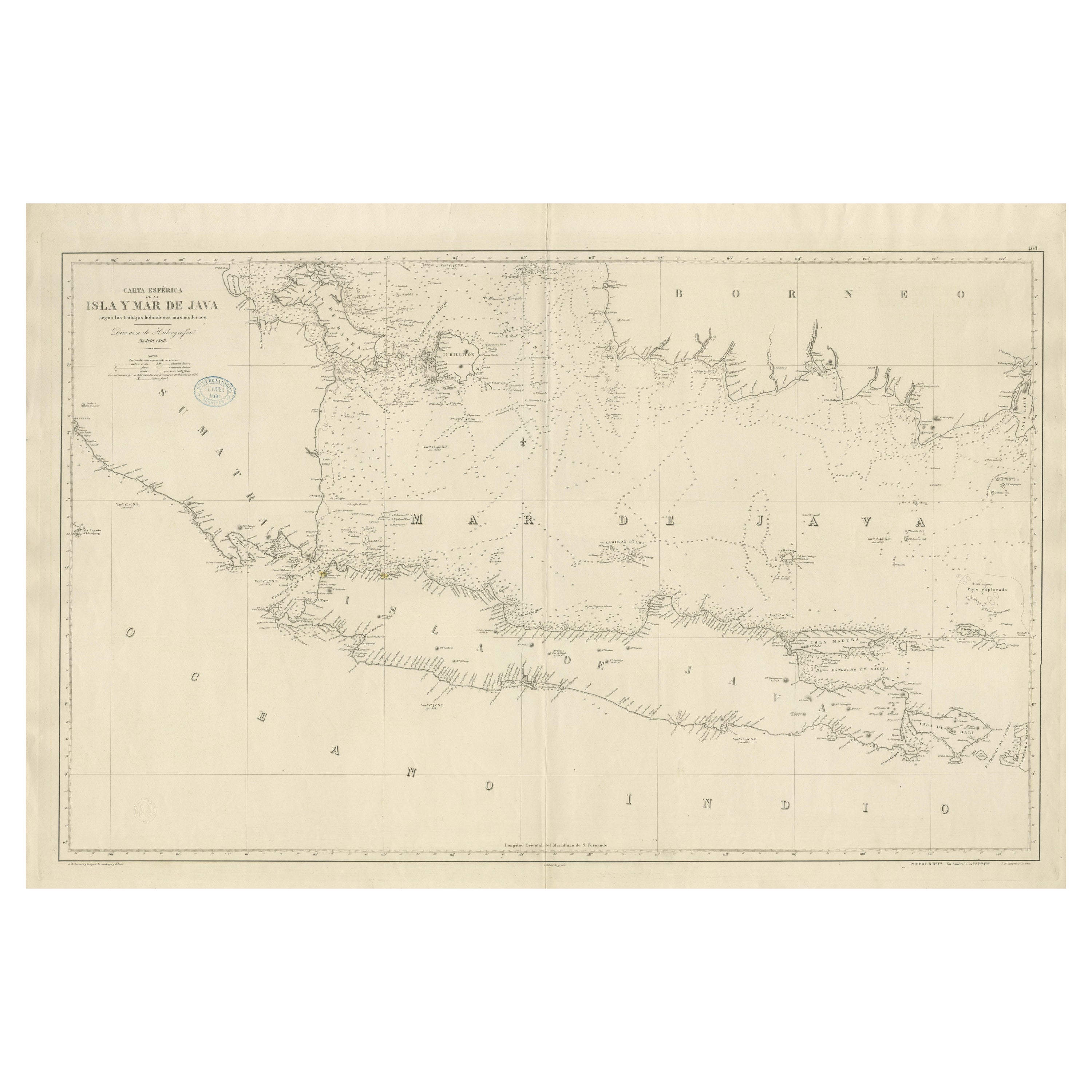
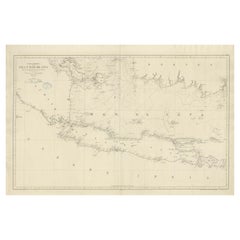
Large Chart of the island and sea of Java, Indonesia
Located in Langweer, NL
Antique map titled 'Carte Esférica de la Isla Y Mar de Java'. Large chart of the island and sea of Java, Indonesia. Beautiful nautical chart, published 1863 in Spain.
Category
Antique Mid-19th Century Maps
Materials
Paper
$2,358 Sale Price
20% Off
You May Also Like
Large Original Antique Map of Java and Borneo, Fullarton, C.1870
Located in St Annes, Lancashire
Great map of Java and Borneo
Wonderful figurative borders
From the celebrated Royal Illustrated Atlas
Lithograph. Original color.
Published by Fullarton, Edinburgh. C.1870
Unfr...
Category
Antique 1870s Scottish Maps
Materials
Paper

Large Original Antique Map of the The Windward Islands. 1894
Located in St Annes, Lancashire
Superb Antique map of The Windward Islands
Published Edward Stanford, Charing Cross, London 1894
Original colour
Good condition
Unframed.
Free shipping
Category
Antique 1890s English Maps
Materials
Paper

Large Original Antique Map of The Bahamas. 1894
Located in St Annes, Lancashire
Superb Antique map of The Bahamas
Published Edward Stanford, Charing Cross, London 1894
Original colour
Good condition
Unframed.
Free shipping
Category
Antique 1890s English Maps
Materials
Paper

Antique Maritime Chart of East Coast Virginia to Nova Scotia
Located in Norwell, MA
1920 nautical chart of the East Coast of the United States from Virginia to Maine, New Brunswick, and Nova Scotia. The chart shows Cape Cod, Long Island, the Connecticut coast, Jersey Shore, Maine, New Hampshire, etc. Very detailed, showing ports, lighthouses, shoals, depths, etc. The chart is by famous cartographer George W. Eldridge, compiled from surveys of the United States government, British Admiralty, George Eldridge, and others. First authorized by George Eldridge, published in 1916 by Wilfred O. White with a merchant's stamp of Charles Hutchinson...
Category
Vintage 1920s North American Maps
Materials
Paper

Large Original Antique Map of The Greek Islands. 1894
Located in St Annes, Lancashire
Superb Antique map of The Greek Islands
Published Edward Stanford, Charing Cross, London 1894
Original colour
Good condition
Unframed.
Free shipping
Category
Antique 1890s English Maps
Materials
Paper

Original Antique Map of US Possessions In The Pacific Ocean, C.1900
Located in St Annes, Lancashire
Fabulous map of US possessions in the Pacific Ocean
Original color.
Engraved and printed by the George F. Cram Company, Indianapolis.
Published, C.1900.
Unframed.
Free shipping.
Category
Antique 1890s American Maps
Materials
Paper

More Ways To Browse
Patagonia Map
Shepherd And Hedger
Vignola Furniture
Washington Dc Map
Antique Map Of Cornwall
Coronelli Globe
Vintage Bartholomew Maps
Antique Alabama Map
Cape Cod Map
Goa France
Antique Planisphere
Charlotte Reine
Dutch Malacca
Gabon Antique Map
J And C Bavaria
Map Of Barbados
Montreal Map
Antique Furniture Toledo Ohio