Items Similar to Late 16th Century Sheet with Copper Engravings of India, Pakistan, etc, 1598


Want more images or videos?
Request additional images or videos from the seller
1 of 7
Late 16th Century Sheet with Copper Engravings of India, Pakistan, etc, 1598
$537.23
$671.5420% Off
£399.65
£499.5620% Off
€448
€56020% Off
CA$735.65
CA$919.5720% Off
A$817.95
A$1,022.4320% Off
CHF 427.09
CHF 533.8620% Off
MX$9,956.42
MX$12,445.5220% Off
NOK 5,449.45
NOK 6,811.8120% Off
SEK 5,105.87
SEK 6,382.3420% Off
DKK 3,410.38
DKK 4,262.9720% Off
Shipping
Retrieving quote...The 1stDibs Promise:
Authenticity Guarantee,
Money-Back Guarantee,
24-Hour Cancellation
About the Item
One sheet with two engraved maps, one on each site, and text in Italian. Late 16th century copper engravings in great condition, considering its age.
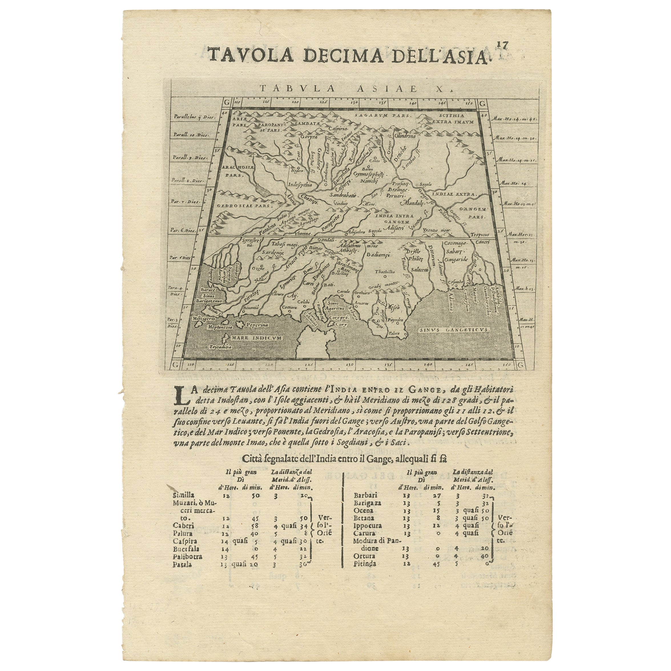
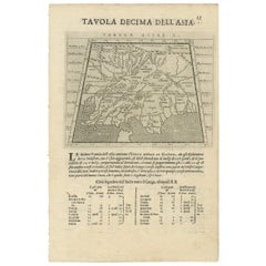
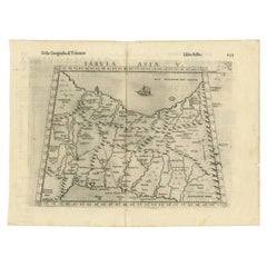
"Tavola Decima Dell'Asia" - Tabula Asiae X" Plate X (10). Pakistan, Cashmir, Bangla Desh, North-India between Indus and Ganges
Type of print: Copper etching
Artist: Girolamo Porro after Ptolemy
Published in: "Geografia cioe Descrittione Universale della Terra"
Publisher: Gio. Battista & Giorgio Galignani Fratelli
Edition: Italian edition
Editor: Giovanni Antonio Magini (1555-1617)
Text: Italian. Complete on front and on reverse side: Tavola Undecicima Asiae (11)
Published in: Venice
Date: 1598
Measurements:
Map size: Ca. 12,5 x 17 cm (ca. 4.9 x 6.7")
Page size: Ca. 28,5 x 19 cm (ca. 11.2 x 7.5")
Condition: Very minor traces of age.
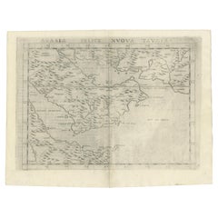
REVERSE SIDE:
"Tavola Undecima Dell'Asia" - Tabula Asiae XI" Plate XI (11). Bangla Desh, Northeast-India,
Myanmar (Birma), Laos, Thailand, Southwest-China, Singapore
Type of print: Copper etching
Artist: Girolamo Porro after Ptolemy
Published in:"Geografia cioe Descrittione Universale della Terra"
Publisher: Gio. Battista & Giorgio Galignani Fratelli
Edition: Italian edition
Editor: Giovanni Antonio Magini (1555-1617)
Text:Italian. Complete on front and on reverse side: Tavola Decima Asiae
Published in: Venice
Date: 1598
Measurements:
Map size: Ca. 12,5 x 17 cm (ca. 4.9 x 6.7")
Page size: Ca. 28,5 x 19 cm (ca. 11.2 x 7.5")
Condition: Very minor traces of age.
- Dimensions:Height: 11.82 in (30 cm)Width: 8.08 in (20.5 cm)Depth: 0 in (0.02 mm)
- Materials and Techniques:
- Period:
- Date of Manufacture:1598
- Condition:Excellent condition, considering age. Very light browning of the paper. Check the image carefully.
- Seller Location:Langweer, NL
- Reference Number:Seller: BGSH-0191stDibs: LU3054328597362
About the Seller
5.0
Recognized Seller
These prestigious sellers are industry leaders and represent the highest echelon for item quality and design.
Platinum Seller
Premium sellers with a 4.7+ rating and 24-hour response times
Established in 2009
1stDibs seller since 2017
2,510 sales on 1stDibs
Typical response time: <1 hour
- ShippingRetrieving quote...Shipping from: Langweer, Netherlands
- Return Policy
Authenticity Guarantee
In the unlikely event there’s an issue with an item’s authenticity, contact us within 1 year for a full refund. DetailsMoney-Back Guarantee
If your item is not as described, is damaged in transit, or does not arrive, contact us within 7 days for a full refund. Details24-Hour Cancellation
You have a 24-hour grace period in which to reconsider your purchase, with no questions asked.Vetted Professional Sellers
Our world-class sellers must adhere to strict standards for service and quality, maintaining the integrity of our listings.Price-Match Guarantee
If you find that a seller listed the same item for a lower price elsewhere, we’ll match it.Trusted Global Delivery
Our best-in-class carrier network provides specialized shipping options worldwide, including custom delivery.More From This Seller
View AllTwo Maps of Asia on One Sheet, India, Bangladesh and Malaysia & Burma etc., 1617
Located in Langweer, NL
Antique map titled 'Tabula Asiae'.
Two maps of Asia on one sheet, recto and verso. The recto features an interesting map of India, Bangladesh and the Ganges River. On the verso, ...
Category
Antique 1610s Maps
Materials
Paper
$613 Sale Price
20% Off
Rare and Very Old Antique Map of South East Asia, Published circa 1574
Located in Langweer, NL
A very fine impression of this map of the Malay Peninsula, Sumatra, Java, with Singapore denoted as 'Cinca Pula'.
Highly distorted and inaccurate map by Girolamo Ruscelli after J...
Category
Antique 16th Century Maps
Materials
Paper

$1,151 Sale Price
20% Off
Free Shipping
Old Ptolemaic Map of the Region Between the Persian Gulf and Caspian Sea, 1598
Located in Langweer, NL
"Tabula Asiae V", Ptolemy/Ruscelli
Subject: Persia - Iran
Period: 1598 (published)
Publication: Geografia di Claudio Tolomeo Allessadrino…
Claudius Ptolemy was a mathematician, ast...
Category
Antique 16th Century Maps
Materials
Paper
$383 Sale Price
20% Off
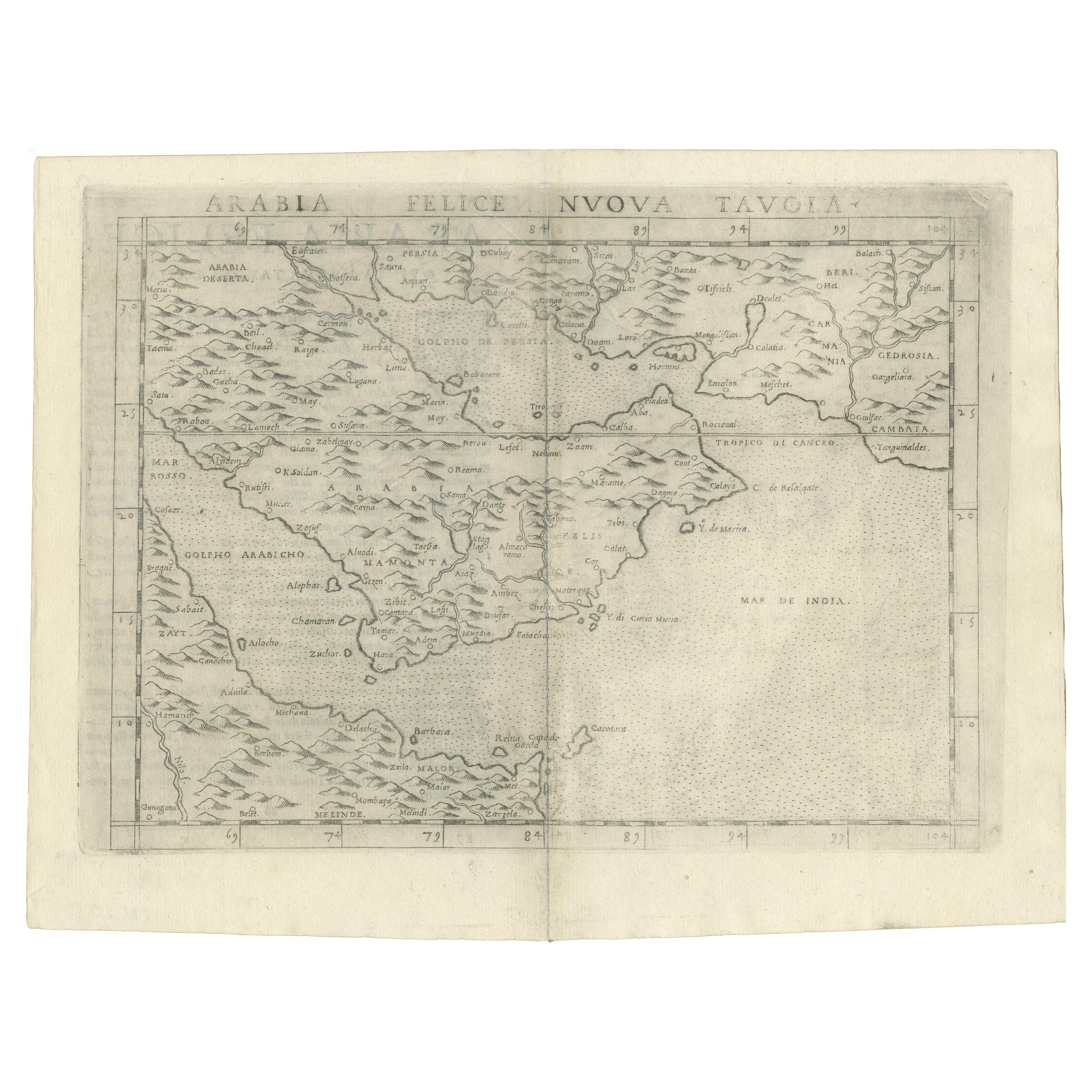
16th Century Map of Saudi Arabia, the Persian Gulf and Red Sea, ca. 1574
Located in Langweer, NL
Ptolemaic map of the Arabian Peninsula based on the 1548 map of Giacomo Gastaldi. It covers nearly all of the peninsula, but does not include the head of the Red Sea. The coastlines ...
Category
Antique 16th Century Maps
Materials
Paper
$440 Sale Price
20% Off
Antique Map of the Mughal Empire by Van der Aa, C.1725
By Pieter Van Der Aa
Located in Langweer, NL
Antique map titled 'Royaume de Grand Mogol (..).' This map shows the extend of the Mughal Empire, which includes northern India, from Golconda to Afghanistan and eastwards to Bengal....
Category
Antique 18th Century Maps
Materials
Paper

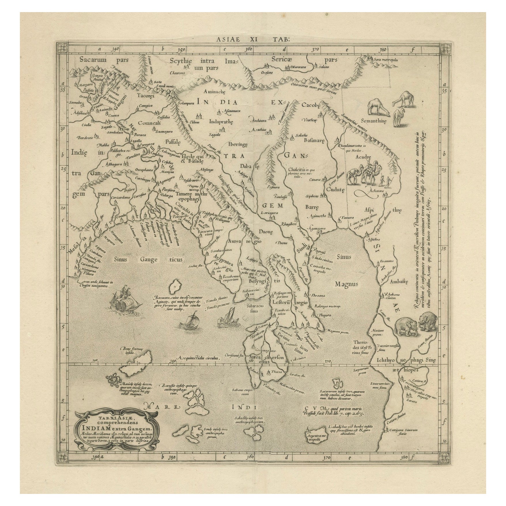
1698 Mercator Ptolemaic Map of Asia East of the Ganges
Located in Langweer, NL
**Catalogue Description:**
**Title:** Tab. XI. Asiae, comprehendens Indiam extra Gangem.
**Description:**
This is an exquisite Ptolemaic map depicting Asia east of the Ganges, ti...
Category
Antique 1680s Maps
Materials
Paper

$901 Sale Price
20% Off
You May Also Like
Engraving Depicting 16th Century Map of Terra Sancta
Located in Buchanan, MI
Abraham Ortelius (Flemish, 1527-1598) Terra Sancta.
Engraving depicting 16th century map of Terra Sancta. Site 15" x 19.5.
Category
Antique 18th Century and Earlier Maps
Materials
Paper

1627 Hendrik Hondius Map Entitled "Vltoniae Orientalis Pars, " Ric.a009
Located in Norton, MA
1627 Hendrik Hondius map entitled
"Vltoniae orientalis pars,"
Ric.a009
Title:
Vltoniae orientalis : pars
Title (alt.) :
Ultoniae orientalis pars
Creator:
Mercator, Gerh...
Category
Antique 17th Century Dutch Maps
Materials
Paper

1633 Map Entitled "Beauvaisis Comitatus Belova Cium, Ric.0002
Located in Norton, MA
1633 map entitled
"Beauvaisis Comitatus Belova Cium,"
Hand Colored
Ric.0002
Description: Cartographer : - Hondius, Henricus 1587-1638
Artists and Engravers:Jodocus Hondius, one of the most notable engravers of his time. He is known for his work in association with many of the cartographers and publishers prominent at the end of the sixteenth and the beginning of the seventeenth century. A native of Flanders, he grew up in Ghent, apprenticed as an instrument and globe maker and map engraver. In 1584, to escape the religious troubles sweeping the Low Countries at that time, he fled to London where he spent some years before finally settling in Amsterdam about 1593. In the London period he came into contact with the leading scientists and geographers of the day and engraved maps in The Mariner\\\\\\\\\\\\\\\'s Mirrour, the English edition of Waghenaer\\\\\\\\\\\\\\\'s Sea Atlas, as well as others with Pieter van den Keere, his brother-in-law. No doubt his temporary exile in London stood him in good stead, earning him an international reputation, for it could have been no accident that Speed chose Hondius to engrave the plates for the maps in The Theatre of the Empire of Great Britaine in the years between 1605 and 1610. In 1604 Hondius bought the plates of Mercator\\\\\\\\\\\\\\\'s Atlas which, in spite of its excellence, had not competed successfully with the continuing demand for the Ortelius Theatrum Orbis Terrarum. To meet this competition Hondius added about 40 maps to Mercator\\\\\\\\\\\\\\\'s original number and from 1606 published enlarged editions in many languages, still under Mercator\\\\\\\\\\\\\\\'s name but with his own name as publisher. These atlases have become known as the Mercator/Hondius series. The following year the maps were reengraved in miniature form and issued as a pocket Atlas Minor. After the death of Jodocus Hondius the Elder in 1612, work on the two atlases, folio and miniature, was carried on by his widow and sons, Jodocus II and Henricus, and eventually in conjunction with Jan Jansson in Amsterdam.
In all, from 1606 onwards, nearly 50 editions with increasing numbers of maps with texts in the main European languages were printed. Summaries of these issues are given under the entry for Gerard Mercator. Jodocus Hondius the Elder * 1588 Maps in The Mariner\\\\\\\\\\\\\\\'s Mirrour (Waghenaer/Ashley) * 1590 World Map...
Category
Antique 17th Century Dutch Maps
Materials
Paper

Antique French Map of Asia Including China Indoneseia India, 1783
Located in Amsterdam, Noord Holland
Very nice map of Asia. 1783 Dedie au Roy.
Additional information:
Country of Manufacturing: Europe
Period: 18th century Qing (1661 - 1912)
Condition: Overall Condition B (Good Used)...
Category
Antique 18th Century European Maps
Materials
Paper

$648 Sale Price
20% Off
1590 Mercator Map Entitled "France Picardie Champaigne, Ric.0001
Located in Norton, MA
Description: Published in Amsterdam by Mercator/Hondius ca. 1590.
Ric.0001
Artists and Engravers: Map : 'France Picardie Champaigne cum regionibus adiacentibus'. (Map of the french provinces of Picardie and Champagne.) Copper engraved map of the french provinces of Picardie and Champagne, showing the cities of Caen, Paris, Melun, Auxerre, Verdun, etc. Copperplate engraving on verge type hand laid paper with watermark. Description: Published in Amsterdam by Mercator/Hondius ca. 1600.Artists and Engravers: Mercator was born in Rupelmonde in Flanders and studied in Louvain under Gemma Frisius, Dutch writer, astronomer and mathematician. The excellence of his work brought him the patronage of Charles V, but in spite of his favor with the Emperor he was caught up in the persecution of Lutheran protestants and charged with heresy, fortunately without serious consequences. No doubt the fear of further persecution influenced his move in 1552 to Duisburg, where he continued the production of maps, globes and instruments. Mercator's sons and grandsons, were all cartographers and made their contributions in various ways to his atlas. Rumold, in particular, was responsible for the complete edition in 1595. The map plates...
Category
Antique 16th Century Dutch Maps
Materials
Paper

1592 Abraham Ortelius Map "Lorraine: Lotharingiae Nova Descripti, Ric.A005
Located in Norton, MA
1592 Abraham Ortelius map entitled
"Lorraine: Lotharingiae Nova Descripti
Ric.a005
Description: Ortelius is best known for producing the atlas from which this map comes from, "...
Category
Antique 16th Century Dutch Maps
Materials
Paper

More Ways To Browse
Antique Copper Engravings
16th Century Plate
India Engraving
Singapore Antique
Porro Italy
Burmese Antique Print
Laos Antique Map
Caucasus Map
Map Of Puerto Rico
Nevada Antique Map
Shetland Map
Antique Chicago Maps
Kolkata Antique Furniture
Antique Bermuda Furniture
Antique Dairy Collectibles
Antique Map Of Cuba
Antique Map Of Yorkshire
Antique Map Vietnam