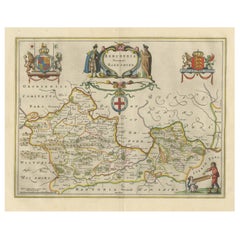
Items Similar to Leicestershire – Antique Map of Leicester by Richard Blome, Britannia 1673

Video Loading
Want more images or videos?
Request additional images or videos from the seller
1 of 11
Leicestershire – Antique Map of Leicester by Richard Blome, Britannia 1673
$422.11
$527.6420% Off
£314.01
£392.5120% Off
€352
€44020% Off
CA$578.01
CA$722.5220% Off
A$642.67
A$803.3420% Off
CHF 335.57
CHF 419.4620% Off
MX$7,822.90
MX$9,778.6220% Off
NOK 4,281.71
NOK 5,352.1420% Off
SEK 4,011.76
SEK 5,014.6920% Off
DKK 2,679.58
DKK 3,349.4820% Off
Shipping
Retrieving quote...The 1stDibs Promise:
Authenticity Guarantee,
Money-Back Guarantee,
24-Hour Cancellation
About the Item
Leicestershire – Antique Map of Leicester by Richard Blome, Britannia 1673
This original antique map titled A Mapp of the Country of Leicester presents a detailed and decorative depiction of Leicestershire, England. Published in 1673 by Richard Blome, one of the leading cartographers of Restoration England, this map is from his important work Britannia: or, a Geographical Description of the Kingdoms of England, Scotland, and Ireland. Blome’s Britannia aimed to provide a comprehensive and visually engaging description of the British Isles at a time of increasing interest in national identity and regional geography.
The map is delicately hand-colored and features county boundaries, towns, forests, rivers, and roads. Prominent settlements such as Leicester, Loughborough, and Market Harborough are marked, and the surrounding counties—Warwickshire, Northamptonshire, Derbyshire, and others—are outlined. A large decorative cartouche bearing the royal coat of arms is positioned in the lower left corner, reinforcing the official and celebratory nature of Blome’s work.
Blome was known for commissioning his maps using a subscription model, and while he borrowed liberally from earlier cartographers like Saxton and Speed, his editions are prized for their unique aesthetic, typically engraved by Wenceslaus Hollar or Francis Lamb, with richly symbolic flourishes.
Maps from Britannia such as this one are valued for their historical content and as examples of 17th-century English cartography, blending geographic accuracy with ornate Baroque design.
Condition report: Very good condition with clear impressions and attractive hand-coloring. Some light age toning and a few minor spots in the margins. No tears, two small tapes on the back of the paper, which are not visible from the front.
Framing tips: A period-style black or dark oak frame with an ivory or pale tan mat would complement the muted hand-coloring and engraved detailing. A gilt fillet could add an elegant historical touch.
- Dimensions:Height: 10.79 in (27.4 cm)Width: 13.39 in (34 cm)Depth: 0.02 in (0.5 mm)
- Materials and Techniques:Paper,Engraved
- Place of Origin:
- Period:Late 17th Century
- Date of Manufacture:1673
- Condition:Very good condition with clear impressions and attractive hand-coloring. Some light age toning and a few minor spots in the margins. No tears, two small tapes on the back of the paper, which are not visible from the front.
- Seller Location:Langweer, NL
- Reference Number:Seller: BG-13324-31stDibs: LU3054333591322
About the Seller
5.0
Recognized Seller
These prestigious sellers are industry leaders and represent the highest echelon for item quality and design.
Platinum Seller
Premium sellers with a 4.7+ rating and 24-hour response times
Established in 2009
1stDibs seller since 2017
2,511 sales on 1stDibs
Typical response time: <1 hour
- ShippingRetrieving quote...Shipping from: Langweer, Netherlands
- Return Policy
Authenticity Guarantee
In the unlikely event there’s an issue with an item’s authenticity, contact us within 1 year for a full refund. DetailsMoney-Back Guarantee
If your item is not as described, is damaged in transit, or does not arrive, contact us within 7 days for a full refund. Details24-Hour Cancellation
You have a 24-hour grace period in which to reconsider your purchase, with no questions asked.Vetted Professional Sellers
Our world-class sellers must adhere to strict standards for service and quality, maintaining the integrity of our listings.Price-Match Guarantee
If you find that a seller listed the same item for a lower price elsewhere, we’ll match it.Trusted Global Delivery
Our best-in-class carrier network provides specialized shipping options worldwide, including custom delivery.More From This Seller
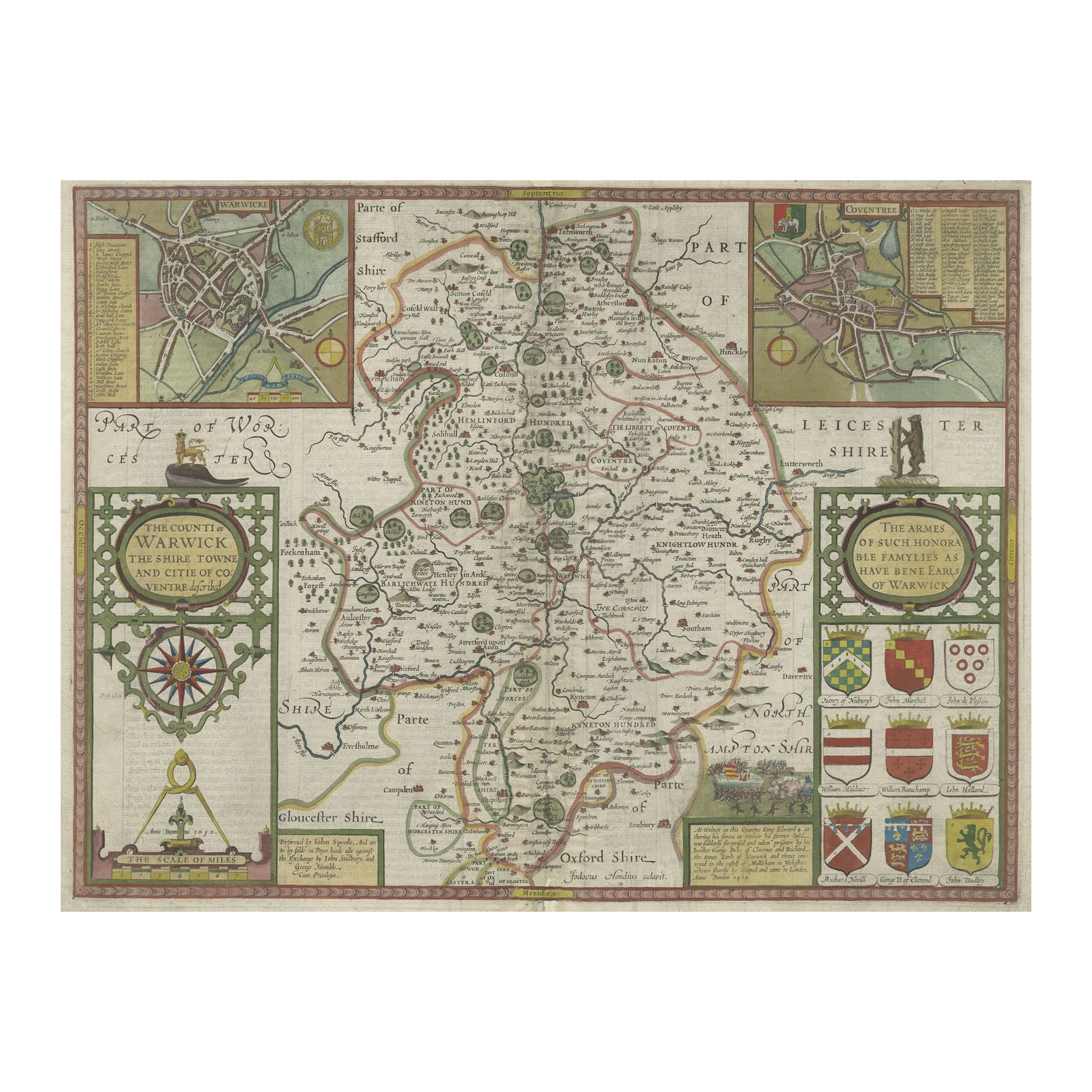
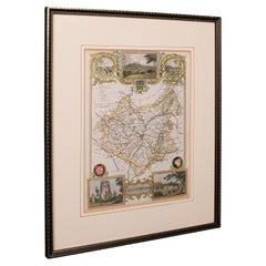
View AllAntique Map of Warwickshire in England by Speed, c.1614
Located in Langweer, NL
Antique map titled 'The Counti of Warwick the Shire Towne and Citie of Coventre described'. Map of Warwickshire, England. Includes inset town plans of Warwic...
Category
Antique 17th Century Maps
Materials
Paper
$729 Sale Price
20% Off
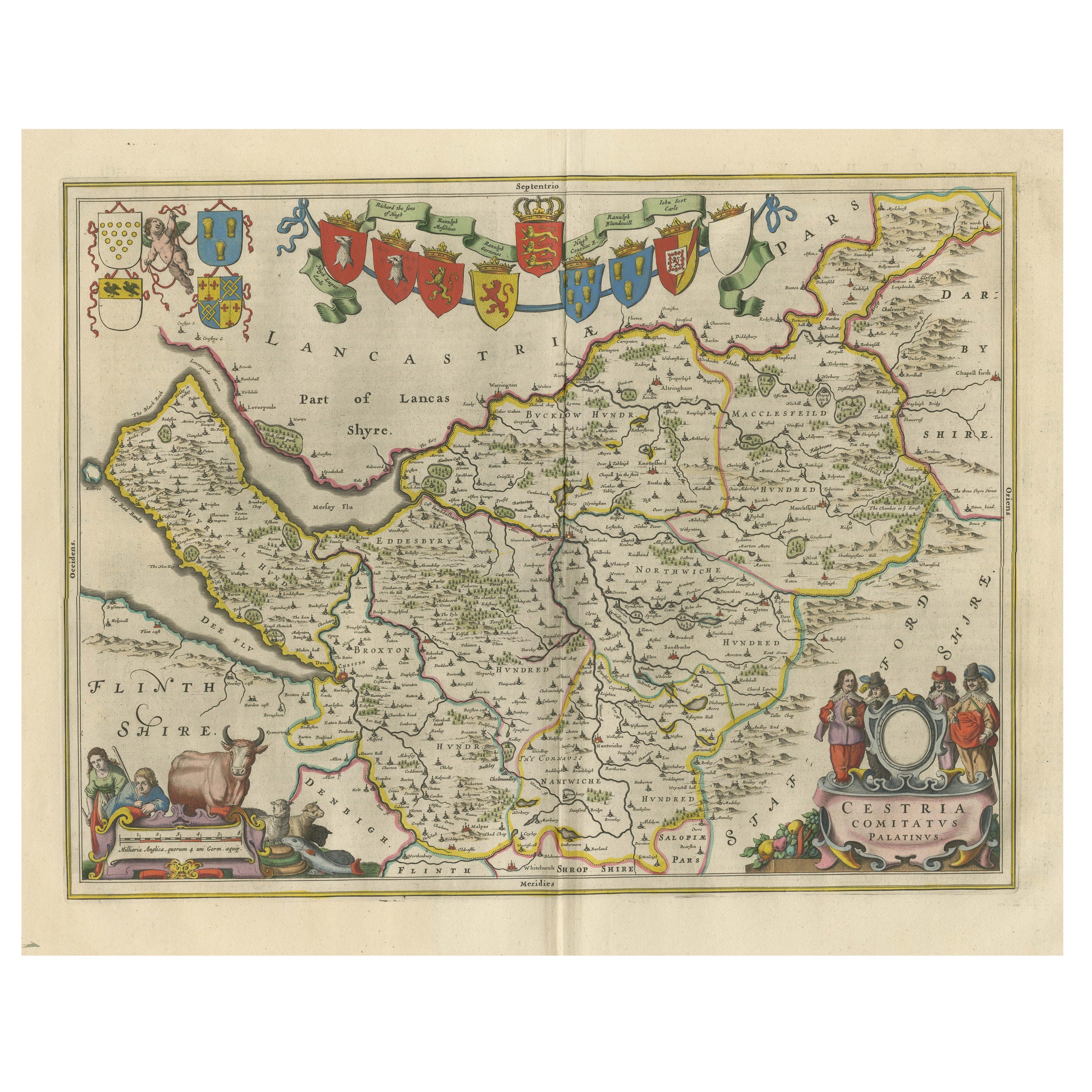
Antique Map of Cheshire, North West England
By Joan (Johannes) Blaeu
Located in Langweer, NL
Antique map titled 'Cestria comitatus Palatinus'. Original old map of Cheshire, Northwest England. Published circa 1665 by J. Blaeu. Willem Jansz. Blaeu and his son Joan Blaeu are th...
Category
Antique Mid-17th Century Maps
Materials
Paper
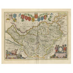
$1,151 Sale Price
20% Off
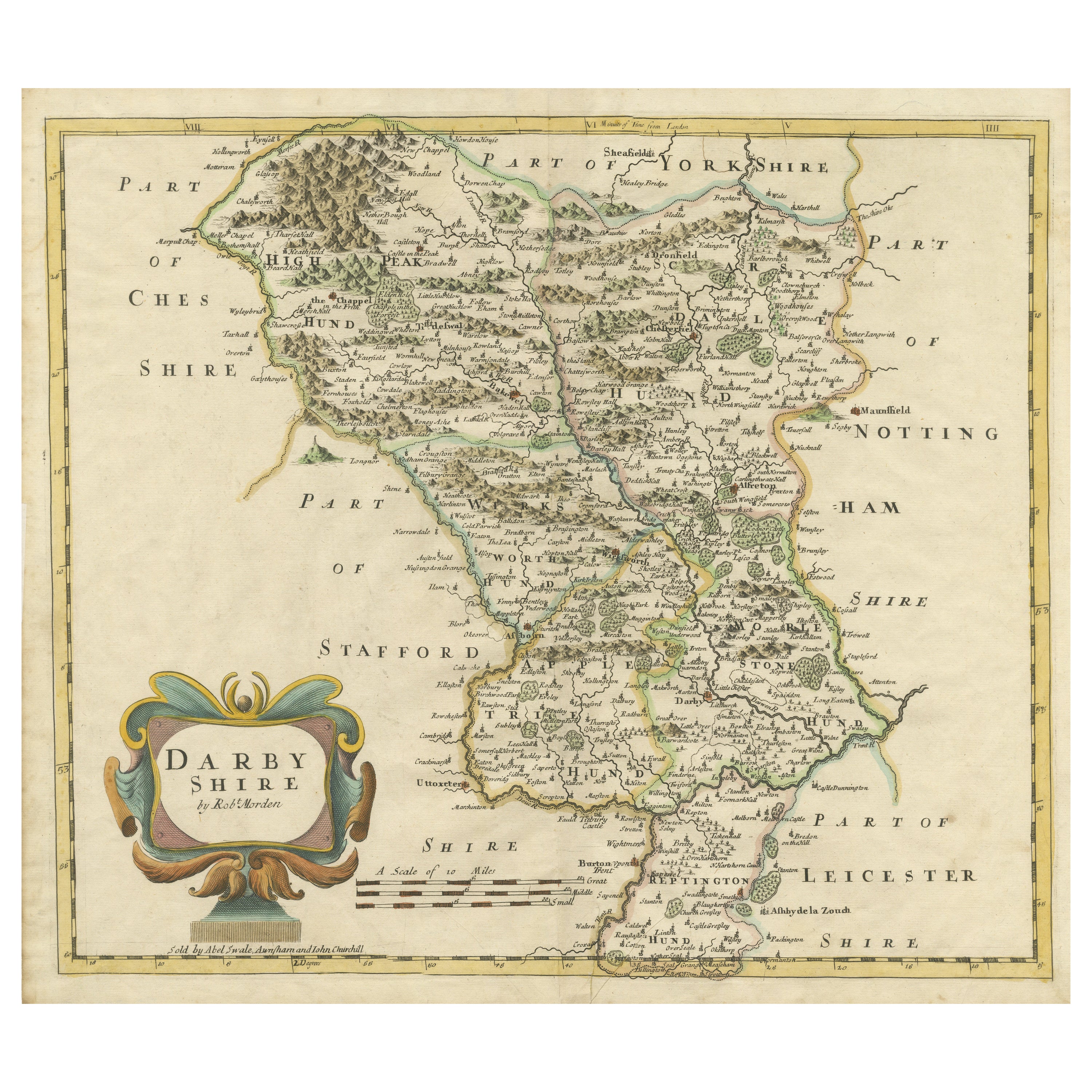
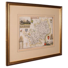
Original Antique County Map of Derbyshire, England
Located in Langweer, NL
Antique map titled 'Darbyshire'. Original antique map of the country of Derbyshire, England. Engraved by Robert Morden. Sold by Abel Swale, Awnsham and John Churchill...
Category
Antique Late 17th Century Maps
Materials
Paper
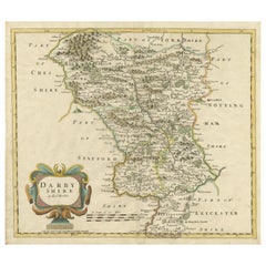
$527 Sale Price
20% Off
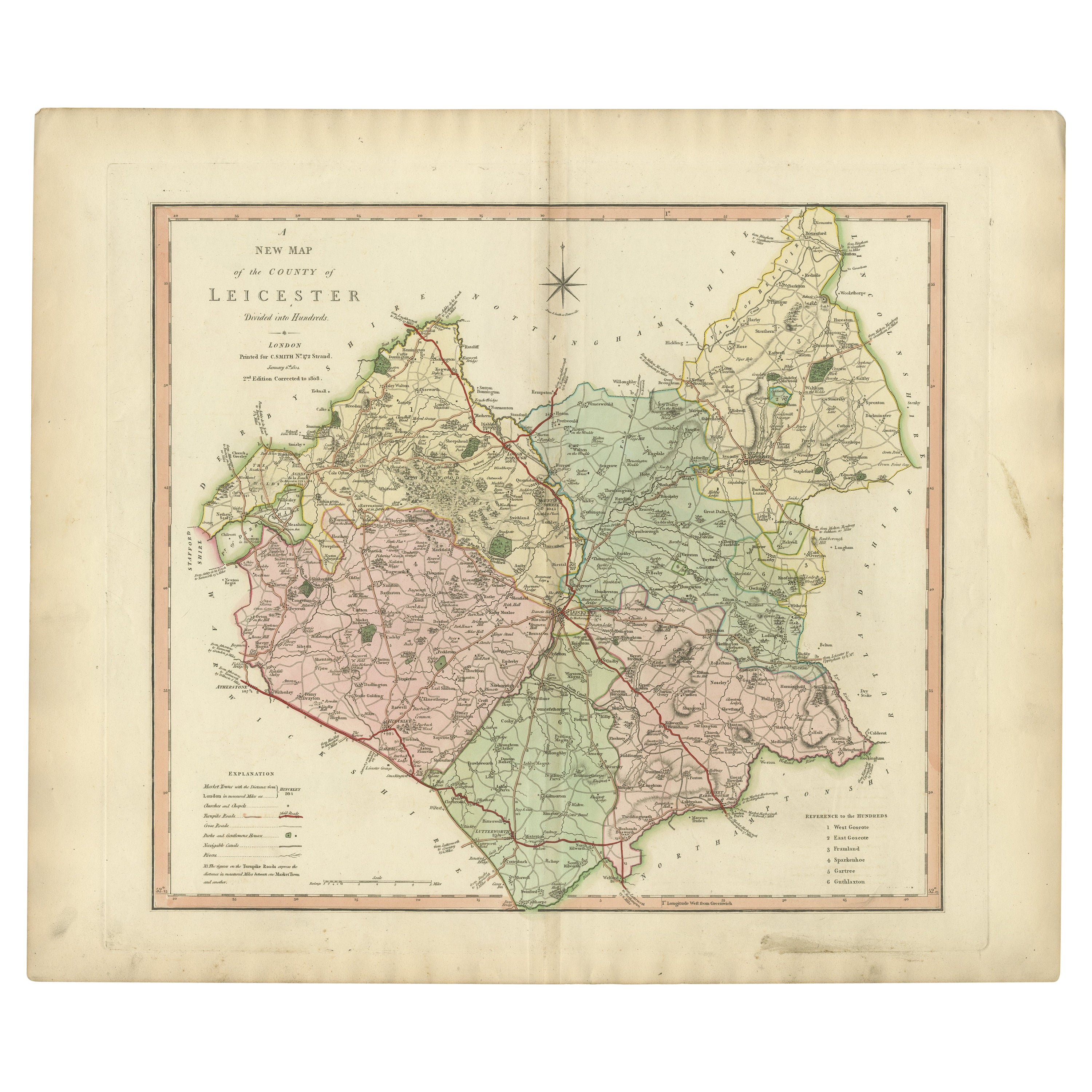
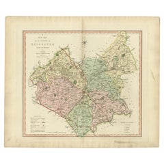
Antique County Map of Leicestershire, England, 1804
Located in Langweer, NL
Antique county map of Leicestershire first published c.1800. Villages, towns, and cities illustrated include Lutterworth, Ashby, Hinkley, and Marke...
Category
Antique Early 1800s Maps
Materials
Paper
$311 Sale Price
20% Off
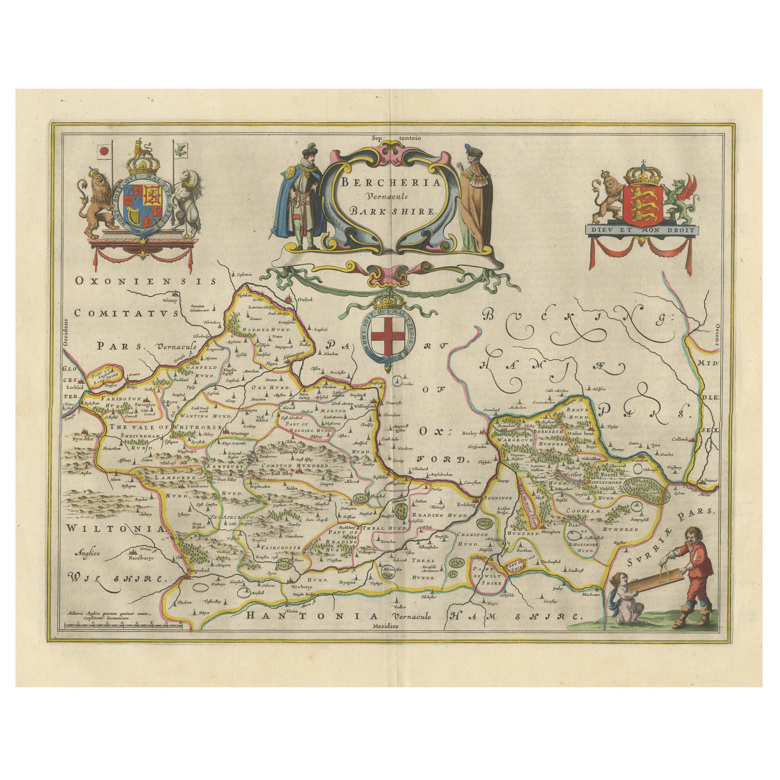
Antique Map of Berkshire, South East England
By Joan (Johannes) Blaeu
Located in Langweer, NL
Antique map titled 'Bercheria vernacule Barkshire'. Original old map of Berkshire, a historic county in South East England. Published circa 1665 by J. Blaeu. Willem Jansz. Blaeu and ...
Category
Antique Mid-17th Century Maps
Materials
Paper
$1,151 Sale Price
20% Off
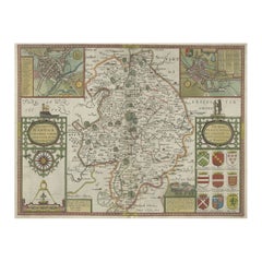
Antique Map of Hertfordshire in England by Speed, 1627
Located in Langweer, NL
Antique map titled 'Hartfordshire described the sittuations of Hartford (..)'.
Map of Hertfordshire, England. Includes inset maps of Hertford and the Roman settlement of Verolani...
Category
Antique 17th Century Maps
Materials
Paper

$431 Sale Price
20% Off
You May Also Like
Original Antique English County Map, Leicestershire, J & C Walker, 1851
Located in St Annes, Lancashire
Great map of Leicestershire
Original colour
By J & C Walker
Published by Longman, Rees, Orme, Brown & Co. 1851
Unframed.
Category
Antique 1850s English Other Maps
Materials
Paper

Original Antique English County Map, Nottinghamshire, J & C Walker, 1851
Located in St Annes, Lancashire
Great map of Nottinghamshire
Original colour
By J & C Walker
Published by Longman, Rees, Orme, Brown & Co. 1851
Unframed.
Category
Antique 1850s English Other Maps
Materials
Paper

Antique Leicestershire Map, English, Framed Cartographic Interest, Victorian
Located in Hele, Devon, GB
This is an antique lithography map of Leicestershire. An English, framed atlas engraving of cartographic interest, dating to the mid 19th century and later.
Superb lithography of Le...
Category
Antique Mid-19th Century British Victorian Maps
Materials
Wood
Antique County Map, Hertfordshire, English, Framed Engraving, Cartography, Litho
Located in Hele, Devon, GB
This is an antique county map of Hertfordshire. An English, framed atlas engraving of cartographic interest, dating to the mid 19th century and later.
Superb lithography of Hertfor...
Category
Antique Mid-19th Century British Victorian Maps
Materials
Glass, Wood, Paper
Antique County Map, Shropshire, English, Atlas Engraving, Richard Blome, C.1673
Located in Hele, Devon, GB
This is an antique county map of Shropshire. An English, framed atlas engraving by Richard Blome, dating to the 17th century and later.
A treat for the collector or county native, ...
Category
Antique 17th Century British Restauration Maps
Materials
Glass, Wood, Paper

Cambridgeshire map 17th century engraving by John Speed
By John Speed
Located in London, GB
To see more, scroll down to "More from this Seller" and below it click on "See all from this Seller."
John Speed (1551 or 1552 - 1629)
Map of Cambridgeshire
Engraving with later hand colouring
39 x 53 cm
A beautifully coloured map of Cambridgeshire, with an antique description...
Category
1610s Landscape Prints
Materials
Engraving

More Ways To Browse
17th Century Scottish Furniture
17th Century Scottish
Tipu Sultan
Antique Map Bermuda
Antique Map Holder
Lancashire Map
Maltese Falcon
Raised Relief Map
William Dampier
Antique Chesapeake Bay Map
Astrology Map
Mauritius Antique Map
Oman Map
Tanzania Antique Map
Georgetown Map
Nova Hollandia
Aden Yemen
Antique Map Of Republic Of Texas