Items Similar to Map of Baja California and Mexico - Jesuit Observations and Native Tribes, 1777


Want more images or videos?
Request additional images or videos from the seller
1 of 6
Map of Baja California and Mexico - Jesuit Observations and Native Tribes, 1777
$1,126.25
£838.42
€940
CA$1,542.69
A$1,715.81
CHF 895.94
MX$20,879.53
NOK 11,442.53
SEK 10,731.07
DKK 7,155.89
Shipping
Retrieving quote...The 1stDibs Promise:
Authenticity Guarantee,
Money-Back Guarantee,
24-Hour Cancellation
About the Item
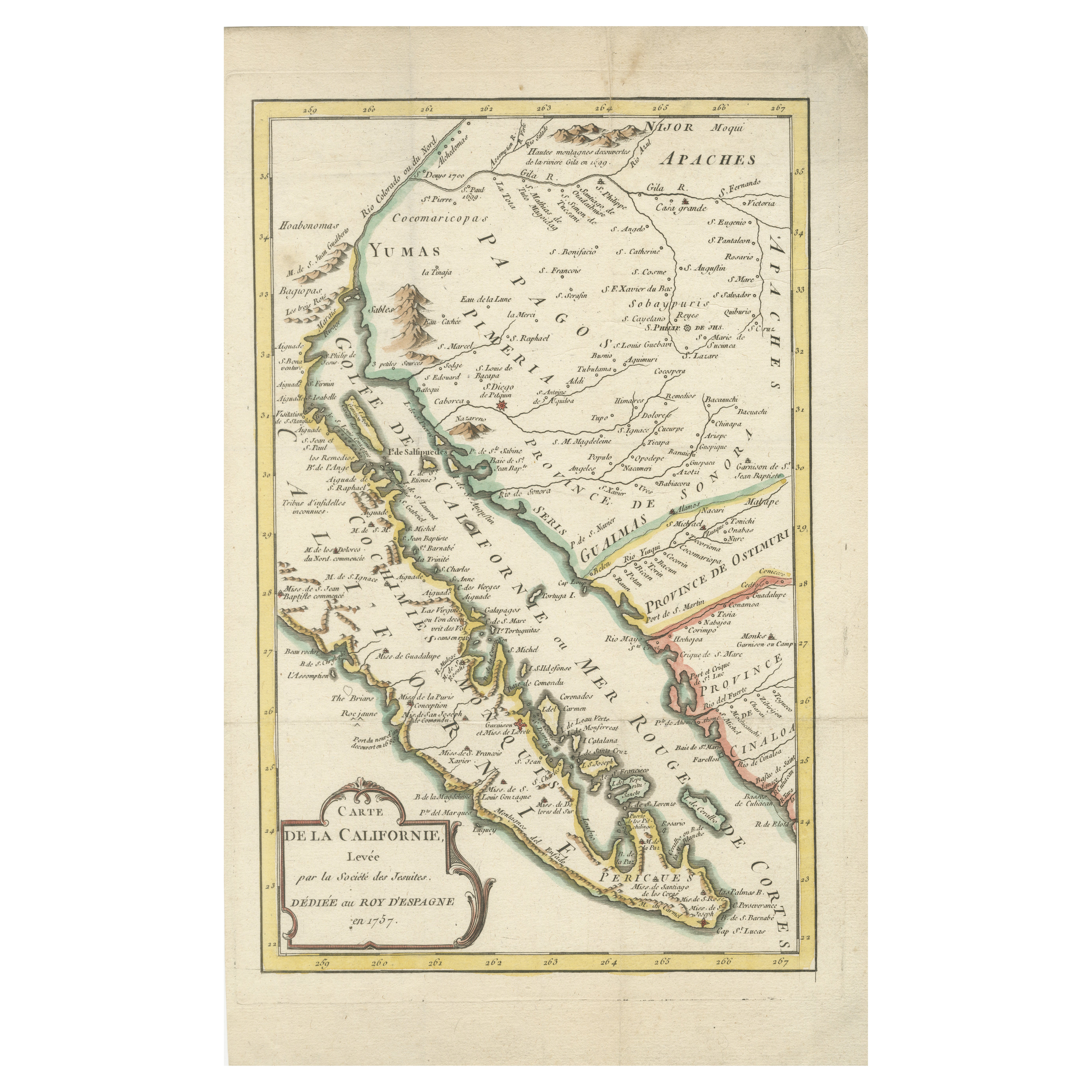
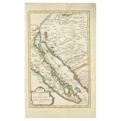
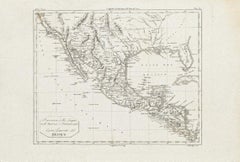
1777 A. Krevelt Map of Baja California and Northwestern Mexico - Jesuit Observations and Native Tribes
A. Krevelt - Carte de la Californie d'Après les observations les plus exactes Pour servir à l'Histoire Générale des Voyages Publication Place / Date: Amsterdam / 1777
This scarce map of Baja California, northwestern Mexico, and southern Arizona was published in 1777 by A. Krevelt, based on previous cartographic works and observations. It shows California correctly as a peninsula, as opposed to the earlier fallacy of California being depicted as an island. The map provides intricate details of settlements, mountain ranges, islands, missions, and native tribes.
This map incorporates information from Father Kino’s explorations, which established that California was indeed a peninsula, a correction that took many years to gain widespread acceptance. It also reflects updates made by Jesuit scholars such as Father Consag, informed by Venegas’s "Noticia de la California."
Numerous native tribes are identified, including the Cochimi, Apache, Pericu, and Yuma. The detailed depiction of missions and native settlements offers a significant insight into the geography and peoples of the region during the 18th century.
This example of the map appeared in a Dutch edition of Bellin's Histoire Générale (Tom XXII).
- Dimensions:Height: 14.38 in (36.5 cm)Width: 8.94 in (22.7 cm)Depth: 0.01 in (0.2 mm)
- Materials and Techniques:Paper,Engraved
- Period:1770-1779
- Date of Manufacture:1777
- Condition:Very good condition with minor toning and folds. Vibrant hand-coloring, stable paper, and intact margins. No significant tears, annotations, or intrusive markings. Overall well-preserved and visually appealing.
- Seller Location:Langweer, NL
- Reference Number:Seller: BHZ100751stDibs: LU3054342588422
About the Seller
5.0
Recognized Seller
These prestigious sellers are industry leaders and represent the highest echelon for item quality and design.
Platinum Seller
Premium sellers with a 4.7+ rating and 24-hour response times
Established in 2009
1stDibs seller since 2017
2,510 sales on 1stDibs
Typical response time: <1 hour
- ShippingRetrieving quote...Shipping from: Langweer, Netherlands
- Return Policy
Authenticity Guarantee
In the unlikely event there’s an issue with an item’s authenticity, contact us within 1 year for a full refund. DetailsMoney-Back Guarantee
If your item is not as described, is damaged in transit, or does not arrive, contact us within 7 days for a full refund. Details24-Hour Cancellation
You have a 24-hour grace period in which to reconsider your purchase, with no questions asked.Vetted Professional Sellers
Our world-class sellers must adhere to strict standards for service and quality, maintaining the integrity of our listings.Price-Match Guarantee
If you find that a seller listed the same item for a lower price elsewhere, we’ll match it.Trusted Global Delivery
Our best-in-class carrier network provides specialized shipping options worldwide, including custom delivery.More From This Seller
View AllRare 1757 Jesuit Map of California and Baja, Dedicated to the King of Spain
Located in Langweer, NL
Title: Rare 1757 Jesuit Map of California and Baja, Dedicated to the King of Spain
This rare and detailed map, titled *Carte de la Californie Levee par la Société des Jésuites*, wa...
Category
Antique 1750s Maps
Materials
Paper
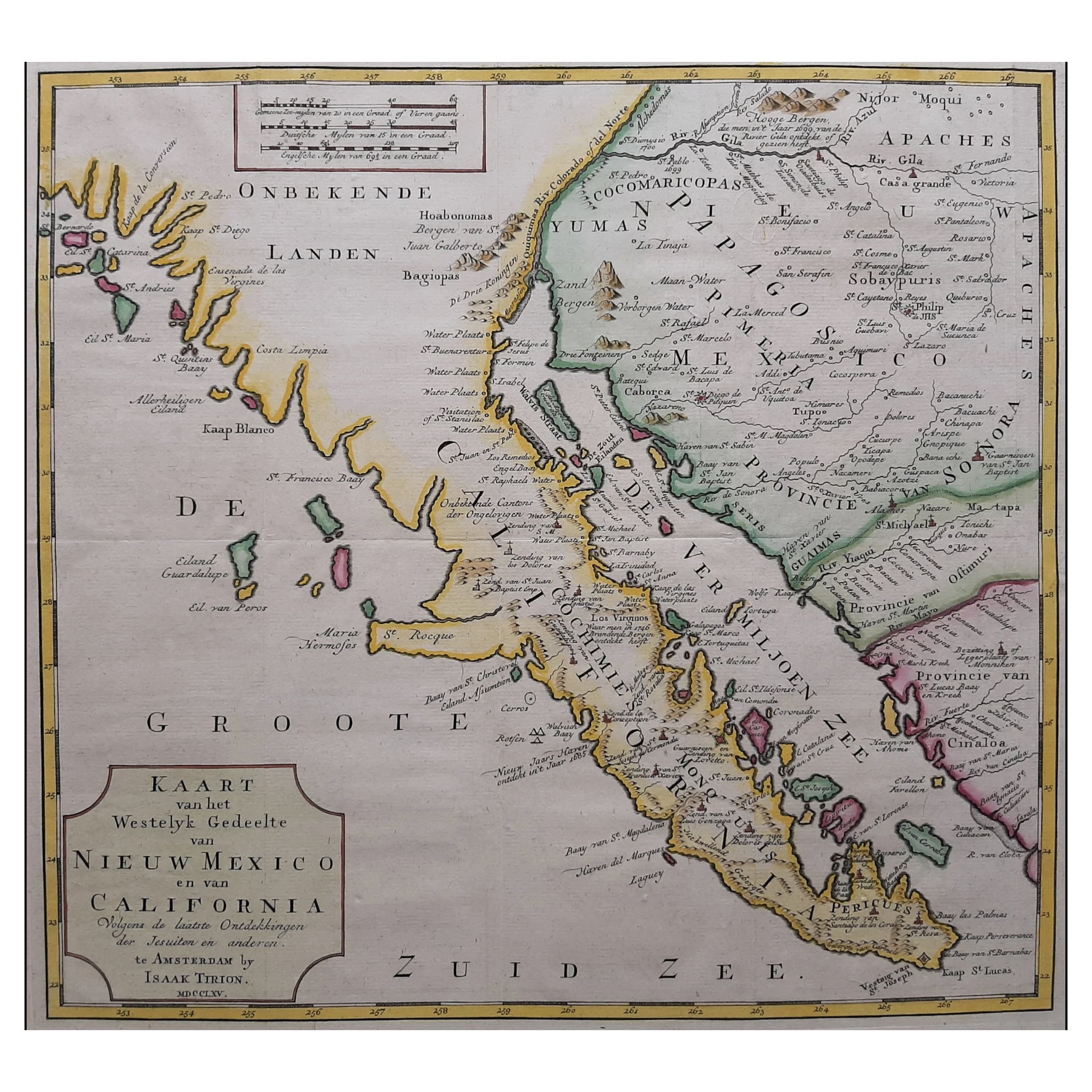
Original Antique Map of the Western Part of NEW MEXICO & CALIFORNIA
Located in Langweer, NL
Title: "Map of the Western Part of NEW MEXICO and CALIFORNIA According to the Latest Discoveries by the Jesuits and Others"
Description:
This exquisite original Dutch map, titled "...
Category
Antique 1760s Maps
Materials
Paper
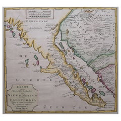
$1,246 Sale Price
20% Off
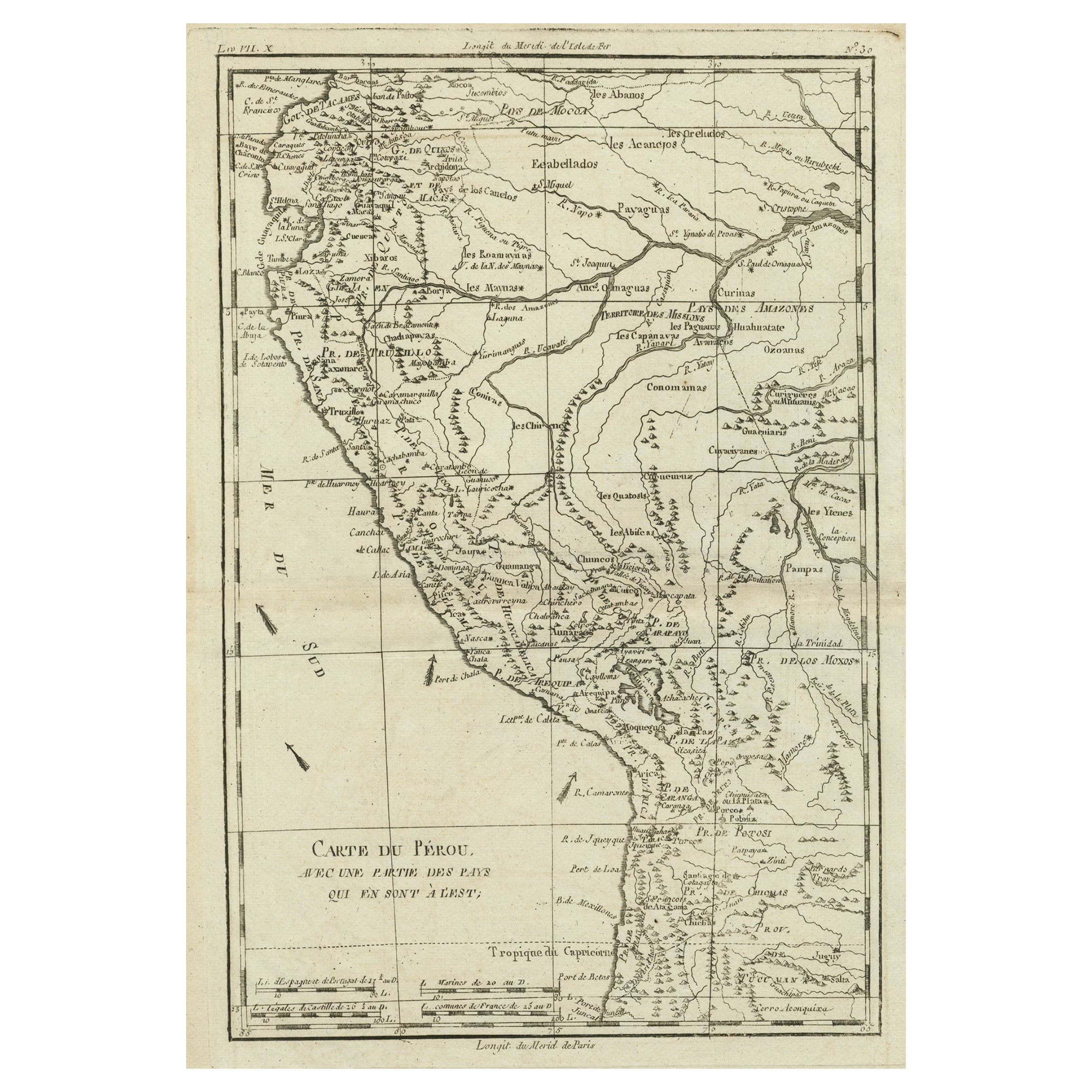
Map of the Western Coast of South America from Ecuador into Chili, ca.1780
Located in Langweer, NL
Antique map titled 'Carte du Perou avec une partie des pays qui en sont a l'est.'
Map of the western coast of South America extending from Ecuador, through Peru and present-day B...
Category
Antique 1780s Maps
Materials
Paper
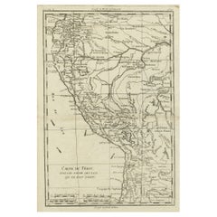
$325 Sale Price
20% Off
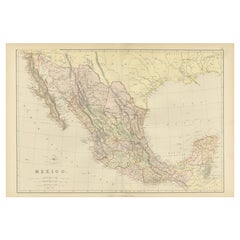
1882 Antique Map of Mexico Highlighting Geographical and Political Boundaries
Located in Langweer, NL
This 1882 map of Mexico, published by Blackie and Son as part of the 'Comprehensive Atlas and Geography of the World,' provides a highly detailed representation of the country's geog...
Category
Antique 1880s Maps
Materials
Paper
Antique Map of America with California as an Island by Homann '1710'
Located in Langweer, NL
This antique map, titled "Totius Americae Septentrionalis et Meridionalis," represents a significant cartographic piece from 1710 by Johann Baptist Homann. Here's a description of this remarkable map:
- Title: Totius Americae Septentrionalis et Meridionalis (...)
- Date: Published in 1710 by Johann Baptist Homann.
Description:
This map is a first edition of Johann Baptiste Homann's map of America, and it is notable for several cartographic features and historical representations:
1. California as an Island...
Category
Antique Early 18th Century Maps
Materials
Paper

$2,246 Sale Price
25% Off
Antique Map of Persia by A. Zatta, circa 1785
Located in Langweer, NL
Antique map titled 'L'Impero della Persia diviso ne suoi Stati'. The Empire of Persia divided into its states. Originates from 'Atlante Novissimo, illustrato ed accresciuto sulle oss...
Category
Antique Late 18th Century Italian Maps
Materials
Paper

You May Also Like
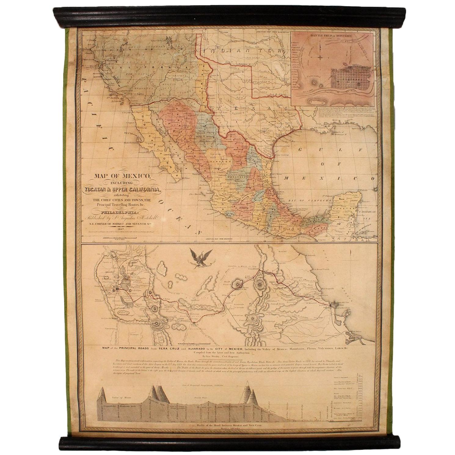
1847 Antique Map of Mexico, Texas and California by Samuel Augustus Mitchell
By Samuel Augustus Mitchell 1
Located in Colorado Springs, CO
Presented is the second edition of Samuel Augustus Mitchell's Map of Mexico, Including Yucatan & Upper California, an important map showing the progress of the Mexican-American War. ...
Category
Antique 1840s American Maps
Materials
Paper

Ancient Map of Mexico - Original Etching - 19th Century
Located in Roma, IT
This Map of Mexico is an etching realized in 19th century.
The state of preservation of the artwork is good with some small missing papers on the right angles. At the top of the pap...
Category
19th Century More Prints
Materials
Etching
California, Alaska and Mexico: 18th Century Hand-Colored Map by de Vaugondy
By Didier Robert de Vaugondy
Located in Alamo, CA
This is an 18th century hand-colored map of the western portions of North America entitled "Carte de la Californie et des Pays Nord-Ouest separés de l'Asie par le détroit d'Anian, ex...
Category
Antique 1770s French Maps
Materials
Paper

Antique Map of California as an Island "The 5 Californias" by Robert de Vaugondy
Located in San Diego, CA
A very nice and rare antique map entitled "Carte de la Californie Suivant" (The 5 Californias), by Didier Robert de Vaugondy of Paris, circa 1772. The map itself measures 15.5" x 13...
Category
Antique Mid-19th Century American Maps
Materials
Paper

Early 19th Century Hand Coloured Map of North America by Aaron Arrowsmith
By Aaron Arrowsmith
Located in Hamilton, Ontario
Hand coloured map in French by English cartographer Aaron Arrowsmith (1750–1823) titled "Amerique Septentionale" (North America).
Map size: 9.5" x 8"
Mat size: 20.5" x 14.25".
Category
Antique Early 19th Century English Maps
Materials
Paper

$795 Sale Price
36% Off
West Coast of Africa, Guinea & Sierra Leone: An 18th Century Map by Bellin
By Jacques-Nicolas Bellin
Located in Alamo, CA
Jacques Bellin's copper-plate map entitled "Partie de la Coste de Guinee Dupuis la Riviere de Sierra Leona Jusquau Cap das Palmas", depicting the coast of Guinea and Sierra Leone in ...
Category
Antique Mid-18th Century French Maps
Materials
Paper

More Ways To Browse
Early California Furniture
Antique Furniture California
California Mission Furniture
Elios Chair
Plata Lappas
Red Retro Dining Set
Antique Bouquet
Antique Silver Glasses Case
Carlo Scarpa 1934 Chairs
Christofle Marly
1900 Antique Chairs
Glass Table Italian Round
Mid Century Colonial
Alvar Aalto Poster
Geometric Metal Table
Post Modern High Chairs
United Nations
Vintage Vine Rug