Items Similar to Map Bedfordshire No 3 General Framed
Want more images or videos?
Request additional images or videos from the seller
1 of 7
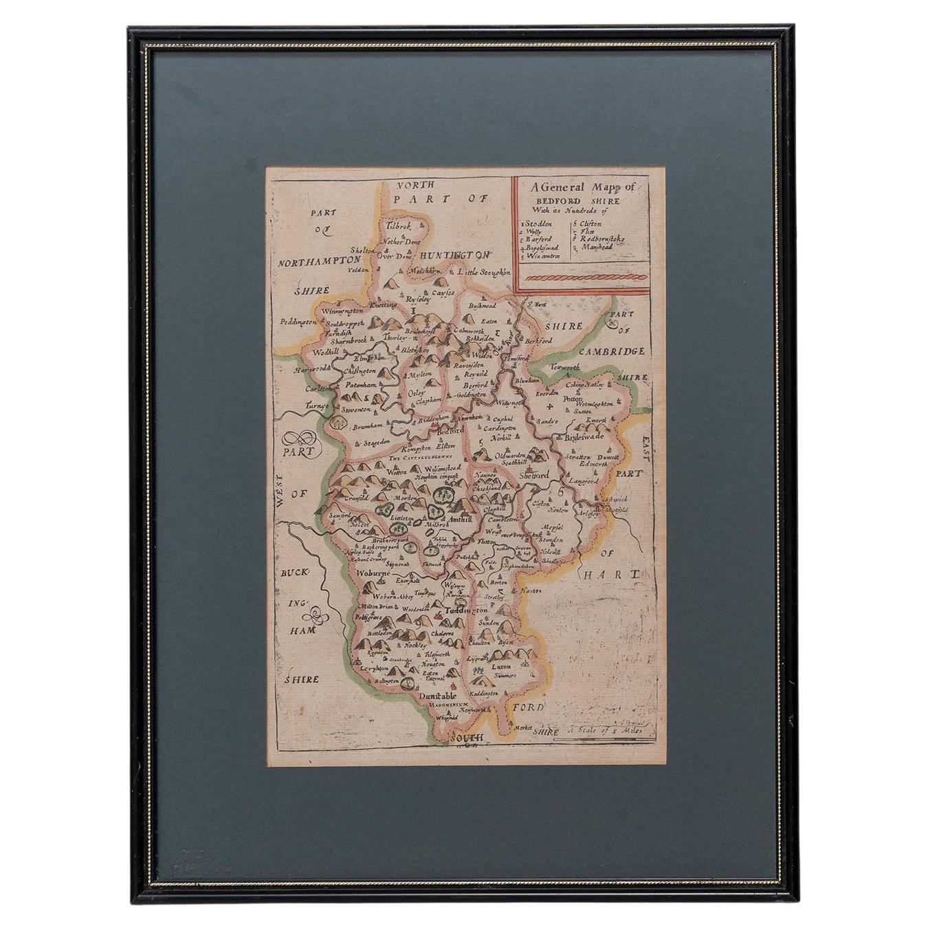
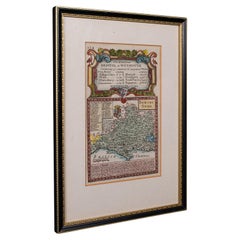
Map Bedfordshire No 3 General Framed
$1,370.17
£1,000
€1,166.45
CA$1,876.79
A$2,087.40
CHF 1,089.97
MX$25,401.38
NOK 13,920.62
SEK 13,055.08
DKK 8,705.63
Shipping
Retrieving quote...The 1stDibs Promise:
Authenticity Guarantee,
Money-Back Guarantee,
24-Hour Cancellation
About the Item
A general map of Bedfordshire with its hundreds. Measure: 37cm 14 1/2" high
A scale of 5 miles.
in the original green mount and traditional black and gold frame.
charming map with lovely detailing and colouring.
- Dimensions:Height: 14.57 in (37 cm)Width: 12.21 in (31 cm)Depth: 0.79 in (2 cm)
- Style:Georgian (Of the Period)
- Materials and Techniques:
- Place of Origin:
- Period:
- Date of Manufacture:circa 1730
- Condition:Wear consistent with age and use.
- Seller Location:BUNGAY, GB
- Reference Number:1stDibs: LU3867332648742
About the Seller
5.0
Vetted Professional Seller
Every seller passes strict standards for authenticity and reliability
Established in 1985
1stDibs seller since 2018
97 sales on 1stDibs
Typical response time: 7 hours
- ShippingRetrieving quote...Shipping from: BUNGAY, United Kingdom
- Return Policy
Authenticity Guarantee
In the unlikely event there’s an issue with an item’s authenticity, contact us within 1 year for a full refund. DetailsMoney-Back Guarantee
If your item is not as described, is damaged in transit, or does not arrive, contact us within 7 days for a full refund. Details24-Hour Cancellation
You have a 24-hour grace period in which to reconsider your purchase, with no questions asked.Vetted Professional Sellers
Our world-class sellers must adhere to strict standards for service and quality, maintaining the integrity of our listings.Price-Match Guarantee
If you find that a seller listed the same item for a lower price elsewhere, we’ll match it.Trusted Global Delivery
Our best-in-class carrier network provides specialized shipping options worldwide, including custom delivery.More From This Seller
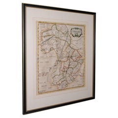
View AllMap Bedfordshire General Framed
Located in BUNGAY, SUFFOLK
A general map of Bedfordshire with its hundreds
A scale of 5 miles
in the original green mount and traditional black and gold frame. Measures: 36cm 14" high.
Category
Antique 18th Century English Georgian Maps
Materials
Paper

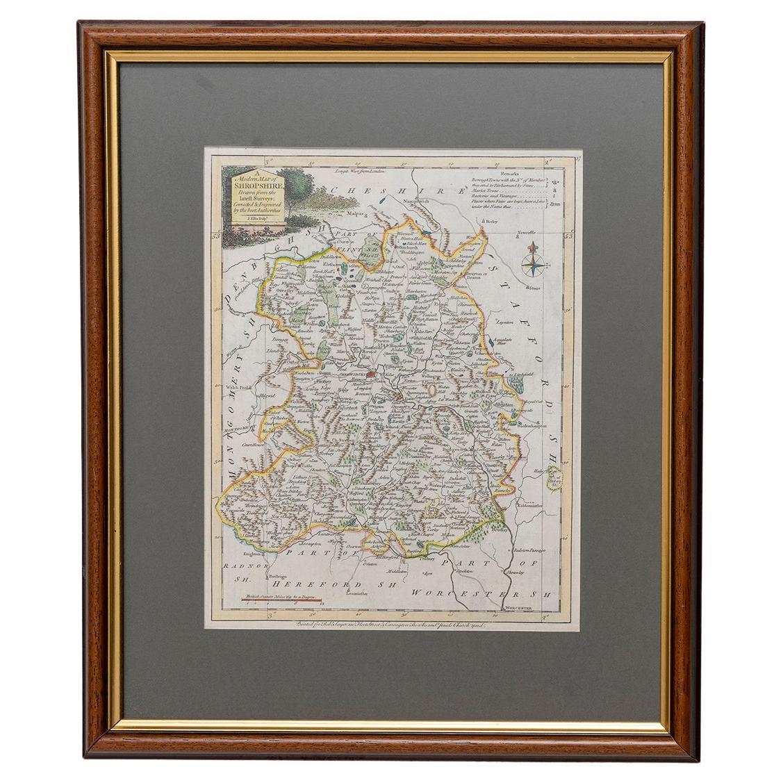
Map Shropshire Joseph Ellis Robert Sayer Carington Bowles Framed
Located in BUNGAY, SUFFOLK
A modern map of Shropshire Drawn from the latest surveys corrected and improved by the best authorities.
Artist Joseph Ellis sculptor.
Joseph Ellis was an engraver and publisher from Clerkenwell in London and was apprenticed to Richard William Seale in 1749. He is best know to county map collectors for The New English Atlas published in 1765 which was later reissued as Ellis's English Atlas in 1766, 1768 1777, 1786, 1790 and 1796.
Maker carington bowles 1724 - 1793.
Carington Bowles worked in London as a publisher in partnership with his father John Bowles from about 1752 until 1763. Carington Bowles worked as a publisher in partnership with his father John Bowles from about 1752 until 1763 before taking over his uncle's business. His address was 69 St. Pauls Church Yard, London. He worked with a number of well known cartographers of the day including Emanuel Bowen, Thomas Kitchin, Robert Sayer...
Category
Antique 18th Century English Georgian Maps
Materials
Paper

Map Huntingdonshire R Scott Archibald Fullarton & Co Glasgow
Located in BUNGAY, SUFFOLK
Folding Map of Huntingdonshire by R Scott with distances from London and reference to the hundreds.
Published by Archibald Fullarton & Co Glasgow. Measure: 40...
Category
Antique 19th Century English Victorian Maps
Materials
Paper

Map Lancashire 1793 John Cary engraver 37cm 14 1/2" high
Located in BUNGAY, SUFFOLK
Map of Lancashire by John Cary engraver
published 1st Jan 1793 by J Cary Engraver & Mapseller Strand
in original black and gold classic map frame
Category
Antique 18th Century English Georgian Maps
Materials
Paper

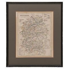
Map Wiltshire Joshua Archer Pentonville London framed 35cm 14" high
Located in BUNGAY, SUFFOLK
Map of Wiltshire Drawn & Engraved by Joshua Archer Pentonville London
Window Parts of Wiltshire in Berkshire
Explanation of Salisbury
County Divisions
Category
Antique 19th Century English Georgian Maps
Materials
Paper
Map Nottinghamshire Worksop Manor Newstead Abbey Nottingham Castle Shields H37cm
Located in BUNGAY, SUFFOLK
Map of Nottinghamshire with engravings of Worksop Manor Nottingham Castle Newstead Abbey
BIBLIOGRAPHY published in Barclay's Universal English Dicti...
Category
Antique 19th Century English Victorian Maps
Materials
Paper
You May Also Like
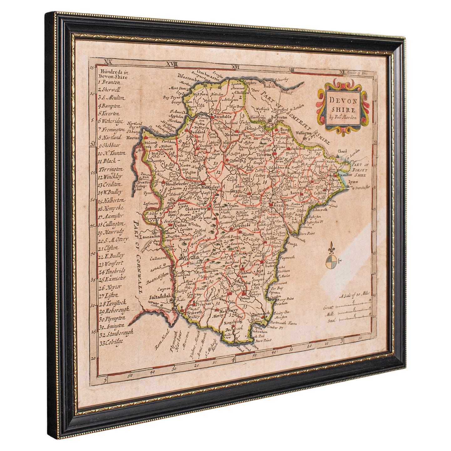
Antique Devonshire Map, English Framed Robert Morden Devon Cartography, Georgian
Located in Hele, Devon, GB
This is a small antique map of Devonshire, an English framed cartographic engraving by Robert Morden, dating to the early Georgian period, circa 1720. A charming and historically ric...
Category
Antique 1720s British Georgian Maps
Materials
Glass, Paper

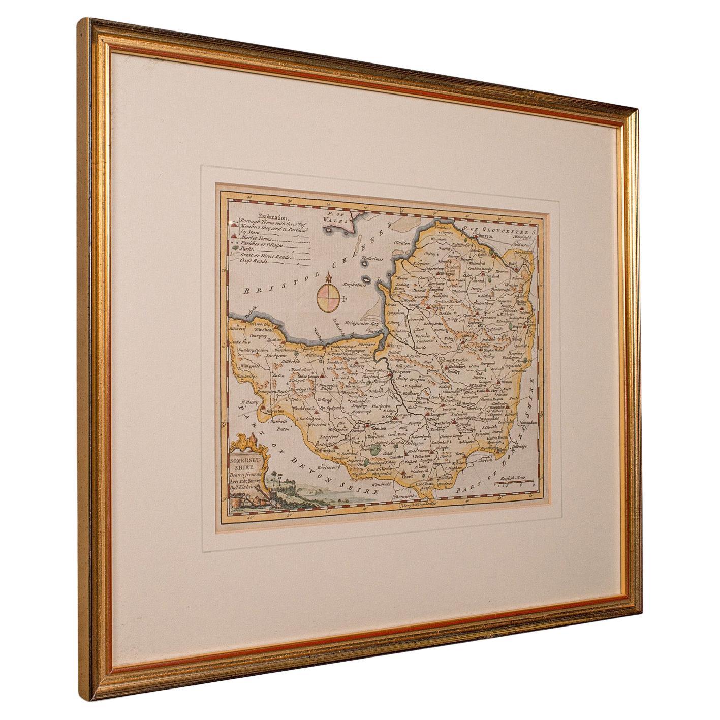
Antique Somerset Map, Thomas Kitchin, English, Cartographic Reference, Georgian
Located in Hele, Devon, GB
This is a fine antique Somerset map. An 18th century English cartographic county reference engraving by Thomas Kitchin (1718–1784), dating to the Georgian period, circa 1780. A beaut...
Category
Antique 1780s British Georgian Maps
Materials
Glass, Paper

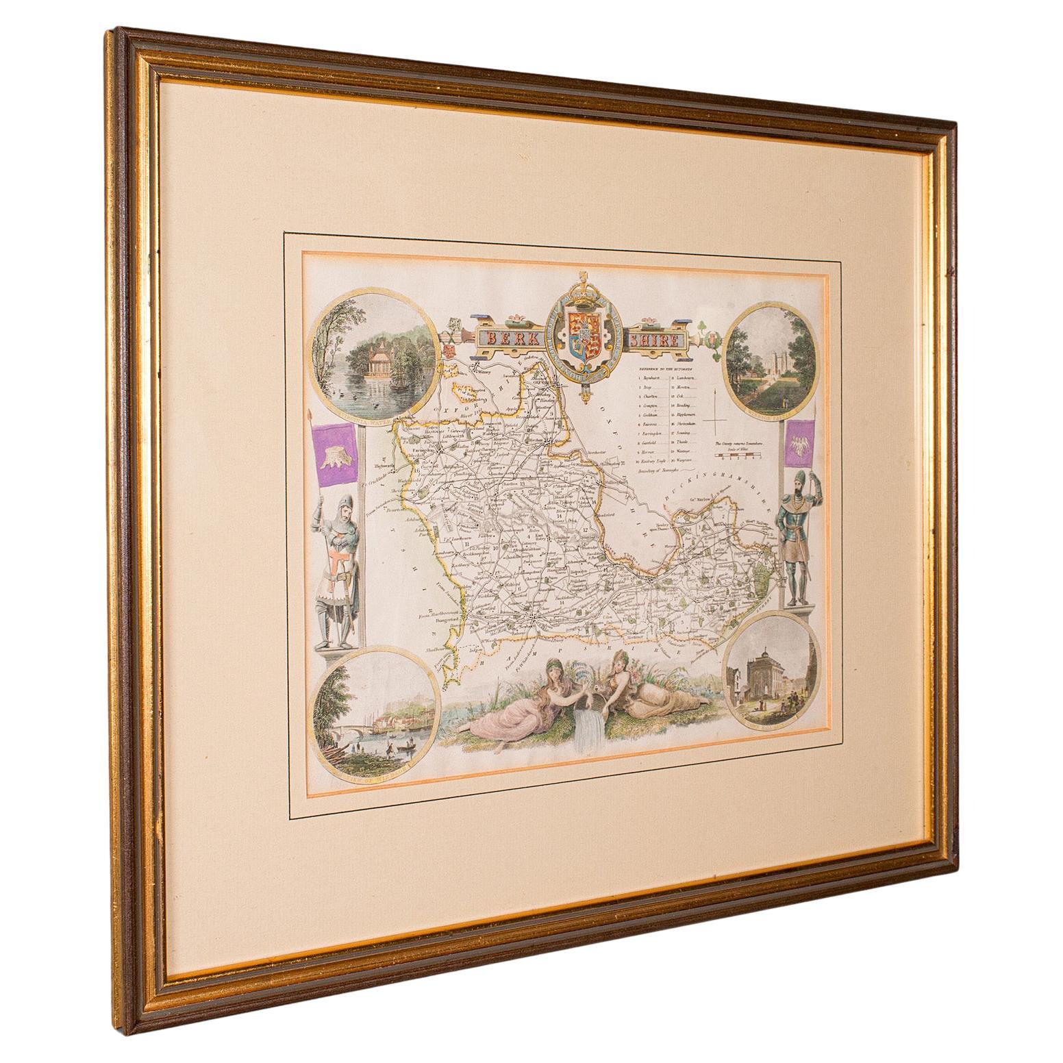
Antique Berkshire Map, English County, Framed Engraving, Cartography, Lithograph
Located in Hele, Devon, GB
This is an antique county map of Berkshire. An English, framed atlas engraving of cartographic interest, dating to the mid 19th century and later.
Superb lithography of Berkshire a...
Category
Antique Mid-19th Century British Victorian Maps
Materials
Glass, Wood, Paper

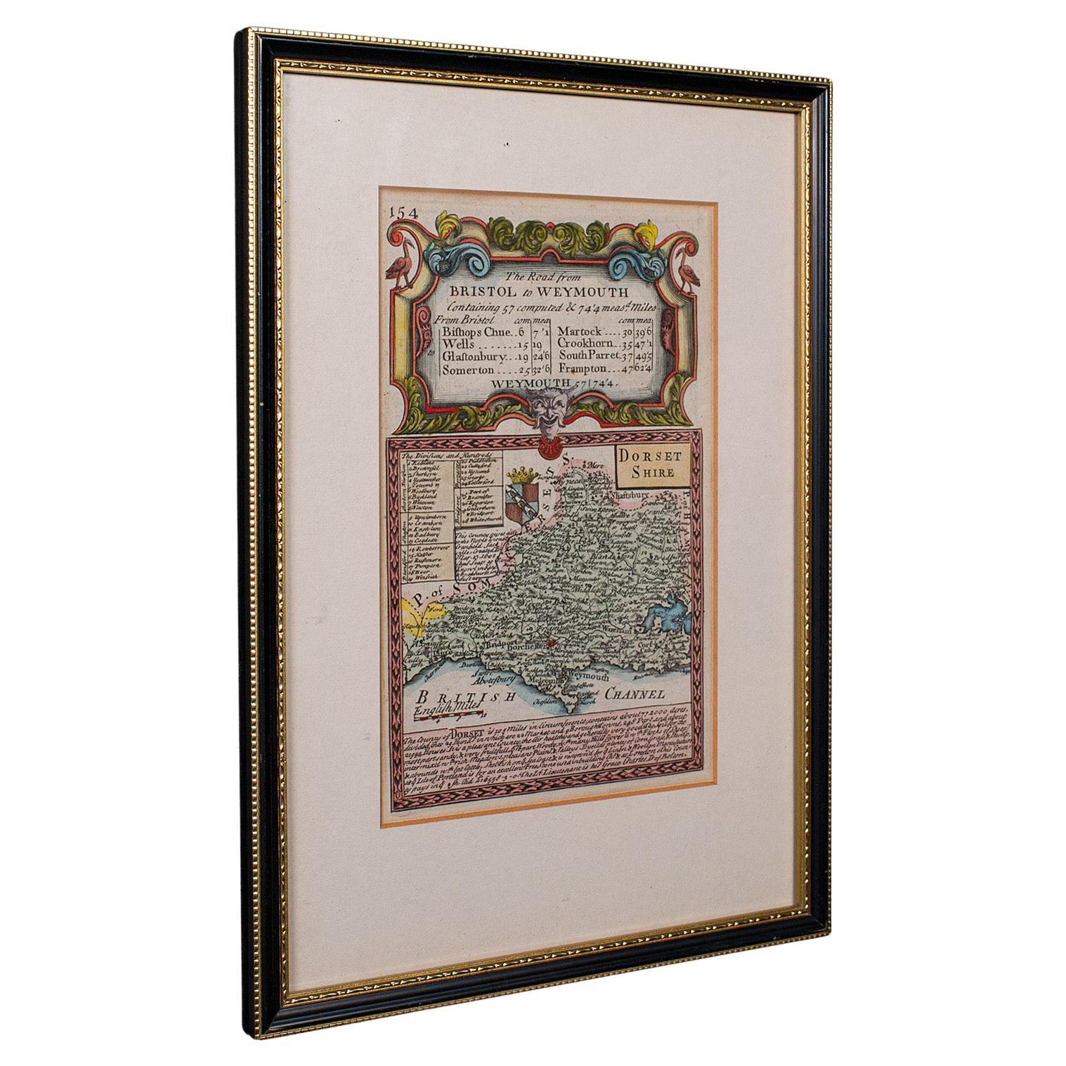
Antique Road Map, Bristol to Weymouth, English, Framed Cartography, Georgian
Located in Hele, Devon, GB
This is an antique coaching road map of Bristol to Weymouth. An English, framed lithograph engraving of regional interest with second map to reverse, dating to the mid 18th century ...
Category
Antique Mid-18th Century British George II Maps
Materials
Glass, Wood, Paper
Antique Lithography Map, Cumbria, English, Framed Cartography Interest, Georgian
Located in Hele, Devon, GB
This is an antique lithography map of Cumbria. An English, framed engraving of cartographic interest, dating to the early 18th century and later.
...
Category
Antique Early 18th Century British Georgian Maps
Materials
Wood

Antique County Map, Cambridgeshire, English, Framed Cartography, Robert Morden
Located in Hele, Devon, GB
This is an antique county map of Cambridgeshire. An English, framed atlas engraving of cartographic interest By Robert Morden, dating to the late 17th century and later.
Superb lit...
Category
Antique Early 18th Century British Other Maps
Materials
Glass, Wood, Paper
More Ways To Browse
Laos Antique Map
Orinoco Furniture
Johann Baptist Homann On Sale
Rand Mcnally Vintage Maps
Tipu Sultan
Antique Map Bermuda
Antique Map Holder
Lancashire Map
Maltese Falcon
Raised Relief Map
William Dampier
Antique Chesapeake Bay Map
Astrology Map
Mauritius Antique Map
Oman Map
Tanzania Antique Map
Georgetown Map
Nova Hollandia