Items Similar to Map of the Kingdom of Württemberg, Oberamt Tettnang in Germany, circa 1885
Want more images or videos?
Request additional images or videos from the seller
1 of 10
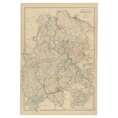
Map of the Kingdom of Württemberg, Oberamt Tettnang in Germany, circa 1885
$326.11
£247.04
€280
CA$451.79
A$506.71
CHF 265.36
MX$6,157.01
NOK 3,369.57
SEK 3,194.59
DKK 2,131.85
About the Item
Administrative Map of the Kingdom of Württemberg, Oberamt Tettnang, circa 1885
This detailed antique map titled "Handkarte von dem Königl. Württ. Oberamt Tettnang" was created by G. Wilhelm Bauser and published in Stuttgart in 1885 as part of his renowned hand atlas of the Kingdom of Württemberg. A prime example of late 19th-century German cartography, the map captures the administrative division known as Oberamt Tettnang in exceptional detail, including topographical features, jurisdictional boundaries, and settlements of varying status.
Highlighted with finely hand-colored borders, this map delineates towns, villages, parishes, castles, ruins, mills, chapels, as well as roads, railways, and footpaths. Tettnang, the principal town, is situated near the northern shores of Lake Constance (Bodensee), and the district is shown with its extensive connections to surrounding territories including Ravensburg, Wangen, and the Prussian exclave of Achberg. The administrative region is bordered in red and colored in soft pastel hues to distinguish it from neighboring jurisdictions.
Historically, the region transitioned through complex sovereignties. Formerly part of Anterior Austria, it included domains held by the Habsburgs, Imperial cities such as Ravensburg and Lindau, and numerous ecclesiastical and noble estates. After the Peace of Pressburg in 1805 and the Paris Treaty of 1810, Tettnang was incorporated into Württemberg. The map not only reflects its historical borders but also its transformation into a cohesive administrative entity. By 1885, this region had strategic relevance due to its shoreline on Lake Constance and its evolving infrastructure.
This map is not only a rich historical document but also a beautifully executed lithograph reflecting the precision and aesthetics of 19th-century German mapping traditions. It appeals to collectors of historical cartography, regional historians, and admirers of visual representations of territorial development in Central Europe.
Condition Report:
Excellent condition with sharp impression and original hand-coloring intact. Light age toning along margins and a few minor spots typical for the period. No tears or repairs. Mounted on sturdy paper backing with clean matting.
Framing Tips:
Ideal for display with a neutral mat in ivory or soft beige, accented with a thin red or muted ochre inner border to match the map’s outlining. A dark wood or antiqued bronze frame enhances the historical tone. Use UV-protective glass.
- Dimensions:Height: 10.24 in (26 cm)Width: 13.78 in (35 cm)Depth: 0.01 in (0.2 mm)
- Materials and Techniques:
- Period:
- Date of Manufacture:circa 1885
- Condition:Excellent condition with sharp impression and original hand-coloring intact. Light age toning along margins and a few minor spots typical for the period. No tears or repairs. Mounted on sturdy paper backing with clean matting.
- Seller Location:Langweer, NL
- Reference Number:Seller: BG-13836-1131stDibs: LU3054345119242
About the Seller
5.0
Recognized Seller
These prestigious sellers are industry leaders and represent the highest echelon for item quality and design.
Platinum Seller
Premium sellers with a 4.7+ rating and 24-hour response times
Established in 2009
1stDibs seller since 2017
2,517 sales on 1stDibs
Typical response time: <1 hour
- ShippingRetrieving quote...Shipping from: Langweer, Netherlands
- Return Policy
Authenticity Guarantee
In the unlikely event there’s an issue with an item’s authenticity, contact us within 1 year for a full refund. DetailsMoney-Back Guarantee
If your item is not as described, is damaged in transit, or does not arrive, contact us within 7 days for a full refund. Details24-Hour Cancellation
You have a 24-hour grace period in which to reconsider your purchase, with no questions asked.Vetted Professional Sellers
Our world-class sellers must adhere to strict standards for service and quality, maintaining the integrity of our listings.Price-Match Guarantee
If you find that a seller listed the same item for a lower price elsewhere, we’ll match it.Trusted Global Delivery
Our best-in-class carrier network provides specialized shipping options worldwide, including custom delivery.More From This Seller
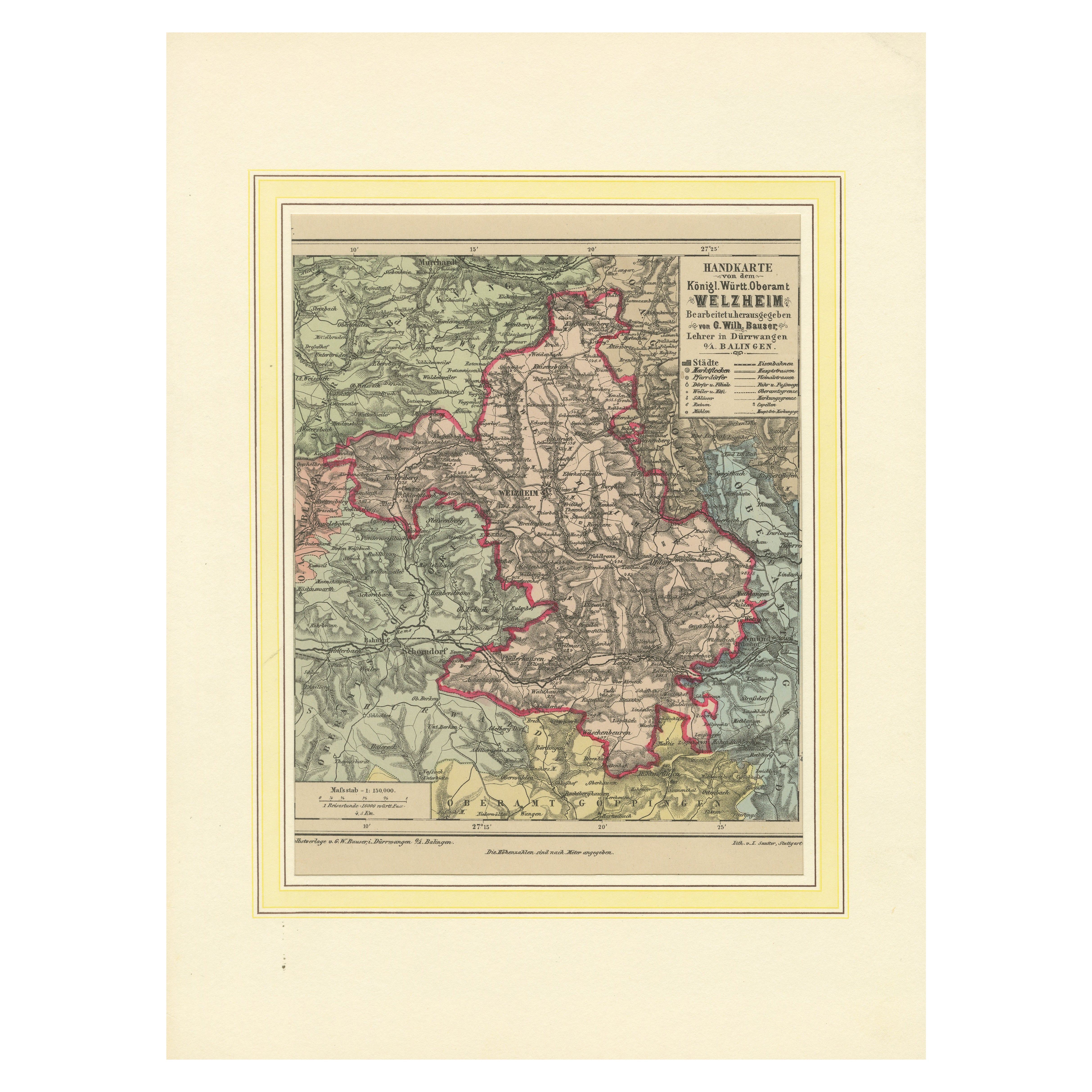
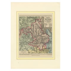
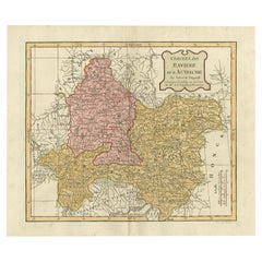
View AllDecorative Map of the Royal Württemberg District of Welzheim, Germany, ca.1880
Located in Langweer, NL
The Royal Württemberg District of Welzheim is located in Germany. Welzheim is a town in the state of Baden-Württemberg, which was historically part of the Kingdom of Württemberg. The...
Category
Antique 1880s Maps
Materials
Paper
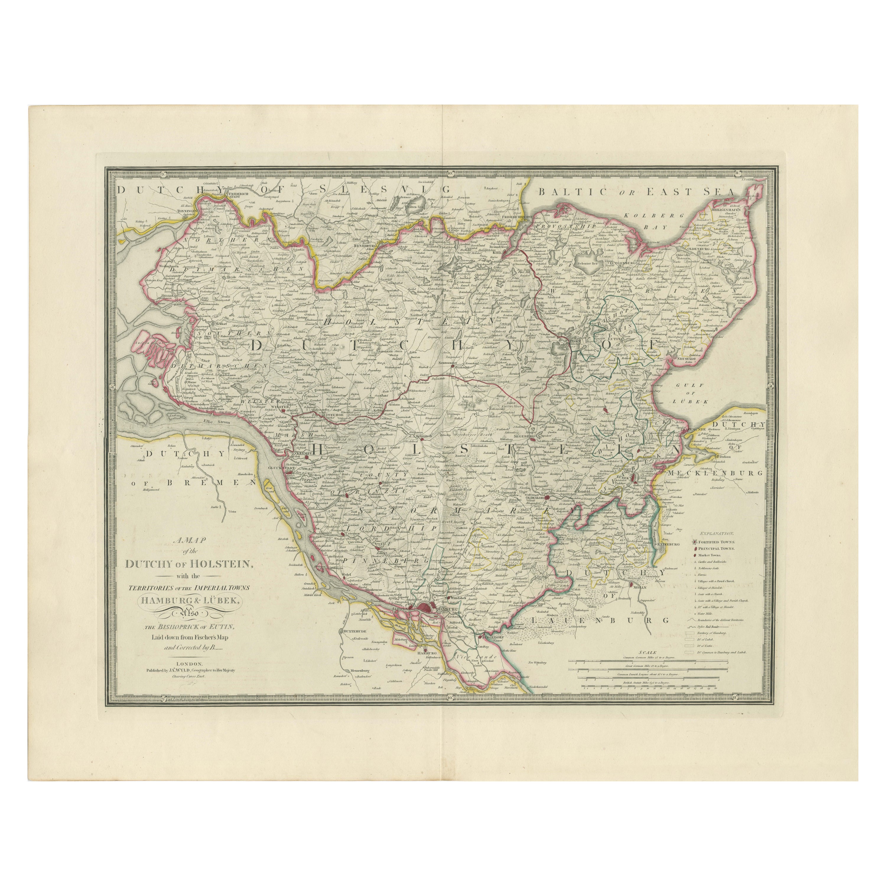
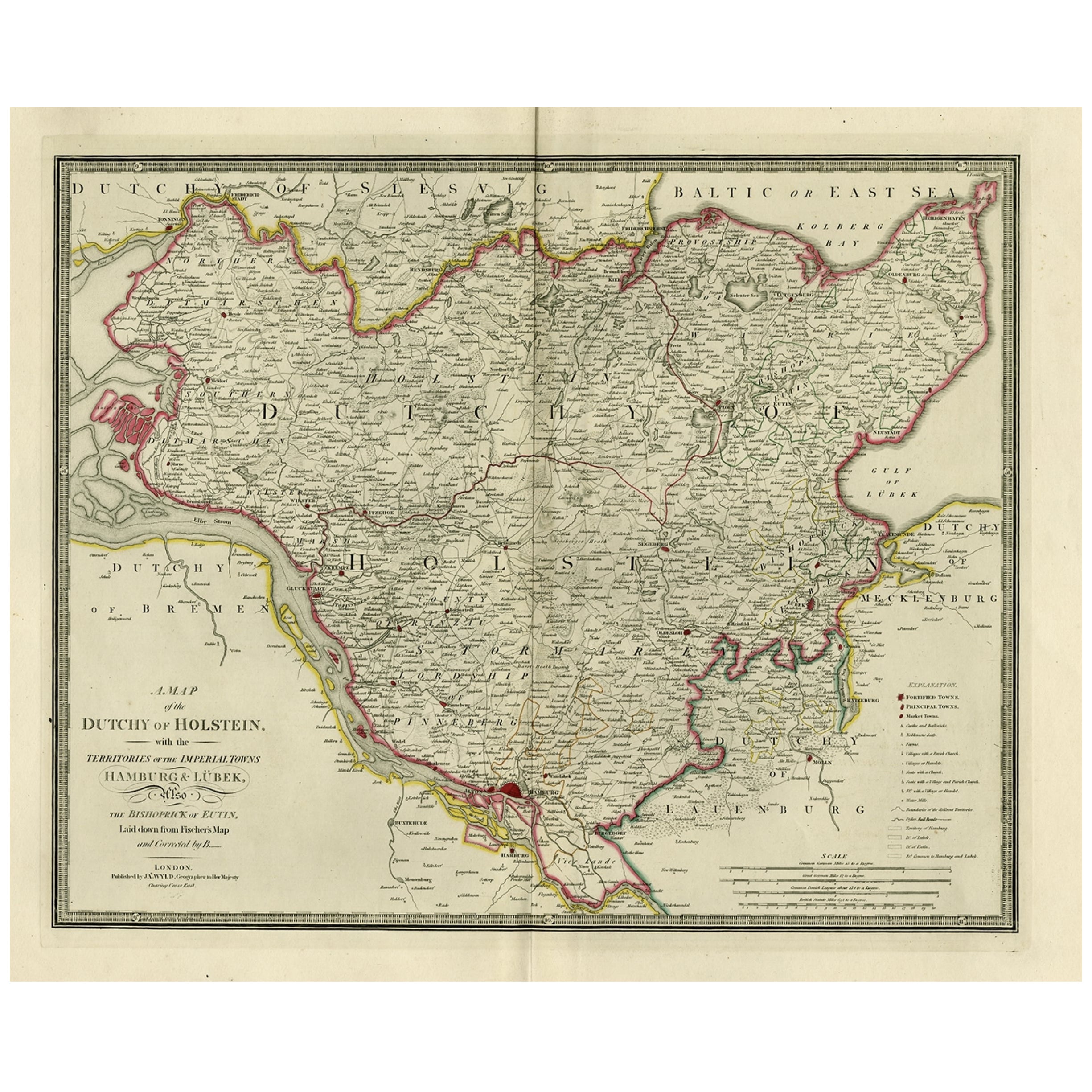
Map of the Dutchy of Holstein and the Territories of Hamburg & Lübek, 1875
Located in Langweer, NL
Title: Map of the Dutchy of Holstein and the Territories of Hamburg & Lübek by James Wyld, ca. 1875
Description: This is an antique map titled "A Map of the Dutchy of Holstein, with...
Category
Antique 1870s Maps
Materials
Paper

$875 Sale Price
20% Off
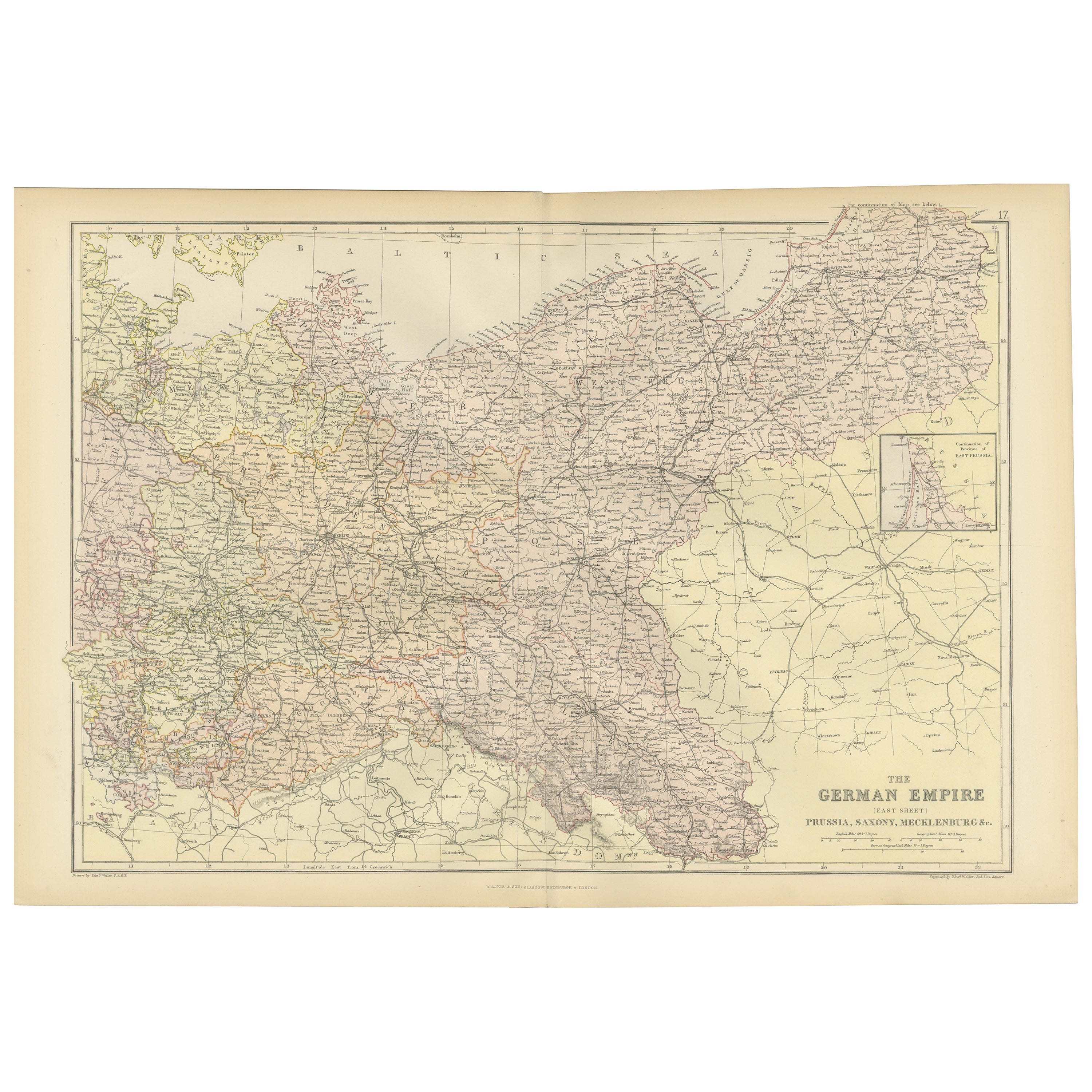
Antique Map of The German Empire (East Sheet), 1882
Located in Langweer, NL
Step into history with an authentic Antique Map of The German Empire (East Sheet) from the esteemed 'Comprehensive Atlas and Geography of the World,' meticulously crafted in 1882. Th...
Category
Antique 1880s Maps
Materials
Paper
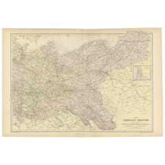
$177 Sale Price
20% Off
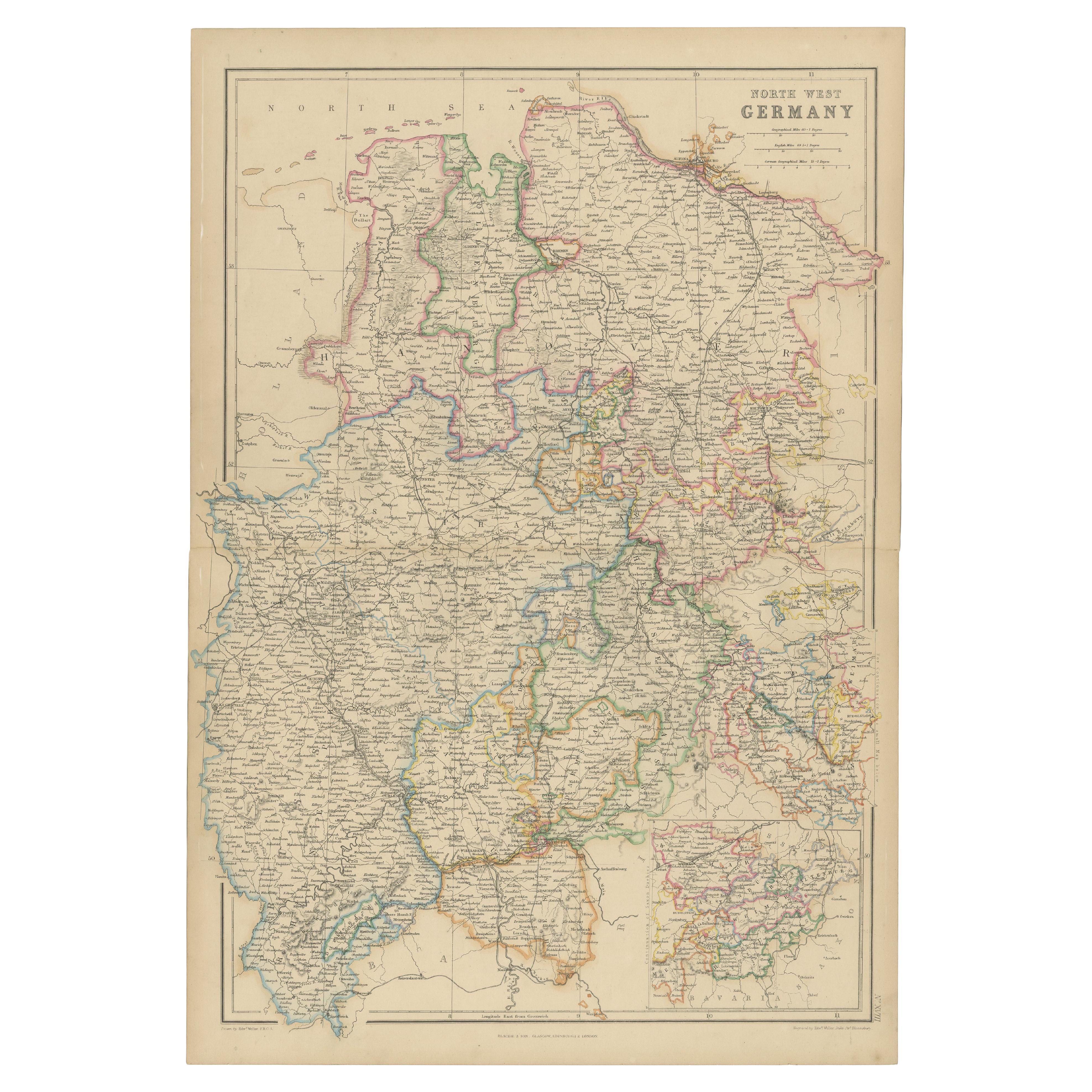
1859 Detailed Map of North West Germany with Bavaria Inset - Blackie's Atlas
Located in Langweer, NL
The "Antique Map of North West Germany" with an inset map of Bavaria is a distinguished piece from 'The Imperial Atlas of Modern Geography', published i...
Category
Antique Mid-19th Century Maps
Materials
Paper
$203 Sale Price
30% Off
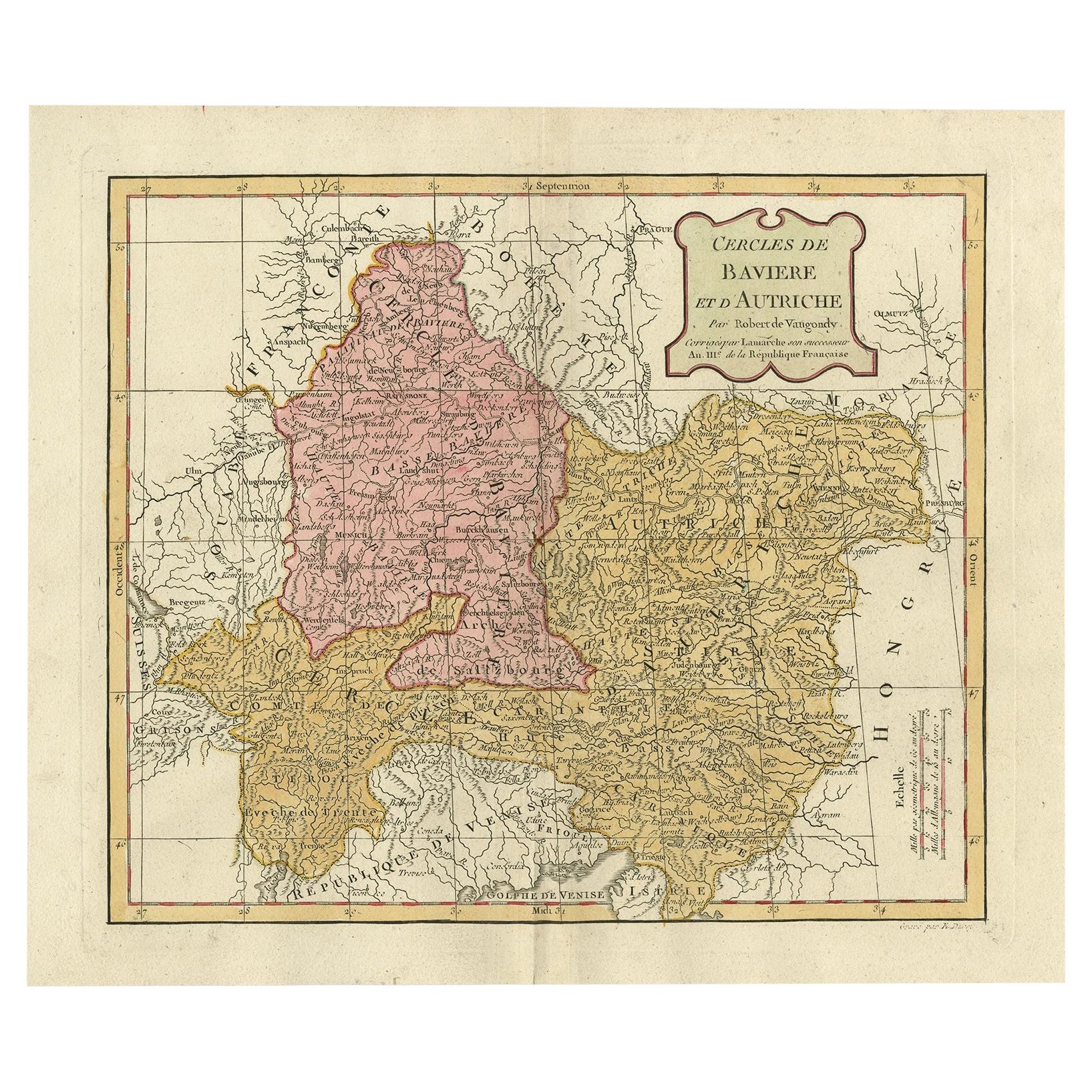
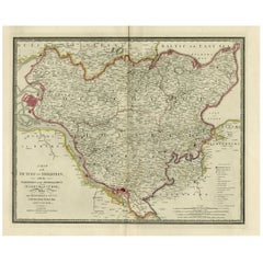
Antique Map of Bavaria in Southern Germany and Austria, 1806
Located in Langweer, NL
Antique map titled 'Cercles de Baviere et d'Autriche.' This map shows Bavaria in southern Germany and Austria. By Robert de Vaugondy, revised and published by Delamarche. Source unkn...
Category
Antique 19th Century Maps
Materials
Paper
$326 Sale Price
20% Off
Old Map of Holstein with the Imperial Towns Hamburg & Lubeck, Germany, 1854
Located in Langweer, NL
Antique map titled 'Map of the Duchy of Holstein with the territories of the Imperial Towns Hamburg & Lubeck (..)
Based on a map by Fischer.' Map of the Duchy of Holstein. From Jam...
Category
Antique 1850s Maps
Materials
Paper
$903 Sale Price
20% Off
You May Also Like
Austria-Hungary, Western Part. Century Atlas antique vintage map
Located in Melbourne, Victoria
'The Century Atlas. Austria-Hungary, Western Part'
Original antique map, 1903.
Central fold as issued. Map name and number printed on the reverse corners.
Sheet 40cm by 29.5cm.
Category
Early 20th Century Victorian More Prints
Materials
Lithograph

Original Antique English County Map, Nottinghamshire, J & C Walker, 1851
Located in St Annes, Lancashire
Great map of Nottinghamshire
Original colour
By J & C Walker
Published by Longman, Rees, Orme, Brown & Co. 1851
Unframed.
Category
Antique 1850s English Other Maps
Materials
Paper

1853 Map of "Russia in Europe Including Poland" Ric.r016
Located in Norton, MA
Description
Russia in Europe incl. Poland by J Wyld c.1853
Hand coloured steel engraving
Dimension: Paper: 25 cm W x 33 cm H ; Sight: 22 cm W x 28 cm H
Condition: Good ...
Category
Antique 19th Century Unknown Maps
Materials
Paper

Original Antique English County Map, Derbyshire, J & C Walker, 1851
Located in St Annes, Lancashire
Great map of Derbyshire
Original colour
By J & C Walker
Published by Longman, Rees, Orme, Brown & Co. 1851
Unframed.
Category
Antique 1850s English Other Maps
Materials
Paper

1839 Map of Karte Des "Russischen Reiches in Europa Und Asien" Ric.R0013
Located in Norton, MA
1839 map of Karte Des
"Russischen Reiches in Europa and Asien"
Ric.r013
Map of the European and Asian parts of Russian Empire. Karte der Russischen Reiches in Europa und Asien...
Category
Antique 19th Century Unknown Maps
Materials
Paper

1849 Map of "Europaische Russland", 'Meyer Map of European Russia', Ric. R017
Located in Norton, MA
1849 Map of
"Europaische Russland"
( Meyer Map of European Russia)
Ric.r017
A lovely map of European Russia dating to 1849 by Joseph Meyer. It covers the European portions of...
Category
Antique 19th Century Unknown Maps
Materials
Paper

More Ways To Browse
Antique Ivory Collectables
German Wurttemberg
Antique Village Soft
Imperial German
Railway Map
Used Domain Furniture
Austrian Bronze Collectibles
Milling Road Furniture
Solid Mahogany Table
Dessert Glasses
Geometric Glass Table
Mid Century Pin
6x10 Rug
Studded Furniture
Styles Of Antique Desks
Black And White Coffee Table
Metal Relief
Curved Velvet Couch