Items Similar to New Map of North America from the Latest Discoveries, 1763


Want more images or videos?
Request additional images or videos from the seller
1 of 17
New Map of North America from the Latest Discoveries, 1763
$1,800
£1,365.80
€1,561.67
CA$2,514.11
A$2,795.35
CHF 1,459.58
MX$34,026.22
NOK 18,623.58
SEK 17,449.40
DKK 11,655.02
Shipping
Retrieving quote...The 1stDibs Promise:
Authenticity Guarantee,
Money-Back Guarantee,
24-Hour Cancellation
About the Item
A fine antique 18th century map of the North American seaboard.
Entitled "A New Map of North America from the Latest Discoveries 1763".
By the Cartographer/Engraver - John Spilsbury, 1739-1769.
Depicting the British Colonies in North America at the end of the French & Indian War.
The claims of the Carolinas, Virginia, and New England have extend westward towards the Pacific Ocean. Georgia is now shown along with many Indian regions, and the Earl of Granville's line and the Florida/Carolina border is also shown.
Publisher: London magazine, v. 32, 1763.
Housed in a thin gilt wooden Neoclassical frame, triple matted, and housed behind what we believe is UV protective plexiglass.
There is a tear, staining and some apparent loss to the western latitudinal guide.
Simply a great historical map that predates the United States!
Date:
1763
Overall Condition:
It is in overall good, as-pictured, used estate condition.
Condition Details:
There seems to be some yellowing and past acid burn to the edges, a few spots of foxing, and expected folds and creasing throughout. There is a small tear, staining and some a lack of margin paper to the western latitudinal guide (which seems to be typical of this map).
Not observed outside the frame
The frame is in good condition with some spots of loss its gilding, nicks, and some spots of edge wear here & there. There are some scratches to what appears to be (UV protective) plexiglass housing the mat. Otherwise, there are some fine & light surface scratches and other signs of expected light wear consistent with age.
Measurements:
Width: ca. 25 7/8 in.
Height: ca. 22 in.
Depth: ca. 1 in.
Sight width: ca. 16 in.
Sight height: ca. 11 1/2 in.
Items purchased from this dealer must delight you. Purchases may be returned for any reason for a period of 7 days.
- Dimensions:Height: 22 in (55.88 cm)Width: 25.88 in (65.74 cm)Depth: 1 in (2.54 cm)
- Style:Georgian (Of the Period)
- Materials and Techniques:
- Place of Origin:
- Period:
- Date of Manufacture:1763
- Condition:Wear consistent with age and use. See description for condition details.
- Seller Location:Philadelphia, PA
- Reference Number:Seller: DSA INV SS M221stDibs: LU1610230344572
About the Seller
5.0
Gold Seller
Premium sellers maintaining a 4.3+ rating and 24-hour response times
Established in 1996
1stDibs seller since 2015
536 sales on 1stDibs
Typical response time: 1 hour
- ShippingRetrieving quote...Shipping from: Philadelphia, PA
- Return Policy
Authenticity Guarantee
In the unlikely event there’s an issue with an item’s authenticity, contact us within 1 year for a full refund. DetailsMoney-Back Guarantee
If your item is not as described, is damaged in transit, or does not arrive, contact us within 7 days for a full refund. Details24-Hour Cancellation
You have a 24-hour grace period in which to reconsider your purchase, with no questions asked.Vetted Professional Sellers
Our world-class sellers must adhere to strict standards for service and quality, maintaining the integrity of our listings.Price-Match Guarantee
If you find that a seller listed the same item for a lower price elsewhere, we’ll match it.Trusted Global Delivery
Our best-in-class carrier network provides specialized shipping options worldwide, including custom delivery.More From This Seller
View AllAntique 18th Century Map of the Province of Pensilvania 'Pennsylvania State'
Located in Philadelphia, PA
A fine antique of the colony of Pennsylvania.
Noted at the top of the sheet as a 'Map of the province of Pensilvania'.
This undated and anonymous map is thought to be from the Gentleman's Magazine, London, circa 1775, although the general appearance could date it to the 1760's.
The southern boundary reflects the Mason-Dixon survey (1768), the western boundary is placed just west of Pittsburgh, and the northern boundary is not marked.
The map has a number of reference points that likely refer to companion text and appear to be connected to boundaries. The western and southern boundaries are marked Q, R, S, for example. A diagonal line runs from the Susquehanna R to the Lake Erie P. A broken line marked by many letters A, B, N, O, etc., appears in the east.
There are no latitude or longitude markings, blank verso.
Framed in a shaped contemporary gilt wooden frame and matted under a cream colored matte.
Bearing an old Graham Arader Gallery...
Category
Antique 18th Century British American Colonial Maps
Materials
Paper

Antique Map of Virginia & the Chesapeake Bay by Jacques-Nicolas Bellin, c. 1750
By Jacques-Nicolas Bellin
Located in Philadelphia, PA
A fine antique 18th century French map of North America.
By Jacques-Nicolas Bellin.
On laid paper with polychrome highlights.
Depicting Virginia, the Chesapeake Bay, and the nearb...
Category
Antique 18th Century French Baroque Maps
Materials
Paper

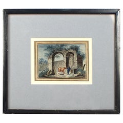
Antique Late 18th-Early 19th Century English Watercolor Painting of Ruins
Located in Philadelphia, PA
Offered here for your consideration is an antique watercolor painting on laid paper.
It depicts a cowherd with a cow and sheep at a water trough by ancient architectural ruins. Th...
Category
Antique Early 19th Century European Georgian Paintings
Materials
Paint, Paper
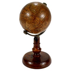
Antique 19th Century Miniature French Edition Globe by C. Abel-Klinger
By C. Abel-Klinger
Located in Philadelphia, PA
A fine antique French Edition miniature globe.
By C. Abel-Klinger.
On a turned wooden stand with an uncalibrated brass half meridian.
The globe is marked with an integral l...
Category
Antique 19th Century German Neoclassical Maps
Materials
Paper
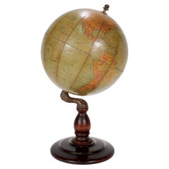
Antique Hammond's 6-Inch Terrestrial Globe on Stand
By C.S. Hammond & Co.
Located in Philadelphia, PA
Offered here for your consideration is, A fine antique 6-inch terrestrial globe.
Additional Details:
By C.S. Hammond & Co.
The globe likely dates from 1927 to 1930 due to the ...
Category
20th Century Unknown Art Deco Globes
Materials
Wood, Paper
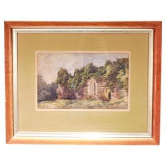
Antique 19th C English Watercolor View of Rievaulx Abbey
By William Turner
Located in Philadelphia, PA
A fine antique English watercolor landscape painting.
Depicting the ruins of Rievaulx Abbey in England circa July 1881.
Pencil signed to the lower right: Rievaulx Abbey July 1881
...
Category
Antique 1880s English Romantic Paintings
Materials
Paint, Paper
You May Also Like
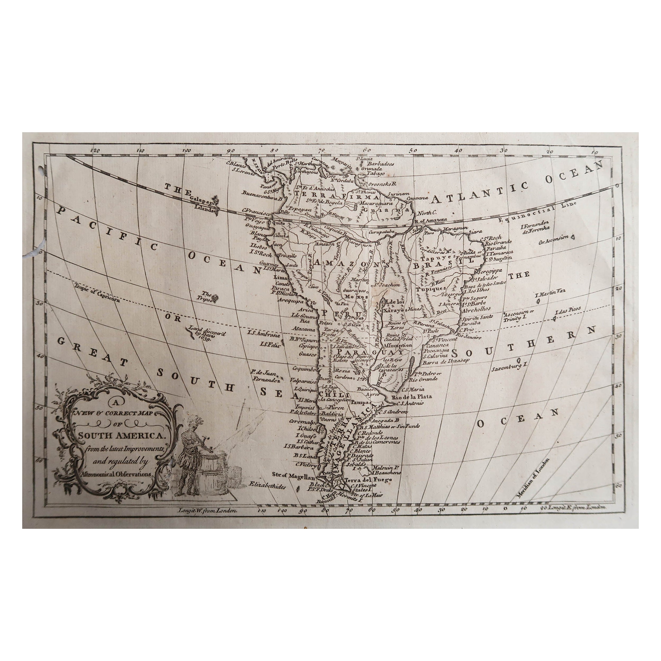
Original Antique Map of South America. C.1780
Located in St Annes, Lancashire
Great map of South America
Copper-plate engraving
Published C.1780
Two small worm holes to left side of map
Unframed.
Category
Antique Early 1800s English Georgian Maps
Materials
Paper

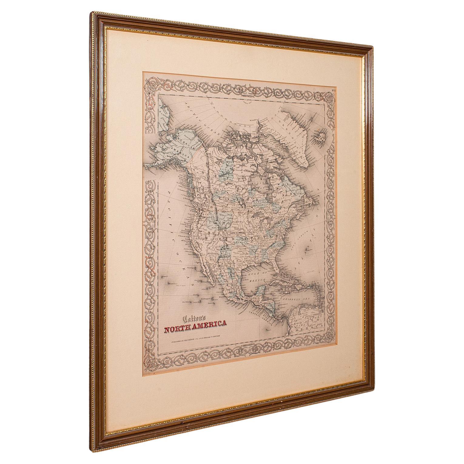
Antique North America Map, USA, Canada, Mexico, Cartography, Colton, Victorian
Located in Hele, Devon, GB
This is an antique North America map. A USA, framed lithography atlas engraving of the continent by JH Colton, dating to the Victorian period and later, circa 1860.
Fascinating, large framed map...
Category
Antique Mid-19th Century American Victorian Maps
Materials
Paper

Antique Map of the Americas and West Indies by Robert de Vaugondy, 1778
Located in Langweer, NL
Antique Map of the Americas and West Indies by Robert de Vaugondy, 1778
This detailed antique map titled "Amérique ou Indes Occidentales" was published in 1778 by the renowned Frenc...
Category
Antique Late 18th Century French Maps
Materials
Paper

$1,349 Sale Price
25% Off
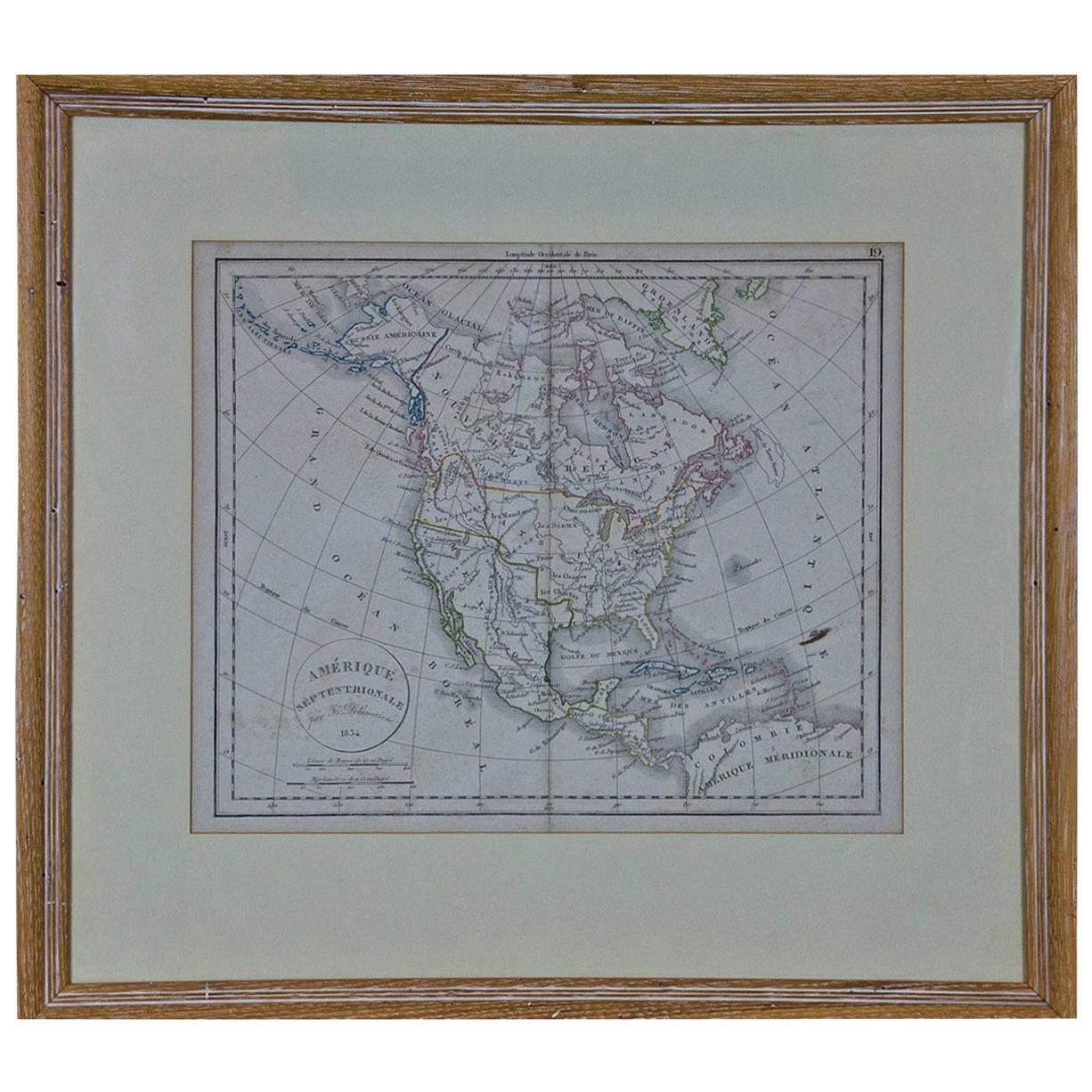
America "Amérique Septentrionale": A 19th Century French Map by Delamarche
By Maison Delamarche 1
Located in Alamo, CA
This framed mid 19th century map of North America entitled "Amérique Septentrionale" by Felix Delamarche was published in Paris in 1854 by Quay de l'Horloge du Palais, avec les Carte...
Category
Antique Mid-19th Century American Other Maps
Materials
Paper

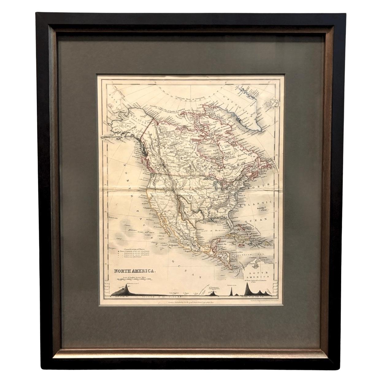
1846 "North America" Map, Engraved by I. Dower
Located in Colorado Springs, CO
Presented is an original 1846 map of “North America.” The map was drawn and engraved by I. Dower and published in London by Orr & Company. The map depicts North America, to include G...
Category
Antique 1840s English Victorian Maps
Materials
Paper

Antique Map of North America by Dufour 'circa 1834'
Located in Langweer, NL
Antique map titled 'Amérique Septentrionale'. Uncommon map of North America. Published by or after A.H. Dufour, circa 1834. Source unknown, to be determined.
Category
Antique Mid-19th Century Maps
Materials
Paper

$191 Sale Price
20% Off
More Ways To Browse
North Carolina Furniture
American Georgian Furniture
Antique North Carolina Furniture
18th Century Virginia
Cham Antiques
Antique Furniture Trinidad
Cornwall Map
Marie Galante
Patagonia Map
Shepherd And Hedger
Vignola Furniture
Washington Dc Map
Antique Map Of Cornwall
Coronelli Globe
Vintage Bartholomew Maps
Antique Alabama Map
Cape Cod Map
Goa France