Items Similar to Old Copper Engraving of the Port City Dabhol in India, 1757

Want more images or videos?
Request additional images or videos from the seller
1 of 6
Old Copper Engraving of the Port City Dabhol in India, 1757
$306.62
$383.2820% Off
£227.22
£284.0320% Off
€256
€32020% Off
CA$418.60
CA$523.2520% Off
A$465.67
A$582.0920% Off
CHF 244.11
CHF 305.1420% Off
MX$5,690.39
MX$7,112.9920% Off
NOK 3,108.45
NOK 3,885.5620% Off
SEK 2,926.17
SEK 3,657.7220% Off
DKK 1,949.16
DKK 2,436.4520% Off
Shipping
Retrieving quote...The 1stDibs Promise:
Authenticity Guarantee,
Money-Back Guarantee,
24-Hour Cancellation
About the Item
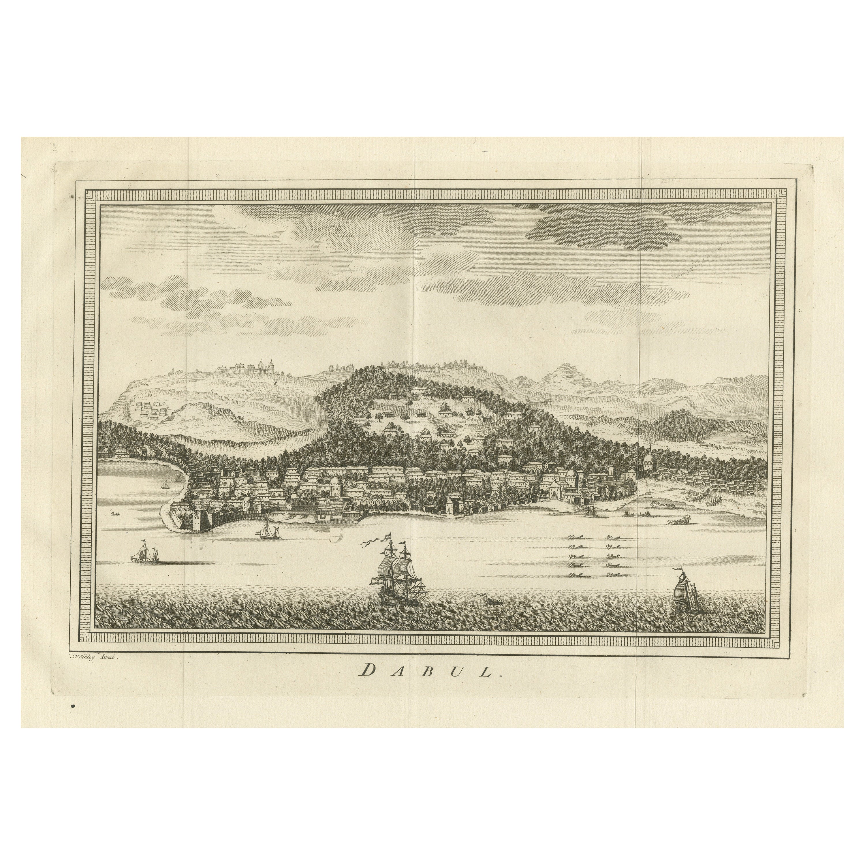
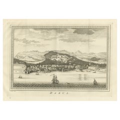
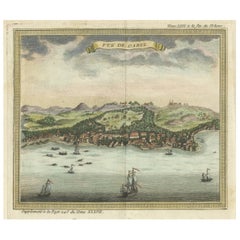
Antique print titled 'Dabul'.
Old print of the port city Dabhol in India. In the 15th and 16th centuries, Dabul was an opulent Muslim trade center. Around 1660 it was annexed to the new Maratha kingdom. Originates from 'Historische beschryving der reizen (..)'.
Artists and Engravers: Jacob van der Schley was a dutch engraver and artist, who studied under the French engraver Bernard Picart (1673-1733) since he was 12.
- Dimensions:Height: 9.45 in (24 cm)Width: 12.8 in (32.5 cm)Depth: 0 in (0.02 mm)
- Materials and Techniques:
- Period:1750-1759
- Date of Manufacture:1757
- Condition:Condition: Very good, general age-related toning. Original folding lines, blank verso. Please study image carefully.
- Seller Location:Langweer, NL
- Reference Number:Seller: PCT-5268 1stDibs: LU3054326758322
About the Seller
5.0
Recognized Seller
These prestigious sellers are industry leaders and represent the highest echelon for item quality and design.
Platinum Seller
Premium sellers with a 4.7+ rating and 24-hour response times
Established in 2009
1stDibs seller since 2017
2,494 sales on 1stDibs
Typical response time: 1 hour
- ShippingRetrieving quote...Shipping from: Langweer, Netherlands
- Return Policy
Authenticity Guarantee
In the unlikely event there’s an issue with an item’s authenticity, contact us within 1 year for a full refund. DetailsMoney-Back Guarantee
If your item is not as described, is damaged in transit, or does not arrive, contact us within 7 days for a full refund. Details24-Hour Cancellation
You have a 24-hour grace period in which to reconsider your purchase, with no questions asked.Vetted Professional Sellers
Our world-class sellers must adhere to strict standards for service and quality, maintaining the integrity of our listings.Price-Match Guarantee
If you find that a seller listed the same item for a lower price elsewhere, we’ll match it.Trusted Global Delivery
Our best-in-class carrier network provides specialized shipping options worldwide, including custom delivery.More From This Seller
View AllAntique Print of the city of Dabhol, Dabul, India
By Jakob van der Schley
Located in Langweer, NL
Antique print titled 'Dabul'. Original old print of the port city Dabhol in India. In the 15th and 16th centuries, Dabul was an opulent Muslim trade center. Around 1660 it was annexe...
Category
Antique Mid-18th Century Prints
Materials
Paper
$268 Sale Price
20% Off
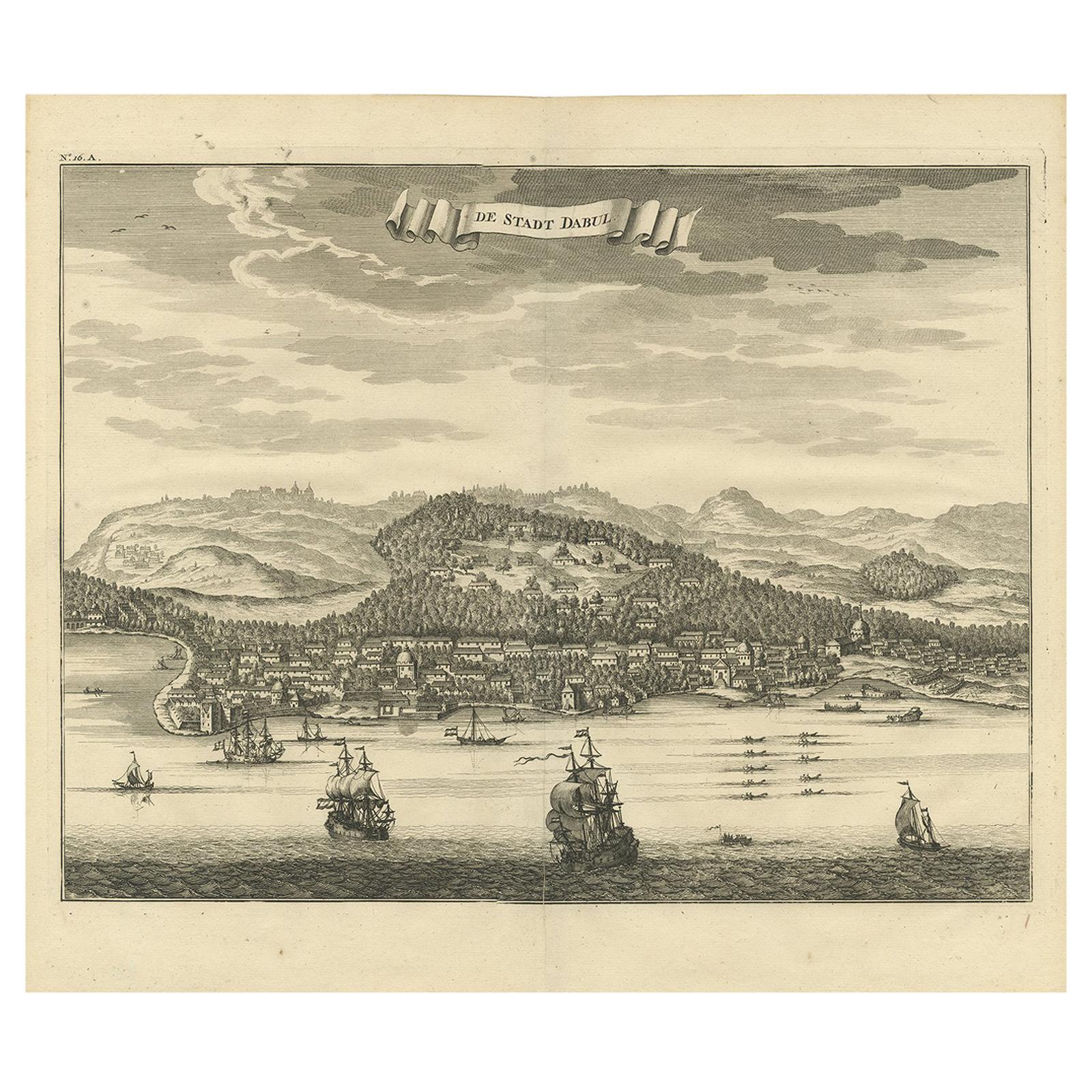
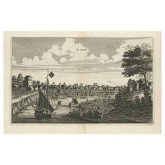
Antique Print of the City of Dabhol 'India' by Valentijn '1726'
By F. Valentijn
Located in Langweer, NL
Antique print titled 'De Stadt Dabul'. Antique print depicting the City of Dabhol in India. This print originates from 'Oud en Nieuw Oost-Indiën' by F. Valentijn.
Category
Antique Early 18th Century Dutch Prints
Materials
Paper

$359 Sale Price
20% Off
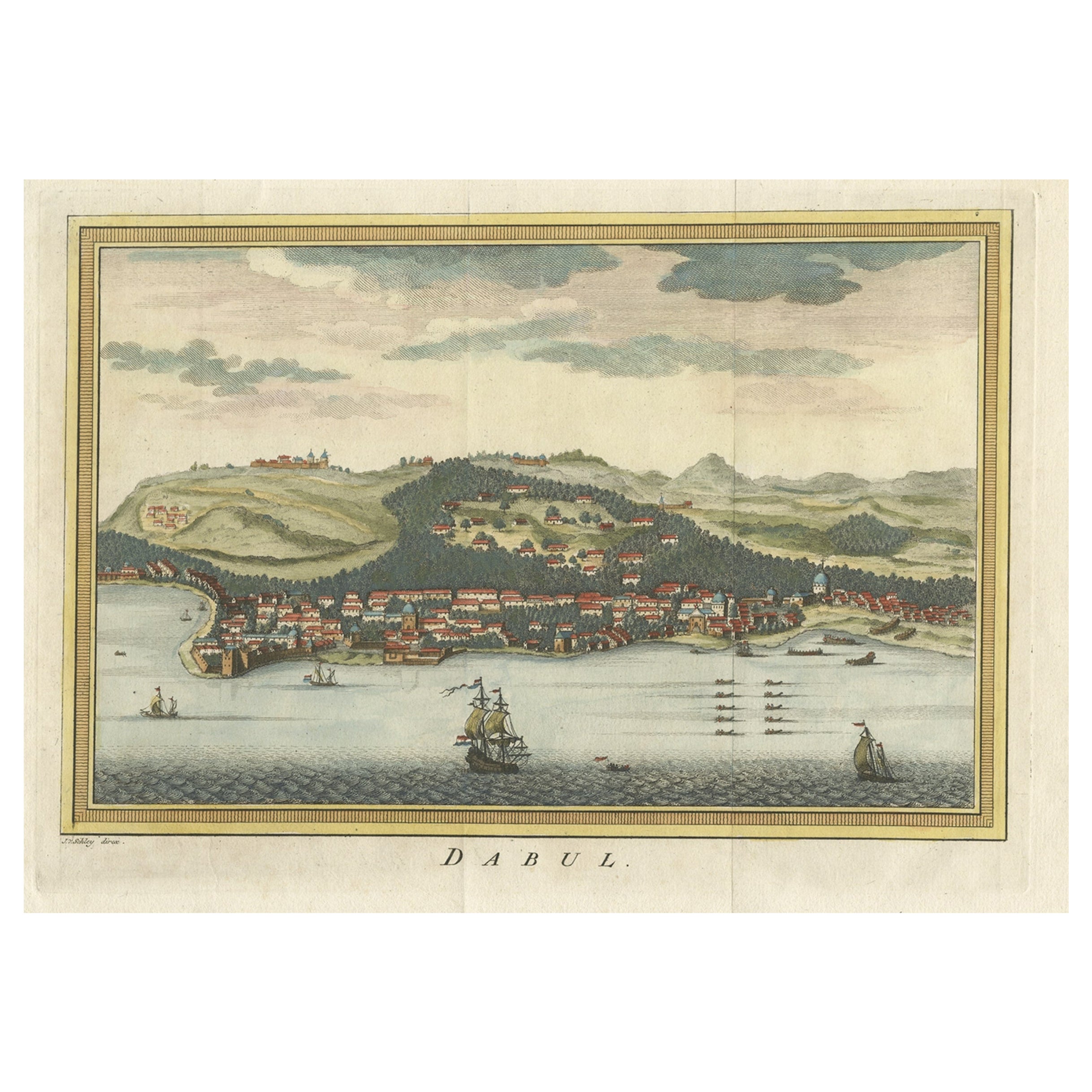
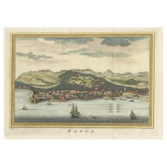
Antique Handcolored Engraving of Dabhol or Dabul in India, '1757'
Located in Langweer, NL
Antique print titled 'Dabul'. Old print of the port city Dabhol in India. In the 15th and 16th centuries, Dabul was an opulent Muslim trade center. Around 1660 it was annexed to the ...
Category
Antique 18th Century Prints
Materials
Paper
$344 Sale Price
20% Off
Antique Copper Engraving of the City of Kuchin in China, 1668
By Johannes Nieuhof
Located in Langweer, NL
Antique print China titled 'Kuching'.
Old print depicting a view on the Chinese city of Kuching or Kuchin (Gui Jiang, Kuei Chiang), near the river Gui (Guei). This area is close ...
Category
Antique 17th Century Prints
Materials
Paper
$325 Sale Price
20% Off
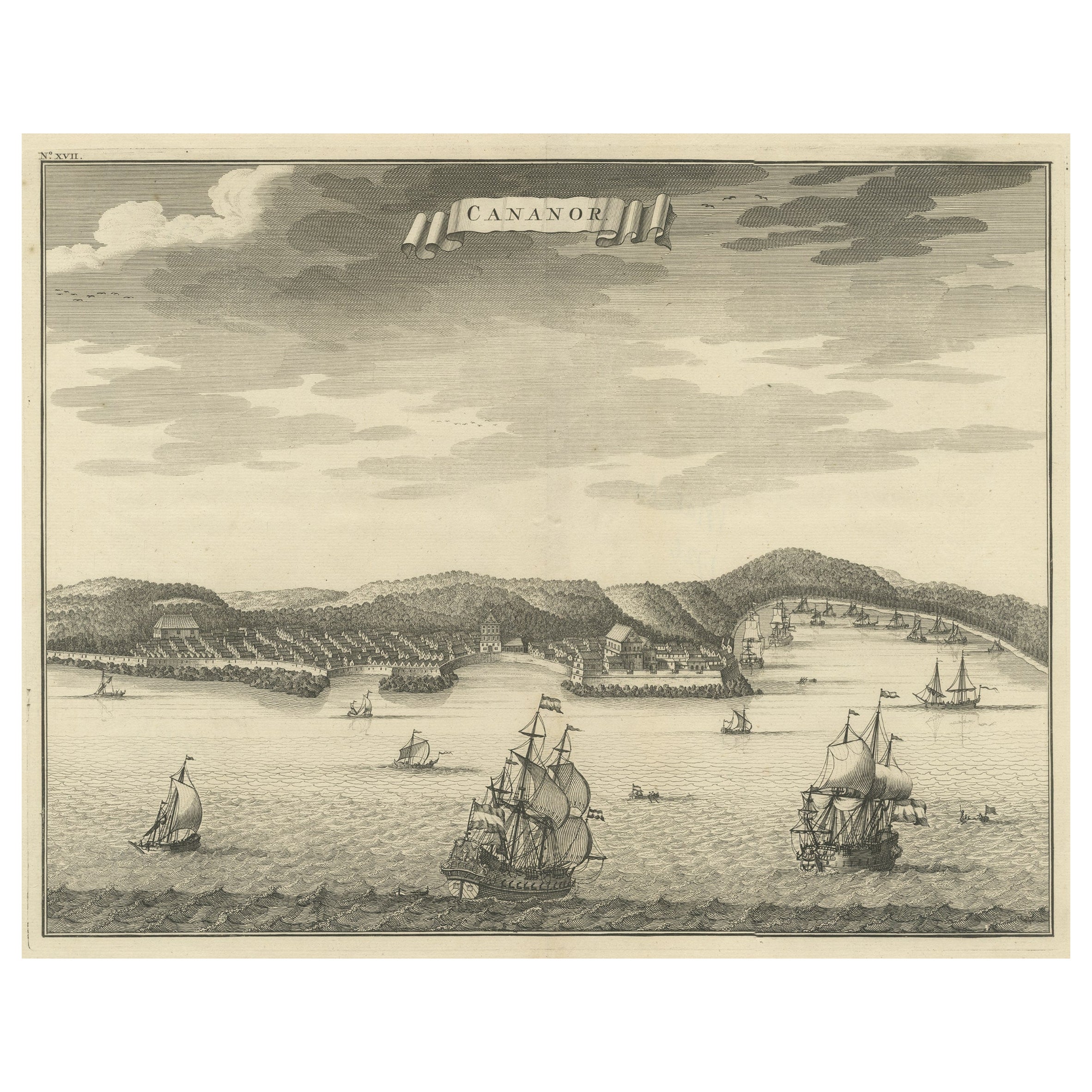
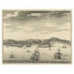
Original Antique Engraving of Kannur 'or Cannanore', Kerala, India, 1726
Located in Langweer, NL
Antique print, titled: 'Cananor' - This is a print of a view of Kannur (or Cannanore), Kerala, India. From the monumental: "Oud en Nieuw Oost-Indiën ..." ...
Category
Antique 1720s Maps
Materials
Paper
$527 Sale Price
20% Off
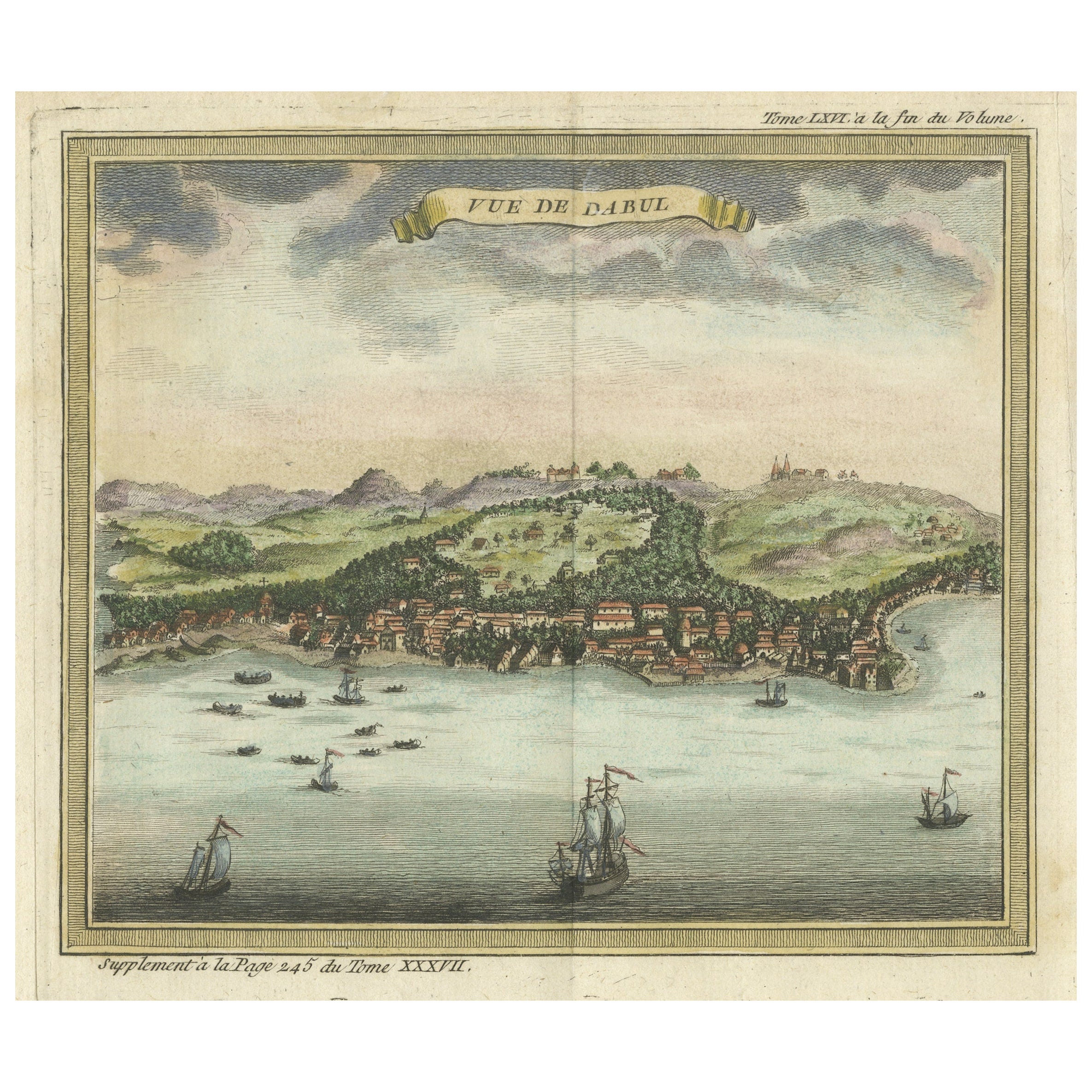
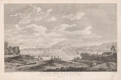
Antique Print of Dabul 'now Dabhol' India
Located in Langweer, NL
Antique print titled 'Vue de Dabul'. View of Dabhol, Ratnagiri district, Maharashtra, India. This print originates from 'Histoire générale des voyages, ou nouvelle collection de tout...
Category
Antique Mid-18th Century Prints
Materials
Paper
$555 Sale Price
20% Off
You May Also Like
18th Century Map Engraving - Plan of the Works of the City of Messina, Sicily
Located in Corsham, GB
A map of Messina, a harbour city in northeast Sicily. Inscribed with the title in plate to the lower edge, 'Plan of the Works of the City of Messina, one of the strongest and most co...
Category
18th Century More Prints
Materials
Engraving

$285 Sale Price
20% Off
17th Century Topographical Engraving Nantes & St. Malo, France, by Iohan Peeters
Located in New York, NY
The ancient city of Saint Malo in North Western France has long been associated with adventure on the high seas, piracy and exploration. It was the birthplace of several important in...
Category
Antique 17th Century Dutch Maps
Materials
Paper

17th-18th Century Siege of Graves Mapping Engraving By Willian III
Located in Kingston, NY
RARE French 17th-18th Century Enhanced Siege of Graves Mapping Engraving BY William III, also widely known as William of Orange,
The Siege of Grave in Dutch Brabant started by Monsie...
Category
Antique 17th Century French Prints
Materials
Paper

Map Of India - Original Lithograph - 19th Century
Located in Roma, IT
Map of India is an original lithograph artwork realized by an Anonymous engraver of the 19th Century.
Printed in the series of "France Pittoresque".
Titled "France Pittoresque".
...
Category
19th Century Modern Figurative Prints
Materials
Lithograph

Vue d'une partie du Lac de Geneve, Switzerland, engraving, circa 1780
Located in Melbourne, Victoria
French copper-line engraving depicting the Lake of Geneva, Switzerland.
From 'The Scenery and Science of Switzerland illustrated', by Antoine Baron de Zurlauben (1720-1795) & Jean B...
Category
1780s Naturalistic Landscape Prints
Materials
Engraving
18th Century French Map and City View of Joppe/Jaffa (Tel Aviv) by Sanson
By Nicholas Sanson d'Abbeville
Located in Alamo, CA
An original antique engraving entitled "Joppe; in ’t Hebreeusch by ouds Japho; hedendaags Japha, of Jaffa; volgens d’aftekening gedaan 1668", by Nicholas Sanson d'Abbeville (1600 - 1667). This is a view of the city of Joppe (in Hebrew Japho), now called Japha or Jaffa, the harbor portion of modern day Tel Aviv, Israel as it appeared in 1668 . It depicts a very busy harbor with numerous boats. A large ship on the left appears to be firing its canons and a small ship on the right appears to be sitting very low in the water, either heavily loaded with cargo or sinking. The town is seen on the far shore with a fortress on a hill across in the background. The map is printed from the original Sanson copperplate and was published in 1709 by his descendants.
The map is presented in an ornate brown wood frame embellished by gold-colored leaves and gold inner trim with a double mat; the outer mat is cream-colored and the inner mat is black. There is a central vertical fold, as issued. There are two small spots in the lower margin and one in the upper margin, as well as two tiny spots adjacent to the central fold. 1717 is written below the date 1668 in the inscription. The map is otherwise in very good condition.
Another map of the "Holy Land" (by Claes Visscher in 1663), with an identical style frame and mat is available. This pair of maps would make a wonderful display grouping. Please see Reference #LU117324709892.
Artist: Nicholas Sanson d'Abbeville (1600 - 1667) and his descendents were important French cartographer's active through the 17th century. Sanson started his career as a historian and initially utilized cartography to illustrate his historical treatises. His maps came to the attention of Cardinal Richelieu and then King Louis XIII of France, who became a supporter and sponsor. He subsequently appointed Sanson 'Geographe Ordinaire du Roi' the official map maker to the king. Sanson not only created maps for the king, but advised him on geographical issues and curated his map collection...
Category
Early 1700s Prints and Multiples
Materials
Engraving

More Ways To Browse
Antique Copper Engravings
India Engraving
15th Century India
Thailand Map
Antique Maps Of Russian Empire
Antique Navigational Tools
Australian Colonial
Antique German Compass
Key Trade Sign
Spanish Galleon
World Map Of Trade Routes
Antique Puerto Rico
Albanian Antique
Antique Furniture Wiltshire
Antique Maps Of Israel
Framed Africa Maps
Antique Furniture Goa
Croatian Antiques