Scottish Maps
to
21
21
5
21
21
772
724
332
218
146
21
21
21
Place of Origin: Scottish
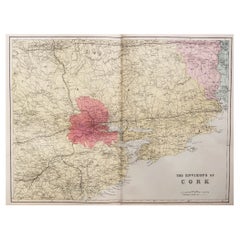
Large Original Antique Map of the Environs of Cork, Ireland, circa 1880
Located in St Annes, Lancashire
Great map of The Environs of Cork
Published circa 1880
Unframed
Free shipping.
Category
1880s Antique Scottish Maps
Materials
Paper
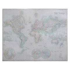
Large Original Antique Map of the World, Fullarton, circa 1870
Located in St Annes, Lancashire
Great map of the World.
From the celebrated Royal Illustrated Atlas
Lithograph. Original color.
Published by Fullarton, Edinburgh, circa 1870.
Unframed.
Category
1870s Antique Scottish Maps
Materials
Paper
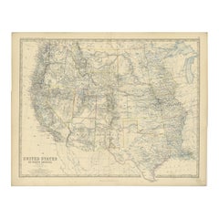
1874 Map of Western United States – Detailed Atlas by Keith Johnston
Located in Langweer, NL
1874 Map of Western United States by Keith Johnston – Detailed Atlas
This is an original antique map titled “United States of North America (Western States)” by Alexander Keith John...
Category
1870s Antique Scottish Maps
Materials
Paper
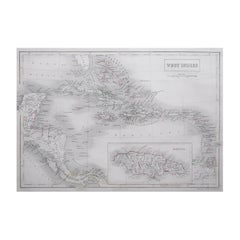
Large Original Antique Map of The West Indies by Sidney Hall, 1847
Located in St Annes, Lancashire
Great map of The West Indies
Drawn and engraved by Sidney Hall
Steel engraving
Original colour outline
Published by A & C Black. 1847
Unframed
Free shipping.
Category
1840s Antique Scottish Maps
Materials
Paper
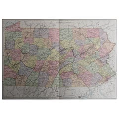
Original Antique Map of the American State of Pennsylvania, 1889
Located in St Annes, Lancashire
Great map of Pennsylvania
Drawn and Engraved by W. & A.K. Johnston
Published By A & C Black, Edinburgh.
Original colour
Unframed.
Repair to a minor tear on bottom edge.
Category
1880s Victorian Antique Scottish Maps
Materials
Paper
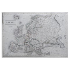
Large Original Antique Map of Europe by Sidney Hall, 1847
Located in St Annes, Lancashire
Great map of Europe
Drawn and engraved by Sidney Hall
Steel engraving
Original colour outline
Published by A & C Black. 1847
Unframed
Free shipping.
Category
1840s Antique Scottish Maps
Materials
Paper
Large Original Antique Map of The Pacific Ocean, Fullarton, C.1870
Located in St Annes, Lancashire
Great map of The Pacific Ocean
From the celebrated Royal Illustrated Atlas
Lithograph by Swanston. Original color.
Published by Fullarton,...
Category
1870s Antique Scottish Maps
Materials
Paper
Original Antique Map of the American State of Washington, 1889
Located in St Annes, Lancashire
Great map of Washington
Drawn and Engraved by W. & A.K. Johnston
Published By A & C Black, Edinburgh.
Original colour
Unframed.
Category
1880s Victorian Antique Scottish Maps
Materials
Paper
Large Original Antique Map of The World, Fullarton, C.1870
Located in St Annes, Lancashire
Great map of the World. Showing both hemispheres
From the celebrated Royal Illustrated Atlas
Lithograph. Original color.
Published by Fullarton, Edinburgh, C.1870
Unframed.
Rep...
Category
1870s Antique Scottish Maps
Materials
Paper
Original Antique Map of the American State of Oregon, 1889
Located in St Annes, Lancashire
Great map of Oregon
Drawn and Engraved by W. & A.K. Johnston
Published By A & C Black, Edinburgh.
Original colour
Unframed.
Category
1880s Victorian Antique Scottish Maps
Materials
Paper
Original Antique Map of New Brunswick and Nova Scotia, 1889
Located in St Annes, Lancashire
Great map of New Brunswick and Nova Scotia
Drawn and Engraved by W. & A.K. Johnston
Published By A & C Black, Edinburgh.
Original colour
Unfr...
Category
1880s Victorian Antique Scottish Maps
Materials
Paper
Original Antique Map of the American State of Nevada, 1889
Located in St Annes, Lancashire
Great map of Nevada
Drawn and Engraved by W. & A.K. Johnston
Published By A & C Black, Edinburgh.
Original colour
Unframed.
Category
1880s Victorian Antique Scottish Maps
Materials
Paper
Large Original Antique Map of Australia by Sidney Hall, 1847
Located in St Annes, Lancashire
Great map of Australia
Drawn and engraved by Sidney Hall
Steel engraving
Original colour outline
Published by A & C Black. 1847
Unframed
Free shipping.
Category
1840s Antique Scottish Maps
Materials
Paper
Large Original Antique Map of South Italy and Malta by Sidney Hall, 1847
Located in St Annes, Lancashire
Great map of South Italy and Malta
Drawn by Sidney Hall
Steel engraving by G.Aikman
Original color outline
Published by A & C Black. 1847
Un...
Category
1840s Antique Scottish Maps
Materials
Paper
Large Original Antique Map of Poland by Sidney Hall, 1847
Located in St Annes, Lancashire
Great map of Poland
Drawn and engraved by Sidney Hall
Steel engraving
Original colour outline
Published by A & C Black. 1847
Unframed
...
Category
1840s Antique Scottish Maps
Materials
Paper
Original Antique Decorative Map of Iceland & Faroe, Fullarton, C.1870
Located in St Annes, Lancashire
Great map of Iceland and The Faroe Islands
Wonderful figural border
From the celebrated Royal Illustrated Atlas
Lithograph. Original color.
Published by Fullarton, Edinb...
Category
1870s Antique Scottish Maps
Materials
Paper
Large Original Antique Map of The Environs of Dublin, Ireland, circa 1880
Located in St Annes, Lancashire
Great map of The Environs of Dublin
Published circa 1880
Unframed
Free shipping.
Category
1880s Antique Scottish Maps
Materials
Paper
Large Original Antique Map of Asia by Sidney Hall, 1847
Located in St Annes, Lancashire
Great map of Asia
Drawn and engraved by Sidney Hall
Steel engraving
Original colour outline
Published by A & C Black. 1847
Unframed
Free shipping
Category
1840s Antique Scottish Maps
Materials
Paper
Large Original Antique City Plan of Dublin, Ireland, circa 1880
Located in St Annes, Lancashire
Great city plan of Dublin
Published circa 1880
Unframed
Free shipping.
.
Category
1880s Antique Scottish Maps
Materials
Paper
Original Antique Decorative Map of South America-West Coast, Fullarton, C.1870
Located in St Annes, Lancashire
Great map of Chili, Peru and part of Bolivia
Wonderful figural border
From the celebrated Royal Illustrated Atlas
Lithograph. Original color.
Published by Fullarton, Edi...
Category
1870s Antique Scottish Maps
Materials
Paper
Large Original Antique Map of Java and Borneo, Fullarton, C.1870
Located in St Annes, Lancashire
Great map of Java and Borneo
Wonderful figurative borders
From the celebrated Royal Illustrated Atlas
Lithograph. Original color.
Published by Fullarton, Edinburgh. C.1870
Unfr...
Category
1870s Antique Scottish Maps
Materials
Paper
Related Items
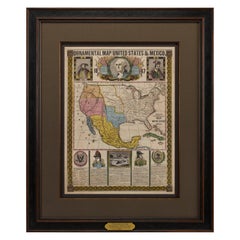
1847 Ornamental Map of the United States & Mexico by H. Phelps
Located in Colorado Springs, CO
Offered is an original 1847 ornamental map of the U.S. entitled "Ornamental Map of the United States & Mexico" by Humphrey Phelps. The map was issued as an act of Congress by Phelps on Fulton Street, New York. The broadside is elaborately hand-colored.
This is a very detailed and graphic propaganda map of the United States expressing U.S. dominance of the North American continent. The hand-colored map proclaims the Manifest Destiny, with the recent acquisition of Upper California and Texas at the conclusion of the Mexican-American War. The newly acquired land is boldly colored, standing in stark contrast to the rest of the U.S. The map details a potential route for a railroad running from New York City, to Buffalo, to Chicago, then west along the Oregon Trail to Oregon City. This route anticipates the construction of the transcontinental railroad by nearly 20 years.
The map includes elaborately detailed renderings of George Washington, Hernan Cortez, and Montezuma at top to represent European expansion to the Americas. At bottom are four inset designs with text showing the following: a chronological history of the U.S. beginning from settlement to the U.S. victory in the Mexican-American war; an illustration of General Zachary Taylor with details on the Oregon Territory; an illustration of the Aztec Temple of the Sun in Tenochtitlan and a chronology of the Conquest of the Aztec Empire under Cortez; a portrait of General Antonio Lopez de Santa Anna...
Category
1840s Antique Scottish Maps
Materials
Paper
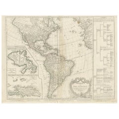
Antique Map of the Americas and West Indies by Robert de Vaugondy, 1778
Located in Langweer, NL
Antique Map of the Americas and West Indies by Robert de Vaugondy, 1778
This detailed antique map titled "Amérique ou Indes Occidentales" was published in 1778 by the renowned Frenc...
Category
Late 18th Century Antique Scottish Maps
Materials
Paper
$1,326 Sale Price
25% Off
H 20.87 in W 27.56 in D 0.02 in
1859 "Map of the United States of America..." by J. H. Colton
By J.H. Colton
Located in Colorado Springs, CO
Presented is an 1859 “Map of the United States of America, the British Provinces, Mexico, the West Indies and Central America with Part of...
Category
1850s Antique Scottish Maps
Materials
Paper
Antique Map of North America by Dufour 'circa 1834'
Located in Langweer, NL
Antique map titled 'Amérique Septentrionale'. Uncommon map of North America. Published by or after A.H. Dufour, circa 1834. Source unknown, to be determined.
Category
Mid-19th Century Antique Scottish Maps
Materials
Paper
$188 Sale Price
20% Off
H 8.08 in W 10.44 in D 0.02 in
Original Antique Map of The United States of America by Dower, circa 1835
Located in St Annes, Lancashire
Nice map of the USA
Drawn and engraved by J.Dower
Published by Orr & Smith. C.1835
Unframed.
Free shipping
Category
1830s Antique Scottish Maps
Materials
Paper
$60
H 12.25 in W 9.25 in D 0.07 in
Antique Map of Venezuela by Montanus, 1671
By Arnoldus Montanus
Located in Langweer, NL
Antique map titled 'Venezuela cum parte Australi Novae Andalusiae'. The map extends from Coquibocoa to the Orinoque River, centered on Bariquicemento and Cape de Curiacao. Large cart...
Category
Mid-17th Century Antique Scottish Maps
Materials
Paper
Antique Map of the East Indies by Bonne '1776'
Located in Langweer, NL
Antique map titled 'Indes IVe Feuille'. Very decorative original antique map of the East Indies. Covbers from the Gulf of Siam (Gulf of Thailand) and Malacca (Malaysia) eastward to i...
Category
Late 18th Century Antique Scottish Maps
Materials
Paper
Antique Map of the East Indies by Janssonius, c.1644
By Johannes Janssonius
Located in Langweer, NL
Antique map titled 'India quae Orientalis dicitur, et Insulae adiacentes'. Old map of the East Indies and Southeast Asia showing the area between India in the West and parts of Japan...
Category
17th Century Antique Scottish Maps
Materials
Paper
$2,500 Sale Price
20% Off
H 8.08 in W 10.04 in D 0 in
Antique Map of the Netherlands and Belgium, circa 1880
Located in Langweer, NL
Antique map titled 'Hollande et Belgique'. Old map of the Netherlands and Belgium. With decorative vignette of the Antwerp cathedral. This map o...
Category
19th Century Antique Scottish Maps
Materials
Paper
$179 Sale Price
20% Off
H 18.71 in W 13.59 in D 0 in
Antique Map of North America and the West Indies by Stieler, circa 1865
Located in Langweer, NL
Antique map titled 'Nord-America und West-Indien'. Old map of North America and the West Indies. This map originates from Stieler's 'Schul-Atlas'.
Category
Mid-19th Century Antique Scottish Maps
Materials
Paper
$113 Sale Price
20% Off
H 9.45 in W 12.21 in D 0.02 in
Set of 6 Original Vintage Maps of American States, circa 1900
Located in St Annes, Lancashire
Wonderful set of 6 vintage maps.
Random American states including Maine, Utah, New Hampshire, Nevada, Vermont and New Mexico.
Monochrome with red color outline.
Published by Rand,...
Category
Early 1900s Edwardian Antique Scottish Maps
Materials
Paper
$950 / set
H 23.75 in W 17.75 in D 0.75 in
Vintage World Map Mirror Based on the Original by Johnson 1882 Military Campaign
Located in West Sussex, Pulborough
We are delighted to offer for sale this lovely Antique style pictorial plan map of the globe based on the original by Johnson in 1882
This is a very interesting and decorative pie...
Category
20th Century Campaign Scottish Maps
Materials
Mirror
$286 Sale Price
30% Off
H 18.9 in W 24.02 in D 0.79 in
Previously Available Items
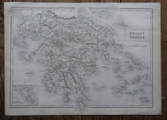
Large Original Antique Map of Greece by Sidney Hall, 1847
Located in St Annes, Lancashire
Great map of Greece
Drawn and engraved by Sidney Hall
Steel engraving
Original colour outline
Published by A & C Black. 1847
Unframed
Free shipping.
Category
1840s Antique Scottish Maps
Materials
Paper
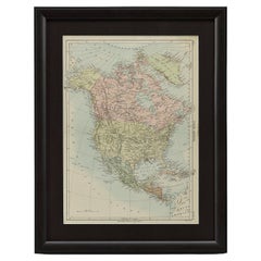
1875 "North America" Map by J. Bartholomew
Located in Colorado Springs, CO
Presented is an original 1875 map of “North America.” The map was issued in Volume 1 of the Ninth Edition of the Encyclopædia Britannica, published in Edinburgh. The map was drawn by famous Scottish mapmaker John Bartholomew. The map depicts North America, to include Greenland, the Dominion of Canada, the United States, Mexico, the countries of Central America, and the islands of the West Indies. Prominent rivers, mountain ranges, and cities are labeled on the map, and country borders are emphasized in red.
The Encyclopædia Britannica has been published continuously since 1768, appearing in fifteen official editions. The landmark ninth edition of the Encyclopædia Britannica, often called "the Scholar's Edition," was published from January 1875 to 1889 in 25 volumes. The editor and author of the “Foreword” was Thomas Spencer Baynes, the first English-born editor after a series of Scots. After 1880, Baynes was assisted by William Robertson Smith. The 9th edition is often lauded as a high point among early editions for scholarship.
The 9th edition was far more luxurious than any previously printed Encyclopædia Britannicas, with thick boards and quality leather bindings, premier paper, and a production which took full advantage of the technological advances of printing in the years between the 1850s and 1870s. The publishers took advantage of the new ability to print large graphic illustrations on the same pages as the text, as opposed to limiting illustrations to separate copper plate engravings. Although this technology had first been used in a primitive fashion the 7th edition, and to a much lesser extent in the 8th, in the 9th edition there were thousands of quality illustrations and maps set...
Category
1870s Antique Scottish Maps
Materials
Paper
Original Antique City Plan of Philadelphia, Pennsylvania, 1889
Located in St Annes, Lancashire
Great city plan of Philadelphia
Drawn and Engraved by W. & A.K. Johnston
Published By A & C Black, Edinburgh.
Original colour
Unframed.
...
Category
1880s Victorian Antique Scottish Maps
Materials
Paper
Original Antique Map of Newfoundland, 1889
Located in St Annes, Lancashire
Great map of Newfoundland
Drawn and Engraved by W. & A.K. Johnston
Published By A & C Black, Edinburgh.
Original colour
Unframed.
Category
1880s Victorian Antique Scottish Maps
Materials
Paper
Original Antique Map of the Philippines, 1889
Located in St Annes, Lancashire
Great map of The Philippines
Drawn and Engraved by W. & A.K. Johnston
Published By A & C Black, Edinburgh.
Original colour
Unframed.
Category
1880s Victorian Antique Scottish Maps
Materials
Paper
Original Antique Map of Sicily, Italy, 1889
Located in St Annes, Lancashire
Great map of Sicily
Drawn and Engraved by W. & A.K. Johnston
Published By A & C Black, Edinburgh.
Original colour
Unframed.
Category
1880s Victorian Antique Scottish Maps
Materials
Paper
Original Antique Map of The American State of New York, 1889
Located in St Annes, Lancashire
Great map of New York
Drawn and Engraved by W. & A.K. Johnston
Published By A & C Black, Edinburgh.
Original colour
Unframed.
Category
1880s Victorian Antique Scottish Maps
Materials
Paper
Original Antique Map of The States of Wyoming, Idaho, Montana & Dakota
Located in St Annes, Lancashire
Great map of Wyoming, Idaho, Montana and Dakota
Drawn and Engraved by W. & A.K. Johnston
Published By A & C Black, Edinburgh. 1889
Original col...
Category
1880s Victorian Antique Scottish Maps
Materials
Paper
Original Antique Map of The American State of Texas, 1889
Located in St Annes, Lancashire
Great map of Texas
Drawn and Engraved by W. & A.K. Johnston
Published By A & C Black, Edinburgh.
Original colour
Unframed.
Category
1880s Victorian Antique Scottish Maps
Materials
Paper
Original Antique City Plan of New York City, 1889
Located in St Annes, Lancashire
Great map of New York City
Drawn and engraved by W. & A.K. Johnston
Published By A & C Black, Edinburgh.
Original colour
Unframed.
...
Category
1880s Victorian Antique Scottish Maps
Materials
Paper
Original Antique Map of The American State of California, 1889
Located in St Annes, Lancashire
Great map of California
Drawn and engraved by W. & A.K. Johnston
Published By A & C Black, Edinburgh.
Original colour
Unframed.
...
Category
1880s Victorian Antique Scottish Maps
Materials
Paper
Original Antique Map of The American State of Missouri, 1889
Located in St Annes, Lancashire
Great map of Missouri
Drawn and engraved by W. & A.K. Johnston
Published By A & C Black, Edinburgh.
Original colour
Unframed.
Category
1880s Victorian Antique Scottish Maps
Materials
Paper
