Items Similar to Original and Decorative Antique Engraved Map of Finland and Sweden, ca.1720


Want more images or videos?
Request additional images or videos from the seller
1 of 5
Original and Decorative Antique Engraved Map of Finland and Sweden, ca.1720
$1,391.05
$1,738.8120% Off
£1,034.80
£1,293.5020% Off
€1,160
€1,45020% Off
CA$1,904.82
CA$2,381.0220% Off
A$2,117.90
A$2,647.3820% Off
CHF 1,105.85
CHF 1,382.3120% Off
MX$25,780.01
MX$32,225.0120% Off
NOK 14,110.17
NOK 17,637.7220% Off
SEK 13,220.56
SEK 16,525.7020% Off
DKK 8,830.44
DKK 11,038.0520% Off
Shipping
Retrieving quote...The 1stDibs Promise:
Authenticity Guarantee,
Money-Back Guarantee,
24-Hour Cancellation
About the Item
Antique map titled 'Ducatus Uplandiae cum Westmanniae Sudermanniae (..)'
This map shows parts of Finland and Sweden. Originally published by Frederick de Wit in the late 1600's. This map was probably part of a composite atlas published c.1720-1741.
Artists and Engravers: Publisher: Covens and Mortier. Cartographer: Frederick de Wit. Frederick de Wit (ca. 1630-1706) was a cartographer and artist who drew, printed and sold maps.
- Dimensions:Height: 21.23 in (53.9 cm)Width: 25.12 in (63.8 cm)Depth: 0 in (0.02 mm)
- Materials and Techniques:
- Period:1720-1729
- Date of Manufacture:circa 1720
- Condition:Wear consistent with age and use. Condition: Very good, given age. Original middle fold, as issued. Contemporary hand colouring. General age-related toning and/or occasional minor defects from handling. Please study image carefully.
- Seller Location:Langweer, NL
- Reference Number:Seller: PCT-563851stDibs: LU3054327294892
About the Seller
5.0
Recognized Seller
These prestigious sellers are industry leaders and represent the highest echelon for item quality and design.
Platinum Seller
Premium sellers with a 4.7+ rating and 24-hour response times
Established in 2009
1stDibs seller since 2017
2,511 sales on 1stDibs
Typical response time: <1 hour
- ShippingRetrieving quote...Shipping from: Langweer, Netherlands
- Return Policy
Authenticity Guarantee
In the unlikely event there’s an issue with an item’s authenticity, contact us within 1 year for a full refund. DetailsMoney-Back Guarantee
If your item is not as described, is damaged in transit, or does not arrive, contact us within 7 days for a full refund. Details24-Hour Cancellation
You have a 24-hour grace period in which to reconsider your purchase, with no questions asked.Vetted Professional Sellers
Our world-class sellers must adhere to strict standards for service and quality, maintaining the integrity of our listings.Price-Match Guarantee
If you find that a seller listed the same item for a lower price elsewhere, we’ll match it.Trusted Global Delivery
Our best-in-class carrier network provides specialized shipping options worldwide, including custom delivery.More From This Seller
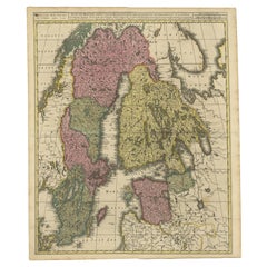
View AllAntique Map of Scandinavia by T. Jefferys, circa 1750
Located in Langweer, NL
Antique map titled 'Sweden, Denmark, Norway & Finland'. An original mid-18th century copper engraved antique map of Scandinavia by Thomas Jefferys....
Category
Antique Mid-18th Century Maps
Materials
Paper

$182 Sale Price
20% Off
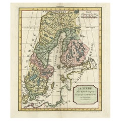
Antique Map of Scandinavia by Van der Aa 'circa 1710'
Located in Langweer, NL
Antique map titled 'Scandinavie Septentrionale' and 'Scandinavie Meridionale'. Copper engraving with two maps on one sheet. The upper map depicts Northern Scandinavia with Norway, Sw...
Category
Antique Early 18th Century Maps
Materials
Paper

$671 Sale Price
20% Off
Southern Sweden Provinces Map – Homann’s ‘Nova Tabula Scaniae’, ca. 1730
Located in Langweer, NL
Southern Sweden Provinces Map – Homann’s ‘Nova Tabula Scaniae’, ca. 1730
Antique map titled 'Nova Tabula Scaniae in qua sunt Scania, Blekingia et Hallandia'. This decorative map sho...
Category
Antique Mid-18th Century German Maps
Materials
Paper

$527 Sale Price
20% Off
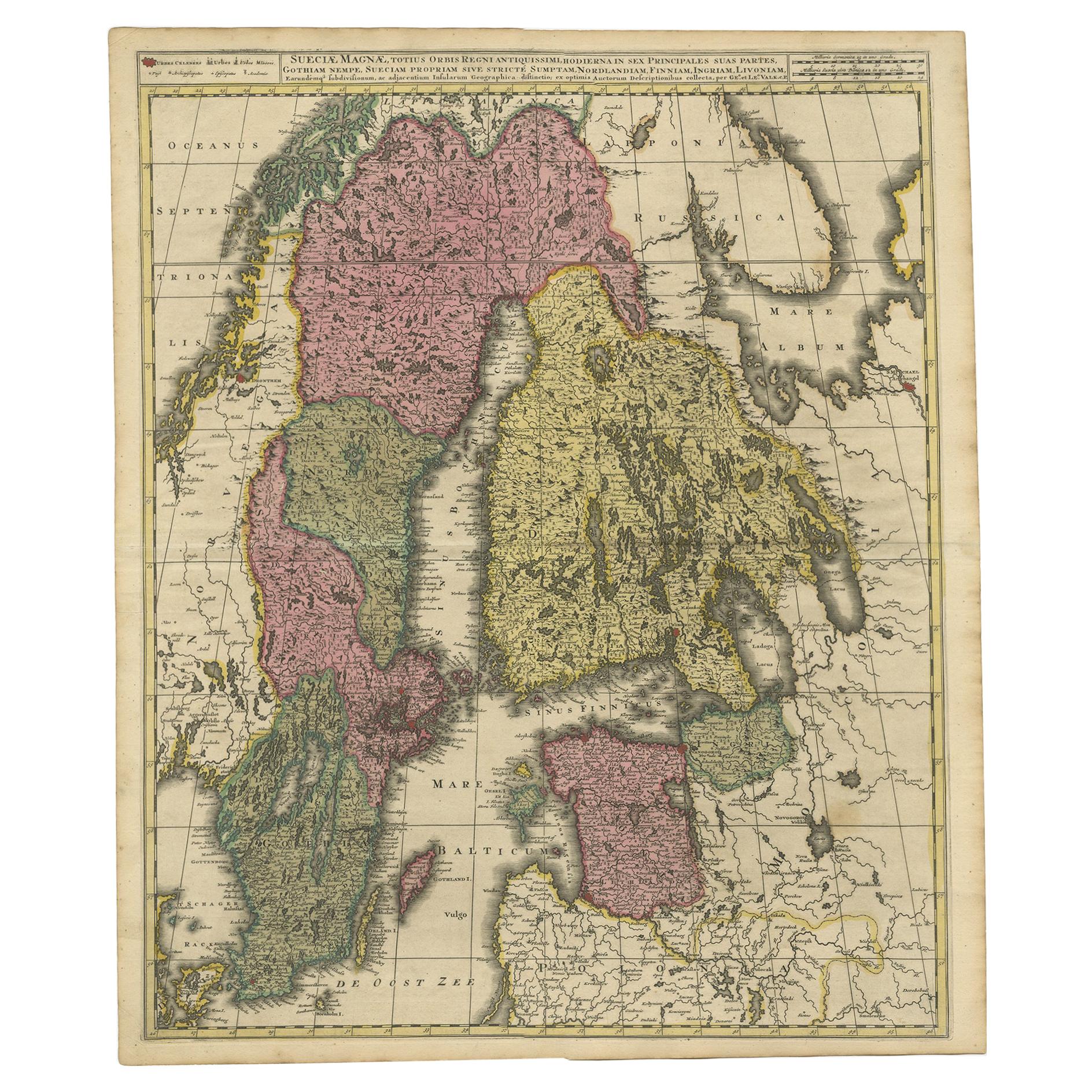
Scandinavia & Baltic Map – Antique by G. & L. Valk, incl. Sweden, Finland, c1700
Located in Langweer, NL
Scandinavia & Baltic Map – Antique by G. & L. Valk, incl. Sweden, Finland, 1700
Antique map titled 'Sueciae Magnae, totius orbis regni antiquissimi (..)' by Gerard and Leonard Valk....
Category
Antique Late 17th Century Dutch Maps
Materials
Paper
$623 Sale Price
20% Off
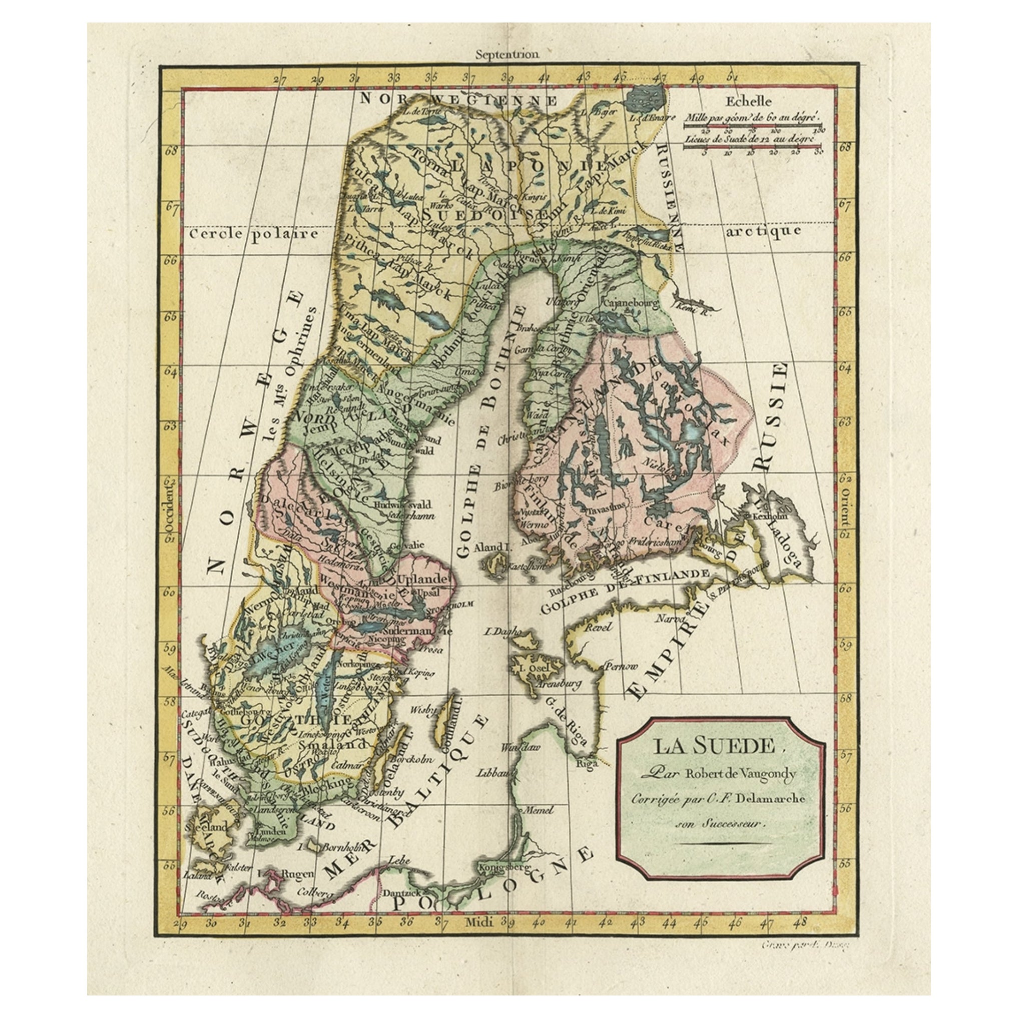
Decorative Antique Map of Sweden and Part of Finland, 1806
Located in Langweer, NL
Antique map titled 'La Suede.'
Decorative map of Sweden and part of Finland by Robert de Vaugondy, revised and published by Delamarche. Source unknown, to be determined.
Artists and Engravers: Made by 'Charles Francois Delamarche' after an anonymous artist. Charles Francois Delamarche (1740-1817) founded the important and prolific Paris based Maison Delamarche map publishing firm in the late 18th century. A lawyer by trade Delamarche entered the map business with the acquisition from Jean-Baptiste Fortin of Robert de Vaugondy's map plates...
Category
Antique Early 1800s French Maps
Materials
Paper
Antique Map of South Sweden 'Scandinavia' by F. de Wit, 1680
Located in Langweer, NL
Antique map titled 'Accurata Scaniae, Blekingae et Hallandiae Descriptio per F. de Wit Amstelodami'. This map shows South Sweden with an inset of Halmstad and vicinity. Contemporary ...
Category
Antique Late 17th Century Maps
Materials
Paper

$810 Sale Price
20% Off
You May Also Like
Original Antique Map of Sweden, Engraved by Barlow, 1806
Located in St Annes, Lancashire
Great map of Sweden
Copper-plate engraving by Barlow
Published by Brightly & Kinnersly, Bungay, Suffolk. 1806
Unframed.
Category
Antique Early 1800s English Maps
Materials
Paper

Scandinavia & Portions of Eastern Europe: 18th Century Hand-Colored Homann Map
By Johann Baptist Homann
Located in Alamo, CA
An early 18th century hand-colored copper-plate map entitled "Regni Sueciae in omnes suas Subjacentes Provincias accurate divisi Tabula Generalis" by Johann Baptist Homann (1663-1724...
Category
Antique Early 18th Century German Maps
Materials
Paper

Sweden & Adjacent Portions of Scandinavia: A Hand-Colored 18th C. Map by Homann
By Johann Baptist Homann
Located in Alamo, CA
This hand-colored map of Sweden and adjacent portions of Scandinavia entitled "Regni Sueciae in Omnes suas Subjacentes Provincias accurate divisi Tabula Generalis" was created by Joh...
Category
Antique 1720s German Maps
Materials
Paper

1646 Jansson Map Entitled "Procinvia Connactiae, " Ric.a006
Located in Norton, MA
1646 Jansson map entitled
"Procinvia connactiae,"
Ric.a006
Description: The PROVINCE of CONNAVGT 490 x 380From vol 4 of Jansson's Atlas Novus 1646, published in Amsterdam with...
Category
Antique 17th Century Unknown Maps
Materials
Paper

Hand-Colored 18th Century Homann Map of Denmark and Islands in the Baltic Sea
By Johann Baptist Homann
Located in Alamo, CA
An 18th century copper plate hand-colored map entitled "Insulae Danicae in Mari Balthico Sitae utpote Zeelandia, Fionia, Langelandia, Lalandia, Falstria, Fembria Mona" created by Joh...
Category
Antique Early 18th Century German Maps
Materials
Paper

Sweden and Adjacent Portions of Scandinavia: A Hand-colored 18th C. Homann Map
By Johann Baptist Homann
Located in Alamo, CA
This hand-colored copper-plate map of Sweden and adjacent portions of Scandinavia entitled "Regni Sueciae in Omnes suas Subjacentes Provincias accurate divisi Tabula Generalis" was c...
Category
Early 18th Century Old Masters Landscape Prints
Materials
Engraving

More Ways To Browse
Finnish Antiques
1600S Antique
Antique Maps Of Sicily
Antique Celestial Maps
Antique Compass Maritime Compasses
Bengal Map
J C Walker Map
Map Of Ancient Greece
Ptolemy Map
Antique Marine Compass
Map Of Jerusalem
1820 World Map
Cyprus Antique Maps
Antique Ecuador
Antique Map Of Thailand
Antique Mississippi Map
Antique Ohio Maps
Burgundy Map