Items Similar to Original Engraved Map of Saint Lucia in the West Indies by Bellin, 1758
Want more images or videos?
Request additional images or videos from the seller
1 of 6
Original Engraved Map of Saint Lucia in the West Indies by Bellin, 1758
$325.90
$407.3720% Off
£242.56
£303.2020% Off
€272
€34020% Off
CA$446.39
CA$557.9920% Off
A$496.49
A$620.6120% Off
CHF 259.25
CHF 324.0620% Off
MX$6,041.74
MX$7,552.1720% Off
NOK 3,311.03
NOK 4,138.7920% Off
SEK 3,105.16
SEK 3,881.4520% Off
DKK 2,070.64
DKK 2,588.3020% Off
Shipping
Retrieving quote...The 1stDibs Promise:
Authenticity Guarantee,
Money-Back Guarantee,
24-Hour Cancellation
About the Item
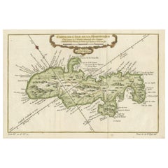
The "Carte de L’Isle de Sainte Lucie" by Jacques Nicolas Bellin, a prominent figure as the Royal Hydrographer and engineer of the French Navy, is a remarkable antique map showcasing the intricate details of Saint Lucia island in the Caribbean Sea.
**Title:** Carte de L’Isle de Sainte Lucie
**Mapmaker:** Jacques Nicolas Bellin (1703 – 1772)
**Published for:** Antoine-François Prevost's "L`Histoire Generale des Voyages"
This finely crafted map is a copperplate engraving, meticulously detailed and enhanced with hand coloring, reflecting Bellin's expertise as a cartographer. The use of copperplate engraving allowed for precise and intricate lines, while the hand coloring adds visual distinction to various geographical features.
Key features of the map include:
1. **Geographical Accuracy:** Bellin's expertise as the Royal Hydrographer ensured a high level of accuracy in depicting the island's geography, including its coastline, inland features, and surrounding waters.
2. **Decorative Elements:** The map features a decorative title cartouche, a characteristic embellishment often found in antique maps, adding aesthetic appeal and a sense of grandeur to the piece.
3. **Detailing:** It highlights significant aspects of Saint Lucia, such as towns, topographical features, coastal landmarks, and even navigational information.
Published as part of Prevost's "L`Histoire Generale des Voyages," a comprehensive collection of travel accounts and geographic explorations, this map holds historical significance. Its inclusion in such an esteemed compilation speaks to its value as a representation of geographic knowledge and exploration during the 18th century.
The collaboration between Bellin, renowned for his contributions to naval cartography, and Prevost's renowned publication, coupled with the elegant engraving techniques and hand coloring, elevates this map to a valuable artifact, offering both historical and aesthetic appreciation for collectors and enthusiasts of cartography and exploration.
VERSO: There is nothing printed on the reverse side, which is plain
AUTHENTICITY: This is an authentic historic print, published at the date stated above. I do not offer reproductions. It is not a modern copy. The term 'original' when applied to a print means that it was printed at the first or original date of publication; it does not imply that the item is unique. 'Print' means any image created by applying an inked block to paper or card under pressure by any method including wood engraving, steel engraving, copperplate, wood cut and lithography.
- Dimensions:Height: 9.65 in (24.5 cm)Width: 13 in (33 cm)Depth: 0 in (0.02 mm)
- Materials and Techniques:Paper,Engraved
- Period:1750-1759
- Date of Manufacture:1758
- Condition:Very Good; Thin on hand laid (verge) paper, but very clean and very suitable for framing. Flattened folding line. Most antiquarian maps and prints are subject to some normal aging due to use and time which is not obtrusive unless otherwise stated.
- Seller Location:Langweer, NL
- Reference Number:Seller: BG-13618-281stDibs: LU3054337581432
About the Seller
5.0
Recognized Seller
These prestigious sellers are industry leaders and represent the highest echelon for item quality and design.
Platinum Seller
Premium sellers with a 4.7+ rating and 24-hour response times
Established in 2009
1stDibs seller since 2017
2,508 sales on 1stDibs
Typical response time: <1 hour
- ShippingRetrieving quote...Shipping from: Langweer, Netherlands
- Return Policy
Authenticity Guarantee
In the unlikely event there’s an issue with an item’s authenticity, contact us within 1 year for a full refund. DetailsMoney-Back Guarantee
If your item is not as described, is damaged in transit, or does not arrive, contact us within 7 days for a full refund. Details24-Hour Cancellation
You have a 24-hour grace period in which to reconsider your purchase, with no questions asked.Vetted Professional Sellers
Our world-class sellers must adhere to strict standards for service and quality, maintaining the integrity of our listings.Price-Match Guarantee
If you find that a seller listed the same item for a lower price elsewhere, we’ll match it.Trusted Global Delivery
Our best-in-class carrier network provides specialized shipping options worldwide, including custom delivery.More From This Seller
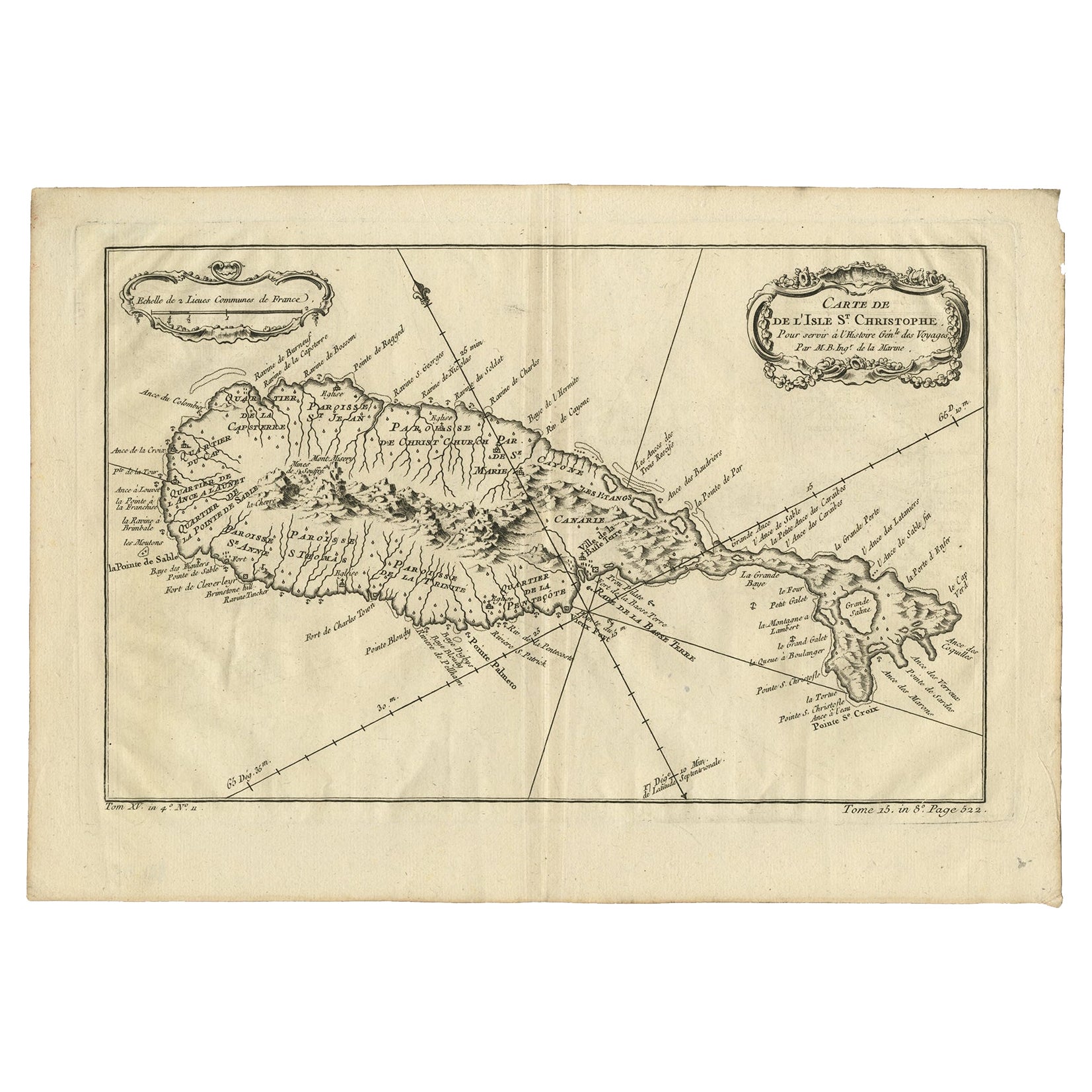
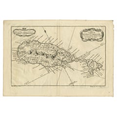
View AllAntique Map of the Caribbean Island of St Kitts, ca.1750
Located in Langweer, NL
Description: Antique map titled 'Carte de l'Isle St. Christophe pour Servir a l'Histoire Genle. des Voyages.'
Detailed map of the Island of St. Kitts, showing the Parishes, towns, ...
Category
Antique 1750s Maps
Materials
Paper
$690 Sale Price
20% Off
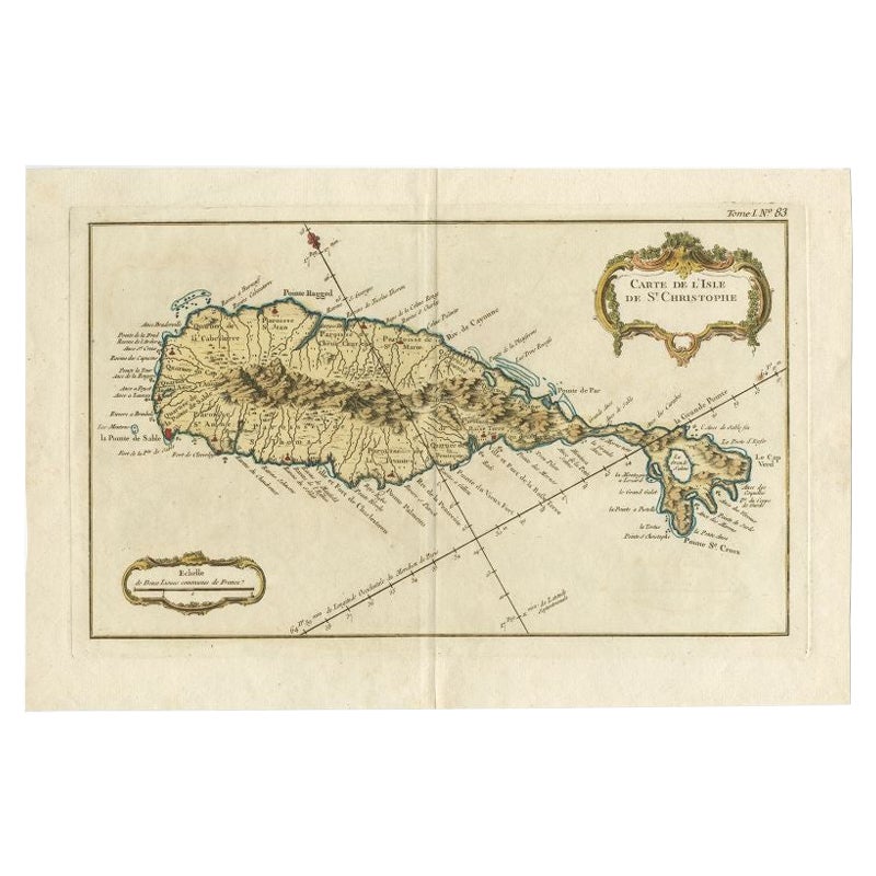
Old Map of the island of Saint Christopher or St. Kitts in the Caribbean, c.1765
Located in Langweer, NL
Antique map titled 'Carte de l'Isle de Saint-Christophe'.
A detailed map of the island of Saint Christopher or St. Kitts showing mountain ranges, port towns and parishes. This map ...
Category
Antique 18th Century Maps
Materials
Paper

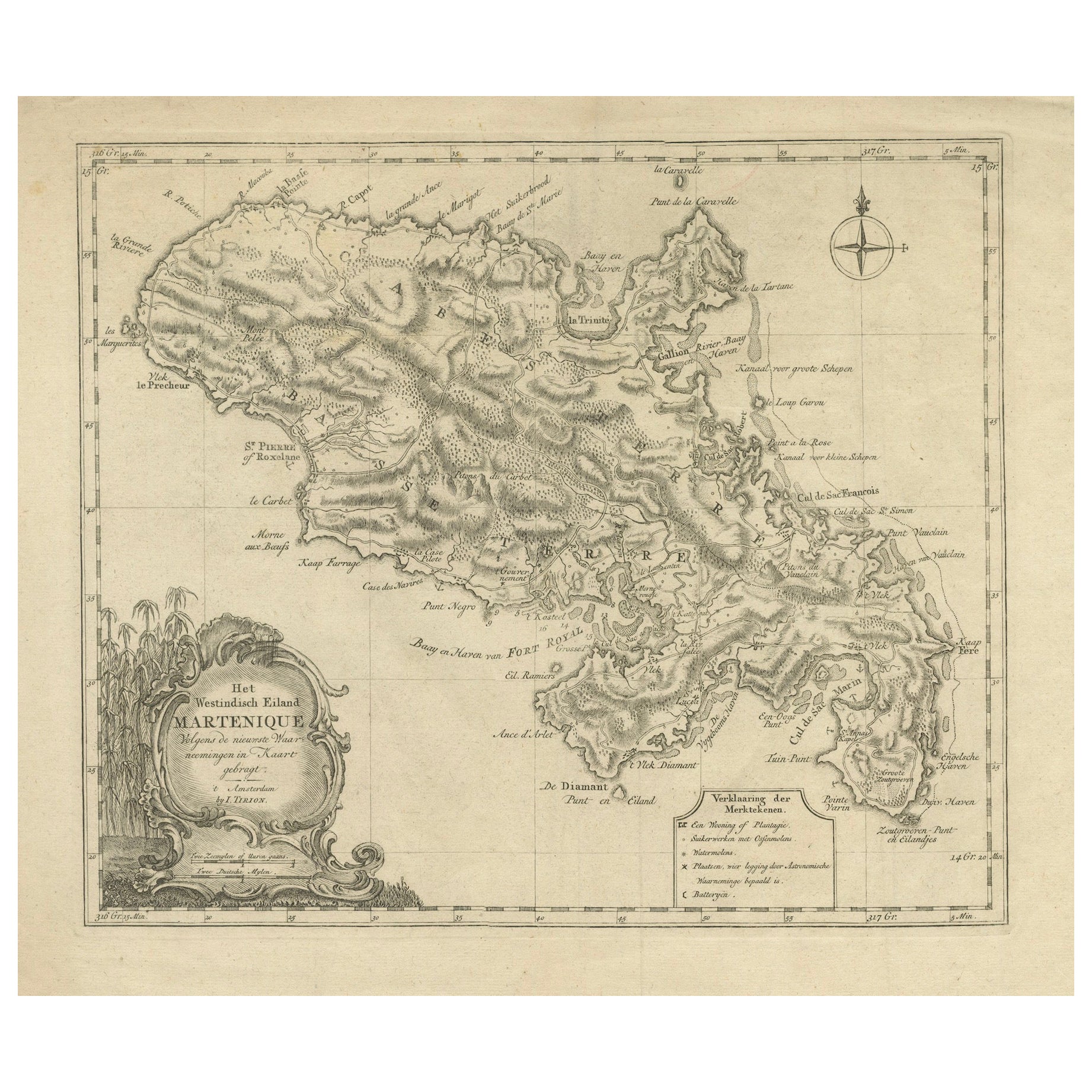
18th Century Original Dutch Map of Martinique in The West Indies by Isaak Tirion
Located in Langweer, NL
This is an 18th-century Dutch map of Martinique, titled *Het Westindisch Eiland Martinique*. The map was produced by Isaak Tirion, a renowned Dutch cartographer and publisher known for his precise and beautifully crafted maps. The cartouche in the lower left corner, adorned with decorative elements, adds to the aesthetic appeal of the map.
### Key Features:
- Martinique: The map offers detailed topographical information of the island, including mountains, rivers, and settlements.
- Geographical Details: Locations such as Fort Royal, Bay de St. Pierre, and Point de Cloche are marked, showcasing significant features of the island.
- Cartouche: The ornate cartouche, featuring tropical plants, reflects the importance of the island's agricultural production during the colonial period, particularly its sugar plantations.
This map captures Martinique during its time as a French colony and provides valuable insight into the island’s layout and strategic significance in the Caribbean. The attention to coastal detail highlights the importance of Martinique as a hub of maritime activity.
The map’s combination of aesthetic elegance and cartographic precision makes it a remarkable piece for collectors and those interested in Caribbean colonial...
Category
Antique 1760s Maps
Materials
Paper

$421 Sale Price
20% Off
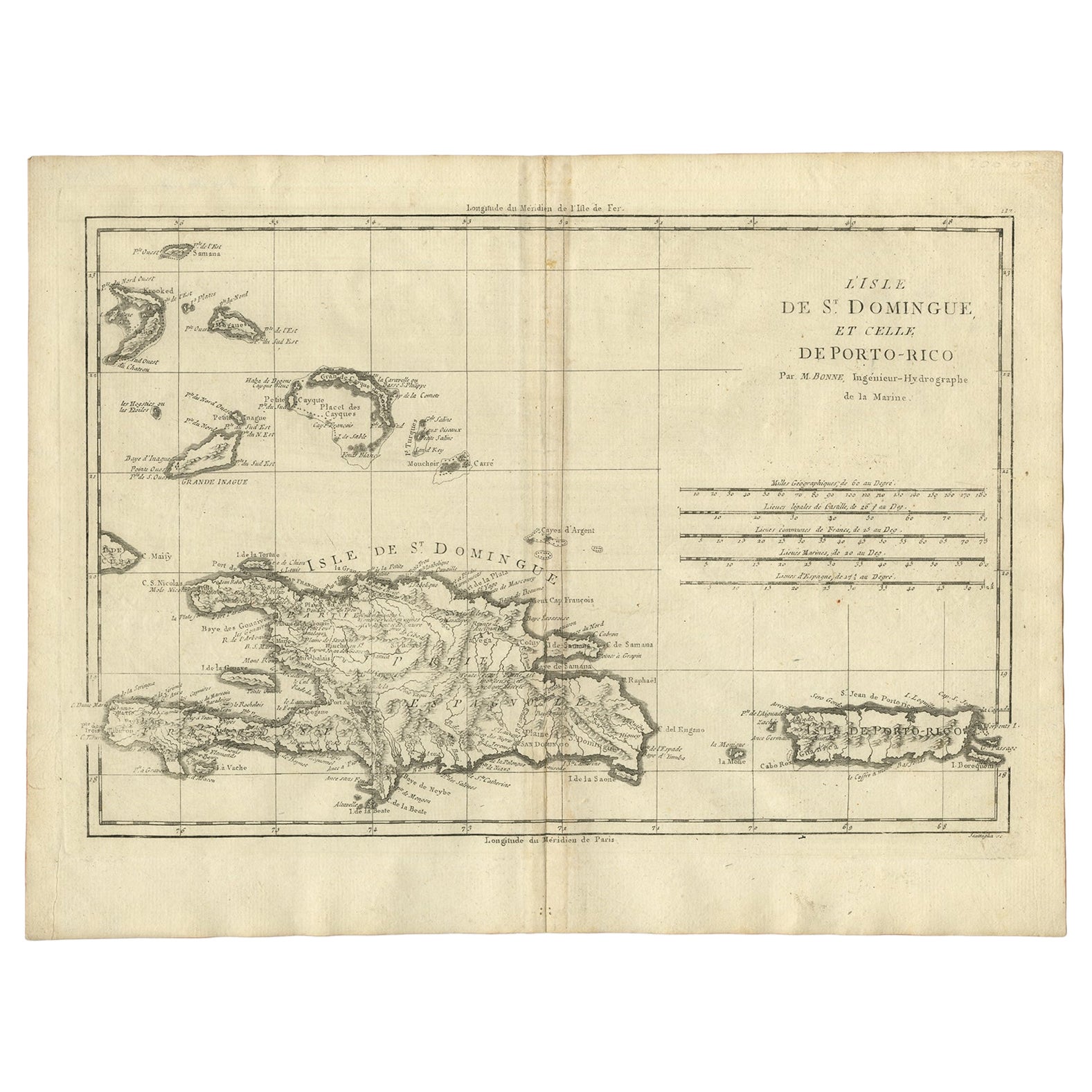
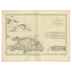
Detailed Antique Map of Santa Domingo, Puerto Rico, Eastern Bahamas, ca. 1780
Located in Langweer, NL
Description: Antique map titled 'L'Isle De St. Domingue, et celle De Porto-Rico.'
Detailed map of Santa Domingo, Puerto Rico, etc. Includes substanti...
Category
Antique 1780s Maps
Materials
Paper
$670 Sale Price
20% Off
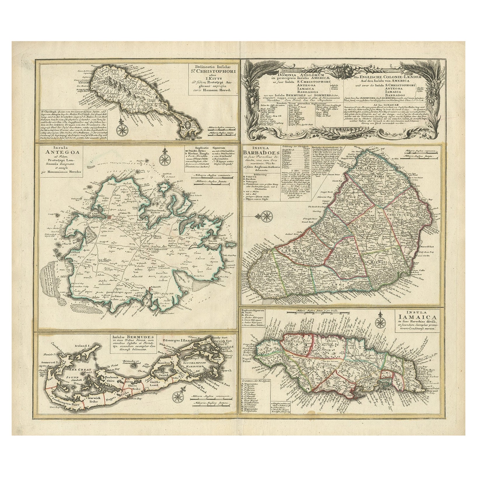
Original Old Map of St Kitts, Antigua, Bermuda, Barbados, and Jamaica, ca.1745
Located in Langweer, NL
Antique map titled 'Dominia Anglorum in praecipuis Insulis Americae ut sunt Insula S. Christophori, Antegoa, Iamaica, Barbados nec non Insulae Bermudes vel Sommers dictae. Die Englis...
Category
Antique 1740s Maps
Materials
Paper
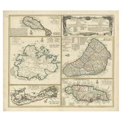
$1,389 Sale Price
20% Off
Free Shipping
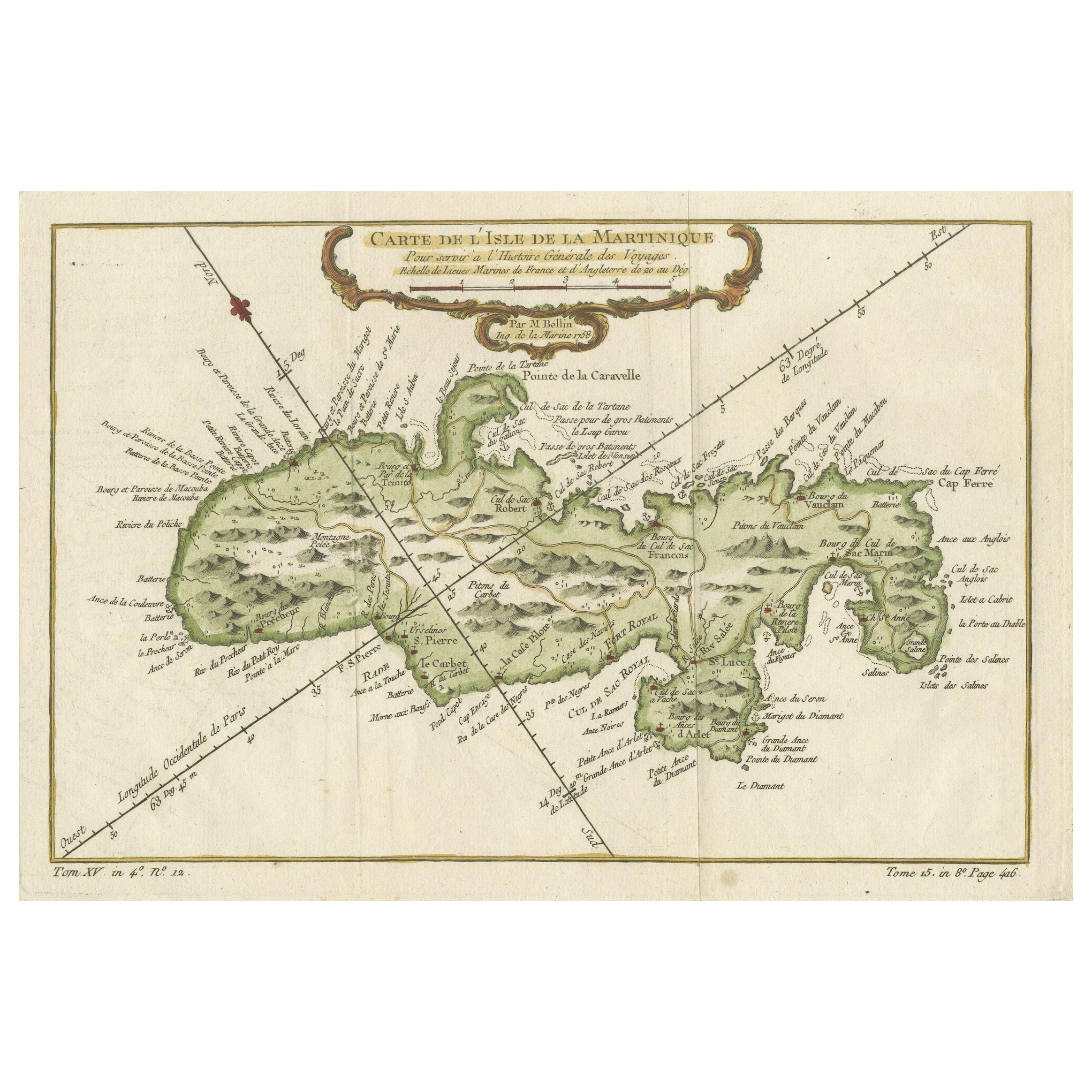
Martinique Island in the Caribbean by Bellin Original Original Antique Map, 1780
Located in Langweer, NL
This mid-18th century map, "Carte de l'Isle de la Martinique pour servir a l'historie generale des voyages," was issued in 1780 by M. Bellin in Paris. It presents a detailed and visually captivating depiction of the Island of Martinique within the context of the Caribbean and the Lesser Antilles.
**Title:** Carte de l'Isle de la Martinique pour servir a l'historie generale des voyages
**Issuer:** M. Bellin
**Date:** 1780
**Location Coverage:** North America, Caribbean, Martinique, Lesser Antilles
This engraved map is notable for its pleasing aesthetics, featuring lovely hand coloring that enhances its visual appeal. The inclusion of a scroll cartouche, an ornamental frame, and measurement lines adds a distinctive and visually appealing quality to the map.
Martinique, situated within the Lesser Antilles in the Caribbean, is presented with meticulous detail, showcasing geographical features, coastlines, settlements, and other notable landmarks. Bellin, known for his accuracy in cartography, crafted this map to serve as a geographical reference within the broader context of historical voyages and exploration.
The combination of detailed cartographic information and artistic embellishments, such as hand coloring and decorative elements, makes this map not only a valuable geographical document but also a visually pleasing piece of cartographic art...
Category
Antique Late 18th Century Maps
Materials
Paper
$268 Sale Price
20% Off
You May Also Like
St. Christophe 'St. Kitts' Island: An 18th Century Hand-colored Map by Bellin
By Jacques-Nicolas Bellin
Located in Alamo, CA
Jacques Bellin's copper-plate map of the Caribbean island of Saint Kitts entitled "Carte De De l'Isle St. Christophe Pour servir á l'Histoire Genle. des V...
Category
Antique Mid-18th Century French Maps
Materials
Paper

St. Christophe (St. Kitts): Bellin 18th Century Hand Colored Map
Located in Alamo, CA
Jacques Bellin's copper-plate map of the Caribbean island of Saint Kitts entitled "Carte De De l'Isle St. Christophe Pour servir á l'Histoire Genle. des V...
Category
1740s Other Art Style Landscape Prints
Materials
Engraving

West Coast of Africa, Guinea & Sierra Leone: An 18th Century Map by Bellin
By Jacques-Nicolas Bellin
Located in Alamo, CA
Jacques Bellin's copper-plate map entitled "Partie de la Coste de Guinee Dupuis la Riviere de Sierra Leona Jusquau Cap das Palmas", depicting the coast of Guinea and Sierra Leone in ...
Category
Antique Mid-18th Century French Maps
Materials
Paper

Large Original Antique Map of The West Indies by Sidney Hall, 1847
Located in St Annes, Lancashire
Great map of The West Indies
Drawn and engraved by Sidney Hall
Steel engraving
Original colour outline
Published by A & C Black. 1847
Unframed
Free shipping.
Category
Antique 1840s Scottish Maps
Materials
Paper

Original Antique Map of South America. C.1780
Located in St Annes, Lancashire
Great map of South America
Copper-plate engraving
Published C.1780
Two small worm holes to left side of map
Unframed.
Category
Antique Early 1800s English Georgian Maps
Materials
Paper

Captain Cook's Exploration of Tahiti 18th C. Hand-Colored Map by Bellin
By Jacques-Nicolas Bellin
Located in Alamo, CA
This beautiful 18th century hand-colored copper plate engraved map is entitled "Carte de l'Isle de Taiti, par le Lieutenant J. Cook" was created by Jacques Nicolas Bellin and publish...
Category
Antique Mid-18th Century French Maps
Materials
Paper

More Ways To Browse
Used Furniture Key West
West Indies Furniture
West Indies Antique Furniture
18th Century Naval
Vintage Art Deco Rugs
Vintage Serving Forks
Herati Rug
Italian Wood Console Tables
Maison Jansen Argentina
Antique Oushak
Mid Century Danish Directors Chairs
Moller 70
Wood Relief Art
Argentina Travel Poster
Century Furniture Faux Bamboo
Early American Chairs
Hans Muller
Vintage Wood Table With Glass Top