1810s Maps
to
11
18
3
21
1
1
2,975
2,239
474
3
289
34
9
126
8
36
9
2
5
4
3
2
21
2
2
2
1
6
4
4
1
1
21
21
21
1
Period: 1810s
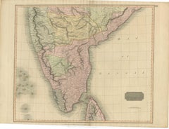
1816 Large Southern Hindostan Map by J. Thomson – New General Atlas
Located in Langweer, NL
Title: 1816 Southern Hindostan Map by J. Thomson – New General Atlas
This map, titled "Southern Hindostan," was published in 1816 as part of J. Thomson’s *New General Atlas*. The ma...
Category
Antique 1810s Maps
Materials
Paper
$507 Sale Price
20% Off
Original Antique Map of South East Asia by Thomas Clerk, 1817
Located in St Annes, Lancashire
Great map of South East Asia
Copper-plate engraving
Drawn and engraved by Thomas Clerk, Edinburgh.
Published by Mackenzie And Dent, 1817
Unframed.
Category
English Antique 1810s Maps
Materials
Paper
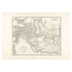
Empire of the Parthians: Historical Cartographic Masterpiece by d'Anville, 1819
Located in Langweer, NL
Description:
Ancient map of the Parthian Empire (19th century), original engraving extracted from the atlas of the history of the emperors from 1819, based on the history of the Rom...
Category
Antique 1810s Maps
Materials
Paper
$94 Sale Price
20% Off
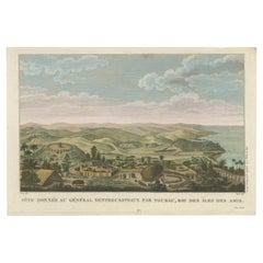
Beautiful and Rare Original Antique Engraving of a Village in Tonga, 1817
Located in Langweer, NL
Fete donnee au General Dentrecasteaux par Toubau, Roi des Iles des Amis
Original antique engraving showing the party given to General Dentrecasteaux by Toubau, King of the Friendl...
Category
Antique 1810s Maps
Materials
Paper
$613 Sale Price
20% Off
Early 19th Century Original Framed Land Indenture, England, 1810
Located in Lambertville, NJ
A large hand written land indenture document England, 1810, framed. The beautifully hand written document mounted on board with a red velvet border and ...
Category
English Regency Antique 1810s Maps
Materials
Glass, Giltwood, Parchment Paper
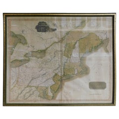
English Engraved Hand Colored Map of the North Eastern United States, circa 1817
Located in Charleston, SC
English copper engraved hand colored map of the North Eastern United States matted under glass in a gilt frame, Early 19th Century. Drawn and Engraved for Thomson's New General Atlas...
Category
English George III Antique 1810s Maps
Materials
Glass, Giltwood, Paint, Paper
Map of Turkish Dominions in Europe, Ottoman Balkan Territories 1813
Located in Langweer, NL
Map of Turkish Dominions in Europe, Ottoman Balkan Territories 1814
This antique map titled "Turkish Dominions in Europe" provides a detailed depiction of the Balkan Peninsula and a...
Category
Antique 1810s Maps
Materials
Paper
Curaçao map - C. van Baarsel en zoon
Located in UTRECHT, UT
“Kaart van het eiland Curaçao.”, “Algemeene kaart der Caraïbische eilanden”, “Plan van het fort Amsterdam op Curaçao” from the atlas “Atlas der overzeesche bezittingen van Zijne Maje...
Category
Dutch Other Antique 1810s Maps
Materials
Paper
Antique Colourful Antique Map of Spain and Portugal, 1815
Located in Langweer, NL
Antique map of Spain and Portugal. Thomson's map includes both countries in full, with Spain being divided into its various semi-autonomous provin...
Category
Antique 1810s Maps
Materials
Paper
$277 Sale Price
20% Off
Original Antique Map of The World by Thomas Clerk, 1817
Located in St Annes, Lancashire
Great map of The Eastern and Western Hemispheres
On 2 sheets
Copper-plate engraving
Drawn and engraved by Thomas Clerk, Edinburgh.
Published by Mackenzie And Dent, 1817
...
Category
English Antique 1810s Maps
Materials
Paper
Antique Print of the Bolshoi Theatre in Saint Petersburg, Russia, ca.1810
Located in Langweer, NL
Description: Antique print titled 'The Stone Theatre at St. Petgersbourg'. View ofthe Bolshoi Theatre in Saint Petersburg, Russia. In 1886 the building was declared unsafe and, at th...
Category
Antique 1810s Maps
Materials
Paper
$229 Sale Price / item
20% Off
Old Costume Print Showing People at the Fair in Rotterdam, The Netherlands, 1817
Located in Langweer, NL
Antique costume print titled 'Group at the Fair at Rotterdam'.
Old costume print depicting a group of people from Rotterdam. This print originates from 'The Costume of the Nether...
Category
Antique 1810s Maps
Materials
Paper
$229 Sale Price
20% Off
Antique Print of Saint Isaac's Square, in Saint Petersburg, Russia, ca.1810
Located in Langweer, NL
Description: antique print titled 'The Place of St. Isaac'. View of Saint Isaac's Square, in Saint Petersburg or St Petersbourg, Russia. A city square spra...
Category
Antique 1810s Maps
Materials
Paper
$229 Sale Price
20% Off
1811 John Cary Map of Lower Saxony - Featuring Bremen, Holstein, and More
Located in Langweer, NL
Title: "1811 John Cary Map of Lower Saxony - Featuring Bremen, Holstein, and More"
Description: This is an exquisite map of the Lower Saxony region, created by the renowned cartogra...
Category
Antique 1810s Maps
Materials
Paper
Prussian Dominions Map by John Pinkerton, 1818 - Detailed Copperplate Engraving
Located in Langweer, NL
Prussian Dominions Map by John Pinkerton, 1818 - Detailed Copperplate Engraving
Description: This detailed map by John Pinkerton depicts the Prussian Dominions as of 1818, including...
Category
Antique 1810s Maps
Materials
Paper
1817 Large Northern Hindostan Map by J. Thomson – New General Atlas
Located in Langweer, NL
1817 Thomson Map of Northern Hindoostan – Detailed British Cartography of India
This map, titled "A New Map of Hindoostan from the Latest Authorities," was drawn and engraved for Jo...
Category
Antique 1810s Maps
Materials
Paper
$507 Sale Price
20% Off
Academic Costumes; a Pensioner of Trinity Hall, a Doctor of Physics & Law, 1815
Located in Langweer, NL
Antique print titled 'Pensioner of Trinity Hall - Common Dress of the Doctor in Law & The Doctor in Physic'.
Portraits of three men in academic costum...
Category
Antique 1810s Maps
Materials
Paper
View of Dover Castle Atop the Cliffs in the Background, England, 1818
Located in Langweer, NL
Antique print, titled: 'Dover Castle.'
A view of the beach and sea with Dover Castle atop the cliffs in the background. Published by T. McLean in 1818.
Artists and Engravers: ...
Category
Antique 1810s Maps
Materials
Paper
$316 Sale Price
20% Off
Original Antique Print of a Young Woman from Prättigau, Switzerland, ca.1815
Located in Langweer, NL
Antique print titled 'A young woman, Valley of Prettigaw'.
Original antique print of a young woman from Prättigau, Switzerland. This print originates from 'Switzerland, as now di...
Category
Antique 1810s Maps
Materials
Paper
$153 Sale Price
20% Off
Original Antique Map of Oceania, the 5th Continent, 1816
Located in Langweer, NL
Antique map titled ‘Océanie ou cinquième partie du monde‘.
This is an original antique map of Oceania, the 5th continent, by Herisson taken from atlas "Nouv. Abrége de Géographie...
Category
Antique 1810s Maps
Materials
Paper
$268 Sale Price
20% Off
1812 United States Map, by Pierre Tardieu, Antique French Map Depicting the U.S.
Located in Colorado Springs, CO
1812 "United States of Nth America -- Carte des Etats-Unis De L'Amerique Septentrionale" Two-Sheet Map by Tardieu
This attractive map, published in Paris in 1812, is one of the most rare large format maps from the period. It features a view of the East Coast of the U.S. from Maryland to just below South Carolina. Additionally, Ellicott’s plan for the City of Washington D.C. is included at the top right and an illustration of Niagara Falls is shown at the bottom right with a description in both French and English. This extremely detailed map not only depicts the mountainous regions of the southeastern U.S., but also includes names of regions, rivers, and towns.
Based on the first state of Arrowsmith’s 4-sheet map of the United States, this map is completely engraved by Tardieu in Paris and showcases high quality engravings. This detailed map of the recently independent United States includes one of the largest and earliest examples of the Ellicott plan of Washington DC.
The artist, Pierre François Tardieu (PF Tardieu) was a very well-known map engraver, geographer, and illustrator. Awarded a bronze medal by King Louis-Phillipe for the accuracy and beauty of his map-making, Tardieu produced many fine works including maps of Louisiana...
Category
French Antique 1810s Maps
Materials
Paper
Related Items
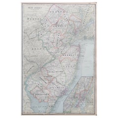
Large Original Antique Map of New Jersey, USA, circa 1900
Located in St Annes, Lancashire
Fabulous map of New Jersey
Original color
Engraved and printed by the George F. Cram Company, Indianapolis.
Published, circa 1900
Unframed
Repairs to minor edge tears
Category
American Antique 1810s Maps
Materials
Paper
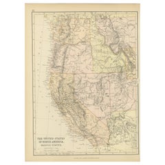
Antique Map of The United States of North America, Pacific States, 1882
Located in Langweer, NL
The map is from the same 1882 Blackie Atlas and focuses on the Pacific States of the United States of America during that period. Here are some details and historical context about t...
Category
Antique 1810s Maps
Materials
Paper
$239 Sale Price
20% Off
H 14.97 in W 11.03 in D 0 in
Small Map of the United States
Located in Langweer, NL
Antique map titled 'Amérique septe. Physique'. Small map of the United States. lithographed by C. Callewaert brothers in Brussels circa 1870.
Category
Antique 1810s Maps
Materials
Paper
Antique Golf Engraving, Henry Callender ESQ, Golf Mezzotint
Located in Oxfordshire, GB
Golf mezzotint of 'Henry Callender Esq' (Captain of the society of Golfers at Blackheath) after Lemuel Francis Abbott (1760-1803).
Henry Callend...
Category
British Sporting Art Antique 1810s Maps
Materials
Paper
Regal Elegance: The Reeves's Pheasant - A Flying Taxidermy Masterpiece
Located in New York, NY
Majestic Flying Reeves's Pheasant (Syrmaticus reevesii), a stunning avian specimen native to China, meticulously preserved to capture its intricate beauty and remarkable history. N...
Category
American 1810s Maps
Materials
Feathers
$1,800
H 51 in W 33 in D 12.5 in
Original Drawing, Circle of Giovanni Battista Tiepolo 1696-1770 Venice, Italy
By Giovanni Battista Tiepolo
Located in Vero Beach, FL
Original Drawing, Circle of Giovanni Battista Tiepolo 1696-1770 Venice, Italy
Although we offer this old master drawing as circle of Tiepolo, we are convinced, based on the composi...
Category
Italian Rococo Antique 1810s Maps
Materials
Paper
$8,200
H 19.25 in W 20.25 in D 0.5 in
Early 19th Century Italian Altar
Located in Baton Rouge, LA
This early 19th century Italian altar is made of worn painted wood and worn fabric details. This is a highly decorative altar for the unknown Catholic saint...
Category
Italian Antique 1810s Maps
Materials
Fabric, Wood, Paint
Antique County Map, Shropshire, English, Atlas Engraving, Richard Blome, C.1673
Located in Hele, Devon, GB
This is an antique county map of Shropshire. An English, framed atlas engraving by Richard Blome, dating to the 17th century and later.
A treat for the collector or county native, ...
Category
British Restauration Antique 1810s Maps
Materials
Glass, Wood, Paper
$1,181
H 15.95 in W 15.16 in D 0.99 in
Sun and Moon a Story of Astronomy, Photography and Cartography
Located in New York, NY
A unique pictorial history of astronomical exploration from the earliest Prehistoric observatories to the latest satellite images with 280 spectacular images and an inspiring story i...
Category
European 1810s Maps
Materials
Paper
$80 / item
H 2.5 in W 11.13 in D 12.13 in
Early 19th Century Marionette Puppets
Located in London, GB
Early 19th Century Marionette Puppets
A rare untouched example of two hand crafted early 19th century marionette puppets, likely to be French in...
Category
French Antique 1810s Maps
Materials
Fabric, Pine, Paper
18th / Early 19th Century Miniature Painting
Located in Delft, NL
An 18th / early 19th century miniature painting
An 18th / early 19th century miniature painting painted on glass and framed.
The copper framed miniature painting in another copp...
Category
European Antique 1810s Maps
Materials
Copper
Impressive Early 19th Century Model Chateau
Located in Pease pottage, West Sussex
Extraordinary Early 19th Century Chateau Model found untouched in its original painted finish. impressive attention to detail with some carved brickwork,...
Category
French Antique 1810s Maps
Materials
Wood
Previously Available Items
Original Antique Map of Poland by Thomas Clerk, 1817
Located in St Annes, Lancashire
Great map of Poland
Copper-plate engraving
Drawn and engraved by Thomas Clerk, Edinburgh.
Published by Mackenzie And Dent, 1817
Unframed.
Category
English Antique 1810s Maps
Materials
Paper
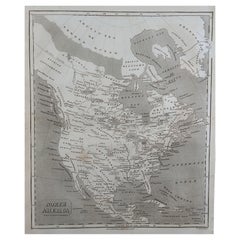
Original Antique Map of North America by Thomas Clerk, 1817
Located in St Annes, Lancashire
Great map of North America
Copper-plate engraving
Drawn and engraved by Thomas Clerk, Edinburgh.
Published by Mackenzie And Dent, 1817
Unframed.
Category
English Antique 1810s Maps
Materials
Paper
Original Antique Map of Africa By Thomas Clerk, 1817
Located in St Annes, Lancashire
Great map of Africa
Copper-plate engraving
Drawn and engraved by Thomas Clerk, Edinburgh.
Published by Mackenzie And Dent, 1817
Unframed.
Category
English Antique 1810s Maps
Materials
Paper
Original Antique Map of India by Thomas Clerk, 1817
Located in St Annes, Lancashire
Great map of India
Copper-plate engraving
Drawn and engraved by Thomas Clerk, Edinburgh.
Published by Mackenzie And Dent, 1817
Unframed.
Category
English Antique 1810s Maps
Materials
Paper
Original Antique Map of Ireland by Thomas Clerk, 1817
Located in St Annes, Lancashire
Great map of Ireland
Copper-plate engraving
Drawn and engraved by Thomas Clerk, Edinburgh.
Published by Mackenzie And Dent, 1817
Unframed.
Category
English Antique 1810s Maps
Materials
Paper
1818 Carey Atlas Correct Hand-Colored Map of Virginia
Located in Colorado Springs, CO
This is an exceptional 1818 hand-colored copper plate engraved map titled, "A CORRECT MAP OF VIRGINIA" Published by M. Carey & Sons, Philadelphia.
This original, historic Map...
Category
