Late 19th Century Maps
to
280
404
13
417
9
1
2,974
2,232
473
3
288
34
9
126
8
36
9
2
5
4
3
2
413
5
4
4
3
58
55
48
26
15
417
417
417
23
6
1
1
1
Period: Late 19th Century
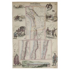
Original Antique Decorative Map of South America-West Coast, Fullarton, C.1870
Located in St Annes, Lancashire
Great map of Chili, Peru and part of Bolivia
Wonderful figural border
From the celebrated Royal Illustrated Atlas
Lithograph. Original color.
Published by Fullarton, Edi...
Category
Scottish Antique Late 19th Century Maps
Materials
Paper
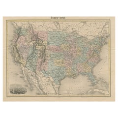
Antique Map of the United States with Vignette of Washington
Located in Langweer, NL
Antique map titled 'États-Unis'. A very attractive and detailed late 19th century map of the United States, with a fine decorative vignette of Washington. The extensive railway netwo...
Category
Antique Late 19th Century Maps
Materials
Paper
$453 Sale Price
20% Off
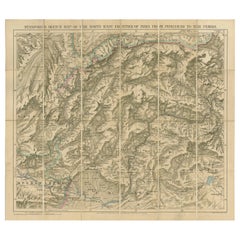
Antique Map of the North-West Frontier by Stanford, 1895
By E. Stanford
Located in Langweer, NL
Antique map titled 'Stanford's Sketch Map of the North West Frontier of India from Peshawar to the Pamirs'. Linen backed folding map of the North-West Frontier of India from Peshawar...
Category
Antique Late 19th Century Maps
Materials
Linen, Paper
$850 Sale Price
20% Off
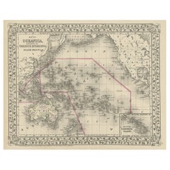
Old Map of the Pacific, Incl Australia, Polynesia, Melanesia and Malaysia, 1872
Located in Langweer, NL
Antique map Oceania titled 'Map of Oceanica exhibiting its various divisions, island groups & c'.
Map of the Pacific, including Australia, Polynes...
Category
Antique Late 19th Century Maps
Materials
Paper
$179 Sale Price
20% Off
Old Original Antique Map of Western Canada, 1882
Located in Langweer, NL
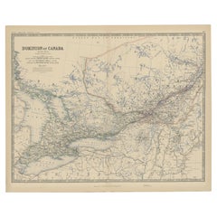
Antique map titled 'Dominion of Canada'.
Old map of Western Canada. This map originates from 'The Royal Atlas of Modern Geography, Exhibiting, in a ...
Category
Antique Late 19th Century Maps
Materials
Paper
$264 Sale Price
20% Off
Antique Map of Winchester, Eldorado & Orangeburg, 1871
Located in Langweer, NL
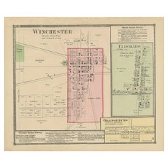
Antique map titled 'Winchester, Eldorado, Orangeburg'. Original antique map of villages and communities of Ohio. This map originates from 'Atlas of Preble County Ohio' by C.O. Titus....
Category
Antique Late 19th Century Maps
Materials
Paper
$236 Sale Price
20% Off
Antique Map of Iowa
Located in Langweer, NL
Antique map titled 'Iowa'. Original antique map of Iowa, United States. This print originates from 'Encyclopaedia Britannica', Ninth Edition. Published 188...
Category
Antique Late 19th Century Maps
Materials
Paper
$274 Sale Price
20% Off
Antique Map of New Hampshire
Located in Langweer, NL
Antique map titled 'New Hampshire'. Original antique map of New Hampshire, United States. This print originates from 'Encyclopaedia Britan...
Category
Antique Late 19th Century Maps
Materials
Paper
$274 Sale Price
20% Off
Antique Map with Hand Coloring of the United States and the Caribbean
Located in Langweer, NL
Antique map titled 'Verein-Staaten von Nord-America, Mexico, Yucatan u.a.'. Very detailed map of the United States of America showing the Caribbean. With an inset map of the surround...
Category
Antique Late 19th Century Maps
Materials
Paper
$529 Sale Price
20% Off
Antique Map with Hand Coloring of North America and the West Indies
Located in Langweer, NL
Original antique map titled 'Nord-America'. Old map of North America and the West Indies.
This map originates from Stielers Handatlas, published circa 1879. Stielers Handatlas (a...
Category
Antique Late 19th Century Maps
Materials
Paper
$549 Sale Price
25% Off
Antique Map of Brazil by Levasseur '1875'
Located in Langweer, NL
Antique map titled 'Carte du Brésil'. Large map of Brazil, with small fold out. This map originates from 'Atlas de Géographie Moderne Physique et Politiq...
Category
Antique Late 19th Century Maps
Materials
Paper
$378 Sale Price
20% Off
Antique Map of Denmark with Schleswig & Holstein by A & C. Black, 1870
Located in Langweer, NL
Antique map titled 'Denmark with Schleswig & Holstein'. Original antique map of Denmark with Schleswig & Holstein. This map originates from ‘Black's General Atlas of The World’. Publ...
Category
Antique Late 19th Century Maps
Materials
Paper
$124 Sale Price
40% Off
Antique Map of Spain and Portugal by A & C. Black, 1870
Located in Langweer, NL
Antique map titled 'Spain and Portugal'. Original antique map of General map of Spain and Portugal with inset map of Gibraltar. This map originates from ‘Black's General Atlas of The...
Category
Antique Late 19th Century Maps
Materials
Paper
$194 Sale Price
40% Off
Antique Map of Mexico, Central America and West Indies by A & C. Black, 1870
Located in Langweer, NL
Antique map titled 'Mexico, Central America and West Indies'. Original antique map of Mexico, Central America and West Indies with inset map of Panama railway. This map originates fr...
Category
Antique Late 19th Century Maps
Materials
Paper
$165 Sale Price
20% Off
Antique Map of New Zealand by A & C. Black, 1870
Located in Langweer, NL
Antique map titled 'New Zealand'. Original antique map of New Zealand with inset Maps of Australia, New Zealand and Tasmania. This map origi...
Category
Antique Late 19th Century Maps
Materials
Paper
$165 Sale Price
20% Off
Pl. 33 Antique Chart of the US Wealth Distribution in 1870 '1874'
Located in Langweer, NL
Antique chart titled 'Map showing the distribution of wealth. Compiled from the tables of "true valuation," ninth census of the United States, 1870'. Chart of the US wealth distribut...
Category
Antique Late 19th Century Maps
Materials
Paper
$472 Sale Price
20% Off
Antique Map of France by A & C. Black, 1870
Located in Langweer, NL
Antique map titled 'France'. Original antique map of France with inset map of France as divided into provinces, before the revolution of 1789 and map of Corsica...
Category
Antique Late 19th Century Maps
Materials
Paper
$259 Sale Price
20% Off
Antique Map of Preble County 'Ohio' by Titus, 1871
Located in Langweer, NL
Antique map titled 'Outline Plan of Prble County, Ohio'. Original antique map of Preble County, Ohio. This map originates from 'Atlas of Preble County Ohio' by C.O. Titus. Published ...
Category
Antique Late 19th Century Maps
Materials
Paper
$283 Sale Price
20% Off
Antique Chart of the Pacific Coast '1874'
Located in Langweer, NL
Antique chart titled 'Maps of the Pacific Coast exhibiting various subjects. Compiled from the statistics of the eight and ninth census of the United Sta...
Category
Antique Late 19th Century Maps
Materials
Paper
$472 Sale Price
20% Off
Bhor Ghat a Mountain Passage Between Karjat & Khandala, Maharashtra, India, 1883
Located in Langweer, NL
Plate: 'Bhor Ghat, 'Rampe du Chemin de fer, pres de Khandala'. This plate shows the Bhor Ghat a mountain passage located between Karjat and Khandala in Maharashtra, India. This plate...
Category
Antique Late 19th Century Maps
Materials
Paper
$113 Sale Price
20% Off
Antique Map of North and Central America by Migeon '1880'
By J. Migeon
Located in Langweer, NL
Antique map titled 'Amérique Septentrionale'. Old map of North and Central America. With a decorative vignette of the Niagara Falls. This map originates from 'Géographie Universelle ...
Category
French Antique Late 19th Century Maps
Materials
Paper
$141 Sale Price
20% Off
Antique Map of Gasper, Hamburg and West Elkton, 1871
Located in Langweer, NL
Antique map titled 'Gasper, Hamburg, West Elkton'. Original antique map of villages and communities of Ohio. This map originates from 'Atlas of Preble County Ohio' by C.O. Titus. Pub...
Category
Antique Late 19th Century Maps
Materials
Paper
$236 Sale Price
20% Off
Antique Map of the Twin Township of Ohio by Titus '1871'
Located in Langweer, NL
Antique map titled 'Twin'. Original antique map of Twin, Ohio. This map originates from 'Atlas of Preble County Ohio' by C.O. Titus. Published 1871.
Category
Antique Late 19th Century Maps
Materials
Paper
$206 Sale Price
30% Off
Antique Map of the Chinese Empire and Japan, '1875'
Located in Langweer, NL
Antique map titled 'Carte générale de l'Empire Chinois et du Japon'. Large map of the Chinese Empire and Japan. This map originates from 'Atlas de Géographie Moderne Physique et Poli...
Category
Antique Late 19th Century Maps
Materials
Paper
$378 Sale Price
20% Off
Antique Map of Egypt and Palestina by H. Kiepert 'circa 1870'
Located in Langweer, NL
Antique map titled 'Aegyptus, Phoenice et Palestina'. With inset maps of Tyrus, Alexandria and Hierosolyma. This map originates from 'Atlas Antiquus. Zwölf Karten zur Alten Geschicht...
Category
Antique Late 19th Century Maps
Materials
Paper
$151 Sale Price
20% Off
Pl. 35 Antique Chart of the US Taxation, 1874
Located in Langweer, NL
Antique chart titled 'Map showing the degree of taxation per capita imposed by state, county or municipal authority, within the fiscal year nearest the c...
Category
Antique Late 19th Century Maps
Materials
Paper
$472 Sale Price
20% Off
Antique Chromolithograph Depicting Native Malays, Incl Dayaks of Borneo, 1882
Located in Langweer, NL
Antique print titled 'Malay Race'. Depicts 1. Saghai Dyak N.E. Coast. 2. Loondoo Dyak. S.W. Coast. Natives of Java- 3. Priest. 4. Lady. 5. Gentleman.
Antique chromolithograph...
Category
Antique Late 19th Century Maps
Materials
Paper
$340 Sale Price
20% Off
Antique Chart of the US Population in 1870, published in 1874
Located in Langweer, NL
Antique chart titled 'Map showing, in five degrees of density, the distribution, within the territory of the United States, of the constitutional population, i.e., excluding Indians ...
Category
Antique Late 19th Century Maps
Materials
Paper
$850 Sale Price
20% Off
Antique Map of Illinois by Johnson, 1872
Located in Langweer, NL
Antique map titled 'Johnson's Illinois'. Original map of Illinois. This map originates from 'Johnson's New Illustrated Family Atlas of the World' by A....
Category
Antique Late 19th Century Maps
Materials
Paper
$236 Sale Price
20% Off
Old Hand-Colored Print With a View of the Louvre, France, ca.1885
Located in Langweer, NL
Antique print titled 'Anischt des Louvre mit seinen Galerien, in Paris'.
Old print with a view of the Louvre, France. This print originates from a German illustrated newsletter, pu...
Category
Antique Late 19th Century Maps
Materials
Paper
$406 Sale Price
20% Off
Antique Map of the Somers Township of Ohio by Titus, 1871
Located in Langweer, NL
Antique map titled 'Somers'. Original antique map of Somers, Ohio. This map originates from 'Atlas of Preble County Ohio' by C.O. Titus. Published, 1871.
Category
Antique Late 19th Century Maps
Materials
Paper
$236 Sale Price
20% Off
Antique Map of New Paris and Morning Sun, 1871
Located in Langweer, NL
Antique map titled 'New Paris, Morning Sun'. Original antique map of villages and communities of Ohio. This map originates from 'Atlas of Preble County Ohio' by C.O. Titus. Published...
Category
Antique Late 19th Century Maps
Materials
Paper
$236 Sale Price
20% Off
Nice Antique Asian Village View in Aceh, Sumatra, Indonesia, 1874
Located in Langweer, NL
Antique print Indonesia titled 'Fort en Dorp Pedir, ten oosten van de hoofdstad Atchin gelegen'. Antique print depicting a scene in Indonesia. Originates from 'De Oorlog tusschen Ned...
Category
Antique Late 19th Century Maps
Materials
Paper
$226 Sale Price
20% Off
Antique Map of The United States and Canada by A & C. Black, 1870
Located in Langweer, NL
Antique map titled 'United States North Eastern Section and Canada'. Original antique map of Map of The United States North Eastern Section and Canada. This map originates from ‘Blac...
Category
Antique Late 19th Century Maps
Materials
Paper
$236 Sale Price
20% Off
Antique Map of the Eastern United States by Levasseur '1875'
Located in Langweer, NL
Antique map titled 'Carte de la Region orientale des États-Unis et de la dominion du Canada'. Large map of the Eastern United States. This map originates from 'Atlas de Géographie Mo...
Category
Antique Late 19th Century Maps
Materials
Paper
$378 Sale Price
20% Off
Decorative Antique Map of the Netherlands and Belgium, ca.1875
Located in Langweer, NL
Antique map titled 'Pays-Bas Belgique (..)'. Large map of the Netherlands and Belgium. This map originates from 'Atlas de Géographie Moder...
Category
Antique Late 19th Century Maps
Materials
Paper
$378 Sale Price
20% Off
Pl. 17 Antique Chart of the US Population 1850 by Walker, 1874
Located in Langweer, NL
Antique chart titled 'Map showing in five degrees of density, the distribution, within the territory east of the 100th Meridian, of the population of the United States, excluding Ind...
Category
American Antique Late 19th Century Maps
Materials
Paper
$425 Sale Price
20% Off
Antique Map of South America by A & C. Black, 1870
Located in Langweer, NL
Antique map titled 'South America'. Original antique map of Map of South America. This map originates from ‘Black's General Atlas of The World’. Published by A & C. Black, 1870.
Category
Antique Late 19th Century Maps
Materials
Paper
$259 Sale Price
20% Off
Antique Map of Ontario with an Inset Map of the Niagara River by Johnson, 1872
Located in Langweer, NL
Antique map titled 'Johnson's Ontario, of the dominion of Canada (..)'. Original map of Ontario, Canada, with an inset map of the Niagara River and vicinity. This map originates from...
Category
Antique Late 19th Century Maps
Materials
Paper
$236 Sale Price
20% Off
Antique Map of Prussia and Germany by Johnson, 1872
Located in Langweer, NL
Antique map titled 'Johnson's Prussia and Germany (..)'. Original map of Prussia and Germany, with inset map of North Eastern Prussia. This map originates from 'Johnson's New Illustr...
Category
Antique Late 19th Century Maps
Materials
Paper
$236 Sale Price
20% Off
Antique Map of the Dixon Township of Ohio by Titus, 1871
Located in Langweer, NL
Antique map titled 'Dixon'. Original antique map of Dixon, Ohio. This map originates from 'Atlas of Preble County Ohio' by C.O. Titus. Published 1871.
Category
Antique Late 19th Century Maps
Materials
Paper
$236 Sale Price
20% Off
Antique Map of Western Africa by Levasseur '1875'
Located in Langweer, NL
Antique map titled 'Carte de la Senegambie Soudan et Guinée'. Large map of Western Africa. This map originates from 'Atlas de Géographie Moderne Physique et Politique' by A. Levasseu...
Category
Antique Late 19th Century Maps
Materials
Paper
$378 Sale Price
20% Off
Pl. 40 Antique Chart of the US Birth Rate, 1874
Located in Langweer, NL
Antique chart titled 'Map showing, in five degrees of density, the birth rate prevailing in the territory of the United States east of the 100th Meridian, so far as the same is indic...
Category
Antique Late 19th Century Maps
Materials
Paper
$472 Sale Price
20% Off
Pl. 26 Antique Chart of the US Foreign Population Proportion in 1870, '1874'
Located in Langweer, NL
Antique chart titled 'Map showing the proportion of the foreign to the aggregate population. Compiled from the returns of population at the ninth census of the United States 1870'. C...
Category
Antique Late 19th Century Maps
Materials
Paper
$425 Sale Price
20% Off
Antique Map of Sweden, Norway and Denmark by Johnson, 1872
Located in Langweer, NL
The image is an antique map, a two-page spread from "Johnson's New Illustrated Family Atlas of the World," by A.J. Johnson, dated 1872. This particular map offers a depiction of Swed...
Category
Antique Late 19th Century Maps
Materials
Paper
$236 Sale Price
20% Off
Antique Map of Gratis 'Ohio' by Titus '1871'
Located in Langweer, NL
Antique map titled 'Gratis'. Original antique map of Gratis, Ohio. This map originates from 'Atlas of Preble County Ohio' by C.O. Titus. Published 1871.
Category
Antique Late 19th Century Maps
Materials
Paper
$236 Sale Price
20% Off
Antique Map of College Corner, Sugar Valley, New Lexington & Verona '1871'
Located in Langweer, NL
Antique map titled 'College Corner, Sugar Valley, New Lexington, Verona'. Original antique map of villages and communities of Ohio. This map originates from 'Atlas of Preble County O...
Category
Antique Late 19th Century Maps
Materials
Paper
$236 Sale Price
20% Off
Antique Map of Jefferson County 'Ohio' by Titus, 1871
Located in Langweer, NL
Antique map titled 'Jefferson'. Original antique map of Jefferson, Ohio. This map originates from 'Atlas of Preble County Ohio' by C.O. Titus. Published 1871.
Category
Antique Late 19th Century Maps
Materials
Paper
$236 Sale Price
20% Off
Antique Map of New Westville, Gettysburg, New Hope & Fair Haven, 1871
Located in Langweer, NL
Antique map titled 'New Westville, Gettysburg, New Hope, Fair Haven'. Original antique map of villages and communities of Ohio. This map originates from 'Atlas of Preble County Ohio'...
Category
Antique Late 19th Century Maps
Materials
Paper
$236 Sale Price
20% Off
Antique Map of Iowa and Nebraska by Johnson, '1872'
Located in Langweer, NL
Antique map titled 'Johnson's Iowa and Nebraska'. Original map of Iowa and Nebraska. This map originates from 'Johnson's New Illustrated Family Atlas of th...
Category
Antique Late 19th Century Maps
Materials
Paper
$236 Sale Price
20% Off
Antique Map of New York by Johnson '1872'
Located in Langweer, NL
Antique map titled 'Johnson's New York'. Original map showing New York, with an inset map of Long Island. This map originates from 'Johnson's New Il...
Category
Antique Late 19th Century Maps
Materials
Paper
$236 Sale Price
20% Off
Antique Map of Asia by Johnson, 1872
Located in Langweer, NL
Antique map titled 'Johnson's Asia'. Original map of Asia. This map originates from 'Johnson's New Illustrated Family Atlas of the World' by A.J. Johnson. Published, 1872.
Category
Antique Late 19th Century Maps
Materials
Paper
$330 Sale Price
20% Off
Antique Chart of the US Enteric, Cerebro-Spinal, Typhus Deaths, '1874'
Located in Langweer, NL
Antique chart titled 'Map showing the proportion of deaths from enteric, cerebro-spinal and typhus fevers to deaths from all causes. Compiled from the returns of mortality at the nin...
Category
Antique Late 19th Century Maps
Materials
Paper
$472 Sale Price
20% Off
Map of Scandinavia – Antique Atlas Map by A. Levasseur, France, 1875
Located in Langweer, NL
Map of Scandinavia – Antique Atlas Map by A. Levasseur, France, 1875
This elegant 19th-century map titled Carte des Royaumes de Suède, de Norvège et de Danem...
Category
French Antique Late 19th Century Maps
Materials
Paper
$383 Sale Price
35% Off
Antique Map of Southern Africa by Levasseur, 1875
Located in Langweer, NL
Antique map titled 'Afrique Méridionale'. Large map of Southern Africa. This map originates from 'Atlas de Géographie Moderne Physique et Politique' b...
Category
Antique Late 19th Century Maps
Materials
Paper
$378 Sale Price
20% Off
Antique Map of Russia in Europe by Levasseur, '1875'
Located in Langweer, NL
Antique map titled 'Carte générale de la Russie d'Europe (..)'. Large map of Russia in Europe. This map originates from 'Atlas de Géographie Moderne Physique et Politique' by A. Leva...
Category
Antique Late 19th Century Maps
Materials
Paper
$330 Sale Price
20% Off
Pl. 16 Antique Chart of the US Population 1790-1820 by Walker, '1874'
Located in Langweer, NL
Antique chart titled 'The progress of the nation, 1790-1820. Maps showing in five degrees of density the distribution within the territory east of the 100th meridian of the populatio...
Category
Antique Late 19th Century Maps
Materials
Paper
$425 Sale Price
20% Off
Pl. 34 Antique Chart of the US Public Indebtedness, 1874
Located in Langweer, NL
Antique chart titled 'Map showing the degree of public indebtedness per capita. Contracted by state, county or municipal authority, at the close of the fiscal year nearest the census...
Category
American Antique Late 19th Century Maps
Materials
Paper
$472 Sale Price
20% Off
Antique Chart of the US Malarial Deaths, '1874'
Located in Langweer, NL
Antique chart titled 'Map showing the proportion of deaths from malarial diseases to deaths from all causes. Compiled from the returns of mortality at th...
Category
Antique Late 19th Century Maps
Materials
Paper
$472 Sale Price
20% Off
Pl. 25 Antique Chart of the US Foreign Population in 1870, '1874'
Located in Langweer, NL
Antique chart titled 'Map showing five degrees of density the distribution of the foreign population within the territory of the United States east of the 100th Meridian. Compiled fr...
Category
Antique Late 19th Century Maps
Materials
Paper
$425 Sale Price
20% Off
Recently Viewed
View AllMore Ways To Browse
Bavarian Porcelain Vases
Beer Tankard
Bjorn L
Black Cabinet With Flowers And Birds
Black Tansu Chest
Blue Morpho
Blue Opaline Crystal Vases
Bow Front Buffet
Boy And Girl Statues
Brass Donkey
Brass Hound
Bread Oven
Bronze Atlas Sculpture
Bronze Door Stop
Bronze Shakespeare Sculpture
Buddha Bell
Bull Terrier
Butlers Chest
