Items Similar to Pl. 28 Antique Chart of British American, English (..) US Population, 1874

Want more images or videos?
Request additional images or videos from the seller
1 of 5
Pl. 28 Antique Chart of British American, English (..) US Population, 1874
$350.46
$539.1635% Off
£260.89
£401.3735% Off
€292.50
€45035% Off
CA$480.04
CA$738.5235% Off
A$533.91
A$821.4035% Off
CHF 278.79
CHF 428.9135% Off
MX$6,497.09
MX$9,995.5235% Off
NOK 3,560.57
NOK 5,477.8035% Off
SEK 3,339.19
SEK 5,137.2135% Off
DKK 2,226.70
DKK 3,425.6935% Off
Shipping
Retrieving quote...The 1stDibs Promise:
Authenticity Guarantee,
Money-Back Guarantee,
24-Hour Cancellation
About the Item
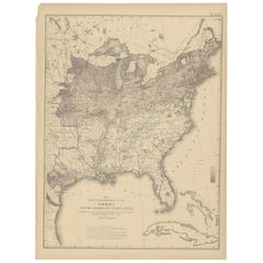
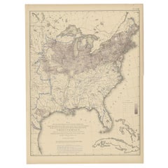
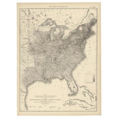
Antique chart titled 'Maps showing the distribution, within the territory of the United States, east of the 100th Meridian, of certain foreign elements of the population. I. according to their number to the square mile, absolute. II. according to their proportion to the aggregate population, relative. Compiled from the returns of population at the ninth census 1870'. Chart of British American, English, Welsh, Swedish, Norwegian population in 1870. Originates from 'Statistical Atlas of the United States based on the results of the ninth census 1870 (..)' by Francis A. Walker.
- Dimensions:Height: 21.66 in (55 cm)Width: 16.15 in (41 cm)Depth: 0.02 in (0.5 mm)
- Materials and Techniques:
- Period:
- Date of Manufacture:1874
- Condition:General age-related toning, minor wear. Blank verso, please study image carefully.
- Seller Location:Langweer, NL
- Reference Number:Seller: BG-11875-151stDibs: LU3054319781982
About the Seller
5.0
Recognized Seller
These prestigious sellers are industry leaders and represent the highest echelon for item quality and design.
Platinum Seller
Premium sellers with a 4.7+ rating and 24-hour response times
Established in 2009
1stDibs seller since 2017
2,510 sales on 1stDibs
Typical response time: <1 hour
- ShippingRetrieving quote...Shipping from: Langweer, Netherlands
- Return Policy
Authenticity Guarantee
In the unlikely event there’s an issue with an item’s authenticity, contact us within 1 year for a full refund. DetailsMoney-Back Guarantee
If your item is not as described, is damaged in transit, or does not arrive, contact us within 7 days for a full refund. Details24-Hour Cancellation
You have a 24-hour grace period in which to reconsider your purchase, with no questions asked.Vetted Professional Sellers
Our world-class sellers must adhere to strict standards for service and quality, maintaining the integrity of our listings.Price-Match Guarantee
If you find that a seller listed the same item for a lower price elsewhere, we’ll match it.Trusted Global Delivery
Our best-in-class carrier network provides specialized shipping options worldwide, including custom delivery.More From This Seller
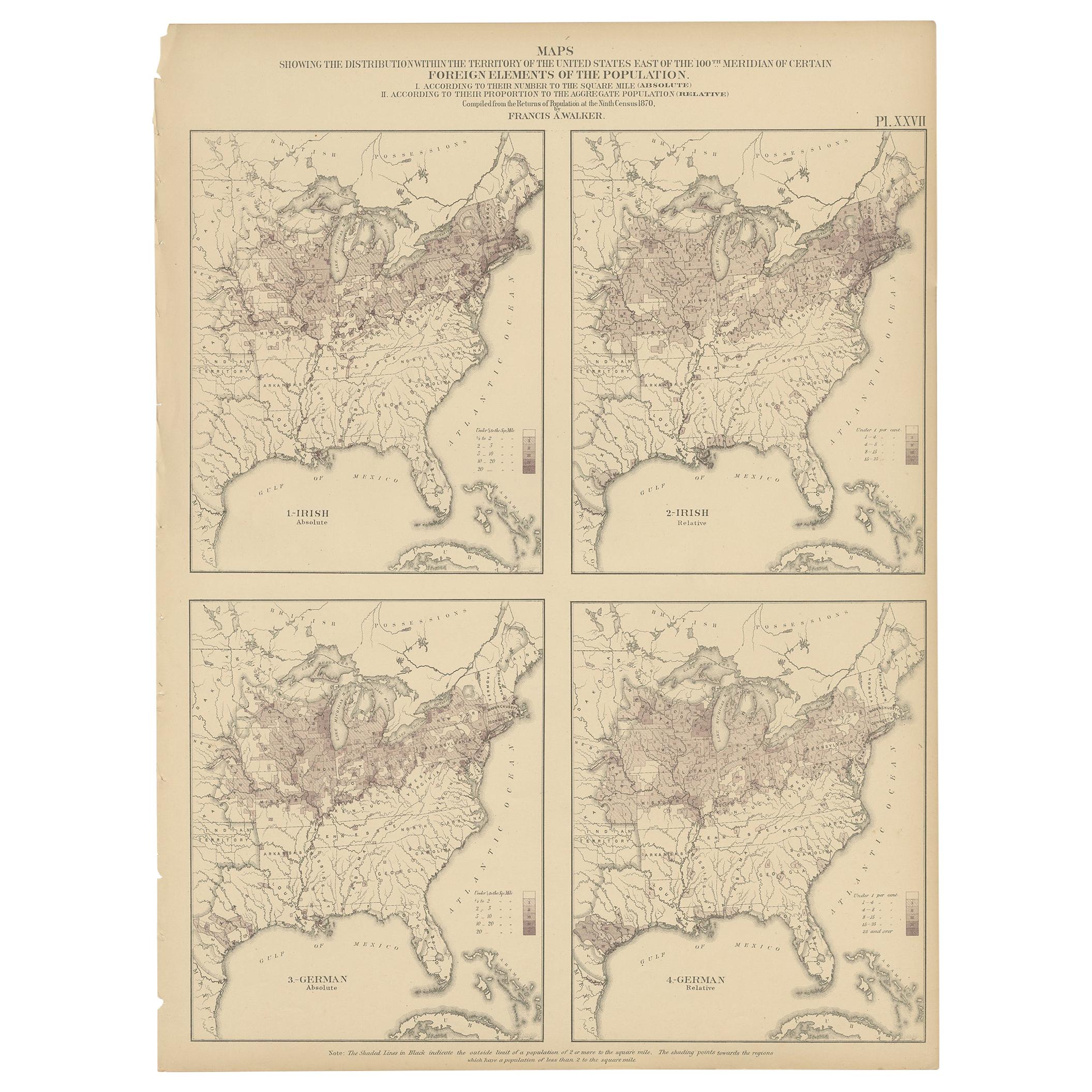
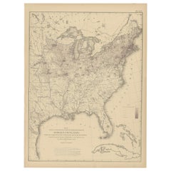
View AllPl. 27 Antique Chart of the US Irish and German Population in 1870, '1874'
Located in Langweer, NL
Antique chart titled 'Maps showing the distribution, within the territory of the United States, east of the 100th Meridian, of certain foreign elements of the population. I. accordin...
Category
Antique Late 19th Century Maps
Materials
Paper
$350 Sale Price
35% Off
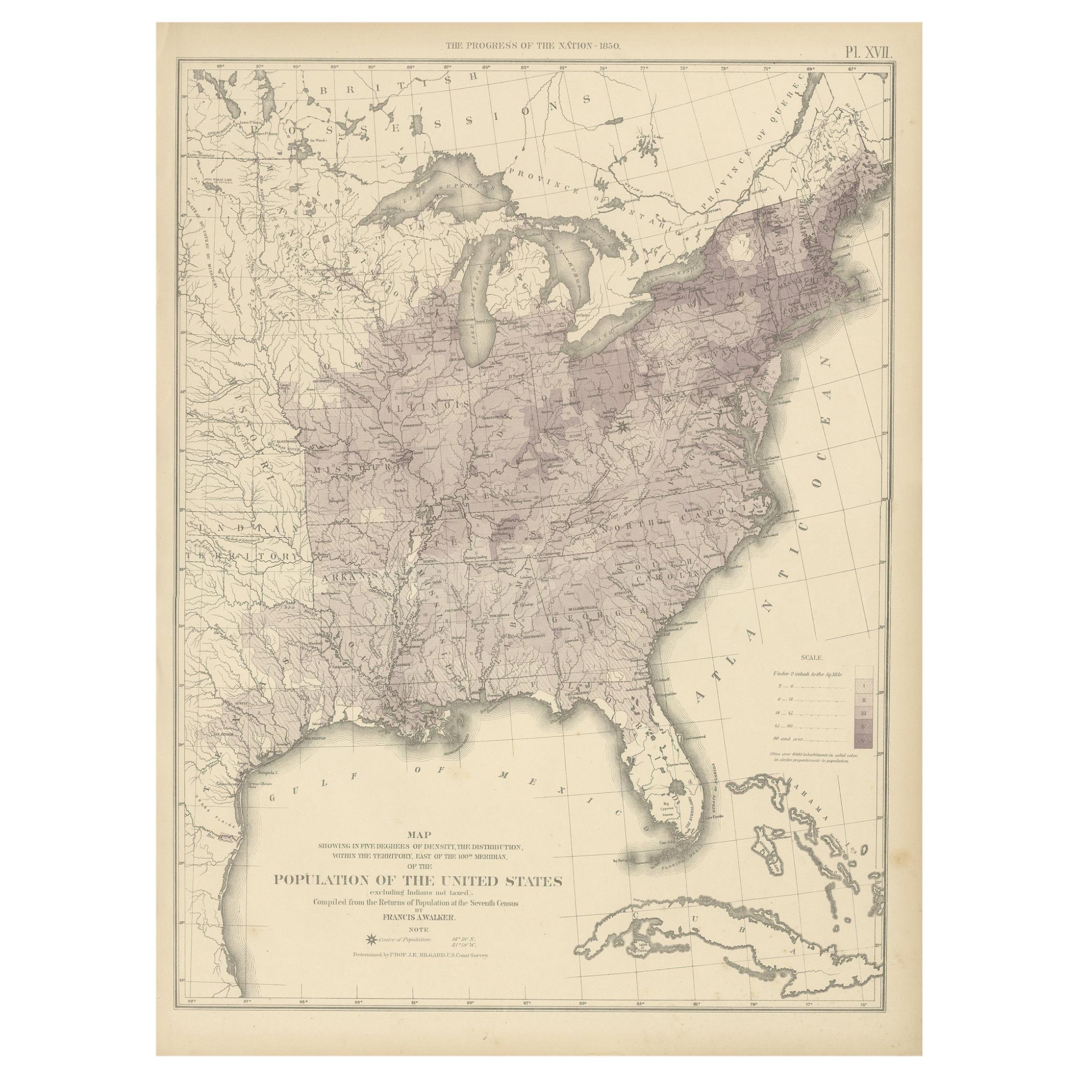
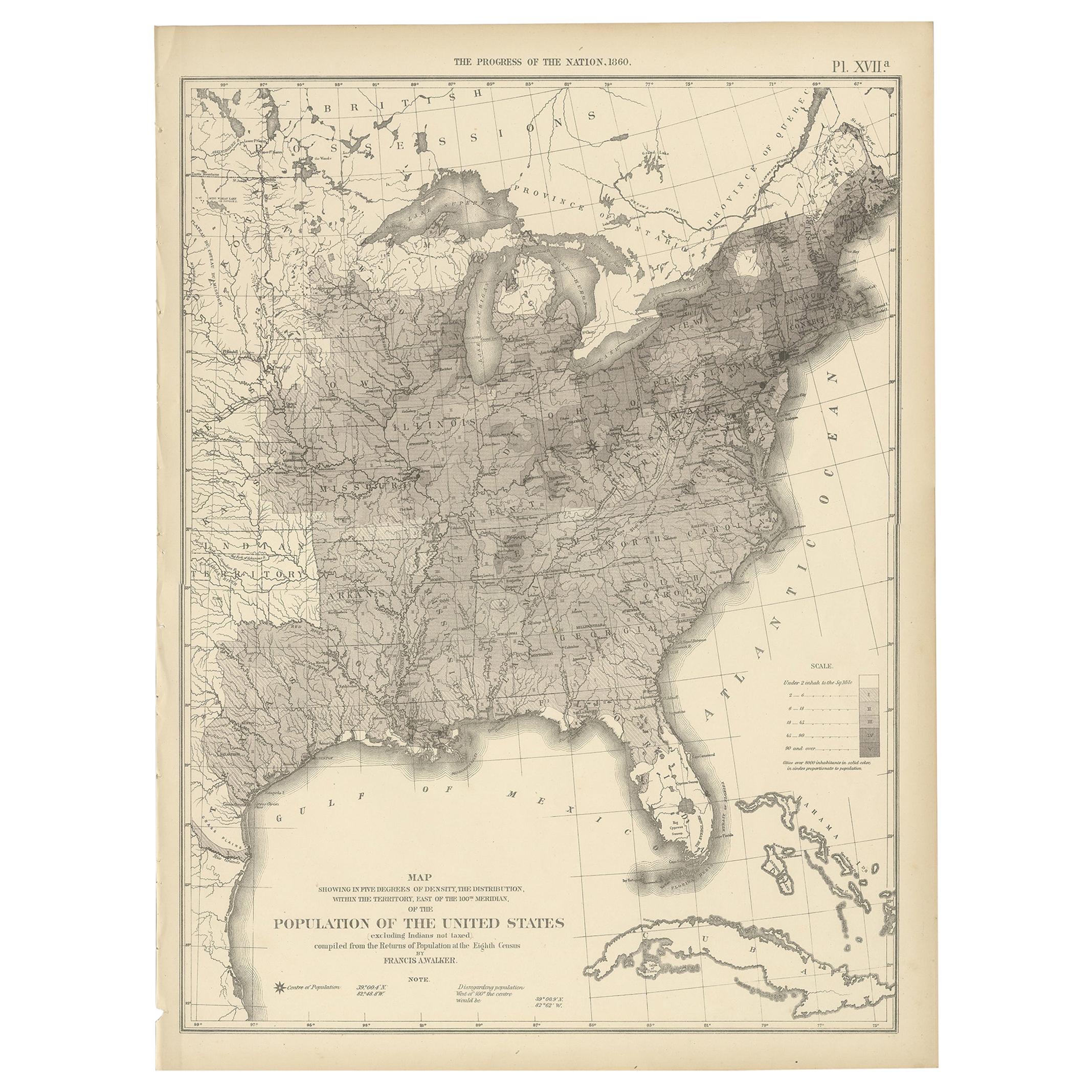
Pl. 17 Antique Chart of the US Population 1850 by Walker, 1874
Located in Langweer, NL
Antique chart titled 'Map showing in five degrees of density, the distribution, within the territory east of the 100th Meridian, of the population of the United States, excluding Ind...
Category
Antique Late 19th Century American Maps
Materials
Paper
$431 Sale Price
20% Off
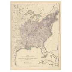
Pl. 25 Antique Chart of the US Foreign Population in 1870, '1874'
Located in Langweer, NL
Antique chart titled 'Map showing five degrees of density the distribution of the foreign population within the territory of the United States east of the 100th Meridian. Compiled fr...
Category
Antique Late 19th Century Maps
Materials
Paper
$431 Sale Price
20% Off
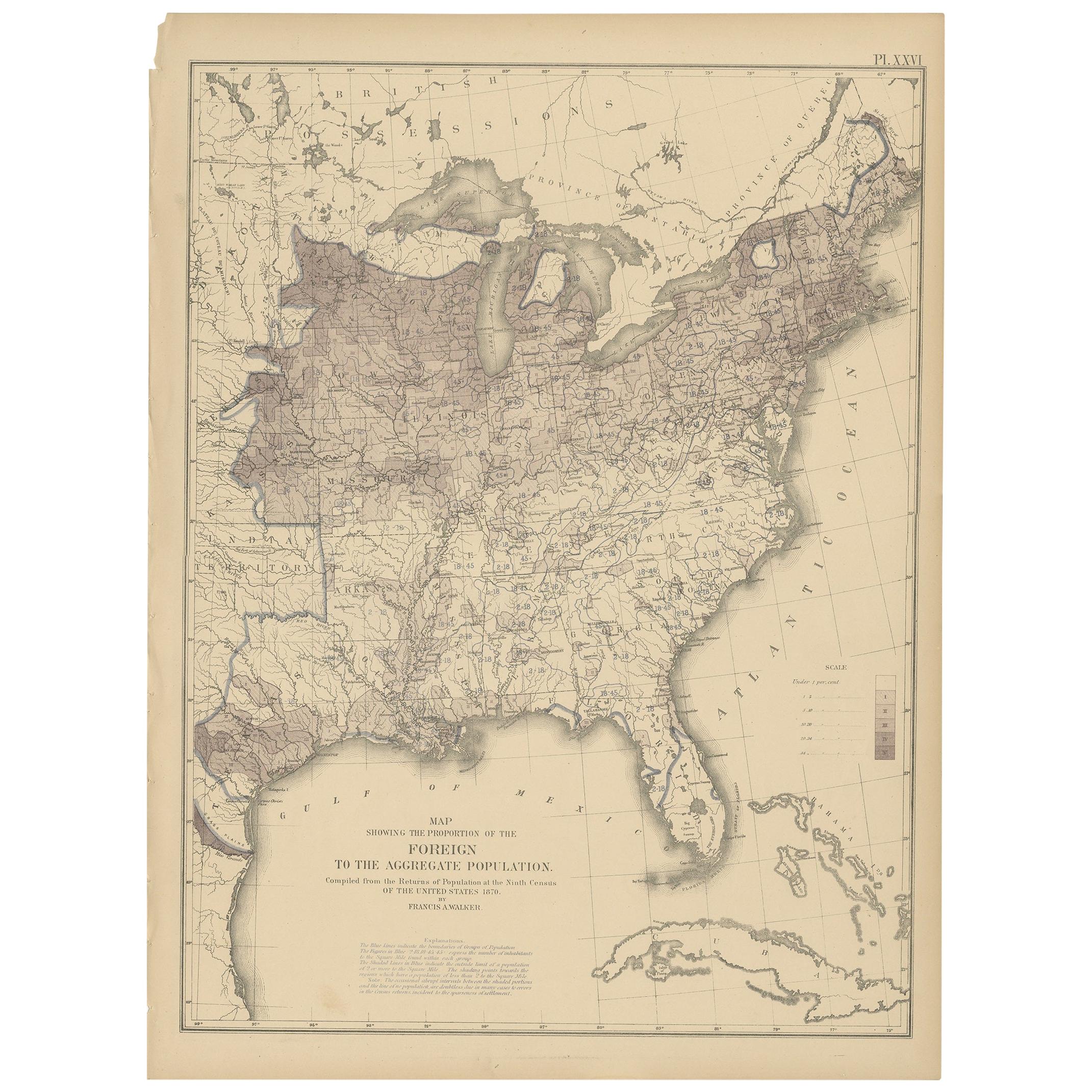
Pl. 26 Antique Chart of the US Foreign Population Proportion in 1870, '1874'
Located in Langweer, NL
Antique chart titled 'Map showing the proportion of the foreign to the aggregate population. Compiled from the returns of population at the ninth census of the United States 1870'. C...
Category
Antique Late 19th Century Maps
Materials
Paper
$431 Sale Price
20% Off
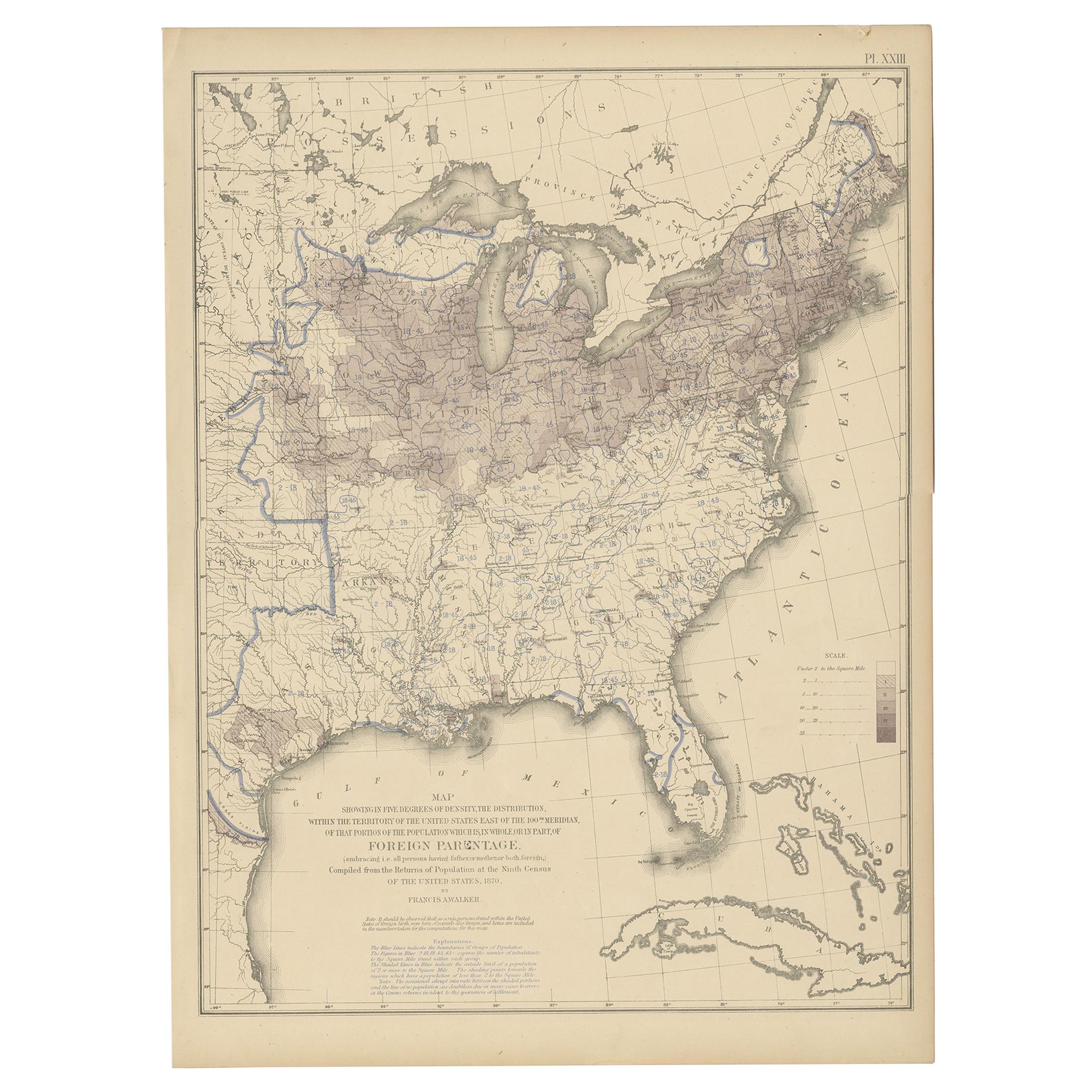
Pl. 23 Antique Chart of the US Foreign Parentage in 1870, '1874'
Located in Langweer, NL
Antique chart titled 'Map showing, in five degrees of density, the distribution, within the territory of the United States east of the 100th Meridian, of that portion of the populati...
Category
Antique Late 19th Century Maps
Materials
Paper
$431 Sale Price
20% Off
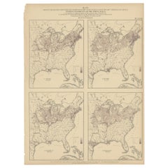
Pl. 17A Antique Chart of the US Population 1860 by Walker, '1874'
Located in Langweer, NL
Antique chart titled 'Map showing in five degrees of density, the distribution, within the territory east of the 100th Meridian, of the population of the United States, excluding Ind...
Category
Antique Late 19th Century Maps
Materials
Paper
$431 Sale Price
20% Off
You May Also Like
Original Antique Map of the American State of Virginia, 1903
Located in St Annes, Lancashire
Antique map of West Virginia
Published By A & C Black. 1903
Original colour
Good condition
Unframed.
Free shipping
Category
Antique Early 1900s English Maps
Materials
Paper
Original Antique Map of the American State of Tennessee, 1903
Located in St Annes, Lancashire
Antique map of Tennessee
Published By A & C Black. 1903
Original colour
Good condition
Unframed.
Free shipping
Category
Antique Early 1900s English Maps
Materials
Paper

Original Antique Map of the American State of Ohio ( Southern Part ), 1903
Located in St Annes, Lancashire
Antique map of Ohio ( Southern part )
Published By A & C Black. 1903
Original colour
Good condition
Unframed.
Free shipping
Category
Antique Early 1900s English Maps
Materials
Paper

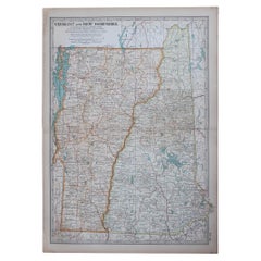
Original Antique Map of the American States of Vermont & New Hampshire, 1903
Located in St Annes, Lancashire
Antique map of Vermont and New Hampshire
Published By A & C Black. 1903
Original colour
Good condition
Unframed.
Free shipping
Category
Antique Early 1900s English Maps
Materials
Paper
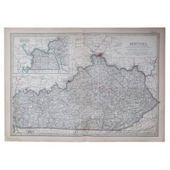
Original Antique Map of the American State of Kentucky, 1903
Located in St Annes, Lancashire
Antique map of Kentucky
Published By A & C Black. 1903
Original colour
Good condition
Unframed.
Free shipping
Category
Antique Early 1900s English Maps
Materials
Paper
Original Antique Map of the American State of Maine, 1903
Located in St Annes, Lancashire
Antique map of Maine
Published By A & C Black. 1903
Original colour
Good condition
Unframed.
Free shipping
Category
Antique Early 1900s English Maps
Materials
Paper

More Ways To Browse
Scotland Map
Antique Maps Indonesia
Map Of Japan
Antique Rollers
Compass Rose Antique
Dutch Empire
Swiss Antiques And Collectables
Antique Compass Map
Blaeu Maps
Coat Of Arms German
Antique Collectables Australia
Military Map
Spanish Empire
Antique Maps Scotland
Mississippi Antique
Denmark Map
Antique Maps Of North America
Wine Map