Items Similar to Steel Engraved Map of Central Asia Covering the Chinese Empire, Tibet Etc, C1843

Want more images or videos?
Request additional images or videos from the seller
1 of 5
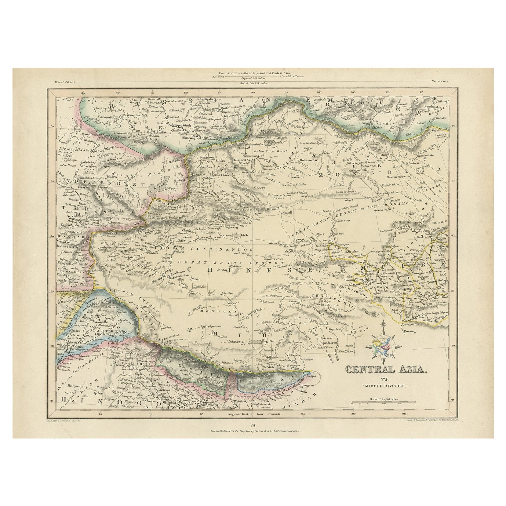
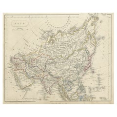
Steel Engraved Map of Central Asia Covering the Chinese Empire, Tibet Etc, C1843
$249.43
$311.7920% Off
£185.55
£231.9420% Off
€208
€26020% Off
CA$341.55
CA$426.9420% Off
A$379.76
A$474.7020% Off
CHF 198.29
CHF 247.8620% Off
MX$4,622.62
MX$5,778.2820% Off
NOK 2,530.10
NOK 3,162.6320% Off
SEK 2,370.58
SEK 2,963.2320% Off
DKK 1,583.39
DKK 1,979.2420% Off
Shipping
Retrieving quote...The 1stDibs Promise:
Authenticity Guarantee,
Money-Back Guarantee,
24-Hour Cancellation
About the Item
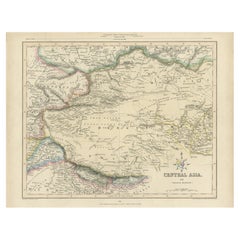
Antique map titled 'Central Asia (Middle Division)'.
Steel engraved map of Central Asia covering the Chinese Empire, Tibet and surroundings. This map originates from 'Gilberts Modern Atlas'.
Artists and Engravers: Drawn and engraved by J. Archer.
About the Seller
5.0
Recognized Seller
These prestigious sellers are industry leaders and represent the highest echelon for item quality and design.
Platinum Seller
Premium sellers with a 4.7+ rating and 24-hour response times
Established in 2009
1stDibs seller since 2017
2,510 sales on 1stDibs
Typical response time: <1 hour
- ShippingRetrieving quote...Shipping from: Langweer, Netherlands
- Return Policy
Authenticity Guarantee
In the unlikely event there’s an issue with an item’s authenticity, contact us within 1 year for a full refund. DetailsMoney-Back Guarantee
If your item is not as described, is damaged in transit, or does not arrive, contact us within 7 days for a full refund. Details24-Hour Cancellation
You have a 24-hour grace period in which to reconsider your purchase, with no questions asked.Vetted Professional Sellers
Our world-class sellers must adhere to strict standards for service and quality, maintaining the integrity of our listings.Price-Match Guarantee
If you find that a seller listed the same item for a lower price elsewhere, we’ll match it.Trusted Global Delivery
Our best-in-class carrier network provides specialized shipping options worldwide, including custom delivery.More From This Seller
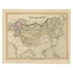
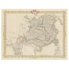
View AllAntique Map of Central Asia, Finely Engraved, 1841
Located in Langweer, NL
Antique map titled 'Central Asia, Middle Division'. A finely engraved and attractive mid 19th Century map of Central Asia which was drawn and engraved by Joshua Archer and published ...
Category
Antique 19th Century Maps
Materials
Paper
$230 Sale Price
20% Off
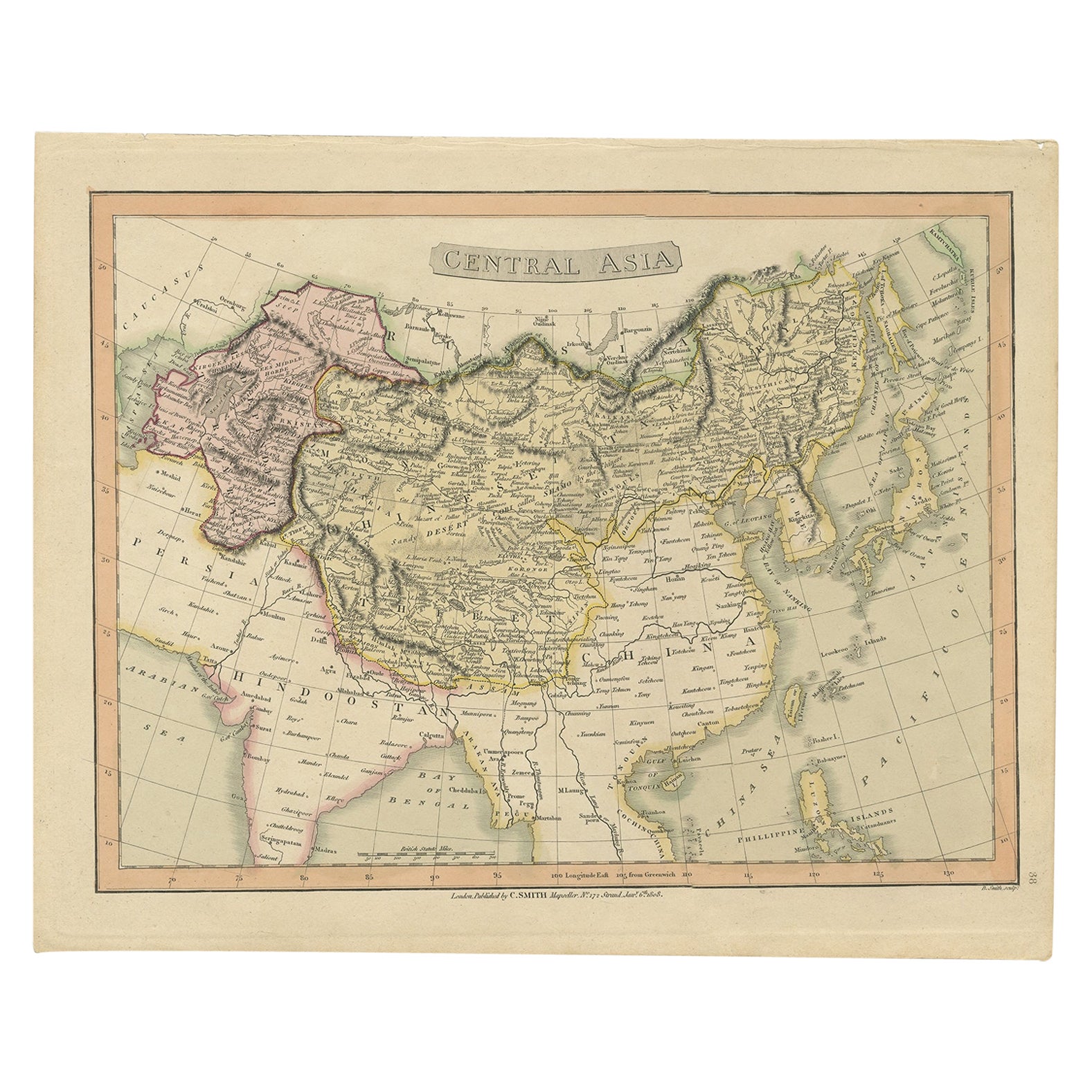
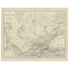
Original Antique Map of Central Asia by Smith, 1808
Located in Langweer, NL
Antique map titled 'Central Asia'. Old map of central Asia originating from 'Smith's New General Atlas Containing Distinct Maps Of all the Principal Empires, Kingdoms, & States Throu...
Category
Antique 19th Century Maps
Materials
Paper
$230 Sale Price
20% Off
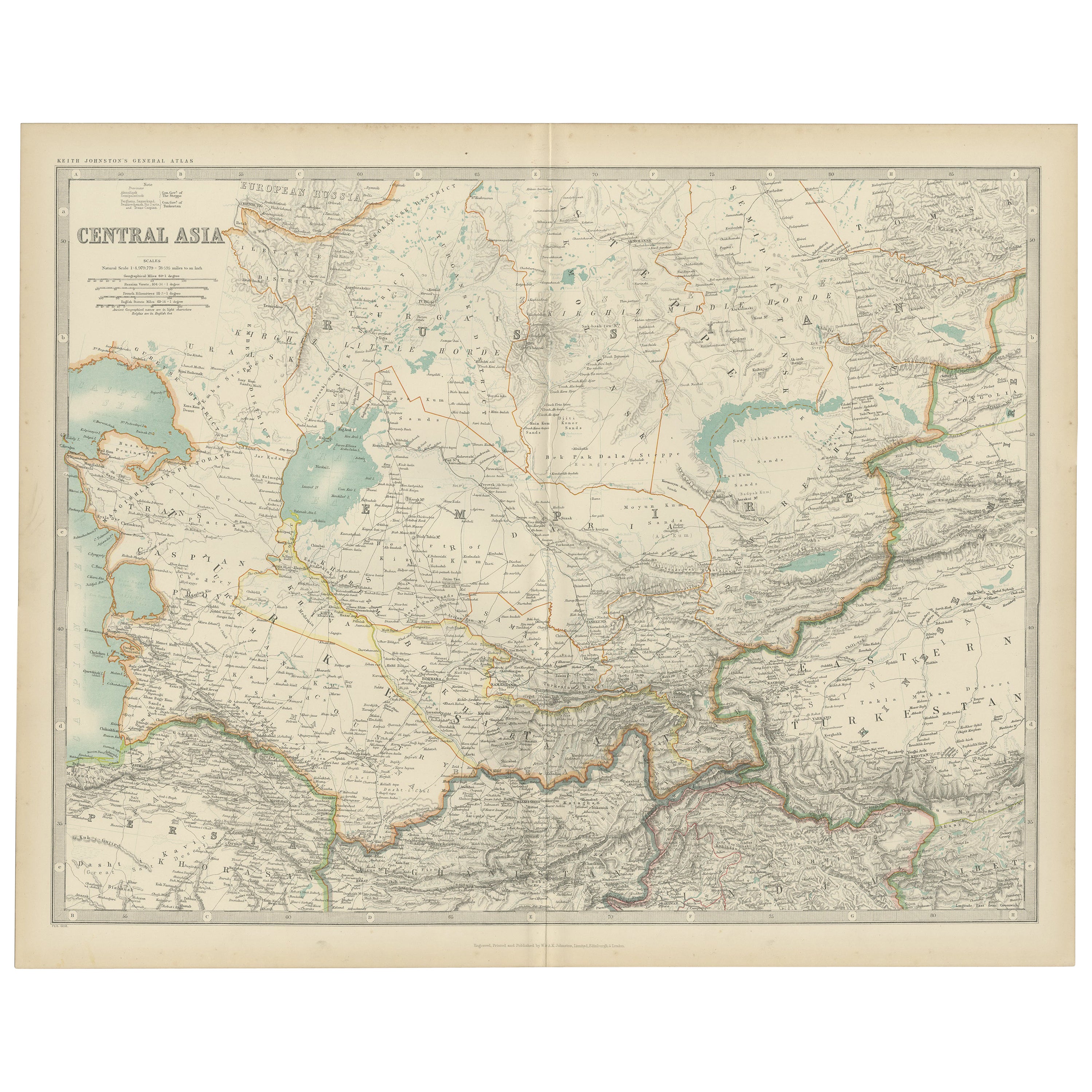
Antique Map of Central Asia by Johnston '1909'
Located in Langweer, NL
Antique map titled 'Central Asia'. Original antique map of Central Asia. This map originates from the ‘Royal Atlas of Modern Geography’. Published by W. & A.K. Johnston, 1909.
Category
Early 20th Century Maps
Materials
Paper
$239 Sale Price
20% Off
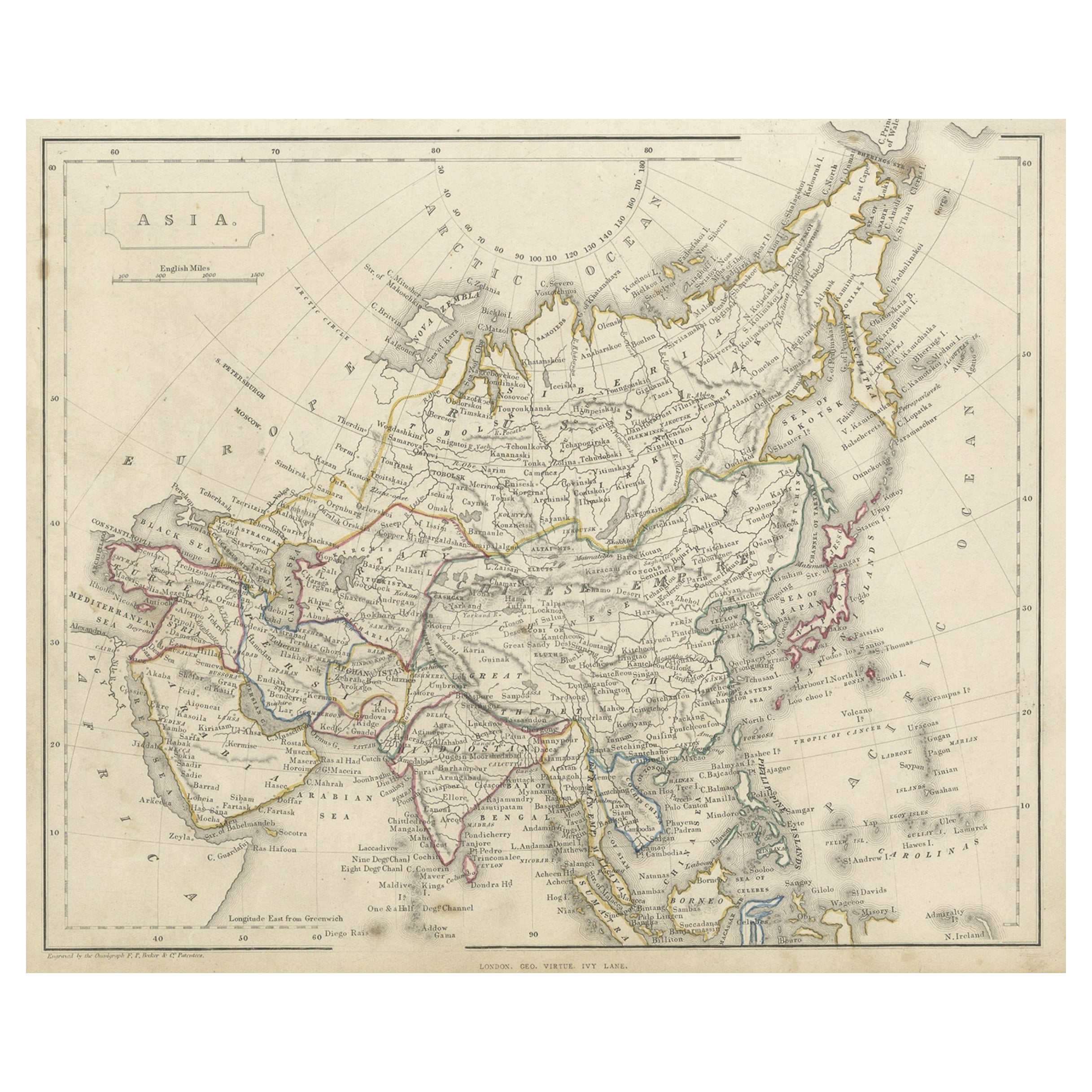
Antique Steel Engraved Map of Asia, c.1860
Located in Langweer, NL
Antique map titled 'Asia'. Steel engraved map of Asia by F. P. Becker & Co.
Artists and Engravers: Engraved by F.P. Becker & Co. Published in London.
Condition: Very good, gen...
Category
Antique 19th Century Maps
Materials
Paper
$75 Sale Price
20% Off
Antique Map of Afghanistan and Surroundings, '1845'
Located in Langweer, NL
Antique map titled 'Map of Persia and Caubul'. Original antique map of Afghanistan and surroundings.
This map originates from 'An Atlas of the World, Comprehending Separate Maps of...
Category
Antique Mid-19th Century Maps
Materials
Paper

$191 Sale Price
20% Off
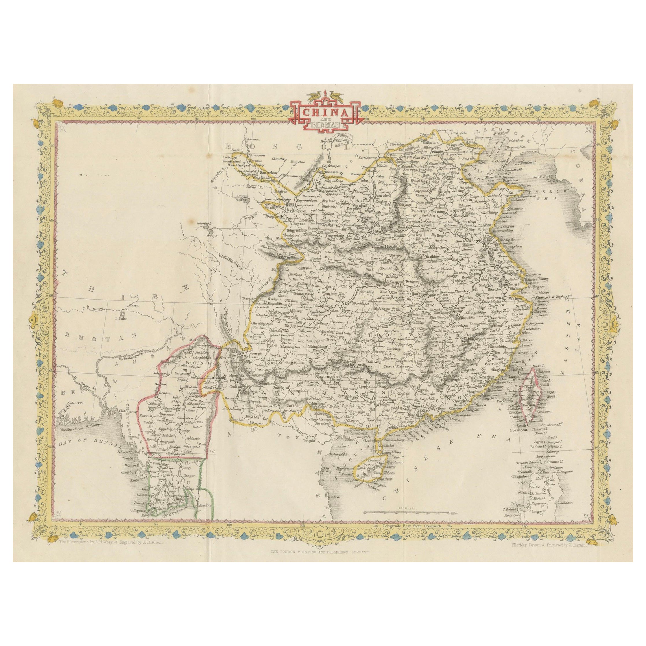
1851 Tallis Map of China with Tibet, Formosa, and Burma – Engraved by J. Rapkin
Located in Langweer, NL
Title: 1851 Tallis Map of China with Tibet, Formosa, and Burma – Engraved by J. Rapkin
Description: This is a finely engraved and delicately hand-colored map of China, published a...
Category
Antique 1850s Maps
Materials
Paper
$326 Sale Price
20% Off
You May Also Like
Large Original Antique Map of Asia by Sidney Hall, 1847
Located in St Annes, Lancashire
Great map of Asia
Drawn and engraved by Sidney Hall
Steel engraving
Original colour outline
Published by A & C Black. 1847
Unframed
Free shipping
Category
Antique 1840s Scottish Maps
Materials
Paper

Large Original Antique Map of Afghanistan. Edward Weller, 1861
Located in St Annes, Lancashire
Great map of Afghanistan
Lithograph engraving by Edward Weller
Original colour
Published, 1861
Unframed
Good condition
Category
Antique 1860s English Victorian Maps
Materials
Paper

Original Antique Map of China, Arrowsmith, 1820
Located in St Annes, Lancashire
Great map of China
Drawn under the direction of Arrowsmith
Copper-plate engraving
Published by Longman, Hurst, Rees, Orme and Brown, 1820
Unfr...
Category
Antique 1820s English Maps
Materials
Paper

Antique 1803 Italian Map of Asia Including China Indoneseia India
Located in Amsterdam, Noord Holland
Antique 1803 Italian Map of Asia Including China Indoneseia India
Very nice map of Asia. 1803.
Additional information:
Type: Map
Country of Manufacturing: Europe
Period: 19th centu...
Category
Antique 19th Century European Maps
Materials
Paper

$584 Sale Price
20% Off
Super Rare Antique French Map of Chine and the Chinese Empire, 1780
Located in Amsterdam, Noord Holland
Super Rare Antique French Map of Chine and the Chinese Empire, 1780
Very nice map of Asia. 1780 Made by Bonne.
Additional information:
Type: Map
...
Category
Antique 18th Century European Maps
Materials
Paper

$584 Sale Price
33% Off
Original Antique Map of The Eastern Hemisphere by Dower, circa 1835
Located in St Annes, Lancashire
Nice map of the Eastern Hemisphere
Drawn and engraved by J.Dower
Published by Orr & Smith. C.1835
Unframed.
Free shipping
Category
Antique 1830s English Maps
Materials
Paper

More Ways To Browse
Tibet Antiques
Antique Navigational Tools
Antique German Compass
Key Trade Sign
Spanish Galleon
World Map Of Trade Routes
Antique Puerto Rico
Albanian Antique
Antique Furniture Wiltshire
Antique Maps Of Israel
Framed Africa Maps
Antique Furniture Goa
Croatian Antiques
Map Of Israel
Teak Sphere
18th Century Scottish Collectibles
Map Of Mexican California
Ottoman Map