Baroque Maps

BAROQUE STYLE

The decadence of the Baroque style, in which ornate furnishings were layered against paneled walls, painted ceilings, stately chandeliers and, above all, gilding, expressed the power of the church and monarchy through design that celebrated excess. And its influence was omnipresent — antique Baroque furniture was created in the first design style that truly had a global impact.

Theatrical and lavish, Baroque was prevalent across Europe from the 17th to mid-18th century and spread around the world through colonialism, including in Asia, Africa and the Americas. While Baroque originated in Italy and achieved some of its most fantastic forms in the late-period Roman Baroque, it was adapted to meet the tastes and materials in each region. French Baroque furniture informed Louis XIV style and added drama to Versailles. In Spain, the Baroque movement influenced the elaborate Churrigueresque style in which architecture was dripping with ornamental details. In South German Baroque, furniture was made with bold geometric patterns.

Compared to Renaissance furniture, which was more subdued in its proportions, Baroque furniture was extravagant in all aspects, from its shape to its materials.

Allegorical and mythical figures were often sculpted in the wood, along with motifs like scrolling floral forms and acanthus leaves that gave the impression of tangles of dense foliage. Novel techniques and materials such as marquetry, gesso and lacquer — which were used with exotic woods and were employed by cabinetmakers such as André-Charles Boulle, Gerrit Jensen and James Moore — reflected the growth of international trade. Baroque furniture characteristics include a range of decorative elements — a single furnishing could feature everything from carved gilded wood to gilt bronze, lending chairs, mirrors, console tables and other pieces a sense of motion.

Find a collection of authentic antique Baroque tables, lighting, decorative objects and other furniture on 1stDibs.

to
9
4
13
79
35
19
6
5
4
4
4
3
1
1
12
1
13
3
1
1
13
8
7
2
2
13
13
13
1
Style: Baroque
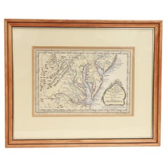
Antique Map of Virginia & the Chesapeake Bay by Jacques-Nicolas Bellin, c. 1750
Located in Philadelphia, PA
A fine antique 18th century French map of North America. By Jacques-Nicolas Bellin. On laid paper with polychrome highlights. Depicting Virginia, the Chesapeake Bay, and the nearb...
Category

18th Century French Antique Baroque Maps

Materials

Paper

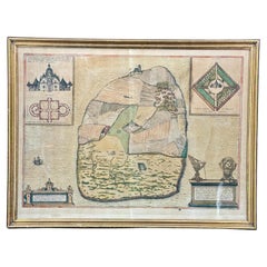
16th Century Antique Map of Ven Framed in Gold
Located in Haddonfield, NJ
Ven (older Swedish spelling Hven), is a Swedish island in the Öresund strait laying between Skåne, Sweden and Zealand and Denmark. The island was historically under Danish rule. Dani...
Category

16th Century Danish Antique Baroque Maps

Materials

Wood, Paper

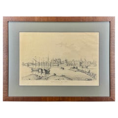
19th Century Reprint of 16th Century Harbor Map of Copenhagen
Located in Haddonfield, NJ
This reprint of 1587 antique map of Copenhagen, Denmark retains its original mid-century mat and has been recently reframed in classic wood frame. The muted sepia colored map is a wo...
Category

1880s Danish Antique Baroque Maps

Materials

Wood, Paper

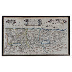
Map Holy Promise Land Canaan Richard Palmer Richard Blome 1687 Joseph Moxon
Located in BUNGAY, SUFFOLK
Canaan comonly called the Holy Land or the Land of Promise, being the Possesion of the Israelites & travelled through by Our Lord & Saviour Iesus Christ and his Apostles. Engraven by Richard Palmer for Richard Blome. 1687 Blome, Richard, 1641-1705. London. 283 x 452 mm. Copperplate. Probably from an English Bible...
Category

17th Century British Antique Baroque Maps

Materials

Paper

Map Road John Ogilby Britannia No 74 Ipswich to Norwich Cromer Framed
Located in BUNGAY, SUFFOLK
The Road from Ipswich com Suffolk to Norwich and thence to cromer on the sea coast com Norfolk. By John Ogilby, Esq, His Majesties Cosmographer. Containing...
Category

1670s English Antique Baroque Maps

Materials

Paper

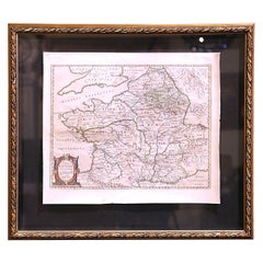
17th Century Framed Map of Ancient France Titled "Typus Galliae Veteris"
Located in Dallas, TX
Decorate an office or a library with this elegant historic map. Crafted in the Netherlands circa 1630, this beautifully framed antique map with pr...
Category

17th Century Dutch Antique Baroque Maps

Materials

Glass, Giltwood, Paper

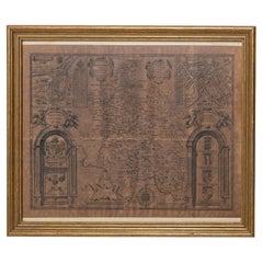
Buckingham Both Shyre and Shire John Speed 1610 Gilded Frame
Located in BUNGAY, SUFFOLK
Just purchased more information to follow. In unrestored condition, the sheet can be cleaned.
Category

17th Century English Antique Baroque Maps

Materials

Paper

Road Map John Ogilby No 75 Kings Lyn Harwich, Britannia Framed Wallhanging
Located in BUNGAY, SUFFOLK
The Road from Kings Lyn Co Norfolk to Harwich Co Essex. By John Ogilby His Majesties Cosmographer. Containing 76 miles, 1 furlong. From Lyn to Swaffam, to Stanford, to Thetford, To Icksworth, to Stowmarket, to Ipswich and to Harwich including ye Ferry, No 75, inscribed in pencil 1698 Hand colored and floated in the original black and gold frame, c1961. Some creasing commensurate with age. The back of the frame inscribed May 1961. Provenance : Private Collection, acquired c1961, along with No 74 Ipswich to Norwich & No 54 London to Yarmouth. All in the original black and gold frames. Sheet width 45cm., 17 ¾”., height 34.5cm., 13 ½“ Frame width 50cm 19 ¾”., height 40cm., 15 ¾” Literature: In a remarkable life John Ogilby pursued, several careers, each ending in misfortune, and yet he always emerged undeterred, to carry on. His modern reputation is based on his final career, started in his sixty-sixth year, as a publisher of maps and geographical accounts. Ogilby was born outside Dundee, in 1600, the son of a Scottish gentleman. While he was still a child, the family moved to London. When the elder Ogilby was imprisoned for debt, the young John invested his savings in a lottery, won a minor prize, and settled his father's debts. Unfortunately, not enough money was left to secure John a good apprenticeship; instead, he was apprenticed to a dance master. Ogilby was soon dancing in masques at court but, one day, while executing a particularly ambitious leap, he landed badly. The accident left him with a permanent limp, and ended his dancing career. However, he had come to the attention of Thomas Wentworth, later Earl of Strafford, Charles I's most senior minister. Ever one to exploit his contacts, Ogilby became a dance instructor in Strafford's household. When Strafford was sent to Ireland, Ogilby accompanied him as Deputy-Master of the Kings Revels, and then Master of Revels. In Dublin, he built the New Theatre, in St. Werburgh Street, which prospered at first, but the Irish Rebellion, in 1641, cost Ogilby his fortune, which he estimated at £2,000, and almost his life. After brief service as a soldier, he returned to England, survived shipwreck on the way, and arrived back penniless. On his return, Ogilby turned his attention to the Latin classics, as a translator and publisher. His first faltering attempt, in 1649, was a translation of the works of Virgil, but after his marriage to a wealthy widow the same year, his publishing activities received a considerable boost. One means by which Ogilby financed these volumes was by subscription, securing advance payments from his patrons, in return for including their name and coats-of-arms on the plates of illustrations. Another approach was to secure a patron, preferably in the court circle. Ogilby's first patron was Strafford, who found out too late that all leading ministers are dispensable when Charles I assented to his execution in 1641. As he re-established himself, Ogilby sought a new patron, the King himself. In 1661, Ogilby was approached to write poetry for Charles II's coronation procession; he later published 'The Relation of His Majesties Entertainment Passing Through the City of London', and a much enlarged edition the following year, which included a Fine set of plates depicting the procession. Royal favour was bestowed in 1674 when John Ogilby received the title of 'His Majesty's Cosmographer and Geographick Printer' with a salary of £13.6s.8d per annum. In 1665, Ogilby left London to avoid the Plague then ravaging the capital. The following year, in the Great Fire of London, Ogilby claimed that he lost his entire stock of books valued at some £3,000, as well as his shop and house, leaving him worth just £5. As he sought to restore his fortunes, Ogilby was already looking in new directions. The initial opportunity he seized on was the reconstruction of London's burnt-out centre. He secured appointment as a 'sworn viewer', whose duty was to establish the property boundaries as they existed before the Fire. Ogilby was assisted in the project by his step-grandson, William Morgan...
Category

1670s European Antique Baroque Maps

Materials

Paper

Map Road Strip Britannia Sheet 2 John Ogilby London Aberistwith Islip Bramyard
Located in BUNGAY, SUFFOLK
From John Ogilby's, 'Britannia, an Illustration of the Kingdom of England and Dominion of Wales'. First published in 1675 it remains the greatest advance ...
Category

17th Century English Antique Baroque Maps

Materials

Paper

Road Map, John Ogilby, No 54, London, Yarmouth, Britannia
Located in BUNGAY, SUFFOLK
The Road from London to Yarmouth com. Norfolk. By John Ogilby, His Majesties Cosmographer. Containing 122 miles, 5 furlongs. No 54. From Standard in Co...
Category

1670s English Antique Baroque Maps

Materials

Paper

Road Map John Ogilby London St David's Britannia No 15 Abingdon Monmouth Framed
Located in BUNGAY, SUFFOLK
John Ogilby (British 1600-1676) Cosmographer and Geographick Printer to Charles II. A road map from Britannia, 1675/6. No 15. The continuation of the r...
Category

1670s English Antique Baroque Maps

Materials

Paper

Road Map, John Ogilby, London, Barwick, York, Chester, Darlington, Durham Framed
Located in BUNGAY, SUFFOLK
The continuation of the road from London to Barwick beginning at York and extending to Chester in ye Street. Plate ye 4th continuing 76 ½ miles. No 8. York to Burrowbridge, to Top...
Category

1670s English Antique Baroque Maps

Materials

Paper

Countye of Monmouth, Dated 1610
Located in BUNGAY, SUFFOLK
The countye of Monmouth with the situation of the townshire described Anno, 1610 The reverse with Monmouthshire, Chapter VI and an alphabetical list of towns. In a beautiful Flemish oak polished and gilded frame Cartographer: John Speed...
Category

1610s English Antique Baroque Maps

Materials

Paper

Related Items
Bronze Pax or Pax Board, 16th Century
Located in Madrid, ES
Paper holder bronze. 16th century. Portapaz made of bronze with a flat handle in "that" on the back that presents a decoration in light relief framed in an architectural composition of classic taste. Under the columns of the sides two heraldic shields are presented; the center shows a Birth of Christ under a winged dome with heads of winged angels in the corners; flanked by two birds, at the top and under a semicircular arch, is the bust of Saint Dominic...
Category

16th Century Spanish Antique Baroque Maps

Materials

Bronze

Bronze Pax or Pax Board, 16th Century
H 5.52 in W 4.14 in D 1.78 in
Antique Map of Palestine or The Holy Land, 1903, with Biblical Details
Located in Langweer, NL
Title: Antique Map of Palestine or The Holy Land, 1903, with Biblical and Geographical Details Description: This antique map, titled "Palestine or The Holy Land," was engraved and p...
Category

Early 20th Century Baroque Maps

Materials

Paper

Antique 16th Century German (Augsburg) parcel-gilt Silver-Gold Chalice/Goblet
Located in Doha, QA
This is an absolutely exquisite rare Cooper-gilt ,silver-gold and three Sterling Silver angels Chalice originated from Augsburg (Germany ) in th...
Category

16th Century German Antique Baroque Maps

Materials

Gold, Silver, Copper

16th Century Italian Renaissance Carving of a Male Saint
Located in Stamford, CT
16th century Italian carved and polychromed figure of a male saint or prophet with a wonderful presence. Shown holding an open book in his right hand with flames at his feet, mid-16t...
Category

16th Century Italian Antique Baroque Maps

Materials

Wood

Frame with Vellum Painting, 17th Century
Located in Madrid, ES
Carved and gilded frame with painting on vellum, "Virgin of the Rosary with Santo Domingo de Guzmán and Santa Catalina of Siena", 17th century. Registration in the back zone (Mr. Jos...
Category

17th Century European Antique Baroque Maps

Materials

Leather, Wood, Paint

Frame with Vellum Painting, 17th Century
H 13 in W 14.57 in D 3.94 in
16th-Century Map of the Ottoman Empire and Near East: Turcici Imperii Descriptio
Located in Langweer, NL
Title: Original 16th-Century Map of the Ottoman Empire and Near East: *Turcici Imperii Descriptio* by Ortelius, 1571 This rare copperplate engraving, Turcici Imperii Descriptio, i...
Category

16th Century Antique Baroque Maps

Materials

Paper

Sebastian Münster's 16th Century Map of the British Isles, ca.1590
Located in Langweer, NL
GREAT BRITAIN -- "ENGELLANDT mit dem anstossenden Reich Schottlandt so vorzeiten Albion und Britannia haben geheissen". (Basel, c. 1590). Partly handcolored woodcut double-page map from S. Munster's 'Cosmographey'. 330 x 408 mm. (Lower margin cut short (touching the line), tiny hole in upper margin, sl. foxed/browned, lower right corner a bit thumbed). Sebastian Münster's 16th Century Map of the British Isles from 'Cosmographia Universalis...
Category

16th Century Antique Baroque Maps

Materials

Paper

1709 Map of the Holy Land - Twelve Tribes of Israel, Hand-Colored, Antique Map
Located in Langweer, NL
This is a beautiful 1709 map of the Holy Land, titled "Iudaea seu Terra Sancta quae Hebraeorum sive Israelitarum in suas duodecim Tribus divisa," by Guillaume Sanson and Alexis Huber...
Category

Early 1700s Antique Baroque Maps

Materials

Paper

John Baeder’s Road Well Taken Book by Jay Williams
Located in New York, NY
John Baeder’s Road Well Taken By: Jay Williams Echoing Paul Gauguin’s momentous decision of a century earlier, John Baeder, in 1972, suddenly made up his mind to forgo the growing riches of a career on Madison Avenue to become a full-time painter. With little more to bank on than an offer by the legendary Ivan Karp of a future show at his New York gallery, Baeder bravely gambled his livelihood on Karp’s evaluation of his first four efforts at serious painting: a diner, a motel, a gas station, a tourist camp. “They were works of cultural consequence, . . . works of visual power.” Based on color-postcards in his growing collection of roadside memorabilia, John had made blow-ups of the cards “to see what they’d look like as paintings.” It was a bold, inventive move, but typical Baeder as he continued to lay the groundwork for what soon became known, through his efforts, as “Diner Culture.” And his masterful technique inevitably put him at the forefront of the growing photo-realist movement, along with Ralph Goings and Richard Estes. Baeder’s paintings, particularly of vintage diners...
Category

21st Century and Contemporary Baroque Maps

Materials

Paper

16th Century Map of Saudi Arabia, the Persian Gulf and Red Sea, ca. 1574
Located in Langweer, NL
Ptolemaic map of the Arabian Peninsula based on the 1548 map of Giacomo Gastaldi. It covers nearly all of the peninsula, but does not include the head of the Red Sea. The coastlines ...
Category

16th Century Antique Baroque Maps

Materials

Paper

French 17th Century Baptismal Font
Located in Round Top, TX
A very beautiful 17th century Baptismal Font from the South of France beautifully carved from marble. Minimalist lines give this piece a calming feel. Wil...
Category

17th Century French Antique Baroque Maps

Materials

Marble

Original 16th Century Engraving of a Medieval Tournament, ca.1578
Located in Langweer, NL
Antique print titled 'Das rennen und stechen'. Engraving of a Medieval tournament. This print originates from 'Thurnier Buch. Von Anfang, Ursachen, ursprung und herkommen (..)' b...
Category

16th Century Antique Baroque Maps

Materials

Paper

Previously Available Items
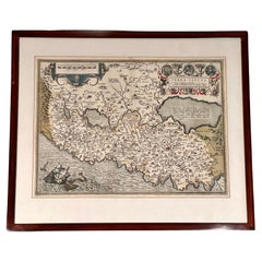
"Terra Sancta" Map of the Holy Land by Abraham Ortelius (1527-1598) Framed
Located in San Francisco, CA
Abraham Ortelius (1527-1598) was a cartographer, geographer and map maker from Antwerp in the Spanish Netherlands. He created the first modern atlas, titled in Latin "Theatrum Orbis ...
Category

17th Century Belgian Antique Baroque Maps

Materials

Paper

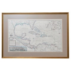
West-Indies Herman Moll William Paterson Spanish Trade Routes Gold
Located in BUNGAY, SUFFOLK
A rare map of the West-Indies or the islands of America in the North Sea with ye adjacent countries explaining what belongs to Spain, England, France, Holland &c also ye Trade Winds and ye several Tracts made by ye Galeons and flota from place to place. Wil Paterson this map of the West-Indies is most humbly dedicated by Her. Moll geographer. According to ye newest and most exact observations by Herman Moll Geographer. Map of the Caribbean islands including southern North America, Mexico, Central America, and northern South America. Inset at lower left: The City of Mexico in New Spain. Derived from a view in an unpublished atlas by Johannes Vingboons 1628. This image was probably copied from a map by Juan Gomez de Trasmonte, supervisor of the construction of a drainage system for Mexico city in 1628. Kagan, Urban images of the Hispanic world, fig. 4.23 Insets at upper right: La Vera Cruz; A Draught of the Bay and Citty of Havana Cuba; The Bay of Porto Bella; A Draught of ye Citty of Cartagena; A Draught of St. Augustin Saint Augustine, Florida. Artist : Herman Moll d. 1732. Bibliography : A new and compleat atlas, London, 1708-1720 Hermand Moll. Provenance: Private collection. In a buff mount and gilded frame with green highlight. Maps are generally framed in insigificant frames so that the attention is soley on the map. This map could easily be reframed depending on how and where it will be hung and there are many different choices. Frame size height 56 cm., 22" length 84 cm., 33". This is a map that reveals Moll both as an astute political observer and thinker, and tactian. This map of the West Indies is full of commercially sensitive information about the Spanish gold runs, and it is entirely feasible that the map was deliberately suited as a guide to English piracy and privateering in the West Indies. Through his London connections, Moll knew of two prominent English pirates or privateers: Woodes Rogers and William Dampier...
Category

18th Century Central American Antique Baroque Maps

Materials

Paper

Antique 18th Century Map of Mexico and Central America by Robert DeVaugody
Located in Philadelphia, PA
A fine antique printed & hand colored map. By Robert DeVaugody, Published in the Atlas Portrait Universel, Paris, 1749 Matted and ready for framing. Simply a wonderful 18th Century Mexican map...
Category

1740s French Antique Baroque Maps

Materials

Paper

Antique Framed Hand Colored Map of the Americas by Frederick De Wit, circa 1675
Located in Morristown, NJ
Frederick De Wit (Dutch, 1629-1706), "Novissima et Accuratissima totius Americae Descriptio", hand-colored map engraving of North and South America with California depicted as an island, decorated with images of Native Americans and indigenous flora and fauna, framed under glass, 19.5"h x 23"l (sheet), 22.5"h x 1.75"d x 26"w (frame), From the collection of an NY corporation. A fine example of De Wit’s map of the Americas, first published ca. 1675. This map is fascinating. It was the first Dutch map to include all five Great Lakes; Lac Superieur (Lake Superior), Lac des Puans (Lake Michigan), Mare Dulce (Lake Huron...
Category

1670s Dutch Antique Baroque Maps

Materials

Glass, Wood, Giltwood, Paint, Paper

Celestial Maps, Set of Four, Ignace Gaston Pardies
By Ignace Gaston Pardies
Located in Pasadena, CA
This is a rare set of four of a complete set of six 17th century Gaston Ignace Pardies*** (1636-1673) Celestial Maps. The folios were colored contemporan...
Category

17th Century French Antique Baroque Maps

Materials

Paper

Baroque maps for sale on 1stDibs.

Find a broad range of unique Baroque maps for sale on 1stDibs. Many of these items were first offered in the 18th Century and Earlier, but contemporary artisans have continued to produce works inspired by this style. If you’re looking to add vintage maps created in this style to your space, the works available on 1stDibs include more furniture and collectibles, wall decorations and other home furnishings, frequently crafted with paper and other materials. If you’re shopping for used Baroque maps made in a specific country, there are Europe, United Kingdom, and England pieces for sale on 1stDibs. While there are many designers and brands associated with original maps, popular names associated with this style include and Herman Moll. It’s true that these talented designers have at times inspired knockoffs, but our experienced specialists have partnered with only top vetted sellers to offer authentic pieces that come with a buyer protection guarantee. Prices for maps differ depending upon multiple factors, including designer, materials, construction methods, condition and provenance. On 1stDibs, the price for these items starts at $1,926 and tops out at $6,421 while the average work can sell for $2,568.

Recently Viewed

View All