Industrial Maps

INDUSTRIAL STYLE

Industrial floor lamps, bar stools, desks and other industrial-style furnishings have experienced a resurgence in popularity with the rise of interest in minimalist design.

It's a look that celebrates the past even as it suggests vigor, productivity and brawn. The newly chic industrial style of decor repurposes the simple, sturdy furniture of an earlier world of commerce — brushed-metal storage cabinets and display shelves, task lamps and pendant lights with enameled shades, work tables with worn wooden tops and cast-iron bases — and couples them with aesthetic touches emblematic of energy and optimism, from bright upholstery fabrics to flowers.

The rise in prominence of the industrial style has come hand-in-hand with the residential repurposing of former manufacturing and warehouse districts throughout the United States, Canada and Europe. In many loft apartments created in shuttered factories, the architectural envelope has been left intact.

Industrial-style interiors feature elements like raw brick walls, exposed steel beams and oak floors whose history is written in every pit and gouge. Iron and glass transom windows give definition and interest to small kitchen areas anchored by kitchen islands made of marble, steel and brass, while taxidermy or vintage neon signs serve as wall art in living rooms dotted with leather club chairs. Patina is the keynote to a decor in sync with such surroundings. 

On 1stDibs you will find industrial furniture designs that wear their age beautifully — and were built to last.

to
1
3
1
4
76
35
18
13
6
5
4
4
3
1
1
4
3
1
1
1
2
2
1
1
1
2
2
1
1
4
4
4
1
1
Style: Industrial
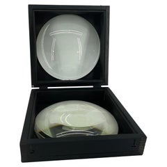
Large European 1930's Nautical Map Reader Magnifying Glass
Located in Haddonfield, NJ
This European set of two nautical magnifying glass map-readers are quite unusual and rarely found. It is fully encased in it's heavy wooden and metal enforced box. Hailing from betwe...
Category

1930s German Vintage Industrial Maps

Materials

Metal

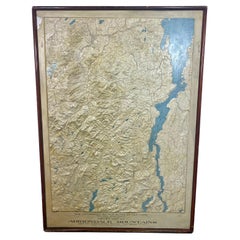
Rare and Early Plaster Relief Map of Adirondack Mountains by F J H Merrill
By E. W. Merrill, P.F. Howells
Located in Buffalo, NY
Rare and Early Monumental Plaster Relief Map of Adirondack Mountains by The University of the State of New York, New York State Museum..F J H Merrill director,,,modeled by Howell's ...
Category

1910s American Vintage Industrial Maps

Materials

Plaster, Wood

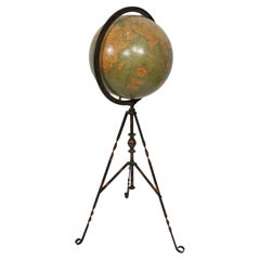
Antique Webber Costello Globe on Metal Tripod Base c 1900 / 1920's
Located in New York, NY
Rare floor model globe made by Weber Costello, circa 1900. The 12" globe rests on a folding metal base. This example is in very good, original condition, showing only light wear, nor...
Category

Early 20th Century American Industrial Maps

Materials

Metal

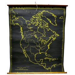
University Chart “Black Map of North America
Located in Godshill, Isle of Wight
University Chart “Black Map of North America W&A K Johnston’s Charts of Physical Maps By G W Bacon, This is a Black Physical map of North A...
Category

Early 20th Century Industrial Maps

Materials

Linen

Related Items
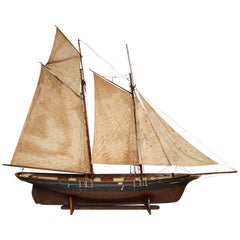
Massive Merchant Schooner Model
Located in Greenwich, CT
Impressive and rare example of a model English merchant sailing vessel, circa 1860, that plied the China Trade from England to Hong Kong. The ship has the sail rig of the Sandy Hook pilot boats...
Category

1860s English Antique Industrial Maps

Materials

Linen, Wood

Massive Merchant Schooner Model
$24,000
H 97 in W 128 in D 18 in
Rare Antique Map of Southwestern Europe and West Africa by V.M. Coronelli, 1692
Located in Langweer, NL
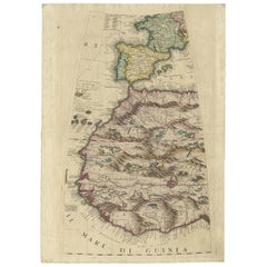
Antique Globe Gore: Southwestern Europe and West Africa by Vincenzo Coronelli This exquisite, hand-colored globe gore by Vincenzo Coronelli, one of the most renowned 17th-century cartographers, represents Southwestern Europe and West Africa. A segment of Coronelli's monumental 42-inch terrestrial globe, this gore is a remarkable example of the artistry and geographical knowledge of the late 1600s. Covering France, the Iberian Peninsula, and all of Africa west of a line extending from Algeria to the Bight of Benin, it also includes the Canary Islands and Madeira. Coronelli’s globe gores are celebrated for their exceptional engraving and accuracy, and this piece is no exception. The coastline of Africa is depicted with remarkable precision for its time, reflecting the latest geographical knowledge of European explorers. In contrast, the interior of Africa—still a mystery to European mapmakers—features mythical elements such as fantastical mountain ranges and exotic fauna. Giraffes, elephants, lions, and mysterious giant birds populate the landscape, offering a glimpse into the imagination and curiosity of the era. One notable detail is the Gambia...
Category

Late 17th Century Antique Industrial Maps

Materials

Paper

Rare Antique Map of Southwestern Europe and West Africa by V.M. Coronelli, 1692
$2,315 Sale Price
20% Off
H 19.3 in W 13.59 in D 0.02 in
Antique Hammond's 6-Inch Terrestrial Globe on Stand
Located in Philadelphia, PA
Offered here for your consideration is, A fine antique 6-inch terrestrial globe. Additional Details: By C.S. Hammond & Co. The globe likely dates from 1927 to 1930 due to the ...
Category

20th Century Unknown Industrial Maps

Materials

Wood, Paper

Large Scale Hand Crafted Sail Boat Model
Located in Douglas Manor, NY
3-569 Hand crafted sail boat model on base.
Category

1960s Vintage Industrial Maps

Materials

Canvas, Hardwood

Large Scale Hand Crafted Sail Boat Model
$1,400
H 32 in W 33 in D 5 in
1846 "North America" Map, Engraved by I. Dower
Located in Colorado Springs, CO
Presented is an original 1846 map of “North America.” The map was drawn and engraved by I. Dower and published in London by Orr & Company. The map depicts North America, to include G...
Category

1840s English Antique Industrial Maps

Materials

Paper

1846 "North America" Map, Engraved by I. Dower
$950
H 16.25 in W 13.75 in D 0.75 in
American Nautical Brass Yacht Binnacle Mounted in Mahogany Case, Circa 1890
Located in Charleston, SC
American nautical mahogany yacht binnacle with a hinged locking oval glass viewing port, original removable brass side light burner with font, brass carrying handle, and fitted with ...
Category

1890s American Antique Industrial Maps

Materials

Brass

American Cast Brass Engraved Yachtsman's Speaking Trumpet, Circa 1830
Located in Charleston, SC
American hand held cast brass engraved Yachtsman's speaking trumpet with bell shaped soldered mouthpiece, coned-shaped column with original interior red paint, and terminating on a r...
Category

1830s American Antique Industrial Maps

Materials

Brass

Antique Map of North America by Johnston, 1882
Located in Langweer, NL
Antique map titled 'North America'. Old map of North America. This map originates from 'The Royal Atlas of Modern Geography, Exhibiting, in a Series of Entirely Original and Authen...
Category

19th Century Antique Industrial Maps

Materials

Paper

Antique Map of North America by Johnston, 1882
$212
H 24.18 in W 19.49 in D 0 in
Scale Nautical Vintage Model of an English Motorboat, 1950s
Located in Milan, IT
Scale model of an English motorboat (antique motor yacht) from the 1950s, wooden planking hull. Measures: Length 57 cm, 23.44 inches, width 13.5 cm, 5.3 ...
Category

1950s British Vintage Industrial Maps

Materials

Wood

Antique Map of North America, 1821
Located in Langweer, NL
Antique map of America titled 'Carte de l'Amerique septentrionale'. Scarce map of North America, shortly after the Louisiana Purchase and the first ...
Category

19th Century Antique Industrial Maps

Materials

Paper

Antique Map of North America, 1821
$614 Sale Price
20% Off
H 24.02 in W 18.12 in D 0 in
Folk Art Scratch Built Boat, Early 20th C
Located in London, GB
Scandinavian folk art boat of 2 rigged masts - completely scratch built from pine and teak wood. Original paint finish. Handmade and dating from the earl...
Category

Early 20th Century Scandinavian Industrial Maps

Materials

Steel

Folk Art Scratch Built Boat, Early 20th C
$666
H 23.63 in W 30.32 in D 10.24 in
Antique Map of North America by Lapie '1842'
Located in Langweer, NL
Antique map titled 'Carte de l'Amérique septentrionale'. Map of North America, with an inset map of the Aleutian Islands. This map originates from 'Atlas universel de géographie anci...
Category

Mid-19th Century Antique Industrial Maps

Materials

Paper

Antique Map of North America by Lapie '1842'
$567 Sale Price
20% Off
H 26.78 in W 19.89 in D 0.02 in
Previously Available Items
Large 1907 Vintage Relief Map of Africa by Atlas School Supply of Chicago
By Atlas School Supply
Located in Lafayette, IN
Remarkably original, 1907 Relief map of Africa by the Atlas School Supply Co. of Chicago, Illinois. This exceptional quality map features its original oak f...
Category

Early 20th Century American Industrial Maps

Materials

Oak, Paper

Large 1907 Vintage Relief Map of Europe by Atlas School Supply of Chicago
By Atlas School Supply
Located in Lafayette, IN
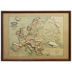
Remarkably original, 1907 Relief map of Europe by the Atlas School Supply Co. of Chicago, Illinois. This exceptional quality map features its original oak f...
Category

Early 20th Century American Industrial Maps

Materials

Oak, Paper

Large 1907 Vintage Relief Map of United States by Atlas School Supply of Chicago
By Atlas School Supply
Located in Lafayette, IN
Remarkably original, 1907 Relief map of the United States by the Atlas School Supply Co. of Chicago, Illinois. This exceptional quality map features its ori...
Category

Early 20th Century American Industrial Maps

Materials

Oak, Paper

Large 1907 Vintage Relief Map of World by Atlas School Supply of Chicago
By Atlas School Supply
Located in Lafayette, IN
Remarkably original, 1907 relief map of world by the Atlas School Supply Co. of Chicago, Illinois. This exceptional quality map features its original oak fr...
Category

Early 20th Century American Industrial Maps

Materials

Oak, Paper

Large 1907 Vintage Relief Map of Asia by Atlas School Supply of Chicago
By Atlas School Supply
Located in Lafayette, IN
Remarkably original, 1907 Relief map of Asia by the Atlas School Supply Co. of Chicago, Illinois. This is an exceptional quality map features its original o...
Category

Early 20th Century American Industrial Maps

Materials

Oak, Paper

1920s Double Sided Cartocraft Slated School Map, U.S.A. & World Denoyer Geppert
Located in Buffalo, NY
1920s Double Sided Cartocraft Slated School Map, One side depecting the United States, other side depecting the World, Made by Denoyer Geppert ,Pull down retractable, Slated material...
Category

1920s American Vintage Industrial Maps

Materials

Canvas, Wood

1923 Denoyer-Geppert School House Map of Africa
Located in Garnerville, NY
Amazing size and quality Denoyer-Geppert Map of Africa. Africa's strong colonial influences and exploiters are still fully evident and give a great history lesson. Belgian Kongo, Ita...
Category

1920s American Vintage Industrial Maps

Materials

Oak, Paper

Industrial maps for sale on 1stDibs.

Find a broad range of unique Industrial maps for sale on 1stDibs. Many of these items were first offered in the Mid-20th Century, but contemporary artisans have continued to produce works inspired by this style. If you’re looking to add vintage maps created in this style to your space, the works available on 1stDibs include more furniture and collectibles, folk art and other home furnishings, frequently crafted with metal, wood and other materials. If you’re shopping for used Industrial maps made in a specific country, there are North America, United States, and Europe pieces for sale on 1stDibs. While there are many designers and brands associated with original maps, popular names associated with this style include E. W. Merrill, and P.F. Howells. It’s true that these talented designers have at times inspired knockoffs, but our experienced specialists have partnered with only top vetted sellers to offer authentic pieces that come with a buyer protection guarantee. Prices for maps differ depending upon multiple factors, including designer, materials, construction methods, condition and provenance. On 1stDibs, the price for these items starts at $898 and tops out at $6,650 while the average work can sell for $2,200.

Recently Viewed

View All