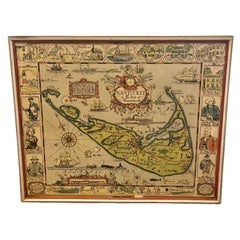
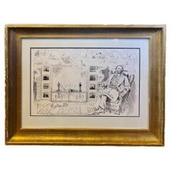
Tony Sarg Hand Colored Whimsical Map of Nantucket, circa 1926
View Similar Items


Want more images or videos?
Request additional images or videos from the seller
1 of 8
Tony Sarg Hand Colored Whimsical Map of Nantucket, circa 1926
$1,800List Price
About the Item
- Creator:Tony Sarg (Designer)
- Dimensions:Height: 15.5 in (39.37 cm)Width: 18.5 in (46.99 cm)Depth: 0.75 in (1.91 cm)
- Style:Folk Art (Of the Period)
- Materials and Techniques:
- Place of Origin:
- Period:
- Date of Manufacture:Circa 1926
- Condition:Wear consistent with age and use.
- Seller Location:Nantucket, MA
- Reference Number:Seller: AD - 292-25 IEA1stDibs: LU903942118802
About the Seller
5.0
Platinum Seller
Premium sellers with a 4.7+ rating and 24-hour response times
1stDibs seller since 2010
272 sales on 1stDibs
Typical response time: 1 hour
Authenticity Guarantee
In the unlikely event there’s an issue with an item’s authenticity, contact us within 1 year for a full refund. DetailsMoney-Back Guarantee
If your item is not as described, is damaged in transit, or does not arrive, contact us within 7 days for a full refund. Details24-Hour Cancellation
You have a 24-hour grace period in which to reconsider your purchase, with no questions asked.Vetted Professional Sellers
Our world-class sellers must adhere to strict standards for service and quality, maintaining the integrity of our listings.Price-Match Guarantee
If you find that a seller listed the same item for a lower price elsewhere, we’ll match it.Trusted Global Delivery
Our best-in-class carrier network provides specialized shipping options worldwide, including custom delivery.More From This Seller
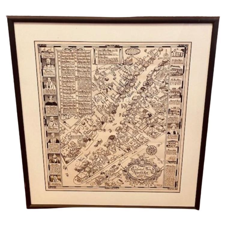
View AllTony Sarg Map of Nantucket Town, 1937
By Tony Sarg
Located in Nantucket, MA
Tony Sarg Map of Residential Main Street, Nantucket, 1937, a black and white printed map of our historic downtown area, with images of each building, street names and whimsical figur...
Category
Vintage 1930s American Other Maps
Materials
Paper

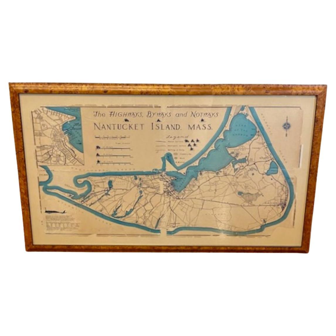
Nantucket High-Ways, By-Ways and Not-Ways Decorative Map by Tony Sarg, ca 1930
By Tony Sarg
Located in Nantucket, MA
Vintage Nantucket High-Ways, By-Ways and Not-Ways Decorative Map by Tony Sarg, (Nantucket: 1880 - 1942) circa 1930, a decorative tourist map of Nantucket Island with details of roadw...
Category
Vintage 1930s American Other Maps
Materials
Paper

Hand Colored Photograph of Nantucket Street Scene by Marshall Gardiner, Ca 1910
Located in Nantucket, MA
Antique Hand Colored Photograph of Nantucket Street Scene by Marshall Gardiner (1884-1942), circa 1910, a period hand tinted photograph entitled "Nantucket Shearing Cart and Quakers" showing classic grey shingled houses on a cobblestone paved street, with a couple in horse drawn cart riding away from the viewer, and four women on doorstep and sidewalk, all dressed in period Quaker attire. It is interesting to note that the couple in cart are seated on antique Nantucket Bow Back Windsor chairs. The photograph was titled and hand signed in pencil across the bottom of the old acid foxed mat; the photograph is now mounted in new archival acid free matting, and a photocopy of the original pencil inscription has been preserved on the reverse. The photograph itself remains in excellent condition.
H. Marshall Gardiner (1884-1942) was born on September 18, 1884 in Windsor, Ontario, and immigrated to the United States circa 1890, where his father W.H. Gardiner opened two photographic studios, one in Detroit during the winter months and a second at Mackinac Island during the more tourist-oriented summer months. Recognizing the potential of Florida's rapidly growing tourist trade, around 1894-95 he moved with his family from Detroit to Daytona, Florida which proved much more accommodating to the family's photographic business during the colder winter months.
Marshall learned many of his photographic techniques from his father prior to going out on his own at a relatively early age. Whereas his father generally used wet collodian negatives, technology had advanced to where he was able to use gelatin dry plates in his earlier years, and later the less expensive and much more convenient roll film. Another very important lesson learned from his father was strategy of setting up shop in a tourist resort. Early in his career he traveled to Bermuda where he shot a series of beautiful Bermuda scenes that he hand-colored and successfully sold over a number of years to the local tourist trade.
Around 1910, at the age of around 24, he first traveled to the island of Nantucket. The year-round population of Nantucket was then just over 2500, not nearly enough to sustain a photographic business for the entire year, so he opened a joint Photography and Art Supplies Store. Working as Nantucket's exclusive agent for Eastman Kodak, his business expanded to include the island's only photo-finishing service. However, with such a small year-round population, even the addition of a Gift Shop to compliment the hand-painted photographs, general portrait...
Category
Early 20th Century American Other Photography
Materials
Paper

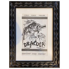
Original Program for Nantucket Stage Production Dracula, Signed by Edward Gorey
Located in Nantucket, MA
Original program for the Nantucket Stage Company Production of "Dracula", signed by Edward Gorey, 1973. The Nantucket Stage Company (which became the Stra...
Category
Vintage 1970s American Post-Modern Historical Memorabilia
Materials
Paper
Print of Nantucket Daydreams, by Henry S. Wyer, Nantucket, circa 1900
Located in Nantucket, MA
Antique Print of Nantucket Daydreams, by Henry S. Wyer, Nantucket, circa 1900, a period print depicting a gentleman in overstuffed wing chair by the hearth, a copy of Nantucket's "Inquirer and Mirror" open on lap, smoking a cigar and leaning back lost in thought: in the curls of smoke are simple sketches of many iconic Nantucket landmarks and views. Flanking the fireplace in place of tiles are a series of miniature copies of eight of H.S. Wyer's photographs. This is one of the rarest of antique Nantucket prints...
Category
Antique Early 1900s American Late Victorian Prints
Materials
Paper
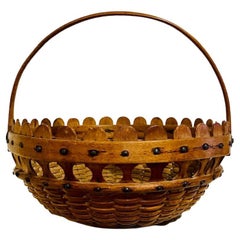
Nantucket "Double Lollipop" Basket, circa 1900
Located in Nantucket, MA
Antique and extremely rare Nantucket "double lollipop" basket, circa 1900, a shallow oval swing handled basket with carved wooden staves, handle and bottom plate, and cane weave. The...
Category
Antique Early 1900s American Folk Art Decorative Baskets
Materials
Cane, Wood
You May Also Like
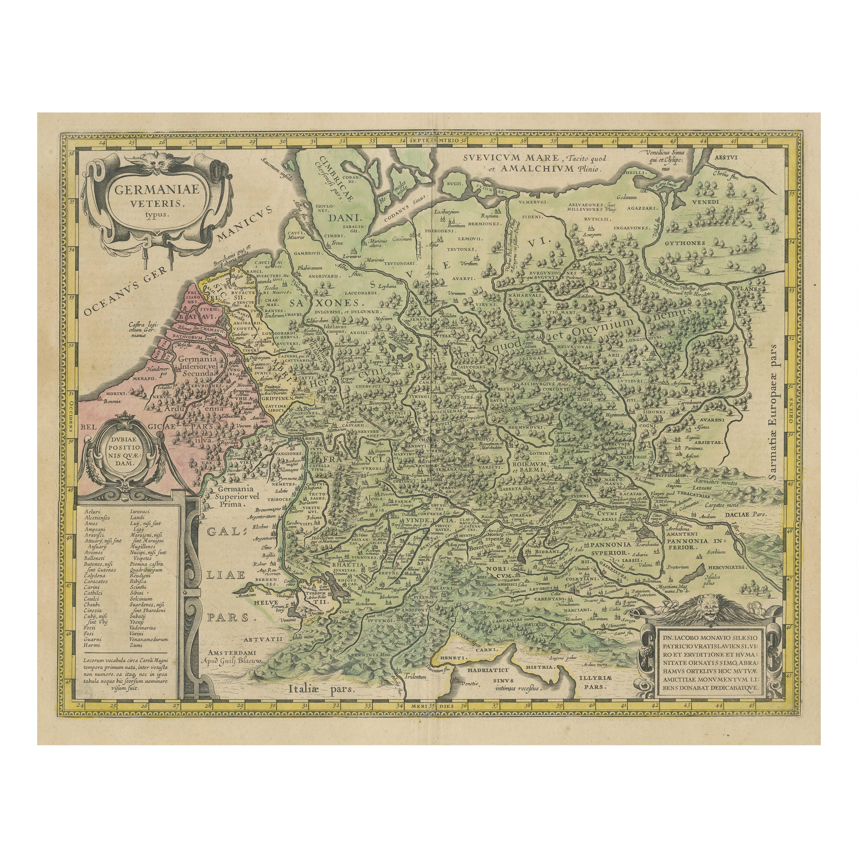
Original Hand-Colored Antique Map of Ancient Germany, circa 1630
Located in Langweer, NL
Antique map titled 'Germaniae Veteris typus'. Very attractive map of ancient Germany. Published by G. Blaeu after A. Ortelius, circa 1630.
Willem Jans...
Category
Antique Mid-17th Century Maps
Materials
Paper
$797 Sale Price
20% Off
Homann Heirs Map of France – Antique Hand-Colored, circa 1745
Located in Langweer, NL
Antique map titled 'Gallia Postarum geographice designata in qua Cursus Postarum Secundum Statum (..)'. Unusual postal map of France, with coat of arms. Very detailed map showing all...
Category
Antique Mid-18th Century German Maps
Materials
Paper

$379 Sale Price
20% Off
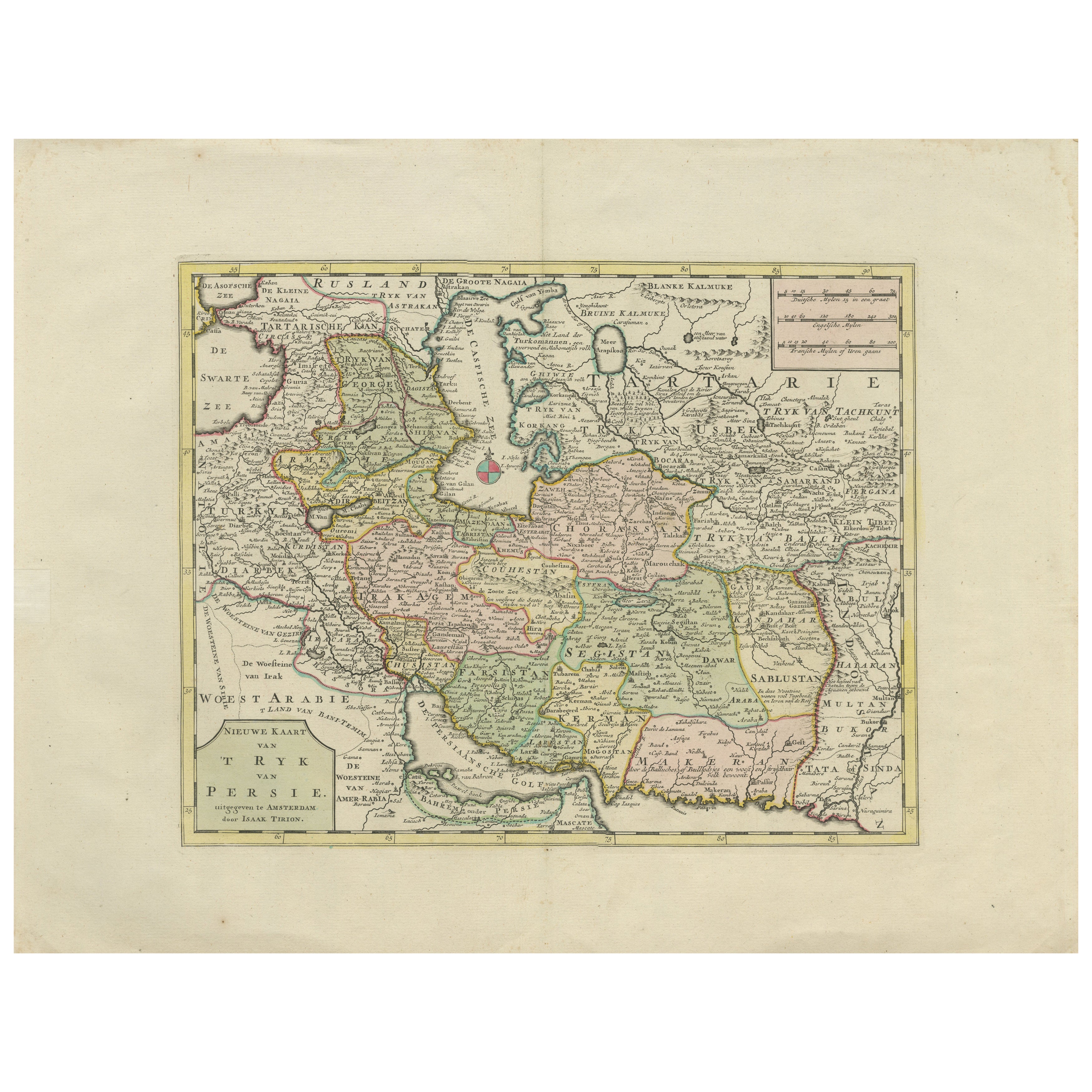
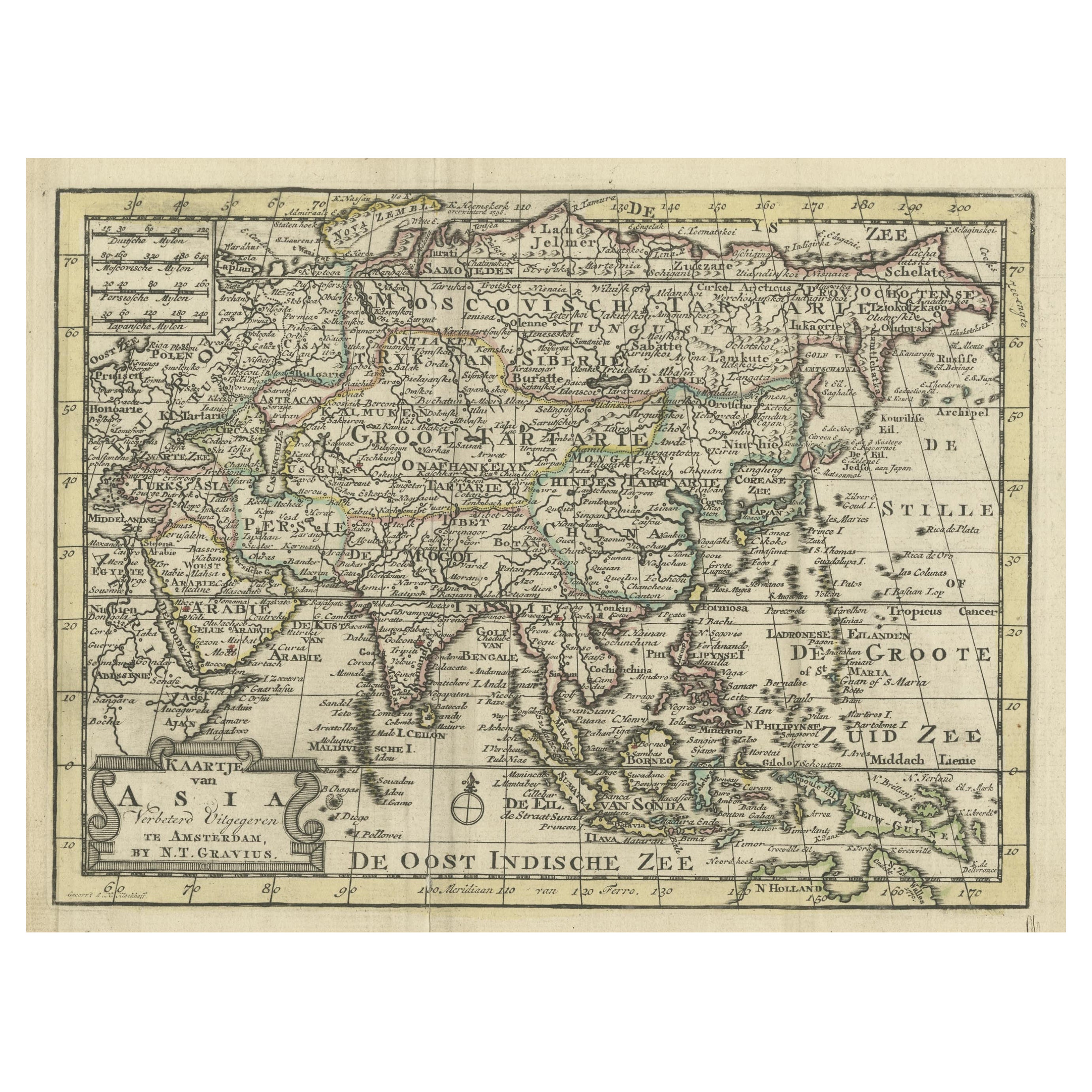
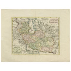
Map of the Persian Empire circa 1750 by Tirion – Hand-Colored Dutch Map
Located in Langweer, NL
Map of the Persian Empire circa 1750 by Tirion – Hand-Colored Dutch Map
This finely detailed antique map titled "Nieuwe Kaart van 't Ryk van Persie" (New Map of the Empire of Persia...
Category
Antique 1750s Dutch Maps
Materials
Paper
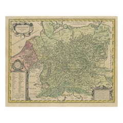
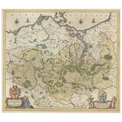
Antique Hand-colored Map of Brandenburg, Germany
Located in Langweer, NL
Antique map titled 'Marchionatus Brandenburgicus'. Original antique map of Brandenburg, with Königsberg and Stettin, Germany. Published by J. Janssonius, circ 1650.
Jan Janssonius ...
Category
Antique Mid-17th Century Maps
Materials
Paper
$398 Sale Price
20% Off
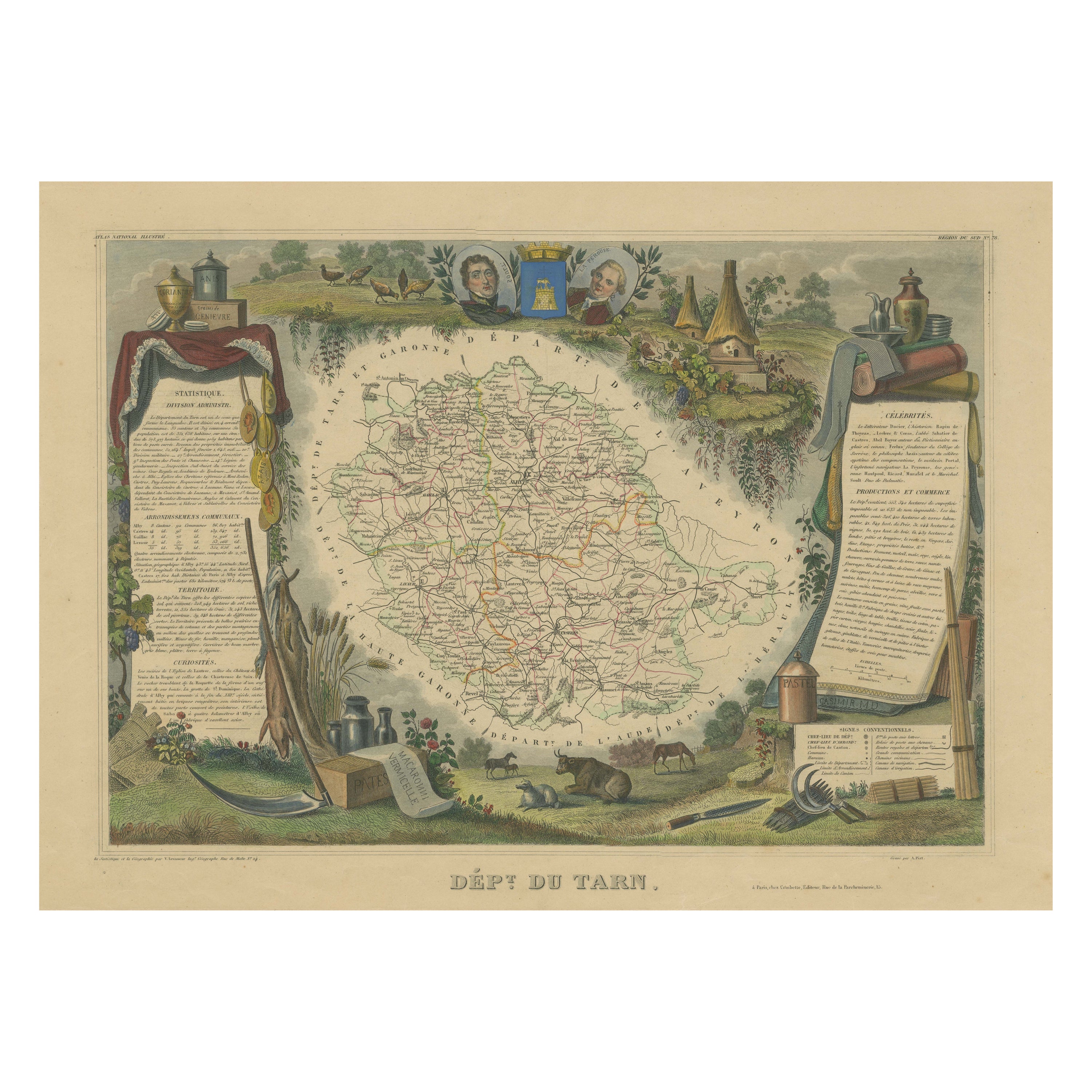
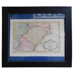
Hand Colored Antique Map of the Department of Tarn, France, circa 1852
By Victor Levasseur
Located in Langweer, NL
Antique map titled 'Dépt. du Tarn'. Map of the French department of Tarn, France. This area produces a variety of traditional wines, including Cahors, Mauzac, Loin de l’Oeil and Onde...
Category
Antique Mid-19th Century Maps
Materials
Paper

$322 Sale Price
20% Off
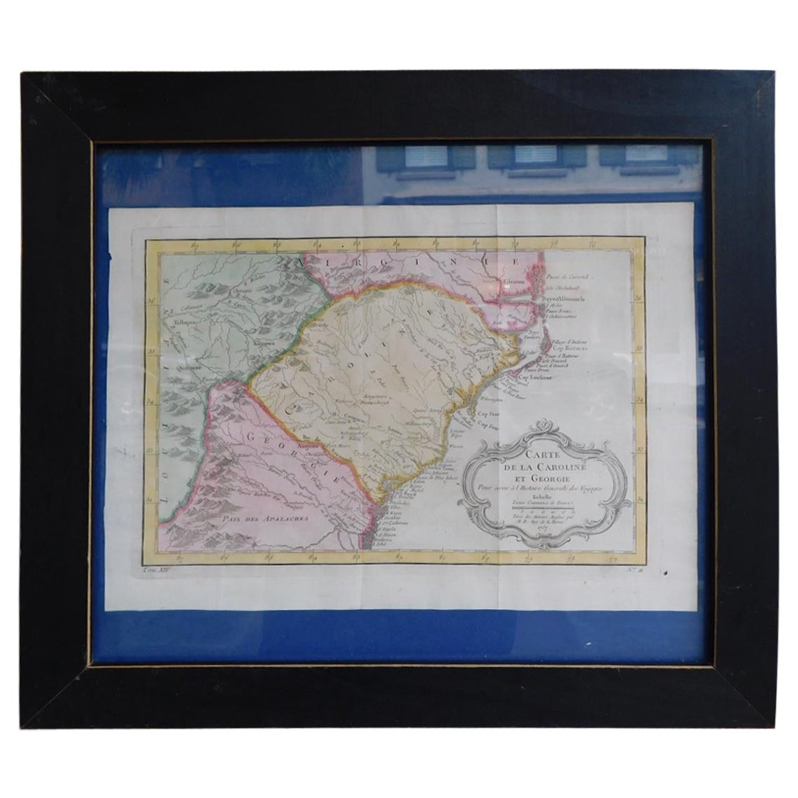
French Framed Copper Engraved Hand Colored Map of Carolina & Georgia, Circa 1757
Located in Charleston, SC
French copper engraved hand colored map of Carolina & Georgia matted under glass with a painted frame, mid-18th century
Category
Antique 1750s French Louis XV Maps
Materials
Glass, Wood, Paint, Paper
Recently Viewed
View AllMore Ways To Browse
Nantucket Signs
Antique Puppet
Marionette Puppet
Puppets And Marionettes
Pantry Box
Antique Pantry Box
German Hand Puppets
Antique Post Office Boxes
Painted Pantry Boxes
Antique Nantucket Signs
Antique Puppet Theater
Antique Post Office Window
Antique Puzzle Box
Antique Decoupage Box
Antique Toy Theater
Coffee Tables Europe
Marble Top Dining Tables
Nordiska Argentina