Paint Maps
3
to
2
1
3
3
3
1
1
1
1
1
1
1
1
195,701
5,353
87
32
31
3
1
1
1
1
Material: Paint
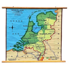
School Chart or Pull Down Map of Geography of the Netherlands, 1950s
Located in Hemiksem, VAN
A beautiful old school map of the Netherlands, painted on linen. The map shows the 3 different reliefs (low, middle, high) of the Netherlands. The beau...
Category
1950s Belgian Mid-Century Modern Vintage Paint Maps
Materials
Linen, Paint
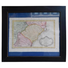
French Framed Copper Engraved Hand Colored Map of Carolina & Georgia, Circa 1757
Located in Hollywood, SC
French copper engraved hand colored map of Carolina & Georgia matted under glass with a painted frame, mid-18th century
Category
1750s French Louis XV Antique Paint Maps
Materials
Glass, Wood, Paint, Paper
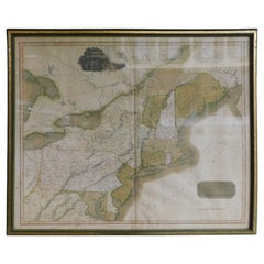
English Engraved Hand Colored Map of the North Eastern United States, circa 1817
Located in Hollywood, SC
English copper engraved hand colored map of the North Eastern United States matted under glass in a gilt frame, Early 19th Century. Drawn and Engraved for Thomson's New General Atlas...
Category
1810s English George III Antique Paint Maps
Materials
Glass, Giltwood, Paint, Paper
Related Items
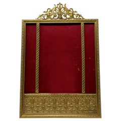
Antique French Empire Style Ormolu Frame circa 1900
Located in New Orleans, LA
Antique French Empire style ormolu frame, circa 1900.
Category
Early 20th Century French Paint Maps
Materials
Ormolu
Original Antique Map of The United States of America, circa 1890
Located in St Annes, Lancashire
Great map of the USA
By The Stanford's Geographical Establishment
Original colour
Unframed.
Category
1890s English Victorian Antique Paint Maps
Materials
Paper
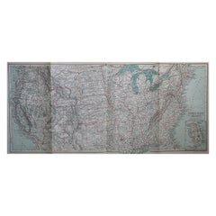
Antique Map of The United States of North America, 1882
Located in Langweer, NL
This is a historical map titled "The United States of North America, Central Part" from the 1882 Blackie Atlas. It depicts the continental United States with a high level of detail, ...
Category
1880s Antique Paint Maps
Materials
Paper
Vintage Gold Colored Open Center Frame
Located in Seattle, WA
Frame Features a Floral Motif. Possible Signature Reading JM as Pictured. Perina and Wear Consistent with Age
Dimensions. 16 W ; 4 D ; 18 H
Category
1970s Mid-Century Modern Vintage Paint Maps
Materials
Wood
Original Antique Hand-colored Map of the United States, circa 1845
Located in Langweer, NL
Antique map titled 'United States'. Old map of the United States, includes the last part of the North West Territory (present day Wisconsin and part of Minnesota). It also marks Ft. Crawford at the confluence of the Mississippi River and the Ouisconsin River (present day Wisconsin River). Published by Orr & Company; Amen Corner...
Category
Mid-19th Century Antique Paint Maps
Materials
Paper
Antique Art Nouveau Photo Album or Book with Brass Stand Up Frame
Located in Hamilton, Ontario
This antique standing photo album is unsigned, but presumed to have originated from France and date to approximately 1900 and done in the period Art Nouveau style. The album is compo...
Category
Late 19th Century French Art Nouveau Antique Paint Maps
Materials
Brass
1938 Pull Down Anatomy Chart, Denoyer-Geppert, Artist P.M. Lariviere
Located in Buffalo, NY
1938 pull down anatomy chart, Denoyer-Geppert. Artist P.M. Lariviere. KL3 circulatory system. Stunning image, screenprint on linen.
Category
1930s American Industrial Vintage Paint Maps
Materials
Linen
Antique Map of the Netherlands, Belgium and Luxembourg
Located in Langweer, NL
Antique map titled 'Carte des Royaumes Hollande et Belgique'. Attractive map of the Netherlands, Belgium and Luxembourg. This map originates fro...
Category
Mid-19th Century Antique Paint Maps
Materials
Paper
French Art Deco Engraved Mirror Standing Photo Frame, circa 1930
Located in Labrit, Landes
Picture frame in engraved mirror
French, circa 1930
Some signs of wear on the frame, that make the charm of this antique piece
Frame to be placed on a beautiful piece of furniture to...
Category
Mid-20th Century French Art Deco Paint Maps
Materials
Glass, Mirror
1859 "Map of the United States of America..." by J. H. Colton
By J.H. Colton
Located in Colorado Springs, CO
Presented is an 1859 “Map of the United States of America, the British Provinces, Mexico, the West Indies and Central America with Part of...
Category
1850s American Antique Paint Maps
Materials
Paper
Antique Map of Groningen, the Netherlands, 1771
Located in Langweer, NL
Antique map titled 'De Synode van Stad en Landen in VII Klassen verdeeld (..)'.
Map of the province of Groningen, the Netherlands. This map originates from 'Nieuwe kerkelyke geogra...
Category
18th Century Antique Paint Maps
Materials
Paper
Old Decorative Pictorial Map of the United States, circa 1953
Located in Langweer, NL
Antique map titled 'A Pictorial Map of the United States of America Showing Principal Regional Resources, Products, and Natural Features'.
This information-packed map was create by the General Drafting Company for the New Jersey Bell Telephone Company. The main map features over 700 drawings in full color including points of interest, natural resources, and agricultural products. At bottom are inset maps showing railroad lines, air routes, telephone lines, as well as a pictorial map of New Jersey...
Category
20th Century Paint Maps
Materials
Paper
Previously Available Items
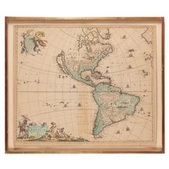
Antique Framed Hand Colored Map of the Americas by Frederick De Wit, circa 1675
Located in Morristown, NJ
Frederick De Wit (Dutch, 1629-1706), "Novissima et Accuratissima totius Americae Descriptio", hand-colored map engraving of North and South America with California depicted as an island, decorated with images of Native Americans and indigenous flora and fauna, framed under glass, 19.5"h x 23"l (sheet), 22.5"h x 1.75"d x 26"w (frame), From the collection of an NY corporation.
A fine example of De Wit’s map of the Americas, first published ca. 1675. This map is fascinating. It was the first Dutch map to include all five Great Lakes; Lac Superieur (Lake Superior), Lac des Puans (Lake Michigan), Mare Dulce (Lake Huron...
Category
1670s Dutch Baroque Antique Paint Maps
Materials
Glass, Wood, Giltwood, Paint, Paper
H 22.5 in W 26 in D 1.75 in
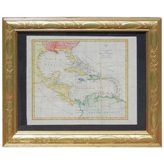
English Map of West Indies with a Gilt Wood Frame Under Glass, Late 19th Cent
Located in Hollywood, SC
English hand colored accurate map of the West Indies with a foliage gilt wood and gesso frame under glass, Late 19th century. Long West from London.
Category
Late 19th Century English Victorian Antique Paint Maps
Materials
Gesso, Glass, Giltwood, Paint, Paper
H 13.75 in W 16.75 in D 0.75 in
Hand Painted Watercolor, "Provincia dalla Forma di Venezia", circa 1930
Located in Atlanta, GA
Painted by an employee of the Estevan Rossetto glass blowing factory in an almost cartoonish style during the 1930, reminiscent of the style of Ludwig Bemelmans, acquired from the Pa...
Category
1930s Italian Art Deco Vintage Paint Maps
Materials
Paint
Original Map of Boston
Located in Norwell, MA
Map of Boston and it's surrounding by Walker Lithographs and Publications, circa 1900. Showing Boston, Quincy, Milton, Hyde Park, Brookline, Watertown, B...
Category
Early 20th Century Paint Maps
Materials
Wood, Paint
Recently Viewed
View AllMore Ways To Browse
Antique Sailing Maps
Antique Sailing Map
West Coat Of Arms
Bay Area Antique Furniture
Greek Asia Minor
Hemisphere World Map
Antique Maps Canada
Antique Map Canada
Canada Antique Map
Speed Map
Charing Cross
Malaysian Antique
West Indies Map
Blaeu World Map
Map Of Brazil
Map Huge
Antique Portuguese Plates
Antique Maps Of Canada
