Items Similar to Vibrant 1782 Map of Northern Upper Saxony and Baltic Coast by Antonio Zatta


Want more images or videos?
Request additional images or videos from the seller
1 of 8
Vibrant 1782 Map of Northern Upper Saxony and Baltic Coast by Antonio Zatta
$401.60
£301.74
€340
CA$553.01
A$618.92
CHF 323.98
MX$7,518.70
NOK 4,113.73
SEK 3,882
DKK 2,587.74
About the Item
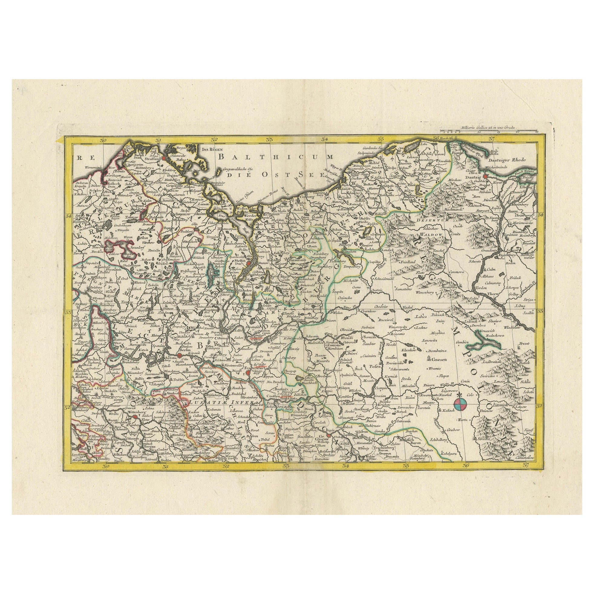
This map is titled "Parte Settentrionale del Circolo dell'Alta Sassonia" and was created by Pietro Antonio Zatta in 1782. It is a beautifully colored copperplate engraving, depicting the northern part of Upper Saxony (Alta Sassonia) in Germany, including its neighboring regions and the Baltic Sea (Mare Baltico).
The map features significant geographical details such as major cities, rivers, borders, and the Baltic coastline, providing a snapshot of this region during the late 18th century. The decorative cartouche at the bottom right corner adds an artistic touch, featuring rustic barrels and a fortified structure, typical of Zatta’s style. The detailing is further highlighted with hand-applied colors that distinguish different regions and borders.
Pietro Antonio Zatta was an Italian cartographer and publisher renowned for his high-quality atlases and maps, and he played an important role in Venetian publishing during the late 18th century. His work often included elaborate decorations, and this map is no exception, featuring both precise geographic content and aesthetic embellishments.
Condition report: This map is in good condition with slight toning and minor edge wear, typical for its age. Colors remain vibrant, and details are well-preserved, maintaining the map's original charm and historical integrity.
- Dimensions:Height: 15.36 in (39 cm)Width: 19.89 in (50.5 cm)Depth: 0.01 in (0.2 mm)
- Materials and Techniques:Paper,Engraved
- Period:1780-1789
- Date of Manufacture:1782
- Condition:Condition report: This map is in good condition with slight toning and minor edge wear, typical for its age. Colors remain vibrant, and details are well-preserved, maintaining the map's original charm and historical integrity.
- Seller Location:Langweer, NL
- Reference Number:Seller: BG-13842-141stDibs: LU3054342582092
About the Seller
5.0
Recognized Seller
These prestigious sellers are industry leaders and represent the highest echelon for item quality and design.
Platinum Seller
Premium sellers with a 4.7+ rating and 24-hour response times
Established in 2009
1stDibs seller since 2017
2,535 sales on 1stDibs
Typical response time: <1 hour
- ShippingRetrieving quote...Shipping from: Langweer, Netherlands
- Return Policy
Authenticity Guarantee
In the unlikely event there’s an issue with an item’s authenticity, contact us within 1 year for a full refund. DetailsMoney-Back Guarantee
If your item is not as described, is damaged in transit, or does not arrive, contact us within 7 days for a full refund. Details24-Hour Cancellation
You have a 24-hour grace period in which to reconsider your purchase, with no questions asked.Vetted Professional Sellers
Our world-class sellers must adhere to strict standards for service and quality, maintaining the integrity of our listings.Price-Match Guarantee
If you find that a seller listed the same item for a lower price elsewhere, we’ll match it.Trusted Global Delivery
Our best-in-class carrier network provides specialized shipping options worldwide, including custom delivery.More From This Seller
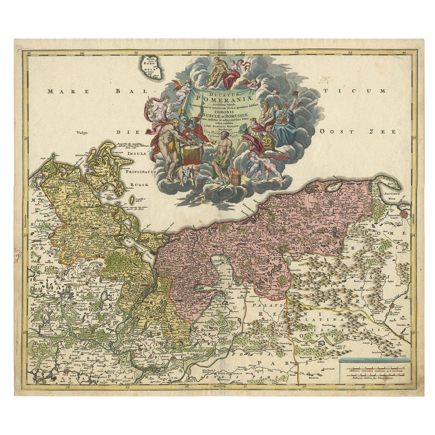
View AllA Detailed Mid-18th Century German Map of North-Central Europe
Located in Langweer, NL
This is an antique, hand-colored engraved map of north-central Europe (centered on the region of Brandenburg, Pomerania, and portions of what is now northern Poland) that was produce...
Category
Antique 1730s Maps
Materials
Paper
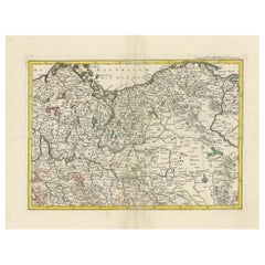
Antique Map of Germany by T. Kitchin, circa 1770
Located in Langweer, NL
Antique map titled 'An Accurate Map of Germany (..) '. Drawn from the best Authorities by T.Kitchin Geogr." Rare edition, drawn and etched by Thomas Kitchin, published, circa 1770.
Category
Antique Mid-18th Century Maps
Materials
Paper

$226 Sale Price
20% Off
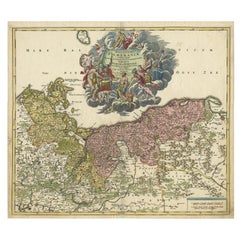
Map of the Duchy of Pomerania – Antique Engraving by P. Schenk Jr., c. 1750
Located in Langweer, NL
Map of the Duchy of Pomerania – Antique Engraving by P. Schenk Jr., c. 1750
Antique map titled 'Ducatus Pomeraniae Tabula Generalis'. This historical map presents the Duchy of Pomer...
Category
Antique Mid-18th Century Dutch Maps
Materials
Paper

$472 Sale Price
20% Off
Antique Map of Lower Saxony in Germany, c.1740
Located in Langweer, NL
Antique map titled 'Nieuwe Kaart van de Neder Saxise Kreits (..).' Attractive detailed map showing Lower Saxony, Germany, including Mekelenburg, Lauwenburg, Holstein, Bremen, Verden ...
Category
Antique 18th Century Maps
Materials
Paper

$519 Sale Price
20% Off
Regional Antique Map of the Baltic, Extending from Stralsund to Dantzig, ca.1720
Located in Langweer, NL
Antique map titled 'Ducatus Pomeraniae (..)'. Regional map of the Baltic, extending from Stralsund and Rugia in the west to Dantzig and Culman on the Vistula in the east. Large carto...
Category
Antique 1720s Maps
Materials
Paper
$841 Sale Price
20% Off
Antique Map of Part of Germany by Moll, c.1740
Located in Langweer, NL
Antique map Germany titled 'The North West Part of Germany; Containing ye Dominions of ye Arch: and El: of Cologne, Westphalia, / Juliers, Cleeves,...
Category
Antique 18th Century Maps
Materials
Paper

$108 Sale Price
20% Off
You May Also Like
1752 Vaugoundy Map of Flanders : Belgium, France, and the Netherlands, Ric.a002
Located in Norton, MA
Large Vaugoundy Map of Flanders:
Belgium, France, and the Netherlands
Colored -1752
Ric.a002
Description: This is a 1752 Didier Robert de Vaugondy map of Flanders. The map de...
Category
Antique 17th Century Unknown Maps
Materials
Paper

1839 Map of Karte Des "Russischen Reiches in Europa Und Asien" Ric.R0013
Located in Norton, MA
1839 map of Karte Des
"Russischen Reiches in Europa and Asien"
Ric.r013
Map of the European and Asian parts of Russian Empire. Karte der Russischen Reiches in Europa und Asien...
Category
Antique 19th Century Unknown Maps
Materials
Paper

1853 Map of "Russia in Europe Including Poland" Ric.r016
Located in Norton, MA
Description
Russia in Europe incl. Poland by J Wyld c.1853
Hand coloured steel engraving
Dimension: Paper: 25 cm W x 33 cm H ; Sight: 22 cm W x 28 cm H
Condition: Good ...
Category
Antique 19th Century Unknown Maps
Materials
Paper

1643 Willem&Joan Blaeu Map NW Flanders "Flandriae Teutonicae Pars Prientalior
Located in Norton, MA
1643 Willem and Joan Blaeu map of northwest Flanders, entitled
"Flandriae Teutonicae Pars Prientalior,"
Ric0012
" Authentic" - Map of the northwest Fl...
Category
Antique 17th Century Dutch Maps
Materials
Paper

1640 Willem Blaeu Map Entitled "Contado di molise et principato vltra, " Ric.a003
By Willem Blaeu
Located in Norton, MA
1640 Willem Blaeu map entitled
"Contado di molise et principato vltra,"
Colored
Ric. a003
Measures: 38 x 49.6 cm and wide margins
DBLAEU.
Cou...
Category
Antique 17th Century Dutch Maps
Materials
Paper

1635 Willem Blaeu Map of Northern France"Comitatvs Bellovacvm" Ric.a08
Located in Norton, MA
1635 Willem Blaeu map of northern France, entitled.
"Comitatvs Bellovacvm Vernacule Beavvais,"
Colored
Ric.a008
“COMITATVS BELLOVACVM…” Amsterdam: W...
Category
Antique 17th Century Unknown Maps
Materials
Paper

More Ways To Browse
Antique German Barrel
Elios Chair
Plata Lappas
Red Retro Dining Set
Antique Bouquet
Antique Silver Glasses Case
Carlo Scarpa 1934 Chairs
Christofle Marly
1900 Antique Chairs
Glass Table Italian Round
Mid Century Colonial
Alvar Aalto Poster
Geometric Metal Table
Post Modern High Chairs
United Nations
Vintage Vine Rug
Cancel An Order
Antique Framing Square