Benelux Maps
to
4,202
5,080
5,466
195
5,079
1
1
2,799
1,969
311
1
179
8
68
3
3
3
1
2
5,070
9
7
2
2
346
114
80
74
38
5,080
5,080
5,080
104
59
20
14
13
Item Ships From: Benelux
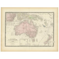
Antique Map of Australia by Levasseur, '1875'
Located in Langweer, NL
Antique map titled 'Carte générale de l'Australie'. Large map of Australia. This map originates from 'Atlas de Géographie Moderne Physique et Politiq...
Category
Late 19th Century Antique Benelux Maps
Materials
Paper
$416 Sale Price
30% Off
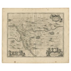
Antique Map of the Region of Aiguillon by Janssonius, 1657
By Johannes Janssonius
Located in Langweer, NL
Antique map 'Le Duche d'Aiguillon'. Decorative map of the Aiguillon region, France. Located at the confluence of the Lot and Garonne rivers. The map is based on the cartography of Pi...
Category
Mid-17th Century Antique Benelux Maps
Materials
Paper
$523 Sale Price
20% Off
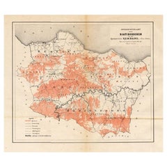
Antique Map of the Djati 'teak wood' Forest Near Rembang, Java by Stemler, 1875
By Stemler
Located in Langweer, NL
Antique map titled 'Overzichtskaart van de Djatibosschen in de Residentie Rembang, Java.' This scarce map shows the Djati (teak) Forest on the indonesian island of Java. Originates f...
Category
19th Century Antique Benelux Maps
Materials
Paper
$256 Sale Price
20% Off
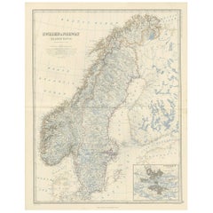
Sweden & Norway – Antique Map of Scandinavia with Stockholm Inset, 1865
Located in Langweer, NL
Sweden & Norway – Antique Map of Scandinavia with Stockholm Inset, 1865
This finely detailed antique map titled Sweden & Norway (Scandinavia) offers a comprehensive 19th-century vie...
Category
Mid-19th Century English Antique Benelux Maps
Materials
Paper
$261 Sale Price
20% Off
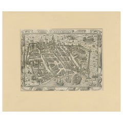
Bordeaux City View – Braun & Hogenberg Original Woodcut, ca. 1575
Located in Langweer, NL
Bordeaux City View – Braun & Hogenberg Original Woodcut, ca. 1575
Description:
This detailed and highly decorative bird’s-eye view of Bordeaux, titled Bovrdeavx, originates from the...
Category
16th Century German Antique Benelux Maps
Materials
Paper
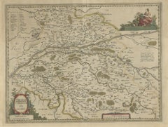
Antique Map of the Region of Touraine in France by Janssonius, 1657
By Johannes Janssonius
Located in Langweer, NL
Antique map titled 'Touraine - Turonensis Ducatus'.
Decorative map of the Touraine region. This map originates from 'Atlas Novus, Sive Theatrum Orbis Orbis Terrarum: In quo Galli...
Category
17th Century Antique Benelux Maps
Materials
Paper
Johnson’s New Brunswick Nova Scotia Newfoundland Map, USA c.1864
Located in Langweer, NL
Johnson’s New Brunswick Nova Scotia Newfoundland Map, USA c.1864
This is a finely engraved and hand-colored map titled Johnson’s New Brunswick, Nova Scotia, Newfoundland, and Prince...
Category
Mid-19th Century American Antique Benelux Maps
Materials
Paper
Antique Map of Gelderland with the Veluwe Etc, the Netherlands, 1864
Located in Langweer, NL
Antique map titled 'De Provincie Gelderland'. Map of the province of Gelderland, the Netherlands.
This map originates from 'F. C. Brugsma's Atlas van het Koninkrijk der Nederland...
Category
19th Century Antique Benelux Maps
Materials
Paper
Rare 1864 Civil War Era Map of Massachusetts, Connecticut, and Rhode Island
Located in Langweer, NL
Title: Rare 1864 Civil War Era Map of Massachusetts, Connecticut, and Rhode Island
Description: This exquisite antique map, titled "Johnson's Massachusetts, Connecticut, and Rhode I...
Category
1860s Antique Benelux Maps
Materials
Paper
Antique Map of Egypt with Detailed Inset of the Nile Delta, ca. 1799
Located in Langweer, NL
Antique Map of Egypt with Detailed Inset of the Nile Delta, ca. 1799
This finely engraved antique map titled Carte Physique et Politique de l’Égypte presents a detailed and scientif...
Category
Early 1800s French Antique Benelux Maps
Materials
Paper
Pl. 67 Antique Print of Decorative Art in the Renaissance Period by Racinet, 186
Located in Langweer, NL
Old print of decorative art in the Renaissance period. This print originates from 'L'Ornement polychrome'. A beautiful work containing about 2000 patterns of all the styles of Art ol...
Category
19th Century Antique Benelux Maps
Materials
Paper
1773 Map of Persia, Gujarat & Malabar Coasts – Arabia to India, Hand-Colored
Located in Langweer, NL
1773 Bellin map of Persia, Gujarat and Malabar coasts with Arabia and Maldives
Description:
This finely engraved and delicately hand-colored 18th-century map titled Kaart van de Kusten van Persië, Guzaratte en Malabar was produced by the eminent French cartographer Jacques-Nicolas Bellin and engraved by Jakob van der Schley. It was published in 1773 in Amsterdam by E. van Harrevelt and D. Changuion, as part of a Dutch edition of Bellin’s maritime atlas focused on the East Indies and the Indian Ocean.
The map presents the coastline bordering the Arabian Sea, extending from the Persian Gulf and parts of the Arabian Peninsula to the shores of Gujarat and the Malabar Coast in southwestern India. It provides a detailed representation of the coastlines of Persia (modern-day Iran), the western coast of India, and a portion of southern Arabia including the Oman Peninsula. Coastal towns, rivers, ports, and geographical landmarks are clearly labeled, including prominent trading centers like Surat, Goa, Calicut, Cochin, and Cape Comorin (now Kanyakumari).
Additionally, the map shows the Laccadive Islands (Laka Dives) and the Maldives (Maldivische Eilanden), with attention to navigational details such as shoals, sandbanks, and anchor points. A large compass rose and clear latitude and longitude markings enhance its utility as a navigational aid.
A highly decorative title cartouche at lower left features maritime iconography such as sea creatures, a fountain, and shells. An inset legend beneath the map provides explanations in Dutch for the symbols used to indicate bays, capes, ports, forts, islands, and towns.
This is a copperplate engraving printed on laid paper with full original hand coloring. It retains its original fold lines as issued. The condition is generally good, with minor age toning and a few light spots in the margins. No repairs or restoration are visible. The paper is strong, and the impression remains crisp and clear.
This historical map is a significant and attractive example of 18th-century European cartography, especially valued for its depiction of maritime trade regions and coastal geography during the age of exploration and colonial expansion.
To frame this 1773 Bellin map attractively and safely:
- Use acid-free matting in a neutral tone like cream or antique white
- Consider double matting with a subtle inner color that complements the map
- Choose a simple wooden frame in walnut, cherry, or aged oak for a classic look
- Use UV-protective glass or acrylic to prevent fading
- For a full display, consider float mounting to show the edges and fold lines
- Allow 2 to 3 inch mat margins to balance the composition and enhance presentation
Keywords:
Bellin map 1773, van der Schley, Persia coast map, Gujarat map, Malabar map...
Category
1780s Antique Benelux Maps
Materials
Paper
$323 Sale Price
20% Off
19th Century Illustrated Map of Ceylon (Sri Lanka) with Notable Landmarks
Located in Langweer, NL
John Tallis & Company is known for producing maps and atlases that were highly regarded for their accurate cartographic detail and their distinctive style. They often included ornate...
Category
1850s Antique Benelux Maps
Materials
Paper
$275 Sale Price
20% Off
Old Map of the UK & Ireland, Insets of Orkney, Shetland and Faroe Islands, 1786
Located in Langweer, NL
Title: "Les Isles Britanniques qui contiennent les Royaumes d'Angleterre, Escosse, et Irlande".
Hand-colored engraved map with 2 (large) decorative cartouches, inset map of the Ork...
Category
1780s Antique Benelux Maps
Materials
Paper
$1,284 Sale Price
20% Off
Old Eastern Balkans Map, with Dalmatia, Croatia, Slavonia, Bosnia, Serbia, 1633
Located in Langweer, NL
Antique map titled 'Sclavonia, Croatia, Bosnia cum Dalmatiae Parte'. Old map of the Eastern Balkans with the geographical & political divisions of Dalmatia, Croatia, Slavonia, Bosnia, Serbia, etc. The map details the course of the Danube, Sauus, and Drauus Rivers. Originates from the 1633 German edition of the Mercator-Hondius Atlas Major, published by Henricus Hondius and Jan Jansson under the title: 'Atlas: das ist Abbildung der gantzen Welt, mit allen darin begriffenen Laendern und Provintzen: sonderlich von Teutschland, Franckreich, Niderland, Ost und West Indien: mit Beschreibung der selben.'
Artists and Engravers: Gerard Mercator (1512 - 1594) originally a student of philosophy was one of the most renowned cosmographers and geographers of the 16th century, as well as an accomplished scientific instrument maker. He is most famous for introducing Mercators Projection, a system which allowed navigators to plot the same constant compass bearing on a flat map...
Category
1630s Antique Benelux Maps
Materials
Paper
$903 Sale Price
20% Off
Antique Map of Roermond & Duchy of Guelders by Sanson – Hand-Colored, c.1667
Located in Langweer, NL
Antique map of Roermond and the Duchy of Guelders with rich detail, c.1667
This beautifully hand-colored 17th-century map presents the region of Roermond and the broader Duchy of Gu...
Category
Late 17th Century French Antique Benelux Maps
Materials
Paper
Antique Map of Africa by Bordiga Fratelli 'circa 1818'
Located in Langweer, NL
Antique map titled 'Carta dell Africa'. Large and quite scarce Italian map of Africa, reflecting the then-current knowledge of the continent's geography, with large areas left comple...
Category
Early 19th Century Antique Benelux Maps
Materials
Paper
$1,712 Sale Price
20% Off
Burnished brass earth globe - Circa 1930s
Located in Linkebeek, BE
Burnished brass earth globe - Circa 1930s
Globe - World map
Measures : 20x18cm H:25cm
Wear consistent with age and use
Category
20th Century Benelux Maps
Materials
Brass
Antique Map of the Region of Aigues-Mortes and Camargue, France
Located in Langweer, NL
Antique map titled 'Environs d'Aiguemortes de Peccais &a et la petite Camargue'. Original map of the region of Aigues-Mortes and Camargue, France. This map originates from 'Le Petit ...
Category
Mid-18th Century Antique Benelux Maps
Materials
Paper
$323 Sale Price
20% Off
Italia Antiqua Philippo Cluvero – 1603 Hondius Map of Ancient Italy, Handcolored
Located in Langweer, NL
Italia Antiqua Philippo Cluvero – 1603 Hondius Map of Ancient Italy with Hand Color
This stunning early 17th-century map, *Italia Antiqua Philippo Cluvero Borusso Designatore*, wa...
Category
Early 1600s Antique Benelux Maps
Materials
Paper
Map of Turkish Dominions in Europe, Ottoman Balkan Territories 1813
Located in Langweer, NL
Map of Turkish Dominions in Europe, Ottoman Balkan Territories 1814
This antique map titled "Turkish Dominions in Europe" provides a detailed depiction of the Balkan Peninsula and a...
Category
1810s Antique Benelux Maps
Materials
Paper
Antique Map of Cyprus (Cypern) from Meyer's Lexikon, Leipzig, circa 1890
Located in Langweer, NL
Antique Map of Cyprus (Cypern) from Meyer's Lexikon, Leipzig, circa 1890
This finely detailed antique map titled "Cypern" presents the island of Cyprus as it appeared in the late 19...
Category
1890s Antique Benelux Maps
Materials
Paper
Ciudad Real 1902: A Detailed Cartographic Survey of La Mancha in Spain
Located in Langweer, NL
This original antitque map presents the province of Ciudad Real, located in the autonomous community of Castilla-La Mancha in central Spain, as of 1902. It includes several notable f...
Category
Early 1900s Antique Benelux Maps
Materials
Paper
$323 Sale Price
20% Off
Antique Map of the British Isles with Contemporary Hand Coloring
Located in Langweer, NL
Antique map titled 'Les Isles Britanniques'. Original antique map of the British Isles, with original/contemporary hand coloring. Published by Crepe, circa 1767.
Category
Late 18th Century Antique Benelux Maps
Materials
Paper
$266 Sale Price
20% Off
Antique Map of North and South America by Schneider and Weigel, 1818
Located in Langweer, NL
Antique map titled 'America nach Arrowsmiths Weltcharte und dessen Globular Projection (..)'. Map of North and South America. Published by Schneider and Weigel, 1818.
Category
Early 19th Century Antique Benelux Maps
Materials
Paper
$1,248 Sale Price
30% Off
Palestine: Tribes & Maccabees – Antique Map by Migeon, Paris, 1892
Located in Langweer, NL
Palestine Divided into Tribes & Under the Maccabees – Antique Map by Migeon, 1892
This detailed antique map features two historical views of the Holy Land side by side: Palestine di...
Category
Late 19th Century Antique Benelux Maps
Materials
Paper
$323 Sale Price
20% Off
Beautiful 17th Century Map of Paris and Isle de France by Templeux, c.1650
Located in Langweer, NL
Map of Isle de France by D. de Templeux, ca. 1650, Hand-Colored and Decorative
This richly detailed antique map titled *Le Gouvernement de L'Isle de France* was engraved by Daniel d...
Category
1650s Antique Benelux Maps
Materials
Paper
Rare Original Double Hemisphere World Map with Allegorical Figures, 1785
Located in Langweer, NL
Antique map titled 'Nieuwe en Naukeurige Kaart der Gantsche bekende Werreld.'
A double hemisphere world map. Four allegorical figures in the c...
Category
1780s Antique Benelux Maps
Materials
Paper
$2,806 Sale Price
20% Off
Antique Map of Greece and the Cyclades, 1903, with Many Details and Inset Maps
Located in Langweer, NL
Title: Antique Map of Greece and the Cyclades, 1903, with Intricate Detail and Inset Maps
Description: This antique map, titled "Greece with Its Islands, Including the Cyclades," wa...
Category
Early 20th Century Benelux Maps
Materials
Paper
Antique Map of Sweden & Norway, 1903, with Intricate Topographical Detail
Located in Langweer, NL
Title: Antique Map of Sweden & Norway, 1903, with Intricate Topographical Detail
Description:
This antique map, titled "Sweden & Norway (Scandinavia)," was engraved and published in...
Category
Early 20th Century Benelux Maps
Materials
Paper
England and London Government Map with Allegorical Vignettes, ca. 1720
Located in Langweer, NL
England and London Government Map with Allegorical Vignettes, ca. 1720
Description:
This highly decorative and information-rich copperplate engraving, titled "Nouvelle carte du Gouv...
Category
Early 18th Century French Antique Benelux Maps
Materials
Paper
Antique Map of the Middle East by Brion de la Tour '1772'
Located in Langweer, NL
Antique map titled 'Carte des Pays et Principaux Lieux (..)'. Original antique map of Middle East, extending to the Red Sea, Egypt, the Eastern Medi...
Category
Late 18th Century Antique Benelux Maps
Materials
Paper
$618 Sale Price
20% Off
Old Map of Guyana, Suriname and French Guiana with Paramaribo and Cayenne, c1760
Located in Langweer, NL
Description: Antique map titled 'Carte de la Guiane.'
Antique map of the Guianas - present day Guyana, Suriname and French Guiana, including Paramaribo and Cayenne. Source unknown, to be determined.
Artists and Engravers: Made by 'Jacques-Nicholas Bellin...
Category
1760s Antique Benelux Maps
Materials
Paper
$428 Sale Price
20% Off
Antique Map of China, Taiwan, Korea, Hong-Kong and Japan, 1903
Located in Langweer, NL
Antique Map of China, Taiwan, Korea, Hong-Kong and Japan, 1903
Description: This antique map, titled "India (Southern Sheet) and the South Eastern Provinces," was engraved and publi...
Category
Early 20th Century Benelux Maps
Materials
Paper
Australia, New Zealand, and Neighbouring Islands Map 1858
Located in Langweer, NL
Australia and Neighbouring Islands Map 1858
This attractive antique print shows “Festland von Australien und benachbarte Inseln” meaning “Mainland Australia and neighbouring islands...
Category
Mid-19th Century German Antique Benelux Maps
Materials
Paper
Map of Shropshire, 1844: Telford, Shrewsbury, Oswestry, Bridgnorth & Wellington
Located in Langweer, NL
Old Map of Shropshire by Samuel Lewis, 1844: Telford, Shrewsbury, Oswestry, Bridgnorth, and Wellington
This 1844 map of Shropshire is an antique engraving from Samuel Lewis' Topogr...
Category
1840s Antique Benelux Maps
Materials
Paper
$180 Sale Price
20% Off
Mountain Elevation Profiles – Alps, Pyrenees, Andes & World Heights 1857
Located in Langweer, NL
Mountain Elevation Profiles – Alps, Pyrenees, Andes & World Heights 1857
This intriguing antique print shows comparative elevation profiles titled “Die bekannteren Höhen über der Me...
Category
Mid-19th Century German Antique Benelux Maps
Materials
Paper
Planiglob of the Antipodes – Unique Global Projection Map 1857
Located in Langweer, NL
Planiglob of the Antipodes – Unique Global Projection Map 1857
This rare and fascinating antique print shows a “Planiglob der Antipoden” or Planiglob of the Antipodes, depicting the...
Category
Mid-19th Century German Antique Benelux Maps
Materials
Paper
Northern Hemisphere Star Map – Constellations & Astronomical Chart, c.1858
Located in Langweer, NL
Northern Hemisphere Star Map – Constellations & Astronomical Chart c.1858
This attractive antique print shows the northern starry sky titled “Der nördliche gestirnte Himmel”, meanin...
Category
Mid-19th Century German Antique Benelux Maps
Materials
Paper
Highly Detailed Antique Map of the Holy Land Showing 12 Tribes of Israel, c.1720
Located in Langweer, NL
Antique map titled 'Heylige Land verdeeld in de Twaalf Stammen Israels (..).'
Highly detailed map of the Holy Land divided into 12 tribes of Israel...
Category
1720s Antique Benelux Maps
Materials
Paper
$456 Sale Price
20% Off
1794 Map of Jamaica by Bryan Edwards – Parishes, Plantations, Settlements
Located in Langweer, NL
1794 Bryan Edwards Map of Jamaica – Parishes, Plantations, Settlements
This is an important antique map titled “A Map of the Island of Jamaica, Divided into Counties and Parishes,” created by Bryan Edwards in 1794. It was published in the second edition of his influential work *The History of the British West Indies*, which provided detailed insights into the geography, society, and economy of the Caribbean at the height of British colonial influence.
The map meticulously depicts Jamaica divided into its traditional counties and parishes, each shaded to aid visual differentiation. Major settlements are clearly labelled, including Kingston, Montego Bay, Spanish Town, and Falmouth. The island’s intricate network of rivers, mountains, and coastal features are rendered with careful hachure and stipple shading to indicate elevation and terrain. Edwards uses small circular symbols to denote the locations of numerous sugar plantations that formed the backbone of Jamaica’s economy during this period, each plantation representing not only agricultural wealth but also the grim history of enslaved African labour central to the island’s prosperity.
Further notations identify churches, barracks, forts, and ports, demonstrating the comprehensive utility of this map for historical research into colonial infrastructure. The map even marks Bryan...
Category
Late 18th Century English Antique Benelux Maps
Materials
Paper
1756 Map of Brazil from Bahia to São Paulo by Bellin – French Colonial Engraving
Located in Langweer, NL
Antique Map of Brazil from Bahia to São Paulo – Bellin for L'Histoire des Voyages
This elegant 18th-century French map titled "Suite du Bresil, Depuis la Baie de Tous les Saints jus...
Category
1750s Antique Benelux Maps
Materials
Paper
Antique Map of Andalusia Spain – Hand-Coloured Tassin Engraving 1651
Located in Langweer, NL
Antique Map of Andalusia Spain – Hand-Coloured Tassin Engraving 1651
This fine hand-coloured engraved map shows the historic kingdom of Andalusia in southern Spain, created by Nicol...
Category
Mid-17th Century French Antique Benelux Maps
Materials
Paper
1616 Petrus Kaerius Map of Southern India and Ceylon – Narsinga et Ceylon
Located in Langweer, NL
Title: 1616 Petrus Kaerius Map of Southern India and Ceylon – Narsinga et Ceylon
This rare early 17th-century copper engraved map titled 'Narsinga et Ceylon' was created by Petrus K...
Category
Early 17th Century German Antique Benelux Maps
Materials
Paper
Map of Côte-d'Or France with Dijon and Burgundy Wine Region, 19th Century
Located in Langweer, NL
Map of Côte-d'Or France with Dijon and Burgundy Wine Region, 19th Century
Description:
This beautifully engraved 19th-century map of Côte-d'Or, located in the historic region of Bur...
Category
Mid-19th Century French Antique Benelux Maps
Materials
Paper
1773 John Blair Map of the Ancient Holy Land: Tribes, Journeys, and Empires
Located in Langweer, NL
Title: 1773 John Blair Map of the Ancient Holy Land: Tribes, Journeys, and Empires
This exceptional map by John Blair, published in London in 1773, offers a richly detailed view o...
Category
1770s English Antique Benelux Maps
Materials
Paper
Antique Map of Saxony and Westphalia by Scherer, 1699
Located in Langweer, NL
Antique map titled 'Saxonia et Westphalia varijs in locis sacris erga dei matre est officiosa & ipsa vicissim erga utramq. Munifica.' Detailed uncommon map of Saxony and Westphalia i...
Category
17th Century Antique Benelux Maps
Materials
Paper
$214 Sale Price
20% Off
Antique Map of Spain & Portugal 'Iberian Peninsula', Decorative Cartouche, c1755
Located in Langweer, NL
Antique map titled 'Spain and Portugal'.
Small, detailed antique map of Spain and Portugal (Iberian Peninsula). Decorative title cartouche.
Artists and Engravers: Thomas Jeff...
Category
1750s Antique Benelux Maps
Materials
Paper
$228 Sale Price
20% Off
Map of Soria Province, 1901: Detailed Cartography of Northeastern Spain
Located in Langweer, NL
The map is a historical map of the province of Soria from 1901.
A decorative coat of arms enhances the aesthetic of the map, signifying the historical and cultural significance of ...
Category
Early 1900s Antique Benelux Maps
Materials
Paper
$313 Sale Price
20% Off
Rare 1690 Map of England by Nicolaes Visscher II – Heptarchy Depicted
Located in Langweer, NL
Map of England 1690 by Nicolaes Visscher II – Heptarchy and Counties Shown
Antique 1690 map of England by Nicolaes Visscher II, showing the Anglo-Saxon Heptarchy and detailed county...
Category
Late 17th Century Dutch Antique Benelux Maps
Materials
Paper
Map of Iran, Arabia, Asia Minor & Caucasus by Perthes, 1858
Located in Langweer, NL
Map of Iran, Arabia, Asia Minor & Caucasus by Perthes, 1858
This is a detailed engraved map titled Vorder-Asien oder Iran, Turan, Arabien, Kleinasien und die Kaukasus Länder, publis...
Category
Mid-19th Century German Antique Benelux Maps
Materials
Paper
Rare and Interesting Small Antique Woodcut Map of the Mediterranean, 1568
Located in Langweer, NL
Very rare untitled antique woodcut map showing the region of the missionary journeys of Apostle Paul. It shows the Mediterranean with Greece, Asia Minor (Turkey), Northern Africa, So...
Category
16th Century Antique Benelux Maps
Materials
Paper
$2,497 Sale Price
25% Off
Attractive Detailed Map of the Empire of the Great Mogul, Incl India, 1731
Located in Langweer, NL
Antique map titled 'Nieuwe Kaart van t Keyzer Ryk Grooten Mogol.'
Attractive detailed map of the Empire of the Great Mogul, which included India, Sri Lanka, Pakistan and Banglade...
Category
1730s Antique Benelux Maps
Materials
Paper
$894 Sale Price
20% Off
Arkansas Map by Colton, USA Published c.1864 – Hand-Colored County Map
Located in Langweer, NL
Arkansas Map by Colton, USA Published c.1864 – Hand-Colored County Map
This is a finely engraved and hand-colored map titled Arkansas, published by G.W. & C.B. Colton & Co. in New Y...
Category
Mid-19th Century American Antique Benelux Maps
Materials
Paper
Plan of Cincinnati Map, USA c.1870 – Hand-Colored Street Plan with Wards
Located in Langweer, NL
Plan of Cincinnati Map, USA c.1870 – Hand-Colored Street Plan with Wards
This is a finely engraved and hand-colored street plan titled Plan of Cincinnati and Vicinity, published in ...
Category
Mid-19th Century American Antique Benelux Maps
Materials
Paper
Attack Plan of Douay Fortress, France, 1710 Siege – Brussels c.1720 Map
Located in Langweer, NL
Attack Plan of Douay Fortress, France, 1710 Siege – Brussels c.1720 Map
This engraved military map shows the detailed plan of attacks on the fortress city of Douay (Douai) in northe...
Category
Early 18th Century French Antique Benelux Maps
Materials
Paper
Minnesota and Dakota Map – Johnson, Hand-Colored, USA c.1864
Located in Langweer, NL
Johnson’s Minnesota and Dakota Map, USA c.1864 – Hand-Colored Territorial Map
Description:
This is a finely engraved and hand-colored map titled Johnson’s Minnesota and Dakota, pub...
Category
Mid-19th Century American Antique Benelux Maps
Materials
Paper
Beneath the Surface: James Wyld's 1844 Geological Map of the British Isles
Located in Langweer, NL
This superb original geological map of the United Kingdom of Great Britain and Ireland by James Wyld, produced in 1844, is a remarkable Victorian artifact.
Description:
Explore th...
Category
1840s Antique Benelux Maps
Materials
Paper
$856 Sale Price
20% Off
Antique Map of Hindustan, or India
Located in Langweer, NL
Antique map titled 'Hindoostan, or India'. Original antique map of India (Hindustan) and Sri Lanka (Ceylon). Engraved by Russell. Published by Nuttall, Fisher & Co, 1814.
Category
Early 19th Century Antique Benelux Maps
Materials
Paper
$275 Sale Price
20% Off
Antique Map of Bavaria with many details, Germany
Located in Langweer, NL
Antique map titled 'Bavariae Circulus atq Electoratus tam cum Adiacentibus quam insertis Regionibus (..)'. Dutch map of Bavaria, showing the many cities, towns, and other features of...
Category
Late 17th Century Antique Benelux Maps
Materials
Paper
$627 Sale Price
20% Off
Recently Viewed
View AllMore Ways To Browse
Greek Key Dresser
Green Glass Bud Vase Vintage
Gucci Tray
Half Moon Shelves
Handblown Glass Decanter
Heart Shaped Glass Dish
Hepplewhite Drop Leaf Table
Herend Cup
Hermes Dish
Horse Head Barware
Horse Mantel Clock
Large Limoges Platter
Michelangelo David Statue
Michelin Guide
Persian Khatam
Royal Worcester Aesthetic
Russell Woodard Aluminum
Russian Silver Niello
