Benelux Maps
to
4,180
5,131
5,516
200
5,130
1
1
2,836
1,982
312
1
180
8
68
3
3
3
1
2
5,121
10
8
2
2
469
186
99
80
58
5,131
5,131
5,131
104
58
20
14
13
Item Ships From: Benelux
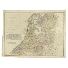
Cary’s Map of the Low Countries – Antique 1813 British Map
Located in Langweer, NL
Antique map of the Netherlands titled 'A New Map of the United Provinces comprehending Holland, Zealand, Utrecht, Gelders, Over Yssel, Friesland and Groningen (..)'. Scarce re-editio...
Category
19th Century English Antique Benelux Maps
Materials
Paper
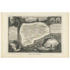
Antique Map of Doubs ‘France’ by V. Levasseur, 1854
By Victor Levasseur
Located in Langweer, NL
Antique map titled 'Dépt. du Doubs'. Map of the French department of Doubs, France. The whole is surrounded by elaborate decorative engravings designed to illustrate both the natural...
Category
Mid-19th Century Antique Benelux Maps
Materials
Paper
$171 Sale Price
20% Off
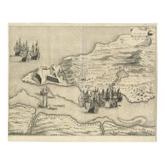
Dutch Conquest of Rio Grande, Brazil (1633) Under Prince Frederick Hendrick
Located in Langweer, NL
The image is an engraving titled “VEROVERINGE VAN RIO GRANDE IN BRASIL ANNO 1633.” This historical print depicts the Dutch conquest of Rio Grande in Brazil, known today as Natal, dur...
Category
1690s Antique Benelux Maps
Materials
Paper
$525 Sale Price
20% Off
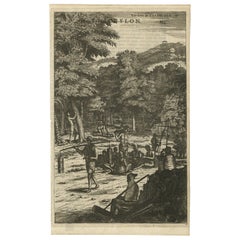
Old Print of Farmers Harvesting Cinnamon on the Island Ceylon or Sri Lanka, 1672
Located in Langweer, NL
Antique print, titled: 'Hoe men de Caneel schilt opt Eyland Ceylon.'
This rare original plate shows a group of farmers harvesting cinnamon on the island of Ceylon / Sri Lanka. Du...
Category
1670s Antique Benelux Maps
Materials
Paper
$362 Sale Price
20% Off
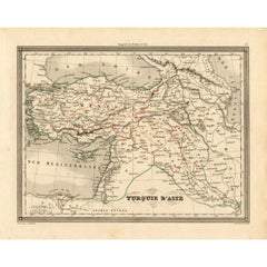
Antique Map of Turkey in Asia 'Asia Minor' by Vuillemin, 1846
Located in Langweer, NL
Antique map titled 'Turqui D'Asie'. Map of Turkey in Asia / Asia Minor. This attractive original old antique print / plate / map originates from: 'Atlas Uni...
Category
19th Century Antique Benelux Maps
Materials
Paper
$71 Sale Price
20% Off
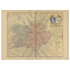
Trás-os-Montes: A Cartographic Exploration of Portugal's Hidden Province in 1903
Located in Langweer, NL
This print is an original historical map of the Trás-os-Montes region in the northeastern part of Portugal, dated 1903. Trás-os-Montes is often translated as "behind the mountains," ...
Category
Early 1900s Antique Benelux Maps
Materials
Paper
$296 Sale Price
20% Off
Original Antique Map of the Duchy of Luxembourg by De Wit, Amsterdam circa 1680
Located in Langweer, NL
Map of the Duchy of Luxembourg by De Wit, Amsterdam circa 1680
Rare original antique map of the Duchy of Luxembourg by Frederick de Wit, published in Amsterdam circa 1680. A highly ...
Category
Late 17th Century Dutch Antique Benelux Maps
Materials
Paper
Large Antique Map of Bass Strait, Tasmania, Australia by Cook, 1803
Located in Langweer, NL
Antique map Australia titled 'Kaart van Basses Straat tusschen Nieuw Zuid Wales en van Diemensland (..)'. Large chart of Bass Strait and one of t...
Category
19th Century Antique Benelux Maps
Materials
Paper
$4,298 Sale Price
20% Off
Original Antique Map of Italy with an Inset of Sardinia, 1882
Located in Langweer, NL
Embark on a historical odyssey with an original Antique Map of Italy from the esteemed 'Comprehensive Atlas and Geography of the World,' meticulously crafted in 1882. This captivatin...
Category
1880s Antique Benelux Maps
Materials
Paper
$200 Sale Price
20% Off
Old Ptolemaic Map of the Region Between the Persian Gulf and Caspian Sea, 1598
Located in Langweer, NL
"Tabula Asiae V", Ptolemy/Ruscelli
Subject: Persia - Iran
Period: 1598 (published)
Publication: Geografia di Claudio Tolomeo Allessadrino…
Claudius Ptolemy was a mathematician, ast...
Category
16th Century Antique Benelux Maps
Materials
Paper
$382 Sale Price
20% Off
Antique Print of Decorative Art in the Renaissance Period, 1869
Located in Langweer, NL
Old print of decorative art in the Renaissance period. This print originates from 'L'Ornement polychrome'. A beautiful work containing about 2000 patterns of all the styles of Art ol...
Category
19th Century Antique Benelux Maps
Materials
Paper
$171 Sale Price
20% Off
Antique Map of France at the Beginning of the 17th Century by Zannoni, 1765
By G. A. Rizzi-zannoni
Located in Langweer, NL
Antique map France titled 'Carte pour servir à intelligence de l'Histoire de France (..)'. Beautiful old map of France. This map originates from 'At...
Category
18th Century Antique Benelux Maps
Materials
Paper
$151 Sale Price
20% Off
1634 Mercator/Jansson Map: Eastern Austria with Vienna, Hand-Colored
Located in Langweer, NL
1634 Mercator/Jansson Map: Eastern Austria with Vienna, Hand-Colored
This hand-colored map from 1634, titled "Austria Archiducatus," by Mercator and Jansson, depicts the eastern reg...
Category
1630s Antique Benelux Maps
Materials
Paper
$534 Sale Price
20% Off
Navigating the Spice Trade: A Maritime Chart of the Banda Sea, 1799
Located in Langweer, NL
This original antique map is an 18th-century nautical chart by Laurie & Whittle, a well-known British firm that was involved in the publication of maps, charts, and maritime books. ...
Category
Late 18th Century Antique Benelux Maps
Materials
Paper
$945 Sale Price
20% Off
Antique Map of the East Indies by Bonne '1776'
Located in Langweer, NL
Antique map titled 'Indes IVe Feuille'. Very decorative original antique map of the East Indies. Covbers from the Gulf of Siam (Gulf of Thailand) and Malacca (Malaysia) eastward to i...
Category
Late 18th Century Antique Benelux Maps
Materials
Paper
$525 Sale Price
20% Off
Antique Coastal Views and a Map of Van Diemens Land (Tasmania), Australia, 1803
Located in Langweer, NL
Antique map Tasmania titled 'Kaart van Diemens Land'.
Coastal views and a map of van Diemens Land (Tasmania). Originates from 'Reizen Rondom de Waereld ...
Category
Early 1800s Antique Benelux Maps
Materials
Paper
$821 Sale Price
20% Off
Original Antique Map of Dresden, Germany by J. Stockdale, 1800
Located in Langweer, NL
Vintage Map of Dresden, Germany by J. Stockdale, 1800
This vintage map titled "A Plan of the City of Dresden" was published by J. Stockdale in Piccadilly, London, in 1800. It provid...
Category
Early 1800s Antique Benelux Maps
Materials
Paper
Antique Map of China and Japan by Tardieu, 1821
Located in Langweer, NL
Antique map titled 'Carte de la Chine et du Japon'. Detailed map of China, showing Korea, Japan and Taiwan. This map originates from 'L'histoire général des voyages' by J.F. de la Harpe.
Category
Early 19th Century Antique Benelux Maps
Materials
Paper
$692 Sale Price
20% Off
Antique Railway Folding Map of Central Europe by Müller, 1870
Located in Langweer, NL
Antique map titled 'Karte der Eisenbahnen Mittel-Europa's (..)'. Railway folding map of Central Europe. Published by Carl Flemming, 1870.
Category
Late 19th Century Antique Benelux Maps
Materials
Paper
$716 Sale Price
20% Off
Set of Three Antique Maps of Africa by Colton (circa 1855)
Located in Langweer, NL
Set of three individual maps of Africa including 'North West Africa', 'North Eastern Africa' and 'Southern Africa'. All three maps are surrounded by Colton's typical spiral motif border. Colton names numerous African tribes and nations throughout. An interesting set of maps...
Category
Mid-19th Century Antique Benelux Maps
Materials
Paper
$334 Sale Price / set
20% Off
Antique Map of Sweden and Norway by W. G. Blackie, 1859
Located in Langweer, NL
Antique map titled 'Sweden and Norway'. Original antique map of Sweden and Norway. This map originates from ‘The Imperial Atlas of Modern Geography’. Published by W. G. Blackie, 1859.
Category
Mid-19th Century Antique Benelux Maps
Materials
Paper
$238 Sale Price
20% Off
Early Woodcut Map of the Rhine River Region in Germany and Holland, circa 1628
Located in Langweer, NL
Early Woodcut Map of the Rhine River Region, "Die Dritte Tafel des Rheinstroms," ca. 16th Century
This early woodcut map, titled "Die Dritte Tafel des Rheinstroms Innhaltend das Nid...
Category
1620s Antique Benelux Maps
Materials
Paper
Antique Map of the East Indies by Levasseur, '1875'
Located in Langweer, NL
Antique map titled 'Carte de la Malaisie'. Large map of the East Indies. This map originates from 'Atlas de Géographie Moderne Physique et Politique' by A. Levasseur. Published 1875.
Category
Late 19th Century Antique Benelux Maps
Materials
Paper
$447 Sale Price
25% Off
Antique Map of the Franconia Region by Scherer, 1699
Located in Langweer, NL
Antique map titled 'Franconia multa numerat loca deiparae sacra in quibus magna recipit à dei matre beneficia.' Detailed uncommon map of the Franconia region in Germany. Source unkno...
Category
17th Century Antique Benelux Maps
Materials
Paper
$214 Sale Price
20% Off
Antique Map of the City of Bolsward, Friesland in The Netherlands, c.1598
Located in Langweer, NL
Antique map titled ‘Bolzvardia vetus in Frisia Foederis (..)’. Old map of the city of Bolsward, Friesland. Originally part of a sheet together with the cities of Stavoren, Harlingen ...
Category
16th Century Antique Benelux Maps
Materials
Paper
$334 Sale Price
20% Off
Exquisite 1600 Ortelius Map of Artois, France: A Collector’s Piece
Located in Langweer, NL
Exquisite 1600 Ortelius Map of Artois, France: A Collector’s Piece with Rich Historical Detail
Description of the Map:
This map, titled "Atrebatum Regionis Vera Descriptio," create...
Category
Early 1600s Antique Benelux Maps
Materials
Paper
$945 Sale Price
20% Off
Antique Map of Russia in Asia and Siberia, with Frame Style Border
Located in Langweer, NL
Antique map titled 'Sibérie ou Russie d'Asie'. Attractive map of Russia in Asia and Siberia. This map originates from Maison Basset's 1852 edition of 'Atlas Illustre Destine a l'ense...
Category
Mid-19th Century Antique Benelux Maps
Materials
Paper
$143 Sale Price
20% Off
Antique Map of the Region of Poitou by Janssonius, 1657
By Johannes Janssonius
Located in Langweer, NL
Antique map 'Pictauiae Ducatus Descriptio vulgo le Pais de Poictov'. Decorative map of the region of Poitou with Rochelle, Nantes, etc., France. This map originates from 'Atlas Novus...
Category
Mid-17th Century Antique Benelux Maps
Materials
Paper
$525 Sale Price
20% Off
Antique Map of the Region of Pays de Caux by Janssonius, 1657
By Johannes Janssonius
Located in Langweer, NL
Antique map 'Le Pais de Caux'. Decorative map of the region of Pays de Caux, France. This map originates from 'Atlas Novus, Sive Theatrum Orbis Orbis Terrarum: In quo Galliae, Helvet...
Category
Mid-17th Century Antique Benelux Maps
Materials
Paper
$525 Sale Price
20% Off
Old Handcolored Antique Map of Pays De Caux in Normandy, France, ca.1640
Located in Langweer, NL
Antique map titled 'Le Pais de Caux'.
Old map of Pays de Caux, France. Pays de Caux is an area in Normandy occupying the greater part of the French département of Seine Maritime ...
Category
1640s Antique Benelux Maps
Materials
Paper
$1,289 Sale Price
20% Off
Antique Map of Greece, Turkey and surroundings with original coloring
Located in Langweer, NL
Antique map titled 'Nieuwe Kaart van Europisch Turkyen na de alderlaatste ontdekking in t licht gebracht'. Antique map of Greece with Crete and Cyprus, Turkey and the Black Sea. Publ...
Category
Mid-18th Century Antique Benelux Maps
Materials
Paper
$659 Sale Price
20% Off
Antique Map of Vermont
Located in Langweer, NL
Antique map titled 'Vermont'. Original antique map of Vermont, United States. This print originates from 'Encyclopaedia Britannica', Ninth Edition. Publ...
Category
Late 19th Century Antique Benelux Maps
Materials
Paper
$276 Sale Price
20% Off
Copper-Engraved Map Showing the Algerian Coast of North Africa, Published 1683
Located in Langweer, NL
Antique map titled 'Partie de Barbarie, ou est le Royaume d'Alger (..)'.
Copper-engraved map showing the Algerian coast of North Africa. Published 1683.
Artists and Engravers:...
Category
1680s Antique Benelux Maps
Materials
Paper
$324 Sale Price
20% Off
Antique Architectural Print of Pavilions for English Gardens by Le Rouge, 1776
Located in Langweer, NL
Antique print titled 'Pavillons Grottes pour les Jardins Anglais'. Copper engraving showing pavilions for English gardens. This print originates from 'J...
Category
18th Century Antique Benelux Maps
Materials
Paper
$324 Sale Price
20% Off
Pl. 2 Antique Print of Vauxhall Gardens by Le Rouge, c.1785
Located in Langweer, NL
Antique print titled 'Vue d'une partie du Voxhal de Londres'. Copper engraving of Vauxhall gardens, London. This print originates from 'Jardins Anglo-Chinois à la Mode' by Georg Loui...
Category
18th Century Antique Benelux Maps
Materials
Paper
Antique Map of Spain and Portugal by Lowry, '1852'
Located in Langweer, NL
Antique map titled 'Spain and Portugal'. Original map of Spain and Portugal. This map originates from 'Lowry's Table Atlas constructed and engraved ...
Category
Mid-19th Century Antique Benelux Maps
Materials
Paper
$95 Sale Price
20% Off
Antique Architectural Print of Villa a Deauville in France, Chabat, c.1900
Located in Langweer, NL
Antique print titled 'Villa a Deauville, Mr. H. Blondel Architecte, Mr. Breney Architecte'. This print depicts the design of a building in France. Originates from 'La Brique et La Te...
Category
20th Century Benelux Maps
Materials
Paper
Original Antique Engraving of Algiers in Algeria, 1773
Located in Langweer, NL
Antique print titled 'Algiers'. Old print with a view of Algiers, Algeria. With Dutch legend. Originates from the first Dutch editon of an interesting travel account of Northern Afri...
Category
18th Century Antique Benelux Maps
Materials
Paper
$468 Sale Price
20% Off
Very Rare Antique Print of the Kings Celebrations in Pegu, Myanmar, 1682
Located in Langweer, NL
Plate: 'Konings feesten tot Pegu.' (Kings celebrations in Pegu.)
On this plate: 1. The King. 2. And the Queen, sprinkling water on each other. 3. Their children. 4. Officers. 5. ...
Category
1680s Antique Benelux Maps
Materials
Paper
$439 Sale Price
20% Off
Antique Map of France in Ancient Roman Times, 1880
Located in Langweer, NL
Antique map titled 'Gaule indépendante et Romaine'.
Old map of Gaul or France in ancient Roman times. The map covers from the southern part of England (Britannia) to the north of S...
Category
19th Century Antique Benelux Maps
Materials
Paper
$181 Sale Price
20% Off
Map of Groningen from The Genealogy of the Illustrious Counts of Nassau (1615)
Located in Langweer, NL
Title: Map of Groningen from "The Genealogy of the Illustrious Counts of Nassau" (1615)
Description: This antique map, titled "Gronenga," offers a detailed depiction of the forti...
Category
1610s Antique Benelux Maps
Materials
Paper
$525 Sale Price
20% Off
Antique Print of Graves Near the City of Nanjing in China, 1665
Located in Langweer, NL
Antique print titled 'Graf-Steden'. Old print depicting graves near the city of Nanjing, China. This print originates from 'Het gezantschap der Nee^rlandtsche Oost-Indische Compagnie...
Category
17th Century Antique Benelux Maps
Materials
Paper
$210 Sale Price
20% Off
Original Antique Map of Egypt by Van Dùren '1749'
Located in Langweer, NL
Decorative German antique engraving with titled 'Neue Vorstellung von Aegypten (..)'. It concerns a rare original antique map of Egypt. This map o...
Category
Mid-18th Century Antique Benelux Maps
Materials
Paper
$245 Sale Price
25% Off
Old Map of the Eastern Region of the Kingdom of Algiers, Algeria, 1773
Located in Langweer, NL
Antique map titled 'Kaart van het Oostelyke Deel van het Ryk van Algiers'.
Old map of the eastern region of the Kingdom of Algiers, Algeria. Originates from the first Dutch edito...
Category
1770s Antique Benelux Maps
Materials
Paper
$439 Sale Price
20% Off
Antique Map of the City of Copenhagen in Denmark c.1720
Located in Langweer, NL
Antique map titled 'Copenhagen'. Original antique map of the city of Copenhagen, Denmark. This map originates from 'Unterschiedliche dieser Zeit Beruffene Laender, Gegenden, Staedte ...
Category
18th Century Danish Antique Benelux Maps
Materials
Paper
Decorative 1850s Map of Eastern Canada and New Brunswick with Historic Vignettes
Located in Langweer, NL
Decorative 1850s Map of Eastern Canada and New Brunswick with Historic Vignettes
This beautifully crafted 19th-century map of Eastern Canada and New Brunswick, drawn and engrave...
Category
1850s Antique Benelux Maps
Materials
Paper
Antique Map of The United States Southern Section by A & C. Black, 1870
Located in Langweer, NL
Antique map titled 'United States Southern Section'. Original antique map of Map of The United States Southern Section. This map originates from ‘Black's General Atlas of The World’....
Category
Late 19th Century Antique Benelux Maps
Materials
Paper
$238 Sale Price
20% Off
Map of Western Australia & Swan River, insets of Perth, Aboriginals, Sheep, 1851
Located in Langweer, NL
Antique map titled 'Western Australia, Swan River'. Map of Western Australia and Swan River, surrounded by illustrations of Perth, Aborigines and sheep shea...
Category
1850s Antique Benelux Maps
Materials
Paper
$305 Sale Price
20% Off
Antique Map of Manchuria and the Northeast Portion of Tartary
Located in Langweer, NL
Antique map titled 'Carte de la Tartarie Orientale (..)'. Detailed map of Manchuria and the Northeast portion of Tartary, including Sagallan Anga Hata--Isle de la Bouche...
Category
Mid-18th Century Antique Benelux Maps
Materials
Paper
$276 Sale Price
20% Off
Antique Map of Italy with Hand-Colored Borders, 1852
Located in Langweer, NL
Antique map titled 'Italië'. Map of Italy. This map originates from 'School-Atlas van alle deelen der Aarde' by Otto Petri. Artists and Engravers: Published by A. Baedeker (Otto Petr...
Category
19th Century Antique Benelux Maps
Materials
Paper
$210 Sale Price
20% Off
Antique Map of the Island of Psara by Dapper, 1688
Located in Langweer, NL
Antique map titled 'Sara.' Map of Psara ( Psyra or Ipsera) Island (North East Aegean Islands), Greece. This map originates from 'Nauwkeurige Beschrijving der eilanden in de Archipel ...
Category
17th Century Antique Benelux Maps
Materials
Paper
$143 Sale Price
20% Off
Map of Styria by William Blaeu, 1645: A Masterpiece of 17th-Century Cartography
Located in Langweer, NL
This 1645 map, created by Willem Janszoon Blaeu, represents Styria (Steyrmark), a historical region in present-day Austria, located in the Alpine regions. Blaeu, one of the most sign...
Category
1640s Antique Benelux Maps
Materials
Paper
Detailed Decorative Antique Map of the Coast of Malabar and Coromandel, India
Located in Langweer, NL
Antique map titled 'Carte des Côtes de Malabar et de Coromandel'. Finely engraved map of the southern part of India, first issued in 1723 by acclaimed French mapmaker Guillaume De L’Isle. It focuses on trade routes within India, as well as the Coromandel and Malabar Coasts...
Category
Mid-18th Century Antique Benelux Maps
Materials
Paper
$1,146 Sale Price
20% Off
1811 John Cary Map of Lower Saxony - Featuring Bremen, Holstein, and More
Located in Langweer, NL
Title: "1811 John Cary Map of Lower Saxony - Featuring Bremen, Holstein, and More"
Description: This is an exquisite map of the Lower Saxony region, created by the renowned cartogra...
Category
1810s Antique Benelux Maps
Materials
Paper
Original Antique Map of the Road from Bristol to Weymouth
Located in Langweer, NL
Antique map titled 'The Road from Bristol to Weymouth (..)'. Original antique map of the road from Bristol to Weymouth. Plate 60 from Ogilby's 'Britannia', the first road atlas of En...
Category
Late 17th Century Antique Benelux Maps
Materials
Paper
$210 Sale Price
20% Off
Antique Map of Southern Germany by F. de Wit, circa 1680
Located in Langweer, NL
This antique map depicts a portion of southern Germany that included the historic regions of Bavaria, the Palatinate, Prussia-Brandenburg, the Rhineland and Saxony. Regensberg, Freis...
Category
Late 17th Century Antique Benelux Maps
Materials
Paper
$663 Sale Price
20% Off
Antique Map of Friesland, Province in The Netherlands, 1864
Located in Langweer, NL
Antique map titled 'De Provincie Friesland'. Map of the province of Friesland, the Netherlands. This map originates from 'F. C. Brugsma's Atlas van het Koninkrijk der Nederlanden (.....
Category
19th Century Antique Benelux Maps
Materials
Paper
$133 Sale Price
20% Off
Antique Engravings of Mauritius and Indonesia, incl de Banda Islands, c.1730
Located in Langweer, NL
Title on page: "Ins. de Cerno a. Nostatibus Mauritius Nominata [on sheet with] Gunnanappi Labetacq [and] Civitas Gammelamme [and] Rex Tubatus", Le Clerc, Jean
This sheet includes fo...
Category
1730s Antique Benelux Maps
Materials
Paper
$525 Sale Price
20% Off
Old Map of The Kurile Islands, from Hokkaido, Japan to Kamchatka, Russia, c.1750
Located in Langweer, NL
Antique map titled 'Carte des Iles Kouriles'. Original antique map of the Kuril Islands.
The Kuril Islands or Kurile Islands are a volcanic archipelago that stretches approximate...
Category
1750s Antique Benelux Maps
Materials
Paper
$315 Sale Price
20% Off
Historic Map of the Bishopric of Paderborn by Blaeu, a Masterpiece of 1645
Located in Langweer, NL
This hand-colored map, titled "Paderbornensis Episcopatus Descriptio Nova," depicts the Bishopric of Paderborn, a historical ecclesiastical territory within the Holy Roman Empire, lo...
Category
1640s Antique Benelux Maps
Materials
Paper
$496 Sale Price
20% Off
Recently Viewed
View AllMore Ways To Browse
Greek Key Dresser
Green Glass Bud Vase Vintage
Gucci Tray
Half Moon Shelves
Handblown Glass Decanter
Heart Shaped Glass Dish
Hepplewhite Drop Leaf Table
Herend Cup
Hermes Dish
Horse Head Barware
Horse Mantel Clock
Large Limoges Platter
Michelangelo David Statue
Michelin Guide
Persian Khatam
Royal Worcester Aesthetic
Russell Woodard Aluminum
Russian Silver Niello
