Items Similar to Antique Coastal Views and a Map of Van Diemens Land (Tasmania), Australia, 1803
Want more images or videos?
Request additional images or videos from the seller
1 of 5
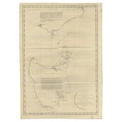
Antique Coastal Views and a Map of Van Diemens Land (Tasmania), Australia, 1803
About the Item
Antique map Tasmania titled 'Kaart van Diemens Land'.
Coastal views and a map of van Diemens Land (Tasmania). Originates from 'Reizen Rondom de Waereld door James Cook (..)'.
Artists and Engravers: Translated by J.D. Pasteur. Published by Honkoop, Allart en Van Cleef.
- Dimensions:Height: 10.04 in (25.5 cm)Width: 17.33 in (44 cm)Depth: 0 in (0.02 mm)
- Materials and Techniques:
- Period:
- Date of Manufacture:1803
- Condition:Condition: Good, general age-related toning. Some tiny holes, please study image carefully.
- Seller Location:Langweer, NL
- Reference Number:
About the Seller
5.0
Platinum Seller
These expertly vetted sellers are 1stDibs' most experienced sellers and are rated highest by our customers.
Established in 2009
1stDibs seller since 2017
1,933 sales on 1stDibs
Typical response time: <1 hour
- ShippingRetrieving quote...Ships From: Langweer, Netherlands
- Return PolicyA return for this item may be initiated within 14 days of delivery.
More From This SellerView All
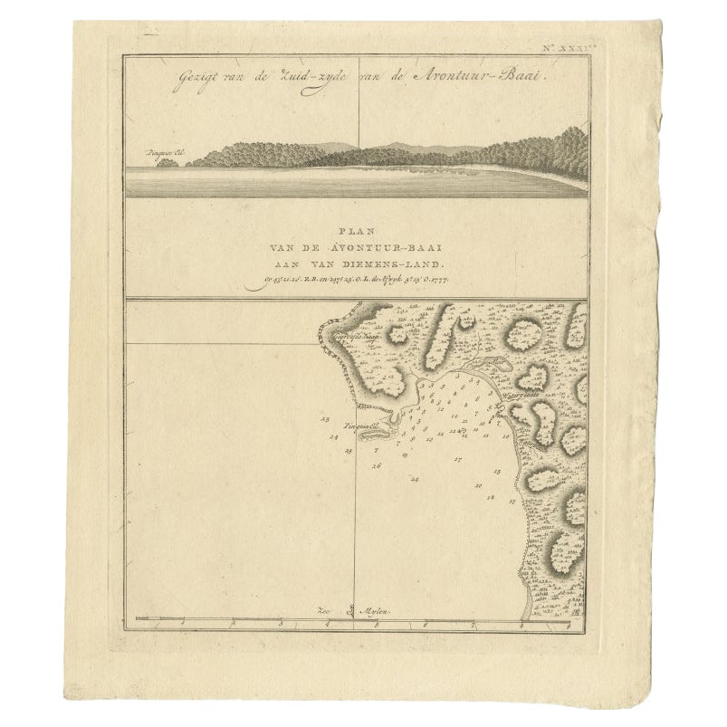
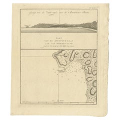
- Antique Map of Adventure Bay, Van Diemens Land, Nowadays Tasmania Island, 1803Located in Langweer, NLAntique map Adventure Bay titled 'Plan van de Avontuur-Baai aan van Diemens-Land'. Antique map and coastal view of Adventure Bay. Originates from 'Reizen Ro...Category
Antique 19th Century Maps
MaterialsPaper
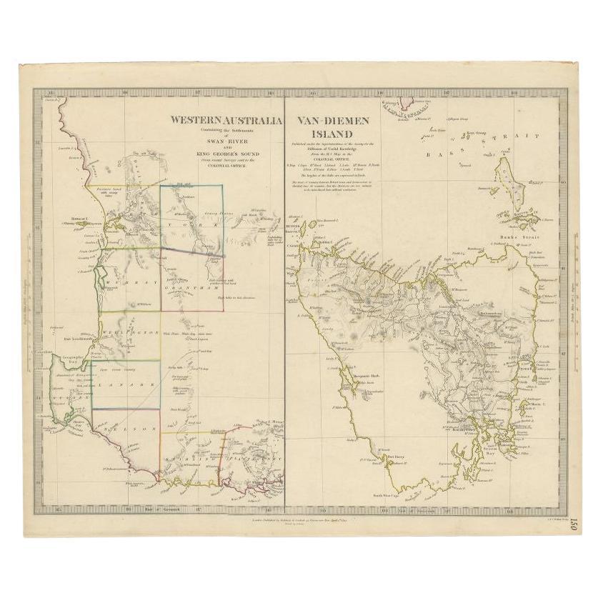
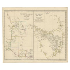
- Antique Map of Western Australia and Van Diemen's Land or Tasmania, 1833Located in Langweer, NLAntique map of Australia titled 'Western Australia - Van-Diemen Island'. Two maps on one sheet. Left, Western Australia containing the settlements of the Swan river...Category
Antique 19th Century Maps
MaterialsPaper
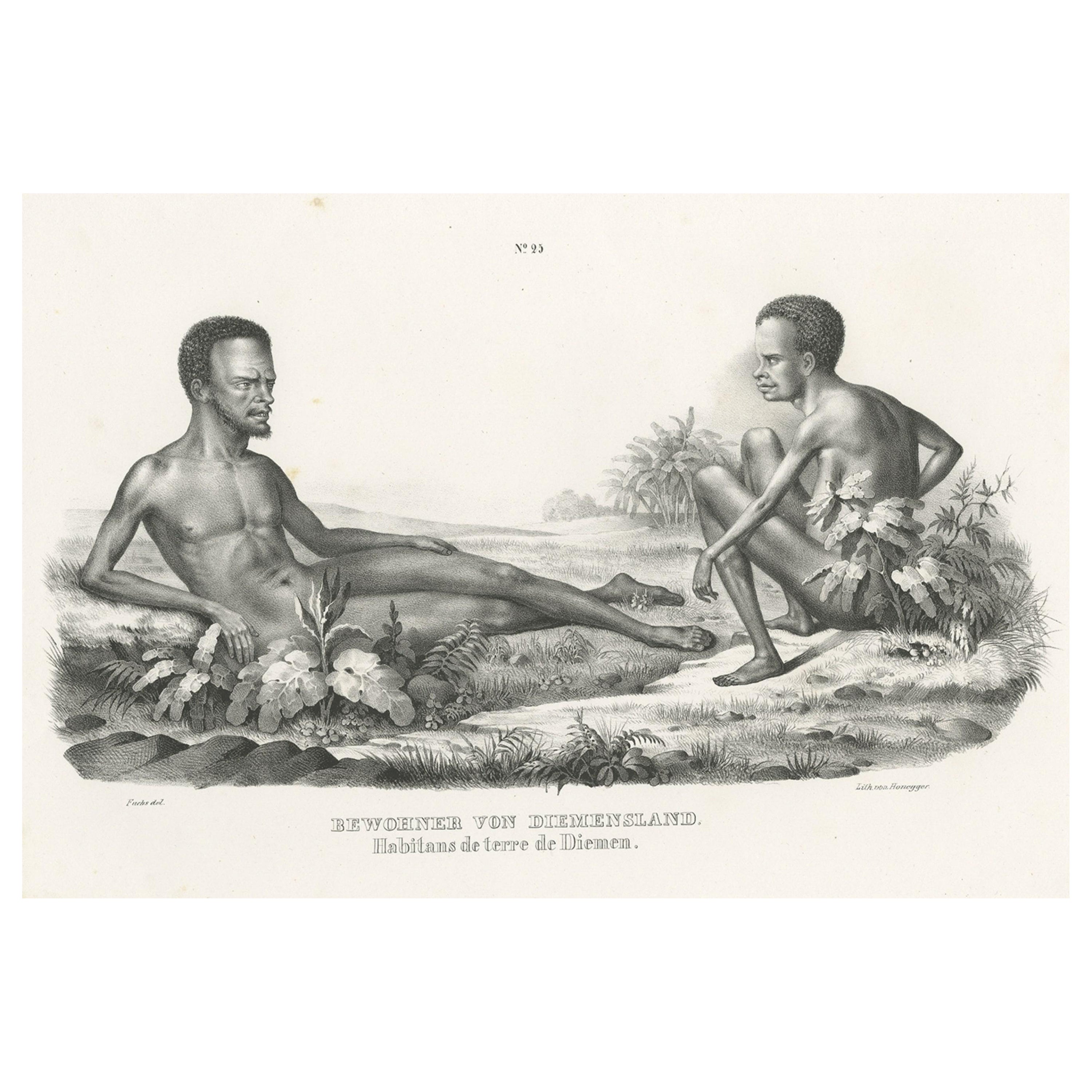
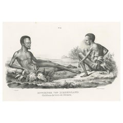
- Old Print Depicting Inhabitants of Van Diemen's Land, Tasmania, Australia, c1845Located in Langweer, NLAntique print titled 'Bewohner von Diemensland, Habitans de terre de Diemen'. This print depicts inhabitants of Van Diemen's Land, Tasmania/Australia. O...Category
Antique 1840s Prints
MaterialsPaper
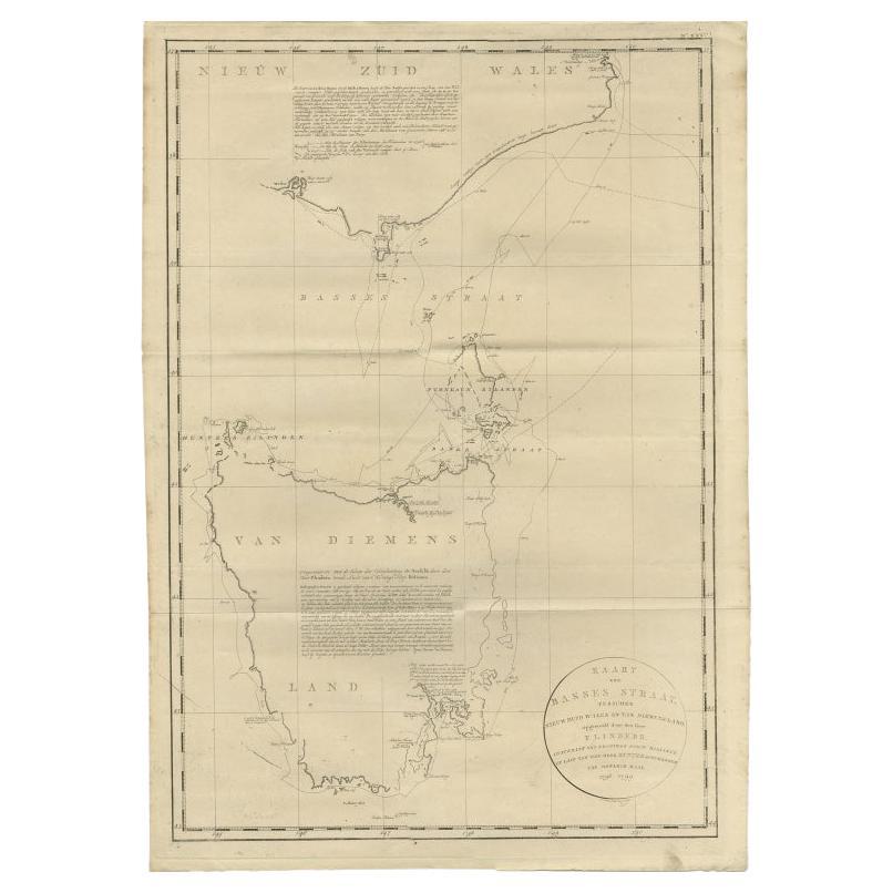
- Large Antique Map of Bass Strait, Tasmania, Australia by Cook, 1803Located in Langweer, NLAntique map Australia titled 'Kaart van Basses Straat tusschen Nieuw Zuid Wales en van Diemensland (..)'. Large chart of Bass Strait and one of t...Category
Antique 19th Century Maps
MaterialsPaper
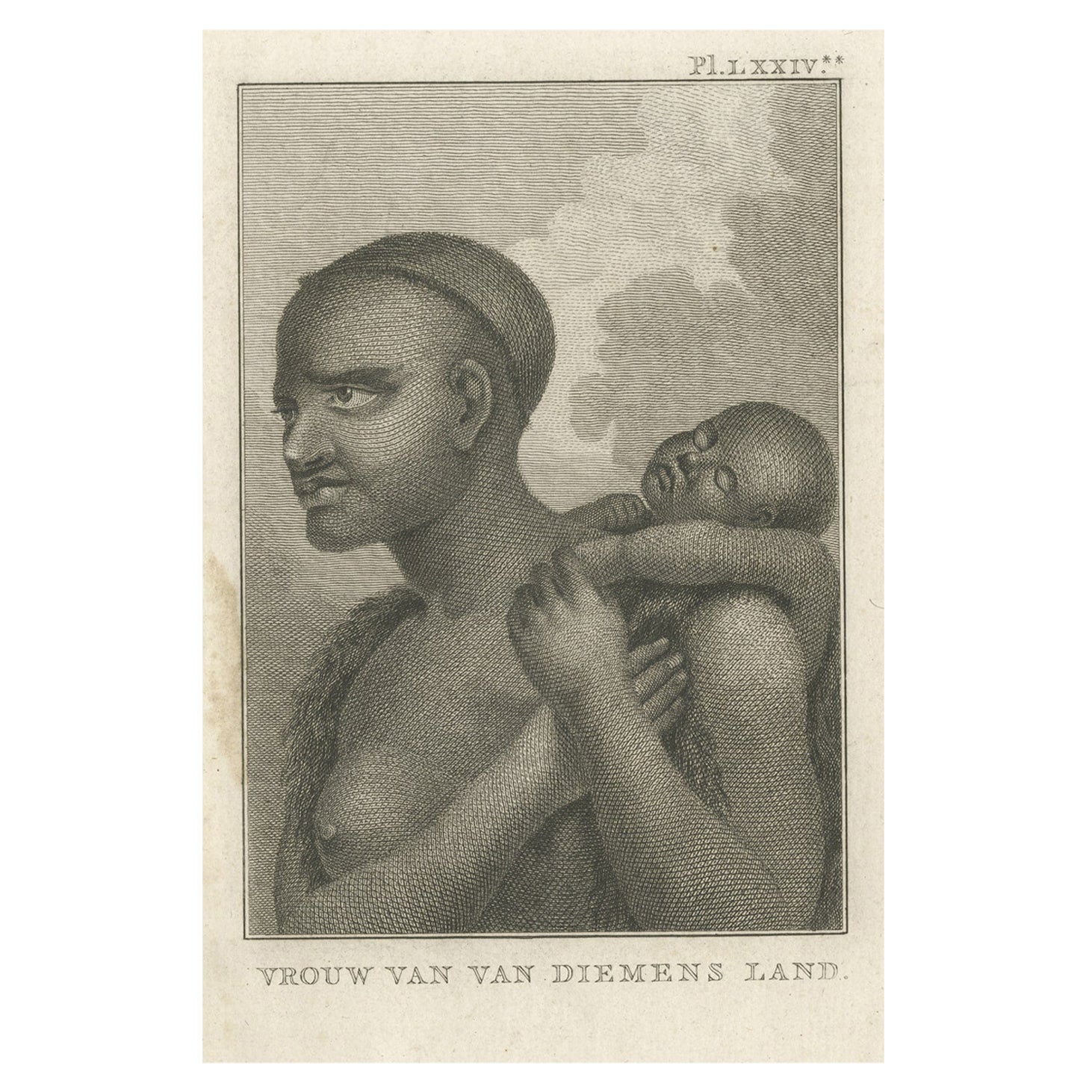
- Antique Print of a Native Aboriginal Woman of Van Diemen's Land, Australia, 1803Located in Langweer, NLDescription: Antique print titled 'Vrouw van Van Diemens Land'. Antique print depicting a woman of Van Diemen's Land, Tasmania, Australia. Originates fr...Category
Antique Early 1800s Prints
MaterialsPaper
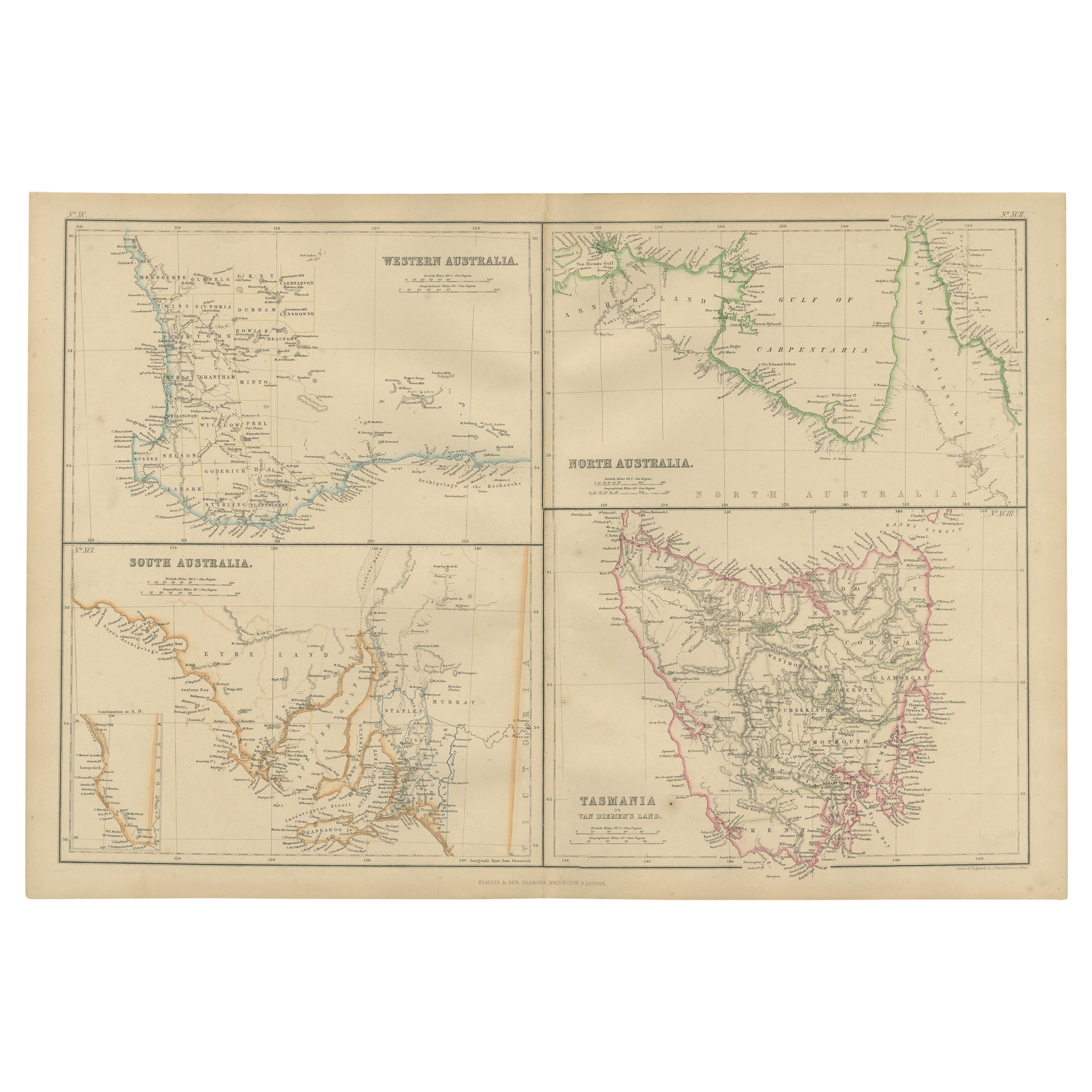
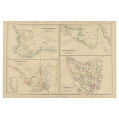
- Antique Map of West, South, North Australia and Tasmania by W. G. Blackie, 1859Located in Langweer, NLAntique map titled 'Western Australia, South Australia, North Australia and Tasmania'. Original antique map of Western Australia, South Australia, North Australia and Tasmania. This ...Category
Antique Mid-19th Century Maps
MaterialsPaper

You May Also Like
- Antique Map of Principality of MonacoBy Antonio Vallardi EditoreLocated in Alessandria, PiemonteST/619 - "Old Geographical Atlas of Italy - Topographic map of ex-Principality of Monaco" - ediz Vallardi - Milano - A somewhat special edition ---Category
Antique Late 19th Century Italian Other Prints
MaterialsPaper
- Original Antique Map of Spain and Portugal, circa 1790Located in St Annes, LancashireSuper map of Spain and Portugal Copper plate engraving by A. Bell Published, circa 1790. Unframed.Category
Antique 1790s English Other Maps
MaterialsPaper
- Original Antique Map of Italy. C.1780Located in St Annes, LancashireGreat map of Italy Copper-plate engraving Published C.1780 Unframed.Category
Antique Early 1800s English Georgian Maps
MaterialsPaper

- Original Antique Map of Asia. C.1780Located in St Annes, LancashireGreat map of Asia Copper-plate engraving Published C.1780 Two small worm holes to right side of map Unframed.Category
Antique Early 1800s English Georgian Maps
MaterialsPaper

- Original Antique Map of India. C.1780Located in St Annes, LancashireGreat map of India Copper-plate engraving Published C.1780 Three small worm holes to right side of map and one bottom left corner Unframed.Category
Antique Early 1800s English Georgian Maps
MaterialsPaper

- Vintage "View of the Center of Paris Taken from the Air" Lithograph MapLocated in San Diego, CAA very stylish "View of the Center of Paris Taken from the Air" lithograph map published by the Paris Ministry of Tourism, circa early 1950s. The piece measures 27" x 43" and shows...Category
20th Century French Mid-Century Modern Prints
MaterialsPaper


Recently Viewed
View AllMore Ways To Browse
Australian Antiques
Coastal Antique
Australia Antique Furniture
Antique Collectables Australia
Antique Van Cleef
Antique Maps Australia
Antique Map Australia
Australia Antique Map
Antique Australian Maps
Antique Australia Map
Antique Australian Map
Antique Maps Of Australia
Antique Map Of Australia
Coastal Maps
James Cook Map
Van Diemen
Tasmania Antique
Antique Tasmania