United Kingdom Maps
to
10
353
5,466
195
353
65
33
9
6
2
1
1
1
59
198
96
88
2
2
52
1
27
1
310
57
30
11
8
294
277
168
53
53
353
353
353
28
4
1
1
1
Item Ships From: United Kingdom
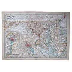
Original Antique Map of the American State of Maryland & Delaware, 1903
Located in St Annes, Lancashire
Antique map of Maryland And Delaware
Published By A & C Black. 1903
Original colour
Good condition
Unframed.
Free shipping
Category
Early 1900s English Antique United Kingdom Maps
Materials
Paper
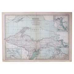
Original Antique Map of the American State of Michigan ( Northern Part ), 1903
Located in St Annes, Lancashire
Antique map of Michigan ( Northern part )
Published By A & C Black. 1903
Original colour
Good condition
Unframed.
Free shipping
Category
Early 1900s English Antique United Kingdom Maps
Materials
Paper
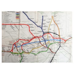
Original Antique Map of The London Underground. 1911
Located in St Annes, Lancashire
Superb map of The London Underground
Published by Ward Lock, 1911
Folding map. Printed on paper
Unframed.
Good condition/ Minor repair to an edge tear on right edge ( shown in ...
Category
1910s English Vintage United Kingdom Maps
Materials
Canvas, Paper
Original Antique Map of Ancient Greece, Achaia, Corinth, 1786
Located in St Annes, Lancashire
Great map of Ancient Greece. Showing the region of Thessaly, including Mount Olympus
Drawn by J.D. Barbie Du Bocage
Copper plate engraving by P.F Tardieu
Original hand color...
Category
1780s French Other Antique United Kingdom Maps
Materials
Paper
Large Original Antique Map of the World, Fullarton, circa 1870
Located in St Annes, Lancashire
Great map of the World.
From the celebrated Royal Illustrated Atlas
Lithograph. Original color.
Published by Fullarton, Edinburgh, circa 1870.
Unframed.
Category
1870s Scottish Antique United Kingdom Maps
Materials
Paper
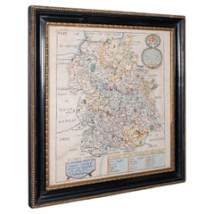
Antique County Map, Shropshire, English, Atlas Engraving, Richard Blome, C.1673
Located in Hele, Devon, GB
This is an antique county map of Shropshire. An English, framed atlas engraving by Richard Blome, dating to the 17th century and later.
A treat for the collector or county native, ...
Category
17th Century British Restauration Antique United Kingdom Maps
Materials
Glass, Wood, Paper
Original Antique Map or City Plan of Rome, Italy. Circa 1835
Located in St Annes, Lancashire
Nice map of Rome
Drawn and engraved by J.Dower
Published by Orr & Smith. C.1835
Unframed.
Free shipping
Category
1830s English Antique United Kingdom Maps
Materials
Paper
Original Antique Map of the American State of Indiana, 1903
Located in St Annes, Lancashire
Antique map of Indiana
Published By A & C Black. 1903
Original colour
Good condition
Unframed.
Free shipping
Category
Early 1900s English Antique United Kingdom Maps
Materials
Paper
Large Original Antique Map of Ireland. C.1900
Located in St Annes, Lancashire
Fabulous map of Ireland
Original color.
Engraved and printed by the George F. Cram Company, Indianapolis.
Published, C.1900.
Unframed.
Free shipping.
Category
1890s American Antique United Kingdom Maps
Materials
Paper
Antique Lithography Map, Huntingdonshire, English, Framed Cartography, Victorian
Located in Hele, Devon, GB
This is an antique lithography map of Huntingdonshire. An English, framed atlas engraving of cartographic interest, dating to the mid 19th century and later.
Superb lithography of ...
Category
Mid-19th Century British Victorian Antique United Kingdom Maps
Materials
Glass, Wood, Paper
Original Antique Map of Hawaii And Adjacent Islands. C.1900
Located in St Annes, Lancashire
Fabulous map of Hawaii. With a vignette of Honolulu
Original color.
Engraved and printed by the George F. Cram Company, Indianapolis.
Published, C.1900.
Unframed.
Free shipping.
Category
1890s American Antique United Kingdom Maps
Materials
Paper
Original Antique Map of South East Asia by Thomas Clerk, 1817
Located in St Annes, Lancashire
Great map of South East Asia
Copper-plate engraving
Drawn and engraved by Thomas Clerk, Edinburgh.
Published by Mackenzie And Dent, 1817
Unframed.
Category
1810s English Antique United Kingdom Maps
Materials
Paper
Original Antique Map or City Plan of Amsterdam, Netherlands. Circa 1835
Located in St Annes, Lancashire
Nice map of Amsterdam
Drawn and engraved by J.Dower
Published by Orr & Smith. C.1835
Unframed.
Free shipping
Category
1830s English Antique United Kingdom Maps
Materials
Paper
Original Antique Map of North America by Dower, circa 1835
Located in St Annes, Lancashire
Nice map of North America
Drawn and engraved by J.Dower
Published by Orr & Smith. C.1835
Unframed.
Free shipping
Category
1830s English Antique United Kingdom Maps
Materials
Paper
Large Original Vintage Map of the United Kingdom, circa 1920
Located in St Annes, Lancashire
Great map of The United Kingdom
Unframed
Original color
By John Bartholomew and Co. Edinburgh Geographical Institute
Published, circa 1920
Free shipping.
Category
1920s British Vintage United Kingdom Maps
Materials
Paper
Large Original Antique Map of the Environs of Cork, Ireland, circa 1880
Located in St Annes, Lancashire
Great map of The Environs of Cork
Published circa 1880
Unframed
Free shipping.
Category
1880s Scottish Antique United Kingdom Maps
Materials
Paper
Original Antique Map of Europe, Arrowsmith, 1820
Located in St Annes, Lancashire
Great map of Europe
Drawn under the direction of Arrowsmith.
Copper-plate engraving.
Published by Longman, Hurst, Rees, Orme and Brown, 1820
...
Category
1820s English Antique United Kingdom Maps
Materials
Paper
Large Original Antique Map of Massachusetts, USA, circa 1900
Located in St Annes, Lancashire
Fabulous map of Massachusetts
In 2 sheets. They can be joined but I have not done it
Original color
Engraved and printed by the George F. Cram ...
Category
1890s American Antique United Kingdom Maps
Materials
Paper
Original Antique Map or City Plan of Venice, Italy. Circa 1835
Located in St Annes, Lancashire
Nice map of Venice
Drawn and engraved by J.Dower
Published by Orr & Smith. C.1835
Unframed.
Free shipping
Category
1830s English Antique United Kingdom Maps
Materials
Paper
Original Antique Map of the American State of Connecticut & Rhode Island, 1903
Located in St Annes, Lancashire
Antique map of Connecticut and Rhode Island
Published By A & C Black. 1903
Original colour
Good condition
Unframed.
Free shipping
Category
Early 1900s English Antique United Kingdom Maps
Materials
Paper
Original Antique Map of the American State of Maine, 1903
Located in St Annes, Lancashire
Antique map of Maine
Published By A & C Black. 1903
Original colour
Good condition
Unframed.
Free shipping
Category
Early 1900s English Antique United Kingdom Maps
Materials
Paper
Original Antique Map of the American State of North Carolina, 1903
Located in St Annes, Lancashire
Antique map of North Carolina
Published By A & C Black. 1903
Original colour
Good condition
Unframed.
Free shipping
Category
Early 1900s English Antique United Kingdom Maps
Materials
Paper
Original Antique Map of the American State of Colorado, 1903
Located in St Annes, Lancashire
Antique map of Colorado
Published By A & C Black. 1903
Original colour
Good condition
Unframed.
Free shipping
Category
Early 1900s English Antique United Kingdom Maps
Materials
Paper
Original Antique Map of the American State of Ohio ( Southern Part ), 1903
Located in St Annes, Lancashire
Antique map of Ohio ( Southern part )
Published By A & C Black. 1903
Original colour
Good condition
Unframed.
Free shipping
Category
Early 1900s English Antique United Kingdom Maps
Materials
Paper
Original Antique Map of the American State of Michigan ( Southern Part ), 1903
Located in St Annes, Lancashire
Antique map of Michigan ( Southern part )
Published By A & C Black. 1903
Original colour
Good condition
Unframed.
Free shipping
Category
Early 1900s English Antique United Kingdom Maps
Materials
Paper
Original Antique Map of Scotland by Dower, circa 1835
Located in St Annes, Lancashire
Nice map of Scotland
Drawn and engraved by J.Dower
Published by Orr & Smith. C.1835
Unframed.
Free shipping
Category
1830s English Antique United Kingdom Maps
Materials
Paper
Large Original Antique Map of Ohio, Usa, C.1900
Located in St Annes, Lancashire
Fabulous map of Ohio
Original color.
Engraved and printed by the George F. Cram Company, Indianapolis.
Published, C.1900.
Unframed.
Free shipping.
Category
1890s American Antique United Kingdom Maps
Materials
Paper
Large Original Vintage Map of Persia / Iran, circa 1920
Located in St Annes, Lancashire
Great maps of Persia.
Unframed.
Original color.
By John Bartholomew and Co. Edinburgh Geographical Institute.
Published, circa 1920.
Free shipping.
Category
1920s British Vintage United Kingdom Maps
Materials
Paper
Original Antique Map of the American State of Missouri ( Northern part ), 1903
Located in St Annes, Lancashire
Antique map of Missouri ( Northern Part )
Published By A & C Black. 1903
Original colour
Good condition
Unframed.
Free shipping
Category
Early 1900s English Antique United Kingdom Maps
Materials
Paper
Vintage Reproduction 17th Century Map of Europe, American, Cartography, Blaeuw
Located in Hele, Devon, GB
This is a vintage reproduction map of Europe. An American, paper stock cartography print in frame after the work by Blaeuw, dating to the late 20t...
Category
Late 20th Century Central American Mid-Century Modern United Kingdom Maps
Materials
Glass, Wood, Paper
Large Original Antique Map of Maryland, Delaware & DC, USA, C.1900
Located in St Annes, Lancashire
Fabulous map of Maryland, Delaware And District of Columbia
Original color
Engraved and printed by the George F. Cram Company, Indianapolis.
Pu...
Category
1890s American Antique United Kingdom Maps
Materials
Paper
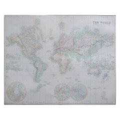
Large Original Vintage Map of The World, circa 1920
Located in St Annes, Lancashire
Great map of The World
Original color.
Good condition / minor foxing
Published by Alexander Gross
Unframed.
Category
1920s English Vintage United Kingdom Maps
Materials
Paper
Original Antique Map of the American State of California ( Southern Part ), 1903
Located in St Annes, Lancashire
Antique map of California ( Southern part )
Published By A & C Black. 1903
Original colour
Good condition
Unframed.
Free shipping
Category
Early 1900s English Antique United Kingdom Maps
Materials
Paper
Original Antique Map of Ireland- Kerry. C.1840
Located in St Annes, Lancashire
Great map of Kerry
Steel engraving
Drawn under the direction of A.Adlard
Published by How and Parsons, C.1840
Unframed.
Category
1840s English Antique United Kingdom Maps
Materials
Paper
Antique North America Map, USA, Canada, Mexico, Cartography, Colton, Victorian
Located in Hele, Devon, GB
This is an antique North America map. A USA, framed lithography atlas engraving of the continent by JH Colton, dating to the Victorian period and later, circa 1860.
Fascinating, large framed map...
Category
Mid-19th Century American Victorian Antique United Kingdom Maps
Materials
Paper
Original Antique Map of the American State of Iowa, 1903
Located in St Annes, Lancashire
Antique map of Iowa
Published By A & C Black. 1903
Original colour
Good condition
Unframed.
Free shipping
Category
Early 1900s English Antique United Kingdom Maps
Materials
Paper
Large Original Antique Map of The Canary Islands. 1894
Located in St Annes, Lancashire
Superb Antique map of The Canary Islands
Published Edward Stanford, Charing Cross, London 1894
Original colour
Good condition
Unframed.
Free shipping
Category
1890s English Antique United Kingdom Maps
Materials
Paper
Original Antique Map of the American State of Illinois ( Northern Part ), 1903
Located in St Annes, Lancashire
Antique map of Illinois ( Northern part )
Published By A & C Black. 1903
Original colour
Good condition
Unframed.
Free shipping
Category
Early 1900s English Antique United Kingdom Maps
Materials
Paper
Original Antique Map of the American State of New Jersey, 1903
Located in St Annes, Lancashire
Antique map of New Jersey
Published By A & C Black. 1903
Original colour
Good condition
Unframed.
Free shipping
Category
Early 1900s English Antique United Kingdom Maps
Materials
Paper
Original Antique Map of the American State of Kansas, 1903
Located in St Annes, Lancashire
Antique map of Kansas
Published By A & C Black. 1903
Original colour
Good condition
Unframed.
Free shipping
Category
Early 1900s English Antique United Kingdom Maps
Materials
Paper
Original Antique Map of the American State of Ohio ( Northern Part ), 1903
Located in St Annes, Lancashire
Antique map of Ohio ( Northern part )
Published By A & C Black. 1903
Original colour
Good condition
Unframed.
Free shipping
Category
Early 1900s English Antique United Kingdom Maps
Materials
Paper
Cosmgraphy and Astrology, 1686 by Richard Blome from the First Edition
By Richard Blome
Located in BUNGAY, SUFFOLK
Cosmography & Astrology
Large oval engraved plate with inscriptions outlining the various parts of cosmography and astronomy; below, two emblematic figures with scientific instruments either side. Lettered with title, dedication, and various inscriptions. To his Excellency Roger Palmer, Earle of Castelmain and Baron of Limerick in Ireland, Embassador Extraordinary from his majesty King James II to his Holyness Pope Innocent 11th anno dom 1686. This plate is humbly DD by Richard Blome. On paper and retaining its original coloring.
Sheet width 26 ½ cm., 10 ½ in., height 41 ½ cm., 16 ½ in.,
In a part-gilded Sansovino frame...
Category
1680s English Charles II Antique United Kingdom Maps
Materials
Paper
Original Antique Map of the American State of New York ( Western Part ) 1903
Located in St Annes, Lancashire
Antique map of New York ( Western Part )
Published By A & C Black. 1903
Original colour
Good condition
Unframed.
Free shipping
Category
Early 1900s English Antique United Kingdom Maps
Materials
Paper
Original Antique Map of The Philippines. C.1900
Located in St Annes, Lancashire
Fabulous map of The Philippines
Original color.
Engraved and printed by the George F. Cram Company, Indianapolis.
Published, C.1900.
Unframed.
Free shipping.
Category
1890s American Antique United Kingdom Maps
Materials
Paper
Large Vintage Maps of the United States, in 3 Sections, 1920
Located in St Annes, Lancashire
Great maps of the USA in 3 sections
Unframed
Original color
By John Bartholomew and Co. Edinburgh Geographical Institute
Published, circa 1920
The measurements given is for just...
Category
1920s British Vintage United Kingdom Maps
Materials
Paper
Original Antique Map of the American State of Illinois ( Southern Part ), 1903
Located in St Annes, Lancashire
Antique map of Illinois ( Southern part )
Published By A & C Black. 1903
Original colour
Good condition
Unframed.
Free shipping
Category
Early 1900s English Antique United Kingdom Maps
Materials
Paper
Original Antique Map of Ancient Greece- Boeotia, Thebes, 1787
Located in St Annes, Lancashire
Great map of Ancient Greece. Showing the region of Boeotia, including Thebes
Drawn by J.D. Barbie Du Bocage
Copper plate engraving by P.F T...
Category
1780s French Other Antique United Kingdom Maps
Materials
Paper
Large Original Vintage Map of Sweden and Norway circa 1920
Located in St Annes, Lancashire
Great map of Sweden and Norway
Original color. Good condition
Published by Alexander Gross
Unframed.
Category
1920s English Victorian Vintage United Kingdom Maps
Materials
Paper
Map Holy Land La Terre Sainte Engraved van Loon Published N de Fer 1703 French
Located in BUNGAY, SUFFOLK
La Terre Sainte, The Holy Land, Tiree Des Memoires De M.De.La Rue. Par N. de Fer. Geographe de Sa Majeste Catoliq et de Monseigneur le Dauphin. Avec Privil du Roi 1703
Detailed map of the Holy Land from Nicholas de Fer's L'Atlas Curieux ou le Monde. East is oriented at the top.
MAKER Nicolas de Fer 1646-1720
The French cartographer and engraver, Nicolas de Fer, was a master at creating maps that were works of art. The maps that he published were printed during the Baroque period when the decorative arts were characterized by ornate detail. De Fer’s detailed maps and atlases were valued more for their decorative content than their geographical accuracy.
Nicolas de Fer was born in 1646. His father, Antoine de Fer, owned a mapmaking firm. At the age of twelve, Nicolas was apprenticed to a Parisian engraver named Louis Spirinx. The family business was starting to decline when his father died in 1673. Nicolas de Fer’s mother, Genevieve, took over the business after the death of her husband. In 1687 the business was passed on to Nicolas and the profits increased after he took over the firm. Nicolas de Fer was a prolific cartographer who produced atlases and hundreds of single maps. He eventually became the official geographer to King Louis XIV of France and King Philip V...
Category
Early 1700s French Louis XIV Antique United Kingdom Maps
Materials
Paper
Large Scale Antique Scroll Map of Lincolnshire, England, Dated 1778
Located in St Annes, Lancashire
Wonderful scroll map of Lincolnshire
By Captain Armstrong, 1778
Copper plate engraving on paper laid on canvas
Original ebonized wood frame with lovely t...
Category
1770s English Georgian Antique United Kingdom Maps
Materials
Wood, Paper
Antique Lithography Map, Shropshire, English, Framed, Cartography, Victorian
Located in Hele, Devon, GB
This is an antique lithography map of Shropshire. An English, framed atlas engraving of cartographic interest, dating to the mid 19th century and later.
Superb lithography of Shrop...
Category
Mid-19th Century British Victorian Antique United Kingdom Maps
Materials
Wood
Original Antique Map of Ireland- Tipperary and Waterford. C.1840
Located in St Annes, Lancashire
Great map of Tipperary and Waterford
Steel engraving
Drawn under the direction of A.Adlard
Published by How and Parsons, C.1840
Unframed.
Category
1840s English Antique United Kingdom Maps
Materials
Paper
Original Antique Map of Spain and Portugal, circa 1790
Located in St Annes, Lancashire
Super map of Spain and Portugal
Copper plate engraving by A. Bell
Published, circa 1790.
Unframed.
Category
1790s English Other Antique United Kingdom Maps
Materials
Paper
Antique Lithography Map, Western Russia, English, Framed, Cartography, Victorian
Located in Hele, Devon, GB
This is an antique lithography map of Western Russia. An English, framed atlas engraving of cartographic interest by John Rapkin, dating to the early Victorian period and later, circ...
Category
Mid-19th Century British Early Victorian Antique United Kingdom Maps
Materials
Wood
Set of 6 Original Vintage Maps of American States, circa 1900
Located in St Annes, Lancashire
Wonderful set of 6 vintage maps.
Random American states including Maine, Utah, New Hampshire, Nevada, Vermont and New Mexico.
Monochrome with red color outline.
Published by Rand,...
Category
Early 1900s American Edwardian Antique United Kingdom Maps
Materials
Paper
Large and Extremely Rare Terrestrial Globe by Newton
By Newton Globes - Planer & Newton
Located in Lymington, Hampshire
A large and extremely rare 24-inch terrestrial globe by Newton
Our most magnificent and rare globes were a pair of 24-inch Newton globes.
These too were updated in 1852 (terre...
Category
Mid-19th Century English Antique United Kingdom Maps
Materials
Mahogany
Oil Lamp with an Illuminating Globe Shade, circa 1885
Located in London, GB
A rare late 19th century oil lamp with a globe shade and base decorated with a castle set in a rural scene, circa 1885.
Northern Europe...
Category
Late 19th Century European Antique United Kingdom Maps
Materials
Glass
Large 1950's Philips' Hanging Globe
By Philips
Located in Hastings, GB
A superb decorators' interior design piece, this very large hanging globe made by the Philips' company in the 1950's hangs from a brass chain, the ...
Category
1950s English Mid-Century Modern Vintage United Kingdom Maps
Materials
Brass
Large Original Antique Map of North Carolina, USA, 1894
By Rand McNally & Co.
Located in St Annes, Lancashire
Fabulous map of North Carolina
Original color
By Rand, McNally & Co.
Published, 1894
Unframed
Free shipping.
Category
1890s American Antique United Kingdom Maps
Materials
Paper
Original Antique Map or City Plan of Istanbul, Turkey. Circa 1835
Located in St Annes, Lancashire
Nice map of Istanbul
Drawn and engraved by J.Dower
Published by Orr & Smith. C.1835
Unframed.
Free shipping
Category
1830s English Antique United Kingdom Maps
Materials
Paper
Recently Viewed
View AllMore Ways To Browse
Enamel Vesta
Fish Chest Of Drawers
Florentine Commode
Fornasetti Martini
French 3 Door Armoire Wardrobe
French Buffet Hutch
French Burl Armoire
French Dessert Buffet
French Empire Secretaire A Abattant
French Limoge China Set
French Vendange Table
Fringe Cabinet
Galvanized Shelf
Garrard And Company
Gateleg Console Table
Georg Jensen Acorn Serving Spoon
Georgian Bedside Commode
Georgian Coffer
