Antique Maps Of Kansas

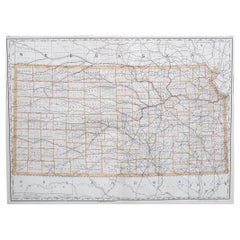
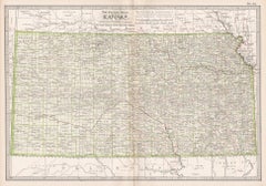
Large Original Antique Map of Kansas, USA, 1894
By Rand McNally & Co.
Located in St Annes, Lancashire
Fabulous map of Kansas Original color By Rand, McNally & Co. Published, 1894 Unframed
Category

1890s American Antique Maps Of Kansas

Materials

Paper

Large Original Antique Map of Kansas, USA, 1894
No Reserve
H 20.5 in W 27 in D 0.07 in
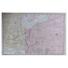
Original Antique City Plan of Kansas City, USA. 1894
By Rand McNally & Co.
Located in St Annes, Lancashire
Fabulous colorful map of Kansas City Original color By Rand, McNally & Co. Published, 1894
Category

1890s American Antique Maps Of Kansas

Materials

Paper

Original Antique City Plan of Kansas City, USA. 1894
No Reserve
H 13 in W 20.5 in D 0.07 in
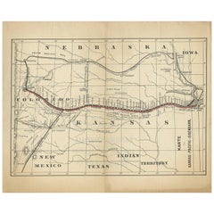
Antique Map of the Kansas Pacific Railroad, circa 1900
Located in Langweer, NL
Antique map titled 'Karte der Kansas-Pacific-Eisenbahn'. Lithographed map of the Kansas Pacific
Category

Early 20th Century Antique Maps Of Kansas

Materials

Paper

Antique Map of the Kansas Pacific Railroad, circa 1900
No Reserve
H 9.26 in W 11.23 in D 0.02 in
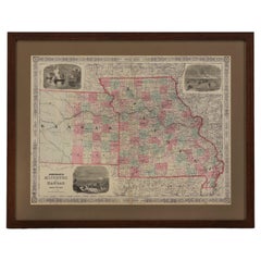
1865 "Johnson's Missouri and Kansas" Map by Johnson and Ward
Located in Colorado Springs, CO
Presented is an original 1865 "Johnson's Missouri and Kansas” map. This map was issued as pages 59
Category

Mid-19th Century Antique Maps Of Kansas

Materials

Paper

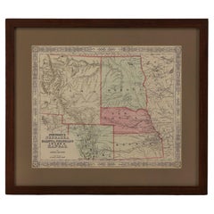
1865 "Johnson's Nebraska, Dakota, Colorado, Idaho & Kansas" Map, Johnson & Ward
Located in Colorado Springs, CO
Presented is an original 1865 "Johnson's Nebraska, Dakota, Colorado, Idaho & Kansas” map. This map
Category

Mid-19th Century Antique Maps Of Kansas

Materials

Paper

1864 Map of North America, Antique Hand-Colored Map, by Adolphe Hippolyte Dufour
Located in Colorado Springs, CO
Offered is a map of North America entitled Amerique du Nord from 1864. This rare, separately
Category

1860s French Antique Maps Of Kansas

Materials

Paper

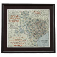
1908 "Map of Texas" by The Kenyon Company
Located in Colorado Springs, CO
station agent at once for rates. Join our Train at Kansas City. FREE BERTHS." The map is artfully
Category

Early 1900s American Antique Maps Of Kansas

Materials

Paper

1859 "Map of the United States of America..." by J. H. Colton
By J.H. Colton
Located in Colorado Springs, CO
includes the Washington Territory, Kansas Territory, and the new state of Minnesota. The map was updated
Category

1850s American Antique Maps Of Kansas

Materials

Paper

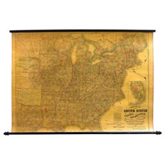
1863 "Lloyd's New Map of the United States, the Canadas, and New Brunswick"
Located in Colorado Springs, CO
Presented is “Lloyd's New Map of the United States, the Canadas and New Brunswick, From the latest
Category

1860s American Antique Maps Of Kansas

Materials

Linen, Wood, Paper

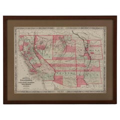
1865 "Johnson's California, Utah, Nevada, Colorado, New Mexico, Arizona" Map
Located in Colorado Springs, CO
, New Mexico, and Arizona” map. First published in 1864, this map was issued as pages 66 and 67 in the
Category

Mid-19th Century Antique Maps Of Kansas

Materials

Paper

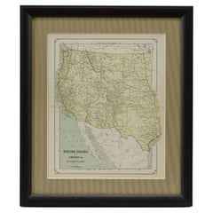
1879 "United States of America, Western Part" by O. J. Stuart
Located in Colorado Springs, CO
This colorful original map, titled “United States of America, Western Part,” was issued in Volume
Category

1870s American Antique Maps Of Kansas

Materials

Paper

Kansas, United States of America, Century Atlas state antique vintage map
Located in Melbourne, Victoria
'The Century Atlas. Kansas.' Original antique map, 1903. Central fold as issued. Map name and
Category

Early 20th Century Victorian Antique Maps Of Kansas

Materials

Lithograph

Memoirs of General William T. Sherman, First Edition, Two-Volume Set, 1875
Located in Colorado Springs, CO
Florida, California, New York, Kansas, and Louisiana. Yet the bulk of the writing is focused on the Civil
Category

1870s American Antique Maps Of Kansas

Materials

Leather, Paper

The 1564 Medici Danti Map of California
By Fra Egnazio Danti
Located in New York, NY
were to be placed large hand-painted maps specially commissioned to document and illustrate the current
Category

17th Century Old Masters Antique Maps Of Kansas

Materials

Canvas, Pen, Gouache, Watercolor, Ink, Paper

People Also Browsed

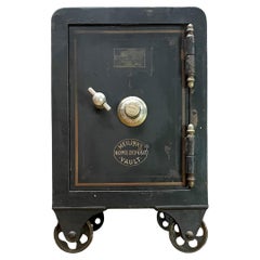
Small Victorian Meilink's Home Vault Railroad Safe Heavy Iron Nightstand
Located in Hyattsville, MD
Small/Medium Home Vault or Iron Safe on Railroad (Inline Caster/Wheels.) It rolls smoothly, and has a working locking mechanism and comes with the correct combination to operate. Th...
Category

Late 19th Century American Late Victorian Antique Maps Of Kansas

Materials

Iron

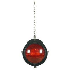
Safetran Systems Corp. Aluminum Red Glass Railroad Light
Located in New York, NY
Black aluminum rail yard railroad pendant light with red glass. Made by Safetran Systems Corp. Ceiling canopy available. Good condition with appropriate wear from age. Cleaned and re...
Category

20th Century Industrial Antique Maps Of Kansas

Materials

Aluminum

Megalodon Tooth From South Carolina, USA // 5.25" High
Located in New York, NY
This huge 5.25" high megalodon tooth is five to ten million years old from South Carolina, USA. The megalodon was the most massive predatory shark to ever live. Reaching lengths of 7...
Category

15th Century and Earlier American Antique Maps Of Kansas

Materials

Organic Material

Megalodon Tooth From South Carolina, USA // 5.25" High
Free Shipping
H 5.25 in W 4.13 in D 1.38 in
Antique Chinoiserie Jacobean Red Lacquered Hand Painted Bookcase or Bar Cabinet
By Baker Furniture Company
Located in South Bend, IN
A gorgeous antique Chinoiserie Jacobean style bookcase, dining cabinet, or bar cabinet In the manner of Baker Furniture USA, Circa 1920s Red lacquered carved walnut, with hand pai...
Category

1920s American Chinoiserie Antique Maps Of Kansas

Materials

Brass

George Washington by Henry Sadd, Antique Engraving, circa 1844
Located in Colorado Springs, CO
This is an 1844 engraving of President George Washington. The print was issued by G. Stuart in Albion, New York and engraved by H. S. Sadd. This standing portrait shows President Ge...
Category

1840s American Antique Maps Of Kansas

Materials

Paper

Lifetime Furniture Antique Mission Oak Arts & Crafts Sideboard or Bar Cabinet
By Lifetime
Located in South Bend, IN
A gorgeous antique Mission or Arts & Crafts sideboard, buffet server, or bar cabinet By Lifetime Furniture USA, Circa 1900 Quarter sawn oak, with mirrored backsplash, and original...
Category

Early 20th Century American Arts and Crafts Antique Maps Of Kansas

Materials

Copper

Megalodon Tooth From South Carolina, USA // 5" High // Ver. 2
Located in New York, NY
This large 5" high megalodon tooth is five to ten million years old from South Carolina, USA. The megalodon was the most massive predatory shark to ever live. Reaching lengths of 70 ...
Category

15th Century and Earlier American Antique Maps Of Kansas

Materials

Organic Material

Watercolor of Nantucket Railroad, by Doris and Richard Beer, circa 1940
By Doris Beer
Located in Nantucket, MA
Vintage Watercolor of Nantucket Railroad, by Doris and Richard Beer, circa 1940, a watercolor on paper view of the Nantucket narrow gauge "Dummy Line" railroad on the Easy Street tre...
Category

1940s American Folk Art Antique Maps Of Kansas

Materials

Paper

Large Original Antique Map of Ohio, Usa, C.1900
Located in St Annes, Lancashire
Fabulous map of Ohio Original color. Engraved and printed by the George F. Cram Company, Indianapolis. Published, C.1900. Unframed. Free shipping.
Category

1890s American Antique Maps Of Kansas

Materials

Paper

Large Original Antique Map of Ohio, Usa, C.1900
No Reserve
H 22 in W 15 in D 0.07 in
View of Piazzo San Marco in Venice
By Pierre Van der Aa
Located in New York, NY
Engraving of Veduta della Piazza di S. Marco, verso L'Horologio by Pierre van der Aa. Printed in 1722. Unsigned. Unframed. Image size, 11 x 13 5/8 in. Has the original center crease.
Category

1720s Antique Maps Of Kansas

Materials

Paper

"Arizona" Vintage Santa Fe Railroad Travel Poster by Don Perceval, circa 1940s
Located in Colorado Springs, CO
This is a vintage Arizona travel poster for the Santa Fe Southern Railway, issued in the 1940s. A very collectible poster, the composition shows two men on horseback as they pass thr...
Category

1940s American Mid-Century Modern Antique Maps Of Kansas

Materials

Paper

Megalodon Tooth From South Carolina, USA // 5.67" High
Located in New York, NY
This huge 5.67" high megalodon tooth is five to ten million years old from South Carolina, USA. The megalodon was the most massive predatory shark to ever live. Reaching lengths of 7...
Category

15th Century and Earlier American Antique Maps Of Kansas

Materials

Organic Material

Megalodon Tooth From South Carolina, USA // 5.67" High
Free Shipping
H 5.67 in W 4.38 in D 1.38 in
Lady's Mahogany Dressing Mirror, Circa 1850, from Portugal
Located in Toronto, CA
Lovely lady's dressing mirror, mid-nineteenth century, from Portugal. Mage of mahogany, with brass knob and finials supporting the hinges. The pivoting mirror is suspended on carved,...
Category

Mid-19th Century Portuguese Victorian Antique Maps Of Kansas

Materials

Brass

Large Original Antique Map of New Mexico, Usa, C.1900
Located in St Annes, Lancashire
Fabulous map of New Mexico. Original color. Engraved and printed by the George F. Cram Company, Indianapolis. Published, C.1900. Unframed. Free shipping.
Category

1890s American Antique Maps Of Kansas

Materials

Paper

Large Original Antique Map of Arizona, Usa, C.1900
Located in St Annes, Lancashire
Fabulous map of Arizona Original color. Engraved and printed by the George F. Cram Company, Indianapolis. Published, C.1900. Unframed. Free shipping.
Category

1890s American Antique Maps Of Kansas

Materials

Paper

Large Original Antique Map of Arizona, Usa, C.1900
No Reserve
H 22 in W 15 in D 0.07 in
Late 19th Century Botanical Chromolithograph Print in Gilt Frame
Located in Chapel Hill, NC
Late 19th century botanical chromolithograph print in gilt frame, Odontoglossum Crispum. From an illustration by B. Herincq. Document taped en verso: "Favourite Flowers of Garden And...
Category

Late 19th Century Unknown Antique Maps Of Kansas

Materials

Glass, Wood, Paper

Recent Sales

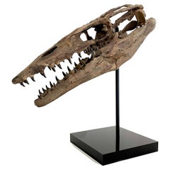
Fossilised Skull of Prehistoric Marine Reptile the Mosasaur
Located in Cambridge, GB
million years ago) 44 x 17 x 16 cm Sourced in Kansas, USA The Tylosaurus belongs to the genus ‘Mosasaur
Category

15th Century and Earlier American Antique Maps Of Kansas

Materials

Bone

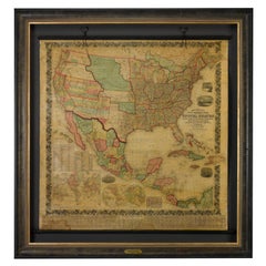
1858 "Mitchell's New National Map Exhibiting the United States" Hanging Wall Map
By Samuel Augustus Mitchell 1
Located in Colorado Springs, CO
Presented is a beautifully engraved, large hanging wall map of the United States, Mexico, and West
Category

1850s American Antique Maps Of Kansas

Materials

Paper

1856 Hanging "Map of the United States from the Latest Authorities"
Located in Colorado Springs, CO
Minnesota, Nebraska, Kansas Territory, Indian Territory and Texas. Inset maps in the lower right include a
Category

1850s American Antique Maps Of Kansas

Materials

Linen, Wood, Paper

1857 Wall Map of the United States by Fanning, Bridgman & Ensign
By Thayer, Bridgman and Fanning
Located in Colorado Springs, CO
Presented is a scarce American wall map of the United States and Mexico issued by Ensign, Bridgman
Category

1850s American Antique Maps Of Kansas

Materials

Paper

The Southern States of North America with Military Positions, Antique Map, 1861
Located in Colorado Springs, CO
1861 hand-colored map of the Southern States of North America with the Forts, Harbours & Military
Category

1860s American Antique Maps Of Kansas

Materials

Paper

1856 a New Map of the Union with the Adjacent Islands and Countries
Located in Colorado Springs, CO
an untitled inset map of portions of Missouri, Kansas, and Nebraska. During the 1840s, the push to
Category

1850s American Antique Maps Of Kansas

1862 Colton's "New Railroad & County Map of the United States and the Canadas"
Located in Colorado Springs, CO
boarder of Kansas. The map shows roads, existing railroads, military roads, as well as areas of Native
Category

1860s American Antique Maps Of Kansas

Materials

Paper

34 Star Parade Flag "Global Rows" Arrangement, Kansas Statehood, circa 1861-1863
Located in York County, PA
," on an antique American flag made during the opening two years of the Civil War, 1861-63, Kansas
Category

1860s American Antique Maps Of Kansas

Materials

Cotton

Tenting on the Plains, or General Custer in Kansas and Texas, by E. B. Custer
Located in Colorado Springs, CO
Custer, Elizabeth B. Tenting on the Plains or General Custer in Kansas and Texas. New York: Charles
Category

1880s American Antique Maps Of Kansas

Materials

Paper

1857 Antique Coltons General Atlas World State Country Map Description Book
Located in Dayton, OH
. Western Americana maps include: ""Nebraska and Kansas Territories,"" ""Oregon and Washington,"" ""Utah and
Category

1850s Victorian Antique Maps Of Kansas

Materials

Leather, Paper

34-Star Flag in a Lineal Configuration of "Global Rows"
Located in York County, PA
MADE DURING THE OPENING TWO YEARS OF THE CIVIL WAR, 1861-63, KANSAS STATEHOOD: 34 star American
Category

1860s Antique Maps Of Kansas

34 STARS, 1861-63, CIVIL WAR PERIOD, “GLOBAL ROWS” DESIGN:
Located in York County, PA
resembles a global map. This is a result of the particular positioning of the rows, which creates a narrow
Category

19th Century American Antique Maps Of Kansas

34 Stars in a Lineal Arrangement That Results in a "Global Rows" Configuration
Located in York County, PA
ROWS," MADE DURING THE OPENING TWO YEARS OF THE CIVIL WAR, 1861-63, KANSAS STATEHOOD: 34 star
Category

19th Century American Antique Maps Of Kansas

34 Star Flag in a, "Global Rows" Pattern
Located in York County, PA
, 1861-63, KANSAS STATEHOOD: 34 star American parade flag, printed on cotton and affixed to its
Category

1860s Antique Maps Of Kansas

34 Star Flag in a, "Global Rows" Pattern
H 20.25 in W 15.5 in D 1 in
From Manassas to Appomattox, by James Longstreet, First Edition, Signed
Located in Colorado Springs, CO
to W. A. Jenkins, both members of the Fifth Regiment Kansas Volunteer Cavalry as line officers in the
Category

1890s Antique Maps Of Kansas

Materials

Paper

34 Stars in a Lineal Arrangement on an Antique American Parade Flag
Located in York County, PA
," ON AN ANTIQUE AMERICAN FLAG MADE DURING THE OPENING TWO YEARS OF THE CIVIL WAR, 1861-63, KANSAS
Category

1860s American Antique Maps Of Kansas

Antique Map of Kansas and Nebraska by Johnson, '1872'
Located in Langweer, NL
Antique map titled 'Johnson's Kansas and Nebraska'. Original map of Kansas and Nebraska. This map
Category

Late 19th Century Antique Maps Of Kansas

Materials

Paper

Large Original Antique Map of Kansas by Rand McNally, circa 1900
By Rand McNally & Co.
Located in St Annes, Lancashire
Fabulous monochrome map with red outline color Original color By Rand, McNally & Co
Category

Early 1900s American Edwardian Antique Maps Of Kansas

Materials

Paper

Large Original Antique Map of Kansas by Rand McNally, circa 1900
1 bid
No Reserve
H 20.5 in W 27.5 in D 0.07 in
Original Antique Map of The American State of Kansas, 1889
Located in St Annes, Lancashire
Great map of Kansas Drawn and engraved by W. & A.K. Johnston Published By A & C Black
Category

1880s Scottish Victorian Antique Maps Of Kansas

Materials

Paper

Original Antique Map of The American State of Kansas, 1889
1 bid
No Reserve
H 8 in W 11 in D 0.07 in
Antique Map of Missouri and Kansas by Johnson, '1872'
Located in Langweer, NL
Antique map titled 'Johnson's Missouri and Kansas'. Original map of Missouri and Kansas. This map
Category

Late 19th Century Antique Maps Of Kansas

Materials

Paper

Memoirs of General William T. Sherman, First Edition, Two-Volume Set, 1875
Located in Colorado Springs, CO
Florida, California, New York, Kansas, and Louisiana. Yet the bulk of the writing is focused on the Civil
Category

1870s American Antique Maps Of Kansas

Materials

Leather, Paper

Large Antique Civil War Map of United States by Theodor Ettling
Located in Gallatin, TN
Civil War Era Map of the United States of American by Theodor Ettling Entitled “United States of
Category

17th Century Antique Maps Of Kansas

Get Updated with New Arrivals
Save "Antique Maps Of Kansas", and we’ll notify you when there are new listings in this category.

Antique Maps Of Kansas For Sale on 1stDibs

There is a range of antique maps of kansas for sale on 1stDibs. The range of distinct antique maps of kansas — often made from paper and bone — can elevate any home. Antique maps of kansas have been made for many years, and versions that date back to the 18th Century alongside those produced as recently as the 20th Century. Antique maps of kansas bearing Victorian hallmark is very popular at 1stDibs. Antique maps of kansas have been a part of the life’s work for many furniture makers, but those produced by Rand McNally & Co. and J.H. Colton are consistently popular.

Finding the Right collectibles-curiosities for You

Antique and vintage collectibles and curiosities can bring whimsy and wonder to any interior. 

Decorating with old scientific instruments, historical memorabilia and vintage musical instruments, as well as other authentic collectibles and curiosities that can be found on 1stDibs, presents an opportunity to create a unique, natural history museum-like atmosphere in your home that can provoke conversation as often as it pays tribute to how far we’ve come in understanding our world. 

And bringing collectibles and curiosities into your space is actually on trend — Wunderkammern, or curiosity cabinets, were all the rage in Europe during the 1500s and continued to have adherents there and in the U.S. in the following centuries. Today, however, they’re experiencing a real surge in popularity and influencing how many interior designers are furnishing and decorating homes — combining contemporary with antique, scientific with tribal, earthly with extraterrestrial, Les Lalanne tables with Flemish tapestries.

The original Wunderkammern were entire rooms filled with objects demonstrating their owners’ worldly knowledge: A proper one included artificiala or preciosa (objets d’art); naturalia (such as skeletons, shells, minerals); exotica (taxidermy or dried plants); and scientifica (scientific instruments), frequently alongside religious relics and ancient artifacts.

Pay tribute to a history of rich and diverse musical traditions that have taken shape all over the world by decorating your home with a collection of antique and vintage musical instruments — with a little help from strong hanging wire or some wall hooks, vintage brass instruments such as a gong, French horn or trumpet can help elevate a home office or complement the efforts you’ve made to ensure a welcoming vibe in your home’s entryway. Bells or antique wind instruments can add provocative metallic contrasts to dark woods as tabletop decorative objects.  

Create an intriguing focal point with Georgian scientific instruments, such as stick barometers with mahogany cases or lacquered brass telescopes. These items stem from an era named for the monarchies of the four King Georges, who ruled England in succession starting in 1714 (plus King William’s reign, which lasted until 1837). Just as there was beautiful jewelry produced during the period that today is coveted by collectors, there is much to be found in the collectibles and curiosities realm too.

Wanderlust, nostalgia and a shared love of good design are contributing factors to certain trends in decorating — just as vintage trunks and luggage have reappeared as furniture or home accents in a bedroom or foyer, decorating with globes, maps or nautical objects is similarly rooted in the allure of travel and a penchant for the stylish finishing touch that collectibles bring to our homes.

Find a wide range of antique and vintage collectibles and curiosities on 1stDibs.

Read More

Pamela Shamshiri Shares the Secrets behind Her First-Ever Book and Its Effortlessly Cool Interiors

The sought-after designer worked with the team at Hoffman Creative to produce a monograph that beautifully showcases some of Studio Shamshiri's most inspiring projects.

Moroccan Artworks and Objects Take Center Stage in an Extraordinary Villa in Tangier

Italian writer and collector Umberto Pasti opens the doors to his remarkable cave of wonders in North Africa.

Montecito Has Drawn Royalty and Celebrities, and These Homes Are Proof of Its Allure

Hollywood A-listers, ex-pat aristocrats and art collectors and style setters of all stripes appreciate the allure of the coastal California hamlet — much on our minds after recent winter floods.

Whaam! Blam! Pow! — a New Book on Pop Art Packs a Punch

Publishing house Assouline and writer Julie Belcove have teamed up to trace the history of the genre, from Roy Lichtenstein, Andy Warhol and Yayoi Kusama to Mickalene Thomas and Jeff Koons.

The Sparkling Legacy of Tiffany & Co. Explained, One Jewel at a Time

A gorgeous new book celebrates — and memorializes — the iconic jeweler’s rich heritage.

What Makes a Gem-Encrusted Chess Set Worth $4 Million?

The world’s most opulent chess set, weighing in at 513 carats, is literally fit for a king and queen.

Tauba Auerbach’s Geometric Pop-Up Book Is Mighty Rare, Thanks to a Hurricane

This sculptural art book has an epic backstory of its own.

Step inside the Storied Mansions of Palm Beach’s Most Effervescent Architect

From Spanish-style courtyards to fanciful fountains, these acclaimed structures abound in surprising and elegant details.