World Map Of Trade Routes

3
to
6
37
10
27
17
14
14
8
8
6
5
4
4
3
2
2
2
2
2
1
1
1
1
1
1
1
1
1
1
1
1
2
1
1
1
1
Sort By
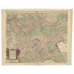
Old Detailed Trade Route and Shipping Map from Italy to the Low Countries, c1671
Located in Langweer, NL
shipping map of the region from Italy to the Low Countries, showing the various trade routes, roads, etc
Category

Antique 17th Century Maps

Materials

Paper

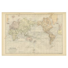
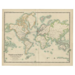
Colorful Detailed Antique Map of The World on Mercators Projection, 1882
Located in Langweer, NL
The 'World of Mercator's Projection' is a map with a stunning portrayal of global geography and
Category

Antique 1880s Maps

Materials

Paper

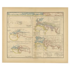
Original Old Composite of Several Maps of the Ancient World on One Sheet, 1880
Located in Langweer, NL
Theodorus Menke. The map is a detailed depiction of the ancient world. The atlas it comes from is known for
Category

Antique 1880s Maps

Materials

Paper

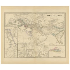
The World in the Assyrian Empire's Era: A Historical Map, Published in 1880
Located in Langweer, NL
as Nineveh, Ashur, and Babylon, which were significant in Assyrian history. 5. **Trade Routes**: It
Category

Antique 1880s Maps

Materials

Paper

Antique Chart of the World by Johnston '1909'
Located in Langweer, NL
Oceans Currents with the Routes and Distances Between Principal Ports'. Detailed map of the World
Category

Early 20th Century Maps

Materials

Paper

Antique Chart of the World by Johnston '1909'
H 19.49 in W 24.41 in D 0.02 in
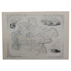
1851 Map of "Independent Tartary", Ric. R018
Located in Norton, MA
map publishers who traded under various names: L. Tallis, Tallis & co, John Tallis, John Tallis & co
Category

Antique 19th Century Unknown Maps

Materials

Paper

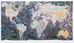
World Trade Routes - Paula Scher, Maps, Screenprint, Contemporary Art
By Paula Scher
Located in London, GB
Signed in pencil, numbered from the edition of 150. Printed by Alexander Heinrici, New York. Published by ARTContent Editions Limited, Vancouver.
Category

2010s Contemporary Prints and Multiples

Materials

Screen

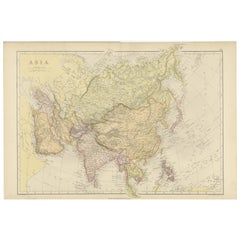
Historical Map Depicting the Continent of Asia, 1882
Located in Langweer, NL
importance of sea routes for trade and exploration. Each nation is populated with its major cities, railways
Category

Antique 1880s Maps

Materials

Paper

Original 1882 Map of Arabia, Red Sea & Persian Gulf
Located in Langweer, NL
," originally published in 1882 as part of the 'Comprehensive Atlas and Geography of the World.' The map is
Category

Antique 1880s Maps

Materials

Paper

Map of Independent Tartary with Vignettes of the Region's Culture, 1851
Located in Langweer, NL
nomadic cultures, significant trade routes like the Silk Road, and strategic geopolitical importance
Category

Antique 1850s Maps

Materials

Paper

Antique Map of the Pacific Ocean by Anson, 1765
Located in Langweer, NL
oceaan (..)'. Nautical chart of the Pacific Ocean depicting the trade routes used by Spanish Galleons
Category

Antique 18th Century Maps

Materials

Paper

Antique Decorative Coloured Map of South Africa and Madagascar, 1882
Located in Langweer, NL
and political boundaries. 8. **Maritime Details**: Given South Africa’s position on the trade route
Category

Antique 1880s Maps

Materials

Paper

Charting the Course of Empire: Bonne's 1770 Masterpiece Maps of the Indian Ocean
Located in Langweer, NL
storied vessels of the 18th century along their lucrative routes. Each map serves as a testament to the
Category

Antique 1770s Maps

Materials

Paper

Mid-19th Century Decorative Map of Asia with Cultural and Natural Vignettes
Located in Langweer, NL
, trade routes, and geographical features. The illustrations on the map likely depict scenes and people
Category

Antique 1850s Maps

Materials

Paper

Original 1859 Map of Asia from W.G. Blackie's Imperial Atlas of Modern Geography
Located in Langweer, NL
. **Cities and Important Landmarks**: Major cities, trade routes, and possibly historical landmarks are
Category

Antique Mid-19th Century Maps

Materials

Paper

Antique Map of the Caspian Sea, Uzbekistan, Northern Persia Etc, C.1735
Located in Langweer, NL
, Eriwan, Isphahan, Samarkand, and Cabul, and shows trade routes. Source unknown, to be determined
Category

Antique 18th Century Maps

Materials

Paper

Antique Map of the Passage Between the Atlantic and Pacific Oceans, circa 1753
Located in Langweer, NL
trade route for the Dutch. The map is adorned with a fine compass rose.Source unknown, to be determined
Category

Antique 18th Century Maps

Materials

Paper

Black Sea in Antiquity: Pontus Euxinus Map, Published in 1880
Located in Langweer, NL
Euxinus. The Black Sea was central to ancient trade routes and cultural exchange, bordered by several
Category

Antique 1880s Maps

Materials

Paper

Black Sea in Antiquity: Pontus Euxinus Map, Published in 1880
Free Shipping
H 15.56 in W 18.51 in D 0 in
Antique Decorative Coloured Map Egypt, Nubia, Abyssinia and more, 1882
Located in Langweer, NL
reveal other unique or historically significant features, such as trade routes, historical notes, or even
Category

Antique 1880s Maps

Materials

Paper

North & South America: A 17th Century Hand-colored Map by Jansson & Goos
By Johannes Janssonius
Located in Alamo, CA
the new world depicted on this fascination map. Among them is the bulging shape of the Northwest coast
Category

Antique 1620s Dutch Maps

Materials

Paper

Antique Physical Chart of the Indian Ocean by Johnston, 1850
Located in Langweer, NL
water, currents of the air and ocean, direction of the wind, districts of hurricanes, trade routes and
Category

Antique 19th Century Maps

Materials

Paper

Ancient Realms of Northeast Africa: Arabia, Ethiopia, and Egypt, Published 1880
Located in Langweer, NL
world, including the Nile River, the Red Sea, and possibly caravan routes across the desert. 3. **Inset
Category

Antique 1880s Maps

Materials

Paper

Empires of Antiquity: The Persian Realm and Beyond Engraved, Published in 1880
Located in Langweer, NL
The map is titled "ORBIS TERRARUM regni Persici tempore," which translates from Latin to "The World
Category

Antique 1880s Maps

Materials

Paper

The Roman Empire from the Time of Constantine the Great, Published in 1880
Located in Langweer, NL
the natural resources that influenced Roman politics and economics. 7. **Roads and Trade Routes
Category

Antique 1880s Maps

Materials

Paper

Ancient Crossroads: Albania to Assyria in Antiquity, Published in 1880
Located in Langweer, NL
these civilizations. 3. **Historical Routes**: It likely outlines ancient trade routes, such as the
Category

Antique 1880s Maps

Materials

Paper

Mediterranean Encounters: From the Punic Wars to the Hannibalic War, 1880
Located in Langweer, NL
within the Empire. 8. **Navigation Lines**: Lines across the sea could represent major trade routes or
Category

Antique 1880s Maps

Materials

Paper

Vintage Geographic Splendor: 1859 Spain and Portugal
Located in Langweer, NL
urban landscape of 19th-century Spain and Portugal. 4. **Transportation and Trade Routes**: The map may
Category

Antique Mid-19th Century Maps

Materials

Paper

Vintage Geographic Splendor: 1859 Spain and Portugal
No Reserve
H 14.57 in W 21.26 in D 0.02 in
1864 Original illustrated planisphere - World Map - Geography
Located in PARIS, FR
, with meticulous details and captivating illustrations. Explore ancient empires, trace trade routes, and
Category

1860s Prints and Multiples

Materials

Linen, Paper, Lithograph

North & South America: A 17th Century Hand-colored Map by Jansson & Goos
By Johannes Jansson
Located in Alamo, CA
the new world depicted on this fascination map. Among them is the bulging shape of the Northwest coast
Category

1620s Landscape Prints

Materials

Engraving

Cadiz Island: A Framed 17th Century Hand-colored Map from Blaeu's Atlas Major
By Joan (Johannes) Blaeu
Located in Alamo, CA
trading routes and colonies. In addition to his cartographic work, Blaeu was also an accomplished
Category

Mid-17th Century Old Masters Landscape Prints

Materials

Engraving

The Grand Waterway of Languedoc: Mapping the Canal du Midi, 1697
Located in Langweer, NL
route. The mention of the map being printed and assembled from two plates indicates that it is a large
Category

Antique 1690s Prints

Materials

Paper

English Pocket Globe, London, Circa 1775-1798
By Herman Moll
Located in Milano, IT
and yellow. It shows: the Cook routes; a wind rose in the Southern Indian Ocean; Antarctica without
Category

Antique Late 18th Century English George III Globes

Materials

Shagreen, Paper

Pocket Globe by Nathaniel Hill, London 1754
Located in Milano, IT
). The route of Admiral Anson is traced (1740) and the trade winds are indicated by arrows. Australia
Category

Antique 1750s English George II Globes

Materials

Shagreen, Paper

Antique Terrestrial Globe Published in 1940s by Girard Barrère et Thomas, Paris
Located in Milan, IT
colored. In addition to the territorial map, the ocean currents and the main trade routes of the period
Category

Vintage 1940s French Scientific Instruments

Materials

Wood, Paper

World Map Published in June 1783 by Stackhouse and Engraved by S.J. Neele London
Located in Milan, IT
World map published in June 1783 by Stackhouse and engraved by S.J. Neele. It is a geographical map
Category

Antique 1780s British Maps

Materials

Glass, Wood, Paper

1856 Hanging "Map of the United States from the Latest Authorities"
Located in Colorado Springs, CO
Presented is a scarce American wall map of the United States by Ensign, Bridgman, and Fanning in
Category

Antique 1850s American Maps

Materials

Linen, Wood, Paper

19th Century Small French Antique Terrestrial Globe Editet by J. Forest a Paris
Located in Milan, IT
territorial maps, ocean currents and the major trade routes of that period. Papier maché and plaster sphere
Category

Antique Late 19th Century Maps

Materials

Paper

"Lava Flow, South of Santiago, Chile" Yellow, Red, Blue Abstract Modern Painting
Located in Houston, TX
examined the world around him as both artist and architect. In his youth, he developed an affinity for the
Category

1960s Modern Abstract Paintings

Materials

Canvas, Oil, Board

1934 "12 Inch Library Globe" by Replogle, Inc.
By Replogle Globes
Located in Colorado Springs, CO
miles are all labeled, tracking just how interconnected the world was in both trade and travel. A time
Category

Vintage 1930s American Modern Globes

Materials

Bronze

American Revenue Cutter Service Ensign (Flag) Belonging to Cpt. William Bagley
Located in York County, PA
turkey-style head, the graphic impact has exceptional value in the world of Americana. Since eagles are
Category

Antique 1870s American Political and Patriotic Memorabilia

American Revenue Cutter Service Ensign Belonging To Capt. W. H. Bagley
Located in York County, PA
believed to be Laura Barnes Bagley. (3) A map with hand-drawn notations by Bagley, detailing routes he
Category

Antique 1870s American Political and Patriotic Memorabilia

West-Indies Herman Moll William Paterson Spanish Trade Routes Gold
By Herman Moll
Located in BUNGAY, SUFFOLK
include and publish on his maps. Moll clearly shows the routes taken by the Spanish in their endeavours to
Category

Antique 18th Century Central American Baroque Maps

Materials

Paper

Antique Chart of the World by A.K. Johnston, 1865
Located in Langweer, NL
Oceans Currents with the Routes and Distances Between Principal Ports'. Detailed map of the World
Category

Antique Mid-19th Century Maps

Empires of the East: An Ornate Tallis Map of Tibet, Mongolia, and Manchuri, 1851
Located in Langweer, NL
British. They would be significant for trade routes, exploration, and for the British understanding of
Category

Antique 1850s Maps

Materials

Paper

Antique Map by Mapmaker Blaeu of Northern India and Central Asia, c.1650
Located in Langweer, NL
maker. Later he started producing map and sea charts, including his first world map in 1605. His most
Category

Antique Mid-17th Century Maps

Materials

Paper

Empires of the East: The Indo-Scythian and Parthian Kingdoms, Published in 1880
Located in Langweer, NL
a campaign route or a detailed view of a significant city. 5. **Trade Routes**: The map might
Category

Antique 1880s Maps

Materials

Paper

Large Abstract Expressionist Textured Painting
By Dan Stewart
Located in Houston, TX
1967. Artist Biography: Dan R. Stewart was born in 1926 and examined the world around him as both
Category

1960s Abstract Abstract Paintings

Materials

Acrylic

Get Updated with New Arrivals
Save "World Map Of Trade Routes", and we’ll notify you when there are new listings in this category.

World Map Of Trade Routes For Sale on 1stDibs

At 1stDibs, there are several options of world map of trade routes available for sale. The range of distinct world map of trade routes — often made from paper, animal skin and shagreen — can elevate any home. World map of trade routes have long been popular, with older editions for sale from the 18th Century and newer versions made as recently as the 20th Century. World map of trade routes made by Georgian designers — as well as those associated with Baroque — are very popular at 1stDibs. Many world map of trade routes are appealing in their simplicity, but Herman Moll and Johannes Janssonius produced popular world map of trade routes that are worth a look.

Finding the Right collectibles-curiosities for You

Antique and vintage collectibles and curiosities can bring whimsy and wonder to any interior. 

Decorating with old scientific instruments, historical memorabilia and vintage musical instruments, as well as other authentic collectibles and curiosities that can be found on 1stDibs, presents an opportunity to create a unique, natural history museum-like atmosphere in your home that can provoke conversation as often as it pays tribute to how far we’ve come in understanding our world. 

And bringing collectibles and curiosities into your space is actually on trend — Wunderkammern, or curiosity cabinets, were all the rage in Europe during the 1500s and continued to have adherents there and in the U.S. in the following centuries. Today, however, they’re experiencing a real surge in popularity and influencing how many interior designers are furnishing and decorating homes — combining contemporary with antique, scientific with tribal, earthly with extraterrestrial, Les Lalanne tables with Flemish tapestries.

The original Wunderkammern were entire rooms filled with objects demonstrating their owners’ worldly knowledge: A proper one included artificiala or preciosa (objets d’art); naturalia (such as skeletons, shells, minerals); exotica (taxidermy or dried plants); and scientifica (scientific instruments), frequently alongside religious relics and ancient artifacts.

Pay tribute to a history of rich and diverse musical traditions that have taken shape all over the world by decorating your home with a collection of antique and vintage musical instruments — with a little help from strong hanging wire or some wall hooks, vintage brass instruments such as a gong, French horn or trumpet can help elevate a home office or complement the efforts you’ve made to ensure a welcoming vibe in your home’s entryway. Bells or antique wind instruments can add provocative metallic contrasts to dark woods as tabletop decorative objects.  

Create an intriguing focal point with Georgian scientific instruments, such as stick barometers with mahogany cases or lacquered brass telescopes. These items stem from an era named for the monarchies of the four King Georges, who ruled England in succession starting in 1714 (plus King William’s reign, which lasted until 1837). Just as there was beautiful jewelry produced during the period that today is coveted by collectors, there is much to be found in the collectibles and curiosities realm too.

Wanderlust, nostalgia and a shared love of good design are contributing factors to certain trends in decorating — just as vintage trunks and luggage have reappeared as furniture or home accents in a bedroom or foyer, decorating with globes, maps or nautical objects is similarly rooted in the allure of travel and a penchant for the stylish finishing touch that collectibles bring to our homes.

Find a wide range of antique and vintage collectibles and curiosities on 1stDibs.

Read More

Pamela Shamshiri Shares the Secrets behind Her First-Ever Book and Its Effortlessly Cool Interiors

The sought-after designer worked with the team at Hoffman Creative to produce a monograph that beautifully showcases some of Studio Shamshiri's most inspiring projects.

Moroccan Artworks and Objects Take Center Stage in an Extraordinary Villa in Tangier

Italian writer and collector Umberto Pasti opens the doors to his remarkable cave of wonders in North Africa.

Montecito Has Drawn Royalty and Celebrities, and These Homes Are Proof of Its Allure

Hollywood A-listers, ex-pat aristocrats and art collectors and style setters of all stripes appreciate the allure of the coastal California hamlet — much on our minds after recent winter floods.

Whaam! Blam! Pow! — a New Book on Pop Art Packs a Punch

Publishing house Assouline and writer Julie Belcove have teamed up to trace the history of the genre, from Roy Lichtenstein, Andy Warhol and Yayoi Kusama to Mickalene Thomas and Jeff Koons.

The Sparkling Legacy of Tiffany & Co. Explained, One Jewel at a Time

A gorgeous new book celebrates — and memorializes — the iconic jeweler’s rich heritage.

What Makes a Gem-Encrusted Chess Set Worth $4 Million?

The world’s most opulent chess set, weighing in at 513 carats, is literally fit for a king and queen.

Tauba Auerbach’s Geometric Pop-Up Book Is Mighty Rare, Thanks to a Hurricane

This sculptural art book has an epic backstory of its own.

Step inside the Storied Mansions of Palm Beach’s Most Effervescent Architect

From Spanish-style courtyards to fanciful fountains, these acclaimed structures abound in surprising and elegant details.