Items Similar to Viliers Costret, French chateau, architectural plan, mid 17th century engraving
Want more images or videos?
Request additional images or videos from the seller
1 of 6
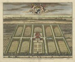
Matthaeus MerianViliers Costret, French chateau, architectural plan, mid 17th century engraving1655
1655
$280
£210.68
€244.03
CA$394.22
A$438.03
CHF 230.25
MX$5,346.58
NOK 2,911.22
SEK 2,729.33
DKK 1,821.23
About the Item
'Viliers Costret'
Copper-line engraving by Matthaeus Merian.
From 'Topographia Galliae', a fine series of engravings of 17th-century French landscapes, gardens, buildings and cities. Circa 1655.
Matthaeus Merian (1593-1650) was one of the most prominent members of the leading print publishing family of 17th-century Germany.
Villers-Cotterets is a commune in the Aisne department in Picardie in northern France. The chateau, known as Chateau de Noue was built in the 16th century for Francis I. It is famous because of the Ordinance of Villers-Cotterets 1539 signed by king Francis I of France which made French the official language in the kingdom.
185mm by 280mm (platemark)
310mm by 360mm (sheet)
Central vertical fold as issued.
- Creator:Matthaeus Merian (1593 - 1650)
- Creation Year:1655
- Dimensions:Height: 12.21 in (31 cm)Width: 14.18 in (36 cm)
- Medium:
- Movement & Style:
- Period:
- Condition:Central vertical fold as issued. Very faint toning along fold - see photo. A few tiny spots in the margins.
- Gallery Location:Melbourne, AU
- Reference Number:1stDibs: LU124426676682
About the Seller
5.0
Platinum Seller
Premium sellers with a 4.7+ rating and 24-hour response times
Established in 2005
1stDibs seller since 2019
593 sales on 1stDibs
Typical response time: <1 hour
- ShippingRetrieving quote...Shipping from: Melbourne, Australia
- Return Policy
Authenticity Guarantee
In the unlikely event there’s an issue with an item’s authenticity, contact us within 1 year for a full refund. DetailsMoney-Back Guarantee
If your item is not as described, is damaged in transit, or does not arrive, contact us within 7 days for a full refund. Details24-Hour Cancellation
You have a 24-hour grace period in which to reconsider your purchase, with no questions asked.Vetted Professional Sellers
Our world-class sellers must adhere to strict standards for service and quality, maintaining the integrity of our listings.Price-Match Guarantee
If you find that a seller listed the same item for a lower price elsewhere, we’ll match it.Trusted Global Delivery
Our best-in-class carrier network provides specialized shipping options worldwide, including custom delivery.More From This Seller
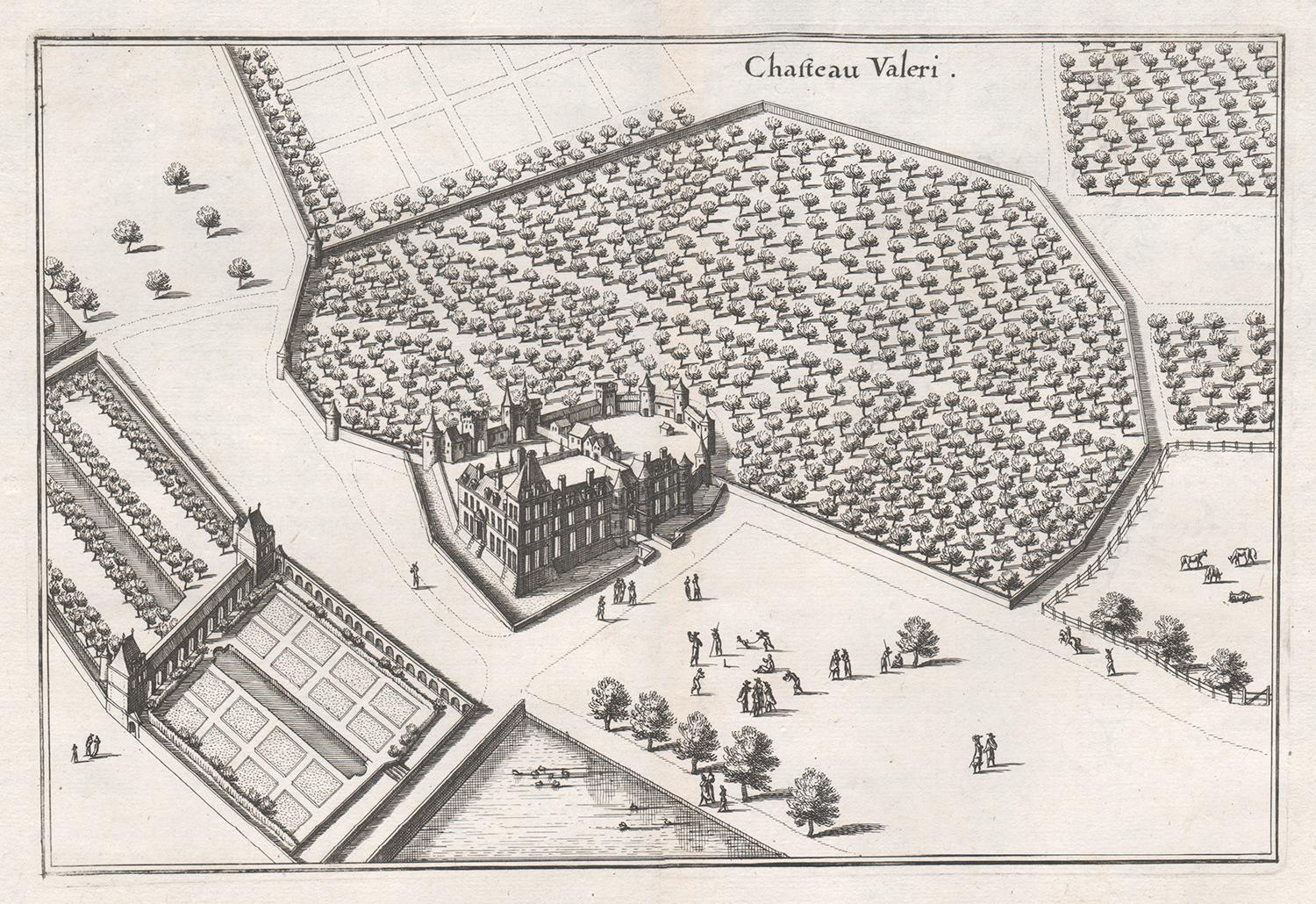
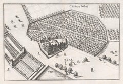
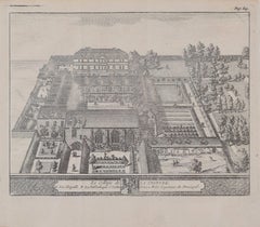
View AllChateau Valeri, French chateau, garden estate plan, mid 17th century engraving
By Matthaeus Merian
Located in Melbourne, Victoria
'Chateau Valeri'
Copper-line engraving by Matthaeus Merian.
From 'Topographia Galliae', a fine series of engravings of 17th-century French landscapes, gardens, buildings and citie...
Category
Mid-18th Century Rococo Landscape Prints
Materials
Engraving
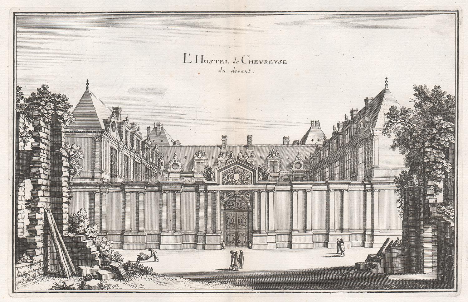
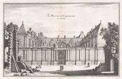
L'Hostel de Chevreuse, French town house in Paris, mid 17th century engraving
By Matthaeus Merian
Located in Melbourne, Victoria
'L'Hostel de Chevreuse'
Copper-line engraving by Matthaeus Merian.
From 'Topographia Galliae', a fine series of engravings of 17th-century French landscapes, gardens, buildings an...
Category
Mid-18th Century Rococo Landscape Prints
Materials
Engraving
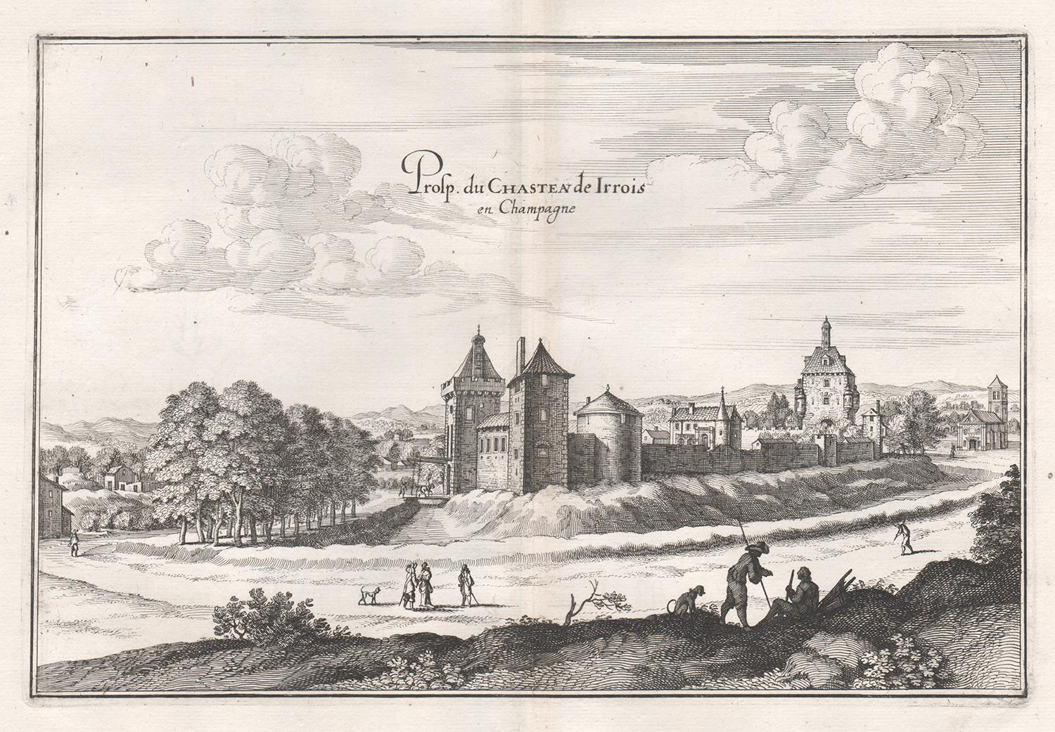
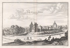
Castle of Irrois in Champagne, French architecture, mid 17th century engraving
By Matthaeus Merian
Located in Melbourne, Victoria
'Prosp. du Chasteau de Irrois en Champagne'
Copper-line engraving by Matthaeus Merian.
From 'Topographia Galliae', a fine series of engravings of 17th-century French landscapes, g...
Category
Mid-18th Century Rococo Landscape Prints
Materials
Engraving
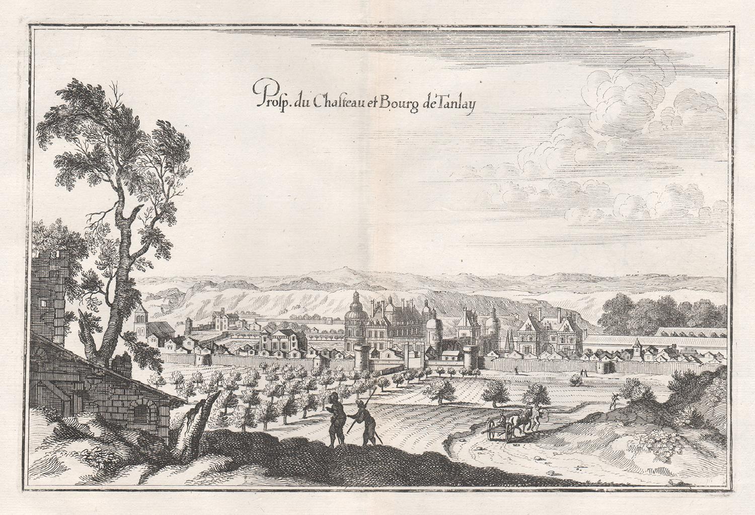
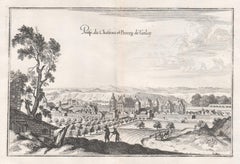
Castle and Town of Tanlay, French architecture, mid 17th century engraving
By Matthaeus Merian
Located in Melbourne, Victoria
'Prosp du Chasteau et Bourg de Tanlay'
Copper-line engraving by Matthaeus Merian.
From 'Topographia Galliae', a fine series of engravings of 17th-century French landscapes, garden...
Category
Mid-18th Century Rococo Landscape Prints
Materials
Engraving
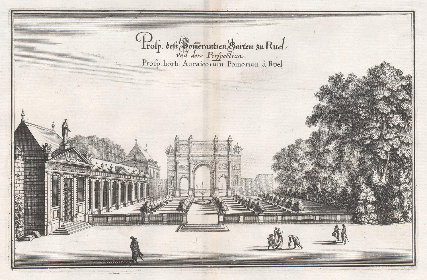
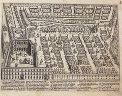
Gardens of the Chateau Rueil, Paris, France, mid 17th century engraving
By Matthaeus Merian
Located in Melbourne, Victoria
'Prosp. horti Auraicorum Pomorum a Ruel'
Copper-line engraving by Matthaeus Merian.
From 'Topographia Galliae', a fine series of engravings of 17th-century French landscapes, gard...
Category
Mid-18th Century Rococo Landscape Prints
Materials
Engraving

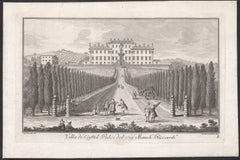
Villa di Castel Pulci del Signor Marchese Riccardi, Italy, engraving, 1744
Located in Melbourne, Victoria
Engraving with etching by Marco Antonio Corsi after a drawing by Giuseppe Zocchi (Italian, 1711/17–1767).
From 'Vedute delle ville, e d'altri luoghi d...
Category
18th Century Naturalistic Landscape Prints
Materials
Engraving
You May Also Like
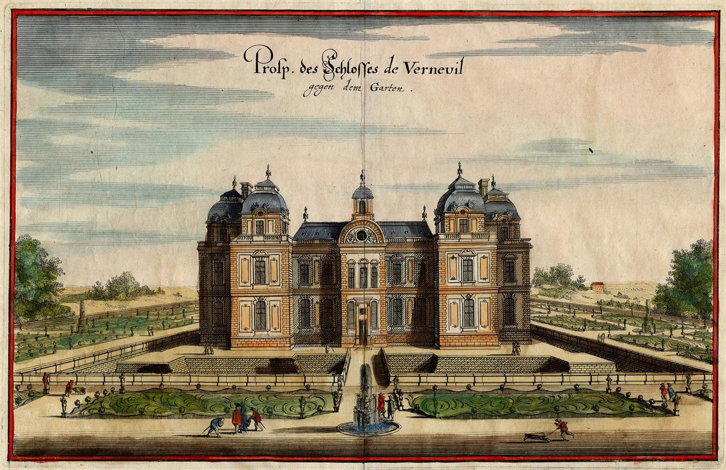
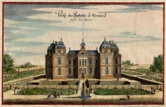
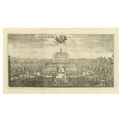
Chateau de Verneuil
By Matthäus Merian the Elder
Located in Middletown, NY
Engraving with hand coloring and heightening in watercolor on two leaves of expertly conjoined handmade laid paper, one leaf with a large watermark a feathered dragon, 7 1/4 x 11 1/4...
Category
Mid-17th Century Old Masters Landscape Prints
Materials
Watercolor, Handmade Paper, Engraving
Old Decorative Handcolored Engraving of the Molenbaix Estate in Belgium, 1696
Located in Langweer, NL
Antique print titled 'Molenbaix - Huys te Molenbaes'. Copper engraving of the estate of Molembaix, Walcheren. This print originates from 'Nieuwe Cronyk van Zeeland' by Mattheus Small...
Category
Antique 17th Century Prints
Materials
Paper
Trinity College, Oxford engraving by Pieter van der Aa after David Loggan
By Pieter Van Der Aa
Located in London, GB
Pieter van der Aa (1659-1733), after David Loggan (1634–1692)
Trinity College, Oxford
Engraving
12 x 16 cm
An eighteenth-century view of Trinity College, engraved by Pieter van der ...
Category
Early 18th Century Prints and Multiples
Materials
Engraving
Cartusia Bruxellensis Monastery in Brussels: A 17th C. Hand-colored Engraving
By Lucas Vorsterman the Younger
Located in Alamo, CA
This is a 17th century hand-colored copperplate engraving entitled "Cartusia Bruxellensis" by Lucas Vorsterman, the Younger, after a drawing by Jacob van Werden or Jacques van Weerden, published in 1659 in Antonius Sanderus' book 'Chorographia sacra Brabantiae sive celebrium aliquot in ea provincia ecclesiarum et coenobiorum descriptio . . . Brussel' (A sacred chorography of Brabant, or a description of several famous churches and convents in that province). It also appeared in other publications by Sanderus. In the 17th century, Brussels was within the Duchy of Brabant.
This engraving depicts a bird's-eye view of the Scheut Carthusian Monastery in Brussels. Scheut is a district of Anderlecht, a municipality of Brussels, Belgium. The monastery housed monks, who took a vow of silence, in 20 rooms. There is a central courtyard with trees and shrubs. Monks are depicted strolling along its pathways. The cells for the friars are in the middle the cloister. There are people along the streets in the foreground and to the right of the large, imposing monastery. Some are on horseback, others are walking. In the lower right, what appears to be a dog pulls a small cart containing barrels, possibly of beer or wine. Districts and neighborhoods are labelled in the background, including Scheut, Anderlecht and Ransfort. A very ornate cartouche in the lower left contains Latin and the artist's attribution. Another decorative cartouche in the upper central area contains the title.
This beautifully hand-colored and detailed engraving is printed on laid, chain-linked paper with wide, full margins. The sheet measures 17.25" high and 21.25" wide. It has Latin text on the verso. It has a central vertical fold, as issued, which is reinforced on the verso. Two small spots in the lower margin may actually represent drops of watercolor paint used to color the engraving. It is otherwise in very good condition.
Antonius Sanderus (1586-1664) was a Flemish Catholic cleric and historian. He was born "Antoon Sanders", but Latinized his name like many writers and scholars of his time. He was the author of several books, including 'Chorographia Sacra Brabantiae', which was illustrated with this engraving.
Lucas Vorsterman the Younger (1624-between 1666 & 1676) was a Flemish Baroque engraver and draughtsman. He produced engravings after the work of contemporary painters and for books by Antwerp publishers.
Jacob van Werden or Jacques van Weerden (active 1643-1669), was a Flemish draughtsman, cartographer, military engineer and archer who was active in the Habsburg Netherlands. His drawings were used as designs for prints executed by various printmakers. He worked on maps, topographical views, historical scenes, portraits and book illustrations. He had a career as a military engineer and a member of the guard of the Spanish King. He advised on various military engineering projects and was an engineer of the Spanish army...
Category
Mid-17th Century Old Masters Landscape Prints
Materials
Engraving

Pianta dei Giardini di S. Maria - Roma - Etching - 17th Century
Located in Roma, IT
Pianta dei Giardini di S.Maria - Roma is an original drawing in etching technique on ivory-colored paper, realized by Anonymous Artist of the 17th Century...
Category
17th Century Modern Landscape Prints
Materials
Etching
The Ekolsund Castle and Gardens in Sweden in Swidde's 1695 Engraving
Located in Langweer, NL
The print is aan original detailed 1695 engraving of Ekolsund Castle in Sweden, crafted by Willem Swidde. The engraving is part of the collection from "Suecia Antiqua et Hodierna," which was a grand work showcasing the estates and landmarks of Sweden through elaborate illustrations.
The scene depicted in the engraving is a classic example of the baroque garden architecture style, with geometrically arranged gardens, symmetrical layouts, and an expansive approach leading up to the castle, emphasizing the grandeur and formality of the estate. The meticulous detail in the gardens and the inclusion of figures within the grounds suggest a vibrant and cultured estate life.
Ekolsund Castle, located in Enköping Municipality in Uppsala County, Sweden, is a manor house with a rich history dating back to the 14th century. By the 15th century, it was owned by the prominent Bengt Jönsson...
Category
Antique 1690s Prints
Materials
Paper
$362 Sale Price
20% Off
Free Shipping
More Ways To Browse
Antique French Engravings
17th Century Engravings
18th Century French Engraving
17th Century German
18th Century French Landscape
17th Century Copper
Rococo Architecture
Antique Architectural Plans
18th Century German Rococo
Copper Engraving Germany
17th Century German Engravings
Antique Garden Plans
Vintage Stone Hats
Womens Gloves
1945 New York Graphic Society
Abstract Swedish Oil Painting 1960s
Amorphous Sculpture
Appalachian Art