Rococo Landscape Prints
to
1
1
7
6
1
Overall Height
to
Overall Width
to
3,372
2,978
663
654
626
430
396
239
211
80
71
61
37
16
6
4
3
2
1
1
1
1
1
1
1
7
7
6
1
7
Style: Rococo
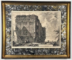
Tiempo Antico vulgarmente detto della Salute
Located in Wilton Manors, FL
Giovanni Battista Piranesi (1720-1778)
Tempio antico volgarmente detto della Salute su la Via d'Albano, cinque miglia lontan da Roma... (Ancient Temple popularly known as the Temple of Health on the Via d'Albano five miles outside Rome...), from Vedute di Roma...
Category
18th Century Rococo Landscape Prints
Materials
Engraving
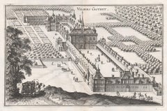
Viliers Costret, French chateau, architectural plan, mid 17th century engraving
Located in Melbourne, Victoria
'Viliers Costret'
Copper-line engraving by Matthaeus Merian.
From 'Topographia Galliae', a fine series of engravings of 17th-century French landscapes, gardens, buildings and citi...
Category
Mid-18th Century Rococo Landscape Prints
Materials
Engraving
Gardens of the Chateau Rueil, Paris, France, mid 17th century engraving
Located in Melbourne, Victoria
'Prosp. horti Auraicorum Pomorum a Ruel'
Copper-line engraving by Matthaeus Merian.
From 'Topographia Galliae', a fine series of engravings of 17th-century French landscapes, gard...
Category
Mid-18th Century Rococo Landscape Prints
Materials
Engraving
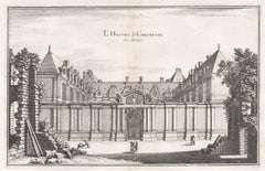
L'Hostel de Chevreuse, French town house in Paris, mid 17th century engraving
Located in Melbourne, Victoria
'L'Hostel de Chevreuse'
Copper-line engraving by Matthaeus Merian.
From 'Topographia Galliae', a fine series of engravings of 17th-century French landscapes, gardens, buildings an...
Category
Mid-18th Century Rococo Landscape Prints
Materials
Engraving
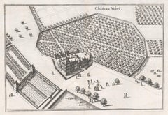
Chateau Valeri, French chateau, garden estate plan, mid 17th century engraving
Located in Melbourne, Victoria
'Chateau Valeri'
Copper-line engraving by Matthaeus Merian.
From 'Topographia Galliae', a fine series of engravings of 17th-century French landscapes, gardens, buildings and citie...
Category
Mid-18th Century Rococo Landscape Prints
Materials
Engraving
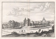
Castle of Irrois in Champagne, French architecture, mid 17th century engraving
Located in Melbourne, Victoria
'Prosp. du Chasteau de Irrois en Champagne'
Copper-line engraving by Matthaeus Merian.
From 'Topographia Galliae', a fine series of engravings of 17th-century French landscapes, g...
Category
Mid-18th Century Rococo Landscape Prints
Materials
Engraving
Castle and Town of Tanlay, French architecture, mid 17th century engraving
Located in Melbourne, Victoria
'Prosp du Chasteau et Bourg de Tanlay'
Copper-line engraving by Matthaeus Merian.
From 'Topographia Galliae', a fine series of engravings of 17th-century French landscapes, garden...
Category
Mid-18th Century Rococo Landscape Prints
Materials
Engraving
Related Items
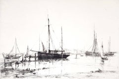
Crab Boats, Southampton Water /// Impressionist British Seascape Ship Maritime
By Aileen Mary Elliot
Located in Saint Augustine, FL
Artist: Aileen Mary Elliot (English, 1896-1966)
Title: "Crab Boats, Southampton Water"
*Signed by Elliot in pencil lower right
Circa: 1925
Medium: Original Drypoint Etching on laid p...
Category
1920s Rococo Landscape Prints
Materials
Drypoint, Etching, Laid Paper, Intaglio
Orchids" Framed 19th C. Hand-Colored Engraving of "Lycaste Harrisoniae" by Fitch
Located in Alamo, CA
This beautiful, original hand-colored orchid lithograph entitled "Lycaste Harrisoniae Eburnea" Orchids by John Nugent Fitch is plate 100 in Robert Warner's publication 'The Orchid Al...
Category
1880s Rococo Landscape Prints
Materials
Engraving
H 20.5 in W 17.25 in D 1.25 in
Her Majesty's Stag Hounds on Ascot, A Colored 19th Century British Hunting Scene
Located in Alamo, CA
"The Meeting of Her Majesty's Stag Hounds on Ascot Heath" is a large colorful mezzotint engraving of an extensive British hunting scene. It was created by Sir Francis Grant...
Category
1830s Rococo Landscape Prints
Materials
Engraving, Mezzotint
Francis Grant Her Majesty's Stag Hounds on Ascot, A Colored 19th Century British Hunting Scene, 1839
H 29 in W 38.88 in D 1.25 in
Persia, Armenia & Adjacent Regions: A Hand-colored 17th Century Map by De Wit
Located in Alamo, CA
This colorful and detailed 17th century copperplate map by Frederick De Wit was published in Amsterdam between 1666 and 1690. It depicts the Caspian Se...
Category
Late 17th Century Rococo Landscape Prints
Materials
Engraving
Frederick de WitPersia, Armenia & Adjacent Regions: A Hand-colored 17th Century Map by De Wit , 1680
H 23.5 in W 27 in D 1.325 in
Northern Italy: A 16th Century Hand-colored Map by Abraham Ortelius
Located in Alamo, CA
This is a framed 16th century hand-colored copperplate map of northern Italy entitled "Veronae Urbis Territorium a Bernardo Bragnolo Descriptium" by Abraham Ortelius from his atlas "Theatrum Orbis Terrarum", which was the first modern atlas of the world, with the first volume published in 1570. This map was part of a subsequent volume, published in Antwerp in 1584. It was based on an earlier map by Bernardo Brognoli.
This beautiful map of northern Italy is focussed on Verona and its environs, including Mantua. Lake Garda and the South Tyrol mountains are prominently depicted. There is a very large striking cartouche in the upper left and a decorative distance scale in the lower right.
This striking hand-colored map of northern Italy is presented in a gold-colored wood frame and an olive green-colored mat. It is glazed with UV conservation glass. All mounting materials used are archival. The frame measures 21.5" high by 28" wide by 0.75" deep. There is a central vertical fold, as issued, with slight separation of the lower portion of the fold. There are faint spots in the upper and right margins, but the map is otherwise in very good condition.
Abraham Ortelius (also known as Ortels, Orthellius, and Wortels) (1527-1598) was a Dutch cartographer, geographer, and cosmographer. He began his career as a map colorist. In 1547 he entered the Antwerp guild of St Luke as an "illuminator of maps". He had an affinity for business from an early age and most of his journeys before 1560, were for business. He was a dealer in antiques, coins, maps, and books.
His business income allowed him to acquire an extensive collection of medals, coins, and antiques, as well as a large library of books...
Category
16th Century Rococo Landscape Prints
Materials
Engraving
H 21.5 in W 28 in D 0.75 in
View of Pisaro, Italy: A 16th Century Hand-colored Map by Braun & Hogenberg
Located in Alamo, CA
This is a 16th century original hand-colored copperplate engraved map of View of Pezaro (Pisaro), Italy entitled "Pisaurum vulgo Pezaro" by Georg Braun & Franz Hogenberg, from their famous city atlas "Civitates Orbis Terrarum", published in Augsberg, Germany in 1575.
The map depicts a view of Pesaro, Italy from the west looking over the town to the Adriatic Sea. The River Foglia flows into the Adriatic in the foreground. The only identifiable building is the cathedral of San Domenico, which rises above the other roofs with its tall spire. Two women, dressed in styles of the 16th century are in conversation on a hill in the foreground on the left. Pesaro is in the province of Pesaro and Urbino and lies on the Adriatic and east of Florence. The city, which was founded by the Etruscans and named Pisaurum by the Romans, belonged from AD 754 onwards to the Papal States, and after 1285 was controlled by the princely families of Malatesta, Sforza and della Rovere. Today it is the capital of the province of Pesaro and Urbino and has a population of about 92,000. Pesaro's most famous resident, composer Gioacchino Rossini, was born here in 1792.
The following is an English translation of an excerpt from Braun's description of the city: "We believe that the astonishingly short life of the inhabitants of Pesaro comes not only from the insalubrious air, but also from the great quantity of delectable and delicious fruits which they consume to excess. For this causes the production in their bodies of evil humours, which then lead to incurably fatal diseases. The area around the city is most charming and well planted with vineyards, fig trees, olive trees and other fruit-bearing trees."
References: Van der Krogt 4, 3369, state 1; Taschen, Braun and Hogenberg...
Category
16th Century Rococo Landscape Prints
Materials
Engraving
Johannes Sadeler I (Flemish 1550-1600) – Engraving 1582 - Jonah and the Whale I
Located in Meinisberg, CH
Johannes Sadeler I
(Flemish, ∗ 1550 in Brussels, Belgium – † 1600 Venice, Italy)
Jonah thrown to the Whale (First Sheet)
Engraved by Sadeler after an image created by Theodor Berna...
Category
16th Century Rococo Landscape Prints
Materials
Engraving, Laid Paper
Free Shipping
H 15.56 in W 13.19 in D 0.6 in
Asia Declineatio: A 17th Century Hand-colored Map of Asia by Justus Danckerts
Located in Alamo, CA
This is a scarce 17th century beautifully hand-colored copperplate engraved map of Asia entitled “Exactissima Asiae Delineatio in Praecipuas Regiones Caerterasque Partes divisa et de...
Category
Late 17th Century Rococo Landscape Prints
Materials
Engraving
Arrest of Christ, Engraving, a. Karel van Mander, p. by Gheyn, Passion of Chris
Located in Greven, DE
The arrest of Christ; Judas embraces Christ as a group of soldiers apprehend Him; Christ places His hand on the fearful Malchus who sits on the ground holding a lamp; Peter grips his...
Category
17th Century Rococo Landscape Prints
Materials
Engraving
Equestrian Scene
Located in Belgrade, MT
This lithograph is a piece from my private collection of 20th Century School of Paris era artists. It is hand signed by the artist and numbered, Guilde de la Gravure, and is in very ...
Category
Early 20th Century Rococo Landscape Prints
Materials
Oil, Engraving, Lithograph
Meissen, Germany : A Large Framed 18th Century Map by Petrus Schenk
Located in Alamo, CA
This is a hand-colored 18th century map of the Meissen region of Germany, entitled "Geographischer Entwurff Derer Aemmter Meissen als Creys-Procuratur-Schul-und Stiffts-Ammt benebst ...
Category
Mid-18th Century Rococo Landscape Prints
Materials
Engraving
H 26.13 in W 42.13 in D 0.75 in
Ikebana 2
Located in Dallas, TX
For this work, the artist made a printing plate by tracing Ikebana images from Kōyō Ikebana Hyakuheizu, a book of illustrations dating to the late 1700s...
Category
2010s Rococo Landscape Prints
Materials
Ink, Archival Paper, Drypoint
Rococo landscape prints for sale on 1stDibs.
Find a wide variety of authentic Rococo landscape prints available for sale on 1stDibs. Works in this style were very popular during the 18th Century, but contemporary artists have continued to produce works inspired by this movement. Many Pop art paintings were created by popular artists on 1stDibs, including Matthaeus Merian, and Giovanni Battista Piranesi. Frequently made by artists working with and Engraving and other materials, all of these pieces for sale are unique and have attracted attention over the years. Not every interior allows for large Rococo landscape prints, so small editions measuring 14.18 inches across are also available. Prices for landscape prints made by famous or emerging artists can differ depending on medium, time period and other attributes. On 1stDibs, the price for these items starts at $280 and tops out at $1,250, while the average work sells for $280.
Recently Viewed
View AllMore Ways To Browse
Club Vintage Dresses
Horse Hounds
Nude Female Torso Sculpture
Tom Hall Paintings
Sporting Dog Art
70s Art Mirror
Toy Bird
Tropical Foliage
Happy Dog
Frederic C
Mosaic Russian
Miles Impressionist
Panorama Of London
Riding School Painting
Contemporary Vases Black And Yellow
France Picnic
Oregon Coast Oil Painting
Pastel Abstract Seascapes
