Entertainment Landscape Prints
to
10
71
70
13
17
2
Overall Width
to
Overall Height
to
45
15
6
2
1
20
17
11
5
5
72
64
32
5
3
1
4
6
4
9
2
23
124
47
2
596
7,060
3,646
2,791
2,302
1,849
1,633
1,607
1,459
1,318
1,200
1,067
968
962
860
839
713
577
535
526
79
42
38
12
7
11
74
80
57
Art Subject: Entertainment
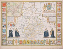
Cambridgeshire map 17th century engraving by John Speed
By John Speed
Located in London, GB
To see more, scroll down to "More from this Seller" and below it click on "See all from this Seller."
John Speed (1551 or 1552 - 1629)
Map of Cambridgeshire
Engraving with later hand colouring
39 x 53 cm
A beautifully coloured map of Cambridgeshire, with an antique description...
Category
1610s Landscape Prints
Materials
Engraving
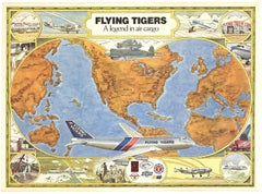
Original "Flying Tigers" vintage airline poster. A legend in Air Cargo
Located in Spokane, WA
Original linen-backed ‘FLYING TIGERS - A legend in air cargo;, aviation vintage poster for sale. This poster is part of The Smithsonian National Air...
Category
Late 20th Century American Realist Landscape Prints
Materials
Offset
$519 Sale Price
20% Off
Picasso, Sans titre, Pablo Picasso, Toros Y Toreros (after)
Located in Southampton, NY
Héliogravure on vélin paper. Paper Size: 14.75 x 10.5 inches. Inscription: Unsigned and unnumbered, as issued. Notes: From the album, Pablo Picasso, Toros y toreros, 1961. Published ...
Category
1960s Cubist Figurative Prints
Materials
Lithograph
$716 Sale Price
20% Off
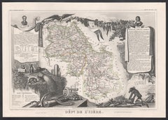
L'Isere, France. Antique map of French department, 1856
Located in Melbourne, Victoria
'Dept. de L'Isere', Steel engraving with original outline hand-colouring., 1856, from Levasseur's 'Atlas National Illustre'.
This area is known for its production of Bleu du Vercor...
Category
19th Century Naturalistic Landscape Prints
Materials
Engraving
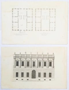
Set of Two Engravings from Campbell's "Vitruvius Britannicus" /// Architecture
Located in Saint Augustine, FL
Artist: Colen Campbell (Scottish, 1676-1729)
Titles: "The Plan of this New Design to the Earl of Islay" (Vol. 1, Plate 53) and "This New Design to the Earl of Islay" (Vol. 1, Plate 5...
Category
1710s Old Masters Landscape Prints
Materials
Laid Paper, Engraving, Etching, Intaglio
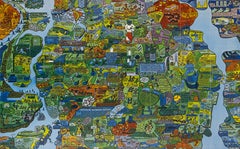
Section of Word Map-A Puzzle
Located in New York, NY
This lithograph by Oyvind Fahlstrom, produced in an edition of 100, is offered by CLAMP in New York City.
Category
1970s Contemporary Prints and Multiples
Materials
Lithograph
Original 'Map of the United States as Californians See It' vintage map poster
Located in Spokane, WA
Original vintage poster: "Map of the United States as Californians See It". 1947, artist: Oren Arnold. Size: 16.5" x 20.5", R. H. MOEBUS COMPANY This poster is not linen-backed. This poster is in very good fine condition, ready to frame.
A humorous satirical pictorial map from 1947 with the golden sun on the upper left, gives a detailed depiction of California, its relative size to the rest of the United States, showing Florida as "Death Valley", the rest of the United States as "Unexplored" 'Unimportant anyway, not in California". The image has your Mexican singer; bikini-clad bathers and others set in the image. Shows rivers, lakes, harbors, landmarks, parks, recreational activities, and local people.
This map shows Los Angeles’ city...
Category
1940s American Modern Landscape Prints
Materials
Offset
$1,280 Sale Price
20% Off
Map of Cambridgeshire, 18th century engraving by Sutton Nicholls
Located in London, GB
To see more, scroll down to "More from this Seller" and below it click on "See all from this Seller."
Sutton Nichols (1668 - 1729)
Map of Cambridgeshire
Engraving
43 x 36 cm
Signe...
Category
18th Century Landscape Prints
Materials
Engraving
Map of Poland - Etching - Early 20th Century
Located in Roma, IT
Map of Poland is an etching map realized in the early 20th century.
Good conditions.
Category
Early 20th Century Modern Figurative Prints
Materials
Etching
West Africa: 18th Century Hand-colored Homann Map Entitled "Guinea Propria"
Located in Alamo, CA
This is a scarce richly hand colored copper plate engraved map of Africa entitled "Guinea Propria, nec non Nigritiae vel Terrae Nigrorum Maxima Pars" by Johann Baptist Homann (1664-1...
Category
1740s Other Art Style Prints and Multiples
Materials
Engraving
Map of Italy - Etching by Pierre François Tardieu - 1837
Located in Roma, IT
Map of Italy is an Etching realized in 1837.
Good conditions.
The artwork is realized in a well-balanced composition. the artwork and belongs to the suite suite "AtlasBatt" realize...
Category
1830s Modern Figurative Prints
Materials
Lithograph
New South Wales, Australia, antique mid 19th century engraved John Tallis map
Located in Melbourne, Victoria
'New South Wales'
With decorative border surrounds and vignettes of 'Sydney Cove'. 'The Murray' and 'Xanthorrhea'.
'Drawn and engraved by J Rapkin'. Published by John Tallis.
375m...
Category
1840s Victorian Landscape Prints
Materials
Engraving
Floor plan of St Albans Cathedral (1810), engraving by James Basire
Located in London, GB
James Basire & John Carter
Floor plan of St Albans Cathedral
Engraving
61 x 95 cm
This engraving was originally published by the Society of Antiquaries of London, an organisation ...
Category
1810s Realist Landscape Prints
Materials
Engraving
Map of Moravia - Etching - 19th Century
Located in Roma, IT
The Map of Moravia is an etching map realized in the 19th century.
Good conditions.
Category
19th Century Modern Figurative Prints
Materials
Etching
L'Herault, France. Antique map of a French department, 1856
Located in Melbourne, Victoria
'Dept. de Saone et Loire', steel engraving with original outline hand-colouring., 1856, from Levasseur's Atlas National Illustre.
This area is home to a wide variety of vineyards a...
Category
19th Century Naturalistic Landscape Prints
Materials
Engraving
Durham, English County Antique map, 1847
By Isaac Slater
Located in Melbourne, Victoria
Steel-engraved map with original outline colouring by Isaac Slater. A detailed engraved map of the English county with title, scale, and key. Decorated with an uncoloured engraved vi...
Category
19th Century Naturalistic Landscape Prints
Materials
Engraving
Haut Rhin, France. Antique map of a French department, 1856
Located in Melbourne, Victoria
'Dept. du Bas Rhin', steel engraving with original outline hand-colouring., 1856, from Levasseur's Atlas National Illustre.
This mountainous area is part of the Alsace wine region ...
Category
19th Century Naturalistic Landscape Prints
Materials
Engraving
Northamptonshire, English County Antique map, 1847
By Isaac Slater
Located in Melbourne, Victoria
Steel-engraved map with original outline colouring by Isaac Slater. A detailed engraved map of the English county with title, scale, and key. Decorated with an uncoloured engraved view of 'Peterborough...
Category
19th Century Naturalistic Landscape Prints
Materials
Engraving
Burdigala, Map from "Civitates Orbis Terrarum" - by F.Hogenberg - 1575
Located in Roma, IT
"Burdigala", from the collection "Civitates Orbis Terrarum", Cologne, T. Graminaeus, 1575.
The “Civitates Orbis Terrarum” (Atlas of Cities of the World) was the second oldest prin...
Category
16th Century Figurative Prints
Materials
Etching, Aquatint
Cumberland, English County Antique map, 1847
By Isaac Slater
Located in Melbourne, Victoria
Steel-engraved map with original outline colouring by Isaac Slater. A detailed engraved map of the English county with title, scale, and key. Decorated with an uncoloured engraved vi...
Category
19th Century Naturalistic Landscape Prints
Materials
Engraving
Hertfordshire, English County Antique map, 1847
By Isaac Slater
Located in Melbourne, Victoria
Steel-engraved map with original outline colouring by Isaac Slater. A detailed engraved map of the English county with title, scale, and key. Decorated with an uncoloured engraved v...
Category
19th Century Naturalistic Landscape Prints
Materials
Engraving
Herefordshire, English County Antique map, 1847
By Isaac Slater
Located in Melbourne, Victoria
Steel-engraved map with original outline colouring by Isaac Slater. A detailed engraved map of the English county with title, scale, and key. Decorated with an uncoloured engraved vi...
Category
19th Century Naturalistic Landscape Prints
Materials
Engraving
Loir and Cher, France. Antique map of a French department, 1856
Located in Melbourne, Victoria
'Dept. de Loir and Cher', steel engraving with original outline hand-colouring., 1856, from Levasseur's Atlas National Illustre.
This area is mainly known for its production of Sel...
Category
19th Century Naturalistic Landscape Prints
Materials
Engraving
Indre and Loire, France. Antique map of a French department, 1856
Located in Melbourne, Victoria
'Dept. d'Indre et Loire', steel engraving with original outline hand-colouring., 1856, from Levasseur's 'Atlas National Illustre'.
This area is known for its production of Chenin b...
Category
19th Century Naturalistic Landscape Prints
Materials
Engraving
Var, France. Antique map of a French department, 1856
Located in Melbourne, Victoria
'Dept. du Var', steel engraving with original outline hand-colouring., 1856, from Levasseur's Atlas National Illustre.
Var covers the heart of the French Riviera or Cote d'Azur., and includes the resort cities of Cannes, Nice and San Tropez...
Category
19th Century Naturalistic Landscape Prints
Materials
Engraving
Ypra, Map from "Civitates Orbis Terrarum" - by F. Hogenberg - 1575
Located in Roma, IT
Braun G., Hogenberg F., Ypra (Ypres), from the collection Civitates Orbis Terrarum, Cologne, T. Graminaeus, 1572-1617.
The “Civitates Orbis Terrarum” (Atlas of Cities of the World) ...
Category
16th Century Figurative Prints
Materials
Etching, Aquatint
Campagne de Russie - Etching by Pierre François Tardieu - 1837
Located in Roma, IT
Campagne de Russie is an Etching realized by Pierre François Tardieu in 1837.
Good conditions.
The artwork is realized in a well-balanced composition. the artwork and belongs to th...
Category
1830s Modern Figurative Prints
Materials
Lithograph
Map of Oxfordshire by Joan Blaeu with college crests
Located in London, GB
To see our other original maps, scroll down to "More from this Seller" and below it click on "See all from this Seller" - or send us a message if you cannot find the poster you want....
Category
1660s Landscape Prints
Materials
Engraving
Map of Ancient Greece - Original Etching by Antonio Zatta - 1785
Located in Roma, IT
This Map of ancient Greek is an etching realized by Antonio Zatta in Venice in 1785.
The state of preservation of the artwork is good expect for the worn paper.
Mounted on a cardbo...
Category
1770s Landscape Prints
Materials
Etching
Greek Theatre - Lithograph - 1862
Located in Roma, IT
Greek Theatre is a lithograph on paper realized in 1862.
The artwork belongs to the Suite Uses and customs of all the peoples of the universe: " History of the government, of the la...
Category
1860s Modern Figurative Prints
Materials
Lithograph
Australia Original Vintage Propaganda Poster post WW2 MacDonald Max Gill
Located in London, GB
To see our other original vintage travel and propaganda posters, scroll down to "More from this Seller" and below it click on "See all from this Seller" - or send us a message if you...
Category
1940s Modern Landscape Prints
Materials
Lithograph
"Death Ramp", 1978, Lithograph by Dennis Oppenheim
Located in Long Island City, NY
Artist: Dennis Oppenheim, American (1938 - 2011)
Title: Death Ramp
Year: 1978
Medium: Lithograph, signed and numbered in pencil
Edition: 100
Size: 39 in. x 27 in. (99.06 cm x 68.58 cm)
Category
1970s Conceptual Landscape Prints
Materials
Lithograph
John Speede Map The Countye of Monmouth
By John Speed
Located in London, GB
To see our other views and maps of England - including London, Oxford and Cambridge, scroll down to "More from this Seller" and below it click on "See all from this Seller" - or send...
Category
17th Century Realist Landscape Prints
Materials
Engraving
Asia Declineatio: A 17th Century Hand-colored Map of Asia by Justus Danckerts
Located in Alamo, CA
This is a scarce 17th century beautifully hand-colored copperplate engraved map of Asia entitled “Exactissima Asiae Delineatio in Praecipuas Regiones Caerterasque Partes divisa et de...
Category
Late 17th Century Old Masters Landscape Prints
Materials
Engraving
View of Paris XV-XVI - Lithograph - Late 19th century
Located in Roma, IT
View of Paris XV-XVI is a lithograph print on paper realized in the Late 19th century
Signed on the plate
Good conditions.
From the suite of "France Pittoresques, including costum...
Category
Late 19th Century Modern Figurative Prints
Materials
Lithograph
"The World" Published by Cummings & Hilliard, No. 1, Cornhill, Boston
Located in Soquel, CA
"The World" Published by Cummings & Hilliard, No. 1, Cornhill, Boston
Early 19th century engraved double hemisphere Atlas Map, titled "The World." Hand colored original outlines. Pu...
Category
1820s American Realist Landscape Prints
Materials
Paper, Printer's Ink, Etching
View of Blois - Etching by G. Braun and F. Hogenberg -Late 16th Century
Located in Roma, IT
This view of Blois (ancient name: Bloys) is an original etching realized by George Braun and Franz Hogenberg as part of the famous "Civitates Orbis Terrarum".
The “Civitates Orbis T...
Category
16th Century Figurative Prints
Materials
Etching
A Hand Colored 17th Century Janssonius Map of Prussia: Poland, N. Germany, etc.
Located in Alamo, CA
An attractive hand-colored copperplate engraved 17th century map of Prussia entitled "Prussia Accurate Descripta a Gasparo Henneberg Erlichensi", published in Amsterdam by Joannes Janssonius in 1664. This very detailed map from the golden age of Dutch cartography includes present-day Poland, Latvia, Lithuania, Estonia and portions of Germany. This highly detailed map is embellished by three ornate pink, red, mint green and gold...
Category
Mid-17th Century Old Masters Landscape Prints
Materials
Engraving
Northern Scotland: 17th Century Hand-colored Map by Mercator
Located in Alamo, CA
This is a framed hand-colored 17th century map of Northern Scotland by Gerard Mercator entitled "Scotiae pars Septentrionalis", published in Amsterdam in 1636. It is a highly detailed map of the northern part of Scotland, with the northwest Highlands and the cities Inverness and Aberdeen, as well as the Orkney Islands and the Hebrides. There is a decorative title cartouche in the upper left corner.
The map is presented in an antiqued brown wood...
Category
Mid-17th Century Other Art Style Landscape Prints
Materials
Engraving
Map of Northumberland by Joannem Janssonium 17th century
Located in London, GB
To see our other original maps, scroll down to "More from this Seller" and below it click on "See all from this Seller" - or send us a message if you cannot find the poster you want....
Category
1640s Landscape Prints
Materials
Engraving
Sweden and Adjacent Portions of Scandinavia: A Hand-colored 18th C. Homann Map
Located in Alamo, CA
This hand-colored copper-plate map of Sweden and adjacent portions of Scandinavia entitled "Regni Sueciae in Omnes suas Subjacentes Provincias accurate divisi Tabula Generalis" was c...
Category
Early 18th Century Old Masters Landscape Prints
Materials
Engraving
Battle of Austerlitz - Etching by Pierre François Tardieu - 1837
Located in Roma, IT
Battle of Austerlitz is an Etching realized by Pierre François Tardieu in 1837.
Good conditions.
The artwork is realized in a well-balanced composition. the artwork and belongs to ...
Category
1830s Modern Figurative Prints
Materials
Lithograph
St. Christophe (St. Kitts): Bellin 18th Century Hand Colored Map
Located in Alamo, CA
Jacques Bellin's copper-plate map of the Caribbean island of Saint Kitts entitled "Carte De De l'Isle St. Christophe Pour servir á l'Histoire Genle. des V...
Category
1740s Other Art Style Landscape Prints
Materials
Engraving
Map of Battle of Aboukir - Etching by Pierre François Tardieu - 1837
Located in Roma, IT
Map of Battle of Aboukir is an Etching realized by Pierre François Tardieu in 1837.
Good conditions.
The artwork is realized in a well-balanced composition. and belongs to the sui...
Category
1830s Modern Figurative Prints
Materials
Etching
Siege of Toulon - Etching by Pierre François Tardieu - 1837
Located in Roma, IT
Siege of Toulon is an Etching realized by Pierre François Tardieu in 1837.
Good conditions.
The artwork is realized in a well-balanced composition. the artwork and belongs to the s...
Category
1830s Modern Figurative Prints
Materials
Lithograph
Central Park, New York, detailed cityscape limited edition print
By Laura Jordan
Located in Deddington, GB
Central Park NY by Laura Jordan is a Limited Edition Print printed on archival paper with a hand finished overlay of pencil watercolour and collage.
The print is an edition of 20.
S...
Category
2010s Contemporary Landscape Prints
Materials
Glitter, Archival Paper, Screen
A Hand Colored 18th Century Framed Map of South America by Thomas Jefferys
Located in Alamo, CA
This detailed hand colored map of South America by Thomas Jefferys was published in London in 1750. The map shows countries, early colonial possessions, towns, rivers, mountains, and...
Category
Mid-18th Century Other Art Style Landscape Prints
Materials
Engraving
Map of Russia - Original Etching - Late 19th Century
Located in Roma, IT
This Map of Russia is an etching realized by an anonymous artist.
The state of preservation of the artwork is good with some small diffused stains.
Sheet dimension:27.5 x 44
At t...
Category
Late 19th Century Modern Figurative Prints
Materials
Etching
Cambridgeshire map 17th century engraving by Kip after Saxton
Located in London, GB
To see more, scroll down to "More from this Seller" and below it click on "See all from this Seller."
William Kip (active 1598 - 1610) after Christopher Saxton (1540 - 1610).
Map o...
Category
1630s Landscape Prints
Materials
Engraving
Pianta dei Giardini di S. Maria - Roma - Etching - 17th Century
Located in Roma, IT
Pianta dei Giardini di S.Maria - Roma is an original drawing in etching technique on ivory-colored paper, realized by Anonymous Artist of the 17th Century...
Category
17th Century Modern Landscape Prints
Materials
Etching
Map of Vallombrosa - Florence 1926
Located in Roma, IT
This Map of Vallombrosa is a vintage offset print realized by an anonymous author in 1926.
The state of preservation of the artwork is aged with some small diffused stains and the a...
Category
1920s Modern Figurative Prints
Materials
Color
17th Century map of Cumberland, UK by Robert Morden
Located in Petworth, West Sussex
Robert Morden (British, circa 1650 – 1703)
A map of Cumberland with hand colouring
An engraving
14.1/4 x 16.5/8 in. (36.5 x 42.5 cm.)
Category
17th Century Academic Landscape Prints
Materials
Engraving
View of La Rochelle - Etching by G. Braun and F. Hogenberg - Late 16th Century
Located in Roma, IT
This View of La Rochelle (ancient name: Rochel) is an original etching realized by George Braun and Franz Hogenberg as part of the famous Series "Civitates Orbis Terrarum".
The “Civ...
Category
16th Century Figurative Prints
Materials
Etching
View of 4 Ancient German Cities - Etching by G. Braun and F. Hogenberg
Located in Roma, IT
Maps is an original etching realized by G. Braun and F. Hogenberg as part of the so called "Civitates Orbis Terrarum".
The “Civitates Orbis Terrarum” (Atlas of Cities of the World) ...
Category
16th Century Figurative Prints
Materials
Etching
View of Leiden - Etching by G. Braun and F. Hogenberg - Late 1500
Located in Roma, IT
This map of Leida is an original etching realized by George Braun and Franz Hogenberg as part of the famous Series "Civitates Orbis Terrarum".
The “Civitates Orbis Terrarum” (Atlas...
Category
16th Century Figurative Prints
Materials
Etching
Map of Calcaria - From "Civitates Orbium Terrarum" by F. Hogenberg - 1575
Located in Roma, IT
"Machelen", from the collection "Civitates Orbis Terrarum", Cologne, T. Graminaeus, 1575.
The “Civitates Orbis Terrarum” (Atlas of Cities of the World) was the second oldest print...
Category
16th Century Figurative Prints
Materials
Etching, Aquatint
Map of Vienne - Original Etching - 19th Century
Located in Roma, IT
Map of Vienne is an original etching realized by an anonymous engraver of the 19th Century.
Belongs to the Series of "France Pittoresque" at the top center.
The state of preservati...
Category
19th Century Figurative Prints
Materials
Etching
Ancient Map of Guyane - Original Etching - 19th Century
Located in Roma, IT
Map of Guyane is an original etching realized by an anonymous engraver of the 19th Century.
Belongs to the Series of "France Pittoresque" at the top center.
The state of preservati...
Category
19th Century Modern Figurative Prints
Materials
Etching
Leyden, Map from "Civitates Orbis Terrarum" - by F. Hogenberg - 1575
Located in Roma, IT
Braun G., Hogenberg F., Leyden, from the collection Civitates Orbis Terrarum, Cologne, T. Graminaeus, 1572-1617.
The “Civitates Orbis Terrarum” (Atlas of Cities of the World) was th...
Category
16th Century Figurative Prints
Materials
Etching, Aquatint
Li Governi di Borgogna - Ancient Map - 1777
Located in Roma, IT
Li Governi di Borgogna is an original black and white etching on paper, printed by Antonio Zatta in Venice, 1777.
Original Title: Li Governi di Borgogna della Franca Contea e del Ly...
Category
1770s Modern Landscape Prints
Materials
Etching
