Antiques Associations Members Maps
Antiques Association Members
Our distinguished antique sellers belong to leading worldwide associations with the highest vetting standards in the industry. Explore pieces from a range of historical periods offered by these design experts.
to
4
7
4
11
1
1
1
7
3
3
7
3
2
1
1
8
6
3
3
2
11
11
11
1
1
1
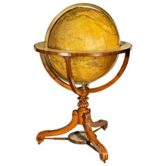
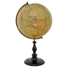
Large and Extremely Rare Terrestrial Globe by Newton
By Newton Globes - Planer & Newton
Located in Lymington, Hampshire
A large and extremely rare 24-inch terrestrial globe by Newton
Our most magnificent and rare globes were a pair of 24-inch Newton globes.
These too were updated in 1852 (terre...
Category
Mid-19th Century English Antique Antiques Associations Members Maps
Materials
Mahogany
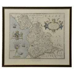
Map of Lancashire
Located in Cheshire, GB
Saxton Map of Lancashire hand coloured. Encased in an ebonised frame.
Dimensions
Height 21 Inches
Width 24 Inches
Depth 1 Inches
Category
Early 20th Century British Antiques Associations Members Maps
Materials
Paper
$757 Sale Price
20% Off
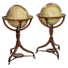
Fine Pair of Floor Globes by J & G Cary, Dated 1820 and 1833
By George & John Cary
Located in Lymington, Hampshire
A fine pair of 15 inch floor globes by J & G Cary, dated 1820 and 1833, each set into a mahogany stand with a vase shaped support and three legs centred on a compass, one with a labe...
Category
Early 19th Century English Regency Antique Antiques Associations Members Maps
Materials
Mahogany
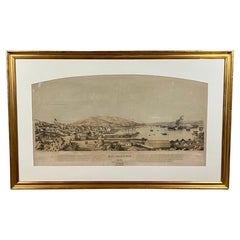
Early San Francisco View by Henry Firks Printed by W.H. Jones in 1849
Located in San Francisco, CA
A tinted lithographic view of San Francisco, made during the gold rush, showing a panoramic view of the bay's waterfront from the south along Montgomery Street to Telegraph Hill. The...
Category
Mid-19th Century American Victorian Antique Antiques Associations Members Maps
Materials
Paper
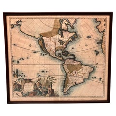
America Septentrionalis by Carroli Allard (1648-1709) Copper Plate Engraving
Located in San Francisco, CA
"Recentissuma Novi Orbis Sive Americae Septentrionale et Meriodionalis"
A hand-colored copper plate engraving of North and South America by Carel Allard depicting recent discoveries...
Category
Late 17th Century Dutch Antique Antiques Associations Members Maps
Materials
Paper
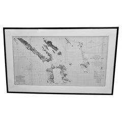
Scarce U.S. Coast Survey Map Depicting Entrance to San Francisco Bay Dated 1856
Located in San Francisco, CA
A fine example of the 1856 U.S. Coast lithographic survey nautical chart of the entrance to San Francisco bay and the city. Published in 1856 by the Office of the Coast Survey the of...
Category
Mid-19th Century American Antique Antiques Associations Members Maps
Materials
Paper
Antique Map of Eastern Hemisphere from the collection of Thierry Despont
Located in New York, NY
Designed by Enrico Bonetti (E. Bonatti) and published by Francesco Vallardi Editore. Based on an earlier map by Evangelista Azzi (Ev. Azzi). Labeled as such at bottom edge of map.
T...
Category
Late 19th Century Italian Antique Antiques Associations Members Maps
Materials
Canvas, Wood
Northwest Coast and Isle of Man Map
Located in Cheshire, GB
Greenville Collins Northwest Coast and Isle of Man. hand coloured chart, encased in an ebonised frame.
Dimensions
Height 26.5 Inches
Width 30 Inches
Depth 1 Inches
Category
Early 20th Century British Antiques Associations Members Maps
Materials
Paper
$517 Sale Price
20% Off
Map of Essex by Emanuel Bowen
Located in Cheshire, GB
Map of part of Essex and part of Kent, hand-coloured. Encased in an ebonized and gilded frame.
Dimensions
Height 25.5 Inches
Length 32.5 Inches
width 1 Inches.
Category
Late 19th Century British Antique Antiques Associations Members Maps
Materials
Paper
$981 Sale Price
50% Off
Chart of the Harbour of Liverpool
Located in Cheshire, GB
PL Burdett A Chart of the Harbour of Liverpool hand coloured. Encased in an ebonised frame.
Dimensions
Height 23.5 Inches
Width 28 Inches
Depth 1 Inches
Category
Early 20th Century British Antiques Associations Members Maps
Materials
Paper
$626 Sale Price
20% Off
Pair of Floor Standing Globes by Gilman Joslin
By Gilman Joslin
Located in Lymington, Hampshire
A pair of 16-inch floor standing globes by Gilman Joslin, each set into a cast-iron tripod base with an acanthus-leaf baluster support on three b...
Category
19th Century American Antique Antiques Associations Members Maps
Materials
Iron
$66,432 / set
Related Items
Replogle Terrestrial Floor Globe
By Replogle Globes
Located in Asbury Park, NJ
This floor globe by Replogle floats within a ring of walnut, supported by four 'turned' chrome stiles, which connect to a base of walnut. The ...
Category
1960s American Mid-Century Modern Vintage Antiques Associations Members Maps
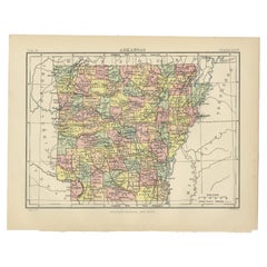
Antique Map of Arkansas
Located in Langweer, NL
Antique map titled 'Arkansas'. Original antique map of Arkansas, United States. This print originates from 'Encyclopaedia Britannica', Ninth Edition. P...
Category
Late 19th Century Antique Antiques Associations Members Maps
Materials
Paper
1950s Rare Marijuana Ashtray Bowl San Francisco Architect California SF
Located in Hyattsville, MD
Amazing 1950s sculptural ashtray created in the MCM period in San Francisco. Small studio craft, low numbers produced. Signed.
Category
1950s American Mid-Century Modern Vintage Antiques Associations Members Maps
Materials
Brass
$1,800
H 3 in W 6.38 in D 5 in
Antique World Globe From Fleet Street London 1923 on Wooden Stand
Located in Reading, Berkshire
Antique Terrestrial Geographia of Fleet Street London 12"inch World Globe on handcrafted Wooden Three Legged Base 1923
Made 55 Fleet Street, London
Beautiful desktop globe, showcas...
Category
1920s British Art Deco Vintage Antiques Associations Members Maps
Materials
Wood, Paper
$1,318 Sale Price
25% Off
H 18.51 in Dm 11.82 in
Old Map of the Namibia and South Africa Coasts & Inset of Saldanha Bay, ca.1700
Located in Langweer, NL
Antique map titled 'Carte particuliere des Costes de l'Afrique'.
Map of the coasts of Namibia and South Africa. With an inset map of Saldanha Bay.
Artists and Engravers: Publ...
Category
Early 1700s Antique Antiques Associations Members Maps
Materials
Paper
$609 Sale Price
20% Off
H 24.81 in W 20.87 in D 0 in
Antique Map of Principality of Monaco
By Antonio Vallardi Editore
Located in Alessandria, Piemonte
ST/619 - "Old Geographical Atlas of Italy - Topographic map of ex-Principality of Monaco" -
ediz Vallardi - Milano -
A somewhat special edition ---
Category
Late 19th Century Italian Other Antique Antiques Associations Members Maps
Materials
Paper
19th Century German Miniature Pocket Terrestrial Globe
By C. Abel-Klinger
Located in Essex, MA
A miniature 19th century 3.5 inch diameter pocket terrestrial globe by C. Abel-Klinger, Nuremberg, Germany, in English for the English speaking markets. Signed with cartouche reading...
Category
1880s German Antique Antiques Associations Members Maps
Materials
Brass
Antique Hammond's 6-Inch Terrestrial Globe on Stand
By C.S. Hammond & Co.
Located in Philadelphia, PA
Offered here for your consideration is, A fine antique 6-inch terrestrial globe.
Additional Details:
By C.S. Hammond & Co.
The globe likely dates from 1927 to 1930 due to the ...
Category
20th Century Unknown Art Deco Antiques Associations Members Maps
Materials
Wood, Paper
English Campaign Trunk of Brass-Bound Leather and Camphor Wood, circa 1820
Located in Austin, TX
A handsome medium-sized British officer's military Campaign camphor trunk or chest of brass-bound and studded leather over camphor wood, circa 1820.
Manufactured by the British East India...
Category
Early 19th Century English Campaign Antique Antiques Associations Members Maps
Materials
Brass, Metal
$3,495
H 13.13 in W 31.5 in D 16 in
Signed St Andrews Golf Print, Bobby Jones
Located in Oxfordshire, GB
Rare Bobby Jones Signed 1927 Open Golf Championship Picture.
An original 1930 limited edition lithograph titled "Robert Tyre Jones Jr. Winning the British Open Golf Championship". The colour lithograph print is one of 999 prints published, with copyright by Currier & Ives, Inc. It depicts Jones with his Calamity Jane...
Category
1920s American Sporting Art Vintage Antiques Associations Members Maps
Materials
Paper
Vintage Reploge Terrestrial World Globe
Located in Douglas Manor, NY
2-309 vintage world globe with raised surfaces set on a custom walnut wood stepped base, circa 1960.
Category
1960s Vintage Antiques Associations Members Maps
Materials
Metal
Floor Standing Globe On A Turned Hardwood & Brass Stand Model No 16
By Cram's
Located in Reading, Berkshire
Crams Imperial World Globe
Floor Standing Globe On A Turned Hardwood & Brass Stand Model No 16
Manufactured by George F Cram Co. Indiana, U.S.A
Category
Early 20th Century American Victorian Antiques Associations Members Maps
Materials
Brass
$1,744
H 34.26 in W 15.75 in D 14.97 in
Previously Available Items
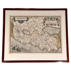
"Terra Sancta" Map of the Holy Land by Abraham Ortelius (1527-1598) Framed
By Abraham Ortelius
Located in San Francisco, CA
Abraham Ortelius (1527-1598) was a cartographer, geographer and map maker from Antwerp in the Spanish Netherlands. He created the first modern atlas, titled in Latin "Theatrum Orbis ...
Category
17th Century Belgian Baroque Antique Antiques Associations Members Maps
Materials
Paper
Large early 20th century globe on stand by Jordglob
Located in Debenham, Suffolk
Large early 20th century globe on stand by jordglob circa 1909.
Beautiful Swedish globe of generous proportions. A 1909 globe in good condition suspended on a brass arm, which sits...
Category
Early 20th Century Swedish Edwardian Antiques Associations Members Maps
Materials
Metal
Map of Ireland Titled "Hiberniae Britannicae Insulae Nova Descriptio Irland"
By Abraham Ortelius
Located in San Francisco, CA
Abraham Ortelius (1527-1598) was a cartographer, geographer and maker from Antwerp in the Spanish Netherlands. He created the first modern atlas titled in Latin Theatrum Orbis Terrar...
Category
Early 18th Century Belgian Antique Antiques Associations Members Maps
Materials
Paper
New Map of North America, with the West India Islands
Located in Downingtown, PA
"A New Map of North America, with the West India Islands...according to the latest surveys, and corrected from the original materials, of Goverr. Pownall, M...
Category
1780s Georgian Antique Antiques Associations Members Maps
Materials
Paper
Silk Needlework Map of England and Wales Signed Anna Brewster Dated 1783
Located in San Francisco, CA
A charming silk needlework depiction of England and Wales executed in 1783 by Anna Brewster. This Georgian map sampler is signed and dated in the upper lef...
Category
Late 18th Century English Georgian Antique Antiques Associations Members Maps
Materials
Canvas, Silk
H 24.5 in W 21.5 in D 1.5 in
Desk Globe by Smith and Son, circa 1860
By Charles Smith & Son
Located in London, GB
A handsome Smith's terrestrial globe, circa 1835. Mounted on a brass semi-meridian that sits on a turned wooden upright and circular base. Printed in several colours, the globe compr...
Category
1860s British Antique Antiques Associations Members Maps
Materials
Brass
Pair of Philip & Son Globes, circa 1946
By George Philip & Son
Located in London, GB
A wonderful set of Terrestrial and Celestial 12 inch globes by George Philip and Son. Presented on brass inclined plain mounts attached to original turned ebonized wooden bases and uprights with axes secured at the top by brass acorn finials. Unusually, the terrestrial globe has a copyright date shown under the cartouche, 1946.
The celestial globe is printed in beige against a dark blue background and shows the constellations and many named stars. Solid lines connect the stars within constellations rather than illustrating them as mythological and other figures.? A cartouche is present that includes the title and maker's address.
When looking at the stars from Earth the viewpoint is effectively inside a celestial sphere. The surface of a celestial globe shows the star field as a projection viewed from the outside and is therefore reversed, with the constellations appearing as their mirror images.
The terrestrial globe is printed in several colours and comprises of twelve coated lithographic paper gores with polar calottes over a twelve inch card sphere. The age of the globe has been confirmed by the political borders and named cities displayed. The globe is nicely detailed and has a grid network of parallels and meridians. It shows all the continents and countries as they were at the time it was printed and also indicates all the principal steamship routes with distances in nautical miles. The globe also has a printed Analemma - a diagram showing the declination of the Sun for every day in the year and the equation of time. The Analemma therefore shows the position of the Sun in the sky as seen from a fixed location on Earth at the same mean solar time, as the sun's position varies over the course of a year. A cartouche is present that includes the title and maker's address.
Dimensions of each globe: 30.5 cm/12 inches (diameter) x 59 cm/23 1/4 inches (max height).
George Philip, (1800–1882) was a cartographer and map publisher. He founded George Philip & Sons in 1834 in Liverpool primarily as a bookseller and stationer, but rapidly expanding to become a publisher of primarily maps, atlases and educational works. He had one son, also George (1823–1902), who was admitted to the business in 1848.
George senior was born in Huntly, Aberdeenshire and by 1819 he had become assistant to the Liverpool bookseller, William Grapel before going on to start his own business. He used cartographers (such as John Bartholomew the elder, August Petermann, and William Hughes) to produce maps on copper plates. Philip then had these printed and hand-coloured by his women tinters. The business expanded rapidly and by the time he produced his county maps of 1862 he was using machine...
Category
1940s British Vintage Antiques Associations Members Maps
Materials
Brass
Geographia 10 Inch Globe, circa 1955
By Geographia, Ltd.
Located in London, GB
A fine 10 inch terrestrial globe by Geographia of Fleet Street London. With chromed semi-meridian on a turned wooden upright and circular base that has an ebon...
Category
1950s British Vintage Antiques Associations Members Maps
Materials
Chrome
Philips' Terrestrial Globe, circa 1925
By George Philip & Son
Located in London, GB
An attractive terrestrial globe by George Philip and Son; circa 1925. Printed in several colours and mounted on a brass semi-meridian attached to original turned ebonized wooden base...
Category
1920s British Vintage Antiques Associations Members Maps
Materials
Gesso, Wood, Paper
Globe by W & AK Johnston, Dated 1888
Located in Lymington, Hampshire
A 12 inch globe by W & AK Johnston, dated 1888, the terrestrial globe set in an ebonized stand with four turned legs and cross stretchers, the cartouche re...
Category
1880s British Antique Antiques Associations Members Maps
Materials
Wood
George IV Floor-Standing Library Globe by John Smith
By John Smith
Located in Lymington, Hampshire
A George IV 18-inch floor-standing library globe by John Smith, set in a mahogany stand with a turned baluster support and three arched legs on brass castors joined by stretchers cen...
Category
19th Century British George IV Antique Antiques Associations Members Maps
Materials
Mahogany
Map of American Indian Reservations 1884 in Period Walnut Frame
Located in San Francisco, CA
Washington: Department of the Interior. This interesting 1884 map presents the Indian Reservations in the United States and its territories covering the entire United States with Ala...
Category
1880s American Antique Antiques Associations Members Maps
Materials
Walnut, Paper
