G. A. Rizzi-zannoni Maps
to
6
6
6
6
6
6
6
6
6
104
63
28
24
Creator: G. A. Rizzi-zannoni
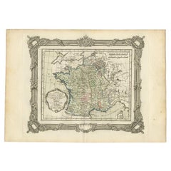
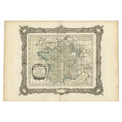
Antique Map of France at the Beginning of the 17th Century by Zannoni, 1765
By G. A. Rizzi-zannoni
Located in Langweer, NL
Antique map France titled 'Carte pour servir à intelligence de l'Histoire de France (..)'. Beautiful old map of France. This map originates from 'At...
Category
18th Century Antique G. A. Rizzi-zannoni Maps
Materials
Paper
$152 Sale Price
20% Off
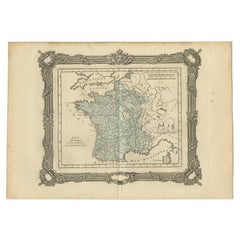
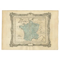
Antique Map of France at the End of the Ministry of Cardinal Richelieu, 1765
By G. A. Rizzi-zannoni
Located in Langweer, NL
Antique map France titled 'Etat du Domaine à la fin du Ministère du Cardinal de Richelieu (..)'. Beautiful old map of France. This map originates fr...
Category
18th Century Antique G. A. Rizzi-zannoni Maps
Materials
Paper
$141 Sale Price
20% Off
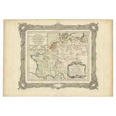
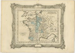
French Antique Map of France and Western Europe, 1765
By G. A. Rizzi-zannoni
Located in Langweer, NL
Antique map titled 'Carte de tous les Lieux, célébres dans l'Histoire (..)'. Beautiful old map of France and western Europe. This map originates from 'Atlas Historique de la France A...
Category
18th Century Antique G. A. Rizzi-zannoni Maps
Materials
Paper
$161 Sale Price
20% Off
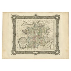
Antique Map of France at the End of the Reign of Jean II by Zannoni, 1765
By G. A. Rizzi-zannoni
Located in Langweer, NL
Antique map France titled 'La France sous la fin du Regne de Jean II (..)'. Beautiful old map of France. This map originates from 'Atlas Historique de la France Ancienne et Moderne' ...
Category
18th Century Antique G. A. Rizzi-zannoni Maps
Materials
Paper
$152 Sale Price
20% Off
Antique Map of France at the end of the Reign of Louis the Great by Zannoni 1765
By G. A. Rizzi-zannoni
Located in Langweer, NL
Antique map France titled 'Etat de la France à la fin du Règne de Louis le Grand (..)'. Beautiful old map of France. This map originates from 'Atlas Historique de la France Ancienne ...
Category
18th Century Antique G. A. Rizzi-zannoni Maps
Materials
Paper
$172 Sale Price
20% Off
Antique Map of France After the Peace of Ryswick by Zannoni, 1765
By G. A. Rizzi-zannoni
Located in Langweer, NL
Antique map France titled 'Etat du Domaine apès le Traité de Ryswick (..)'. Beautiful old map of France. This map originates from 'Atlas Historique de la France Ancienne et Moderne' ...
Category
18th Century Antique G. A. Rizzi-zannoni Maps
Materials
Paper
$141 Sale Price
20% Off
Related Items
The Great Book of French Impressionism by Diane Kelder
Located in North Hollywood, CA
The art of the French impressionists great large heavy art table book by Diane Kelder. A survey of works by French artists of the Impressionist movement focuses on Pissarro, Sisley, Manet, Morisot, Monet, Renoir, Cassatt, Degas, and Toulouse-Lautrec. Absolutely gorgeous extra large coffee table book - “The Great Book of French Impressionism...
Category
1980s French French Provincial Vintage G. A. Rizzi-zannoni Maps
Materials
Paper
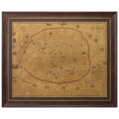
Plan of Paris, France, by A. Vuillemin, Antique Map, 1845
Located in Colorado Springs, CO
This large and detailed plan of Paris was published by Alexandre Vuillemin in 1845. The map conveys a wonderful amount of information and is decorated throughout with pictorial vigne...
Category
1840s American Antique G. A. Rizzi-zannoni Maps
Materials
Paper
Frederick the Great, Oil on Carton, Giltwood Frame, End of 18th Century
Located in Greding, DE
Painting of Frederick II., the Great, in oil on carton, in an oval gilt frame.
Category
Late 18th Century German Antique G. A. Rizzi-zannoni Maps
Materials
Other
$1,917
H 11.82 in W 9.45 in D 1.19 in
North & South America: A 17th Century Hand-colored Map by Jansson & Goos
By Johannes Janssonius
Located in Alamo, CA
A 17th century hand-colored map of North & South America entitled "Americae Descriptio" by the cartographer Johannes Jansson, published in Jansson's Atlas Minor in Amsterdam in 1628....
Category
1620s Dutch Antique G. A. Rizzi-zannoni Maps
Materials
Paper
$1,275
H 7 in W 8.63 in D 0.07 in
Large 17th Century Hand Colored Map of England and the British Isles by de Wit
By Frederick de Wit
Located in Alamo, CA
A large hand colored 17th century map of England and the British Isles by Frederick de Wit entitled "Accuratissima Angliæ Regni et Walliæ Principatus", published in Amsterdam in 1680. It is a highly detailed map of England, Scotland, the Scottish Isles...
Category
Late 17th Century Dutch Antique G. A. Rizzi-zannoni Maps
Materials
Paper
$1,175
H 35 in W 30.5 in D 2 in
1847 The Naval History of Great Britain, from the Declaration of War by France
By William James (Author)
Located in Bath, GB
A beautiful edition of naval historian William James's detailed and richly illustrated history of the Royal Navy.
A 'New Edition' of naval historian William James's impressive work,...
Category
1840s British Antique G. A. Rizzi-zannoni Maps
Materials
Paper
$1,713
H 9 in W 10 in D 6 in
17th Century Thai Bronze Bust Of The Buddha
Located in Stamford, CT
A Thai bronze head of the Buddha. Sukothai period, late 16th-early 17th century. His face with serene expression, arched eyebrows above incised eyes a...
Category
Early 17th Century Thai Other Antique G. A. Rizzi-zannoni Maps
Materials
Bronze
Vintage Reproduction 17th Century Map of Europe, American, Cartography, Blaeuw
Located in Hele, Devon, GB
This is a vintage reproduction map of Europe. An American, paper stock cartography print in frame after the work by Blaeuw, dating to the late 20t...
Category
Late 20th Century Central American Mid-Century Modern G. A. Rizzi-zannoni Maps
Materials
Glass, Wood, Paper
$1,252
H 30.32 in W 38.39 in D 1.38 in
French 17th Century Stone Blasson
Located in Round Top, TX
An exquisite 17th century Blasson of a Pelican nurturing its young - representing the Eucharist. Wonderfully carved from Burgundy Stone. A stunning piece.
Category
Mid-17th Century French Antique G. A. Rizzi-zannoni Maps
Materials
Stone
Original Antique Map of The United States of America by Dower, circa 1835
Located in St Annes, Lancashire
Nice map of the USA
Drawn and engraved by J.Dower
Published by Orr & Smith. C.1835
Unframed.
Free shipping
Category
1830s English Antique G. A. Rizzi-zannoni Maps
Materials
Paper
$60
H 12.25 in W 9.25 in D 0.07 in
Original Antique Map of Hawaii And Adjacent Islands. C.1900
Located in St Annes, Lancashire
Fabulous map of Hawaii. With a vignette of Honolulu
Original color.
Engraved and printed by the George F. Cram Company, Indianapolis.
Published, C.1900.
Unframed.
Free shipping.
Category
1890s American Antique G. A. Rizzi-zannoni Maps
Materials
Paper
Original Antique Map of The London Underground. 1911
Located in St Annes, Lancashire
Superb map of The London Underground
Published by Ward Lock, 1911
Folding map. Printed on paper
Unframed.
Good condition/ Minor repair to an edge tear on right edge ( shown in ...
Category
1910s English Vintage G. A. Rizzi-zannoni Maps
Materials
Canvas, Paper
Previously Available Items
Set of 6 Antique Maps of France, 1765
By G. A. Rizzi-zannoni
Located in Langweer, NL
The set of 6 consists of the following maps:
Antique Map of France at the Beginning of the Reign of Louis XIV, 1765
Antique Map of France under the reign of Louis XII by Zannoni, 1765
Antique Map of France under the reign of Louis VII...
Category
18th Century Antique G. A. Rizzi-zannoni Maps
Materials
Paper
Antique Map of France at the End of the Reign of Henry IV by Zannoni, 1765
By G. A. Rizzi-zannoni
Located in Langweer, NL
Antique map France titled 'À la fin du Regne d'Henri IV (..)'. Beautiful old map of France. This map originates from 'Atlas Historique de la France Ancienne et Moderne' by M. Rizzi Z...
Category
18th Century Antique G. A. Rizzi-zannoni Maps
Materials
Paper
H 11.03 in W 15.75 in L 11.03 in
Antique Map of France After the Death of Charlemagne, 1765
By G. A. Rizzi-zannoni
Located in Langweer, NL
Antique map France titled 'Tableau du Domaine Royal (..)'. Beautiful old map of France. This map originates from 'Atlas Historique de la France Ancienne et Moderne' by M. Rizzi Zanno...
Category
18th Century Antique G. A. Rizzi-zannoni Maps
Materials
Paper
Antique Map of France at the Beginning of the Reign of Louis XIV, 1765
By G. A. Rizzi-zannoni
Located in Langweer, NL
Antique map France titled 'La France au commencement du Regne de Louis XIV (..)'. Beautiful old map of France. This map originates from 'Atlas Historique de la France Ancienne et Mod...
Category
18th Century Antique G. A. Rizzi-zannoni Maps
Materials
Paper
H 11.03 in W 15.75 in L 11.03 in
Antique Map of France at the End of the Ministry of Cardinal Mazarin, 1765
By G. A. Rizzi-zannoni
Located in Langweer, NL
Antique map France titled 'Etat du Domaine a la fin du Ministère (..)'. Beautiful old map of France. This map originates from 'Atlas Historique de l...
Category
18th Century Antique G. A. Rizzi-zannoni Maps
Materials
Paper
H 11.03 in W 15.75 in L 11.03 in
1763 Nautical Portolano Chart of Guascogna Bay from Le Petit Neptune François
By G. A. Rizzi-zannoni
Located in Milan, IT
Antique nautical map of the Bay of Guascogna from Le petit Neptune françois published in Paris in 1763. Printed by engraved copper plate. Measures...
Category
1760s French Antique G. A. Rizzi-zannoni Maps
Materials
Paper
H 12.21 in W 14.18 in D 0.79 in
G. A. Rizzi-zannoni maps for sale on 1stDibs.
G. A. Rizzi-zannoni maps are available for sale on 1stDibs. These distinctive items are frequently made of paper and are designed with extraordinary care. There are many options to choose from in our collection of G. A. Rizzi-zannoni maps, although beige editions of this piece are particularly popular. If you’re looking for additional options, many customers also consider maps by J. Migeon, Heinrich Kiepert, and Abraham Ortelius. Prices for G. A. Rizzi-zannoni maps can differ depending upon size, time period and other attributes — on 1stDibs, these items begin at $160 and can go as high as $194, while a piece like these, on average, fetch $174.
