Herman Moll Maps
German, 1654-1732
Herman Moll (1654-1732) was a prominent mapmaker in London in the early eighteenth century, having moved from Germany in the late 17th century. He initially worked for English printers, but soon opened his own establishment around 1690. He was a friend of the scientist Robert Hooke, the archaeologist William Stuckley, the authors Jonathan Swift and Daniel Defoe, and the pirates William Dampier, Woodes Rogers and William Hacke. He published many atlases, as well as individual maps. He also produced book illustrations, including maps, for books by the pirate William Dampier and Jonathan Swift’s Gulliver’s Travels. Moll died in 1732. to
2
2
2
2
2
2
2
2
2
104
63
28
24
Creator: Herman Moll
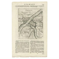
Antique Map of the Koblentz Region by Moll, 1695
By Herman Moll
Located in Langweer, NL
Antique map Koblentz titled 'Coblentz'. Rare antique map of the Koblentz region in Germany. On verso, an antique map of the Mont Royal fortress, Germany. Originates from 'Thesaurus Geographicus. A New Body of Geography: or a Compleat Description of the Earth 'by H. Moll.
Artists and Engravers: Herman Moll...
Category
17th Century Antique Herman Moll Maps
Materials
Paper
$122 Sale Price
20% Off
Antique Map of Denmark by Moll 'circa 1730'
By Herman Moll
Located in Langweer, NL
Antique map titled 'Denmark, agreeable to Modern History'. Uncommon map of Denmark by Herman Moll, published, circa 1730.
Category
Mid-18th Century Antique Herman Moll Maps
Materials
Paper
$335 Sale Price
20% Off
Related Items
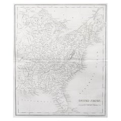
Original Antique Map of The United States of America by Dower, circa 1835
Located in St Annes, Lancashire
Nice map of the USA
Drawn and engraved by J.Dower
Published by Orr & Smith. C.1835
Unframed.
Free shipping
Category
1830s English Antique Herman Moll Maps
Materials
Paper
$60
H 12.25 in W 9.25 in D 0.07 in
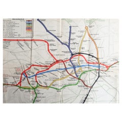
Original Antique Map of The London Underground. 1911
Located in St Annes, Lancashire
Superb map of The London Underground
Published by Ward Lock, 1911
Folding map. Printed on paper
Unframed.
Good condition/ Minor repair to an edge tear on right edge ( shown in ...
Category
1910s English Vintage Herman Moll Maps
Materials
Canvas, Paper
Original Antique Map of Ancient Greece, Achaia, Corinth, 1786
Located in St Annes, Lancashire
Great map of Ancient Greece. Showing the region of Thessaly, including Mount Olympus
Drawn by J.D. Barbie Du Bocage
Copper plate engraving by P.F Tardieu
Original hand color...
Category
1780s French Other Antique Herman Moll Maps
Materials
Paper
Original Antique Map of Spain and Portugal, circa 1790
Located in St Annes, Lancashire
Super map of Spain and Portugal
Copper plate engraving by A. Bell
Published, circa 1790.
Unframed.
Category
1790s English Other Antique Herman Moll Maps
Materials
Paper
Original Antique Map of The Philippines. C.1900
Located in St Annes, Lancashire
Fabulous map of The Philippines
Original color.
Engraved and printed by the George F. Cram Company, Indianapolis.
Published, C.1900.
Unframed.
Free shipping.
Category
1890s American Antique Herman Moll Maps
Materials
Paper
Original Antique Map of the American State of Colorado, 1903
Located in St Annes, Lancashire
Antique map of Colorado
Published By A & C Black. 1903
Original colour
Good condition
Unframed.
Free shipping
Category
Early 1900s English Antique Herman Moll Maps
Materials
Paper
Original Antique Map of South East Asia by Thomas Clerk, 1817
Located in St Annes, Lancashire
Great map of South East Asia
Copper-plate engraving
Drawn and engraved by Thomas Clerk, Edinburgh.
Published by Mackenzie And Dent, 1817
Unframed.
Category
1810s English Antique Herman Moll Maps
Materials
Paper
William Shakespeare, Othello, the Moor of Venice, a Tragedy, 1695 Sixth Edition
Located in Hillsborough, NJ
"But I will wear my heart upon my sleeve"
AUTHOR: SHAKESPEARE, William.
TITLE: Othello, The Moor of Venice. A Tragedy. As it hath divers times Acted at the Globe, and at the Black-Friers: and now at the Theatre Royal,...
PUBLISHER: London: for Richard Bentley, 1695.
DESCRIPTION: SIXTH EDITION. (ii)76pp., complete, quarto, 8-5/8" x 6-1/4", several leaves with untrimmed bottom edges, some toning and foxing to pages, closed tear to F2 mended without loss, a few headlines slightly trimmed but generally good wide margins, ex-libris Viscount Mersey of Bignor Park with book label...
Category
1690s British Antique Herman Moll Maps
Materials
Leather
$19,000
H 8.63 in W 6.25 in D 0.5 in
Map of the Republic of Genoa
Located in New York, NY
Framed antique hand-coloured map of the Republic of Genoa including the duchies of Mantua, Modena, and Parma.
Europe, late 18th century.
Dimension: 25...
Category
Late 18th Century European Antique Herman Moll Maps
Original Antique Map of South America. C.1780
Located in St Annes, Lancashire
Great map of South America
Copper-plate engraving
Published C.1780
Two small worm holes to left side of map
Unframed.
Category
Early 1800s English Georgian Antique Herman Moll Maps
Materials
Paper
Original Antique Map of The World by Thomas Clerk, 1817
Located in St Annes, Lancashire
Great map of The Eastern and Western Hemispheres
On 2 sheets
Copper-plate engraving
Drawn and engraved by Thomas Clerk, Edinburgh.
Published by Mackenzie And Dent, 1817
...
Category
1810s English Antique Herman Moll Maps
Materials
Paper
Antique Map of Principality of Monaco
By Antonio Vallardi Editore
Located in Alessandria, Piemonte
ST/619 - "Old Geographical Atlas of Italy - Topographic map of ex-Principality of Monaco" -
ediz Vallardi - Milano -
A somewhat special edition ---
Category
Late 19th Century Italian Other Antique Herman Moll Maps
Materials
Paper
Previously Available Items
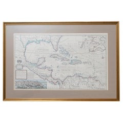
West-Indies Herman Moll William Paterson Spanish Trade Routes Gold
By Herman Moll
Located in BUNGAY, SUFFOLK
A rare map of the West-Indies or the islands of America in the North Sea with ye adjacent countries explaining what belongs to Spain, England, France, Holland &c also ye Trade Winds and ye several Tracts made by ye Galeons and flota from place to place.
Wil Paterson this map of the West-Indies is most humbly dedicated by Her. Moll geographer.
According to ye newest and most exact observations by Herman Moll Geographer.
Map of the Caribbean islands including southern North America, Mexico, Central America, and northern South America.
Inset at lower left: The City of Mexico in New Spain. Derived from a view in an unpublished atlas by Johannes Vingboons 1628. This image was probably copied from a map by Juan Gomez de Trasmonte, supervisor of the construction of a drainage system for Mexico city in 1628. Kagan, Urban images of the Hispanic world, fig. 4.23
Insets at upper right: La Vera Cruz; A Draught of the Bay and Citty of Havana Cuba; The Bay of Porto Bella; A Draught of ye Citty of Cartagena; A Draught of St. Augustin Saint Augustine, Florida.
Artist : Herman Moll d. 1732.
Bibliography : A new and compleat atlas, London, 1708-1720 Hermand Moll.
Provenance: Private collection.
In a buff mount and gilded frame with green highlight. Maps are generally framed in insigificant frames so that the attention is soley on the map. This map could easily be reframed depending on how and where it will be hung and there are many different choices.
Frame size height 56 cm., 22" length 84 cm., 33".
This is a map that reveals Moll both as an astute political observer and thinker, and tactian. This map of the West Indies is full of commercially sensitive information about the Spanish gold runs, and it is entirely feasible that the map was deliberately suited as a guide to English piracy and privateering in the West Indies. Through his London connections, Moll knew of two prominent English pirates or privateers: Woodes Rogers and William Dampier...
Category
18th Century Central American Baroque Antique Herman Moll Maps
Materials
Paper
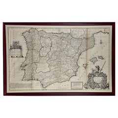
Framed Hand-Colored Early 18th Century Herman Moll Map of Spain and Portugal
By Herman Moll
Located in Alamo, CA
An 18th century copper plate engraved map of Spain and Portugal with attractive original outline hand-coloring entitled "A New And Exact Map Of Spain & Portugal Divided Into Its Kingdoms And Principalities & C., With Ye Principal Roads And Considerable Improvements, The Whole Rectifyd According To Ye. Newest Observations" by Herman Moll, first published in London in 1711. The cartouche in the right lower corner depicts a lion holder a sword atop a display of multiple coats of arms. Below are flags, armor and weapons.
The map is dedicated to Field Marshal John Campbell, 2nd Duke of Argyll, who commanded the British forces in Spain, during the War of Spanish Succession in 1711 and 1712. The English victories in the battles of Gibraltar and Fort Mahon are shown on the map. Also of interest is the 'Advertisment', containing one of Moll also includes the statement 'Among all ye Cheats that ye world are dayly abus'd with, none have lately been more Scandalous than that of Maps', which refers to the frequent plagiarism of his work by competitors.
The map is presented in an ornate black and brown wood frame with beaded design inner and outer margins, with a cream-colored mat. There are three vertical folds, as issued. There is mild discoloration along the right fold and minimal separation superiorly, as well as mild discoloration at the periphery of the margins and faint creases in the left lower corner and light or faded text in a small area on the left.
Herman Moll (1654-1732) was a prominent mapmaker in London in the early eighteenth century, having moved from Germany in the late 17th century. He initially worked for English printers, but soon opened his own establishment around 1690. He was a friend of the scientist Robert Hooke, the archaeologist William Stuckley, the authors Jonathan Swift and Daniel Defoe, and the pirates William Dampier...
Category
1710s English Antique Herman Moll Maps
Materials
Paper
H 27.88 in W 42.13 in D 0.88 in
Antique Map of the Persian Empire 'Persia/Iran' by H. Moll, circa 1745
By Herman Moll
Located in Langweer, NL
Antique map titled 'Persia, agreable to Modern History'. Map of the Persian Empire extending from Georgia to Afghanistan. This map originates from 'Mo...
Category
Mid-18th Century English Antique Herman Moll Maps
Materials
Paper
H 9.26 in W 14.77 in D 0.02 in
Herman Moll maps for sale on 1stDibs.
Herman Moll maps are available for sale on 1stDibs. These distinctive items are frequently made of paper and are designed with extraordinary care. There are many options to choose from in our collection of Herman Moll maps, although white editions of this piece are particularly popular. Many of the original maps by Herman Moll were created in the Baroque style in central america during the 18th century and earlier. Prices for Herman Moll maps can differ depending upon size, time period and other attributes — on 1stDibs, these items begin at $138 and can go as high as $6,421, while a piece like these, on average, fetch $377.
