Herman Moll Collectibles and Curiosities
German, 1654-1732
Herman Moll (1654-1732) was a prominent mapmaker in London in the early eighteenth century, having moved from Germany in the late 17th century. He initially worked for English printers, but soon opened his own establishment around 1690. He was a friend of the scientist Robert Hooke, the archaeologist William Stuckley, the authors Jonathan Swift and Daniel Defoe, and the pirates William Dampier, Woodes Rogers and William Hacke. He published many atlases, as well as individual maps. He also produced book illustrations, including maps, for books by the pirate William Dampier and Jonathan Swift’s Gulliver’s Travels. Moll died in 1732. (Biography provided by Timeless Intaglio)
3
to
3
3
3
3
1
3
3
1
1
1
1
1
2
139
107
82
79
Creator: Herman Moll
English Pocket Globe, London, Circa 1775-1798
By Herman Moll
Located in Milano, IT
Pocket globe
London, between 1775 and 1798
Re-edition of the globe of Hermann Moll (1678-1732) dated 1719
The globe is contained in its original case, which itself is covered in sh...
Category
Late 18th Century English George III Antique Herman Moll Collectibles and Curiosities
Materials
Shagreen, Paper
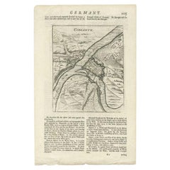
Antique Map of the Koblentz Region by Moll, 1695
By Herman Moll
Located in Langweer, NL
Antique map Koblentz titled 'Coblentz'. Rare antique map of the Koblentz region in Germany. On verso, an antique map of the Mont Royal fortress, Germany. Originates from 'Thesaurus G...
Category
17th Century Antique Herman Moll Collectibles and Curiosities
Materials
Paper
Antique Map of Denmark by Moll 'circa 1730'
By Herman Moll
Located in Langweer, NL
Antique map titled 'Denmark, agreeable to Modern History'. Uncommon map of Denmark by Herman Moll, published, circa 1730.
Category
Mid-18th Century Antique Herman Moll Collectibles and Curiosities
Materials
Paper
Related Items
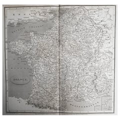
Original Antique Map of France, Arrowsmith, 1820
Located in St Annes, Lancashire
Great map of France
Drawn under the direction of Arrowsmith.
Copper-plate engraving.
Published by Longman, Hurst, Rees, Orme and Brown, 1820
Unframed.
Category
1820s English Antique Herman Moll Collectibles and Curiosities
Materials
Paper
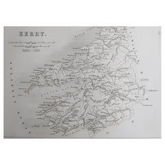
Original Antique Map of Ireland- Kerry. C.1840
Located in St Annes, Lancashire
Great map of Kerry
Steel engraving
Drawn under the direction of A.Adlard
Published by How and Parsons, C.1840
Unframed.
Category
1840s English Antique Herman Moll Collectibles and Curiosities
Materials
Paper
Original Antique Map of Canada, Arrowsmith, 1820
Located in St Annes, Lancashire
Great map of Canada.
Drawn under the direction of Arrowsmith.
Copper-plate engraving.
Published by Longman, Hurst, Rees, Orme and Brown, 1820
...
Category
1820s English Antique Herman Moll Collectibles and Curiosities
Materials
Paper
Original Antique Map of South Africa, Arrowsmith, 1820
Located in St Annes, Lancashire
Great map of South Africa.
Drawn under the direction of Arrowsmith.
Copper-plate engraving.
Published by Longman, Hurst, Rees, Orme and Br...
Category
1820s English Antique Herman Moll Collectibles and Curiosities
Materials
Paper
Original Antique Map of China, Arrowsmith, 1820
Located in St Annes, Lancashire
Great map of China
Drawn under the direction of Arrowsmith
Copper-plate engraving
Published by Longman, Hurst, Rees, Orme and Brown, 1820
Unfr...
Category
1820s English Antique Herman Moll Collectibles and Curiosities
Materials
Paper
Original Antique Map of The United States of America, circa 1890
Located in St Annes, Lancashire
Great map of the USA
By The Stanford's Geographical Establishment
Original colour
Unframed.
Category
1890s English Victorian Antique Herman Moll Collectibles and Curiosities
Materials
Paper
Fine Pair of Floor Globes by J & G Cary, Dated 1820 and 1833
By George & John Cary
Located in Lymington, Hampshire
A fine pair of 15 inch floor globes by J & G Cary, dated 1820 and 1833, each set into a mahogany stand with a vase shaped support and three legs centred on a compass, one with a labe...
Category
Early 19th Century English Regency Antique Herman Moll Collectibles and Curiosities
Materials
Mahogany
Original Antique Map of India. C.1780
Located in St Annes, Lancashire
Great map of India
Copper-plate engraving
Published C.1780
Three small worm holes to right side of map and one bottom left corner
Unframed.
Category
Early 1800s English Georgian Antique Herman Moll Collectibles and Curiosities
Materials
Paper
Original Antique Map of The World by Thomas Clerk, 1817
Located in St Annes, Lancashire
Great map of The Eastern and Western Hemispheres
On 2 sheets
Copper-plate engraving
Drawn and engraved by Thomas Clerk, Edinburgh.
Published by Mackenzie And Dent, 1817
...
Category
1810s English Antique Herman Moll Collectibles and Curiosities
Materials
Paper
Original Antique Map of Italy. C.1780
Located in St Annes, Lancashire
Great map of Italy
Copper-plate engraving
Published C.1780
Unframed.
Category
Early 1800s English Georgian Antique Herman Moll Collectibles and Curiosities
Materials
Paper
Original Antique Map of Ancient Greece, Achaia, Corinth, 1786
Located in St Annes, Lancashire
Great map of Ancient Greece. Showing the region of Thessaly, including Mount Olympus
Drawn by J.D. Barbie Du Bocage
Copper plate engraving by P.F Tardieu
Original hand color...
Category
1780s French Other Antique Herman Moll Collectibles and Curiosities
Materials
Paper
Original Antique Map of Spain and Portugal, circa 1790
Located in St Annes, Lancashire
Super map of Spain and Portugal
Copper plate engraving by A. Bell
Published, circa 1790.
Unframed.
Category
1790s English Other Antique Herman Moll Collectibles and Curiosities
Materials
Paper
Herman Moll collectibles and curiosities for sale on 1stDibs.
Herman Moll collectibles and curiosities are available for sale on 1stDibs. These distinctive items are frequently made of paper and are designed with extraordinary care. There are many options to choose from in our collection of Herman Moll collectibles and curiosities, although white editions of this piece are particularly popular. Many of the original collectibles and curiosities by Herman Moll were created in the Georgian style in united kingdom during the 18th century and earlier. If you’re looking for additional options, many customers also consider collectibles and curiosities by John Speed, John Ogilby, and John Cary. Prices for Herman Moll collectibles and curiosities can differ depending upon size, time period and other attributes — on 1stDibs, these items begin at $138 and can go as high as $9,670, while a piece like these, on average, fetch $3,399.


