John Cary Collectibles and Curiosities
British, 1755-1835
John Cary was an English cartographer. He was born in February of 1755 and died in August of 1835. His career started with his apprenticeship in London, and he opened up his own shop in the Strand in 1783. His atlas New and Correct English Atlas became the standard reference work in England. He was commissioned in 1794 by the Postmaster General to survey England's roads. Out of this commission, he published Cary's New Itinerary in 1798. He later produced Ordnance Survey maps before 1805. His business was eventually taken over by G.F. Cruchley.
to
4
8
8
2
1
7
8
4
4
2
8
8
8
6
104
101
74
71
Creator: John Cary
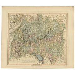
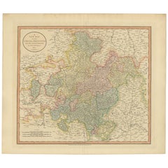
Antique Map of the Swabia Region of Germany by Cary, '1811'
By John Cary
Located in Langweer, NL
Antique map titled 'A New Map of the Circle of Swabia'. Antique map of Swabia in Southwestern Germany. Covers from the Upper Rhine region south as far as Switzerland, Lake Constance ...
Category
Early 19th Century Antique John Cary Collectibles and Curiosities
Materials
Paper
$239 Sale Price
20% Off
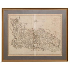
19th Century John Cary Map of North Part of West Riding of Yorkshire, C.1805
By John Cary
Located in Royal Tunbridge Wells, Kent
Antique 19th century British original John Cary sr (1755-1835) map of North part of the West Riding of Yorkshire, From the beft Authorities. Engraved J Car...
Category
19th Century British Antique John Cary Collectibles and Curiosities
Materials
Paper
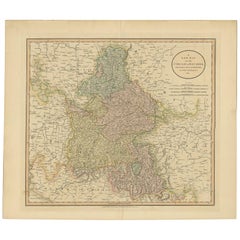
Antique Map of Bavaria and Salzburg by Cary, 1811
By John Cary
Located in Langweer, NL
Antique map titled 'A New Map of the Circle of Bavaria'. Antique map of Bavaria and Salzburg, Germany. Covers the Duchy of Bavaria and the mountainous A...
Category
Early 19th Century Antique John Cary Collectibles and Curiosities
Materials
Paper
$239 Sale Price
20% Off
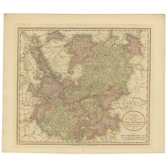
Antique Map of the Upper and Lower Rhine by Cary '1811'
By John Cary
Located in Langweer, NL
Antique map titled 'A New Map of the Circles of the Upper and Lower Rhine'. Antique map covering an area from Westphalia and Lower Saxony in the north to France and Swabia in the south.
Category
Early 19th Century Antique John Cary Collectibles and Curiosities
Materials
Paper
$239 Sale Price
20% Off
Antique Map of Franconia, a region of Germany, '1811'
By John Cary
Located in Langweer, NL
Antique map titled 'A New Map of the Circle of Franconia'. Detailed map of Franconia in Northwestern Germany. Covers from Upper Saxony south to Swabia, west to the Lower Rhine and we...
Category
Early 19th Century Antique John Cary Collectibles and Curiosities
Materials
Paper
$239 Sale Price
20% Off
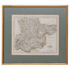
Essex John Cary 1787 Cary's New & Correct English Atlas 40cm 16" long gilt frame
By John Cary
Located in BUNGAY, SUFFOLK
Map of Essex by John Cary Engraver
London published as the act directs Sept 1st 1787 by J Cary Engraver Map & Printseller no 188 the corner of Arundel Str...
Category
18th Century English Georgian Antique John Cary Collectibles and Curiosities
Materials
Paper
Cambridgeshire J Cary
By John Cary
Located in BUNGAY, SUFFOLK
Cambridgeshire published may 1 1814 engraver no 181 strand
Maker John Cary c. 1754 – 1835.
Category
19th Century English Georgian Antique John Cary Collectibles and Curiosities
Materials
Paper
19th Century John Cary Map of South Part of West Riding of Yorkshire, circa 1805
By John Cary
Located in Royal Tunbridge Wells, Kent
Antique 19th century British original John Cary sr (1755-1835) map of South part of the West Riding of Yorkshire, From the beft Authorities. Engraved J Car...
Category
19th Century British Antique John Cary Collectibles and Curiosities
Materials
Paper
Related Items
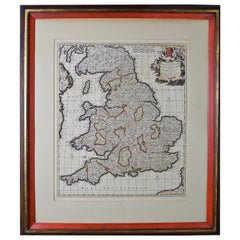
Large 17th Century Hand Colored Map of England and the British Isles by de Wit
By Frederick de Wit
Located in Alamo, CA
A large hand colored 17th century map of England and the British Isles by Frederick de Wit entitled "Accuratissima Angliæ Regni et Walliæ Principatus", published in Amsterdam in 1680. It is a highly detailed map of England, Scotland, the Scottish Isles...
Category
Late 17th Century Dutch Antique John Cary Collectibles and Curiosities
Materials
Paper
$1,175
H 35 in W 30.5 in D 2 in
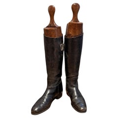
Pair of Late 19th Century English Riding Boots
Located in Chicago, IL
This striking pair of late 19th-century English black leather riding boots is a handsome relic of the sporting life. Crafted with exceptional care, the boots retain their original fo...
Category
Late 19th Century English Edwardian Antique John Cary Collectibles and Curiosities
Materials
Leather, Wood
$1,350 Sale Price / set
25% Off
H 24.5 in W 11.5 in D 3.5 in
Original Antique Map of Ancient Greece, Achaia, Corinth, 1786
Located in St Annes, Lancashire
Great map of Ancient Greece. Showing the region of Thessaly, including Mount Olympus
Drawn by J.D. Barbie Du Bocage
Copper plate engraving by P.F Tardieu
Original hand color...
Category
1780s French Other Antique John Cary Collectibles and Curiosities
Materials
Paper
Antique Map of North Carolina, with inset map of the western part
Located in Langweer, NL
Antique map titled 'North Carolina'. Original antique map of North Carolina, United States. With inset map of the western part of North Carolina....
Category
Late 19th Century Antique John Cary Collectibles and Curiosities
Materials
Paper
$277 Sale Price
20% Off
H 8.27 in W 10.63 in D 0.02 in
Large Antique County Map of the East Riding of Yorkshire, England
Located in Langweer, NL
Antique map titled 'A Map of the East Riding of Yorkshire from the best Authorities'. Original old county map of the East Riding of Yorkshire, England. Engraved by John Cary. Origina...
Category
Early 19th Century Antique John Cary Collectibles and Curiosities
Materials
Paper
$268 Sale Price
20% Off
H 17.21 in W 21.38 in D 0.02 in
18-inch Globe, Cary's, London, 1840
By Cary’s
Located in Milano, IT
John and William Cary
Updated by George and John Cary
Terrestrial Globe
London, 1840
lb 22 (kg 10)
Slight surface abrasions due to use. A small crack on the horizon circle.
The globe rests in its original Dutch style stand with four supporting turned wood columns.
It measures 26 in in height x 23.6 in in diameter with the diameter of the sphere measuring 18 in; 66 cm in height x 60 cm in diameter with the diameter of the sphere measuring 45.72 cm.
The 18 inch...
Category
1840s English Early Victorian Antique John Cary Collectibles and Curiosities
Materials
Paper, Wood
Early 18th Century English Framed Indenture Document, Framed
Located in Bradenton, FL
A Large Early 18th Century Framed Indenture Document. The document (deed) is written in lengthy hand-written detail. Issued in three parts, indentures were legal documents cut with w...
Category
Early 18th Century English George II Antique John Cary Collectibles and Curiosities
Materials
Animal Skin, Wood
New Map of North America from the Latest Discoveries, 1763
Located in Philadelphia, PA
A fine antique 18th century map of the North American seaboard.
Entitled "A New Map of North America from the Latest Discoveries 1763".
By the Cartographer/Engraver - John Spil...
Category
Mid-18th Century English Georgian Antique John Cary Collectibles and Curiosities
Materials
Paper
Pair of 19th Century English J & W Cary Celestial/Terrestrial Table Model Globes
By John & William Cary
Located in Milford, NH
A fine assembled pair of 12-inch English table model globes on stands manufactured by J & W. Cary, the left globe with cartouche labeled “The New Celestial Globe, on which are correc...
Category
Early 19th Century English Antique John Cary Collectibles and Curiosities
Materials
Brass
$18,900 / set
H 25 in Dm 16.5 in
Original Antique Map of Ancient Greece- Boeotia, Thebes, 1787
Located in St Annes, Lancashire
Great map of Ancient Greece. Showing the region of Boeotia, including Thebes
Drawn by J.D. Barbie Du Bocage
Copper plate engraving by P.F T...
Category
1780s French Other Antique John Cary Collectibles and Curiosities
Materials
Paper
English Titled 18th c Lady with Coat of Arms Portrait Oil Painting Gilt Frame
Located in Savannah, GA
18th century English noblewoman in a gold gilt ornate period frame. Lovely detail and color, coat of arms in corner. Unsigned.
Without the frame the painting itself measures 29 inche...
Category
1790s English George III Antique John Cary Collectibles and Curiosities
Materials
Giltwood, Canvas
$5,996 Sale Price
20% Off
H 39 in W 34 in D 4 in
A 19th-Century Map of West Canada with Niagara Falls and Indigenous Scenes
Located in Langweer, NL
Decorative 19th-Century Map of West Canada with Niagara Falls and Indigenous Scenes
This detailed 19th-century map of West Canada, drawn and engraved by J. Rapkin and published by...
Category
1850s Antique John Cary Collectibles and Curiosities
Materials
Paper
$131
H 10.95 in W 14.26 in D 0.01 in
Previously Available Items
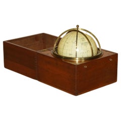
John Cary Travel Celestial Globe in Box Marked Cary & Co London, No. 21540
By John Cary
Located in West Sussex, Pulborough
We are delighted to offer for sale this lovely John Cary Travel Celestial Globe in Box marked Cary & Co London, No. 21540
This globe I believe is classed as a 14 inch which is the...
Category
19th Century English Victorian Antique John Cary Collectibles and Curiosities
Materials
Brass
H 8.47 in W 8.08 in D 8.08 in
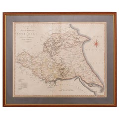
19th Century John Cary Map of the East Riding of Yorkshire, C.1800
By John Cary
Located in Royal Tunbridge Wells, Kent
Antique 19th century British original John Cary sr (1755-1835) map of the East Riding of Yorkshire, with ainsty liberty, From the beft Authorities. Engraved J Cary, mounted in solid ...
Category
19th Century British Antique John Cary Collectibles and Curiosities
Materials
Paper
18th Century John Cary Map of Kent, c.1769
By John Cary
Located in Royal Tunbridge Wells, Kent
Antique 18th century British very rare and original John Cary sr (1755-1835) map of Kent, publication 1769, A Map of the County of Kent taken from an actua...
Category
18th Century British Antique John Cary Collectibles and Curiosities
Materials
Paper
John Cary collectibles and curiosities for sale on 1stDibs.
John Cary collectibles and curiosities are available for sale on 1stDibs. These distinctive items are frequently made of paper and are designed with extraordinary care. There are many options to choose from in our collection of John Cary collectibles and curiosities, although beige editions of this piece are particularly popular. Many of the original collectibles and curiosities by John Cary were created in the Georgian style in united kingdom during the 19th century. Prices for John Cary collectibles and curiosities can differ depending upon size, time period and other attributes — on 1stDibs, these items begin at $176 and can go as high as $2,526, while a piece like these, on average, fetch $376.
