Ric International Antiques More Furniture and Collectibles
to
69
69
1
1
1
37
17
15
15
1
8
48
12
9
8
8
44
25
22
8
8
69
69
69
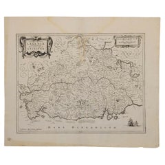
1635 Willem Blaeu Map of Northern France"Comitatvs Bellovacvm" Ric.a08
Located in Norton, MA
1635 Willem Blaeu map of northern France, entitled.
"Comitatvs Bellovacvm Vernacule Beavvais,"
Colored
Ric.a008
“COMITATVS BELLOVACVM…” Amsterdam: W...
Category
Antique 17th Century Unknown Maps
Materials
Paper
1636 Jansson Map of Ireland Entitled "Comitatus Lageniae, " Ric.a007
Located in Norton, MA
1646 Jansson map entitled
"Procinvia connactiae,"
Ric.a006
Description: The PROVINCE of CONNAVGT 490 x 380From vol 4 of Jansson's Atlas Novus 1646, published in Amsterdam with...
Category
Antique 17th Century Unknown Maps
Materials
Paper
1771 Bonne Map of Poitou, Touraine and Anjou, France, Ric.a015
Located in Norton, MA
1771 Bonne Map of Poitou,
Touraine and Anjou, France
Ric.a015
1771 Bonne map of Potiou, Touraine and Anjou entitled "Carte des Gouvernements D'Anjou et du Saumurois, de la Touraine, du Poitou,du Pays d'aunis, Saintonge?Angoumois,"
Carte des gouvernements d'Anjou et du Saumurois, de la Touraine, du Poitou, du Pays d'Aunis, Saintonge-Angoumois. Projettee et assujettie au ciel par M. Bonne, Hyd. du Roi. A Paris, Chez Lattre, rue St. Jacques a la Ville de Bord(ea)ux. Avec priv. du Roi. 1771. Arrivet inv. & sculp., Atlas moderne ou collection de cartes sur toutes...
Category
Antique 17th Century Unknown Maps
Materials
Paper
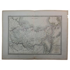
1860 Large Map "Carte De La Siberie Russie D'asie, " Ric.R0001
Located in Norton, MA
Large 1860 map "Carte De La Siberie Russie D'Asie," R-0001
" Authentic" - 1860 map "Carte De La Siberie Russie D'Asie,"
Dimension: Paper: 68 cm W x 51 cm H ; Sight: 51cm W x 4...
Category
Antique 19th Century Unknown Maps
Materials
Paper
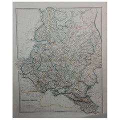
1832 Large Map "Russian & Poland" Ric. R0012
Located in Norton, MA
Large map 1832
"Russian & Poland"
Ric.r0012
Russia & Poland, by J. Arrowsmith. London, pubd. 15 Feby. 1832 by J. Arrowsmith, 35 Essex Street, Strand., ...
Category
Antique 19th Century Unknown Maps
Materials
Paper
1752 Vaugoundy Map of Flanders : Belgium, France, and the Netherlands, Ric.a002
Located in Norton, MA
Large Vaugoundy Map of Flanders:
Belgium, France, and the Netherlands
Colored -1752
Ric.a002
Description: This is a 1752 Didier Robert de Vaugondy map of Flanders. The map de...
Category
Antique 17th Century Unknown Maps
Materials
Paper
1751 Map of Spain Castilla Robert De Vaugondy 1st Edition, Ric.a001
Located in Norton, MA
Large Spain Castilla Robert De Vaugondy
1751 1st Edition
-Colored- Ric.a001
Coming from a family of cartographers, a descendant of the famous Nicolas Sanson and ordinary geographer of the king, Gilles Robert de Vaugondy makes himself known by his maps of the French provinces.
He published an Essay on the History of Geography (1755) from which he excluded the physical geography "too systematic". After a Small Atlas (1748), he draws a universal Atlas (1758), a portable Atlas (1762).
His Atlas of the revolutions of the globe remains unpublished. His warnings and prefaces, his book reviews reveal a Cartesian mind and solid knowledge.
Very early, he associates with his works his son Didier who publishes, since 1742, the methodical tables of Nicolas Sanson, two Globes, one terrestrial, the other celestial (1752).
He is credited with a map of Poland...
Category
Antique 18th Century Unknown Maps
Materials
Paper
Large1852 Map "Russian Empire" Ric.r0011
Located in Norton, MA
Large
1852 map "Russian Empire"
George Phillips & Son 1852
Ric.r0011
Dimension: Paper: 67 cm W x 52 cm H ; Sight: 60cm W x 50 cm H
Condition: Good Condition with aged tonin...
Category
Antique 19th Century Unknown Maps
Materials
Paper
1844 Map "Russia in Eurpoe, Part II to Part VIII", 7 Maps Ric.r023
Located in Norton, MA
1844 Map "Russia in Eurpoe, Part II to Part VIII"
7 Maps
Ric.r023
Fine, original, steel-engraved Map of Russia in Europe Part II t oPart VIII, by the Society for the Diffusion of Useful Knowledge. Detailed map of the regions to the northeast of Moscow. Including Arkhangel, Vologda, Viatka, Perm, Olonetz, Iaroslavl. The SDUK began its map publishing project under the leadership of Captain Francis Beaufort R.N. in 1829, and published the maps in parts, haltingly, over the next 15 years, completing the series in 1844, finally permitting the publication of a whole atlas. Many of the maps were actually drawn by Beaufort, who at the time was the Hydrographer to the Royal Navy, and all were closely supervised by him. J. & C. Walker worked closely with Beaufort in engraving the maps. Finely engraved, carefully researched, the maps set...
Category
Antique 19th Century Unknown Maps
Materials
Paper


