Items Similar to 1584 Abraham Ortelius Map of Lower Burgundy, France


Want more images or videos?
Request additional images or videos from the seller
1 of 12
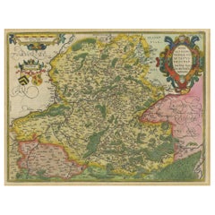
1584 Abraham Ortelius Map of Lower Burgundy, France
$1,217.31
$1,521.6420% Off
£906.21
£1,132.7620% Off
€1,016
€1,27020% Off
CA$1,667.42
CA$2,084.2720% Off
A$1,854.53
A$2,318.1620% Off
CHF 968.38
CHF 1,210.4720% Off
MX$22,567.66
MX$28,209.5820% Off
NOK 12,367.67
NOK 15,459.5820% Off
SEK 11,598.69
SEK 14,498.3620% Off
DKK 7,734.45
DKK 9,668.0720% Off
Shipping
Retrieving quote...The 1stDibs Promise:
Authenticity Guarantee,
Money-Back Guarantee,
24-Hour Cancellation
About the Item
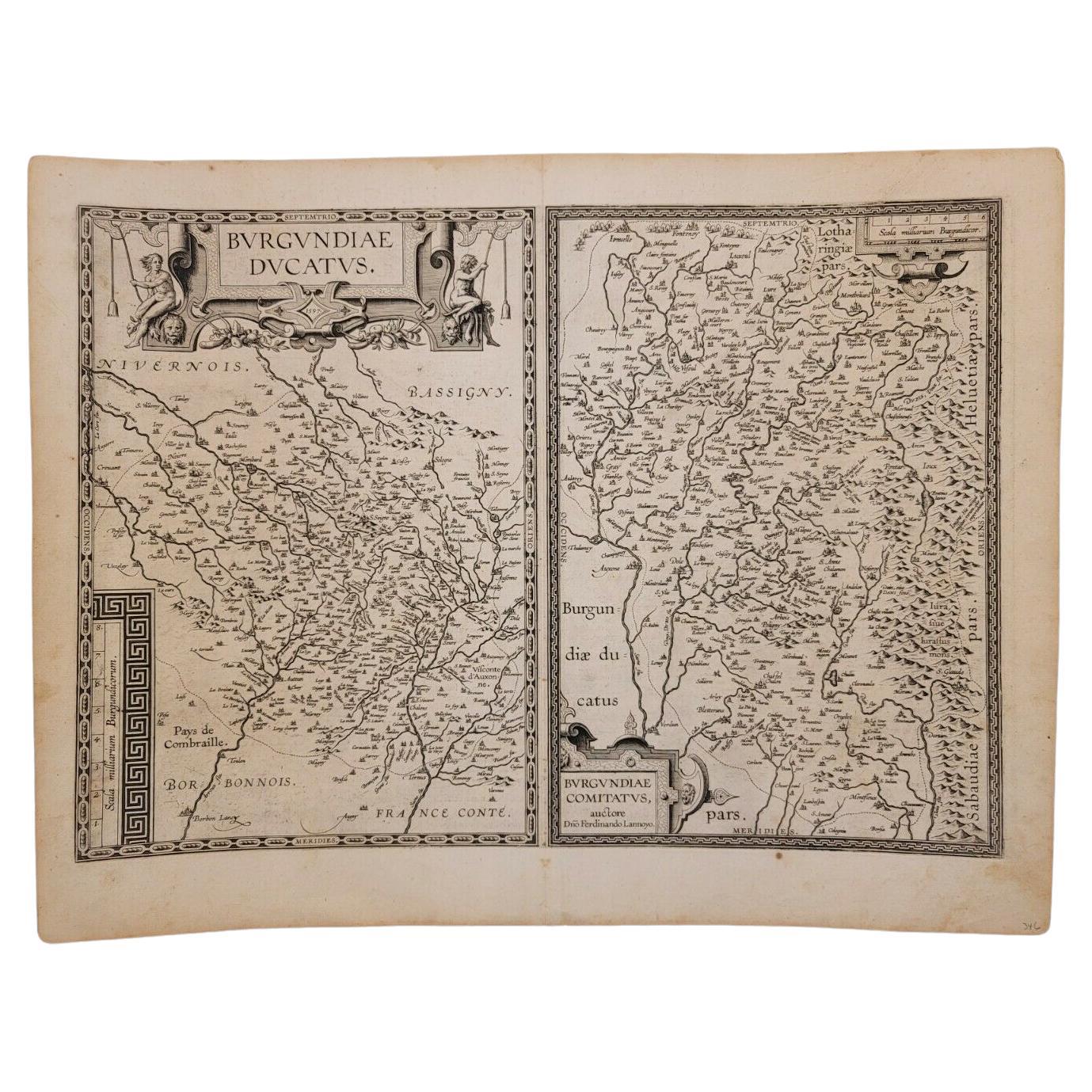
1584 Abraham Ortelius Map of Lower Burgundy, France
Description of the Map:
This antique map by Abraham Ortelius, titled "Bvrgvndiae Inferioris Qvae Dvcatvs Nomine Censetur Des," was published in 1584. It focuses on the region historically known as Lower Burgundy, which corresponds roughly to parts of modern-day eastern France. The map is detailed with geographical names, rivers, and settlements, and it is adorned with a decorative cartouche and a scale bar, both elements typical of the period. The coloration is done by hand, common in maps from this era.
Maker:
Abraham Ortelius was a prominent Flemish geographer and cartographer, considered one of the pioneers of modern cartography. He is most famous for creating the first modern atlas, the "Theatrum Orbis Terrarum."
The map was published in 1584.
Places or Areas on this Map Sought After by Collectors:
Collectors of antique maps may specifically look for features such as the detailed depiction of the Burgundy region, including notable cities and towns like Dijon, Chalon-sur-Saône, and Auxonne. The decorative elements such as the ornate cartouche and the vibrant coloration also enhance its appeal.
Condition of the Map:
The map appears to be in good condition for its age. The colors remain vibrant, suggesting that it has been well-preserved, possibly kept away from direct sunlight. There are no visible signs of significant tears or water damage in the provided image. The paper shows slight signs of aging, such as marginal yellowing, which is typical and often expected by collectors.
- Dimensions:Height: 17.13 in (43.5 cm)Width: 21.66 in (55 cm)Depth: 0 in (0.02 mm)
- Materials and Techniques:Paper,Engraved
- Period:
- Date of Manufacture:1584
- Condition:Condition: Very good, given age. Some remains of tape from previous attachment on the back. General age-related toning and/or occasional minor defects from handling. Please study scan carefully.
- Seller Location:Langweer, NL
- Reference Number:Seller: BG-13644-11stDibs: LU3054341303822
About the Seller
5.0
Recognized Seller
These prestigious sellers are industry leaders and represent the highest echelon for item quality and design.
Platinum Seller
Premium sellers with a 4.7+ rating and 24-hour response times
Established in 2009
1stDibs seller since 2017
2,510 sales on 1stDibs
Typical response time: <1 hour
- ShippingRetrieving quote...Shipping from: Langweer, Netherlands
- Return Policy
Authenticity Guarantee
In the unlikely event there’s an issue with an item’s authenticity, contact us within 1 year for a full refund. DetailsMoney-Back Guarantee
If your item is not as described, is damaged in transit, or does not arrive, contact us within 7 days for a full refund. Details24-Hour Cancellation
You have a 24-hour grace period in which to reconsider your purchase, with no questions asked.Vetted Professional Sellers
Our world-class sellers must adhere to strict standards for service and quality, maintaining the integrity of our listings.Price-Match Guarantee
If you find that a seller listed the same item for a lower price elsewhere, we’ll match it.Trusted Global Delivery
Our best-in-class carrier network provides specialized shipping options worldwide, including custom delivery.More From This Seller
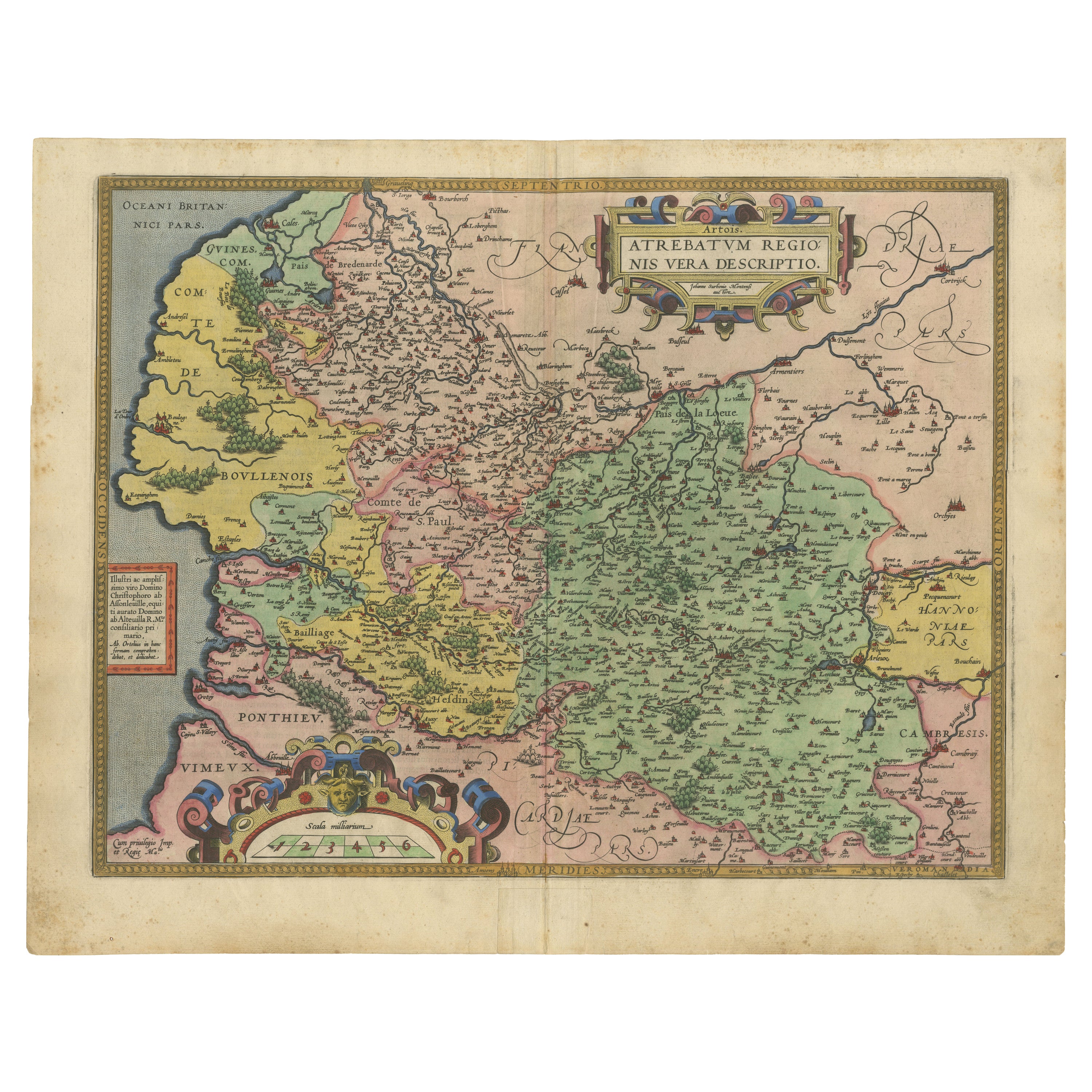
View AllAntique Map of the Picardy Region of France by Ortelius, 'circa 1590'
Located in Langweer, NL
Antique map titled 'Picardiae Belgicae regionis descriptio'. Original antique map of the Picardy region, France. Published by A. Ortelius, circa 1590.
Category
Antique 16th Century Maps
Materials
Paper

$575 Sale Price
20% Off
1579 Ornate Map of Burgundy County by Ferdinand de Lannoy
Located in Langweer, NL
1579 Ornate Map of Burgundy County by Ferdinand de Lannoy
Description of the Map:
This is a beautifully detailed map of the Burgundy region, titled "Bvrgvndiae Comitatus Recentiss....
Category
Antique 16th Century Maps
Materials
Paper
$948 Sale Price
20% Off
Antique Map of the Artois Region of France by Ortelius, 'circa 1590'
Located in Langweer, NL
Antique map titled 'Artesia'. Original antique map of the Artois region, France. Published by A. Ortelius, circa 1590.
Category
Antique 16th Century Maps
Materials
Paper
$575 Sale Price
20% Off
Hainaut Map Ortelius 1590 – Rare Hand-Colored French-Belgian Border Map
Located in Langweer, NL
Decorative 16th Century Map of Northern France by Ortelius, circa 1590
This richly colored antique map titled *Nobilis Hannoniae Comitatus Descriptio* depicts the County of Hainaut ...
Category
Antique 16th Century Belgian Maps
Materials
Paper
Exquisite 1600 Ortelius Map of Artois, France: A Collector’s Piece
Located in Langweer, NL
Exquisite 1600 Ortelius Map of Artois, France: A Collector’s Piece with Rich Historical Detail
Description of the Map:
This map, titled "Atrebatum Regionis Vera Descriptio," create...
Category
Antique Early 1600s Maps
Materials
Paper

$948 Sale Price
20% Off
Antique Map of the Region of Poitou by Ortelius, circa 1600
Located in Langweer, NL
Antique map titled 'Poictou'. Original antique map of the region of Poitou, a former province of west-central France whose capital city was Poitiers. Published by A. Ortelius, circa ...
Category
Antique Early 17th Century Maps
Materials
Paper

$575 Sale Price
20% Off
You May Also Like
1597 Abraham Ortelius Map Burgundy, France Entitled "Bvrgvndiae dvcatvs Ric.a010
Located in Norton, MA
1597 Abraham Ortelius map of Burgundy, France entitled
"Bvrgvndiae dvcatvs
Ric.a010
Description: Ortelius is best known for producing the atla...
Category
Antique 16th Century Dutch Maps
Materials
Paper

1592 Abraham Ortelius Map "Lorraine: Lotharingiae Nova Descripti, Ric.A005
Located in Norton, MA
1592 Abraham Ortelius map entitled
"Lorraine: Lotharingiae Nova Descripti
Ric.a005
Description: Ortelius is best known for producing the atlas from which this map comes from, "...
Category
Antique 16th Century Dutch Maps
Materials
Paper

1625 Mercator Map of the Provenience of Quercy, "Quercy Cadvrcivm Ric.0013
Located in Norton, MA
1625 Mercator map of the provenience of Quercy, entitled
"Quercy Cadvrcivm,"
Ric.0013
" Authentic" - Map of the provenience of Quercy Cadvrcivm
D...
Category
Antique 17th Century French Maps
Materials
Paper

17th Century Hand-Colored Map of a Region in West Germany by Janssonius
By Johannes Janssonius
Located in Alamo, CA
This attractive highly detailed 17th century original hand-colored map is entitled "Archiepiscopatus Maghdeburgensis et Anhaltinus Ducatus cum terris adjacentibus". It was published ...
Category
Antique Mid-17th Century Dutch Maps
Materials
Paper

1590 Ortelius Map of Calais and Vermandois, France and Vicinity Ric.a014
Located in Norton, MA
1590 Ortelius map of
Calais and Vermandois, France and Vicinity
Ric.a014
Two rare regional Abraham Ortelius maps on a single folio sheet. Left map, entitled Caletensium, depic...
Category
Antique 16th Century Dutch Maps
Materials
Paper

1635 Willem Blaeu Map of Northern France"Comitatvs Bellovacvm" Ric.a08
Located in Norton, MA
1635 Willem Blaeu map of northern France, entitled.
"Comitatvs Bellovacvm Vernacule Beavvais,"
Colored
Ric.a008
“COMITATVS BELLOVACVM…” Amsterdam: W...
Category
Antique 17th Century Unknown Maps
Materials
Paper

More Ways To Browse
Coffee Table Black Italian Modern
Christofle America
Iranian Silk Rug Carpet
Poul Moller
Tables With Inlaid Wood
World War Table
Antonio Jacobsen
Ariston Chairs
Coffee Tables Europe
Marble Top Dining Tables
Nordiska Argentina
Pink And Black Rug
Black Wooden Chair
Orrefors Embassy
Black Ebonized
Elios Chair
Panache Designs
Plata Lappas