Items Similar to 1656 "La Souverainete de Sedan et de Raucourt, et la Prevoste de Doncheri Ric004


Want more images or videos?
Request additional images or videos from the seller
1 of 14
1656 "La Souverainete de Sedan et de Raucourt, et la Prevoste de Doncheri Ric004
$1,675
£1,270.95
€1,453.22
CA$2,339.52
A$2,601.23
CHF 1,358.22
MX$31,663.29
NOK 17,330.27
SEK 16,237.64
DKK 10,845.64
Shipping
Retrieving quote...The 1stDibs Promise:
Authenticity Guarantee,
Money-Back Guarantee,
24-Hour Cancellation
About the Item
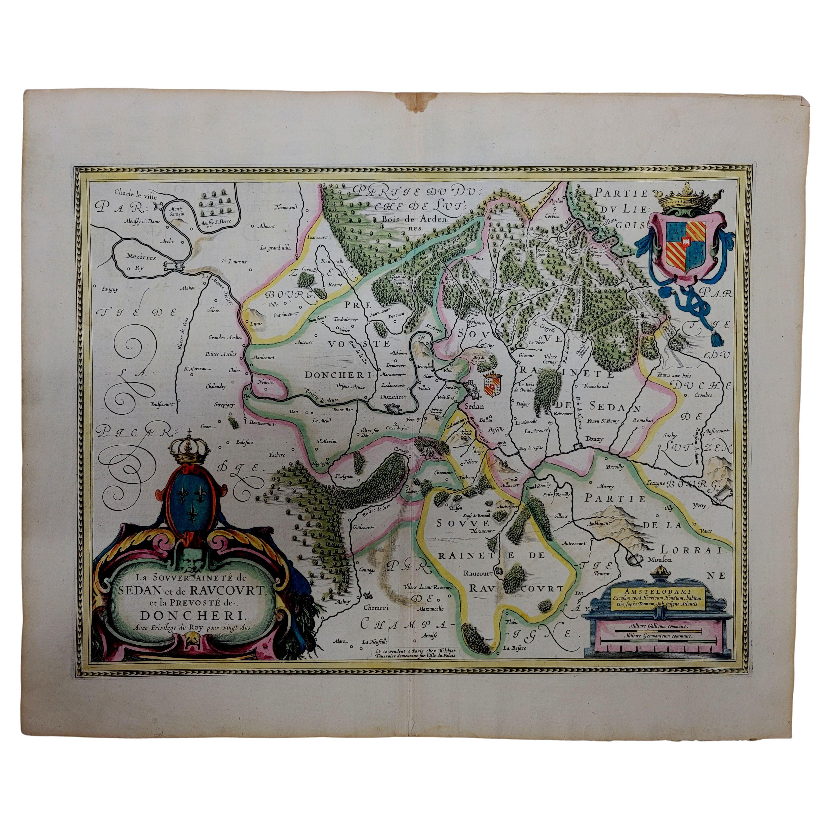
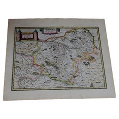
1656 map entitled
"La Souverainete de Sedan et de Raucourt, et la Prevoste de Doncheri,"
Hand Colored
Ric0004.
Description:
Lovely map centered on Sedan and Doncheri and the Meuze River from Charleville and Mezieres to Mosuon and Yvoy. The fortified cities are well depicted. Richly embellished with a large title cartouche with the royal arms, a scale cartouche and coat of arms. Latin text on verso.
Artists and Engravers:
Antique map of France titled 'La Souveraineté de Sedan et de Raucourt, et la prevosté de Doncheri'. Lovely map centered on Sedan and Doncheri and the Meuze River from Charleville and Mezieres to Mosuon and Yvoy. This map originates from 'Atlas Novus, Sive Theatrum Orbis Orbis Terrarum: In quo Galliae, Helvetiae (..)' by J. Janssonius (1656-1657).
Dimension: Paper: 23.3" W x 20.3" H (59 cm W x 51.7 cm H) ; Sight: 19.7" x 15.7" H (50 cm W x 39.8 cm H)
Condition: Good Condition with aged toning, please see photos.
- Dimensions:Height: 20.36 in (51.7 cm)Width: 23.23 in (59 cm)Depth: 0.4 in (1 cm)
- Materials and Techniques:
- Place of Origin:
- Period:
- Date of Manufacture:1656
- Condition:
- Seller Location:Norton, MA
- Reference Number:1stDibs: LU5848230191542
About the Seller
5.0
Platinum Seller
Premium sellers with a 4.7+ rating and 24-hour response times
Established in 2000
1stDibs seller since 2021
116 sales on 1stDibs
Typical response time: <1 hour
- ShippingRetrieving quote...Shipping from: Norton, MA
- Return Policy
Authenticity Guarantee
In the unlikely event there’s an issue with an item’s authenticity, contact us within 1 year for a full refund. DetailsMoney-Back Guarantee
If your item is not as described, is damaged in transit, or does not arrive, contact us within 7 days for a full refund. Details24-Hour Cancellation
You have a 24-hour grace period in which to reconsider your purchase, with no questions asked.Vetted Professional Sellers
Our world-class sellers must adhere to strict standards for service and quality, maintaining the integrity of our listings.Price-Match Guarantee
If you find that a seller listed the same item for a lower price elsewhere, we’ll match it.Trusted Global Delivery
Our best-in-class carrier network provides specialized shipping options worldwide, including custom delivery.More From This Seller
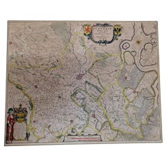
View All1633 Map "La Souverainete De Sedan Et De Raucourt, Et La Prevoste Ric0011
Located in Norton, MA
1653 map entitled
"La Souverainete de Sedan et de Raucourt, et la Prevoste de Doncheri,"
Ric0011
Description:
Lovely map centered on Sedan and Doncheri and the Meuze River fr...
Category
Antique 17th Century Dutch Maps
Materials
Paper

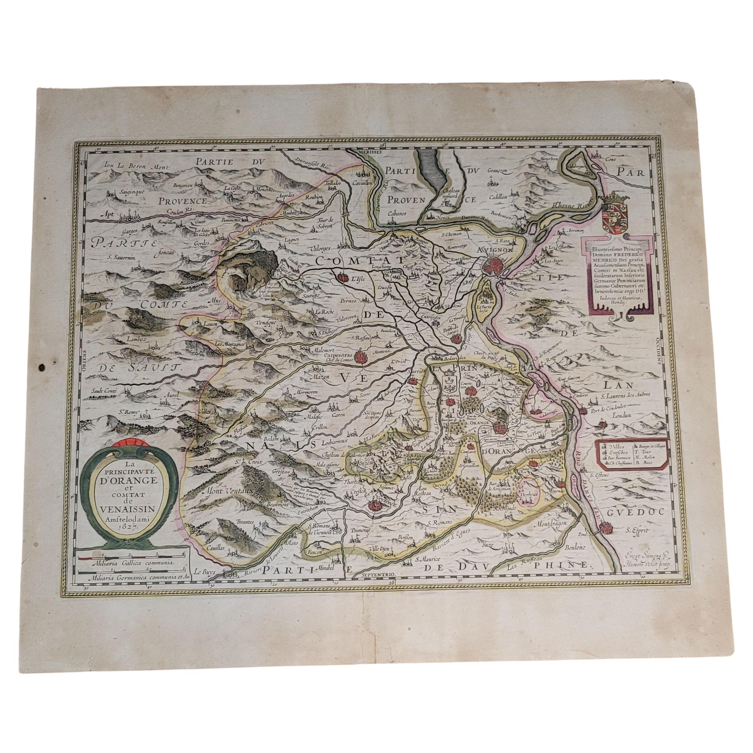
1627 Hondius Map "La Principaute d'Orange et Comtat de Ve", Ric.0003
Located in Norton, MA
1627 Hondius map entitled
"La Principaute d'Orange et Comtat de Venaissin,"
Original Hand-Colored
Description: From Johannes Janssonius's Atlantis Maioris Appendix of 1630.
...
Category
Antique 17th Century Unknown Maps
Materials
Paper

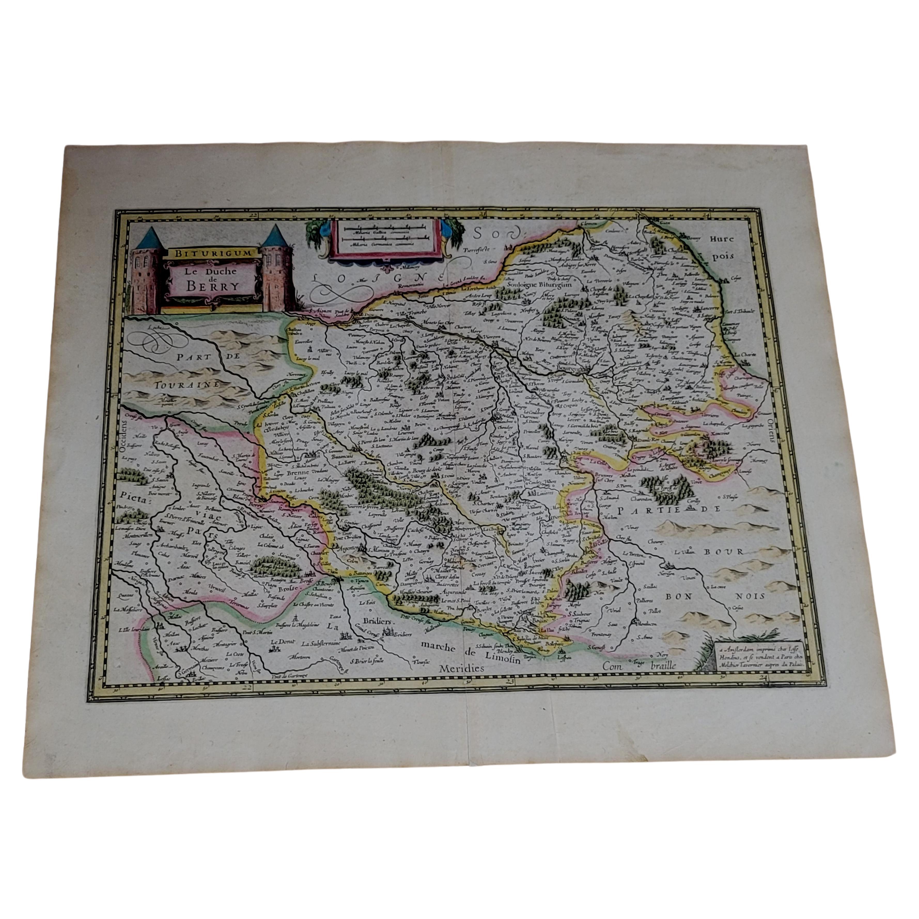
1633 Map, Entitled "La Douche De Berry, " Ric.0005
Located in Norton, MA
1633 map, entitled
"La douche de Berry,"
Hand Colored
Ric.0005
Description:
1633 map, entitled "La douche de Berry,"
Dimension: Paper: 23.3" W x 20.3" H (59 cm W x 51.7 c...
Category
Antique 17th Century Unknown Maps
Materials
Paper
1571-1638 Willem Blaeu map entitled, "Ilcadorino, " Hand Colored Ric0009
Located in Norton, MA
Willem Blaeu map entitled,
"Ilcadorino,".
Hand colored.
Description: large, unusual, and nice antique copper engraved map of Ilcadorino, by Willem BL...
Category
Antique 16th Century Dutch Maps
Materials
Paper

1633 Map Entitled "Beauvaisis Comitatus Belova Cium, Ric.0002
Located in Norton, MA
1633 map entitled
"Beauvaisis Comitatus Belova Cium,"
Hand Colored
Ric.0002
Description: Cartographer : - Hondius, Henricus 1587-1638
Artists and Engravers:Jodocus Hondius, one of the most notable engravers of his time. He is known for his work in association with many of the cartographers and publishers prominent at the end of the sixteenth and the beginning of the seventeenth century. A native of Flanders, he grew up in Ghent, apprenticed as an instrument and globe maker and map engraver. In 1584, to escape the religious troubles sweeping the Low Countries at that time, he fled to London where he spent some years before finally settling in Amsterdam about 1593. In the London period he came into contact with the leading scientists and geographers of the day and engraved maps in The Mariner\\\\\\\\\\\\\\\'s Mirrour, the English edition of Waghenaer\\\\\\\\\\\\\\\'s Sea Atlas, as well as others with Pieter van den Keere, his brother-in-law. No doubt his temporary exile in London stood him in good stead, earning him an international reputation, for it could have been no accident that Speed chose Hondius to engrave the plates for the maps in The Theatre of the Empire of Great Britaine in the years between 1605 and 1610. In 1604 Hondius bought the plates of Mercator\\\\\\\\\\\\\\\'s Atlas which, in spite of its excellence, had not competed successfully with the continuing demand for the Ortelius Theatrum Orbis Terrarum. To meet this competition Hondius added about 40 maps to Mercator\\\\\\\\\\\\\\\'s original number and from 1606 published enlarged editions in many languages, still under Mercator\\\\\\\\\\\\\\\'s name but with his own name as publisher. These atlases have become known as the Mercator/Hondius series. The following year the maps were reengraved in miniature form and issued as a pocket Atlas Minor. After the death of Jodocus Hondius the Elder in 1612, work on the two atlases, folio and miniature, was carried on by his widow and sons, Jodocus II and Henricus, and eventually in conjunction with Jan Jansson in Amsterdam.
In all, from 1606 onwards, nearly 50 editions with increasing numbers of maps with texts in the main European languages were printed. Summaries of these issues are given under the entry for Gerard Mercator. Jodocus Hondius the Elder * 1588 Maps in The Mariner\\\\\\\\\\\\\\\'s Mirrour (Waghenaer/Ashley) * 1590 World Map...
Category
Antique 17th Century Dutch Maps
Materials
Paper

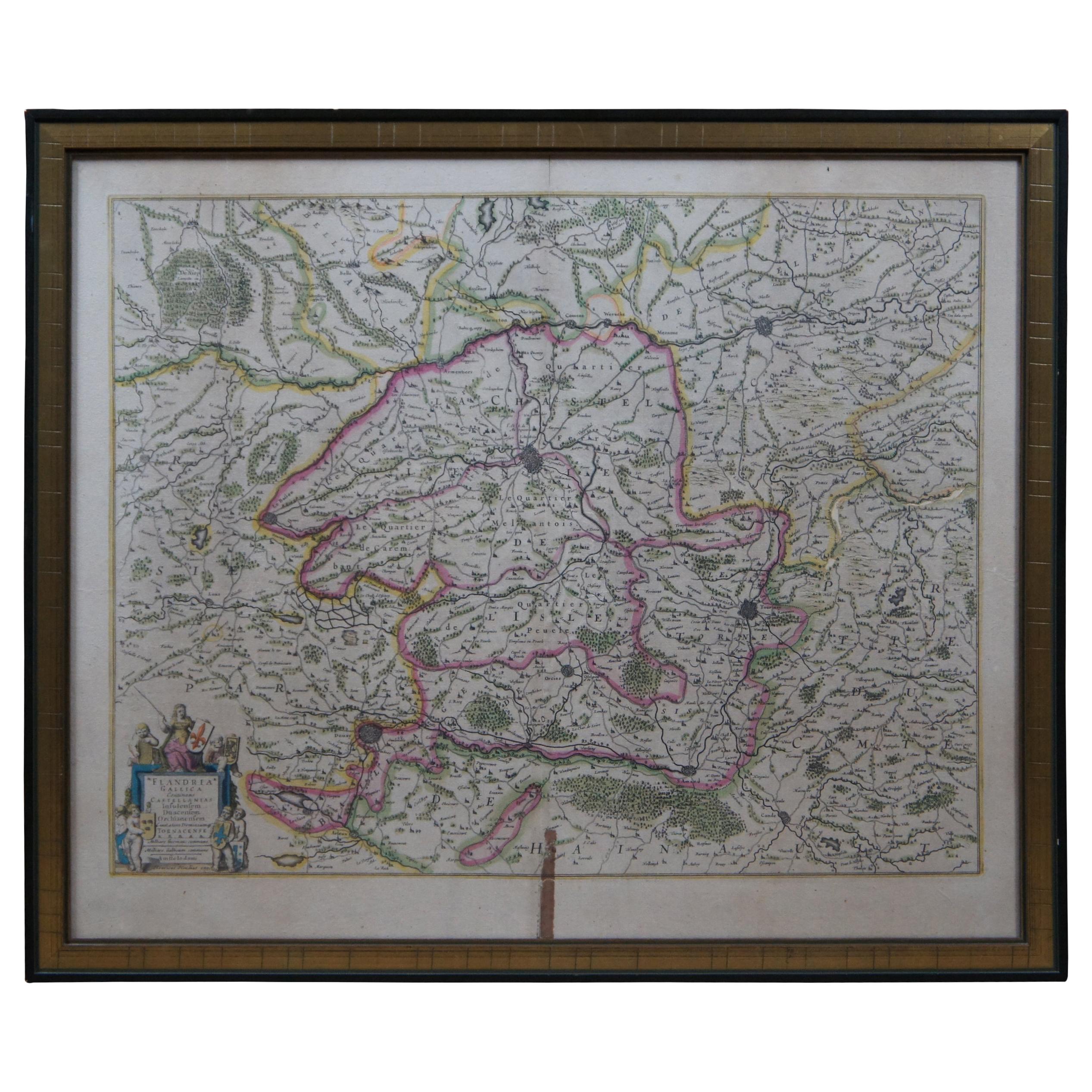
1640 Flandriae Partes Duae Quarum Altera Proprietaria, Ric0016
Located in Norton, MA
1640 Willem and Joan Blaeu map entitled
"Flandriae Partes duae quarum altera Proprietaria, altera Imperialis vulgo dictur,"
Ric0016
(Mounted on Carboard)
Willem Janszoon Blaeu...
Category
Antique 17th Century Dutch Maps
Materials
Paper
You May Also Like
Antique Colored Belgium Map Flandria Gallica Flanders Henricus Hondius
Located in Dayton, OH
Antique hand colored map of Flanders, Belgium, engraved by Henricus Hondius.
Sans frame - 21.25” x 18”.
Category
Antique 19th Century Renaissance Maps
Materials
Paper

$280 Sale Price
20% Off
Old Detailed Trade Route and Shipping Map from Italy to the Low Countries, c1671
Located in Langweer, NL
Antique map of Italy titled 'Carta Nova accurata del Passagio et strada dalli Peis Bassi per via de Allemgna per Italia et per via di Pesi Suizeri a Geenea, Lione et Roma (..)'. Detailed trade route and shipping map...
Category
Antique 17th Century Maps
Materials
Paper
$1,151 Sale Price
20% Off
Antique Map of the Lorraine Region 'France' (c.1735)
Located in Langweer, NL
Antique map titled 'Carte du Duche de Lorraine - Kaart van Lotharingen'. A detailed map of the Duchy of Lorraine. The map is surrounded by thirteen vignette bird-eye view of fortifie...
Category
Antique Mid-18th Century Maps
Materials
Paper

$263 Sale Price
20% Off
Antica Carta Geografica Regno di Napoli - 1706 - XVIII Secolo Francia
Located in Milano, MI
Antica Cartina Regno di Napoli XVIII Secolo 1:700000
Descrizione:
Meravigliosa Cartina con raffigurazione del regno di Napoli , la cartina è stata realizzata in Francia nella pri...
Category
Antique Early 1700s European Louis XVI Picture Frames
Materials
Paper
Antique Map of the Region of Île-de-France by Hondius, circa 1630
Located in Langweer, NL
Antique map titled Gouvernement de l'Isle de France'. Old map of the region of Île-de-France, France. It is located in the north-central part of the country and often called the régi...
Category
Antique Mid-17th Century Maps
Materials
Paper

$527 Sale Price
20% Off
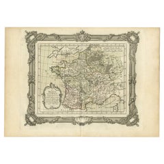
Antique Map of France in the 7th Century by Zannoni, 1765
Located in Langweer, NL
Antique map France titled 'La France sous le VIIe Siècle (..)'. Beautiful old map of France. This map originates from 'Atlas Historique de la France Ancienne et Moderne' by M. Rizzi ...
Category
Antique 18th Century Maps
Materials
Paper
$152 Sale Price
20% Off
More Ways To Browse
Antique Maps Of Maryland
Gambia Antique Map
Antique Manitoba
Antique Map Of Brooklyn
Antique Map Of Michigan
Cham Antiques
Map Of Native American Tribes
Antique Furniture Halifax Furniture
Antique Furniture Trinidad
Antique Kiel Furniture
Cornwall Map
Marie Galante
Patagonia Map
Shepherd And Hedger
Vignola Furniture
Washington Dc Map
Antique Map Of Cornwall
Coronelli Globe