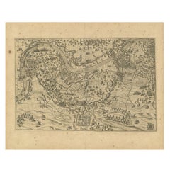
Items Similar to 17th Century Toulouse, Savve, Sommieres Topographical Map by Iohan Peeters


Want more images or videos?
Request additional images or videos from the seller
1 of 9
17th Century Toulouse, Savve, Sommieres Topographical Map by Iohan Peeters
$475
£367.02
€424.31
CA$671.21
A$752.81
CHF 394.23
MX$9,147.33
NOK 5,006.10
SEK 4,746.13
DKK 3,167.25
About the Item
Fine topographical 17th century map of Toulouse, Savve and Sommieres by Iohan Peeters
Beautiful engraving of the capital of France's Occitanie Region, Toulouse, called La Ville Rose- the Pink City, for the terracotta bricks used in its many buildings, giving the city a distinct apricot-rose hue. An important cultural and educational center, the city's residents included Nobel Prize winners and world renown artists- Henri de Toulouse-Lautrec, Henri Martin, Jean-Auguste-Dominique Ingres, Antonin Mercie, Alexandre Falguiere and more recently Cyril Kongo.
Founded by the Romans, Toulouse has undergone many transformations. It is currently the European aerospace industry center, home to Airbus, SPOT and CTS, the largest space center in Europe.
Fabulous period engraving with an expansive view of 17th century Toulouse, offering a window to the past of this dynamic fascinating city.
In excellent condition commensurate with age.
Size: 15.5 inches by 12.5 inches
Iohan Peeters Delin. Topographia Galliae ... Het tweede deel. Amsterdam : By de Weduw van Ioost Broersz en Casper Meriaen, 1661.
- Dimensions:Height: 12.38 in (31.45 cm)Width: 14.88 in (37.8 cm)Depth: 0 in (0 mm)
- Materials and Techniques:
- Place of Origin:
- Period:
- Date of Manufacture:17th Century
- Condition:Wear consistent with age and use.
- Seller Location:New York, NY
- Reference Number:1stDibs: LU5828228829862
About the Seller
5.0
Gold Seller
Premium sellers maintaining a 4.3+ rating and 24-hour response times
1stDibs seller since 2021
57 sales on 1stDibs
Typical response time: 6 hours
- ShippingRetrieving quote...Shipping from: New York, NY
- Return Policy
Authenticity Guarantee
In the unlikely event there’s an issue with an item’s authenticity, contact us within 1 year for a full refund. DetailsMoney-Back Guarantee
If your item is not as described, is damaged in transit, or does not arrive, contact us within 7 days for a full refund. Details24-Hour Cancellation
You have a 24-hour grace period in which to reconsider your purchase, with no questions asked.Vetted Professional Sellers
Our world-class sellers must adhere to strict standards for service and quality, maintaining the integrity of our listings.Price-Match Guarantee
If you find that a seller listed the same item for a lower price elsewhere, we’ll match it.Trusted Global Delivery
Our best-in-class carrier network provides specialized shipping options worldwide, including custom delivery.More From This Seller
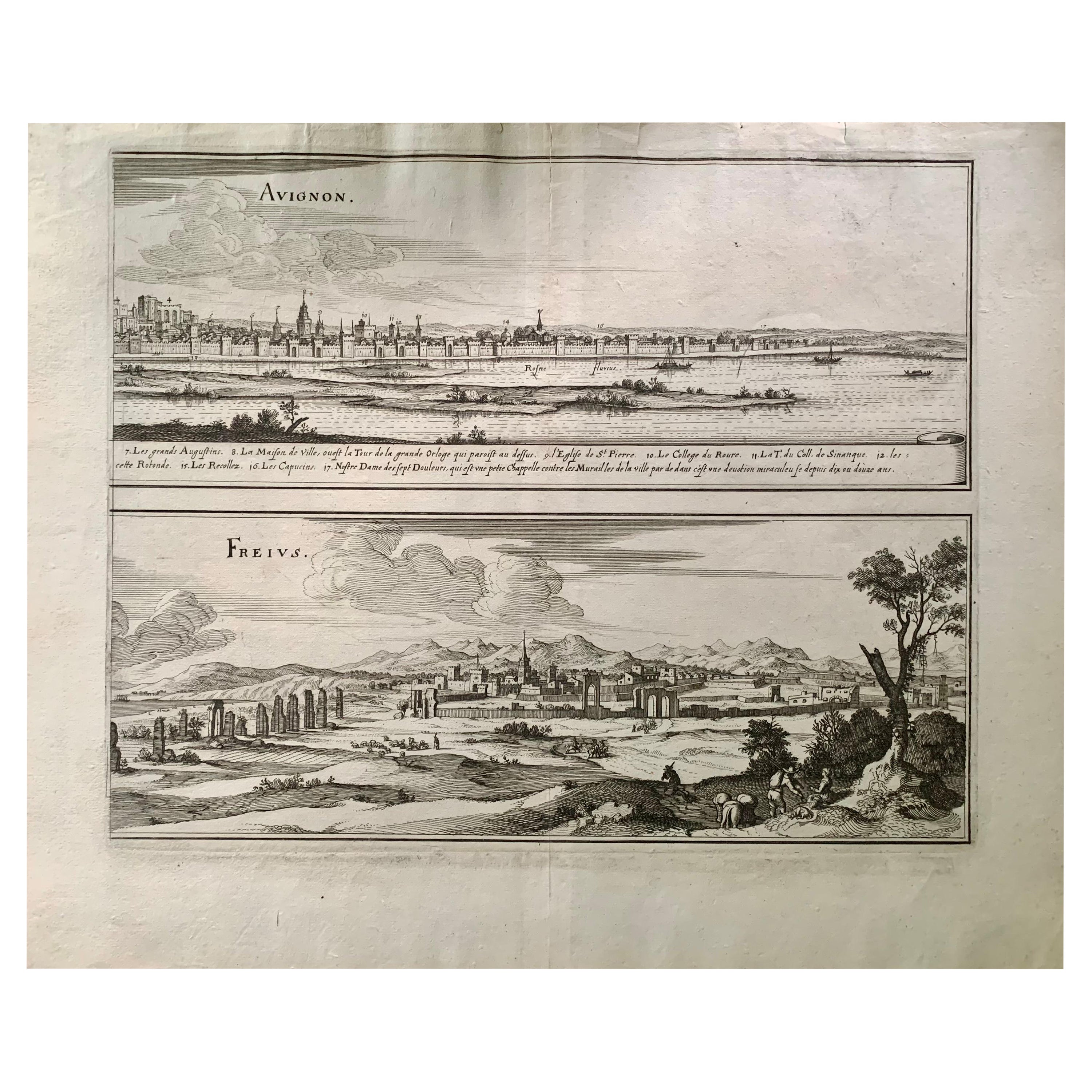
View All17th Century Topographical Map of Cote D'azur, Avignon, Frejus by Iohan Peeters
Located in New York, NY
Fine topographical 17th century map by Iohan Peeters of the towns of Avignon and Frejus in the Cote d'Azur-Provence-Alpes Region of Southeastern France.
Beautifully suited decorativ...
Category
Antique 17th Century Dutch Maps
Materials
Paper

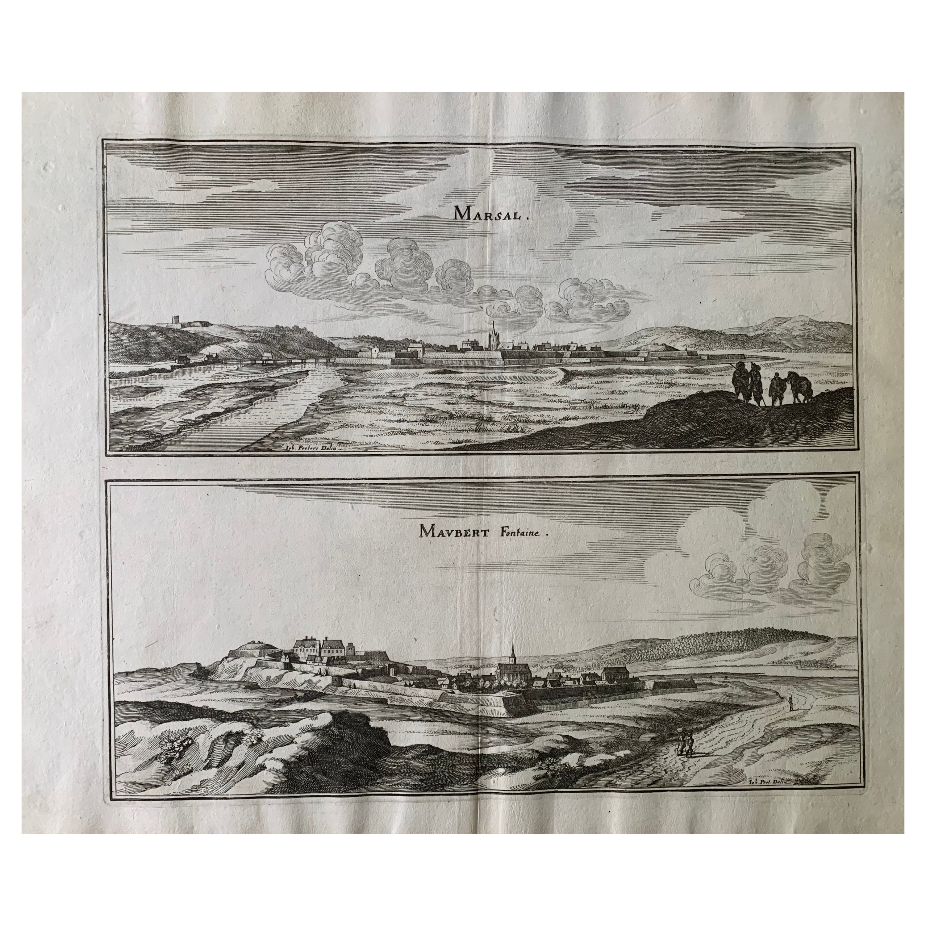
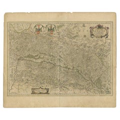
17th Century Topographical Map, Champagne-Ardenne, Marsal, Maubert Iohan Peeters
Located in New York, NY
Fine topographical 17th century map by Iohan Peeters of Marsal and Maubert Fontaine in the Champagne-Ardennes Region of North Eastern France.
Fabulous period engraving for a Wine Ce...
Category
Antique 17th Century Dutch Maps
Materials
Paper

17th Century Topographical Engraving Nantes & St. Malo, France, by Iohan Peeters
Located in New York, NY
The ancient city of Saint Malo in North Western France has long been associated with adventure on the high seas, piracy and exploration. It was the birthplace of several important in...
Category
Antique 17th Century Dutch Maps
Materials
Paper

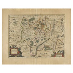
17th Century Topographical Map, French Champagne Region, Epernay, Iohan Peeters
Located in New York, NY
Fine topographical 17th century map by Iohan Peeters of the towns of Epernay and Lametz in the Champagne Region of North Eastern France.
Fabulous period engraving for a Wine Cellar,...
Category
Antique 17th Century Dutch Maps
Materials
Paper

Racinet, Auguste, L'Ornement Polychrome, Paris, Firmin-Didot, Ceiling Designs
By Auguste Racinet
Located in New York, NY
Fine, scarce pair of original chromolithographs of architectural ceiling designs from Racinet's seminal L'Ornement Polychrome published by Firmin-Didot 1869-1873 and 1885-1887. Beaut...
Category
Antique 19th Century French Decorative Art
Materials
Paper
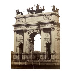
Large Antique Grand Tour Travel Photography Album by Bosetti, X., L.P. Et Al
Located in New York, NY
Large scale 17 inch by 14 inch 19th century Grand Tour photography album comprised of 92 photographs which include a number of rare images, many of which are signed.
53 photographs...
Category
Antique 19th Century European Grand Tour Photography
Materials
Leather, Paper
You May Also Like
Antique Map of the Region of Lyon by Hondius, circa 1630
Located in Langweer, NL
Antique map titled 'Lionnois, Forest et Beauiolois'. Old map of the former region of Lyon, Vienne, Bresse, Rohan and the Rhône River. This map originates f...
Category
Antique Mid-17th Century Maps
Materials
Paper

$465 Sale Price
20% Off
Antique Map of the Region of Grave by Orlers, 1615
Located in Langweer, NL
Antique map of the region of Grave, also including Cuijk and Ravestein. This map originates from 'La genealogie des illustres Comtes de Nassau' by Jan Jansz. Orlers.
Artists and E...
Category
Antique 17th Century Maps
Materials
Paper
$149 Sale Price
20% Off
Antique Map of the Alsace Region of France by Janssonius, c.1650
Located in Langweer, NL
Antique map titled 'Utriusquae Alsatiae Superioris Ac Inferioris Nova Tabula'. Map of the Alsace region (France) including the Rhine from Phillipsburg to south of Basle. Two decorati...
Category
Antique 17th Century Maps
Materials
Paper
$307 Sale Price
20% Off
Antique Map of The Siege of Gennep, the Netherlands, c.1650
Located in Langweer, NL
Antique map titled 'Belagerung des Besten Schloss und Passes Gennep'. Old map of the Siege of Gennep, the Netherlands. This map originates from 'Theatrum Europaeum' by M. Merian. Art...
Category
Antique 17th Century Maps
Materials
Paper

$223 Sale Price
20% Off
Antique Map of the Region of Lyon by Janssonius, 1657
By Johannes Janssonius
Located in Langweer, NL
Antique map of France titled 'La Principaute de Dombes'. Detailed map of the area above Lyon. This map originates from 'Atlas Novus, Sive Theatrum Orbis Orbis Terrarum: In quo Gallia...
Category
Antique 17th Century Maps
Materials
Paper
$384 Sale Price
20% Off
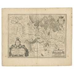
Antique Map of the Region of Sedan and Doncheri by Janssonius, 1657
By Johannes Janssonius
Located in Langweer, NL
Antique map of France titled 'La Souveraineté de Sedan et de Raucourt, et la prevosté de Doncheri'. Lovely map centered on Sedan and Doncheri and the Meuze River from Charleville and...
Category
Antique Mid-17th Century Maps
Materials
Paper
$489 Sale Price
20% Off
More Ways To Browse
Antique Map Of Yorkshire
Antique Map Vietnam
Antique Maps Massachusetts
Guyana Antique Map
Peninsular War
Santa Cruz Island
Ukraine Antique Map
Antique Life Buoy
Antique Map Nova Scotia
Antique Map Of Argentina
Antique Maps Of Kansas
Cambodia Antique Map
Magellan Map
Map Ukraine
Mariners Chart
Papua New Guinea Antique Map
Bermuda Map
Scan Globe