Items Similar to 1859 Antique Arctic Vista: Greenland, Iceland and Faroe Islands, Blackie's Atlas
Want more images or videos?
Request additional images or videos from the seller
1 of 6
1859 Antique Arctic Vista: Greenland, Iceland and Faroe Islands, Blackie's Atlas
$167.89
$209.8620% Off
£124.89
£156.1120% Off
€140
€17520% Off
CA$229.89
CA$287.3720% Off
A$255.61
A$319.5120% Off
CHF 133.46
CHF 166.8320% Off
MX$3,111.38
MX$3,889.2320% Off
NOK 1,702.95
NOK 2,128.6920% Off
SEK 1,595.58
SEK 1,994.4820% Off
DKK 1,065.74
DKK 1,332.1820% Off
Shipping
Retrieving quote...The 1stDibs Promise:
Authenticity Guarantee,
Money-Back Guarantee,
24-Hour Cancellation
About the Item
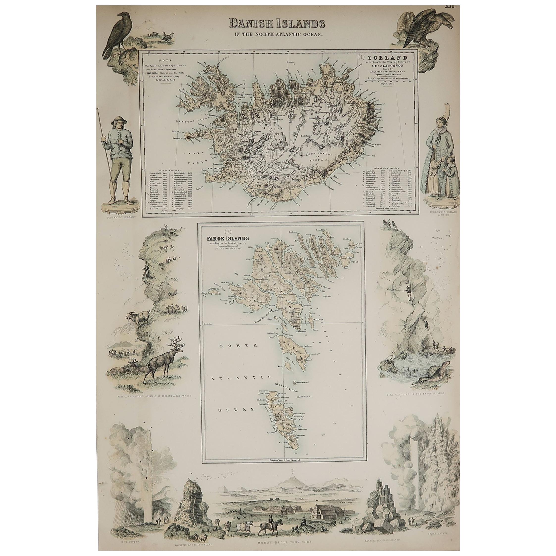
The "1859 Antique Arctic Vista: Greenland, Iceland, and Faroe Islands" is an original antique map from 'The Imperial Atlas of Modern Geography', published by W. G. Blackie in 1859. This map provides a detailed and comprehensive representation of Greenland along with the Danish colonies, Iceland, and the Faroe Islands, as they were understood in the mid-19th century.
**Key Features of the Map:**
1. **Geographical Detail**: The map covers the expansive and rugged landscapes of Greenland, the volcanic terrain of Iceland, and the archipelago of the Faroe Islands. It likely showcases the topographical features such as Greenland's ice cap, Iceland's geysers and volcanoes, and the steep cliffs of the Faroe Islands.
2. **Political Boundaries**: Reflecting the political realities of the time, the map delineates the territories of Greenland, Iceland, and the Faroe Islands, which were under Danish colonial rule. This provides insight into the historical territorial divisions and governance structures of these regions.
3. **Settlements and Colonies**: The map marks key settlements, particularly in Iceland and the Faroe Islands, and the Danish colonies in Greenland. It highlights the locations of towns, villages, and possibly trading posts or mission stations.
4. **Maritime Features**: Given the significant maritime nature of these regions, the map likely details coastal features, sea routes, and possibly ocean currents, reflecting the importance of the sea in the life and economy of these areas.
5. **Artistic and Aesthetic Elements**: Consistent with the Victorian era's cartographic style, the map may feature decorative borders, an elegant title script, and other artistic flourishes that add to its visual appeal.
6. **Historical Annotations**: The map may include notes or legends providing historical and cultural context, particularly regarding the exploration and colonization of these areas.
7. **Educational and Historical Value**: As a part of 'The Imperial Atlas of Modern Geography', this map serves as an important educational tool, offering a glimpse into the geographical understanding and perceptions of Greenland, Iceland, and the Faroe Islands in the mid-19th century.
This map is not only a valuable item for collectors of antique maps but also a significant resource for historians, geographers, and anyone interested in the history and geography of the Arctic and North Atlantic regions.
- Dimensions:Height: 14.57 in (37 cm)Width: 10.63 in (27 cm)Depth: 0.02 in (0.5 mm)
- Materials and Techniques:
- Period:
- Date of Manufacture:1859
- Condition:Wear consistent with age and use. General age-related toning. some foxing, Please study image carefully.
- Seller Location:Langweer, NL
- Reference Number:Seller: BG-12685-1-141stDibs: LU3054325239332
About the Seller
5.0
Recognized Seller
These prestigious sellers are industry leaders and represent the highest echelon for item quality and design.
Platinum Seller
Premium sellers with a 4.7+ rating and 24-hour response times
Established in 2009
1stDibs seller since 2017
2,511 sales on 1stDibs
Typical response time: <1 hour
- ShippingRetrieving quote...Shipping from: Langweer, Netherlands
- Return Policy
Authenticity Guarantee
In the unlikely event there’s an issue with an item’s authenticity, contact us within 1 year for a full refund. DetailsMoney-Back Guarantee
If your item is not as described, is damaged in transit, or does not arrive, contact us within 7 days for a full refund. Details24-Hour Cancellation
You have a 24-hour grace period in which to reconsider your purchase, with no questions asked.Vetted Professional Sellers
Our world-class sellers must adhere to strict standards for service and quality, maintaining the integrity of our listings.Price-Match Guarantee
If you find that a seller listed the same item for a lower price elsewhere, we’ll match it.Trusted Global Delivery
Our best-in-class carrier network provides specialized shipping options worldwide, including custom delivery.More From This Seller
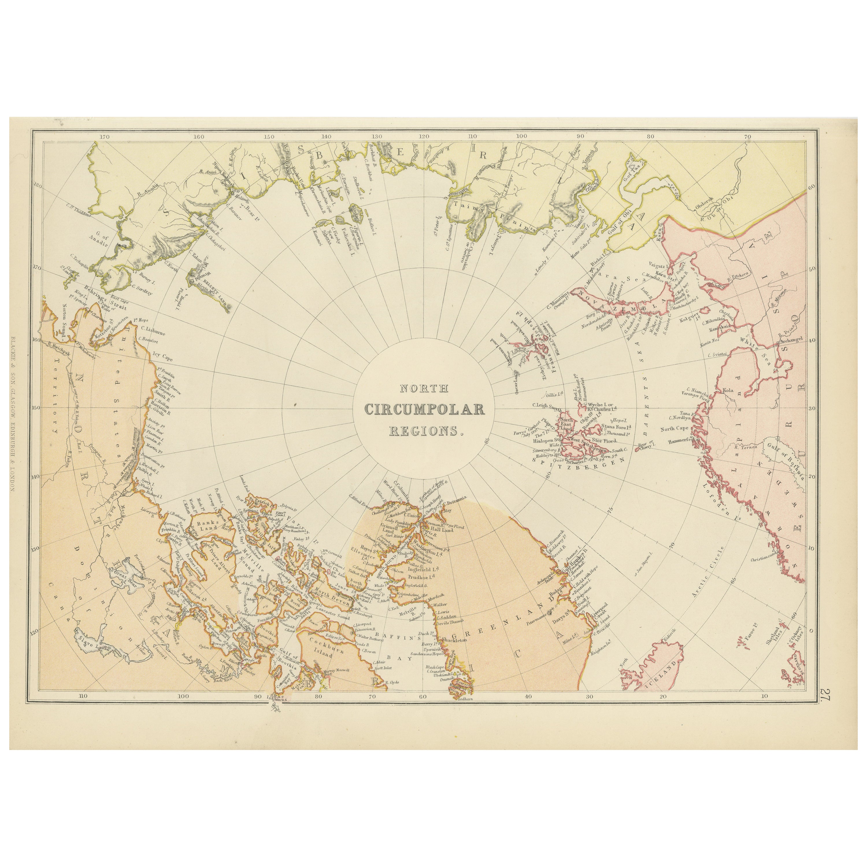
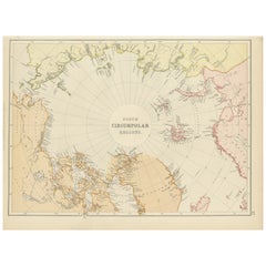
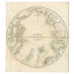
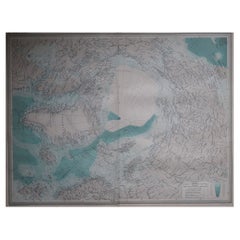
View AllArctic Exploration: An Original Map of the North Circumpolar Regions, 1882
Located in Langweer, NL
This map, extracted from the 1882 atlas by Blackie & Son, presents the North Circumpolar Regions in a projection centered on the North Pole, offering a unique view of the Arctic territories. The map's radial lines emanate from the pole, focusing on the northernmost parts of continents and the intricate archipelagos that are scattered across the Arctic Ocean.
The territories of Canada, Greenland, Northern Europe, Russia, and the northern extremities of Asia are portrayed with careful detail, highlighting the geography known to Victorian explorers. Notably, the map's color palette is subdued, with the cold regions depicted in pale hues, while coastlines and political boundaries are traced in warmer tones, providing a stark contrast that emphasizes the frigid environment.
The map likely served purposes both educational and navigational, capturing the extent of polar exploration at the time. Names of seas, straits, and islands honor explorers and patrons of the age of Arctic exploration, and the map also hints at the incomplete knowledge of the era, with some areas less detailed than others, reflecting the limits of exploration and cartographic knowledge of the Arctic region at that time.
Moreover, the map includes longitudinal and latitudinal markers, which would have been crucial for navigation and expedition planning. The inclusion of such detail illustrates the growing interest in polar exploration during the late 19th century...
Category
Antique 1880s Maps
Materials
Paper
$268 Sale Price
20% Off
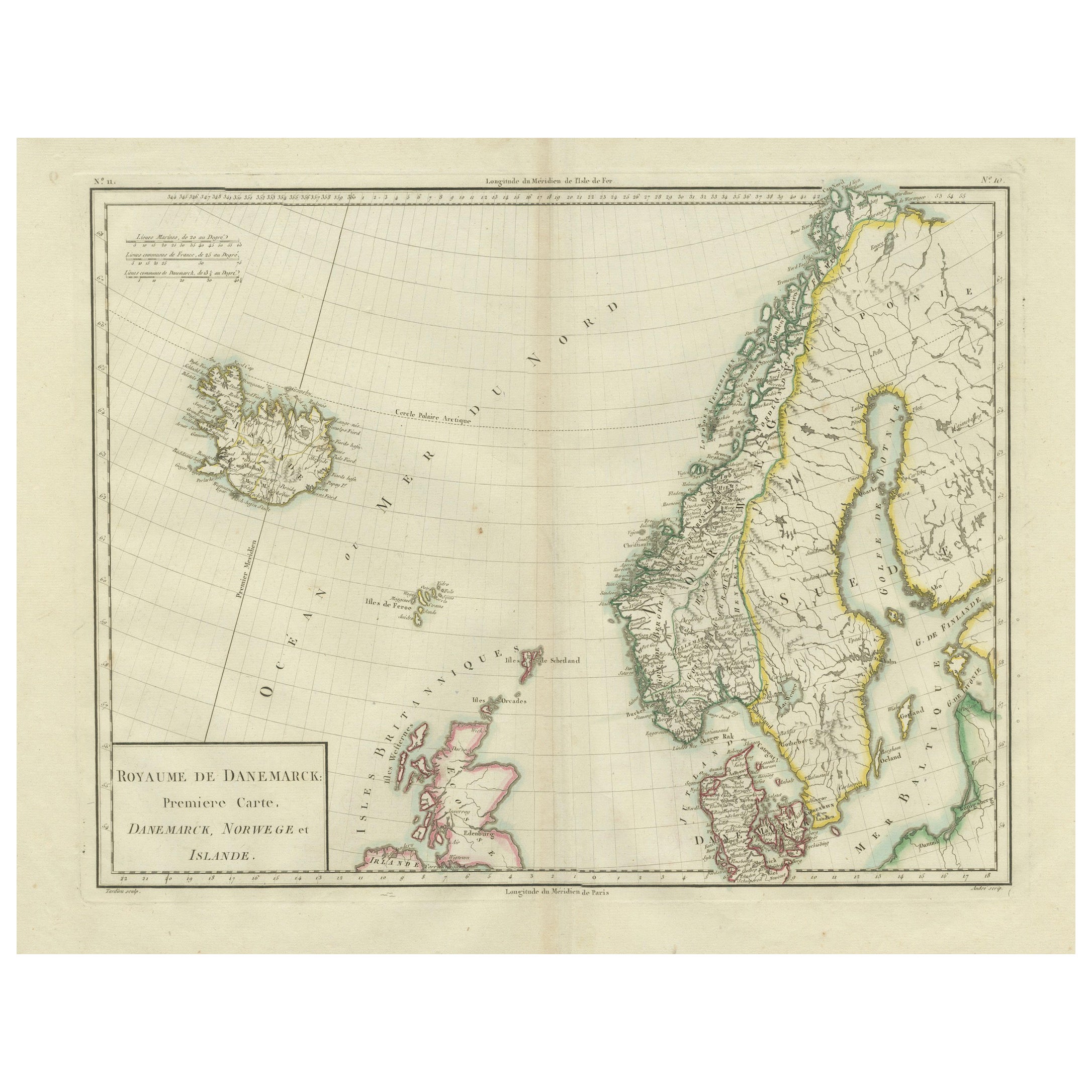
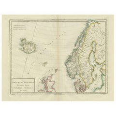
Map of Denmark, Norway & Iceland: Early 19th Century from the 1802 Tardieu Atlas
Located in Langweer, NL
Antique Map Description
Title: Royaume de Danemarck: Première Carte. Danemarck, Norwege et Islande
Publication Details:
- **Atlas Title:** Nouvel Atlas Universel de Géographie Anc...
Category
Antique Early 1800s Maps
Materials
Paper
$460 Sale Price
20% Off
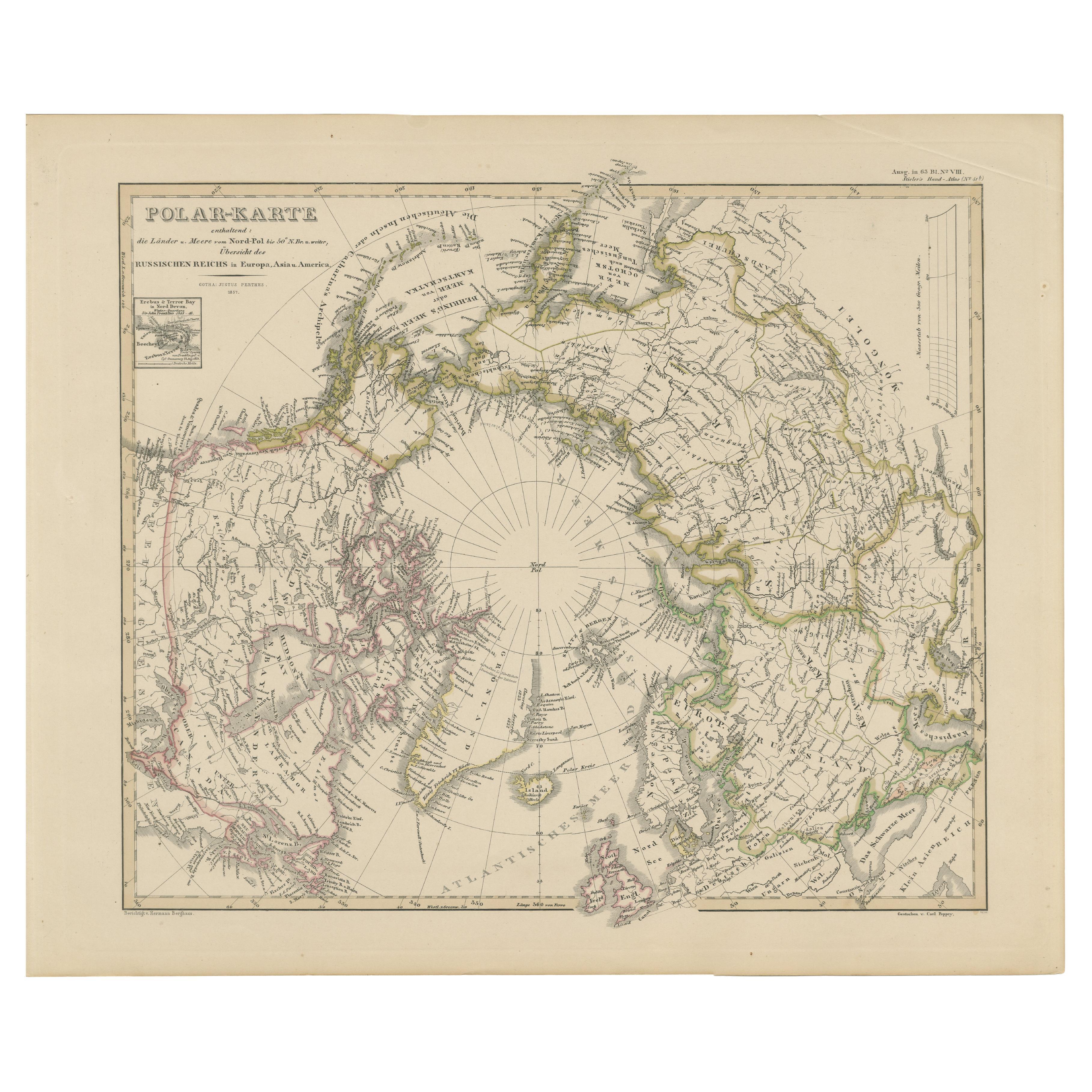
Arctic Polar Map – North Pole and Russian Empire Regions 1857
Located in Langweer, NL
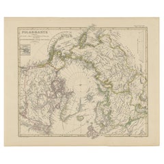
Arctic Polar Map – North Pole and Russian Empire Regions 1857
This remarkable antique print shows the Arctic titled “Polar-Karte enthaltend die Länder und Meere am Nord-Pol” meaning...
Category
Antique Mid-19th Century German Maps
Materials
Paper
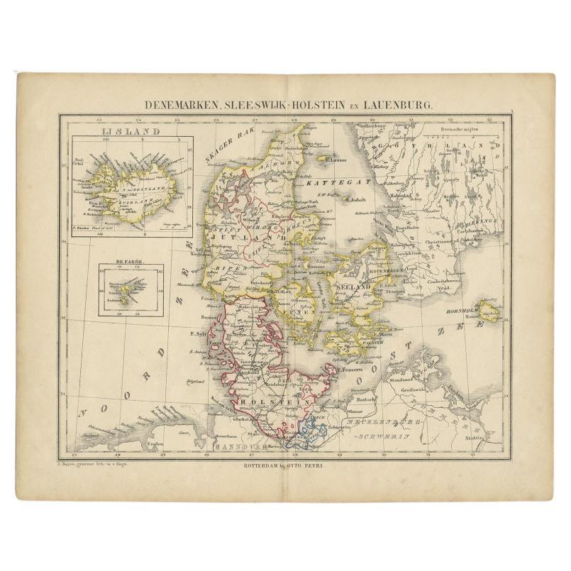
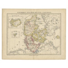
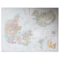
Antique Map of Denmark with Insets of Iceland and the Faroe Islands, c.1873
Located in Langweer, NL
Antique map titled 'Denemarken, Sleeswijk-Holstein en Lauenburg'. Old map depicting Denmark, with inset maps of Iceland and the Faroe Islands. This map originates from 'School-Atlas ...
Category
Antique 19th Century Maps
Materials
Paper
$153 Sale Price
20% Off
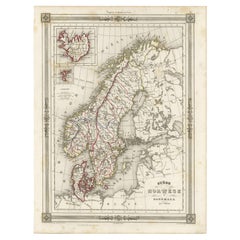
Antique Map of Scandinavia: Norway, Sweden and Denmark
Located in Langweer, NL
Antique map titled 'Suède, Norwège & Danemark'. Attractive map of Scandinavia, with Sweden, Norway and Denmark. With an inset map of Iceland and th...
Category
Antique Mid-19th Century Maps
Materials
Paper
$115 Sale Price
20% Off
Antique Map of the North Pole by Fullarton, 1856
Located in Langweer, NL
Antique map titled 'The Arctic Regions showing the North-West Passage of Captain R. McClure'. Old map of the North Pole, displaying the Northwest Passage di...
Category
Antique 19th Century Maps
Materials
Paper
$121 Sale Price
20% Off
You May Also Like
Original Antique Decorative Map of Iceland & Faroe, Fullarton, C.1870
Located in St Annes, Lancashire
Great map of Iceland and The Faroe Islands
Wonderful figural border
From the celebrated Royal Illustrated Atlas
Lithograph. Original color.
Published by Fullarton, Edinb...
Category
Antique 1870s Scottish Maps
Materials
Paper

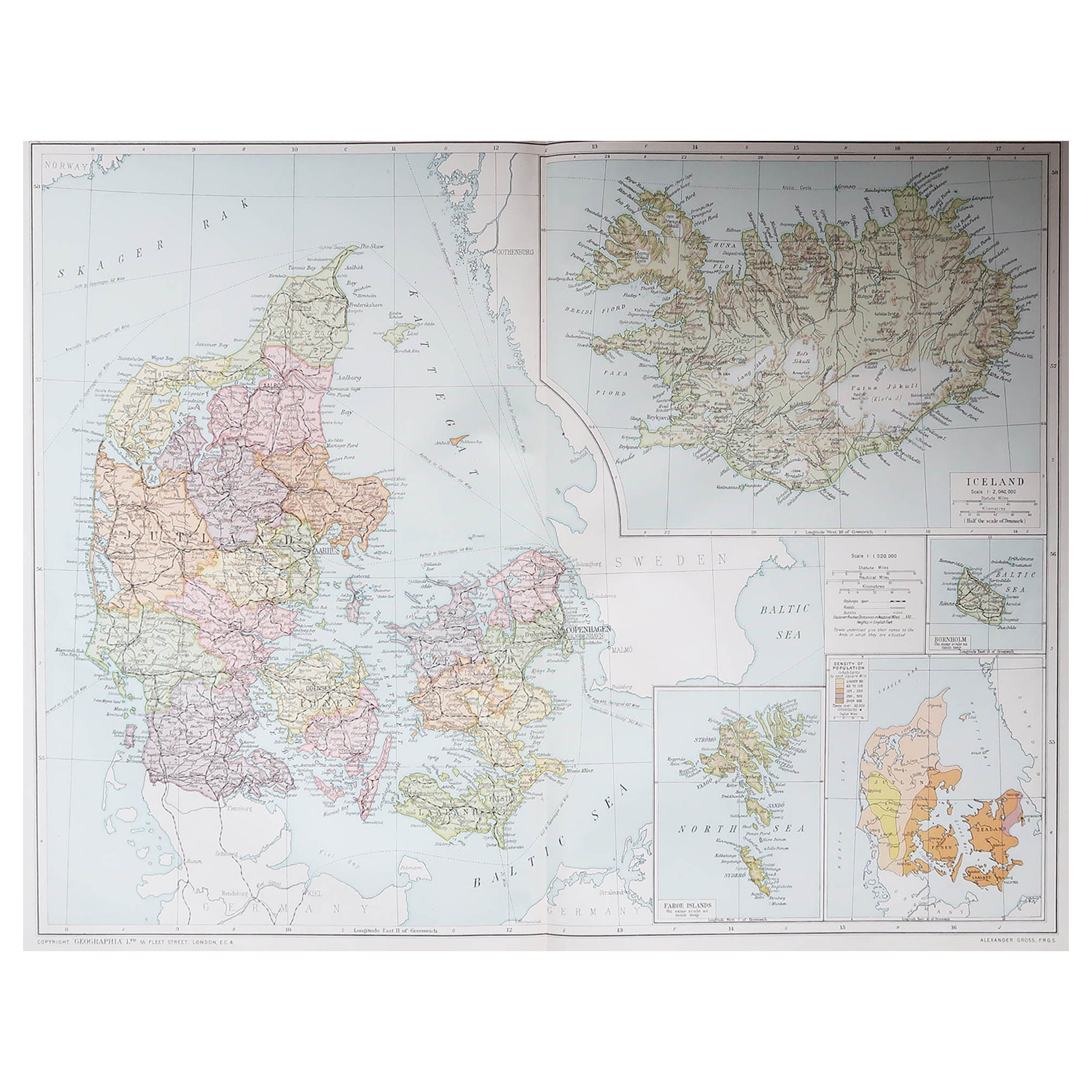
Large Original Vintage Map of Iceland, circa 1920
Located in St Annes, Lancashire
Great map of Iceland
Original color. Good condition
Published by Alexander Gross
Unframed.
Category
Vintage 1920s English Victorian Maps
Materials
Paper
Large Original Antique Map of The Falkland Islands. 1894
Located in St Annes, Lancashire
Superb Antique map of The Falkland Islands
Published Edward Stanford, Charing Cross, London 1894
Original colour
Good condition
Unframed.
Free shipping
Category
Antique 1890s English Maps
Materials
Paper

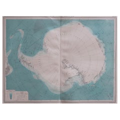
Large Original Vintage Map of the South Pole, circa 1920
Located in St Annes, Lancashire
Great map of the South pole.
Unframed.
Original color.
By John Bartholomew and Co. Edinburgh Geographical Institute.
Published, circa 1920.
Category
Vintage 1920s British Maps
Materials
Paper
Original Antique Map of the American State of Alaska, 1903
Located in St Annes, Lancashire
Antique map of Alaska
Published By A & C Black. 1903
Original colour
Good condition
Unframed.
Free shipping
Category
Antique Early 1900s English Maps
Materials
Paper

Large Original Vintage Map of The North Pole, circa 1920
Located in St Annes, Lancashire
Great maps of The North Pole.
Unframed.
Original color.
By John Bartholomew and Co. Edinburgh Geographical Institute.
Published, circa 1920.
Free shipp...
Category
Vintage 1920s British Maps
Materials
Paper
More Ways To Browse
Iceland Antique
Icelandic Antique
Faroe Islands
Antique Map Iceland
Map New Holland
Treasure Map
Caribbean Antiques
19th Century Map Of Africa
Antique Malaysia
Antique Map Of Ireland
Ships Log
Map Of Egypt
Nautical Maps
Antique Maps Of Long Island
James Cook Map
Antique Doctors Office Furniture
Pirate Furniture
Railroad Collectibles