Items Similar to 1859 Vintage Maps of England and Wales: Blackie's Imperial Geographic Detail


Want more images or videos?
Request additional images or videos from the seller
1 of 6
1859 Vintage Maps of England and Wales: Blackie's Imperial Geographic Detail
$384.32per set
$480.39per set20% Off
£283.05per set
£353.81per set20% Off
€320per set
€400per set20% Off
CA$522.83per set
CA$653.54per set20% Off
A$580.98per set
A$726.23per set20% Off
CHF 304.44per set
CHF 380.55per set20% Off
MX$7,124.70per set
MX$8,905.87per set20% Off
NOK 3,882.96per set
NOK 4,853.70per set20% Off
SEK 3,652.94per set
SEK 4,566.18per set20% Off
DKK 2,436.11per set
DKK 3,045.14per set20% Off
Shipping
Retrieving quote...The 1stDibs Promise:
Authenticity Guarantee,
Money-Back Guarantee,
24-Hour Cancellation
About the Item
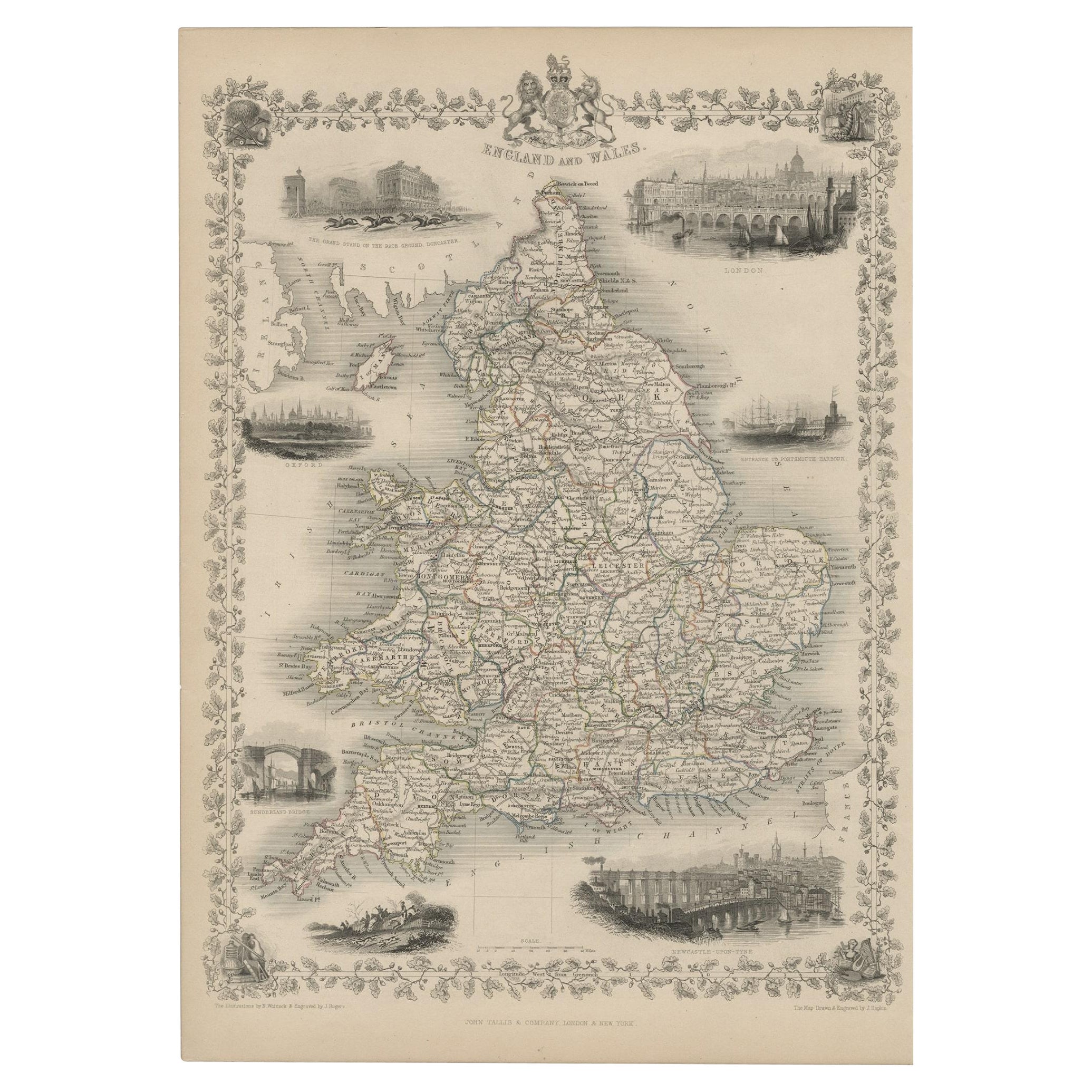
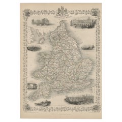
The "Antique Map of England & Wales" from 'The Imperial Atlas of Modern Geography', published by W. G. Blackie in 1859, is an original antique map that provides a detailed depiction of England and Wales during the mid-19th century. This map captures the geographical and political landscape of the region with remarkable detail and accuracy, characteristic of the Victorian era's cartographic style.
**Key Features of the Map:**
1. **Geographical Detail**: The map covers the entire regions of England and Wales, showcasing their diverse landscapes. It likely includes detailed renderings of key topographical features such as the Pennines, the Lake District, and the Welsh mountains, along with major rivers like the Thames, Severn, and Mersey.
2. **County Divisions**: Reflecting the administrative divisions of the time, the map likely delineates the various counties in England and Wales, offering insight into the regional organization and local governance structures of the mid-19th century.
3. **Urban Centers**: Major cities such as London, Manchester, Liverpool, Cardiff, and Birmingham are prominently marked. The map provides a view of the urban distribution and key population centers, highlighting the growing industrial and economic hubs of the era.
4. **Transportation Networks**: The map may detail the expansive railway network, which was rapidly developing during this period, along with major roads and canals, underscoring the industrial growth and improved connectivity across England and Wales.
5. **Coastal and Maritime Features**: Given the importance of maritime trade and naval power, the map likely details the coastal geography, including significant ports and harbors along the English Channel, the Irish Sea, and the North Sea.
6. **Artistic and Aesthetic Elements**: In line with the Victorian era's cartographic style, the map probably features ornate borders, an elegant title script, and possibly other artistic flourishes that enhance its visual appeal.
7. **Educational and Historical Value**: As a historical document, this map is invaluable for educational purposes, offering a glimpse into the geographical knowledge and perceptions of England and Wales in the mid-19th century.
This antique map of England and Wales is not only a collector’s item for enthusiasts of historical maps but also an important resource for historians, geographers, and anyone interested in the historical landscape and development of the British Isles. It captures a pivotal moment in the history of England and Wales, reflecting the era's cultural, industrial, and geographical transformations.
- Dimensions:Height: 14.57 in (37 cm)Width: 21.26 in (54 cm)Depth: 0.02 in (0.5 mm)
- Sold As:Set of 2
- Materials and Techniques:
- Period:
- Date of Manufacture:1859
- Condition:Wear consistent with age and use. Minor structural damages. General age-related toning. some foxing, Please study image carefully.
- Seller Location:Langweer, NL
- Reference Number:Seller: BG-12685-1-5,61stDibs: LU3054325239122
About the Seller
5.0
Recognized Seller
These prestigious sellers are industry leaders and represent the highest echelon for item quality and design.
Platinum Seller
Premium sellers with a 4.7+ rating and 24-hour response times
Established in 2009
1stDibs seller since 2017
2,494 sales on 1stDibs
Typical response time: 1 hour
- ShippingRetrieving quote...Shipping from: Langweer, Netherlands
- Return Policy
Authenticity Guarantee
In the unlikely event there’s an issue with an item’s authenticity, contact us within 1 year for a full refund. DetailsMoney-Back Guarantee
If your item is not as described, is damaged in transit, or does not arrive, contact us within 7 days for a full refund. Details24-Hour Cancellation
You have a 24-hour grace period in which to reconsider your purchase, with no questions asked.Vetted Professional Sellers
Our world-class sellers must adhere to strict standards for service and quality, maintaining the integrity of our listings.Price-Match Guarantee
If you find that a seller listed the same item for a lower price elsewhere, we’ll match it.Trusted Global Delivery
Our best-in-class carrier network provides specialized shipping options worldwide, including custom delivery.More From This Seller
View AllAntique Map of England & Wales by Wyld '1845'
Located in Langweer, NL
Antique map titled 'England & Wales'. Original antique map of England & Wales. This map originates from 'An Atlas of the World, Comprehending Se...
Category
Antique Mid-19th Century Maps
Materials
Paper

$135 Sale Price
24% Off
Antique Map of England and Wales by Johnson '1872'
Located in Langweer, NL
Antique map titled 'Johnson's England and Wales'. Original map of England and Wales. This map originates from 'Johnson's New Illustrated Family Atlas of the World' by A.J. Johnson. P...
Category
Antique Late 19th Century Maps
Materials
Paper

$240 Sale Price
20% Off
Antique Map of England and Wales 'North' by A.K. Johnston, 1865
Located in Langweer, NL
Antique map titled 'England and Wales (Northern Sheet)'. This map originates from the ‘Royal Atlas of Modern Geography’ by Alexander Keith Johnston. Published by William Blackwood an...
Category
Antique Mid-19th Century Maps
Materials
Paper

$264 Sale Price
20% Off
Antique Map of England and Wales with Decorative Vignettes, 1851
Located in Langweer, NL
Antique map titled ‘England and Wales’. Includes decorative vignettes titled The grand stand on the race ground Doncaster, London, Oxford, Entrance to Portsmouth Harbour, Sunderland ...
Category
Antique 19th Century Maps
Materials
Paper
$432 Sale Price
20% Off
Original Antique Map of the United Kingdom and Ireland, Published in 1875
Located in Langweer, NL
Antique map titled 'Iles Britanniques ou Royaume-Uni de la Grande Bretagne (..)'. Large map of the United Kingdom and Ireland. This map originates from...
Category
Antique Late 19th Century French Maps
Materials
Paper

$294 Sale Price
30% Off
Antique Map of, Northern England and Wales by Johnston, 1882
Located in Langweer, NL
Antique map titled 'England and Wales'.
Old map of England and Wales. This map originates from 'The Royal Atlas of Modern Geography, Exhibiting, in a Series of Entirely Original an...
Category
Antique 19th Century Maps
Materials
Paper

You May Also Like
Original Antique English County Map, Herefordshire, J & C Walker, 1851
Located in St Annes, Lancashire
Great map of Herefordshire
Original colour
By J & C Walker
Published by Longman, Rees, Orme, Brown & Co. 1851
Unframed.
Category
Antique 1850s English Other Maps
Materials
Paper

England and Wales, Northern Part. Century Atlas antique vintage map
Located in Melbourne, Victoria
'The Century Atlas. England and Wales, Northern Part'
Original antique map, 1903.
Central fold as issued. Map name and number printed on the reverse corners.
Sheet 29.5cm by 40cm.
Category
Early 20th Century Victorian More Prints
Materials
Lithograph

Original Antique English County Map, Derbyshire, J & C Walker, 1851
Located in St Annes, Lancashire
Great map of Derbyshire
Original colour
By J & C Walker
Published by Longman, Rees, Orme, Brown & Co. 1851
Unframed.
Category
Antique 1850s English Other Maps
Materials
Paper

Original Antique English County Map, Nottinghamshire, J & C Walker, 1851
Located in St Annes, Lancashire
Great map of Nottinghamshire
Original colour
By J & C Walker
Published by Longman, Rees, Orme, Brown & Co. 1851
Unframed.
Category
Antique 1850s English Other Maps
Materials
Paper

Original Antique English County Map - Monmouthshire. J & C Walker. 1851
Located in St Annes, Lancashire
Great map of Monmouthshire
Original colour
By J & C Walker
Published by Longman, Rees, Orme, Brown & Co. 1851
Unframed.
Category
Antique 1850s English Other Maps
Materials
Paper

England, Scotland & Ireland: A Hand Colored Map of Great Britain by Tirion
By Isaak Tirion
Located in Alamo, CA
This is a hand-colored double page copperplate map of Great Britain entitled "Nieuwe Kaart van de Eilanden van Groot Brittannien Behelzende de Kon...
Category
Antique Mid-18th Century Dutch Maps
Materials
Paper

More Ways To Browse
Wales And Wales Furniture
Imperial Mid
Railway Map
Antique Map Of Ireland
Irish Railway
Map New Holland
Treasure Map
Caribbean Antiques
19th Century Map Of Africa
Antique Malaysia
Antique Map Of Ireland
Ships Log
Map Of Egypt
Nautical Maps
Antique Maps Of Long Island
James Cook Map
Antique Doctors Office Furniture
Pirate Furniture