Maps
to
815
1,042
42
1,085
10
1
2,927
2,257
475
3
290
34
10
126
10
37
9
2
5
4
3
3
1,084
10
9
2
2
159
74
62
56
14
1,085
1,085
1,085
59
12
10
6
5
Maps For Sale
Period: Early 1900s
Period: 17th Century
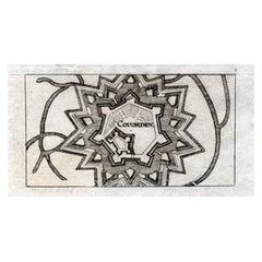
Antique Map of Coevorden in the Netherlands, 1691
Located in Langweer, NL
Plate 'Covorden.' (Plan of the fortified city of Coevorden, The Netherlands.) This attractive original old antique print / plate originates from: 'Ausführliche und grundrichtige Besc...
Category
17th Century Antique Maps
Materials
Paper
$85 Sale Price
20% Off
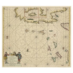
Original Antique Sea Chart of the Northern Part of Hispaniola, Western Cuba
Located in Langweer, NL
Antique map titled 'Pas kaart van de Noord Kust van Espaniola (..)'. Beautiful sea chart of the northern part of Hispaniola, western Cuba. The map includes the Turks & Caicos Islands and southern part of the Bahamas. Shows Guanahami or S. Salvador. Guanahani is an island in the Bahamas that was the first land in the New World sighted and visited by Christopher Columbus' first voyage, on October 12, 1492. It is not known precisely which island it was, and several theories have been put forth by historians. Guanahani is the native Taíno name; Columbus called it San Salvador. Originates from 'De Nieuwe Groote Lightende Zee-Fakkel'. Published by J. van Keulen, circa 1684.
The Van Keulens were a family of chartmakers and publishers. The firm, In de Gekroonde Lootsman (In the Crowned Pilot), was founded in 1678 by Johannes van Keulen (1654-1715). Van Keulen originally registered his business as a vendor of books and instruments (specifically cross-staffs). In 1680, however, he gained a privilege from the States of Holland and West Friesland for the publication of pilot guides and sea atlases.
In that year, van Keulen released his Zee-Atlas (Sea Atlas), which secured him a name in the competitive maritime publishing market. In 1681, he published the first volume of Nieuwe Lichtende Zee-Fakkel (New Shining Sea Torch). This would be the first of an eventual five volumes originally published between 1680 and 1684. A sixth volume was added in 1753. The Zee-Fakkel won van Keulen lasting fame. The atlas had charts compiled by Claes Jansz Vooght and artwork from Jan Luyken...
Category
Late 17th Century Antique Maps
Materials
Paper
$1,795 Sale Price
20% Off
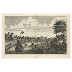
Antique Copper Engraving of the City of Kuchin in China, 1668
Located in Langweer, NL
Antique print China titled 'Kuching'.
Old print depicting a view on the Chinese city of Kuching or Kuchin (Gui Jiang, Kuei Chiang), near the river Gui (Guei). This area is close ...
Category
17th Century Antique Maps
Materials
Paper
$321 Sale Price
20% Off
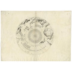
Antique Map of the North Pole by V.M. Coronelli, circa 1692
Located in Langweer, NL
Globe gore by Vincenzo Maria Coronelli shows the North Pole with the coasts of Canada, Greenland, Scandinavia and Siberia, and is decorated with pictorial scenes of bear, seal and wh...
Category
Late 17th Century Antique Maps
Materials
Paper
$1,322 Sale Price
20% Off
Antique Print of Alexandria in Egypt, 1698
Located in Langweer, NL
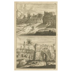
Antique print with two views of Alexandria, Egypt. This print originates from 'Reizen van Cornelis de Bruyn, door de vermaardste deelen van Klein Asia, de eylanden Scio, Rhodus, Cypr...
Category
17th Century Antique Maps
Materials
Paper
$226 Sale Price
20% Off
Antique Map of Japan and Korea by Sanson, 'c.1690'
Located in Langweer, NL
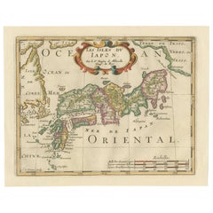
Antique map titled 'Les Iles du Iapon (..)'. Original antique map, with beautiful (later) hand coloring, of Japan and the Island of Corey (Korea). Uncommon edition, with '234' at top...
Category
Late 17th Century Antique Maps
Materials
Paper
$944 Sale Price
20% Off
Antique Map of the Saxony Region 'Germany' by F. de Wit, circa 1680
Located in Langweer, NL
A detailed map of a region in eastern Germany. Cartouches depict coat of arms surrounded by cherubs. The map is fully engraved with towns, political boundaries, rivers and forests. P...
Category
Late 17th Century Dutch Antique Maps
Materials
Paper
Antique Map of Belgium and Northern France by F. de Wit, circa 1680
Located in Langweer, NL
Antique map titled 'Belgii Regii Accuratissima Tabula Pluribus Locis Recens Emen'. Large map of Belgium and Northern France. Published by F. de Wit, circa 1680.
Category
Late 17th Century Antique Maps
Materials
Paper
$614 Sale Price
20% Off
Antique Print of Hanseatic City of Lübeck in Northern Germany by Merian, c.1650
Located in Langweer, NL
Antique print titled 'Lubecca, Lübeck'. A bird's eye view of Lubeck, the northern German city in Schleswig-Holstein. This print originates from 'Topographia Saxoniae Inferioris'.
Ar...
Category
17th Century Antique Maps
Materials
Paper
$368 Sale Price
20% Off
Antique Map of Deventer in the Netherlands, 1691
Located in Langweer, NL
Plate 'Devendr.' (Plan of the fortified city of Deventer, The Netherlands.) This attractive original old antique print / plate originates from: 'Aus...
Category
17th Century Antique Maps
Materials
Paper
$122 Sale Price
20% Off
Antique Print of Büdingenin Germany by Braun & Hogenberg, 1617
Located in Langweer, NL
Antique map titled 'Bingen'. Bird's eye-view of Büdingen, Germany. The view shows a city surrounded by vineyards and well fortified with walls and moats. On the right is the castle w...
Category
17th Century Antique Maps
Materials
Paper
$274 Sale Price
20% Off
Antique Map of Flanders 'Belgium' by F. de Wit, circa 1680
Located in Langweer, NL
Antique map titled 'Comitatus Flandriae Tabula, in Lucem Edita'. Large map of Flanders, Belgium. Published by F. de Wit, circa 1680.
Category
Late 17th Century Antique Maps
Materials
Paper
$566 Sale Price
20% Off
Antique Print of Cairo and Joseph's Well in Egypt, 1698
Located in Langweer, NL
Untitled antique print with a view of the city of Cairo in Egypt and Joseph's Well in Cairo. This print originates from 'Reizen van Cornelis de Bruyn, door de vermaardste deelen van ...
Category
17th Century Antique Maps
Materials
Paper
$160 Sale Price
20% Off
Antique Map of China and Korea incl Formosa and Hainan, by Janssonius, ca.1650
Located in Langweer, NL
Antique map titled 'Imperii Sinarum Nova Descriptio'. Beautiful map of China and Korea, much detail troughout the map. Including the Islands of Formosa (Taiwan) and Hainan. The Great...
Category
17th Century Antique Maps
Materials
Paper
$2,787 Sale Price
20% Off
Antique Map of Northern Italy by F. de Wit, 1690
Located in Langweer, NL
A very decorative map centered on Genua, and including the towns of Milan, Torino, Parma, Cremona, etc. Decorative title cartouche upper right, five putti holding the arms of the reg...
Category
Late 17th Century Antique Maps
Materials
Paper
$519 Sale Price
20% Off
Antique Map of Groningen with Contemporary Hand Coloring
Located in Langweer, NL
Antique map titled 'Tabulae dominii Groeningae quae et complecititur maximam partem Dreniae Emendata a F. de Wit'. Original antique map of the province of Groningen, the Netherlands....
Category
Late 17th Century Antique Maps
Materials
Paper
$623 Sale Price
20% Off
Antique Map of Harlingen, Harbour City in the Netherlands, 1691
Located in Langweer, NL
Plate 'Harlingen.' (Plan of the city of Harlingen, The Netherlands.) This attractive original old antique print / plate originates from: 'Ausführliche und grundrichtige Beschreibung ...
Category
17th Century Antique Maps
Materials
Paper
$132 Sale Price
20% Off
Original Engraved Portrait of Louis II, King of Hungary, Croatia & Bohemia, 1615
Located in Langweer, NL
Antique portrait titled 'Lodovicus D.G. (..)'.
Portrait of Louis II, King of Hungary, Croatia and Bohemia. This print originates from 'Tooneel der keysere...
Category
1610s Antique Maps
Materials
Paper
$274 Sale Price
20% Off
Antique Map of the East Indies by Janssonius, c.1644
Located in Langweer, NL
Antique map titled 'India quae Orientalis dicitur, et Insulae adiacentes'. Old map of the East Indies and Southeast Asia showing the area between India in the West and parts of Japan...
Category
17th Century Antique Maps
Materials
Paper
$2,504 Sale Price
20% Off
Original Antique Engraving of a Sea Chart of the Western Mediterranean, ca.1650
Located in Langweer, NL
Antique map titled 'Pascaerte van 't westlyckste deel vande Middelandsche-Zee (..)'.
Sea chart of the Western Mediterranean. The map extends from the Straits of Gibralter to Italy ...
Category
1650s Antique Maps
Materials
Paper
$1,181 Sale Price
20% Off
Stunning Bird's-Eye View Plan of Hasselt by Blaeu in The Netherlands, 1649
Located in Langweer, NL
Antique print, titled: 'Hasselt.'
Bird's-eye view plan of Hasselt in The Netherlands. With key to locations and coats of arms. Text in Dutch on verso. This plan originates from the famous city Atlas: 'Toneel der Steeden' published by Joan Blaeu...
Category
1640s Antique Maps
Materials
Paper
$1,086 Sale Price
20% Off
Antique Map of the Region of Touraine by Janssonius 'circa 1650'
Located in Langweer, NL
Antique map of France titled 'Touraine - Turonensis Ducatus'. Decorative map of the Touraine region, France. It shows the cities of Tours, Amboise and others. Published by J. Jansson...
Category
Mid-17th Century Antique Maps
Materials
Paper
$425 Sale Price
20% Off
Print of Leopold I, Holy Roman Emperor, King of Hungary, Croatia & Bohemia, 1695
Located in Langweer, NL
Antique print, titled: 'Leopoldus Romanorum Imperator Semper Augustus.'
This original antique plate shows a portrait of Leopold I (9 June 1640 – 5 May 1705), he was Holy Roman Emperor...
Category
1690s Antique Maps
Materials
Paper
$302 Sale Price
20% Off
Original Antique Engraving of the Mighty Imperial Osaka Castle in Japan, 1669
Located in Langweer, NL
Antique print, titled: 'Afbeeldinge vant Maghtich Keyserlyck Casteel Osacca geleegen int groot Ryck Jappan besuyden de Stadt Osacce inde provinsie Qioo.' - ('Image of the Mighty Imperial Castle Osaka').
A bird's eye view of Osaka Castle, Japan. Arnoldus Montanus' "Gedenkwaerdige Gesantschappen der Oost-Indische Maatschappy in 't Vereenigde Nederland aan de Kaisaren van Japan […]. Amsterdam: Jacob Meurs, 1669.
Artists and Engravers: Made by an anonymous engraver after 'Arnoldus Montanus'.
Condition: Very good, given age. Original middle fold, as issued. Some faint browning of the margin edges. A few small spots in the margins (from paper making...
Category
1660s Antique Maps
Materials
Paper
$897 Sale Price
20% Off
Rare Antique Miniature Map of Pakistan, India and Cambaia, ca.1618
Located in Langweer, NL
Old 17th century miniature antique map of 'Cambaia' , from the 1616 edition of Jadocus Hondius Atlas by Petrus Bertius.
Original copperplate engraving with hand coloring.
Carto...
Category
17th Century Antique Maps
Materials
Paper
$368 Sale Price
20% Off
Very Rare Antique Print of the Valley of Terebinthus in Arabia, 1673
Located in Langweer, NL
Antique print titled 'Vallis Therebinthi'. Old print of the Valley of Terebinthus, below a decorative cartouche with lettered key and surrounded by 2 cherubins. This print originates...
Category
17th Century Antique Maps
Materials
Paper
Colorful and Decorative Miniature Map of India, Ceylon by Bertius 1616
Located in Langweer, NL
Old 17th century miniature antique map of India - Ceylon from the 1616 edition of Jadocus Hondius Atlas by Petrus Bertius. Original copperplate engraving with hand coloring.
Carto...
Category
17th Century Antique Maps
Materials
Paper
$368 Sale Price
20% Off
Antique Map of the Region of Poitou by Ortelius, circa 1600
Located in Langweer, NL
Antique map titled 'Poictou'. Original antique map of the region of Poitou, a former province of west-central France whose capital city was Poitiers. Published by A. Ortelius, circa ...
Category
Early 17th Century Antique Maps
Materials
Paper
$566 Sale Price
20% Off
Antique Map of Artois in the North of France by Famous Mapmaker Blaeu, c.1640
Located in Langweer, NL
Antique map titled 'Artesia Comitatus Artois'. Map of Artois or Artesia, France. Artois is former province located in the northwestern part of France, boarding Belgium (Flanders) on ...
Category
17th Century Antique Maps
Materials
Paper
$453 Sale Price
20% Off
Antique Map of Denmark and Southern Sweden, c.1658
Located in Langweer, NL
Antique map titled 'Royaume de Danemarq.' Map centered on Sjaelland and covers all of Denmark and part of southern Sweden where a dramatic title cartouche obscures the interior. Sour...
Category
17th Century Antique Maps
Materials
Paper
$255 Sale Price
20% Off
Old Map of the Western Part of Central Europe, c.1680
Located in Langweer, NL
Antique map titled 'Carta nova accurate del Passagio et strada dalli Paesi Bassi'. Old map of the western portion of Central Europe. Oriented to the Northeast.
Artists and Engrav...
Category
17th Century Antique Maps
Materials
Paper
$354 Sale Price
20% Off
Set of 6 Original Vintage Maps of American States, circa 1900
Located in St Annes, Lancashire
Wonderful set of 6 vintage maps.
Random American states including Maine, Utah, New Hampshire, Nevada, Vermont and New Mexico.
Monochrome with red color outline.
Published by Rand,...
Category
Early 1900s American Edwardian Antique Maps
Materials
Paper
South Sweden Map with Inset of Halmstad – Antique Map by Frederik de Wit, c.1680
Located in Langweer, NL
South Sweden Map with Inset of Halmstad – Antique Map by Frederik de Wit, c.1680
This richly detailed antique map titled Accurata Scaniae, Blekingae et Hallandiae Descriptio present...
Category
Late 17th Century Dutch Antique Maps
Materials
Paper
$798 Sale Price
20% Off
Antique Map of Prussia by Blaeu, circa 1635
By Willem Blaeu
Located in Langweer, NL
Antique map titled 'Prussiae Nova Tabula'. Rare early edition of Blaeu's map of Prussia, embellished with a gorgeous large format cartouche, compass ros...
Category
Mid-17th Century Antique Maps
Materials
Paper
$680 Sale Price
20% Off
Rare 17th Century Map of Batavia and Castle on Java by Isaac de l'Obel
Located in Langweer, NL
Rare 17th Century Map of Batavia and Castle on Java by Isaac de l'Obel
This finely detailed and vividly hand-colored copperplate engraving offers a rare and early view of Batavia (p...
Category
Late 17th Century Dutch Antique Maps
Materials
Paper
Frederic de Wit Map of Palestine – Terra Sancta, Amsterdam c.1670
Located in Langweer, NL
Terra Sancta sive Promissionis, olim Palestina – hand-coloured copper-engraved map of the Holy Land by Frederic de Wit, Amsterdam, circa 1670
This impressive folio sheet, bearing th...
Category
Late 17th Century Dutch Antique Maps
Materials
Paper
1901 Nautical Chart Showing Woods Hole, Mass
Located in Norwell, MA
Rare 1901 chart of Woods Hole, Mass., showing Buzzards Bay, Penzance Point, Nonamesset Island, Downtown Woods Hole, Parker Neck, Nobska Head, Vineyard Sound, Woods Hole Golf Club, Ra...
Category
Early 1900s North American Antique Maps
Materials
Paper
1901 Chart of Port Jefferson, New York
Located in Norwell, MA
Original chart by George Eldridge of Port Jefferson on Long Island, New York. The identified waters include Setauket Harbor, Mount Misery Point, and Match Rock. Two channels are mark...
Category
Early 1900s North American Antique Maps
Materials
Paper
1904 "Nell's Topographical Map of the State of Colorado"
Located in Colorado Springs, CO
This highly detailed pocket map is a topographical map of the state of Colorado by Louis Nell from 1904. The map "has been compiled from all available...
Category
Early 1900s American Antique Maps
Materials
Leather, Paper
1630 Pierre Petit map "Description du Gouvernement de la Capelle" Ric0010
Located in Norton, MA
1630 Pierre Petit map entitled
"Description du Gouvernement de la Capelle,"
Ric0010
Pierre Petit was the son of a minor provincial official in Montluçon. The town, in the Auver...
Category
17th Century Dutch Antique Maps
Materials
Paper
Original Antique Map of Trier and Luxembourg by Joan Blaeu, Amsterdam circa 1640
Located in Langweer, NL
Map of Trier and Luxembourg by Joan Blaeu, Amsterdam circa 1640
This beautifully engraved and hand-colored map titled Trevirensis Archiepiscopatus, et Lutzenburgi Ducatus depicts th...
Category
Mid-17th Century Dutch Antique Maps
Materials
Paper
1687 Engraved View of Rhodes by O. Dapper – Hand-Colored Island of Rhodus
Located in Langweer, NL
1687 Engraved View of Rhodes by O. Dapper – Hand-Colored Island of Rhodus
This original antique print is a beautifully detailed copper engraving titled "Het Eylant Rhodus" (The Isla...
Category
1680s Antique Maps
Materials
Paper
Map of Comitatus Marchia et Ravensberg: Historical Counties in Germany, c.1660
Located in Langweer, NL
Antique map titled 'Comitatus Marchia et Ravensberg'. This map depicts two historical counties of the Holy Roman Empire: Marks and Ravensberg. Major cities, towns, mountains, and riv...
Category
Mid-17th Century Antique Maps
Materials
Paper
$415 Sale Price
20% Off
1658 Large Map of the Holy Land by Jansson – Twelve Tribes of Israel in 6 Sheets
Located in Langweer, NL
Holy Land Divided Among the Twelve Tribes – Six-Part Map by Jan Jansson and Georgius Hornius, circa 1658
This rare and impressive six-sheet engraved map of the Holy Land was publish...
Category
Mid-17th Century Dutch Antique Maps
Materials
Paper
Antique Map of the of the Course of the Albis River 'or Elbe River'
Located in Langweer, NL
Antique map titled 'Albis Fluvius Germaniae celebris A Fontiubus Ad Ostia, Cum Fluminibus ab utroque latere in illum fluenibus descriptus'. Detailed map of the course of the Albis Ri...
Category
Mid-17th Century Antique Maps
Materials
Paper
$566 Sale Price
20% Off
1616 Petrus Bertius Map of Arakan and Pegu in Southeast Asia
Located in Langweer, NL
Title: 1616 Petrus Bertius Map of Arakan and Pegu in Southeast Asia
Description: This early seventeenth-century map, titled Descriptio Arachan et Pegu, was published in 1616 by P...
Category
1610s Antique Maps
Materials
Paper
"Atlas to Accompany Monograph XXXII on the Geology of Yellowstone National Park"
By United States Geological Survey
Located in Colorado Springs, CO
This is an original 1904 "Atlas to Accompany Monograph XXXII on the Geology of the Yellowstone National Park" by Arnold Hague. Published by the Department of the Interior, the Atlas ...
Category
Early 1900s American Antique Maps
Materials
Leather, Fabric, Paper
Original Old Map of Northeastern Greece & Northwestern Turkey, Published in 1661
Located in Langweer, NL
This small map was engraved by Petrus Kaerius and is based on Ortelius' map of the same title. It covers the ancient region of Thrace, present-day European Turkey and part of Greece....
Category
1660s Antique Maps
Materials
Paper
$396 Sale Price
20% Off
Antique Print of the Chinese City of Anhing by Nieuhof, 1668
Located in Langweer, NL
Antique print China titled 'Anhing'. Old print depicting a view on the Chinese city of Anhing with its ramparts. This print originates from the Latin editio...
Category
17th Century Antique Maps
Materials
Paper
$321 Sale Price
20% Off
Original Antique Map of the Southern Coast of France by Janssonius, 1657
Located in Langweer, NL
Antique map of France titled 'Comté et Gouvernement de Provence'. Decorative map of the southern coast of France. This map originates from 'Atlas Novus,...
Category
17th Century Antique Maps
Materials
Paper
$680 Sale Price
20% Off
Scare Map of Canaan, with Portraits of the Apostles of Matheaus and Others
Located in Langweer, NL
Antique map titled 'Geographische Beschreibung des Belobten Landes Canaan (..)'. Scarce map of Canaan, with portraits of the Apostles of Matheaus, S. Marcus, S. Lucas, S. Johannes. With Christ in lower part. The map extends along the coast of the eastern Mediterranean. Published by Georg Andreas...
Category
Late 17th Century Antique Maps
Materials
Paper
$415 Sale Price
20% Off
Original Antique Map of the American State of California ( Northern Part ), 1903
Located in St Annes, Lancashire
Antique map of California ( Northern part )
Published By A & C Black. 1903
Original colour
Good condition
Unframed.
Free shipping
Category
Early 1900s English Antique Maps
Materials
Paper
Antique Map of the Region of Bourbon by Janssonius, 1657
Located in Langweer, NL
Antique map of France titled 'Borbonium Ducatus - Bourbonnois'. Decorative map of the Bourbon region. This map originates from 'Atlas Novus, Sive Theatrum Orbis Orbis Terrarum: In qu...
Category
17th Century Antique Maps
Materials
Paper
$390 Sale Price
20% Off
Handcolored Print of an Estate by Smallegange, Zeeland, The Netherlands, 1696
Located in Langweer, NL
Antique print titled 'Rynsburch'. Copper engraving of the estate of Rijnsburg, the Netherlands. This print originates from 'Nieuwe Cronyk van Zeeland' by Mattheus Smallegange.
Ar...
Category
17th Century Antique Maps
Materials
Paper
1685 Alain Manesson Mallet Map of Hokkaido (Lesso) in Northern Japan
Located in Langweer, NL
Title: 1685 Alain Manesson Mallet Map of Hokkaido, Iesso, and Company’s Land
Description: This engraved seventeenth-century map, titled Terre de Iesso, was published in 1685 as pa...
Category
1680s Antique Maps
Materials
Paper
Antique Map of Roermond & Duchy of Guelders by Sanson – Hand-Colored, c.1667
Located in Langweer, NL
Antique map of Roermond and the Duchy of Guelders with rich detail, c.1667
This beautifully hand-colored 17th-century map presents the region of Roermond and the broader Duchy of Gu...
Category
Late 17th Century French Antique Maps
Materials
Paper
Antique Map of the Region of Aiguillon by Janssonius, 1657
Located in Langweer, NL
Antique map 'Le Duche d'Aiguillon'. Decorative map of the Aiguillon region, France. Located at the confluence of the Lot and Garonne rivers. The map is based on the cartography of Pi...
Category
Mid-17th Century Antique Maps
Materials
Paper
$519 Sale Price
20% Off
Antique Map of Peru in South America by Blaeu, circa 1645
Located in Langweer, NL
Antique map titled 'Peru'. Original antique map of Peru. With cartouche, compass rose, ships and two sea-monsters. Published by W. Blaeu, circa 1645.
Category
Mid-17th Century Antique Maps
Materials
Paper
$665 Sale Price
24% Off
Antique World Map with Astronomical Spheres by Pierre Mortier, Amsterdam, c.1700
Located in Langweer, NL
Antique World Map with Astronomical Spheres by Pierre Mortier, Amsterdam, circa 1700
This fascinating antique world map titled "Carte générale du monde, ou description du monde terr...
Category
17th Century French Antique Maps
Materials
Paper
$868 Sale Price
25% Off
Original Antique Map of the American State of Wisconsin, 1903
Located in St Annes, Lancashire
Antique map of Wisconsin
Published By A & C Black. 1903
Original colour
Good condition
Unframed.
Free shipping
Category
Early 1900s English Antique Maps
Materials
Paper
Recently Viewed
View AllMore Ways To Browse
Antique Wellington Chests
Antonio Cassi Ramelli
Archimede Seguso Birds
Art Deco Coasters
Art Deco Footballer
Art Deco Music Cabinet
Art Deco Waterfall Bedroom Furniture
Art Deco Waterfall Bedroom
Art Deco Whisky
Art Foulard
Art Nouveau Sunflower
Arts And Crafts Silver Coffee Pot
Asian Pink Bowl
Avesn Vase
Baccarat Carafe
Bakelite Bird
Bakelite Cocktail Picks
Bamboo Ikebana Vase
