Items Similar to Scare Map of Canaan, with Portraits of the Apostles of Matheaus and Others
Want more images or videos?
Request additional images or videos from the seller
1 of 6
Scare Map of Canaan, with Portraits of the Apostles of Matheaus and Others
About the Item
Antique map titled 'Geographische Beschreibung des Belobten Landes Canaan (..)'. Scarce map of Canaan, with portraits of the Apostles of Matheaus, S. Marcus, S. Lucas, S. Johannes. With Christ in lower part. The map extends along the coast of the eastern Mediterranean. Published by Georg Andreas Böckler, 1670.
- Dimensions:Height: 10.56 in (26.8 cm)Width: 16.3 in (41.4 cm)Depth: 0.02 in (0.5 mm)
- Materials and Techniques:
- Period:Late 17th Century
- Date of Manufacture:1670
- Condition:General age-related toning. Image trimmed, narrow margins. Shows a few weak spots and some creasing. Blank verso. Please study image carefully.
- Seller Location:Langweer, NL
- Reference Number:
About the Seller
5.0
Platinum Seller
These expertly vetted sellers are 1stDibs' most experienced sellers and are rated highest by our customers.
Established in 2009
1stDibs seller since 2017
1,928 sales on 1stDibs
Typical response time: <1 hour
- ShippingRetrieving quote...Ships From: Langweer, Netherlands
- Return PolicyA return for this item may be initiated within 14 days of delivery.
More From This SellerView All
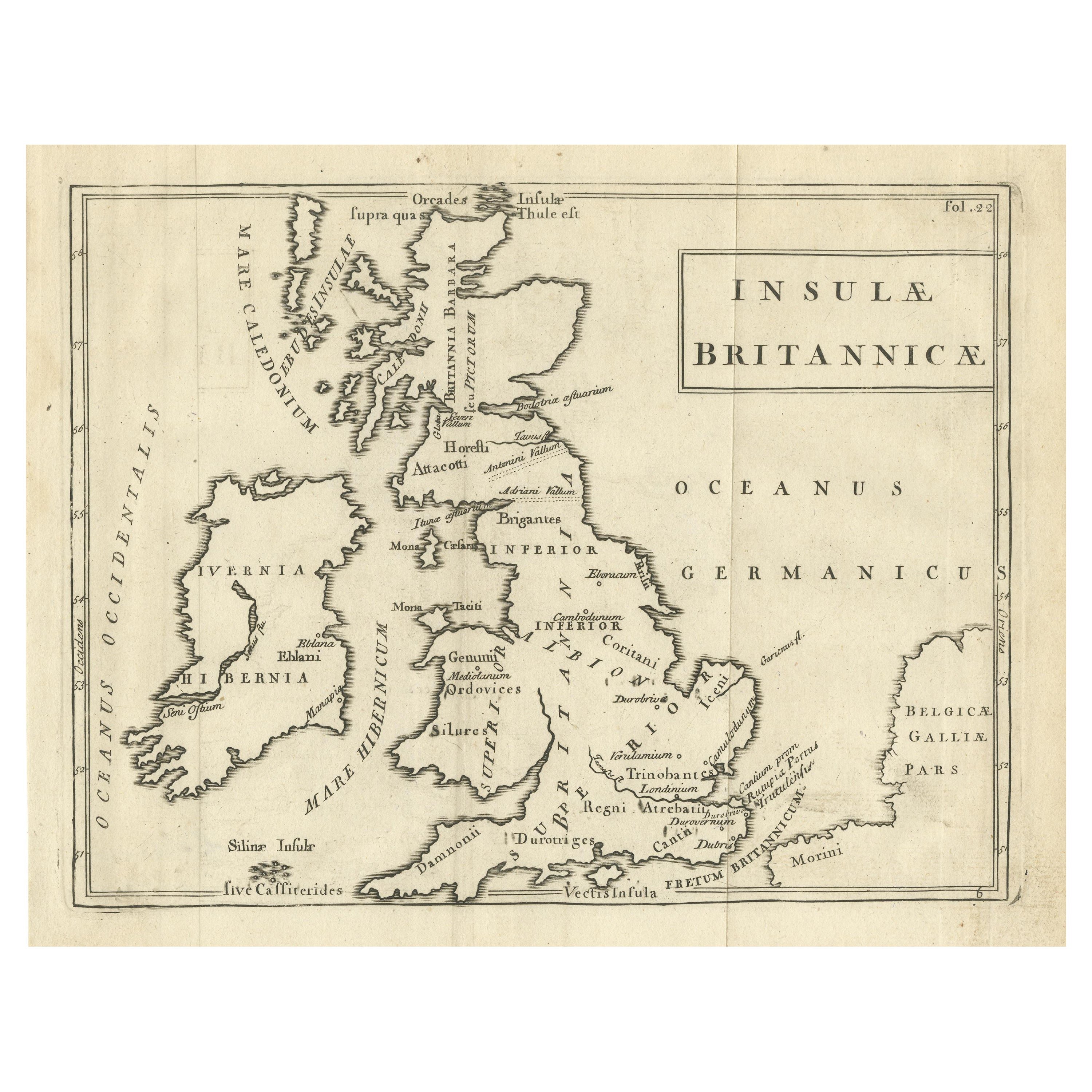
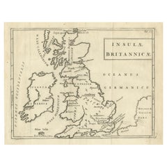
- Antique Map of the British Isles with Walls, Settlements and Other FeaturesLocated in Langweer, NLAntique map titled 'Insulae Britannicae'. Interesting map of Britain, Scotland, and Ireland. It shows a rudimentary outline of the islands according to the geography of the Roman Emp...Category
Antique Late 18th Century Maps
MaterialsPaper
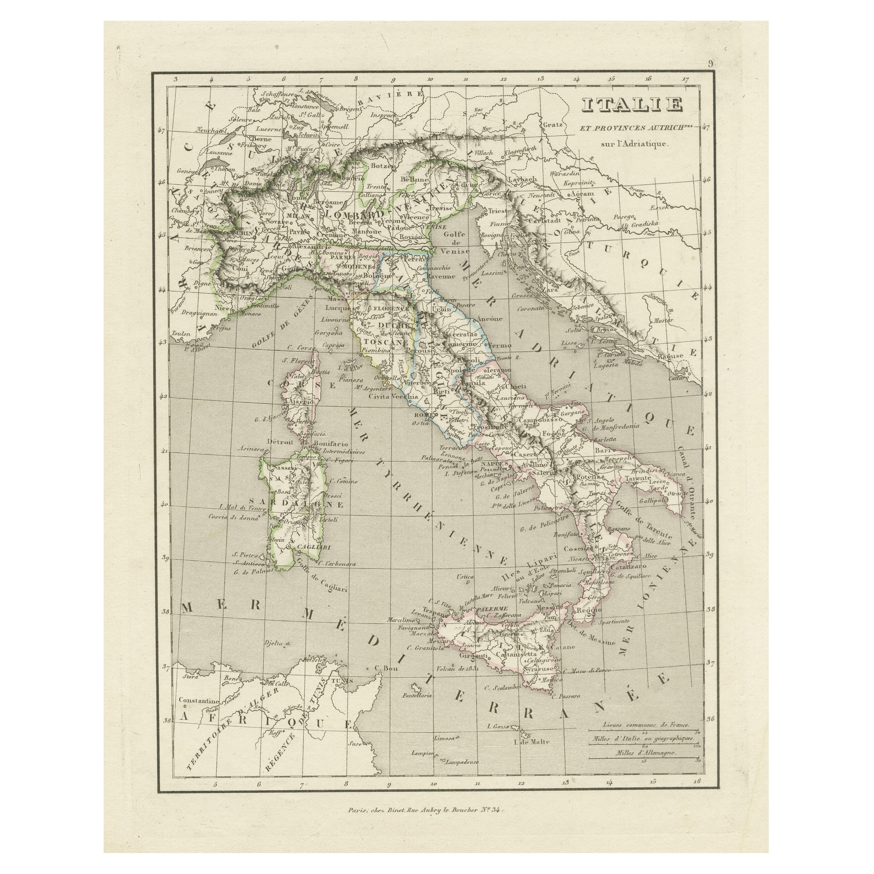
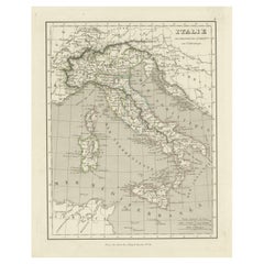
- Antique Map of Italy and Other Regions Near the Adriatic SeaLocated in Langweer, NLAntique map titled 'Italie et Provinces Autrichnes sur l'Adriatique'. Original old map of Italy and surroundings. Also shows Sicily and Sardinia. Ori...Category
Antique Mid-19th Century Maps
MaterialsPaper
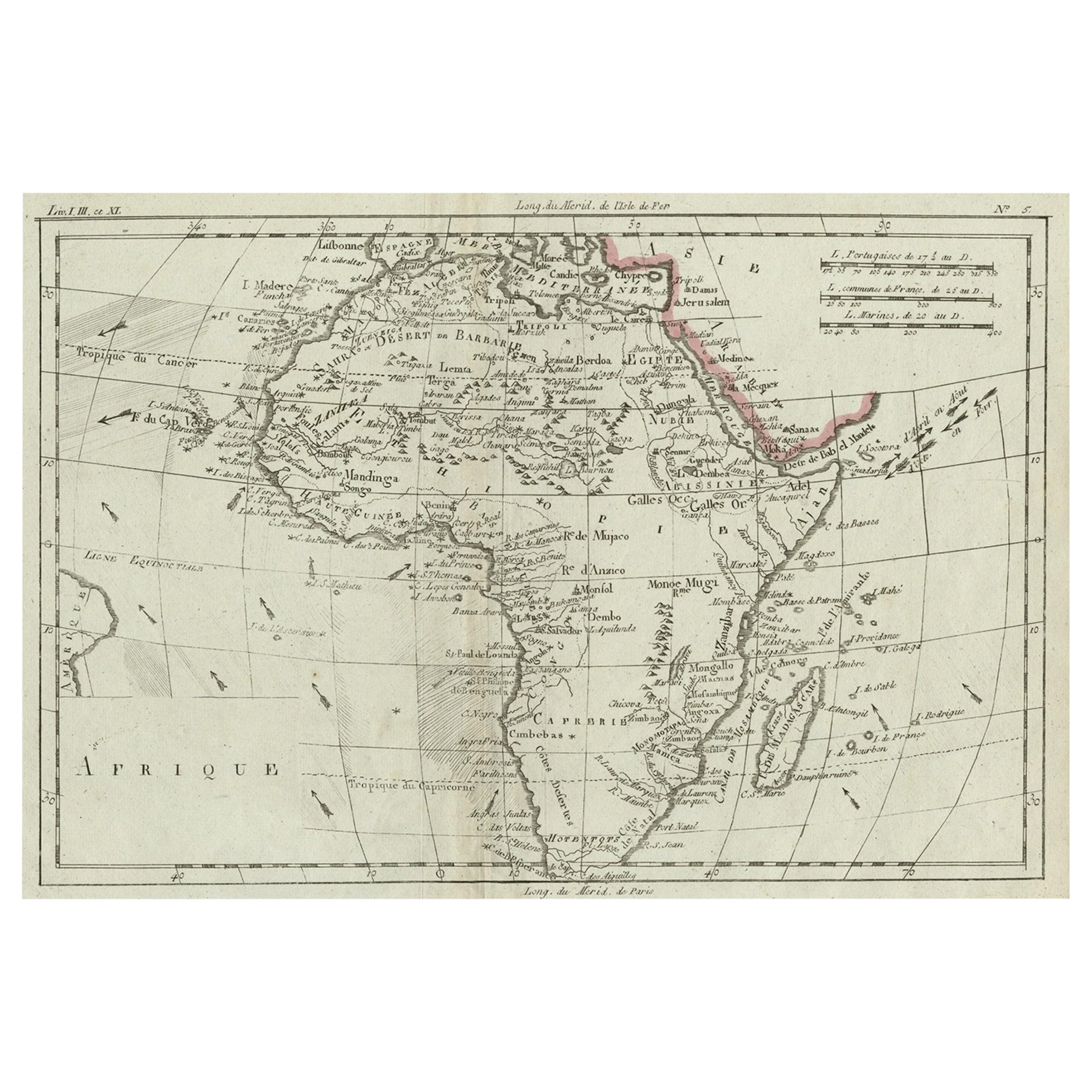
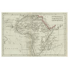
- Antique Map of Africa with Ocean Currents and Other Details, C.1780Located in Langweer, NLAntique map titled 'Afrique.' Detailed map of Africa, showing towns, rivers, some topographical features, ocean currents, ports and political boundaries. Source unknown, to be determ...Category
Antique 18th Century Maps
MaterialsPaper
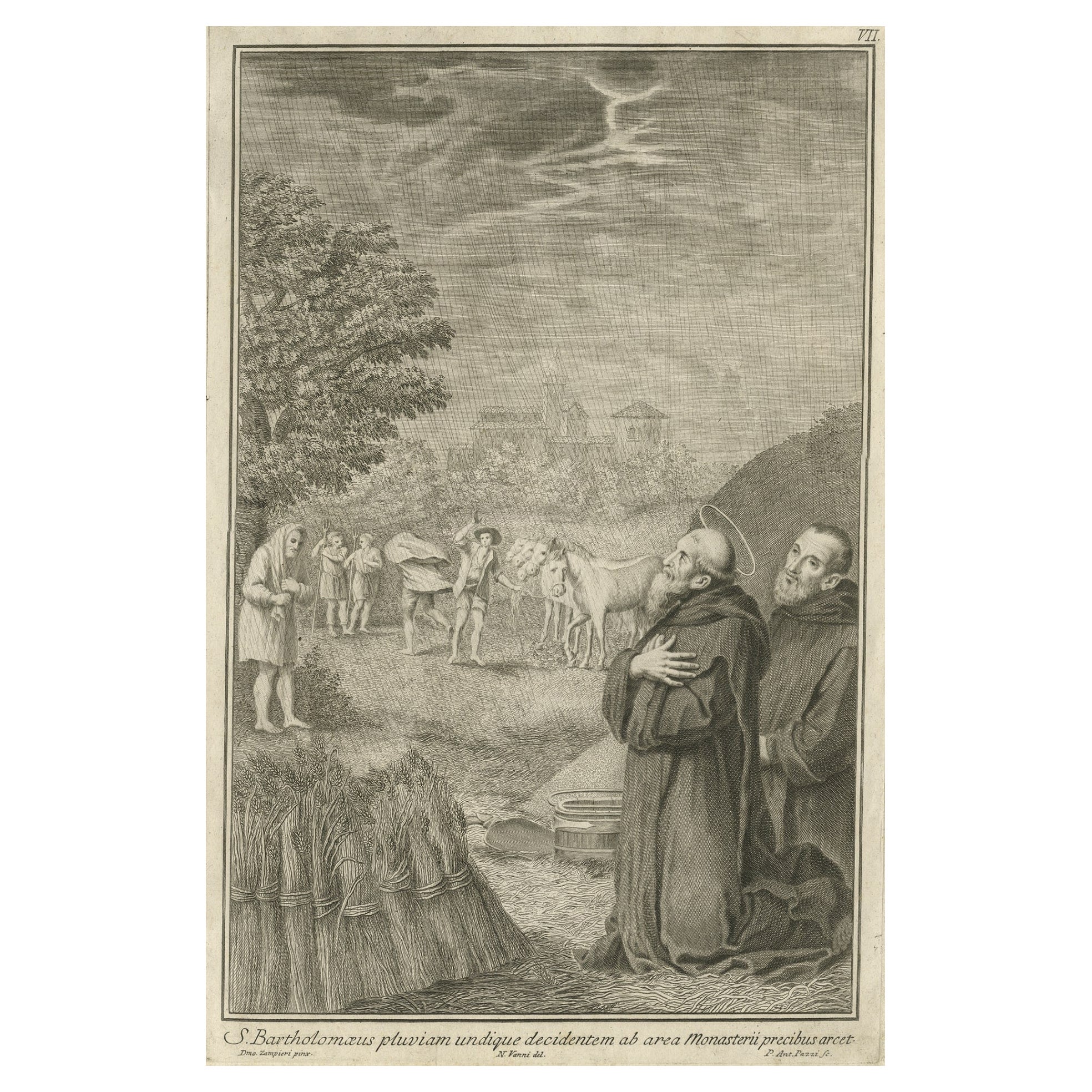
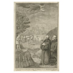
- Antique Print of Bartholomew the Apostle, 1762By Pietro Antonio PazziLocated in Langweer, NLAntique print titled 'S. Bartholomaeus pluvian undique decidentem ab area Monasterii precibus arcet'. Scarce plate showing Bartholomew the Apostle in the ...Category
Antique 18th Century Prints
MaterialsPaper
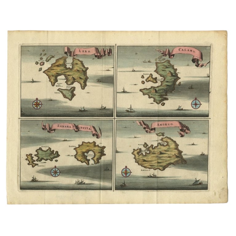
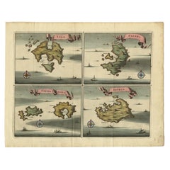
- Original Antique Map of Leros and Kalimnos, and other islands, Greece, 1687Located in Langweer, NLAntique map titled 'Lero, Calamo, Zanara e Levita, Amorgo.' heet with four maps on one page showing the islands Leros, Kalimnos, and other islands, Greece. Source unknown, to be de...Category
Antique 17th Century Maps
MaterialsPaper
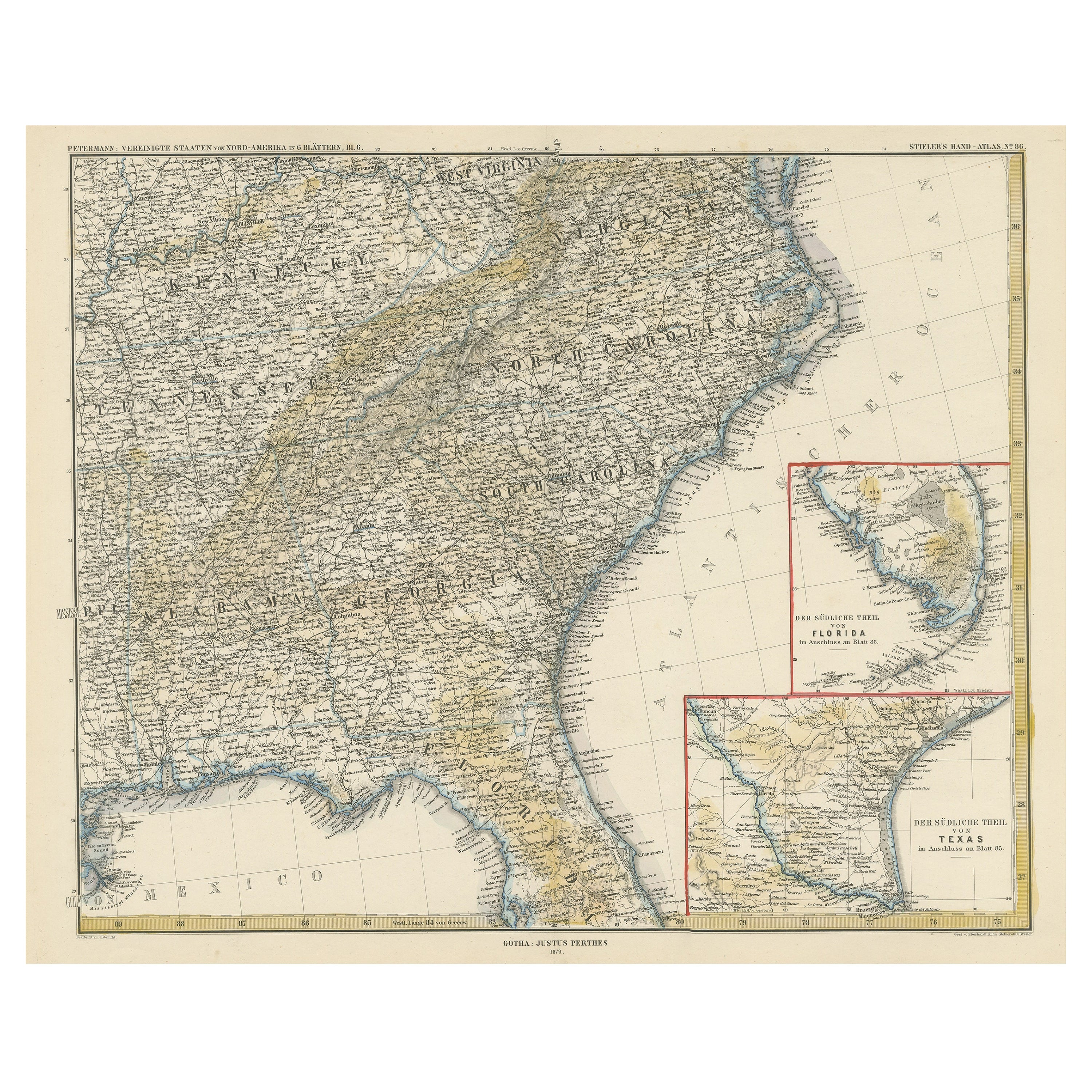
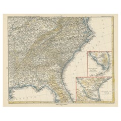
- Antique Map of the Region of Georgia with Inset Maps of Florida and TexasLocated in Langweer, NLAntique map of part of the United States showing Alabama, Georgia, North Carolina, South Carolina, Tennessee, Kentucky, Virginia and part of Florida. With inset maps of the southern ...Category
Antique Late 19th Century Maps
MaterialsPaper
You May Also Like
- Map of the Republic of GenoaLocated in New York, NYFramed antique hand-coloured map of the Republic of Genoa including the duchies of Mantua, Modena, and Parma. Europe, late 18th century. Dimension: 25...Category
Antique Late 18th Century European Maps
- Map "Estuary- Mouth of the Thames"Located in Alessandria, PiemonteST/426 - Antique French Map of the estuary of the Thames, map dated 1769 - "Mape of the entrance of the Thames. Designed by filing of Navy cards fo...Category
Antique Mid-18th Century French Other Prints
MaterialsPaper
- Vintage "View of the Center of Paris Taken from the Air" Lithograph MapLocated in San Diego, CAA very stylish "View of the Center of Paris Taken from the Air" lithograph map published by the Paris Ministry of Tourism, circa early 1950s. The piece measures 27" x 43" and shows...Category
20th Century French Mid-Century Modern Prints
MaterialsPaper
- New Map of North America from the Latest Discoveries, 1763Located in Philadelphia, PAA fine antique 18th century map of the North American seaboard. Entitled "A New Map of North America from the Latest Discoveries 1763". By the Cartographer/Engraver - John Spil...Category
Antique Mid-18th Century English Georgian Maps
MaterialsPaper
- Original Antique Map of The World by Thomas Clerk, 1817Located in St Annes, LancashireGreat map of The Eastern and Western Hemispheres On 2 sheets Copper-plate engraving Drawn and engraved by Thomas Clerk, Edinburgh. Published by Mackenzie And Dent, 1817 ...Category
Antique 1810s English Maps
MaterialsPaper
- The Kingdom of Naples and Southern Italy: A Hand-Colored 18th Century Homann MapBy Johann Baptist HomannLocated in Alamo, CA"Novissima & exactissimus Totius Regni Neapolis Tabula Presentis Belli Satui Accommo Data" is a hand colored map of southern Italy and the ancient Kingdom of Naples created by Johann...Category
Antique Early 18th Century German Maps
MaterialsPaper


