Items Similar to Antique 18th Century Map of the Province of Pensilvania 'Pennsylvania State'


Want more images or videos?
Request additional images or videos from the seller
1 of 12
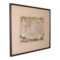
Antique 18th Century Map of the Province of Pensilvania 'Pennsylvania State'
$1,250
£955.69
€1,100.76
CA$1,751.63
A$1,955.53
CHF 1,024.67
MX$23,937.65
NOK 13,013.32
SEK 12,269.91
DKK 8,215.11
About the Item
A fine antique of the colony of Pennsylvania.
Noted at the top of the sheet as a 'Map of the province of Pensilvania'.
This undated and anonymous map is thought to be from the Gentleman's Magazine, London, circa 1775, although the general appearance could date it to the 1760's.
The southern boundary reflects the Mason-Dixon survey (1768), the western boundary is placed just west of Pittsburgh, and the northern boundary is not marked.
The map has a number of reference points that likely refer to companion text and appear to be connected to boundaries. The western and southern boundaries are marked Q, R, S, for example. A diagonal line runs from the Susquehanna R to the Lake Erie P. A broken line marked by many letters A, B, N, O, etc., appears in the east.
There are no latitude or longitude markings, blank verso.
Framed in a shaped contemporary gilt wooden frame and matted under a cream colored matte.
Bearing an old Graham Arader Gallery label to the reverse.
Simply a great map of pre-Statehood Pennsylvania!
Date:
circa 1775
Overall Condition:
It is in overall good, as-pictured, used estate condition.
Condition Details:
There is some toning throughout and what appears to be a small spot of staining to the matte at about 10 o'clock.
It has not been observed outside the frame.
Otherwise, there are other signs of expected light wear consistent with age to the frame.
Measurements:
Height: 10 1/4 in.
Width: 13 1/4 in
Depth: 1/2 in.
Sight Height: ca. 4 1/2 in.
Sight Width: ca. 7 1/2 in.
Items purchased from this dealer must delight you. Purchases may be returned for any reason for a period of 7 days.
- Dimensions:Height: 10.25 in (26.04 cm)Width: 13.25 in (33.66 cm)Depth: 0.5 in (1.27 cm)
- Style:American Colonial (Of the Period)
- Materials and Techniques:
- Place of Origin:
- Period:
- Date of Manufacture:18th Century
- Condition:Wear consistent with age and use. There is some toning throughout and what appears to be a small spot of staining to the matte at about 10 o'clock. It has not been observed outside the frame. Otherwise, there are other signs of expected light wear consistent with age to the frame.
- Seller Location:Philadelphia, PA
- Reference Number:Seller: DSA INV BH S221stDibs: LU1610230937552
About the Seller
5.0
Gold Seller
Premium sellers maintaining a 4.3+ rating and 24-hour response times
Established in 1996
1stDibs seller since 2015
536 sales on 1stDibs
Typical response time: 1 hour
- ShippingRetrieving quote...Shipping from: Philadelphia, PA
- Return Policy
Authenticity Guarantee
In the unlikely event there’s an issue with an item’s authenticity, contact us within 1 year for a full refund. DetailsMoney-Back Guarantee
If your item is not as described, is damaged in transit, or does not arrive, contact us within 7 days for a full refund. Details24-Hour Cancellation
You have a 24-hour grace period in which to reconsider your purchase, with no questions asked.Vetted Professional Sellers
Our world-class sellers must adhere to strict standards for service and quality, maintaining the integrity of our listings.Price-Match Guarantee
If you find that a seller listed the same item for a lower price elsewhere, we’ll match it.Trusted Global Delivery
Our best-in-class carrier network provides specialized shipping options worldwide, including custom delivery.More From This Seller
View AllAntique Map of Virginia & the Chesapeake Bay by Jacques-Nicolas Bellin, c. 1750
By Jacques-Nicolas Bellin
Located in Philadelphia, PA
A fine antique 18th century French map of North America.
By Jacques-Nicolas Bellin.
On laid paper with polychrome highlights.
Depicting Virginia, the Chesapeake Bay, and the nearb...
Category
Antique 18th Century French Baroque Maps
Materials
Paper

New Map of North America from the Latest Discoveries, 1763
Located in Philadelphia, PA
A fine antique 18th century map of the North American seaboard.
Entitled "A New Map of North America from the Latest Discoveries 1763".
By the Cartographer/Engraver - John Spil...
Category
Antique Mid-18th Century English Georgian Maps
Materials
Paper

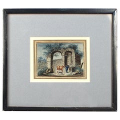
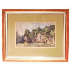
Antique Late 18th-Early 19th Century English Watercolor Painting of Ruins
Located in Philadelphia, PA
Offered here for your consideration is an antique watercolor painting on laid paper.
It depicts a cowherd with a cow and sheep at a water trough by ancient architectural ruins. Th...
Category
Antique Early 19th Century European Georgian Paintings
Materials
Paint, Paper
Antique 19th C English Watercolor View of Rievaulx Abbey
By William Turner
Located in Philadelphia, PA
A fine antique English watercolor landscape painting.
Depicting the ruins of Rievaulx Abbey in England circa July 1881.
Pencil signed to the lower right: Rievaulx Abbey July 1881
...
Category
Antique 1880s English Romantic Paintings
Materials
Paint, Paper
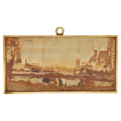
Small Grand Tour Pietra Paesina (Ruin Marble) Bronze Mounted Plaque or Curio
Located in Philadelphia, PA
A fine Grand Tour plaque or curio.
With a pietra paesina or ruin / ruiniform marble form plaque mounted in a gilt bronze frame with an integral bail...
Category
Antique 19th Century Italian Grand Tour Models and Miniatures
Materials
Stone, Marble, Bronze
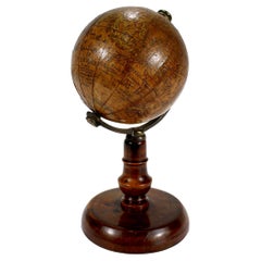
Antique 19th Century Miniature French Edition Globe by C. Abel-Klinger
By C. Abel-Klinger
Located in Philadelphia, PA
A fine antique French Edition miniature globe.
By C. Abel-Klinger.
On a turned wooden stand with an uncalibrated brass half meridian.
The globe is marked with an integral l...
Category
Antique 19th Century German Neoclassical Maps
Materials
Paper
You May Also Like
Antique County Map, Surrey, English, Framed Lithograph, Cartography, Victorian
Located in Hele, Devon, GB
This is an antique lithography map of Surrey. An English, framed atlas engraving of cartographic interest, dating to the mid 19th century and later.
Superb lithography of Surrey an...
Category
Antique Mid-19th Century British Victorian Maps
Materials
Paper
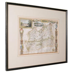
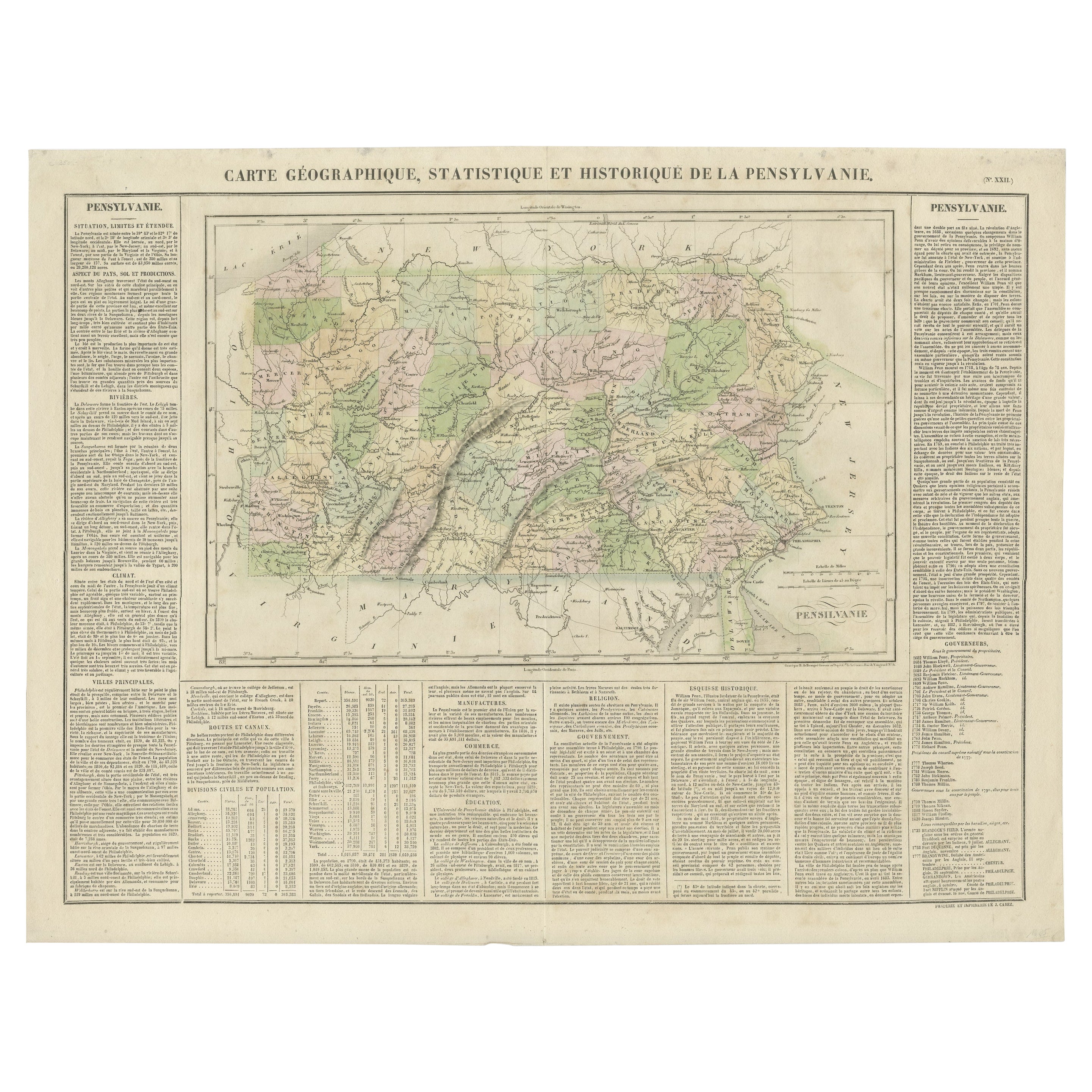
Original Antique Map of Pennsylvania Showing Interesting Statistics Etc, 1825
Located in Langweer, NL
Attractive map of Pennsylvania with bordercoloring of the county and showing the various towns, roads, rivers, bridges, and a host of other details...
Category
Antique 1820s Maps
Materials
Paper
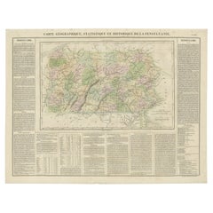
$330 Sale Price
20% Off
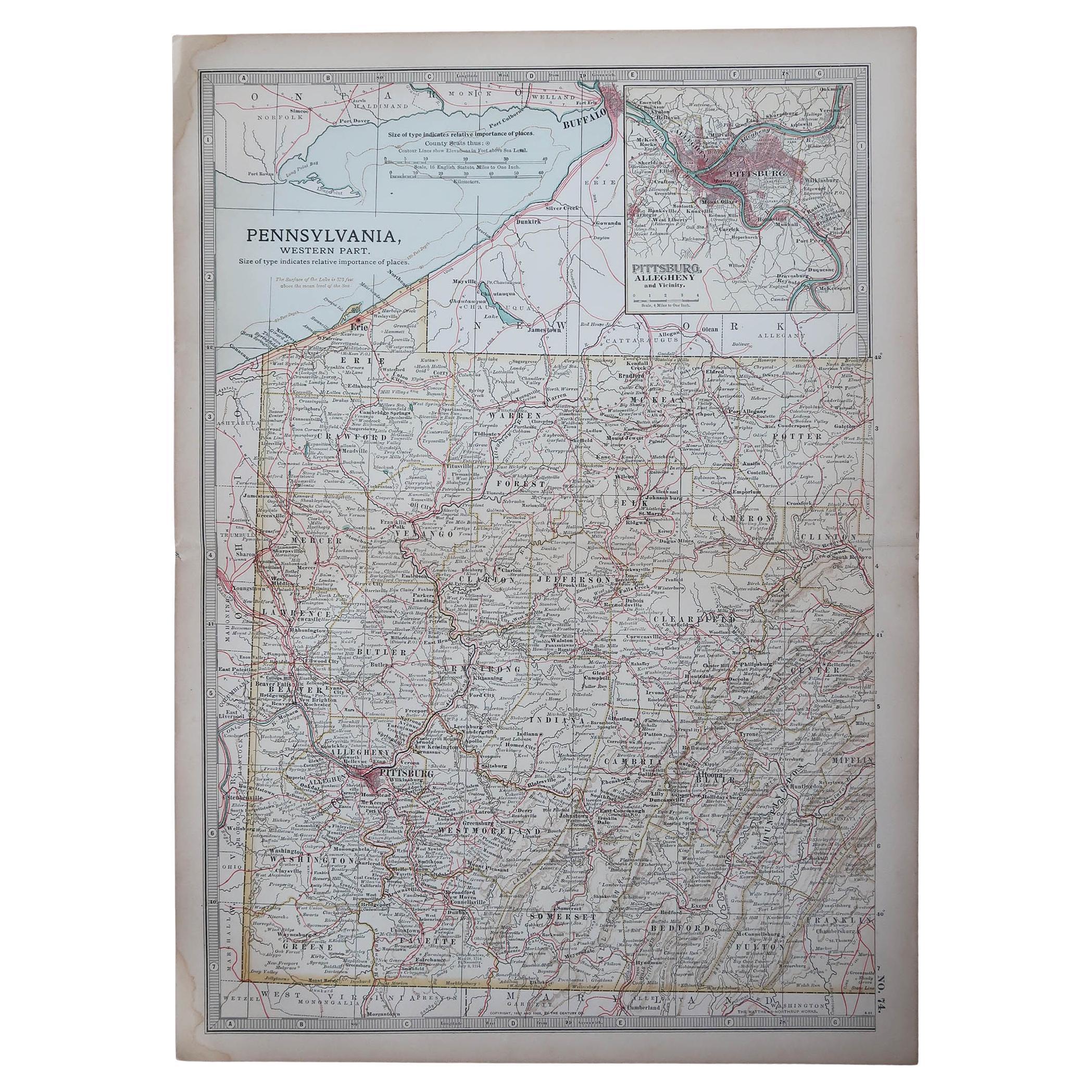
Original Antique Map of the American State of Pennsylvania( Western Part ), 1903
Located in St Annes, Lancashire
Antique map of Pennsylvania ( Western part )
Published By A & C Black. 1903
Original colour
Good condition
Unframed.
Free shipping
Category
Antique Early 1900s English Maps
Materials
Paper

Framed 17th Century Map of Cumberland, England by John Speed, 1610
By John Speed
Located in Middleburg, VA
A fascinating and richly detailed antique map of Cumberland County in northwest England, drawn and published by the celebrated English cartographer John Spe...
Category
Antique Early 17th Century English British Colonial Maps
Materials
Copper, Gold Leaf

1796 Map of North Carolina by John Reid
Located in Chapel Hill, NC
1796 Map of North Carolina by John Reid. A rare & important early map of the state based on the 1795 Lewis/Carey map for his "An American Atlas". Engraved by Benjamin Tanner. Old pur...
Category
Antique Late 18th Century American Prints
Materials
Paper

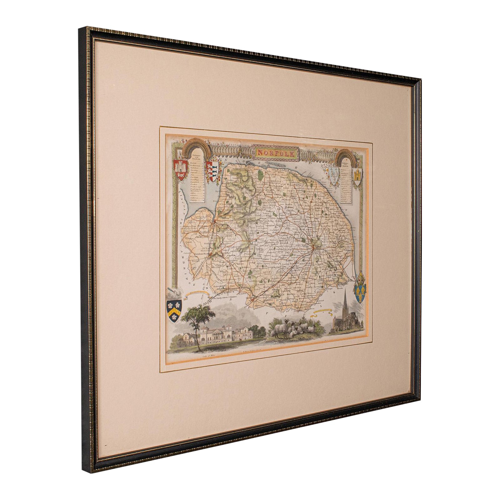
Antique County Map, Norfolk, English, Framed Lithography, Cartography, Victorian
Located in Hele, Devon, GB
This is an antique lithography map of Norfolk. An English, framed atlas engraving of cartographic interest, dating to the mid 19th century and later.
Superb lithography of Norfolk a...
Category
Antique Mid-19th Century British Victorian Maps
Materials
Glass, Wood
More Ways To Browse
Antique American 18th Century Furniture
18th Century American Antiques
Southern Colonial
Antique Colonial Signs
American Colonial Furniture 18th Century
Gallery Clock
R And A Clocks
Gallery B R
R A Clock Antique
Antique Clock Labels
Old Colony Furniture
Colonial Clock
Antiques Antique Clocks United Kingdom
Masons Clock
Cham Antiques
Antique Furniture Trinidad
Cornwall Map
Marie Galante