American Colonial Maps
2
to
2
2
2
2
51
34
16
9
7
6
5
4
4
2
1
1
1
1
1
2
1
1
1
1
Style: American Colonial
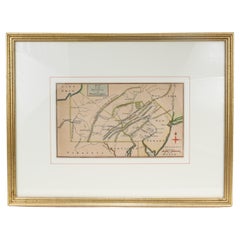
Antique 18th Century Map of the Province of Pensilvania 'Pennsylvania State'
Located in Philadelphia, PA
A fine antique of the colony of Pennsylvania.
Noted at the top of the sheet as a 'Map of the province of Pensilvania'.
This undated and anonymous map is thought to be from the Gentleman's Magazine, London, circa 1775, although the general appearance could date it to the 1760's.
The southern boundary reflects the Mason-Dixon survey (1768), the western boundary is placed just west of Pittsburgh, and the northern boundary is not marked.
The map has a number of reference points that likely refer to companion text and appear to be connected to boundaries. The western and southern boundaries are marked Q, R, S, for example. A diagonal line runs from the Susquehanna R to the Lake Erie P. A broken line marked by many letters A, B, N, O, etc., appears in the east.
There are no latitude or longitude markings, blank verso.
Framed in a shaped contemporary gilt wooden frame and matted under a cream colored matte.
Bearing an old Graham Arader Gallery...
Category
18th Century British Antique American Colonial Maps
Materials
Paper
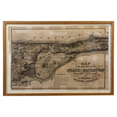
1868 Map of the Upper Part of the Island of Manhattan Above 86th Street
Located in San Francisco, CA
This wonderful piece of New York City history is over 150 years old. It depicts 86th street and above. It was lithographed by WC Rogers and company. It was made to show what was the Battle of Harlem during the Revolutionary war...
Category
1860s American Antique American Colonial Maps
Materials
Paper
Related Items
Pair 19th Century Victorian Eastlake Free Mason Throne Chairs w/ Symbolism
Located in Savannah, GA
Victorian Eastlake large upholstered solid oak throne chairs from Masonic Lodge with lots of detailed carving. The pair consists of one with the plumb bob sy...
Category
1880s American Antique American Colonial Maps
Materials
Velvet, Oak
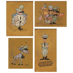
Dutch WWII Caricatures of Hitler, Göring, Stalin, Rooseveld, and Churchill
By Guust
Located in Haarlem, NL
A very remarkable collection of Folk Art caricatures made of Dutch ration 'food stamps.'
First caricature portrays a fat Hermann Go¨ring holding a cerem...
Category
Mid-20th Century Dutch American Colonial Maps
Materials
Paper
H 19.69 in W 12.6 in D 0.79 in
46-Star American Flag, Antique Printed on Silk, Early 20th Century
Located in Colorado Springs, CO
This is an original 46-star American parade flag, printed on silk. Each star represents a state in the Union at the time. The official flag design would update every July 4th, to inc...
Category
Early 1900s American Antique American Colonial Maps
Materials
Silk
Antique American Flag w/ Hand-Written Inscriptions Mourning the Death of FDR
Located in York County, PA
48 STARS ON ANTIQUE AMERICAN FLAG WITH HAND-WRITTEN INSCRIPTIONS AND AN EMBROIDERED DATE OF APRIL 12TH, 1945, MOURNING THE DEATH OF PRESIDENT FRANKLIN DELANO ROOSEVELT:
American national parade flag with 48 stars, printed on cotton, embellished with hand-written inscriptions and an embroidered date to commemorate the death of FDR on April 12th, 1945.
“On this day in 1945, President Franklin D. Roosevelt died of a massive cerebral hemorrhage at his Warm Springs, Georgia, retreat at the age of 63. Roosevelt’s death in the final months of World War II was met with shock and grief throughout the Western world. Many Americans had no inkling of his decline in health. [He] had been president for more than 12 years, longer than any other person. He led the country through some of its greatest domestic and foreign crises to the impending defeat of Nazi Germany and within sight of Japan’s surrender...
Category
1940s American Vintage American Colonial Maps
Materials
Cotton
H 19.5 in W 25.5 in D 2.5 in
Antique Hand-Carved Meerschaum Smoking Pipe of Napoleon Bonaparte & Case
Located in Hamilton, Ontario
This antique well executed hand-carved meerschaum pipe was made by the Drown Pipe company of Vienna Austria and dates to approximately 1900 and done in a Renasissance Revival style. ...
Category
Early 20th Century Austrian American Colonial Maps
Materials
Clay
Large Civil War recruitment Broadside for the 53rd New York Volunteer Infantry
Located in York County, PA
LARGE CIVIL WAR RECRUITMENT BROADSIDE FOR THE 53RD NEW YORK VOLUNTEER INFANTRY, 5th REGIMENT, "EAGLE BRIGADE," WITH AN ATTRACTIVE AND COMPELLING ...
Category
1860s American Antique American Colonial Maps
Materials
Paper
H 48.5 in W 34.5 in D 2.5 in
Antique Miniature Map of the Roman Province of Illyricum 'Dalmatia'
Located in Langweer, NL
Antique miniature map titled 'Illyricum'. Original small map of Illyricum. The Roman province of Illyricum stretched from the Drilon River (the Drin, in...
Category
Early 17th Century Antique American Colonial Maps
Materials
Paper
Antique Federal Eagle American 50 Star Flag with Brass Eagle Pole, 19th Century
Located in Oklahoma City, OK
Monumental 50 star American Flag with antique Federal Eagle brass and wood pole. A patriotic piece suitable for any home. This set includes both ...
Category
19th Century American Antique American Colonial Maps
Materials
Brass, Bronze
H 66 in W 69 in D 1.25 in
Suffragette Plate, "Deeds Not Words" & "Votes for Women", The Only Known Example
Located in York County, PA
ENGLISH PORCELAIN SUFFRAGETTE PLATE WITH "DEEDS, NOT WORDS" AND "VOTES FOR WOMEN" SLOGANS, ONE-OF-A-KIND AMONG KNOWN EXAMPLES, CA 1905-1918
English porcelain plate, made for the Wo...
Category
Early 20th Century English American Colonial Maps
Materials
Porcelain
H 10 in W 10 in D 3 in
Printed Linen Kerchief of George Washington, ca 1806, Germantown, PA
Located in York County, PA
Extraordinarily early (1806) printed linen kerchief glorifying George Washington, Germantown print works, Germantown, Pennsylvania
Printed in sepia ink on coarse, white linen, this patriotic kerchief shows a standing portrait of George Washington, above which is a swag valance and the words “The Effect of Principle, Behold the Man”. The portrait is based on a mezzotint after Gilbert Stuart’s very famous painting of Washington in his later years. Stuart painted it in oil on canvas for a wealthy merchant by the name of William Constable, who commissioned the work for Alexander Hamilton.
The kerchief is interesting because it is both American-made and documented. This is exceptionally unusual for any printed textile of the 19th century or prior and the earlier the time period the more unlikely an object is to be identified. This kerchief and a companion piece entitled “The Love of Truth Mark the Boy” (also glorifying Washington through the fabled story of the cherry tree), were made ca 1806 by Germantown Print Works in Germantown, Pennsylvania.
To the left of Washington's image is a portion of his infamous farewell address to his troops at the end of the Revolutionary War. To the right is a short excerpt from his eulogy. Below these are three images. In the center is a square-rigged tall ship with “Commercial Union” above it, flanked by the American eagle on the left and the British lion...
Category
Early 19th Century American Antique American Colonial Maps
Materials
Linen
19th c Wooden Ceremonial Fraternal Masonic Crook and Metal Spear on Metal Bases
Located in Savannah, GA
Large size gold gilt wooden ceremonial fraternal Masonic Crook perched on a long painted wooden pole. Supported by a decorative three-footed metal base, the gilt wood crook itself me...
Category
1890s American Antique American Colonial Maps
Materials
Metal
H 75 in W 5 in D 10 in
Souvenir of the War 1914-15-16-17-18 Banner
Located in Colorado Springs, CO
Presented is a stunning textile banner from the first World War, dating to 1918. The square tan cotton cloth is embroidered with two crossed flags, the ...
Category
1910s Australian Vintage American Colonial Maps
Materials
Cotton
American Colonial maps for sale on 1stDibs.
Find a broad range of unique American Colonial maps for sale on 1stDibs. Many of these items were first offered in the 19th Century, but contemporary artisans have continued to produce works inspired by this style. If you’re looking to add vintage maps created in this style to your space, the works available on 1stDibs include more furniture and collectibles, folk art, wall decorations and other home furnishings, frequently crafted with paper and other materials. If you’re shopping for used American Colonial maps made in a specific country, there are Europe, North America, and United Kingdom pieces for sale on 1stDibs. It’s true that these talented designers have at times inspired knockoffs, but our experienced specialists have partnered with only top vetted sellers to offer authentic pieces that come with a buyer protection guarantee. Prices for maps differ depending upon multiple factors, including designer, materials, construction methods, condition and provenance. On 1stDibs, the price for these items starts at $475 and tops out at $1,250 while the average work can sell for $863.
Recently Viewed
View AllMore Ways To Browse
Sea Chart Map
Antique Classroom
Antique Nautical Map
Antique Mexican Maps
Antique Map Box
Antique Nautical Maps
Mexican Antique Map
Antique Nautical Charts
King Charles I Of England
17th Century Corpus
Antique Celestial Maps
Antique Celestial Map
Celestial Maps Antique
Antique Map Middle East
Vintage Wooden Roller
Middle East Antique Map
Topographical Plate
Central America Map


