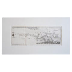
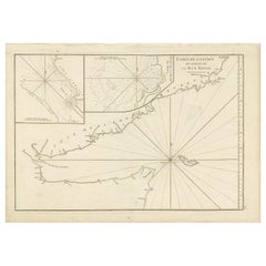
Antique Italian Map of Viaggio da Roma a Napoli 1775
View Similar Items


Want more images or videos?
Request additional images or videos from the seller
1 of 6
Antique Italian Map of Viaggio da Roma a Napoli 1775
Price:$596.89
About the Item
- Dimensions:Height: 5.91 in (15 cm)Width: 14.18 in (36 cm)Depth: 0.04 in (1 mm)
- Materials and Techniques:Parchment Paper,Etched
- Place of Origin:
- Period:1770-1779
- Date of Manufacture:1775
- Condition:
- Seller Location:Florence, IT
- Reference Number:1stDibs: LU8425236318272
About the Seller
5.0
Gold Seller
Premium sellers maintaining a 4.3+ rating and 24-hour response times
Established in 2019
1stDibs seller since 2023
45 sales on 1stDibs
Authenticity Guarantee
In the unlikely event there’s an issue with an item’s authenticity, contact us within 1 year for a full refund. DetailsMoney-Back Guarantee
If your item is not as described, is damaged in transit, or does not arrive, contact us within 7 days for a full refund. Details24-Hour Cancellation
You have a 24-hour grace period in which to reconsider your purchase, with no questions asked.Vetted Professional Sellers
Our world-class sellers must adhere to strict standards for service and quality, maintaining the integrity of our listings.Price-Match Guarantee
If you find that a seller listed the same item for a lower price elsewhere, we’ll match it.Trusted Global Delivery
Our best-in-class carrier network provides specialized shipping options worldwide, including custom delivery.More From This Seller
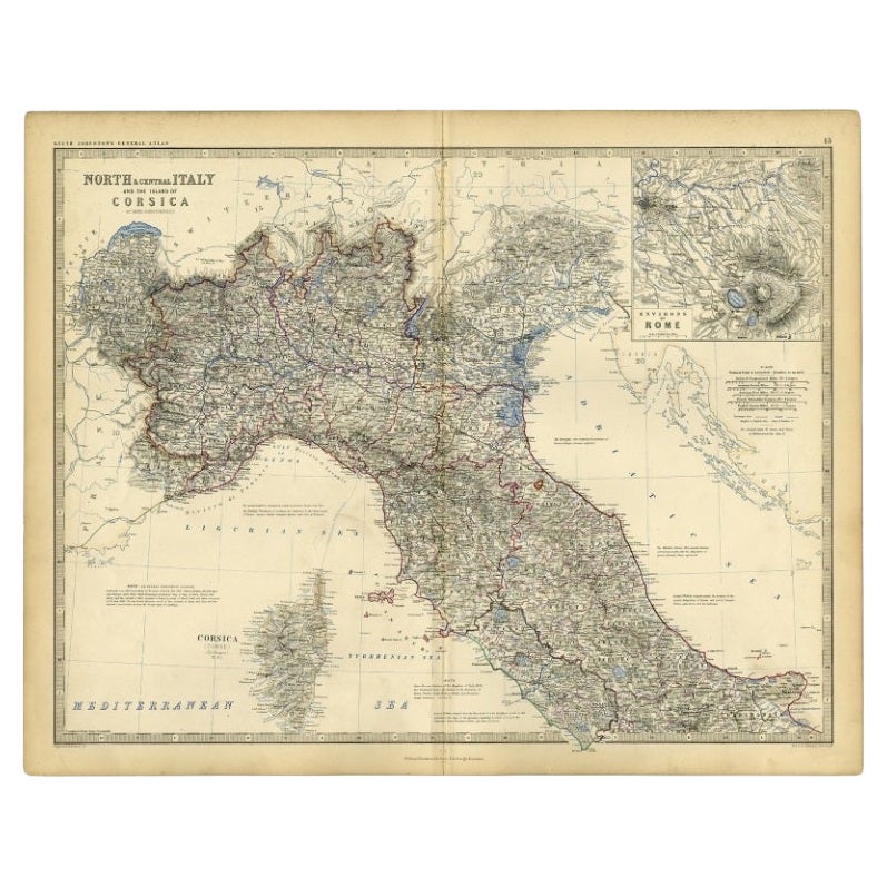
View AllItalian Parchment Map of the City of Pisa Dated, 1640
By Matthäus Merian the Elder
Located in Florence, Tuscany
An antique map of the Tuscan city of Pisa engraved for The 'Itinerarium Italiæ Nov-antiquæ' by Matthäus Merian the Elder and printed in 1640....
Category
Antique 1640s Italian Maps
Materials
Paper

Set of 4 1970s Italian Vintage Christmas Baubles
Located in Florence, Tuscany
A set of four beautifully coloured 1960s/1970s vintage glass Christmas tree baubles. These pieces are incredibly colourful and fragile.
D...
Category
Vintage 1970s Toys and Dolls
Materials
Art Glass

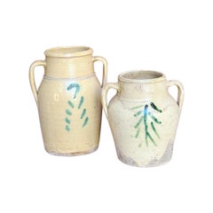
Pair of 1930s Italian Tree of Life Pots with Handles
Located in Florence, Tuscany
A pair of rustic pots with tree of life decorations adorning the front. These pots were made in the early 1900s and used for storing water and wine. The tree of life symbolises good ...
Category
Vintage 1930s Italian Pottery
Materials
Ceramic
1970s Set of Three Minitaure Italian Vases
Located in Florence, Tuscany
A delightful set of 1970s miniature vases. The largest vase is in lilac and the two smaller in pale blue glass with original sticker still in place. All in good condition.
Dimension...
Category
Vintage 1970s Italian Vases
Materials
Crystal

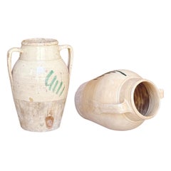
Pair of 1930s Italian Tree of Life Pots with Handles (Large)
Located in Florence, Tuscany
A pair of rustic pots with tree of life decorations adorning the front. These pots were made in the early 1900s and used for storing water and wine. The tree of life symbolises good ...
Category
Vintage 1930s Italian Pottery
Materials
Ceramic
Three 1930s Italian Tree of Life Ceramic Pots
Located in Florence, Tuscany
Three rustic pots with tree of life decorations adorning the front. These pots were made in the early 1900s and used for storing grains and pulses. The tree of life symbolises good f...
Category
Vintage 1930s Italian Pottery
Materials
Ceramic

You May Also Like
Antique Map of South America by J. Cook, 1775
Located in Langweer, NL
Antique map titled 'Kaart van het Zuidlyk Eind van Amerika'. Map of the sourthern part of South America, focusing on Cook's tracks around the Cape Horn and T...
Category
Antique Mid-18th Century Maps
Materials
Paper

$811 Sale Price
20% Off
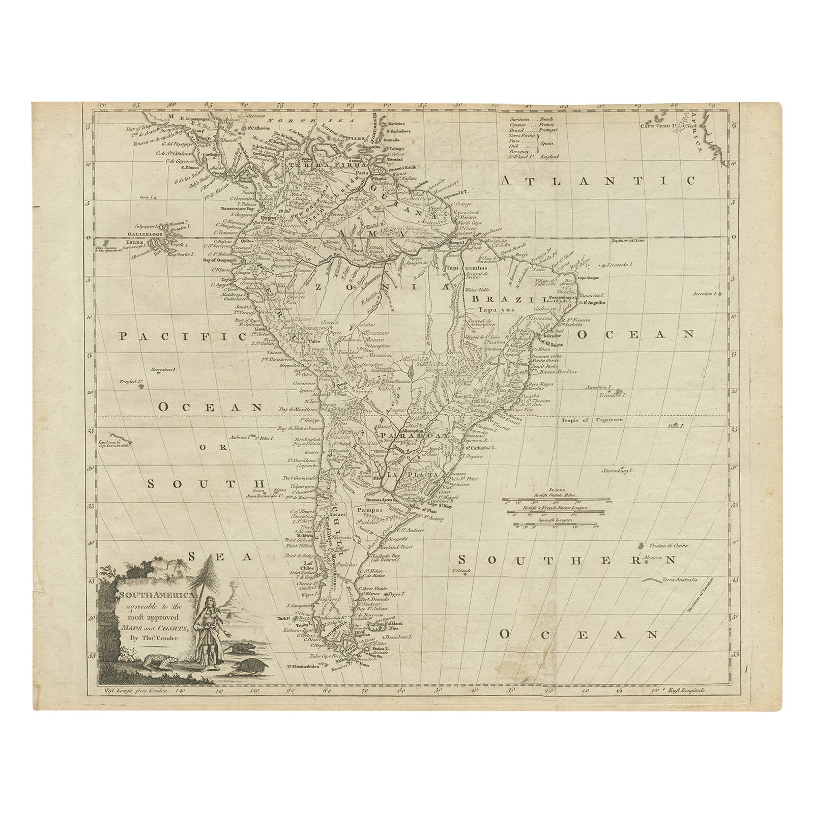
Antique Map of South America by Conder, c.1775
Located in Langweer, NL
Antique map titled 'South America agreeable to the most approved maps and charts'. Rare map of South America depicting Chili, La Plata, Paraguay, Brazil, Peru, the Amazon and surroun...
Category
Antique 18th Century Maps
Materials
Paper

$331 Sale Price
20% Off
Antique Map of South America by J. Cook (1775)
Located in Langweer, NL
Antique map titled 'Kaart van het Zuidlyk Eind van Amerika'. Map of the sourthern part of South America, focusing on Cook's tracks around the Cape Horn and Tierra del Fuego in 1775. ...
Category
Antique Late 18th Century Maps
Materials
Paper

$563 Sale Price
20% Off
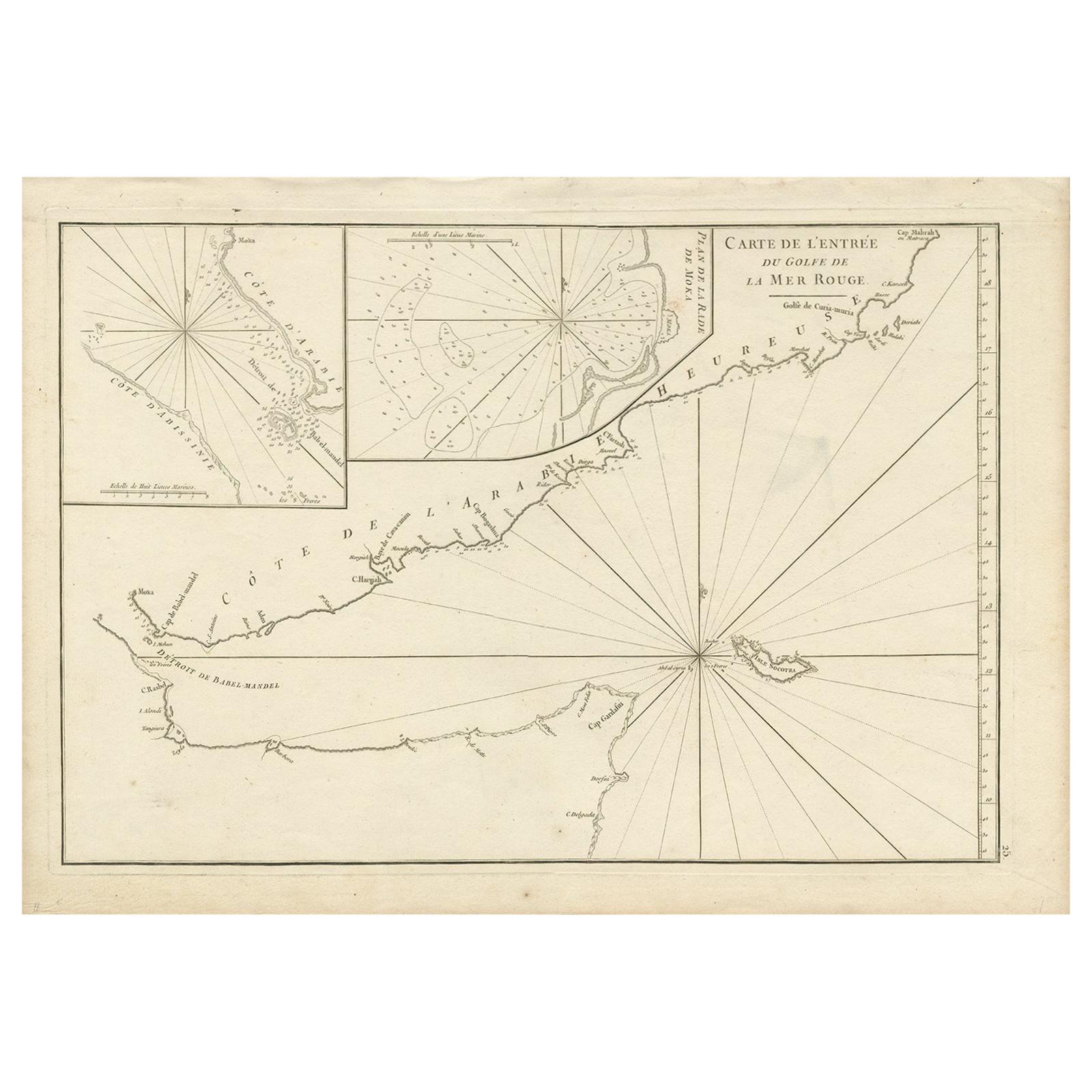
Original Antique Engraved Map of Part of the Red Sea, Arabia, 1775
Located in Langweer, NL
Antique map titled 'Carte de l'Entrée du Golfe de la Mer Rouge'. Uncommon sea chart of the entrance to the Red Seas as far as Mocha, with rhumb lines and soundings. Two insets of the...
Category
Antique Late 18th Century Maps
Materials
Paper
$453 Sale Price
20% Off
Antique Map of South American, The West Indies & Most of Africa, Ca.1775
Located in Langweer, NL
Antique map titled 'Carte pour Servir a l' Histoire Philosophique et Politique des Etablissemens et du Commerce des Europeens dans les deux Indes'.
This map is roughly centered o...
Category
Antique 1770s Maps
Materials
Paper

$725 Sale Price
20% Off
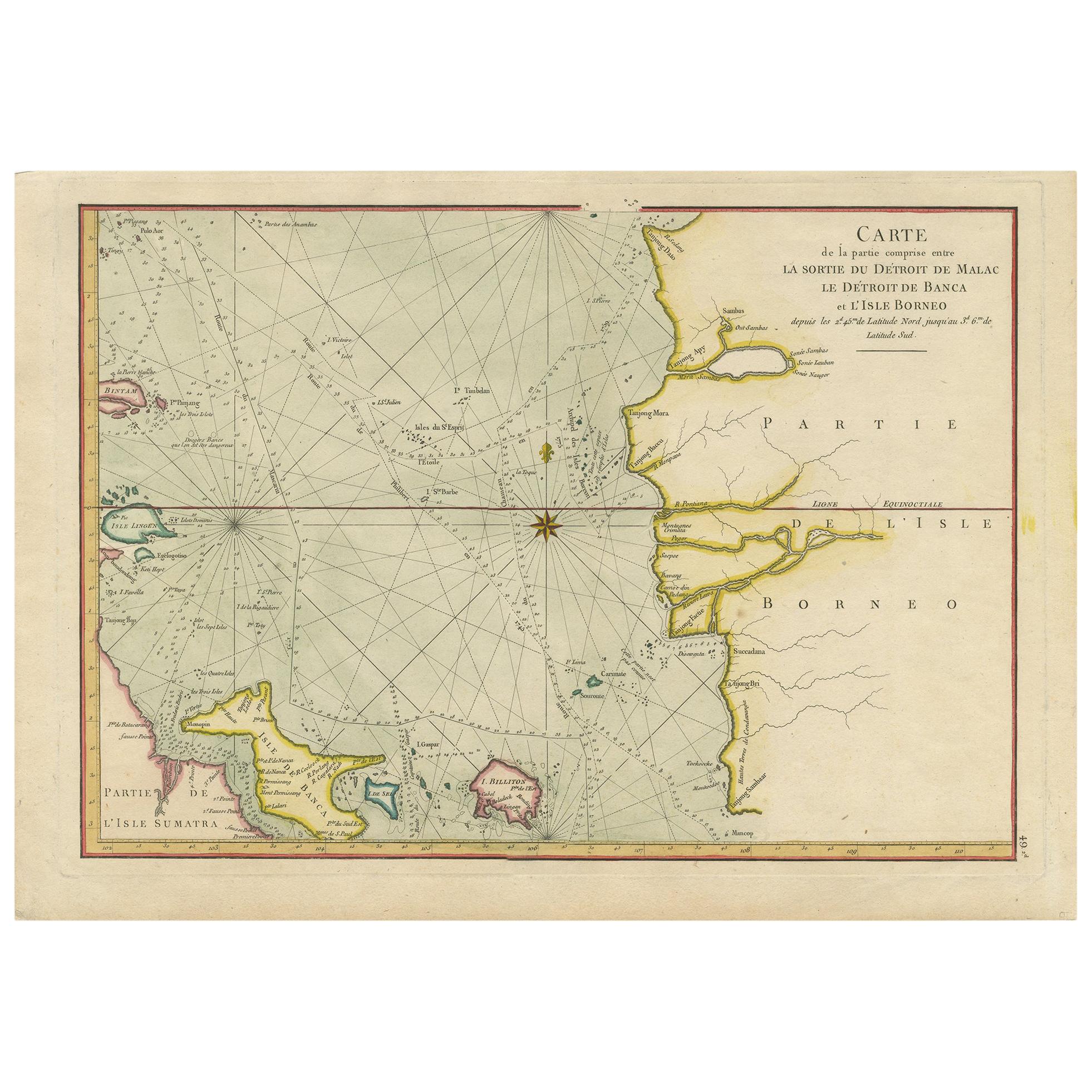
Antique Map of the Malacca and Bangka Strait by De Mannevillette '1775'
Located in Langweer, NL
Antique map titled 'Carte de la Partie Comprise entre la Sortie du Detroit de Malac Le Detroit de Banca et L’Isle Borneo'. Chart of the Strait of Malacca and Bangka Strait. It shows ...
Category
Antique Late 18th Century Maps
Materials
Paper
$1,146 Sale Price
20% Off
Recently Viewed
View AllMore Ways To Browse
Napoli Glass
Antique Rug Wool Navy Blue Red
Antique Silver Platter
Boat Blueprint
Cream Plates
Vintage Art Deco Rugs
Vintage Serving Forks
Brewery Signs
Herati Rug
Gold Leaf Furniture Black
Italian Wood Console Tables
Maison Jansen Argentina
Antique Oushak
Mid Century Danish Directors Chairs
Moller 70
Wood Relief Art
Argentina Travel Poster
Century Furniture Faux Bamboo