Items Similar to Antique Map of the Alsace Region of France by Hondius, c.1630


Want more images or videos?
Request additional images or videos from the seller
1 of 5
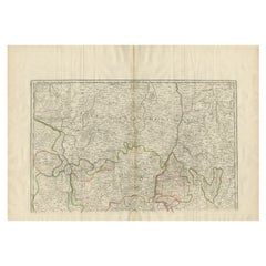
Antique Map of the Alsace Region of France by Hondius, c.1630
$243.46
$304.3320% Off
£181.24
£226.5520% Off
€203.20
€25420% Off
CA$333.48
CA$416.8520% Off
A$370.91
A$463.6320% Off
CHF 193.68
CHF 242.0920% Off
MX$4,513.53
MX$5,641.9220% Off
NOK 2,473.53
NOK 3,091.9220% Off
SEK 2,319.74
SEK 2,899.6720% Off
DKK 1,546.89
DKK 1,933.6120% Off
Shipping
Retrieving quote...The 1stDibs Promise:
Authenticity Guarantee,
Money-Back Guarantee,
24-Hour Cancellation
About the Item
Antique map titled 'Alsatia Superior (..)'. Original antique map of the Alsace (Elzas) region of France. The map is centered on the course of the Rhine River, from Strasbourg in the north to Basle. Artists and Engravers: Published by H. Hondius. Henricus Hondius (1597-1651) was a Dutch engraver and mapmaker, a member of a prominent cartographic family.
Artist: Published by H. Hondius. Henricus Hondius (1597-1651) was a Dutch engraver and mapmaker, a member of a prominent cartographic family.
Condition: Fair/good, general age-related toning. Minor wear and soiling. Original folding line, with repair. German text on verso, please study image carefully.
Date: c.1630
Overall size: 54 x 41.5 cm.
Image size: 0.001 x 47 x 36 cm.
Antique prints have long been appreciated for both their aesthetic and investment value. They were the product of engraved, etched or lithographed plates. These plates were handmade out of wood or metal, which required an incredible level of skill, patience and craftsmanship. Whether you have a house with Victorian furniture or more contemporary decor an old engraving can enhance your living space. We offer a wide range of authentic antique prints for any budget.
- Dimensions:Height: 16.34 in (41.5 cm)Width: 21.26 in (54 cm)Depth: 0 in (0.01 mm)
- Materials and Techniques:
- Period:
- Date of Manufacture:circa 1630
- Condition:
- Seller Location:Langweer, NL
- Reference Number:Seller: BG-12814-11stDibs: LU3054327771412
About the Seller
5.0
Recognized Seller
These prestigious sellers are industry leaders and represent the highest echelon for item quality and design.
Platinum Seller
Premium sellers with a 4.7+ rating and 24-hour response times
Established in 2009
1stDibs seller since 2017
2,508 sales on 1stDibs
Typical response time: <1 hour
- ShippingRetrieving quote...Shipping from: Langweer, Netherlands
- Return Policy
Authenticity Guarantee
In the unlikely event there’s an issue with an item’s authenticity, contact us within 1 year for a full refund. DetailsMoney-Back Guarantee
If your item is not as described, is damaged in transit, or does not arrive, contact us within 7 days for a full refund. Details24-Hour Cancellation
You have a 24-hour grace period in which to reconsider your purchase, with no questions asked.Vetted Professional Sellers
Our world-class sellers must adhere to strict standards for service and quality, maintaining the integrity of our listings.Price-Match Guarantee
If you find that a seller listed the same item for a lower price elsewhere, we’ll match it.Trusted Global Delivery
Our best-in-class carrier network provides specialized shipping options worldwide, including custom delivery.More From This Seller
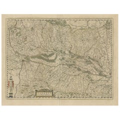
View AllAntique Map of the Alsace Region of France by Janssonius, c.1650
Located in Langweer, NL
Antique map titled 'Utriusquae Alsatiae Superioris Ac Inferioris Nova Tabula'. Map of the Alsace region (France) including the Rhine from Phillipsburg to south of Basle. Two decorati...
Category
Antique 17th Century Maps
Materials
Paper
$316 Sale Price
20% Off
Antique Map of the Region of Lyonnais by Nolin, 1697
Located in Langweer, NL
Untitled map of the French Province of Lyonnais, with its capital at Lyon, on the upper Loire and Rhone rivers. This map is a single sheet and part of a two sheet map titled 'The Gen...
Category
Antique 17th Century Maps
Materials
Paper
$227 Sale Price
20% Off
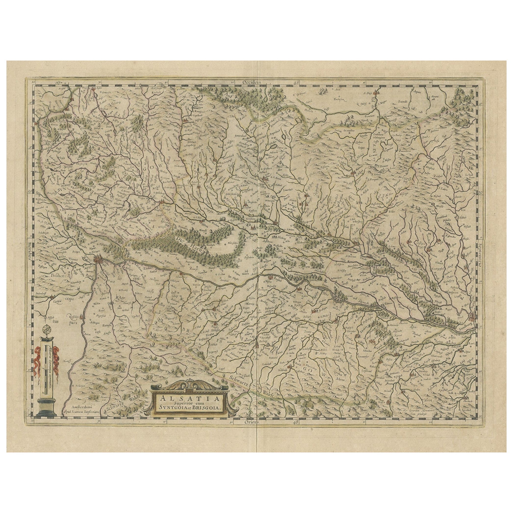
Old Map of the Alsace 'Elzas' Region with Lotharingen 'Lorraine', France, c1650
Located in Langweer, NL
Antique map titled 'Alsatia superior cum Suntgoia et Brisgoia'.
Old map of the Alsace (or Elzas) region with Lotharingen (Lorraine), Strassburg, Freiburg, Basel etc. Source unkno...
Category
Antique 1650s Maps
Materials
Paper
$421 Sale Price
20% Off
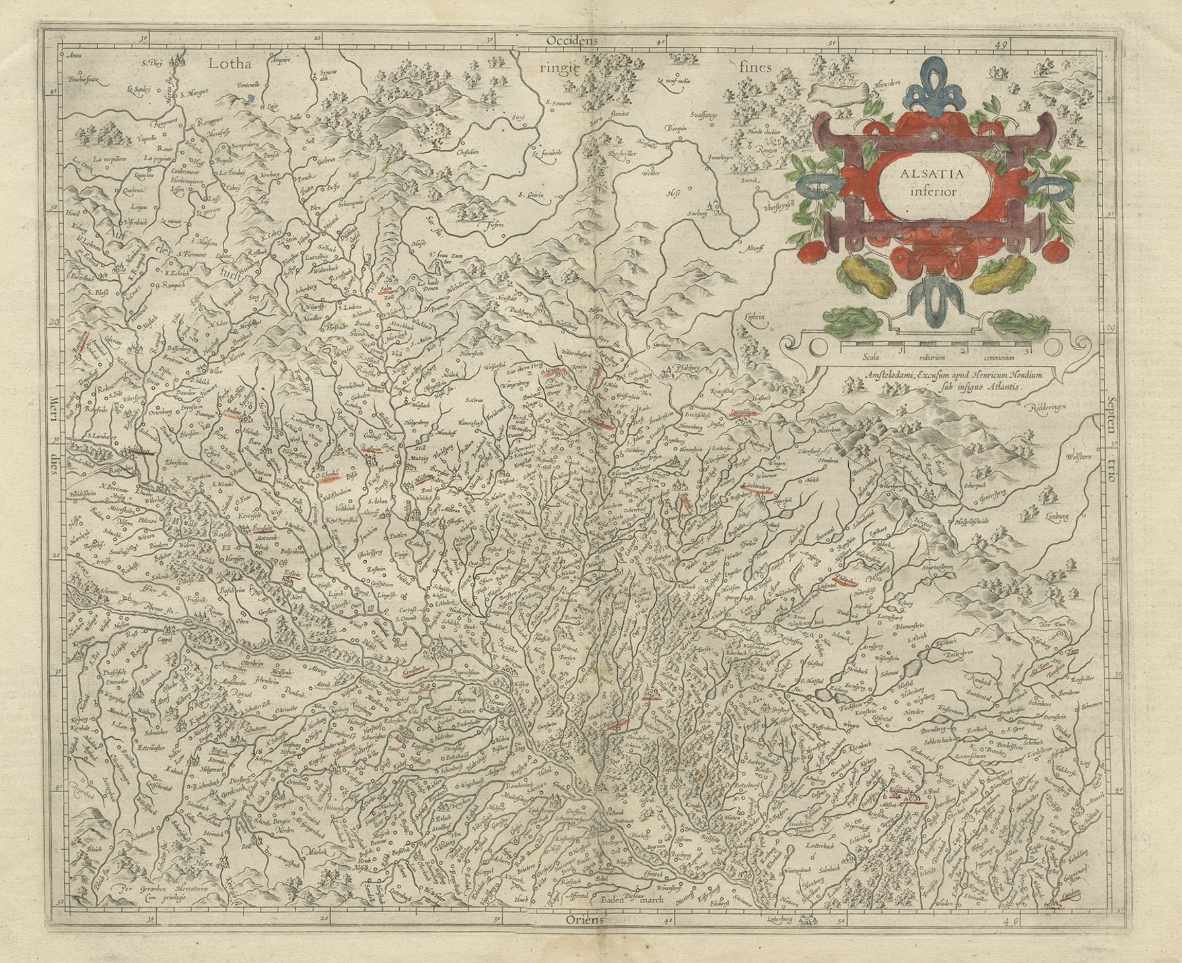
Antique Map of the Lower Alsace Region of France by Mapmaker Hondius, c.1630
Located in Langweer, NL
Antique map titled 'Alsatia Inferior'. Original antique map of the northern Alsace (Elzas) region of France. The map is centered on the course of the Rhine River, with Strasbourg at ...
Category
Antique 17th Century Maps
Materials
Paper
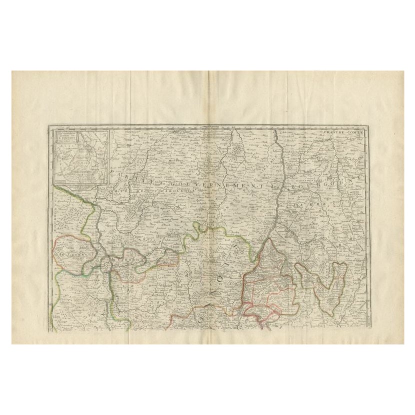
Antique Map of the Region of Franche-Comté by Janssonius, circa 1650
Located in Langweer, NL
Antique map titled 'Burgundiae Comitatus Franche Comté'. Old map of the historical and former region of Franche-Comté, France. As a region, it encompasse...
Category
Antique Mid-17th Century Maps
Materials
Paper

$575 Sale Price
20% Off
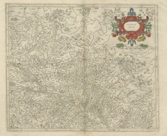
Antique Map of the Alsace Region of France by Schenk 'circa 1700'
Located in Langweer, NL
Antique map titled 'Superioris atque Inferioris Alsatiae'. Beautiful map of the Alsace region, from Basel in the south to Philipsburg in the north, centered on Strassburg. Published ...
Category
Antique Early 18th Century Maps
Materials
Paper

$575 Sale Price
20% Off
You May Also Like
1640 Joan Bleau Map Entitled"Diocecese de rheims et le pais de rethel, " Eic.a011
Located in Norton, MA
1640 Joan Bleau map entitled
"Diocecese de rheims et le pais de rethel,"
Ric.a011
OAN BLAEU
Diocecese de Rheims, et le pais de Rethel.
Handcolored engraving, c.1640.
...
Category
Antique 17th Century Dutch Maps
Materials
Paper

17th Century Hand Colored Map of the Liege Region in Belgium by Visscher
By Nicolaes Visscher II
Located in Alamo, CA
An original 17th century map entitled "Leodiensis Episcopatus in omnes Subjacentes Provincias distincté divisusVisscher, Leodiensis Episcopatus" by Nicolaes Visscher II, published in Amsterdam in 1688. The map is centered on Liege, Belgium, includes the area between Antwerp, Turnhout, Roermond, Cologne, Trier and Dinant.
This attractive map is presented in a cream-colored mat measuring 30" wide x 27.5" high. There is a central fold, as issued. There is minimal spotting in the upper margin and a tiny spot in the right lower margin, which are under the mat. The map is otherwise in excellent condition.
The Visscher family were one of the great cartographic families of the 17th century. Begun by Claes Jansz Visscher...
Category
Antique Late 17th Century Dutch Maps
Materials
Paper

1657 Janssonius Map of Vermandois and Cappelle, Ric. A-004
Located in Norton, MA
1657 Janssonius map of
Vermandois and Cappelle
Ric.a004
Description: Antique map of France titled 'Descriptio Veromanduorum - Gouvernement de la Cappelle'. Two detailed maps o...
Category
Antique 17th Century Unknown Maps
Materials
Paper

1640 Willem Blaeu Map Entitled "Contado di molise et principato vltra, " Ric.a003
By Willem Blaeu
Located in Norton, MA
1640 Willem Blaeu map entitled
"Contado di molise et principato vltra,"
Colored
Ric. a003
Measures: 38 x 49.6 cm and wide margins
DBLAEU.
Cou...
Category
Antique 17th Century Dutch Maps
Materials
Paper

1771 Bonne Map of Poitou, Touraine and Anjou, France, Ric.a015
Located in Norton, MA
1771 Bonne Map of Poitou,
Touraine and Anjou, France
Ric.a015
1771 Bonne map of Potiou, Touraine and Anjou entitled "Carte des Gouvernements D'Anjou et du Saumurois, de la Touraine, du Poitou,du Pays d'aunis, Saintonge?Angoumois,"
Carte des gouvernements d'Anjou et du Saumurois, de la Touraine, du Poitou, du Pays d'Aunis, Saintonge-Angoumois. Projettee et assujettie au ciel par M. Bonne, Hyd. du Roi. A Paris, Chez Lattre, rue St. Jacques a la Ville de Bord(ea)ux. Avec priv. du Roi. 1771. Arrivet inv. & sculp., Atlas moderne ou collection de cartes sur toutes...
Category
Antique 17th Century Unknown Maps
Materials
Paper

1620 Map of Artois Entitled "Artesia Comitatvs Artois, " by Bleau, Ric.a012
Located in Norton, MA
1640 map of Artois entitled
"Artesia Comitatvs Artois,"
by Bleau
Colored
A-012.
Detailed map of the northern province of Artois, France on the border with Belgium. Feature...
Category
Antique 17th Century Dutch Maps
Materials
Paper

More Ways To Browse
Jamaican Antique
Hindeloopen Furniture
Romania Map
Stanford Antique Furniture
Sardinia Map
Victorian Staircase
Nantucket Map
Afghanistan Antique Map
Antique Map Of Hawaii
Antique Florida Map
Map Of Syria
Napoleon Map
South Arabian
Antique Geological Maps
French School Map
Nova Scotia Antique Furniture
Richard Wentworth
Antique Mace