Items Similar to Antique Map of the Banda Islands or Spice Islands, Moluccas, Indonesia, 1697
Want more images or videos?
Request additional images or videos from the seller
1 of 5
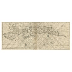
Antique Map of the Banda Islands or Spice Islands, Moluccas, Indonesia, 1697
$425.18
$531.4820% Off
£320.10
£400.1220% Off
€360
€45020% Off
CA$585.71
CA$732.1420% Off
A$655.96
A$819.9520% Off
CHF 342.27
CHF 427.8420% Off
MX$8,012.30
MX$10,015.3720% Off
NOK 4,354.68
NOK 5,443.3420% Off
SEK 4,104.80
SEK 5,13120% Off
DKK 2,740.37
DKK 3,425.4620% Off
About the Item
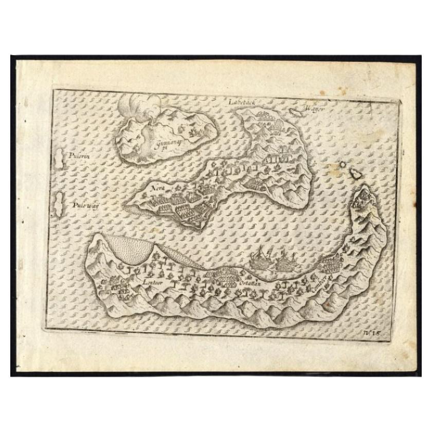
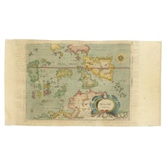
Antique map titled 'Isole di Banda Nelle Molucche'.
Engraved map of Isola di Banda, Nelle, Molucche. On verso: 'Isola di Solor'.
Artists and Engravers: Vincenzo Maria (Padre) Coronelli (1650-1718): Father Corronelli was a Franciscan priest, who spend most of his life in Venice. He was a noted theologian and was appointed as Father General of his order in 1699. At that time he was already famous as a mathematician, cartographer and globe maker. He was very infuential, compiled and engraved over 500 maps.
Condition: Very good. General age-related toning, please study image carefully.
Date: 1697
We sell original antique maps to collectors, historians, educators and interior decorators all over the world. Our collection includes a wide range of authentic antique maps from the 16th to the 20th centuries. Buying and collecting antique maps is a tradition that goes back hundreds of years. Antique maps have proved a richly rewarding investment over the past decade, thanks to a growing appreciation of their unique historical appeal. Today the decorative qualities of antique maps are widely recognized by interior designers who appreciate their beauty and design flexibility. Depending on the individual map, presentation, and context, a rare or antique map can be modern, traditional, abstract, figurative, serious or whimsical. We offer a wide range of authentic antique maps for any budget.
- Dimensions:Height: 18.9 in (48 cm)Width: 13 in (33 cm)Depth: 0 in (0.01 mm)
- Materials and Techniques:
- Period:
- Date of Manufacture:1697
- Condition:
- Seller Location:Langweer, NL
- Reference Number:Seller: BG-041731stDibs: LU3054326555432
About the Seller
5.0
Recognized Seller
These prestigious sellers are industry leaders and represent the highest echelon for item quality and design.
Platinum Seller
Premium sellers with a 4.7+ rating and 24-hour response times
Established in 2009
1stDibs seller since 2017
2,533 sales on 1stDibs
Typical response time: <1 hour
- ShippingRetrieving quote...Shipping from: Langweer, Netherlands
- Return Policy
Authenticity Guarantee
In the unlikely event there’s an issue with an item’s authenticity, contact us within 1 year for a full refund. DetailsMoney-Back Guarantee
If your item is not as described, is damaged in transit, or does not arrive, contact us within 7 days for a full refund. Details24-Hour Cancellation
You have a 24-hour grace period in which to reconsider your purchase, with no questions asked.Vetted Professional Sellers
Our world-class sellers must adhere to strict standards for service and quality, maintaining the integrity of our listings.Price-Match Guarantee
If you find that a seller listed the same item for a lower price elsewhere, we’ll match it.Trusted Global Delivery
Our best-in-class carrier network provides specialized shipping options worldwide, including custom delivery.More From This Seller
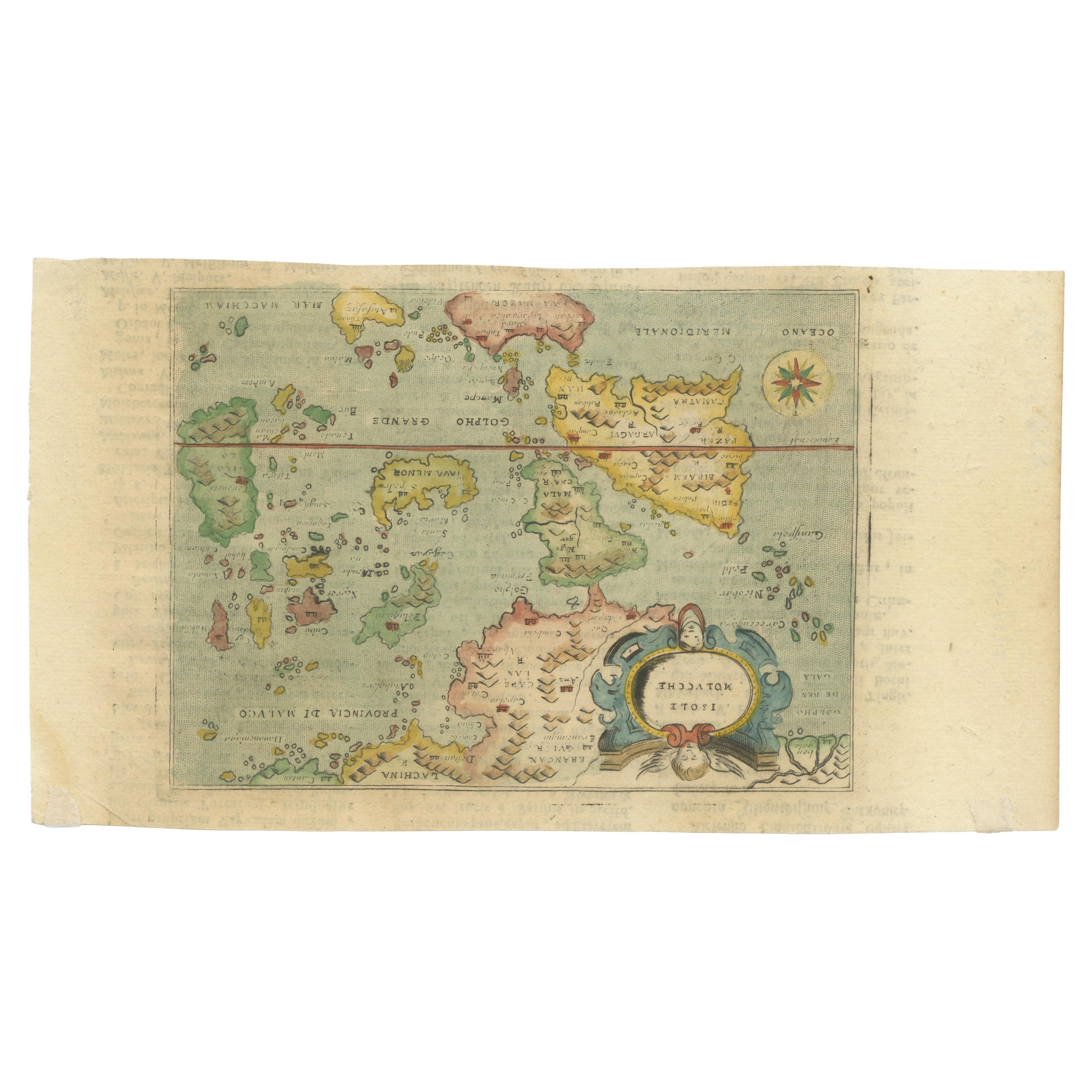
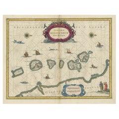
View AllAntique Map of the Banda Islands by Commelin, 1646
Located in Langweer, NL
Plate 15: 'Afteeckeninge van 't Eyland Banda.' Depiction of the Banda Islands, Indonesia. Rare. This attrative plate originates from: 'Title: Waerachtigh verhael van de Schipvaerd op Oost-Indien Ghedaen by de acht Schepen in den jare 1598. van Amsterdam uyt-gezeylt, onder 't beleyd van den Admirael Jacob Cornelissoon van Neck...
Category
Antique 17th Century Maps
Materials
Paper
$333 Sale Price
20% Off
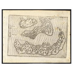
Antique Miniature Map of the Maluku Islands by Lasor a Varea, 1713
Located in Langweer, NL
Antique map titled 'Isole Molucche'. Rare miniature map of the Maluku Islands or the Moluccas, Indonesia. This map originates from 'Universus Terrarum Orbis...
Category
Antique Early 18th Century Maps
Materials
Paper
$566 Sale Price
20% Off
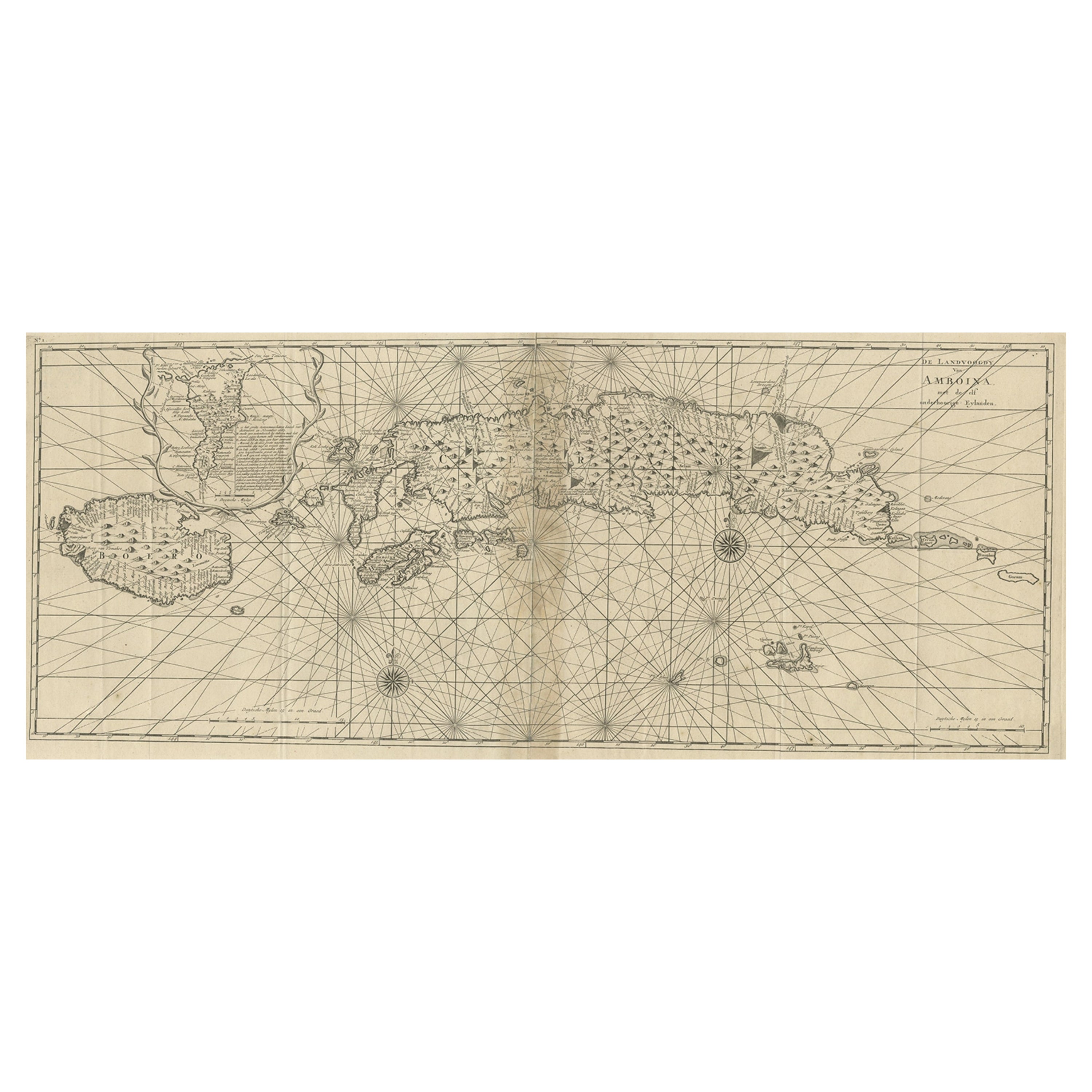
Antique Map of the Moluccas or the Famed Spice Islands of Indonesia, 1724
Located in Langweer, NL
Antique map Spice Islands titled 'De landvoogdy van Amboina met de elf onderhoorige Eylanden'.
This map depicts the central islands of the Maluku Arc...
Category
Antique 1720s Maps
Materials
Paper
$840 Sale Price
20% Off
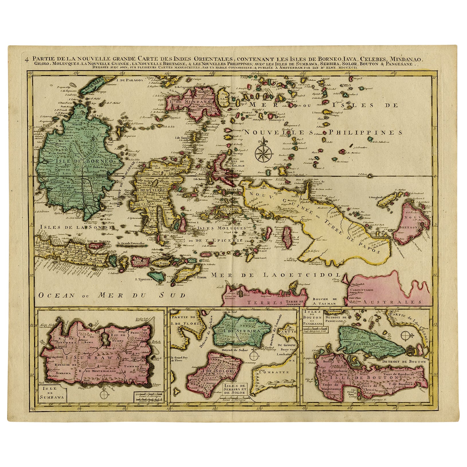
Old Map of Indonesian Islands Borneo, Celebes, New Guinea & New Britain, 1792
Located in Langweer, NL
Antique map titled 'Partie de la Nouvelle Grande Carte des Indes Orientales, contenant les Isles de Borneo, Iava, Celebes, Mindanao (..)'.
Detailed map of the Indonesian islands Bo...
Category
Antique 1790s Maps
Materials
Paper

$1,370 Sale Price
20% Off
Free Shipping
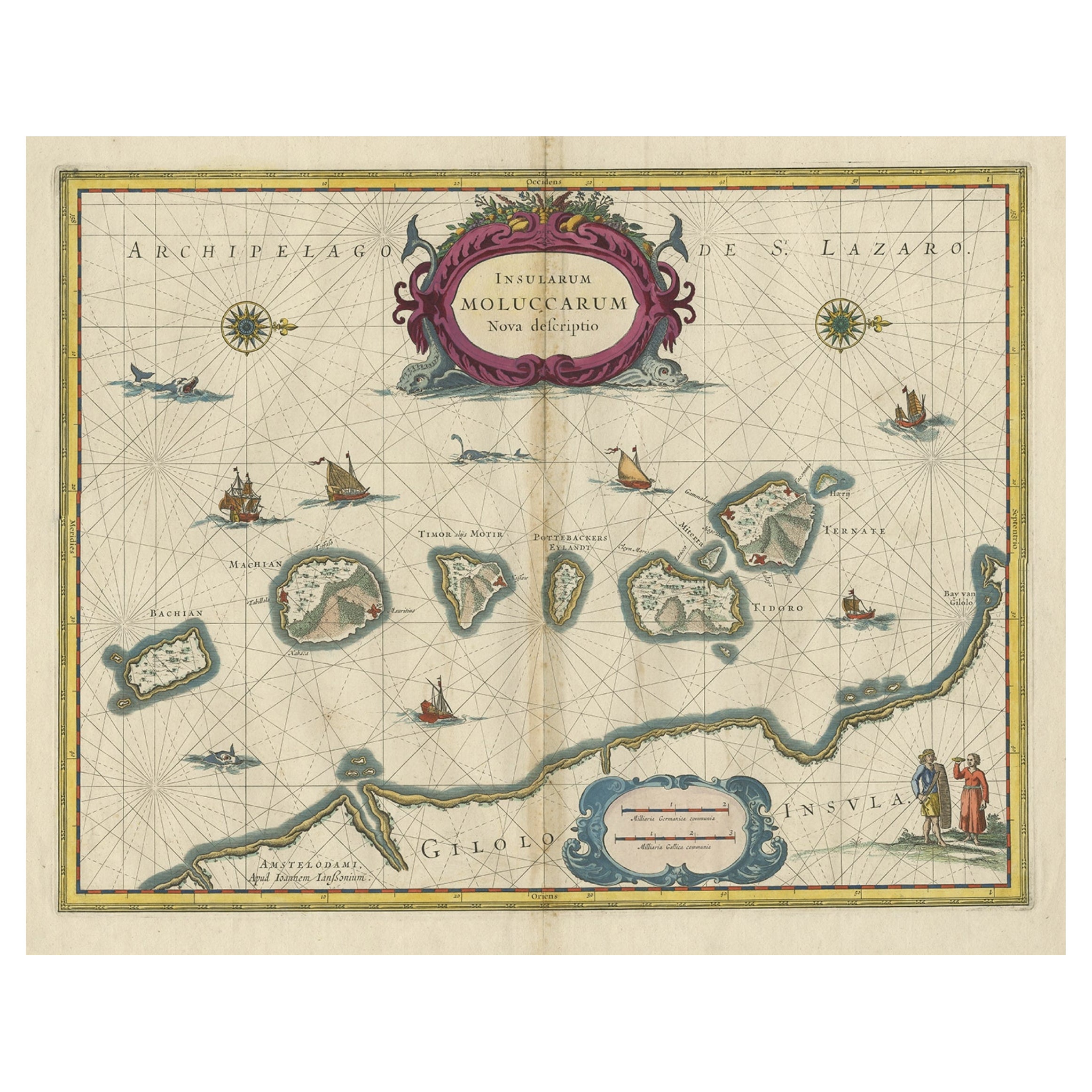
Beautiful Antique Map of the Moluccas or Spice Islands, Indonesia, ca.1650
Located in Langweer, NL
Antique map titled 'Insularum Moluccarum Nova Descriptio.'
Beautiful map of the Moluccas. The famous Spice Islands, the cornerstone of the Dutc...
Category
Antique 1650s Maps
Materials
Paper
$699 Sale Price
20% Off
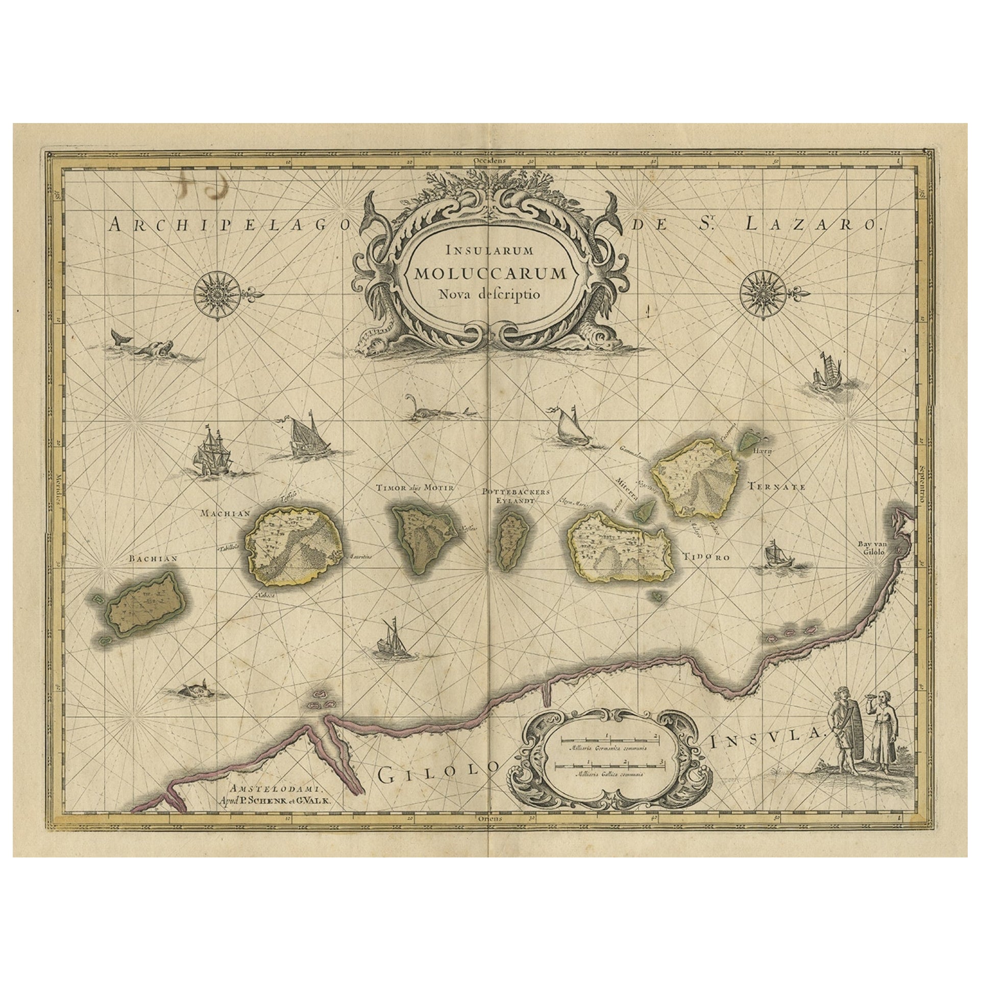
Old Map of the Moluccas, Known as the Famous Spice Islands, Indonesia, ca.1730
Located in Langweer, NL
Antique map titled 'Insularum Moluccarum Nova Descriptio.'
Old map of the Moluccas. The famous Spice Islands, the cornerstone of the Dutch trading empire in the East Indies throughout the 17th Century, is the focus of this exquisite map. Similar to Blaeu's map, except that it extends further south...
Category
Antique 1730s Maps
Materials
Paper

$651 Sale Price
20% Off
You May Also Like
Antique French Map of Asia Including China Indoneseia India, 1783
Located in Amsterdam, Noord Holland
Very nice map of Asia. 1783 Dedie au Roy.
Additional information:
Country of Manufacturing: Europe
Period: 18th century Qing (1661 - 1912)
Condition: Overall Condition B (Good Used)...
Category
Antique 18th Century European Maps
Materials
Paper

$648 Sale Price
20% Off
1714 Henri Chatelain "Nouvelle Carte Des Etatas Du Grand.Duc De Mos Moscovie Eur
Located in Norton, MA
A 1714 Henri Chatelain map, entitled
"Nouvelle Carte Des Etatas Du Grand Duc De Moscovie En Europe,"
Ricb001
Henri Abraham Chatelain (1684-1743) was a Huguenot pastor of Parisi...
Category
Antique Early 18th Century Dutch Maps
Materials
Paper

1627 Hendrik Hondius Map Entitled "Vltoniae Orientalis Pars, " Ric.a009
Located in Norton, MA
1627 Hendrik Hondius map entitled
"Vltoniae orientalis pars,"
Ric.a009
Title:
Vltoniae orientalis : pars
Title (alt.) :
Ultoniae orientalis pars
Creator:
Mercator, Gerh...
Category
Antique 17th Century Dutch Maps
Materials
Paper

Original Antique Map of Switzerland, Engraved By Barlow, Dated 1807
Located in St Annes, Lancashire
Great map of Switzerland
Copper-plate engraving by Barlow
Published by Brightly & Kinnersly, Bungay, Suffolk.
Dated 1807
Unframed.
Category
Antique Early 1800s English Maps
Materials
Paper

1633 Map "La Souverainete De Sedan Et De Raucourt, Et La Prevoste Ric0011
Located in Norton, MA
1653 map entitled
"La Souverainete de Sedan et de Raucourt, et la Prevoste de Doncheri,"
Ric0011
Description:
Lovely map centered on Sedan and Doncheri and the Meuze River fr...
Category
Antique 17th Century Dutch Maps
Materials
Paper

1571-1638 Willem Blaeu map entitled, "Ilcadorino, " Hand Colored Ric0009
Located in Norton, MA
Willem Blaeu map entitled,
"Ilcadorino,".
Hand colored.
Description: large, unusual, and nice antique copper engraved map of Ilcadorino, by Willem BL...
Category
Antique 16th Century Dutch Maps
Materials
Paper

More Ways To Browse
Antique Spices
Antique Map By Coronelli
Coronelli Globe
Victorian Compass
Antique Maps Caribbean Islands
Goa Furniture
George Fleet
Sri Lanka Map
Philippines Map
Antique Map Ceylon
Antique Sri Lanka Map
Persian Maps
Antique Civil War Maps
Antique Map Of The Philippines
Large Map Of Italy
Used Marine Compass
West Indies Colonial
Antique Pamphlets