Items Similar to Antique Map of the Barradeel Township, 1718

Want more images or videos?
Request additional images or videos from the seller
1 of 5
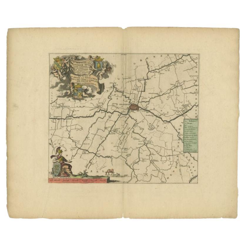
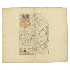
Antique Map of the Barradeel Township, 1718
$364.40
$455.5120% Off
£271.15
£338.9420% Off
€306.40
€38320% Off
CA$500.67
CA$625.8420% Off
A$558.79
A$698.4920% Off
CHF 293.99
CHF 367.4920% Off
MX$6,787.79
MX$8,484.7420% Off
NOK 3,727
NOK 4,658.7520% Off
SEK 3,488
SEK 4,36020% Off
DKK 2,332.51
DKK 2,915.6320% Off
About the Item
Antique map Friesland titled 'De Grietenije van Barra Deel (..)'. Old map of Friesland, the Netherlands. This map depicts the region of Barradeel and includes cities and villages like Sexbierum, Harlingen, Minnertsga and more. With coat of arms of the Van Holdinga family. Originates from 'Uitbeelding van de Heerlijkheid van Friesland' by Bernardus Schotanus à Sterringa. This atlas is considered the best atlas of Friesland, the Netherlands. Artists and Engravers: Published by F. Halma, Leeuwarden.
Artist: Published by F. Halma, Leeuwarden.
Condition: Good, general age-related toning. Minor defects and repair on folding line, please study image carefully.
Date: 1718
Overall size: 66.5 x 55.5 cm.
Image size: 0.001 x 51 x 43 cm.
Antique prints have long been appreciated for both their aesthetic and investment value. They were the product of engraved, etched or lithographed plates. These plates were handmade out of wood or metal, which required an incredible level of skill, patience and craftsmanship. Whether you have a house with Victorian furniture or more contemporary decor an old engraving can enhance your living space. We offer a wide range of authentic antique prints for any budget.
- Dimensions:Height: 21.86 in (55.5 cm)Width: 26.19 in (66.5 cm)Depth: 0 in (0.01 mm)
- Materials and Techniques:
- Period:
- Date of Manufacture:1718
- Condition:
- Seller Location:Langweer, NL
- Reference Number:Seller: BG-05322-131stDibs: LU3054327774382
About the Seller
5.0
Recognized Seller
These prestigious sellers are industry leaders and represent the highest echelon for item quality and design.
Platinum Seller
Premium sellers with a 4.7+ rating and 24-hour response times
Established in 2009
1stDibs seller since 2017
2,567 sales on 1stDibs
Typical response time: <1 hour
- ShippingRetrieving quote...Shipping from: Langweer, Netherlands
- Return Policy
Authenticity Guarantee
In the unlikely event there’s an issue with an item’s authenticity, contact us within 1 year for a full refund. DetailsMoney-Back Guarantee
If your item is not as described, is damaged in transit, or does not arrive, contact us within 7 days for a full refund. Details24-Hour Cancellation
You have a 24-hour grace period in which to reconsider your purchase, with no questions asked.Vetted Professional Sellers
Our world-class sellers must adhere to strict standards for service and quality, maintaining the integrity of our listings.Price-Match Guarantee
If you find that a seller listed the same item for a lower price elsewhere, we’ll match it.Trusted Global Delivery
Our best-in-class carrier network provides specialized shipping options worldwide, including custom delivery.More From This Seller
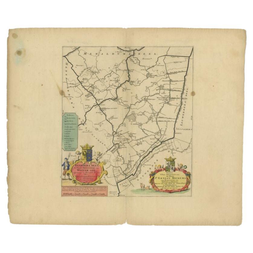
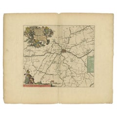
View AllAntique Map of the Baarderadeel Township, 1718
Located in Langweer, NL
Antique map Friesland titled 'Baardera Deel de Vierde Grietenije van Wester Goo (..)'. Old map of Friesland, the Netherlands. This map depicts the region of B...
Category
Antique 18th Century Maps
Materials
Paper
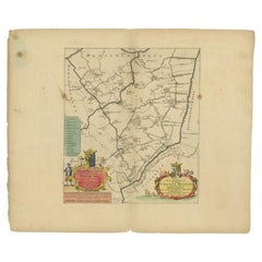
$352 Sale Price
20% Off
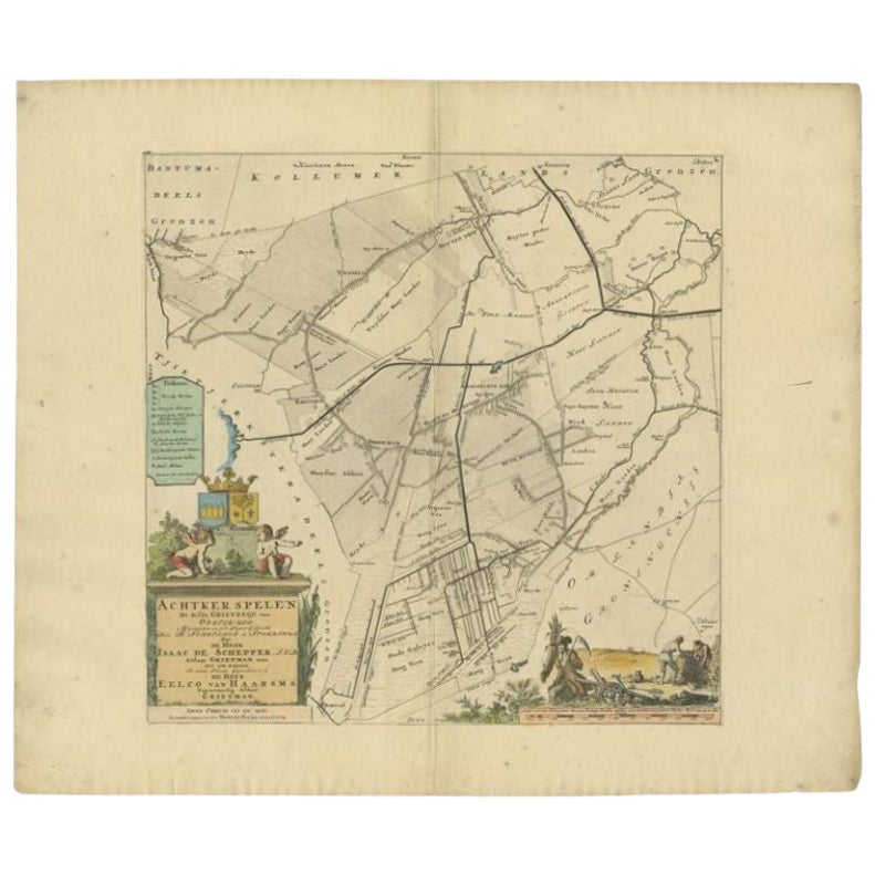
Antique Map of the Achtkarspelen township, Friesland, The Netherlands, 1718
Located in Langweer, NL
Antique map Friesland titled 'Achtkarspelen, de sesde Grietenije van Ooster-Goo (..)'. Old map of Friesland, the Netherlands. This map depicts the region of Achtkarspelen and include...
Category
Antique 18th Century Maps
Materials
Paper
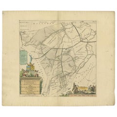
$361 Sale Price
20% Off
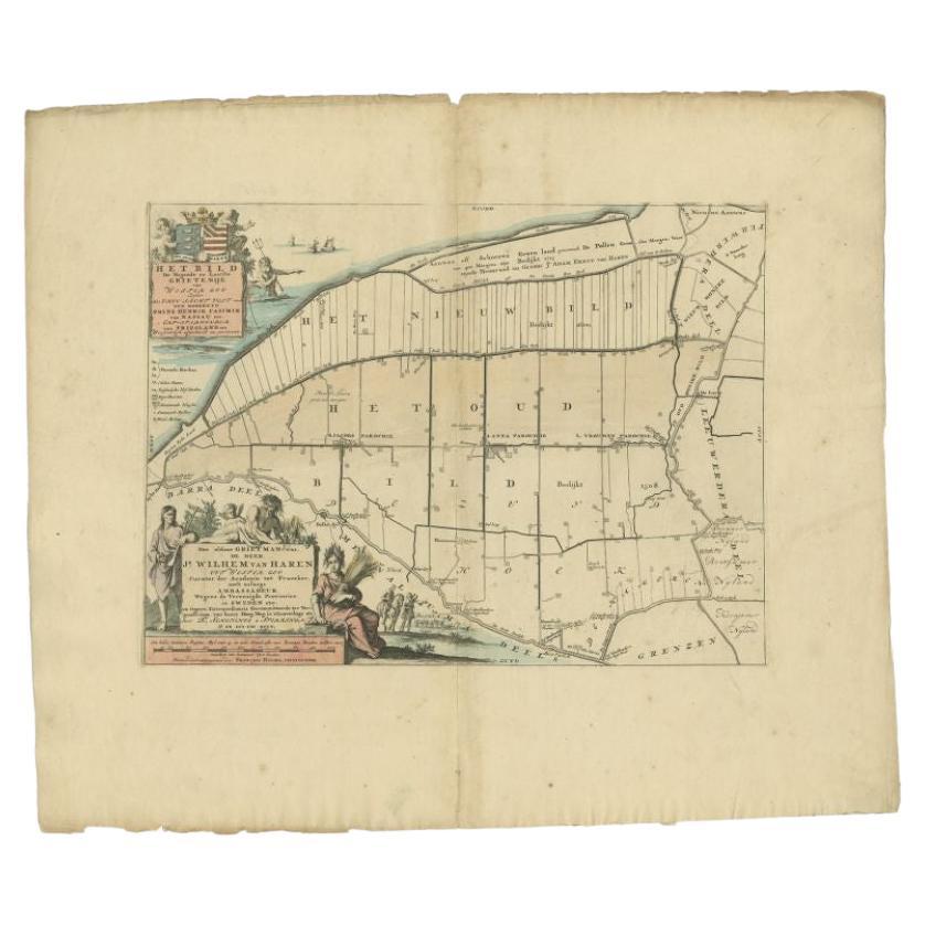
Antique Map of the Bildt Township 'Friesland' by Halma, 1718
Located in Langweer, NL
Antique map Friesland titled 'Het Bild, de negende en laatste Grietenije van Wester Goo (..)'. Old map of Friesland, the Netherlands. This map depicts the reg...
Category
Antique 18th Century Maps
Materials
Paper
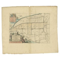
$351 Sale Price
20% Off
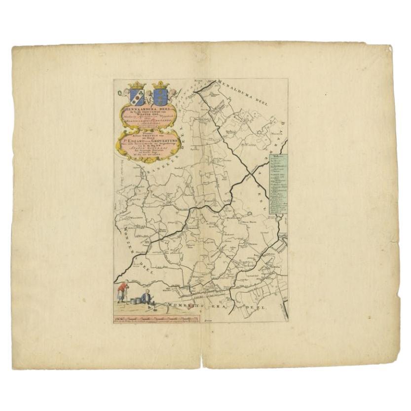
Antique Map of the Hennaarderadeel Township 'Friesland' by Halma, 1718
Located in Langweer, NL
Antique map of Friesland titled 'Hennaardera Deel de Vyfde Grietenije van Wester Goo (..)'. Old map of Friesland, the Netherlands. This map depicts the region...
Category
Antique 18th Century Maps
Materials
Paper
$283 Sale Price
20% Off
Antique Map of the Hennaarderadeel Township 'Friesland' by Halma, 1718
Located in Langweer, NL
Antique map Friesland titled 'Hennaardera Deel de Vyfde Grietenije van Wester Goo (..)'. Old map of Friesland, the Netherlands. This map depicts the region of...
Category
Antique 18th Century Maps
Materials
Paper

$304 Sale Price
20% Off
Antique Map of the Franekeradeel Township 'Friesland' by Halma, 1718
Located in Langweer, NL
Antique map Friesland titled 'De Grietenije van Franeker Deel (..) '. Old map of Friesland, the Netherlands. This map depicts the region of Franekeradeel and includes cities and vill...
Category
Antique 18th Century Maps
Materials
Paper
$342 Sale Price
20% Off
You May Also Like
1633 Map "La Souverainete De Sedan Et De Raucourt, Et La Prevoste Ric0011
Located in Norton, MA
1653 map entitled
"La Souverainete de Sedan et de Raucourt, et la Prevoste de Doncheri,"
Ric0011
Description:
Lovely map centered on Sedan and Doncheri and the Meuze River fr...
Category
Antique 17th Century Dutch Maps
Materials
Paper

1752 Vaugoundy Map of Flanders : Belgium, France, and the Netherlands, Ric.a002
Located in Norton, MA
Large Vaugoundy Map of Flanders:
Belgium, France, and the Netherlands
Colored -1752
Ric.a002
Description: This is a 1752 Didier Robert de Vaugondy map of Flanders. The map de...
Category
Antique 17th Century Unknown Maps
Materials
Paper

1657 Janssonius Map of Vermandois and Cappelle, Ric. A-004
Located in Norton, MA
1657 Janssonius map of
Vermandois and Cappelle
Ric.a004
Description: Antique map of France titled 'Descriptio Veromanduorum - Gouvernement de la Cappelle'. Two detailed maps o...
Category
Antique 17th Century Unknown Maps
Materials
Paper

1630 Pierre Petit map "Description du Gouvernement de la Capelle" Ric0010
Located in Norton, MA
1630 Pierre Petit map entitled
"Description du Gouvernement de la Capelle,"
Ric0010
Pierre Petit was the son of a minor provincial official in Montluçon. The town, in the Auver...
Category
Antique 17th Century Dutch Maps
Materials
Paper

Rare Original Map of New Amsterdam (New York) – “Restitutio”, ca. 1674 –
Located in Dronten, NL
An exceptionally rare and original 17th-century engraving of New Amsterdam, now New York City, published by the renowned Amsterdam cartographer Carel (Carolus) Allard around 1674. Kn...
Category
Antique 17th Century Dutch Maps
Materials
Paper

1654 Joan Blaeu Map the Sutherland, Scotland, Entitled "Southerlandia, "Ric0007
Located in Norton, MA
1654 Joan Blaeu map of the
Sutherland, Scotland, entitled
"Southerlandia,"
Hand Colored
Ric0007
Description:
Lovely map centered on Sedan and D...
Category
Antique 17th Century Dutch Maps
Materials
Paper

More Ways To Browse
Antique Florida Map
Map Of Syria
Napoleon Map
South Arabian
Antique Geological Maps
French School Map
Nova Scotia Antique Furniture
Richard Wentworth
Antique Mace
Map Of Madagascar
Map Of Normandy
Bali Map
Croatia Map
Gibraltar Antique Map
Albania Antique Map
Antique Furniture Kingston
Antique Louisiana Map
Armenia Map